Misc. Massachusetts Highway Photos
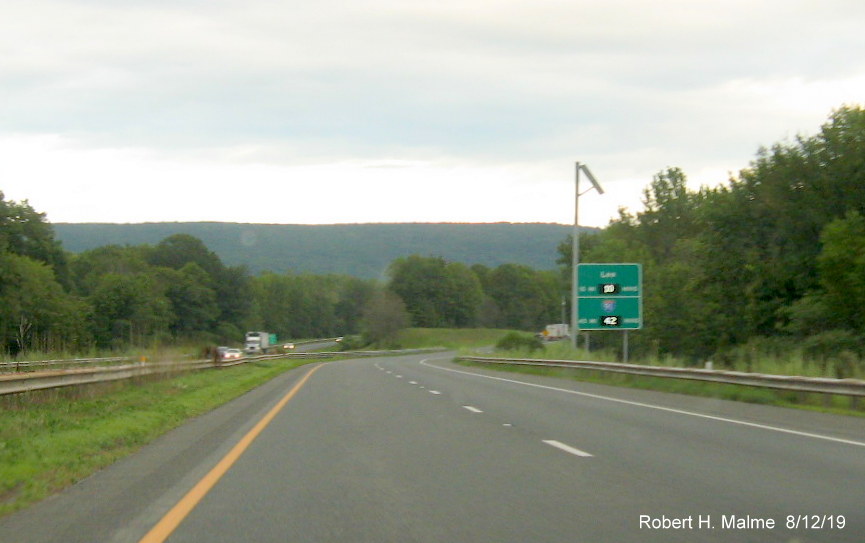
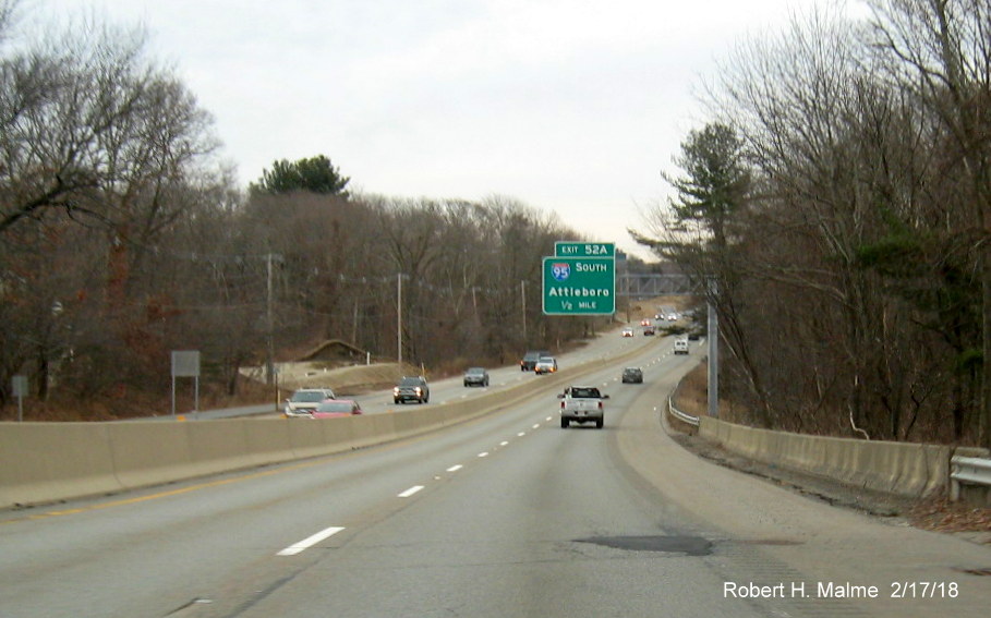
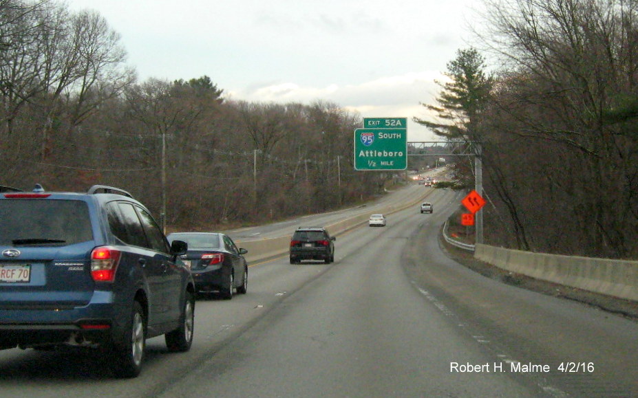
A. Route 3, Braintree to Bourne Sign Replacement, 2025-2026
Signage along Route 3 is being replaced in a project that started
in January 2025. So far, only ground mounted signs, such as gore signs and reassurance markers have been updated. Overhead
signage, though not the support gantries, will be replaced this year. Here are some screen grabs of ground mounted signs from
Google Maps Street View.
Images taken July to October 2025
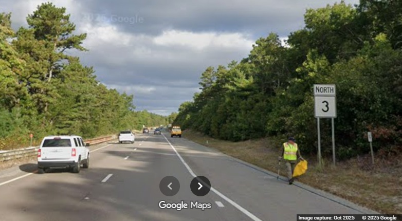
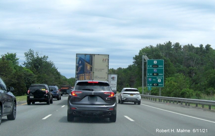
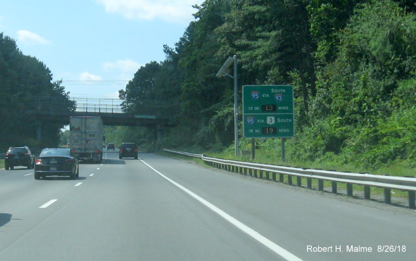
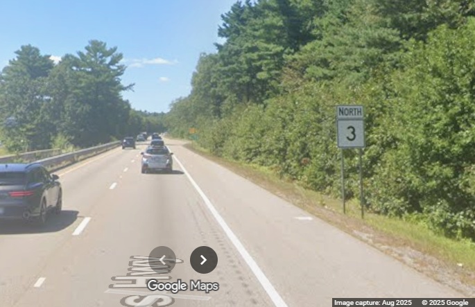
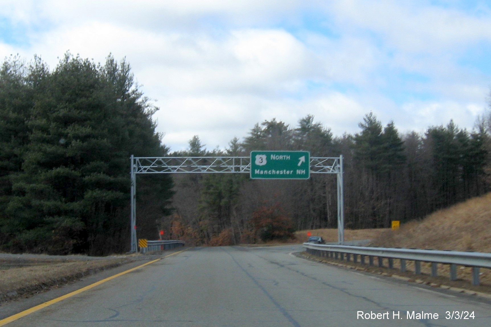
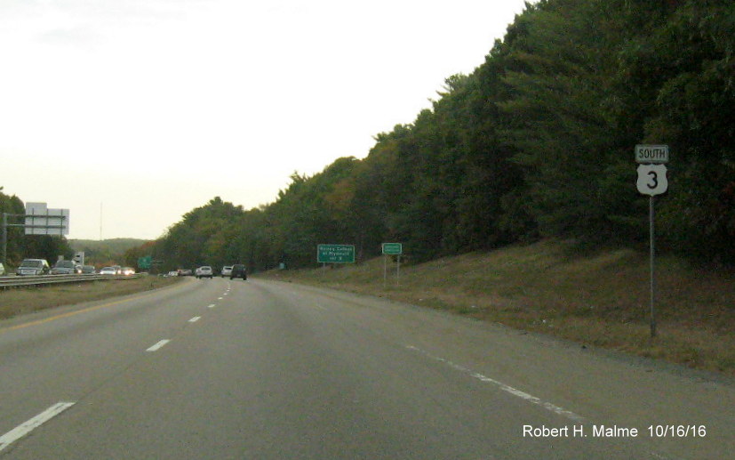
View of a new North Route 3 reassurance marker in Plymouth. The
Google truck catching MassDOT workers on trash pickup. I did this too one summer during college.
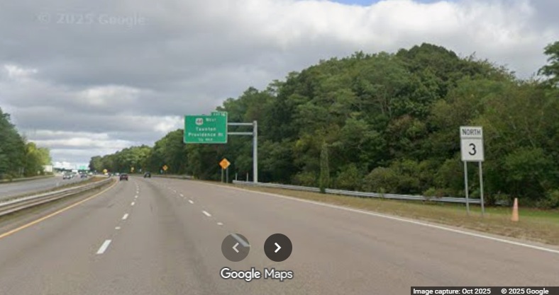
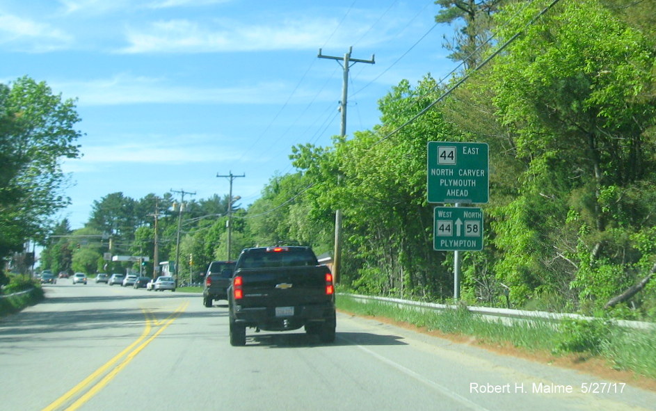
View of a new North Route 3 reassurance marker after the US 44 East
exit. Unfortunately, a West US 44 marker should be there too.
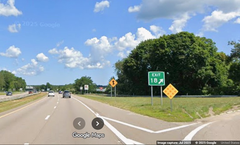
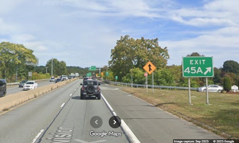
View of a new gore sign for the MA 3A exit in Plymouth on Route 3
North.
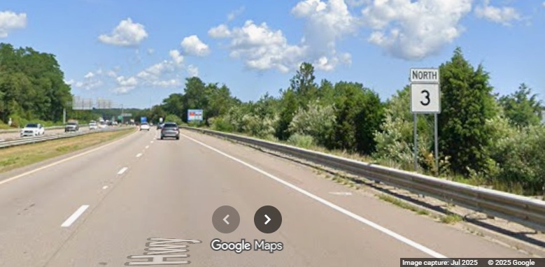
View of a new North Route 3 reassurance marker after the Route
3A exit.
View of another new North Route 3 reassurance marker in Rockland
after the Route 228 exit.
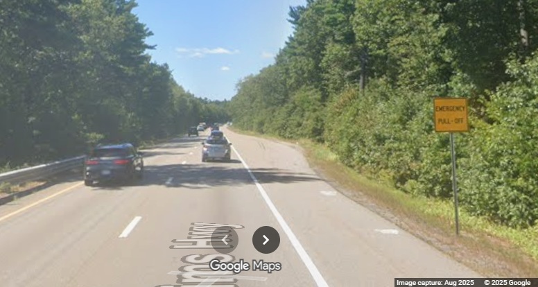
View of a new yellow Emergency Pull Off sign in Rockland.
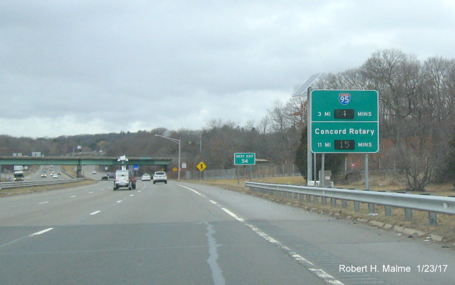
View of a new gore sign for the Derby Street exit on Route 3
South in Hingham.
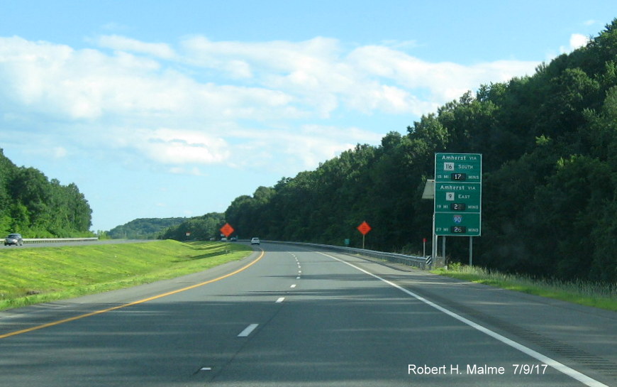
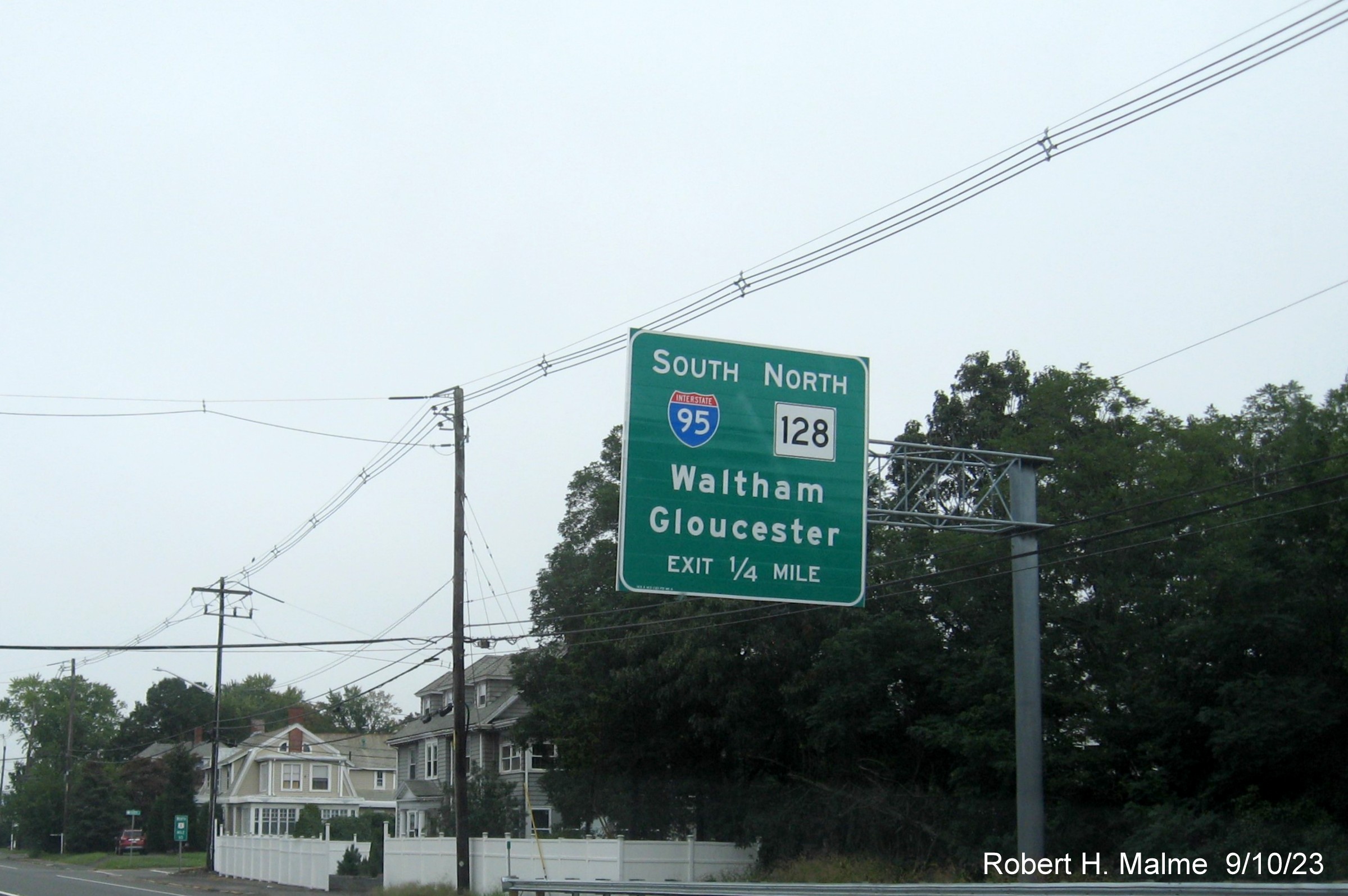
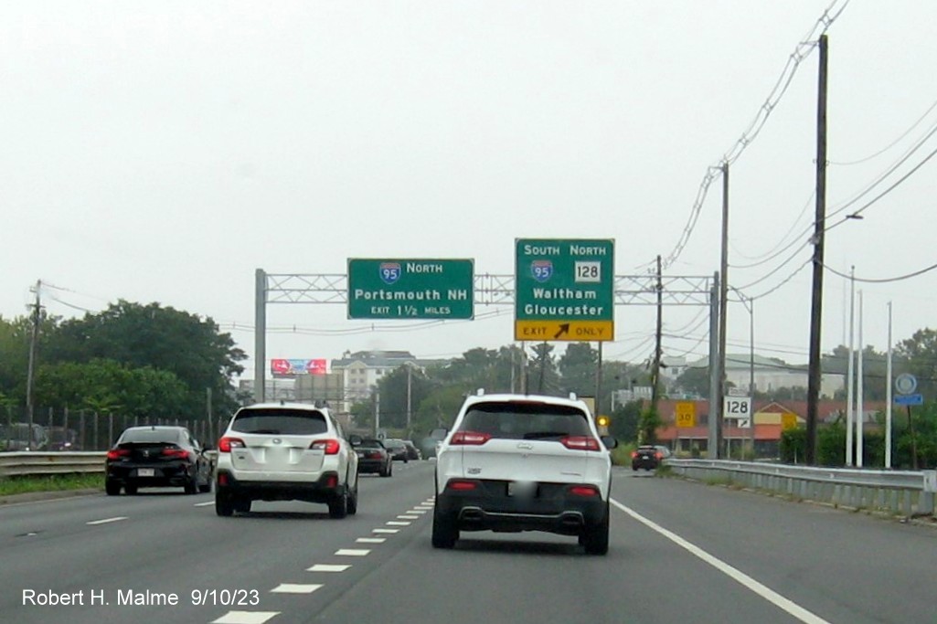
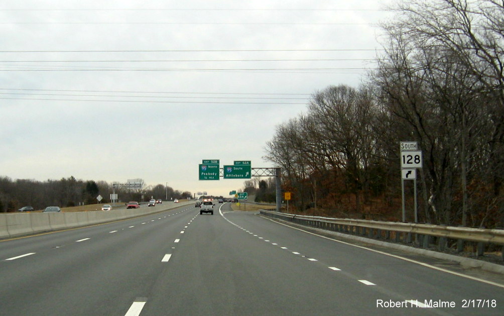
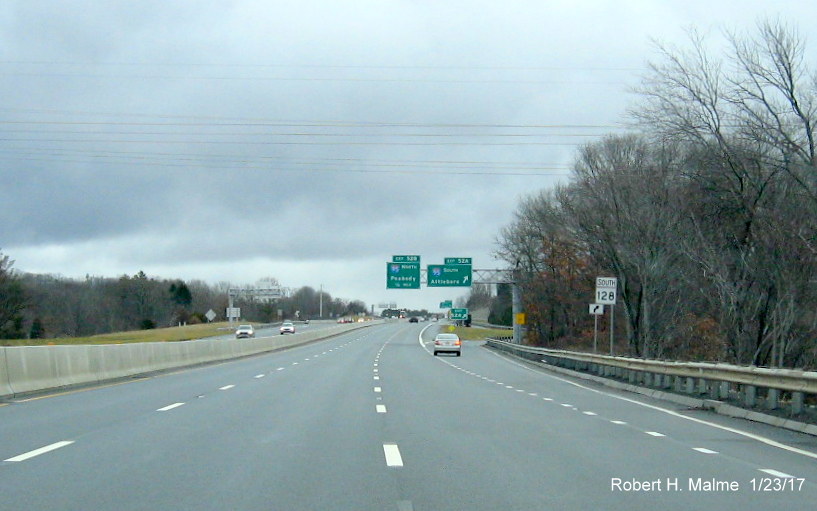
B. Route 128 Sign Replacement, Peabody to Gloucester, 2024-2025
Signage along
Route 128 between Peabody and Gloucester is being replaced in a project that was started in May 2024 and
was 69% complete in November 2025. All the overhead signs are to be replaced along with some of the ground mounted
signage. Here are some screen grabs from Google Maps Street View of the new signage headed northbound. Since the new signage
is mostly idential to the old, I compared earlier Street View images taken of the same signs and if there was no longer an
Old Exit sign and/or if there was no apparent overlay of a new number on the exit tab, I assumed the sign was a new one:
Images Taken in July and September 2025
View of a new MA 128 North ramp guide sign from the bridge over
Centennial Drive in Peabody.

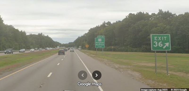
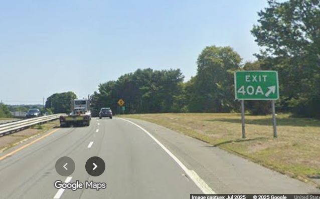
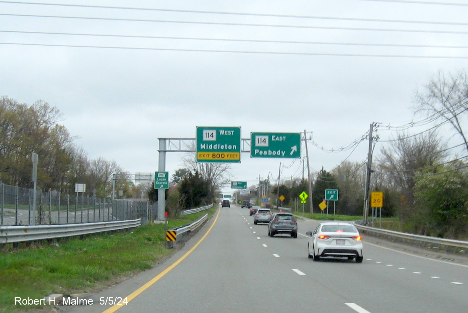
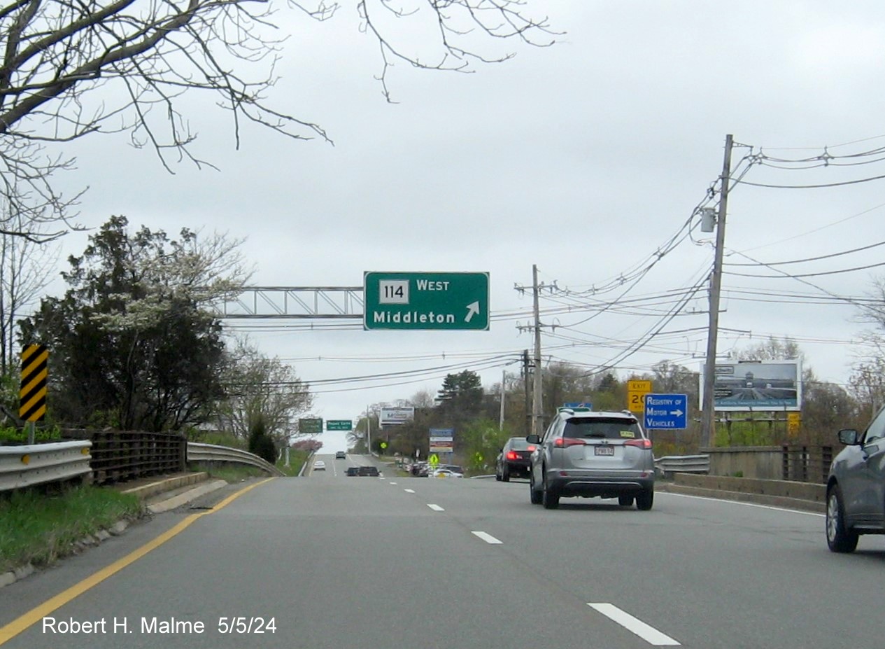
The first exit with new signage was Route 114. While the 1
mile advance sign had not been replaced as of September, the next set had.
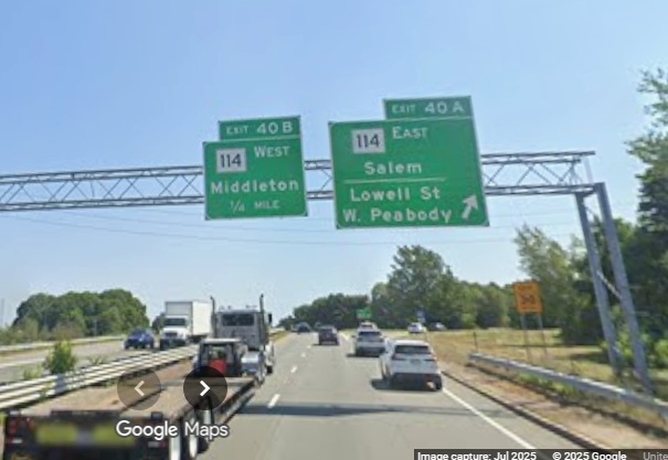
The overhead signs at the Route 114 East exit were up earlier,
as of July.
The new gore sign for the Route 114 East exit, the previous one
had an Old Exit sign below.
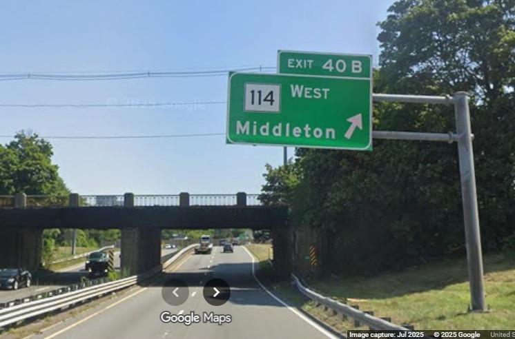
The overhead sign for the Route 114 West exit was also put up
by July.

The signs for the Eliot Street exit northbound had been replaced by
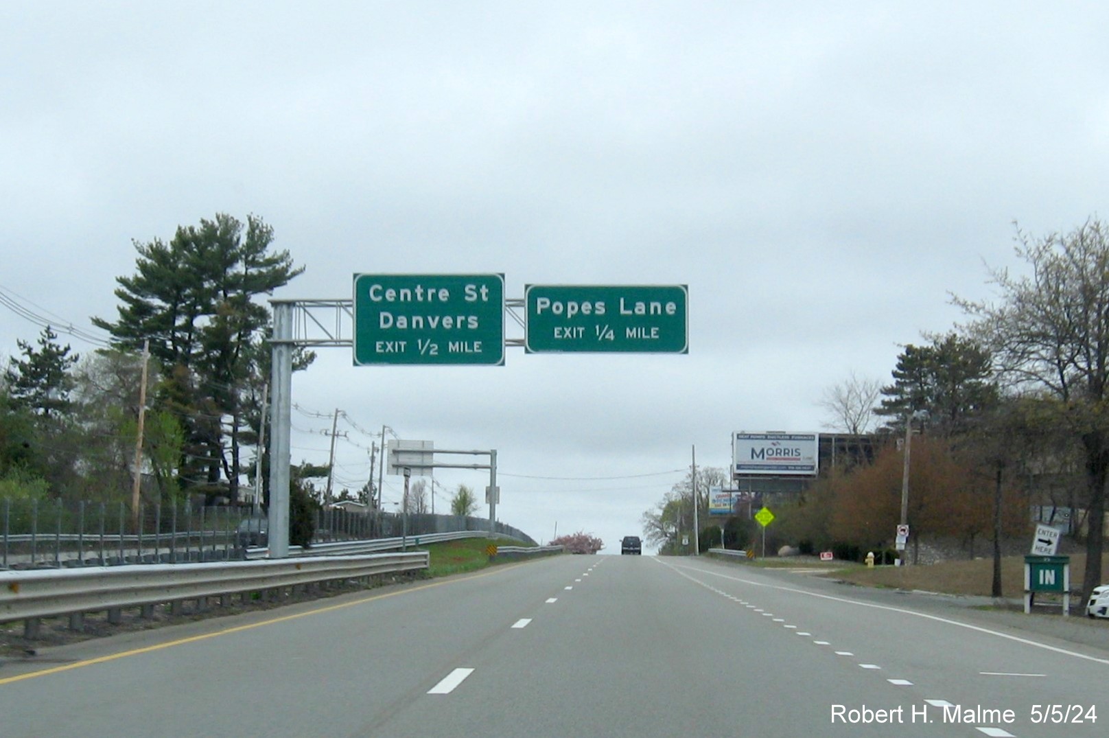
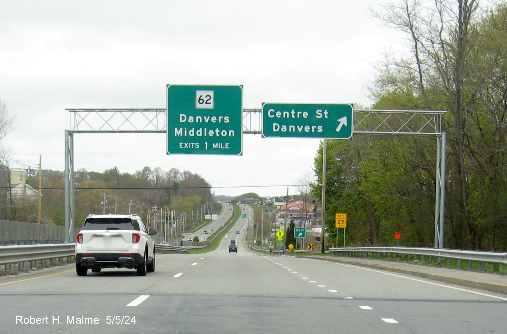
2023 when the interchange was reconstructed. Most of the other Danvers exits advance signs had not been replaced, this is the
new gore sign for the Route 35 exit.
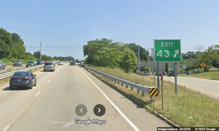
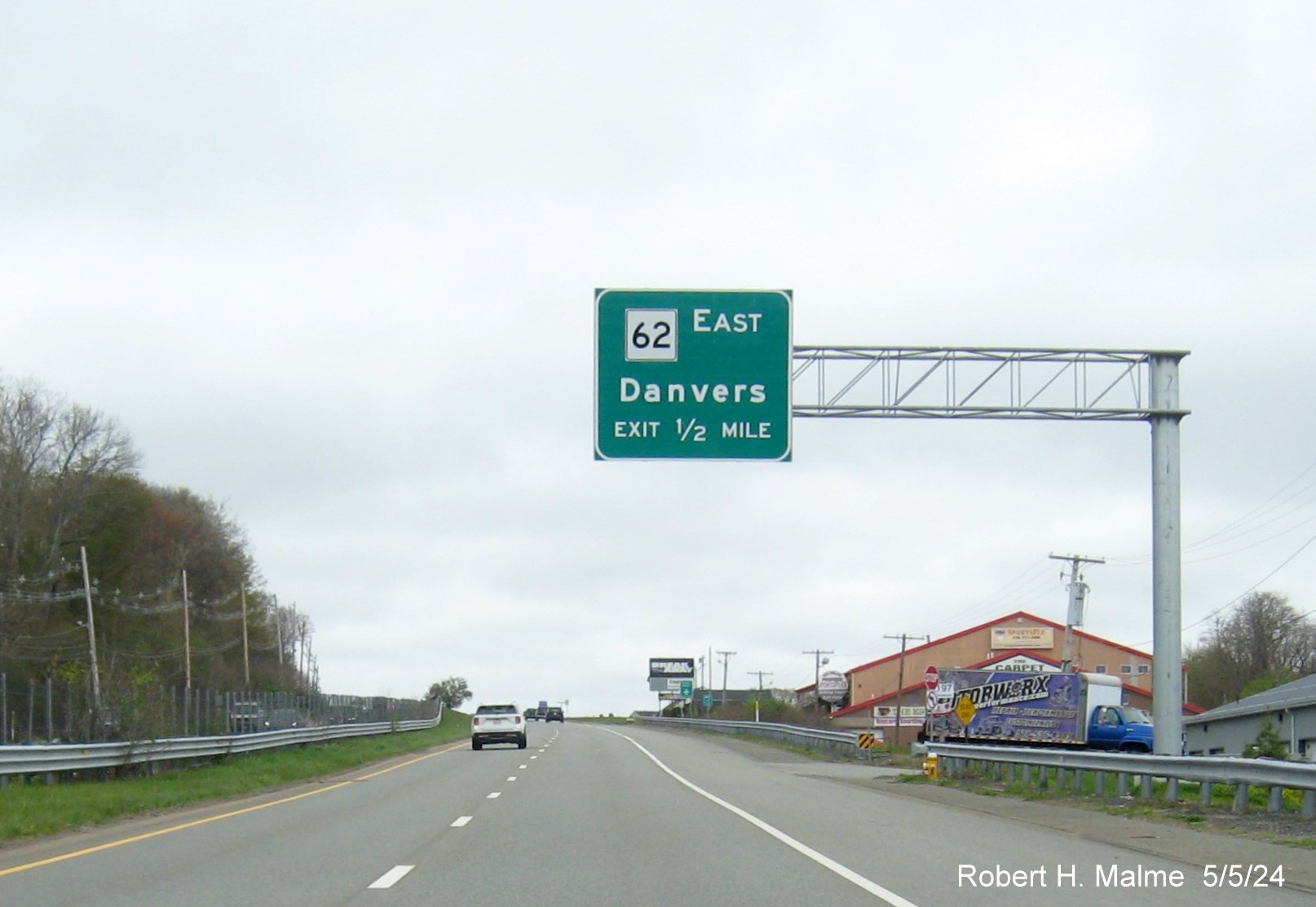
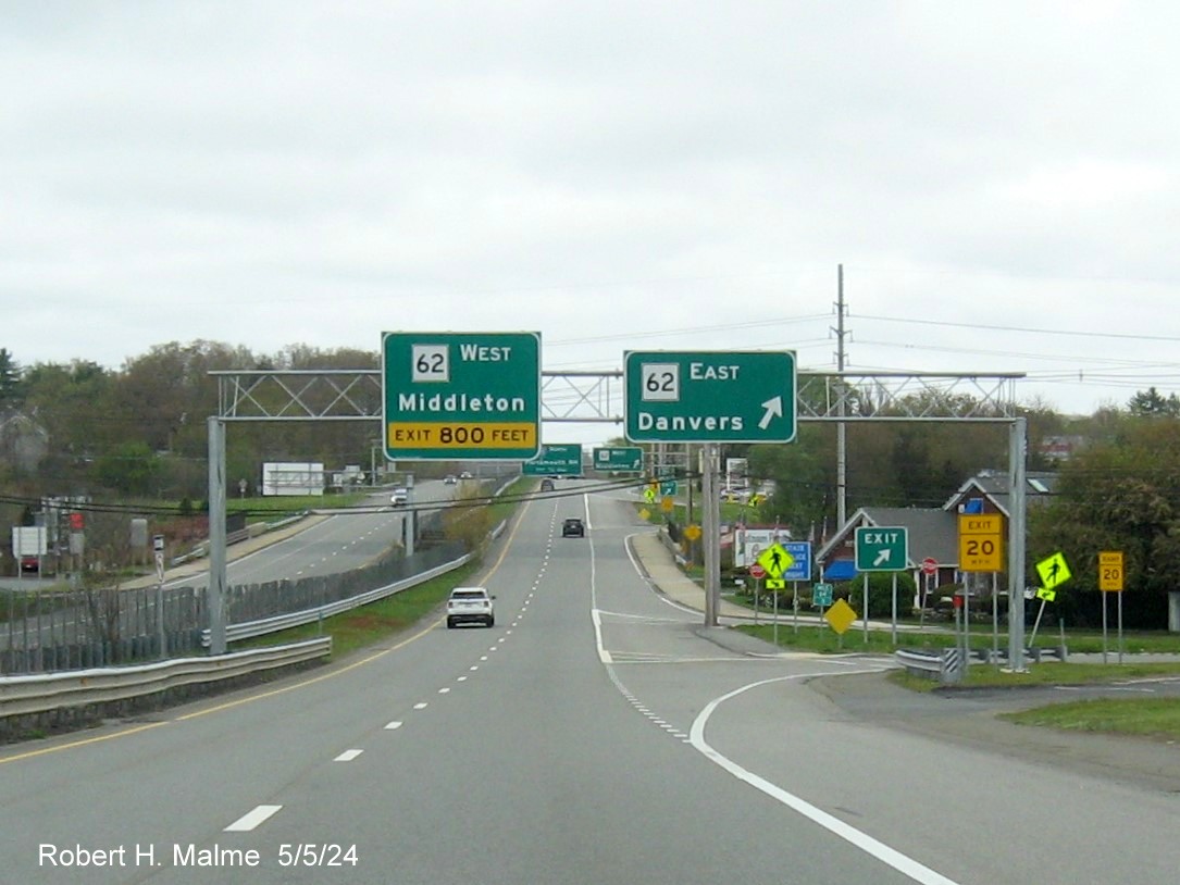
The new gore sign for the Route 62 exit.
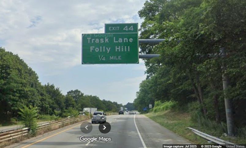
The new 1/4 Mile advance sign for the Trask Lane "exit".
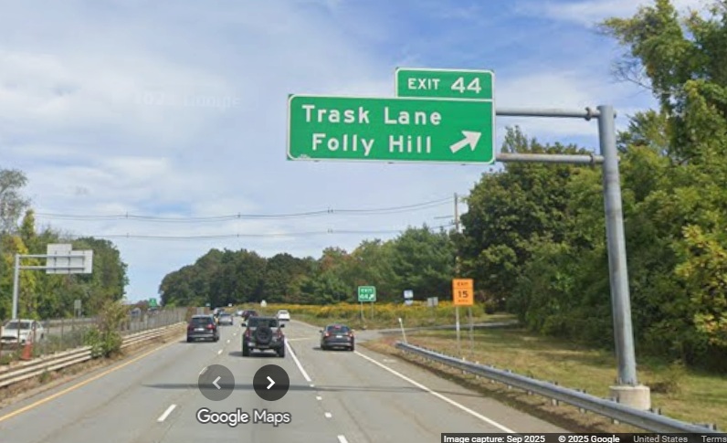
The new sign at the Trask Lane exit. The previous sign had a simpler
right arrow.
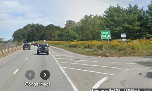
A closer look at the Trask Lane exit gore sign.
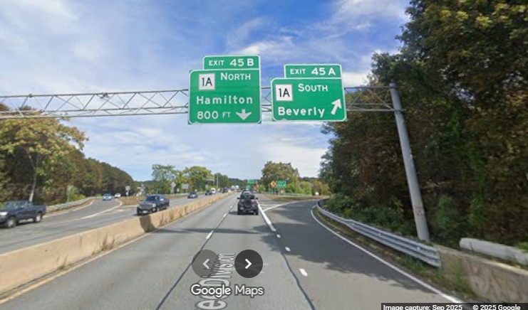
The only new signs for the Route 1A exit were at the ramps, with
one exception.
There was a new auxiliary sign for the Route 1A North exit put up
by July.
The new gore sign for the Route 1A South exit.
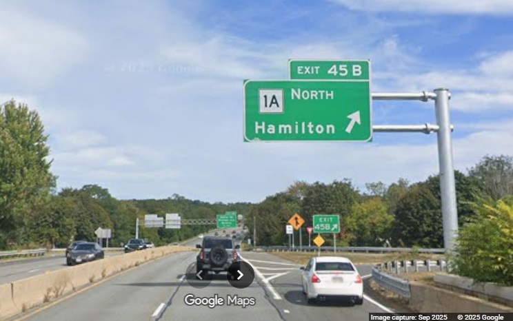
The new Route 1A North exit and gore signs. Most of the
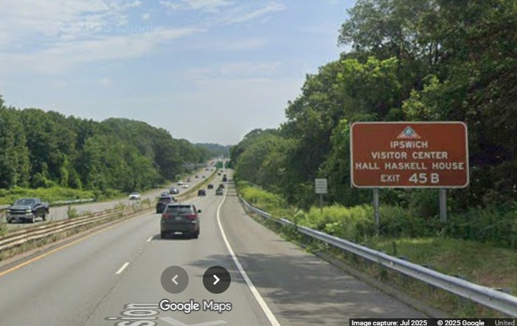
overhead signs were up as of September from here to Gloucester.
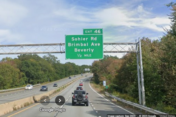
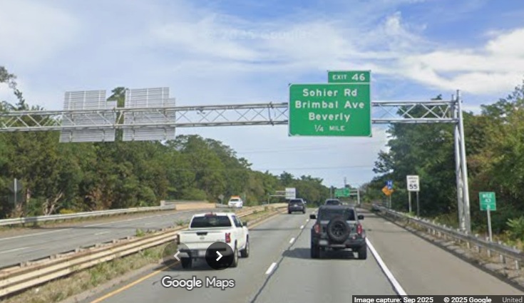
The new 1/2 Mile advance sign for the Sohier Road/Brimbal Avenue
exit. The overhead signs for this exit were not replaced during the previous sign update project.
A new brown auxiliary sign for the Sohier Road/Brimbal Avenue
exit.
The new 1/4 Mile advance sign notice that the exit number
is slightly off the number on the mile marker.
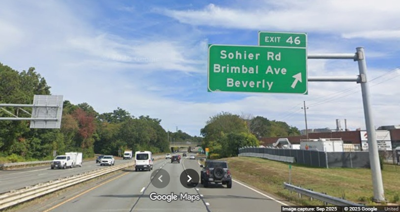
The new Sohier Road/Brimbal Avenue exit sign.
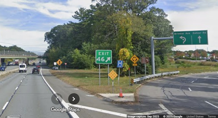
The new gore sign. It did not appear that the overhead ramp
sign directing traffic to either Sohier Road or Brimbal Avenue had been replaced.
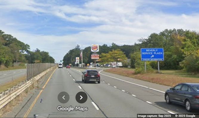
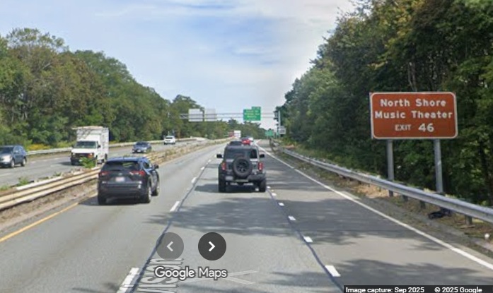
The new blue sign for the Beverly Service Plaza featuring larger
letters. This photo not brought to you by Burger King.
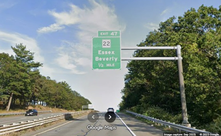
The new 1/2 Mile advance sign for the Route 22 exit.
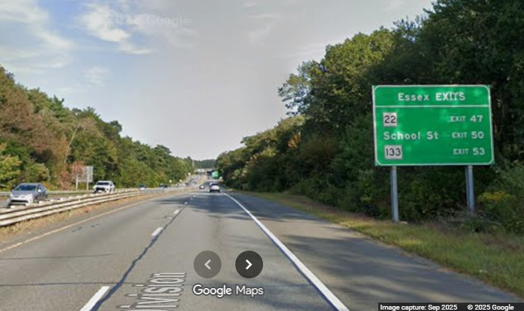
A new mileage sign for the Essex exits on Route 128 North.
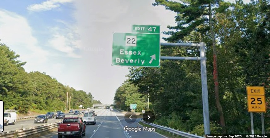
The new exit sign for Route 22.
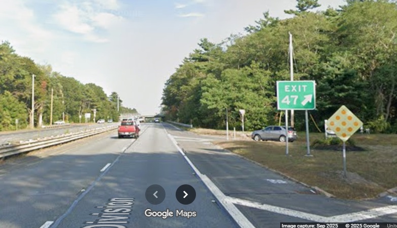
The new gore sign for the Route 22 exit.

The new 1 Mile advance sign for the Grapevine Road exit.
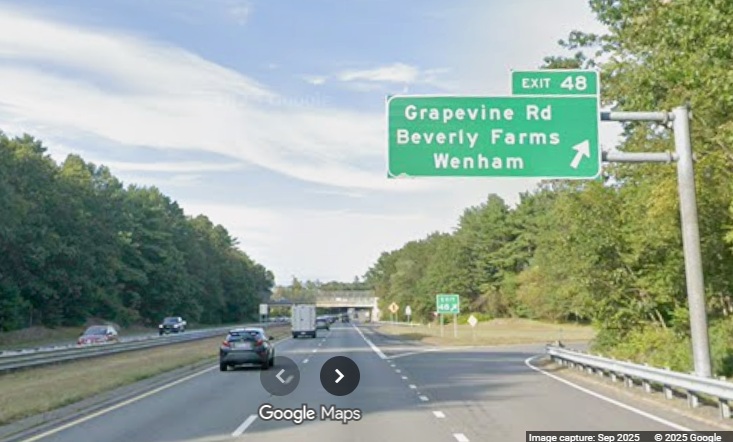
The new exit sign for Grapevine Road.
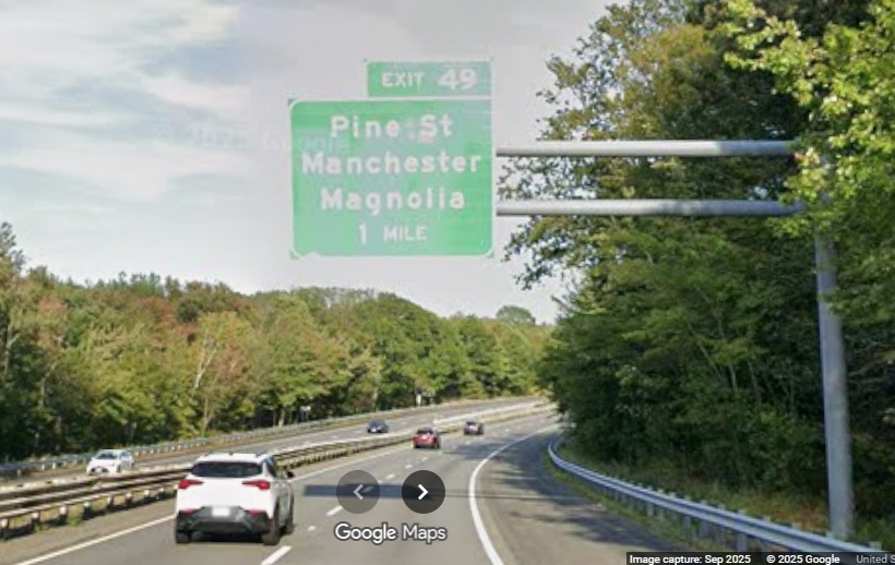
The new 1 Mile advance sign for the Pine Street exit.
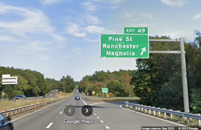
The new Pine Street exit sign.
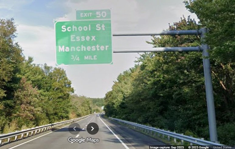
The new 3/4 Mile advance sign for the School Street exit.
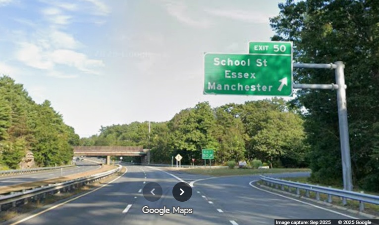
The new School Street exit sign.
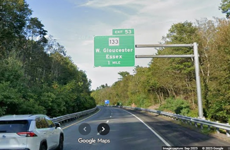
The new 1 Mile advance sign for the Route 133 exit.
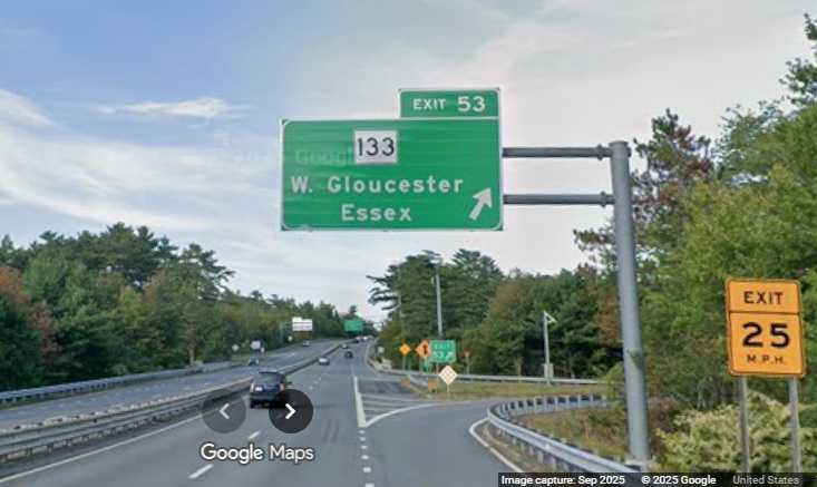
The new Route 133 exit sign.
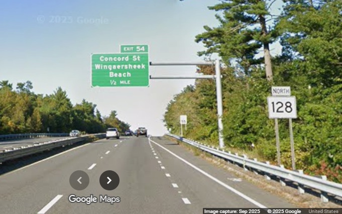
The new 1/2 Mile advance sign for the Concord Street exit (it
doesn't appear that any of the Route 128 reassurance markers have been updated yet).
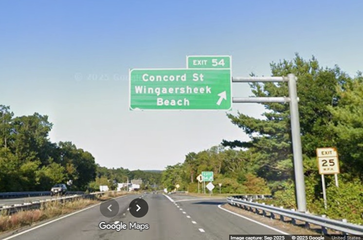
The new Concord Street exit sign.
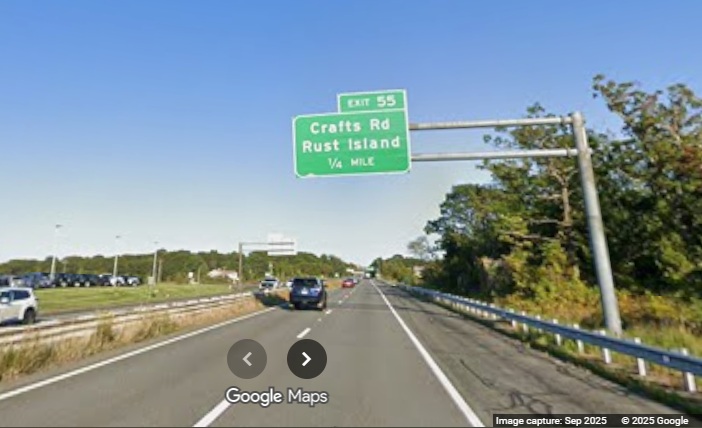
The new 1/4 Mile advance sign for the Crafts Road exit (the
last numbered exit).
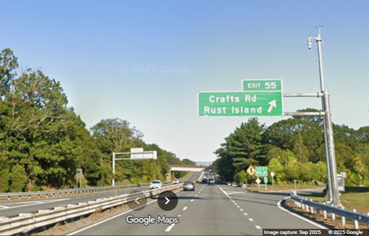
The new Crafts Road exit sign. And a bonus heading south...
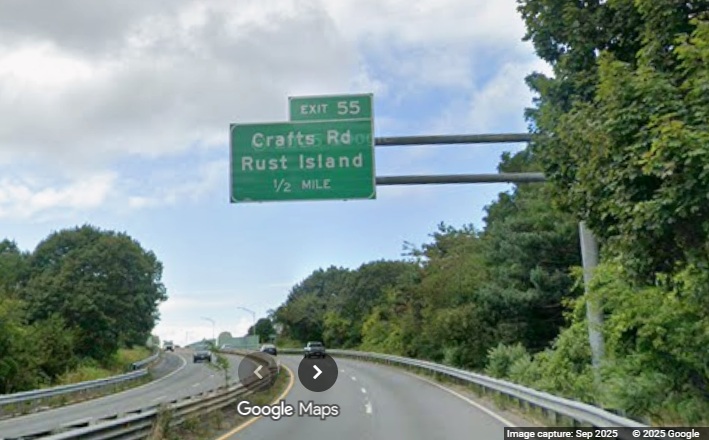
The new 1/2 Mile advance sign for the Crafts Road exit prior to the
Annisquam River Bridge.
C. I-190 Sign Replacement Project, 2023-2025
Signage along
I-190 between Worcester and Leominster was replaced in a project that was started in March 2023 and
was nearly completed in June 2025. All the overhead signs were replaced, except southbound for
Exit 1 that was replaced in a separate project a couple years earlier. Here is some of the new signage
captured by Jay Hogan from his Flickr site:
Northbound, Taken August 2, 2025
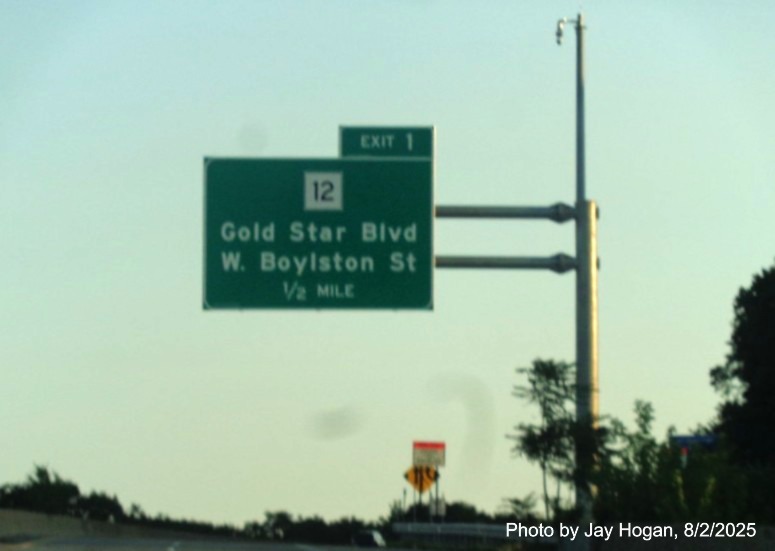
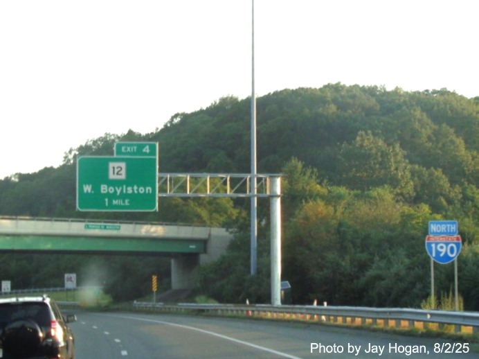
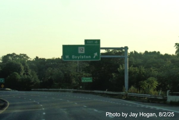
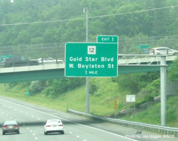
The new 1/2 Mile advance sign on I-190 North for the
Route 12 exit.
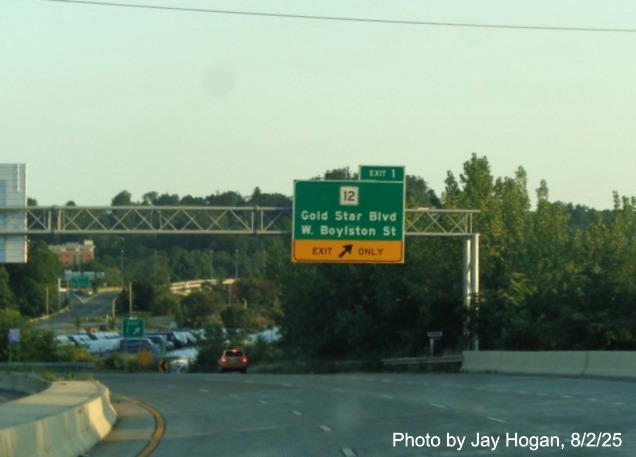
The new exit sign for Route 12.
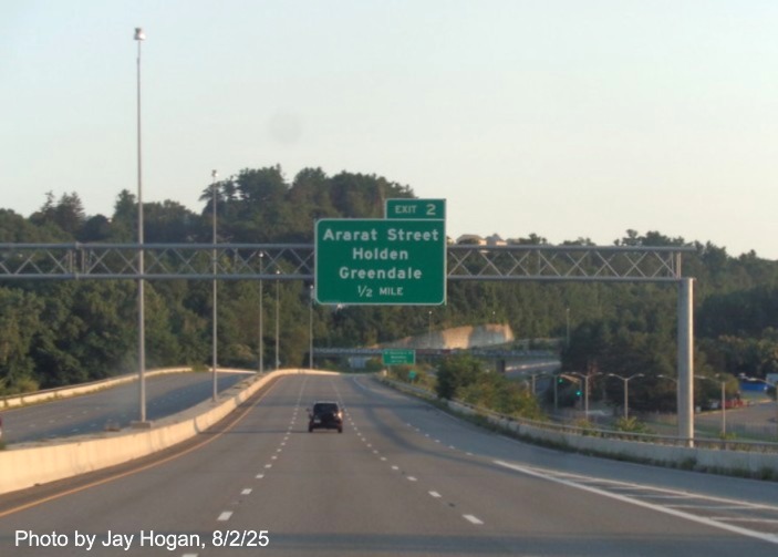
The new 1/2 Mile advance sign for Ararat Street.
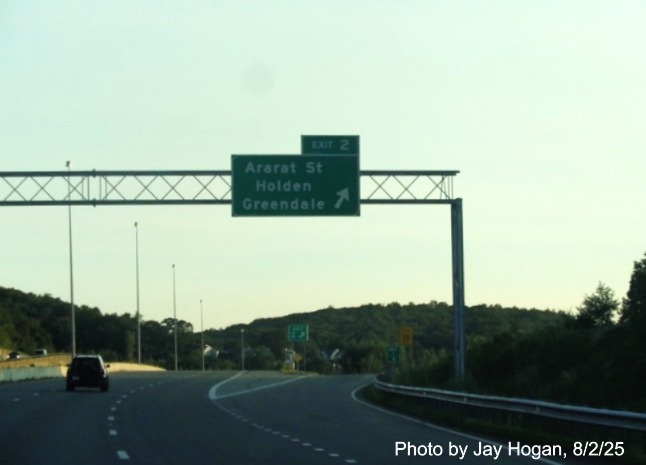
The new exit and gore sign for Exit 2.
The new 1 Mile advance sign for the next Route 12 exit.
The new exit sign for the next Route 12 exit.
The new 1 Mile advance sign for the Route 140 exit, no more
Old Exit 5 sign.
The new exit sign for the last Route 12 (to Route 62) exit.
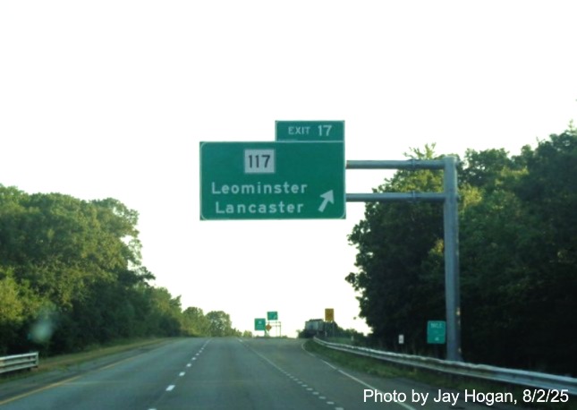
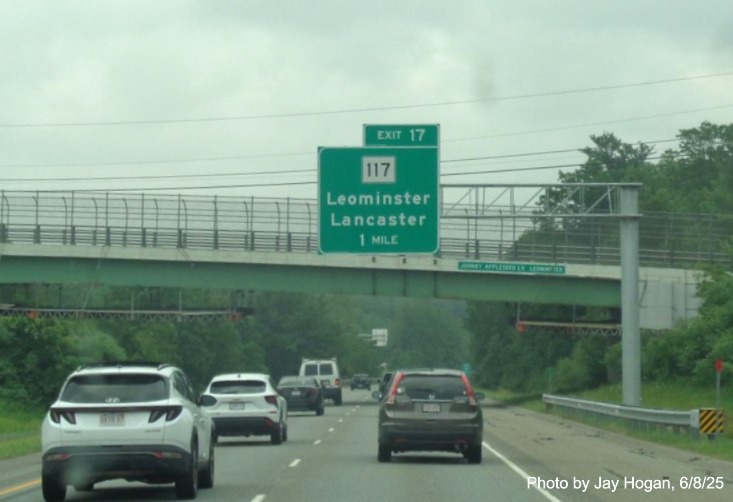
The new exit sign for the Route 117 exit.
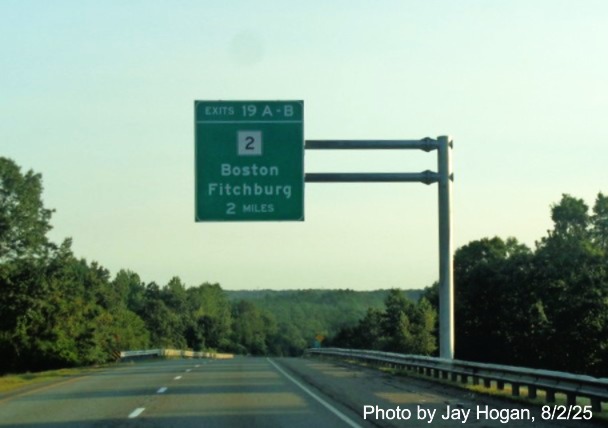
The 2 Miles advance sign for the last exit, Route 2.
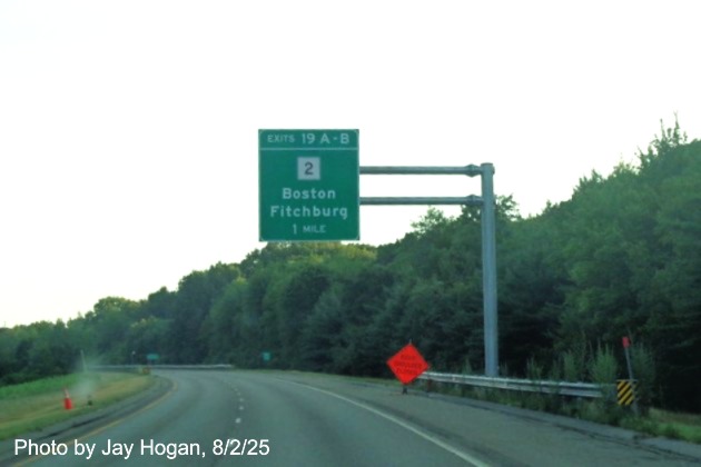
The new 1 Mile advance sign.
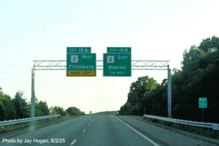
The two new 1/2 Mile advance signs.
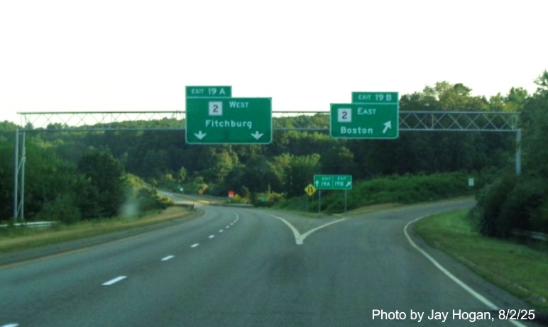
The new 1 Mile advance sign.
Southbound, Taken June 8, 2025
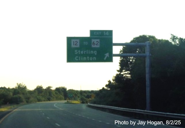
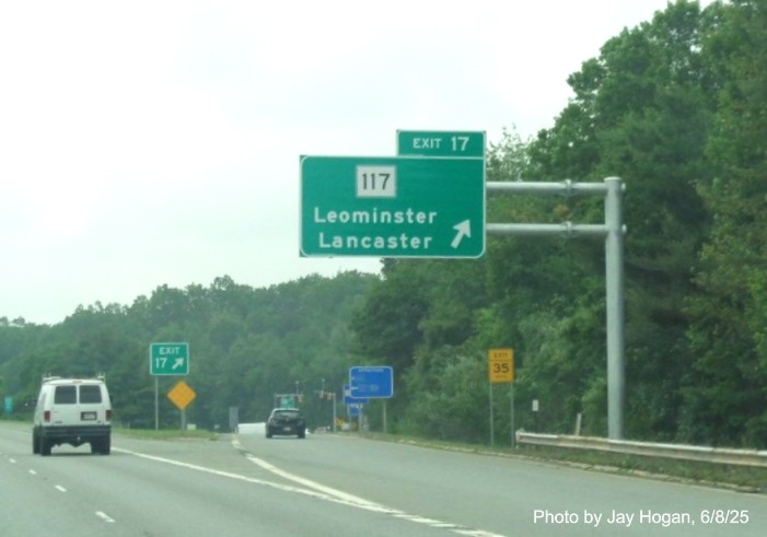
The first new sign on I-190 South for the Route 117 exit.
The new exit and gores signs for the Route 117 exit.
The new overhead signs for the Route 12 exit now include
To Route 62 as well.
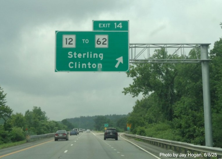
The new Route 12 exit sign, and gore sign in distance.
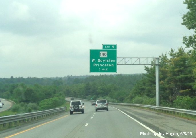
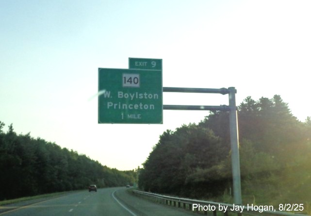
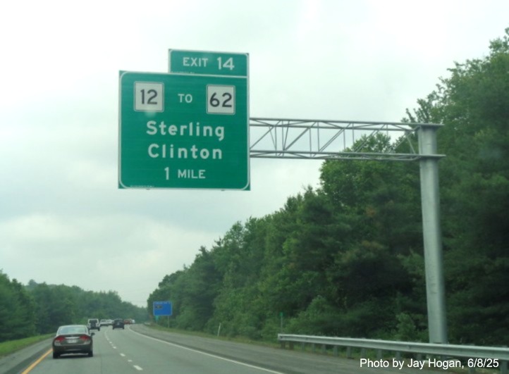
The new 1 Mile advance sign for Route 140.
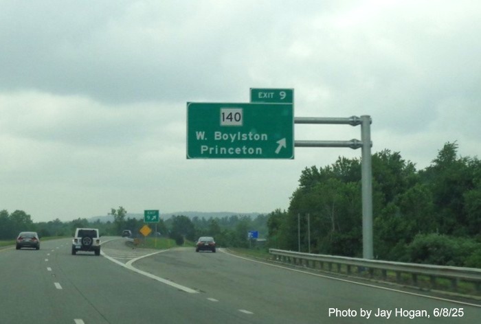
The exit and gore sign for Route 140 in West Boylston.
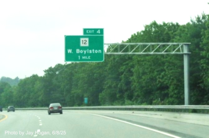
The new 1 Mile advance sign for the Route 12 exit in West
Boylston.
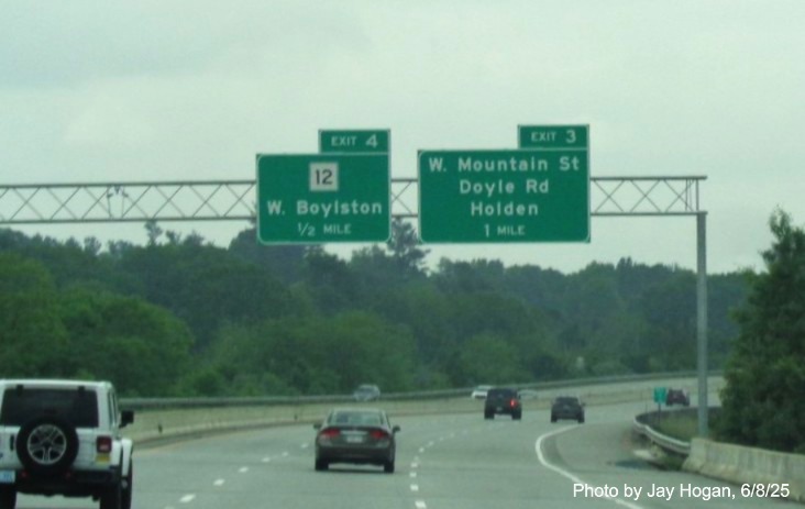
The new 1 Mile advance sign for the West Mountain Street exit in
West Boylston is paired with the 1/2 Mile advance for the Route 12 exit, but the signs should be switched since Exit 4 comes
first.
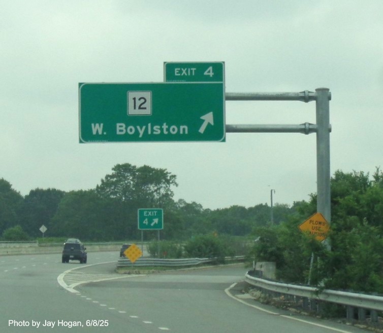
The new exit and gore signs for the Route 12 exit in
West Boylston.
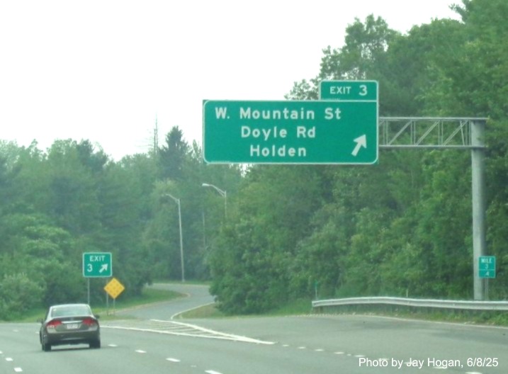
The new exit and gore signs for the West Mountain Street exit in
Holden.
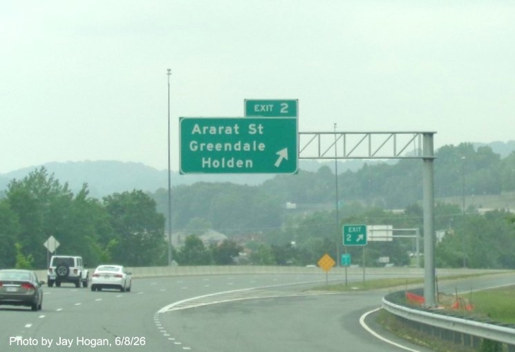
The new exit and gore signs for the Ararat Street exit.
The new 1 Mile advance sign for the Route 12 exit in
Worcester. The signs approaching the exit were already replaced in 2022.
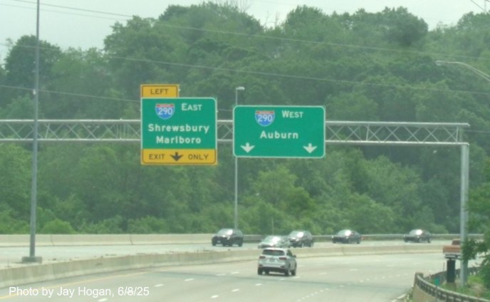
The new overhead advance signs for the I-290 exits at the end
of I-190 South in Worcester. No exit numbers as per the previous signs.
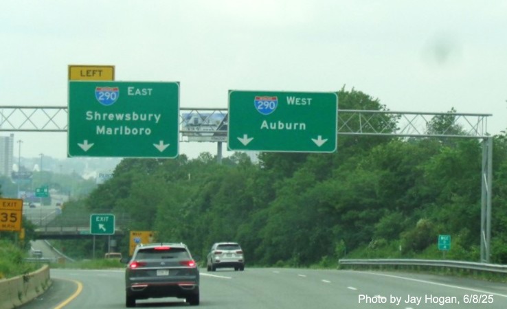
The new overhead signs at the split of ramps for the I-290 exits
at the end of I-190 South in Worcester.
View higher resolution versions and additional photos at
Jay Hogan's I-190 Photo
Gallery
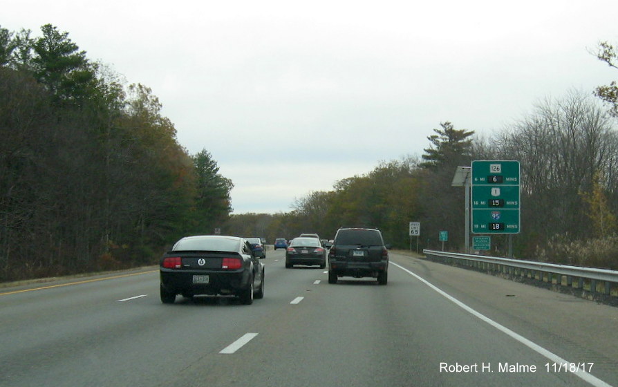
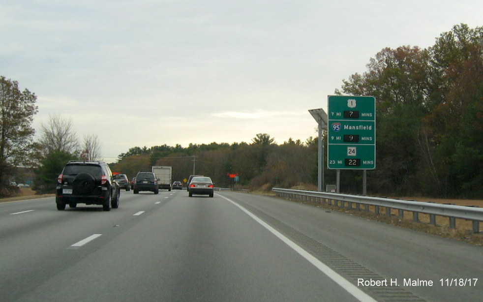
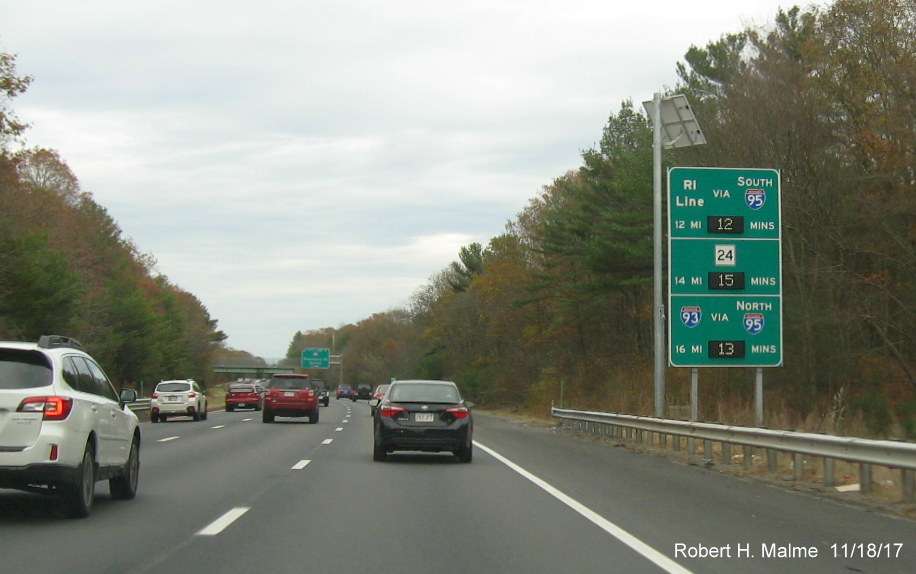
D. MA 25 Sign Replacement Project, 2023-2024
Signage along
Route 25 was replaced in a project that was started in March 2023 and
completed in the fall of 2024. Only the signs were replaced, not the
supports, making it, along with the 10 mile length of the highway, one
of the quicker recent sign replacement projects. Here is new signage
captured eastbound starting at I-495 on November 30, 2024:
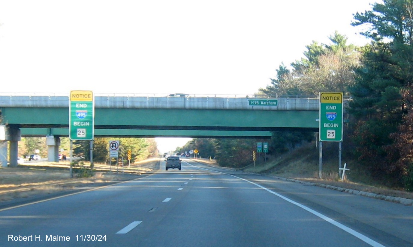
The first new
signs along Route 25 are the twin advisories at the end of I-495 South
and the beginning of Route 25 East, and signage for I-195 Wareham on the bridge ahead.
A new distance sign after the ramp from the end of I-195 East. The
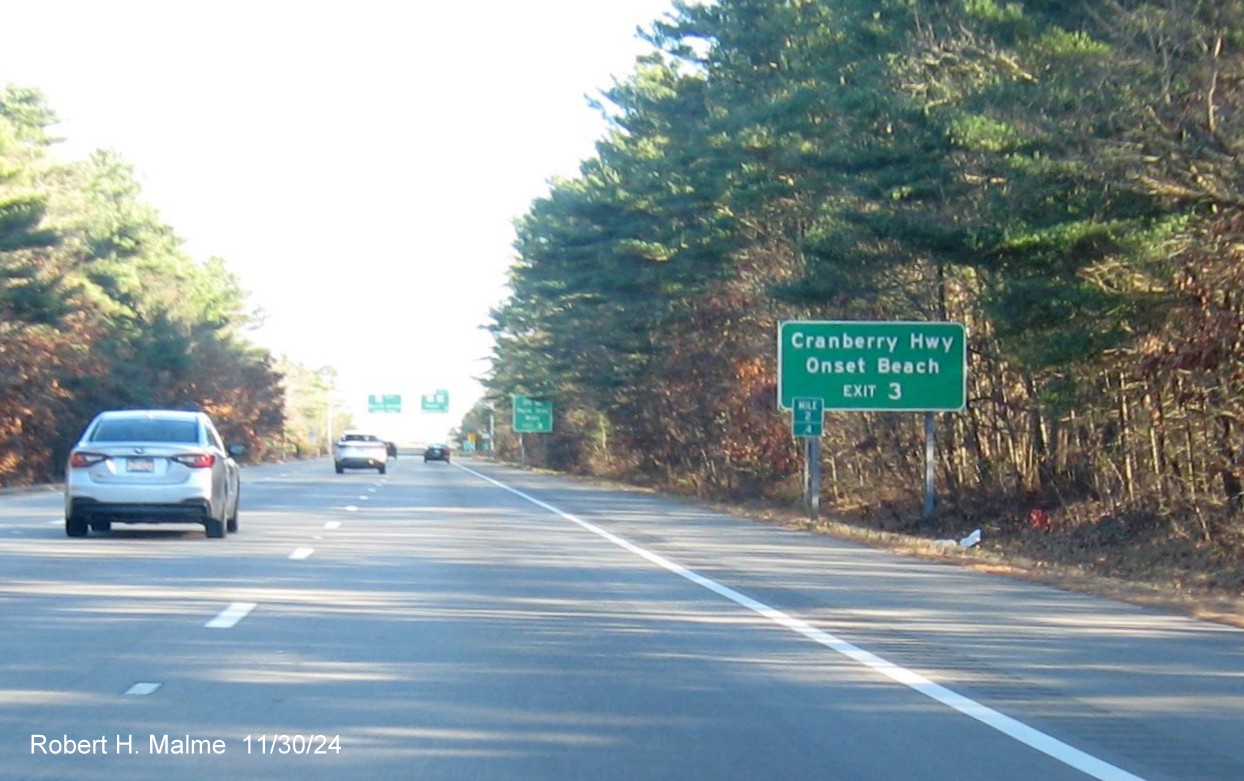
last one is a Route 28 destination.
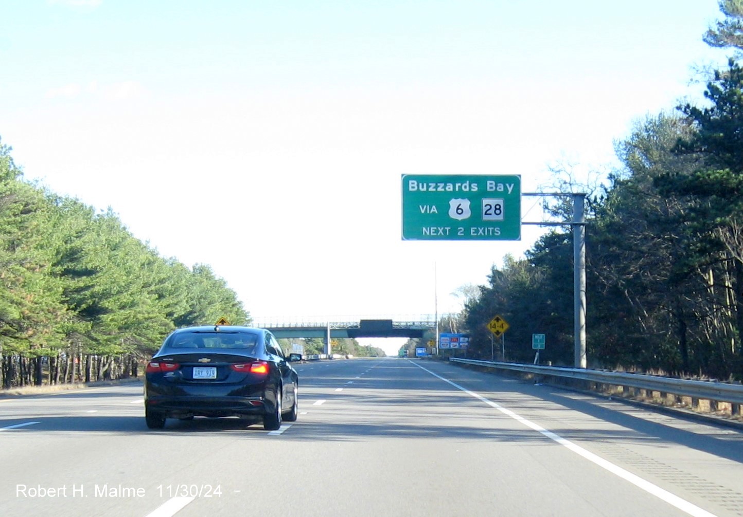
The overhead sign
along Route 25 is not an exit, but exits sign indicating the next two exits lead you to US 6 and Route 28.
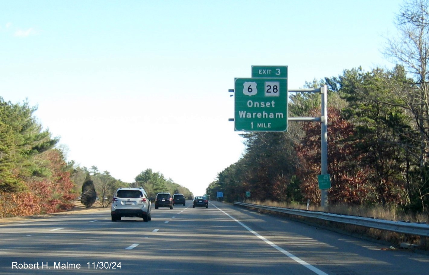
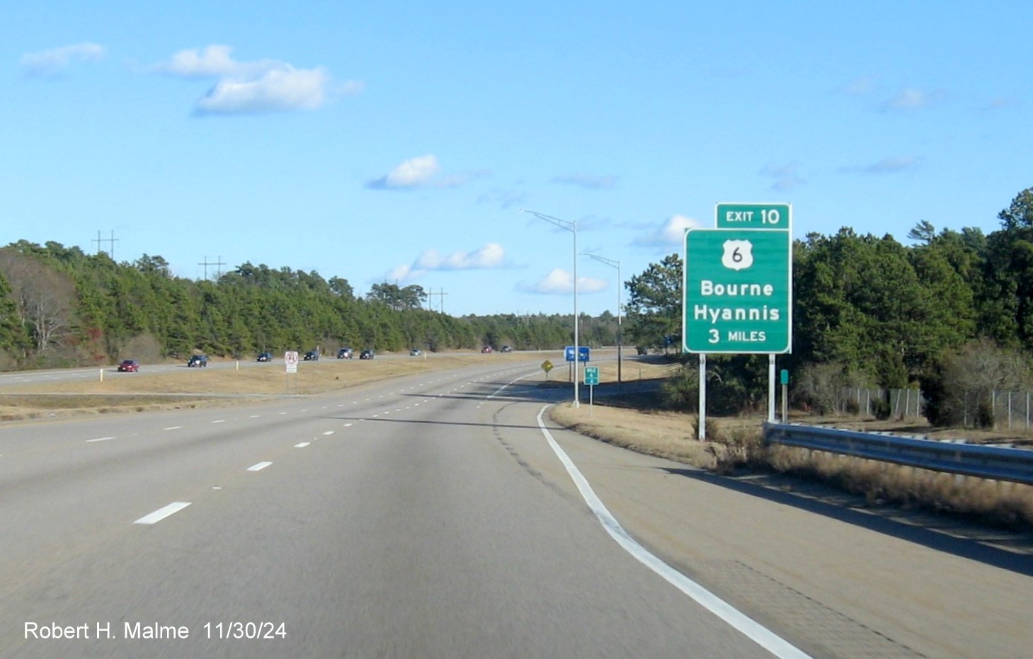
The first advance sign for the US 6/Route 28 exit in
Wareham.
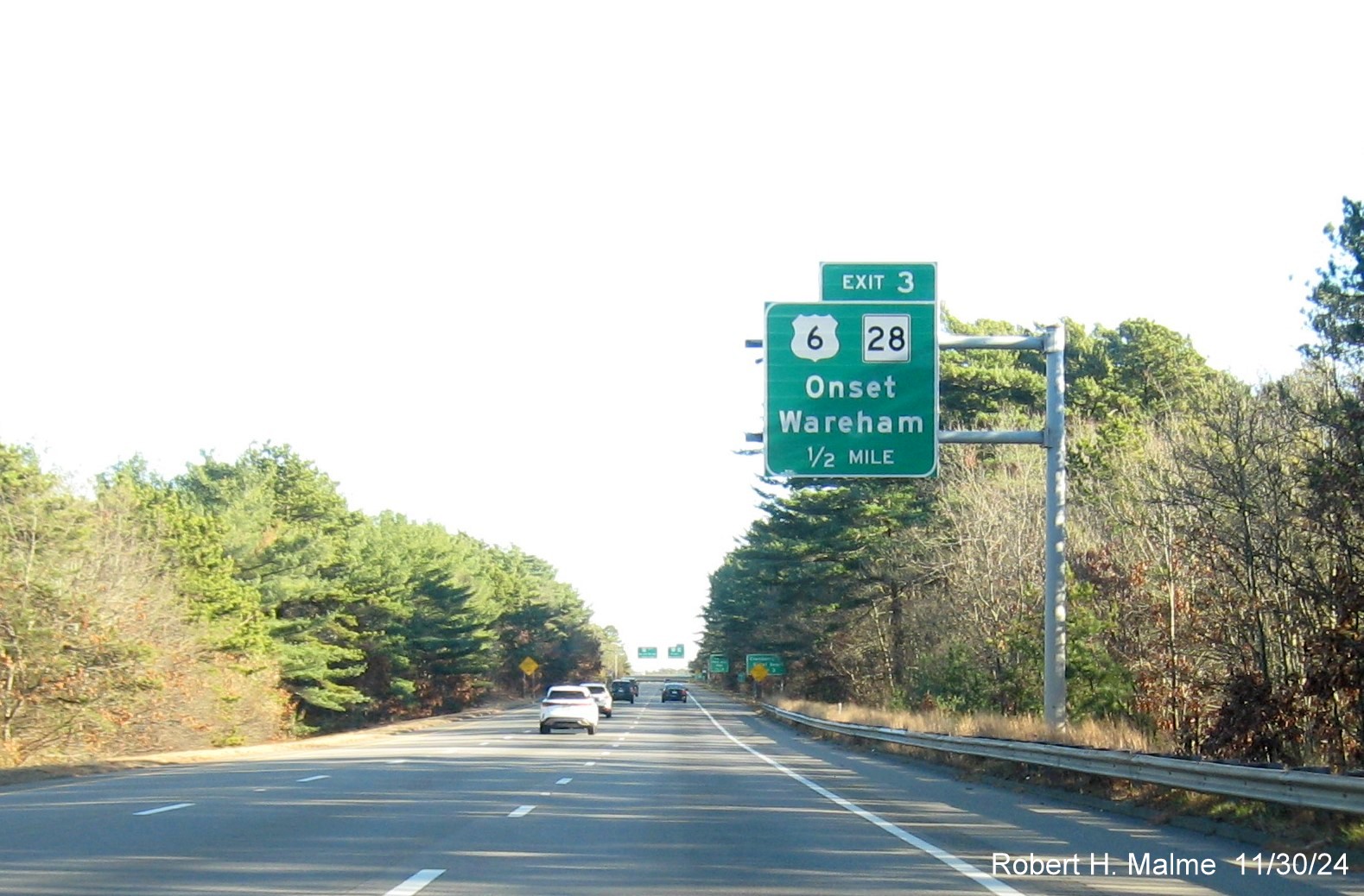
The new 1/2 Mile advance sign.
A new auxiliary sign for the upcoming US 6/Route 28 exit.
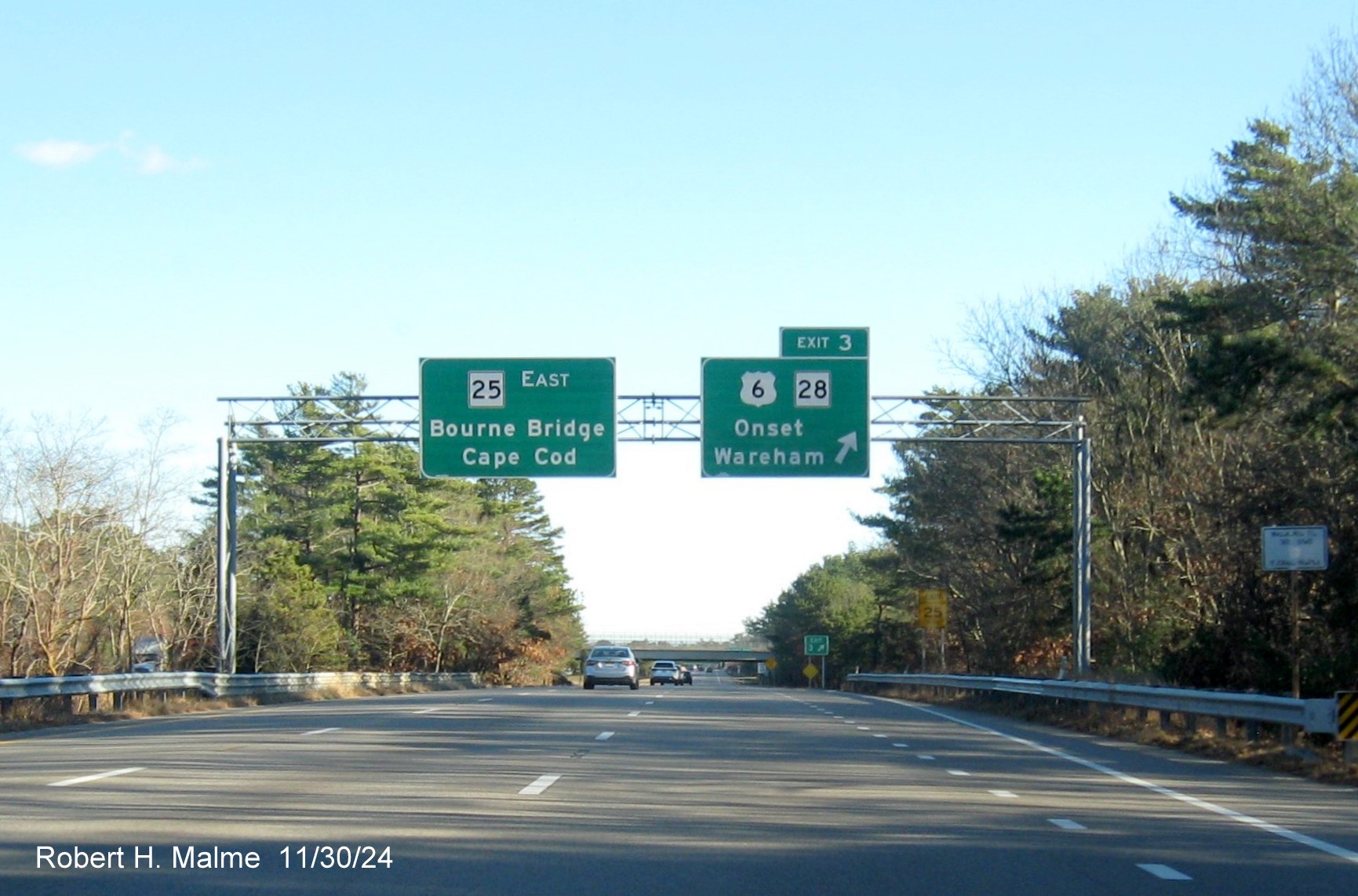
The new signs at the US 6/MA 28 Wareham exit.
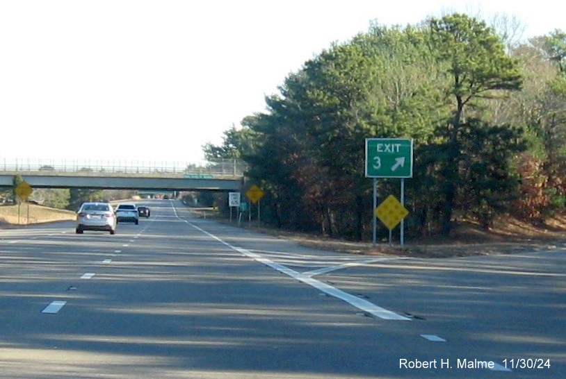
The new gore sign for the US 6/Route 28 Wareham exit. No more Old
Exit 2 sign.
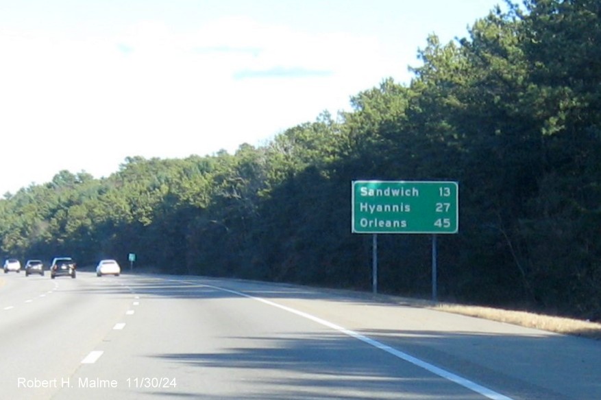
The next new distance sign along Route 25 East. The last 2 can be
reached by either US 6 or Route 28.
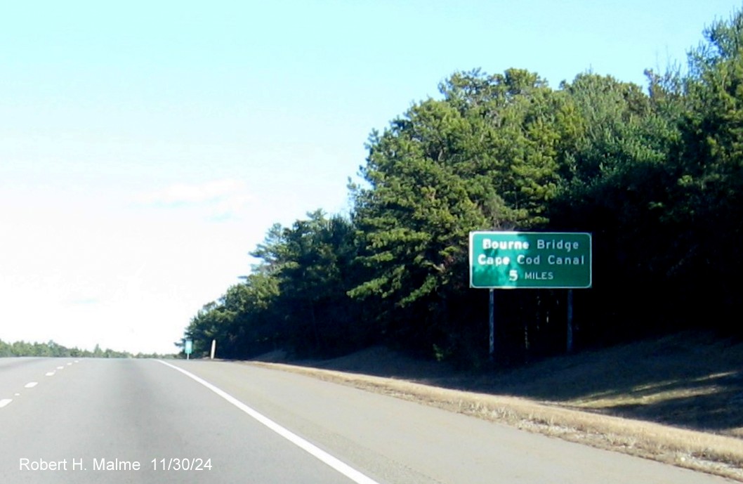
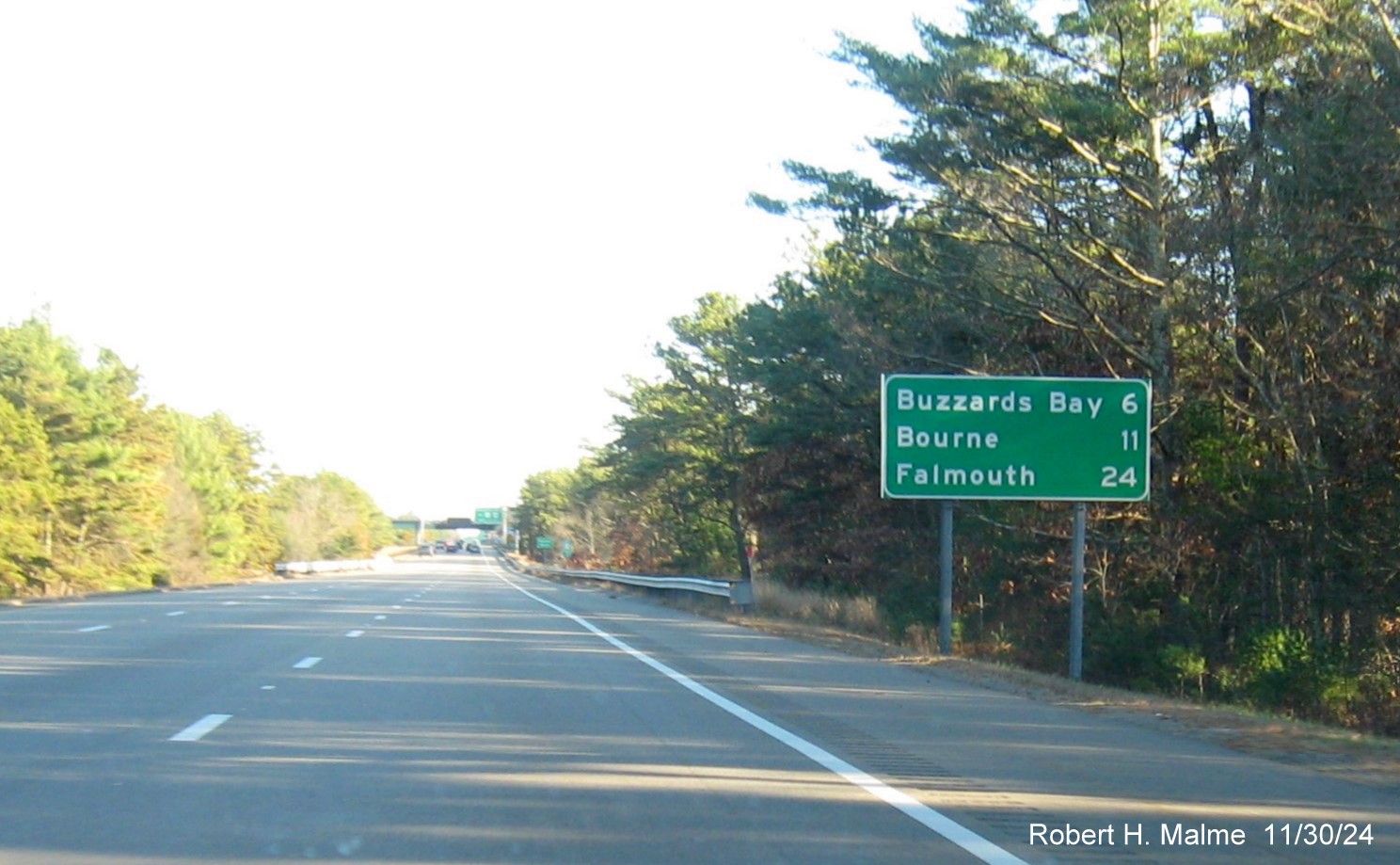
A new sign indicating 5 Miles to the Bourne Bridge, useful to know
if stuck in a traffic jam on a summer holiday weekend.
The rare 3 Miles advance sign for the US 6 exit was replaced prior
to the Route 25 East Rest Area. May also be useful if stuck in traffic.
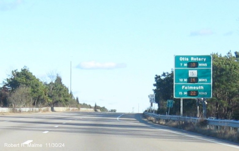
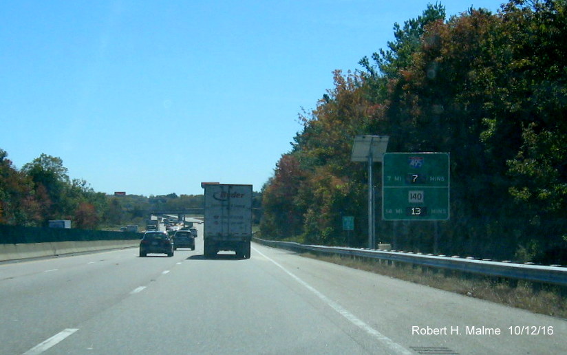
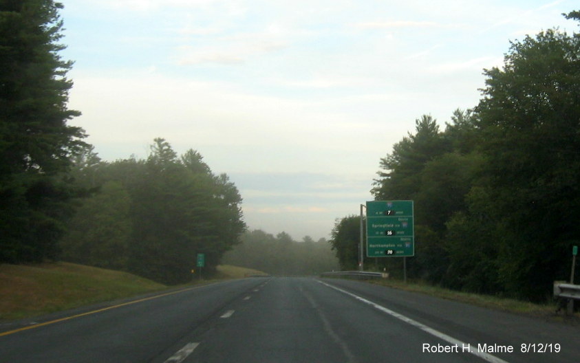
Best photo I got of the new East Route 25 reassurance markers, this
one after the Rest Area on-ramp and behind one of the first Real Time traffic signs installed in April 2014.
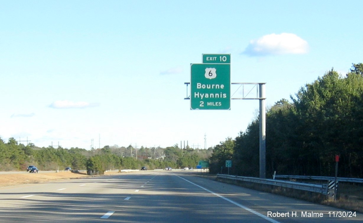
The new 2 Miles advance sign, like the Wareham exit, this too is
also US 6/Route 28 (North), but does not include the latter shield, perhaps to reduce confusion between the 2 exits.
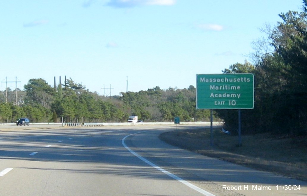
The new auxiliary sign for the Mass. Maritime Academy.
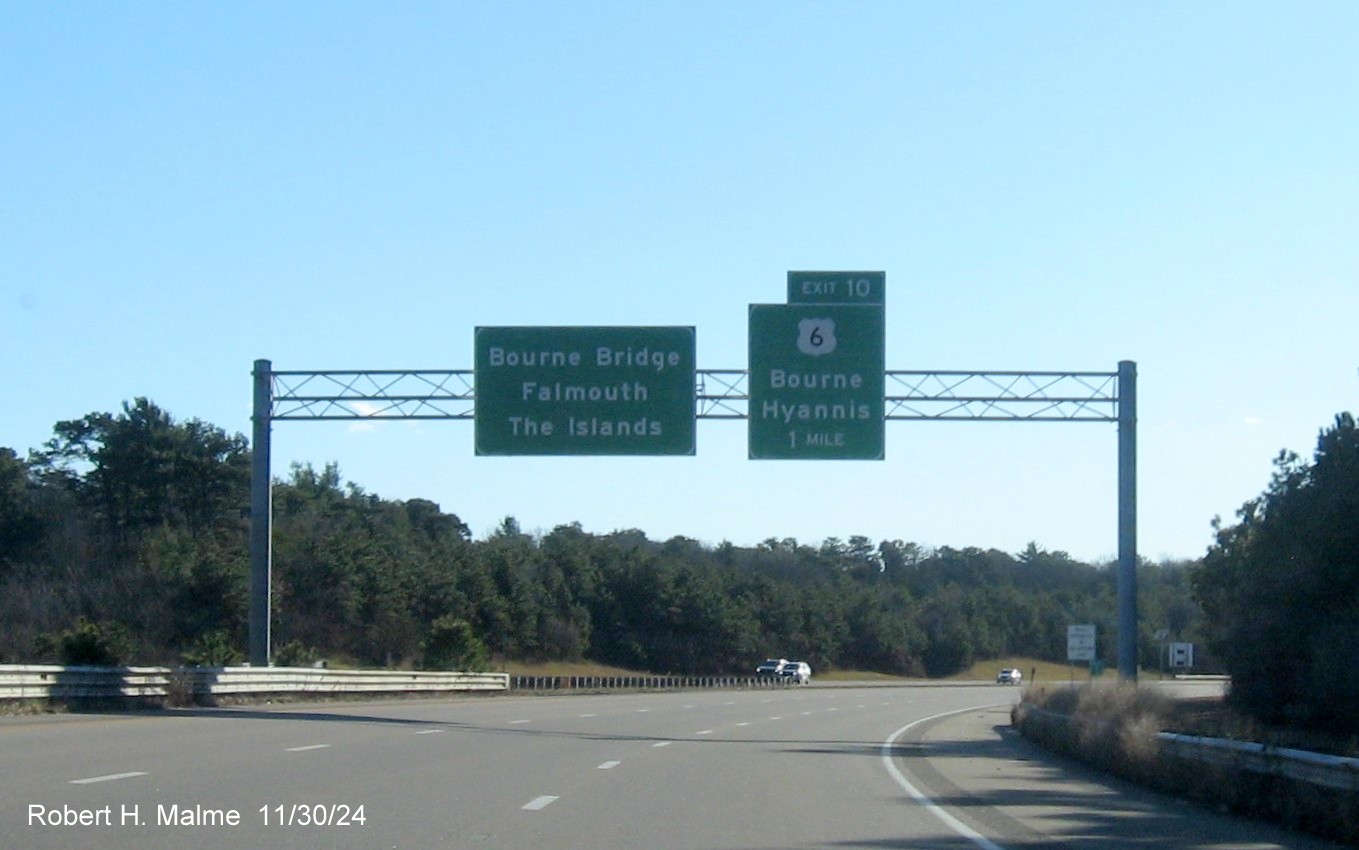
The new 1 Mile advance sign for the US 6 exit approaching the end
of Route 25 East. Again, not only no mention of North Route 28 with US 6 but that South Route 28 takes you across the Bourne
Bridge and Falmouth. It's also helpful if you know the names of the 2 islands.
The solar glare prevented taking decent photos of the last new
signs along Route 25, here's a Google Maps Street View image of the signage at the US 6 exit from August, when there were
traffic jams:
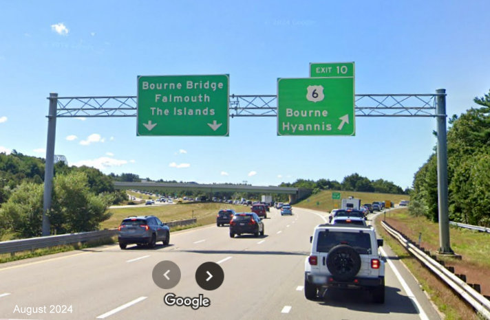
The exit sign, same issue as with the 1 Mile advance.
Here's a Street View image heading west of one of the advance signs
for the I-195 West exit:
The exit sign, same issue as with the 1 Mile advance.
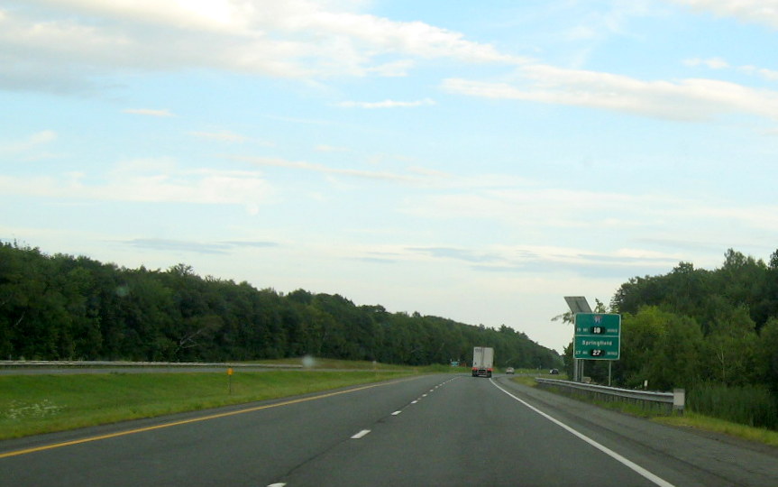
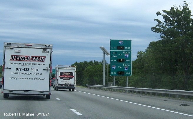
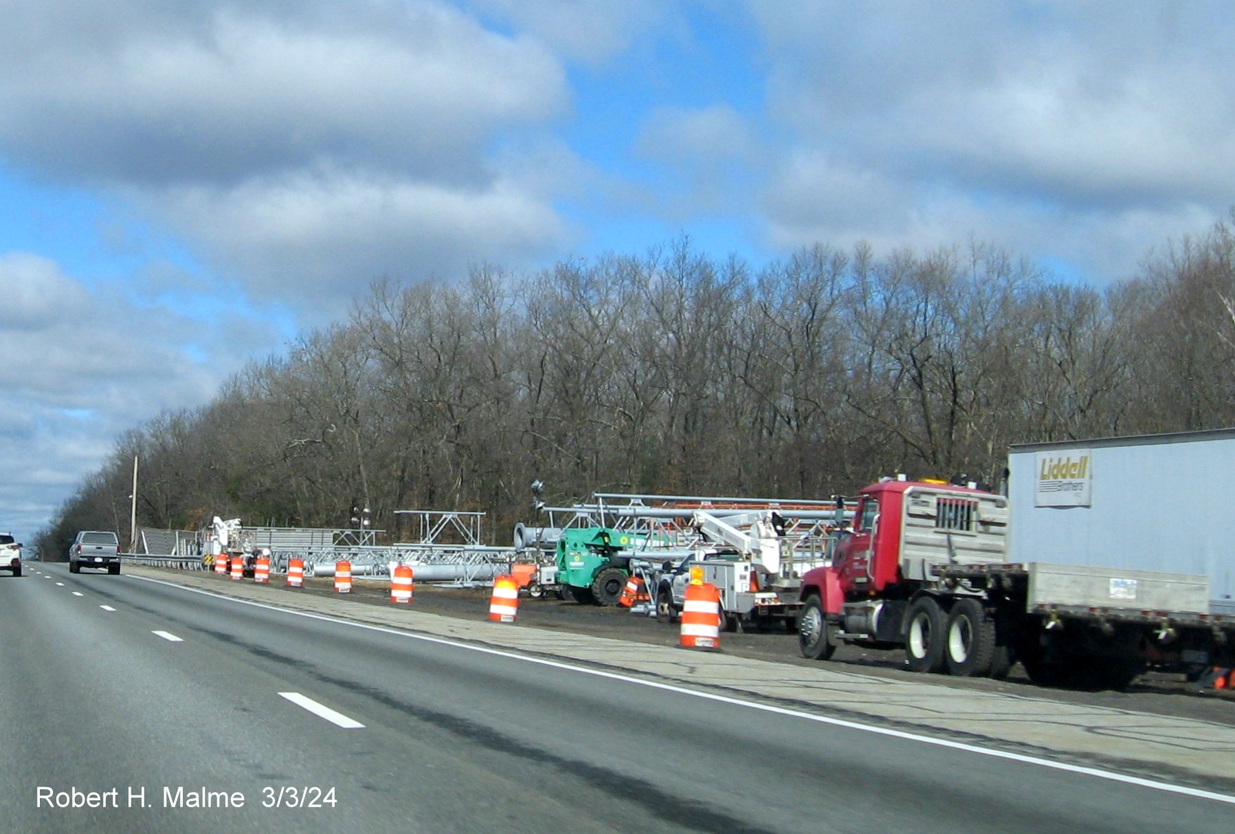
E. US 3 Sign Replacement, Burlington to Tyngsboro, 2021-2024 (UPDATED 7/30/24)
Signs along the
US 3/Northwest Expressway are being replaced under a contract started back in 2021. Only in early 2024 have the overhead
signs along the route started to go up. As of late July 2024 all but 1 overhead sign had been replaced, work still needed
on ground-mounted signs, including most gore signs and reassurance markers. The photos will be grouped by exit
heading north, with northbound exits shown first:
*Photos taken on July 28, 2024:
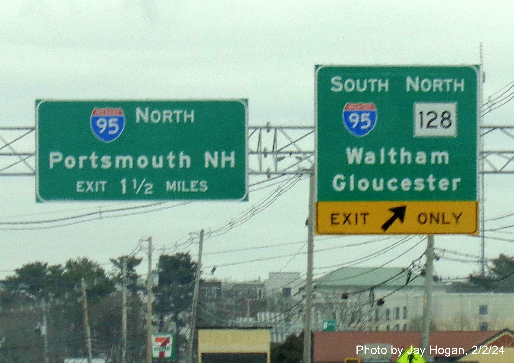
EXIT 72 (SB) - Interstate 95/Route 128
The overhead signs were the first to be replaced on US 3 in
February 2024:
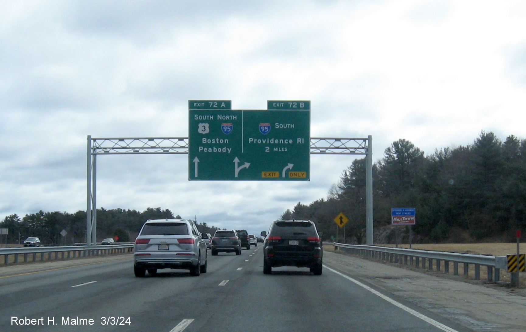
All the new signs, starting with the 2 Miles advance above are
arrow-per-lane (APL)style. The indicated the exit for I-95 South has one lane that is Exit Only while those wanting to stay
on US 3, should go straight. There were no Route 128 shields or trailblazers in place with the new signs.
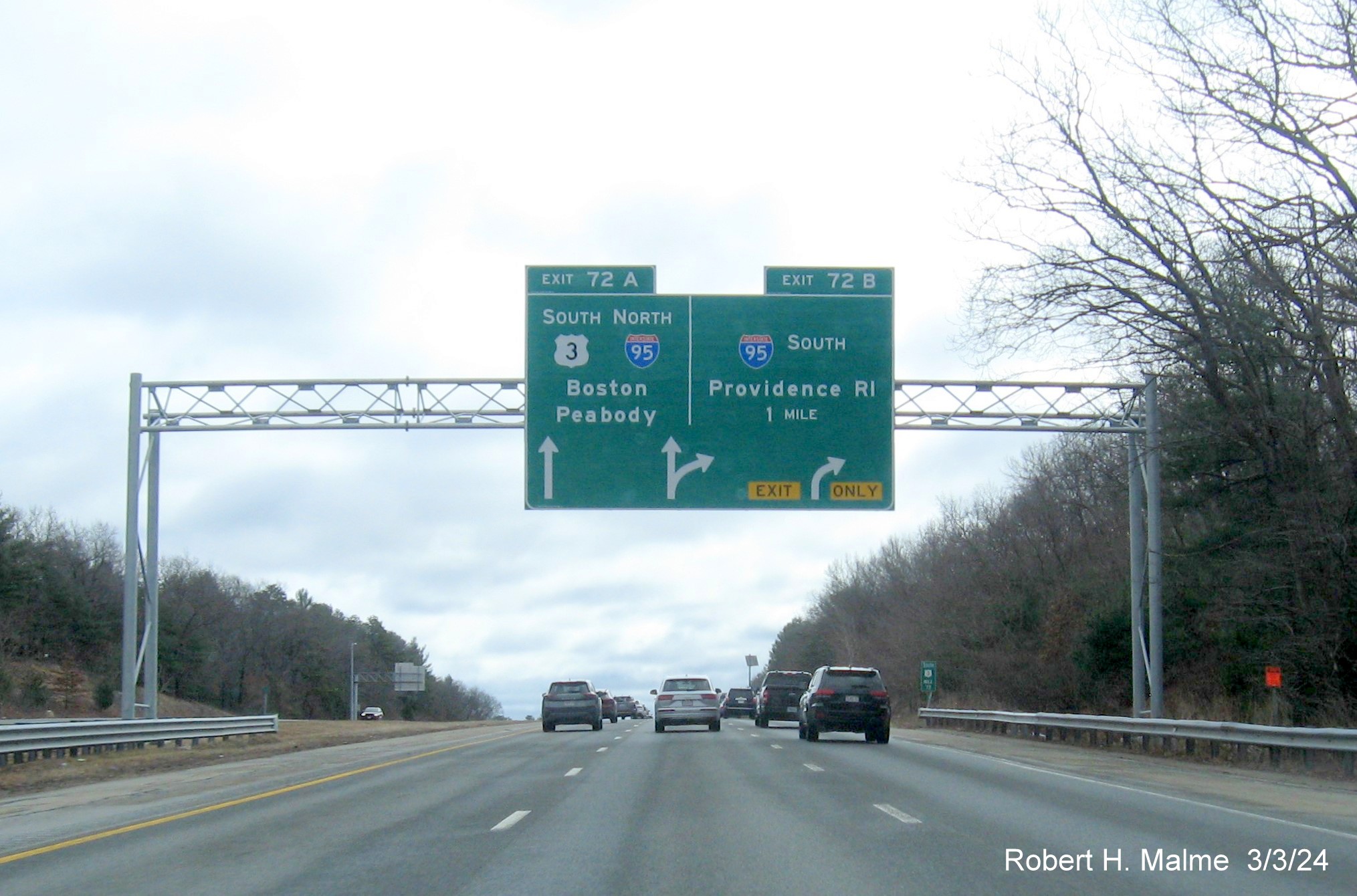
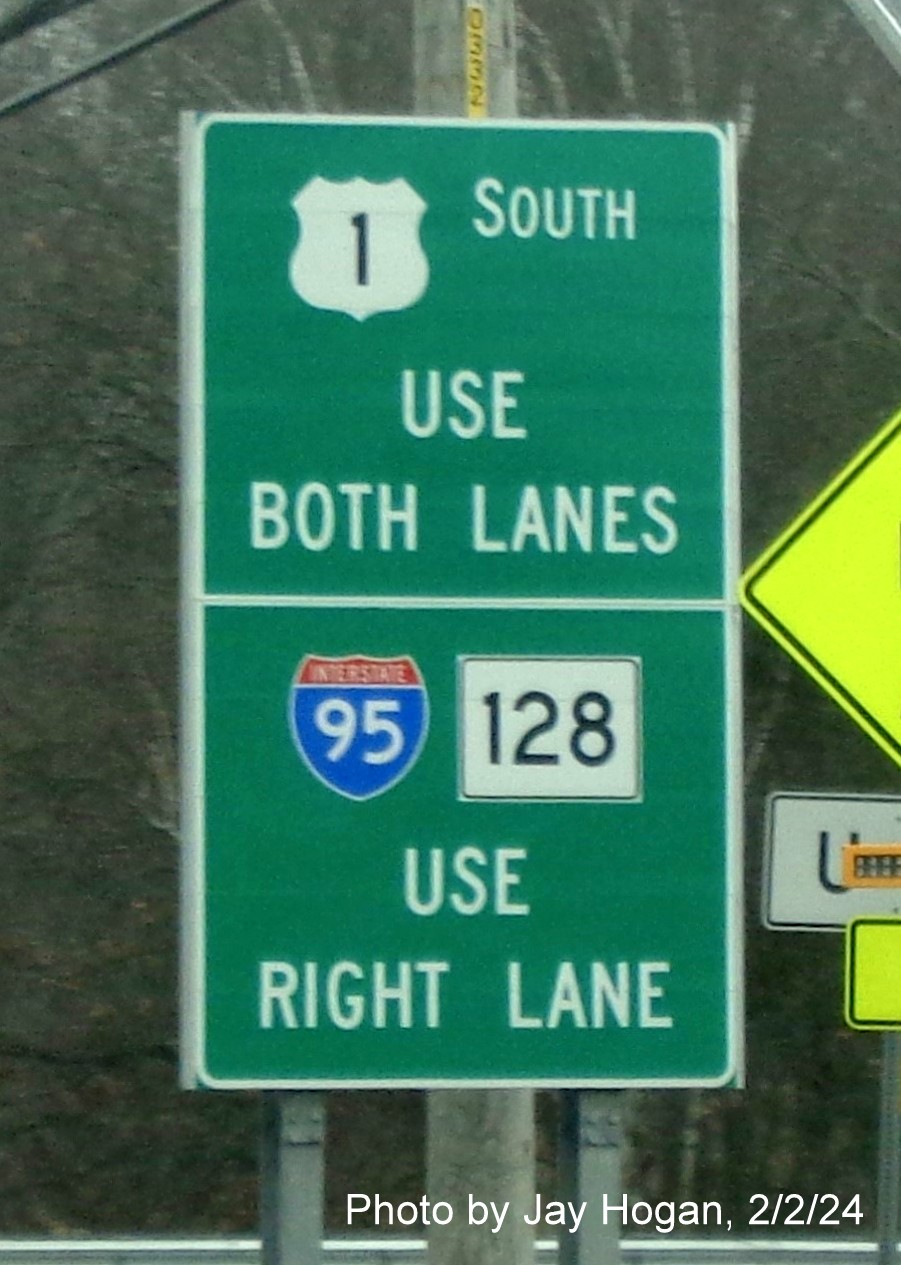
The 1 Mile advance version of the APL sign. It might have been
simpler to just give the I-95 South ramp an exit number so US 3 does not exit off itself. But apparently MassDOT prefers to
have both ramps with numbers.
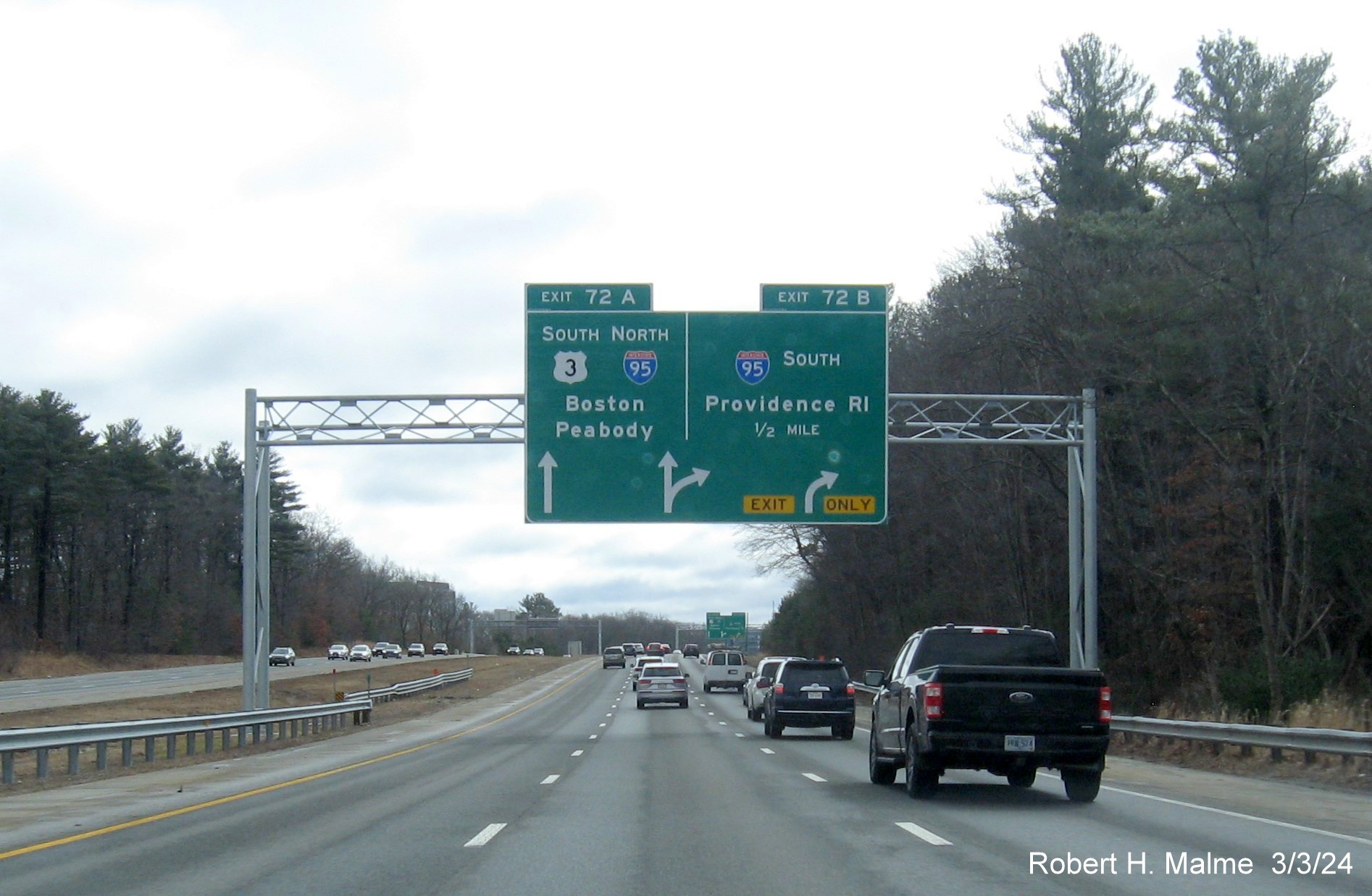
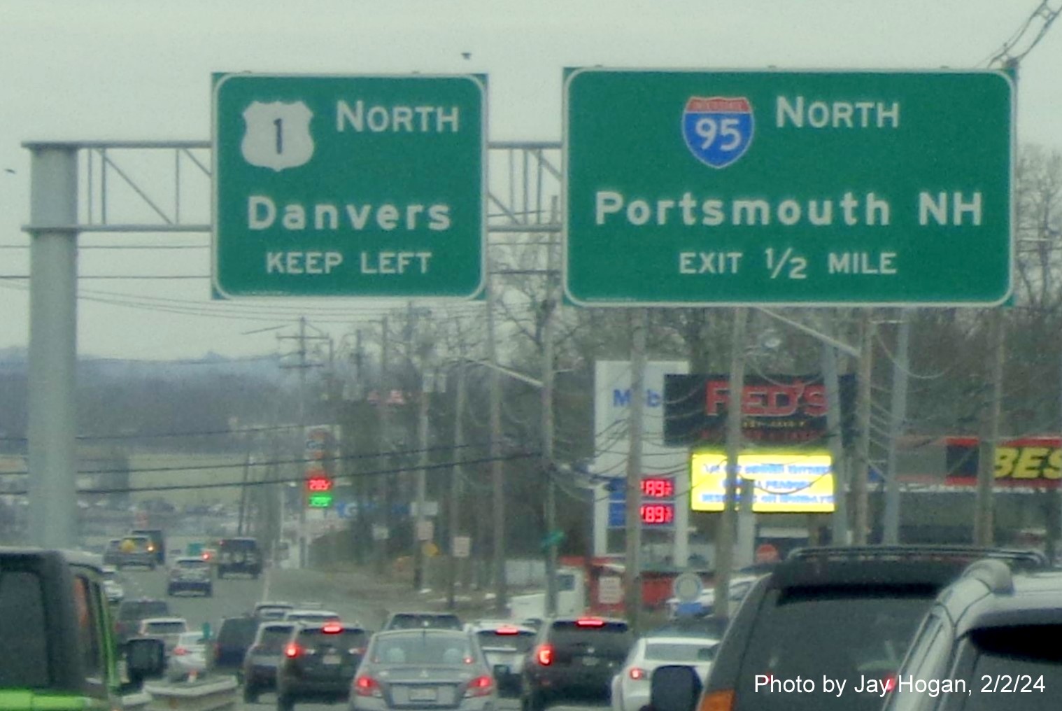
Now the 1/2 Mile advance APL. Other than a reduced speed, there is
no indication that the expressway actually ends after the I-95 South ramp.
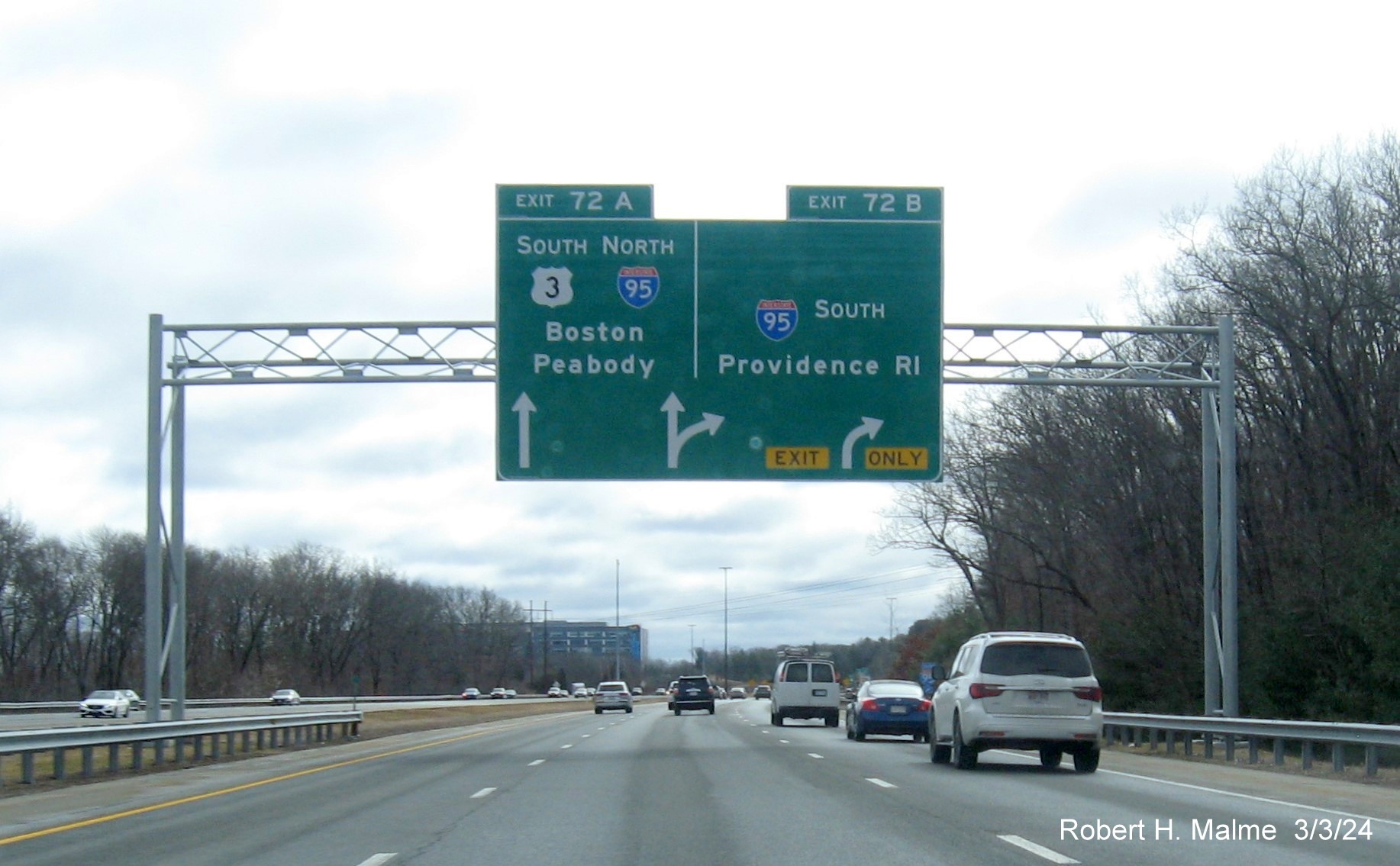
The APL approaching the I-95 (Route 128) South ramp. You can now
see warning signs in the distance regarding the need to exit at the I-95 North/US 3 South ramp. This is the last new sign.
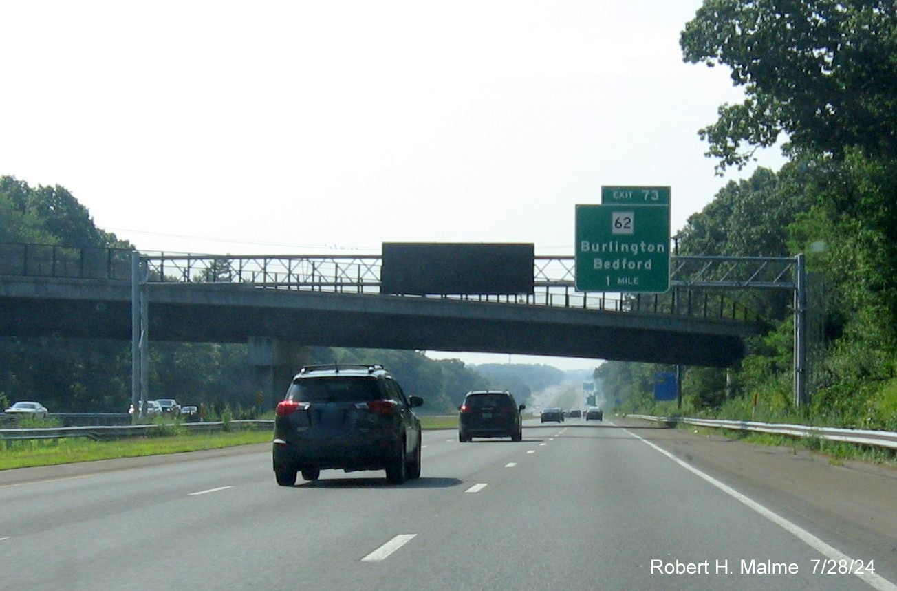
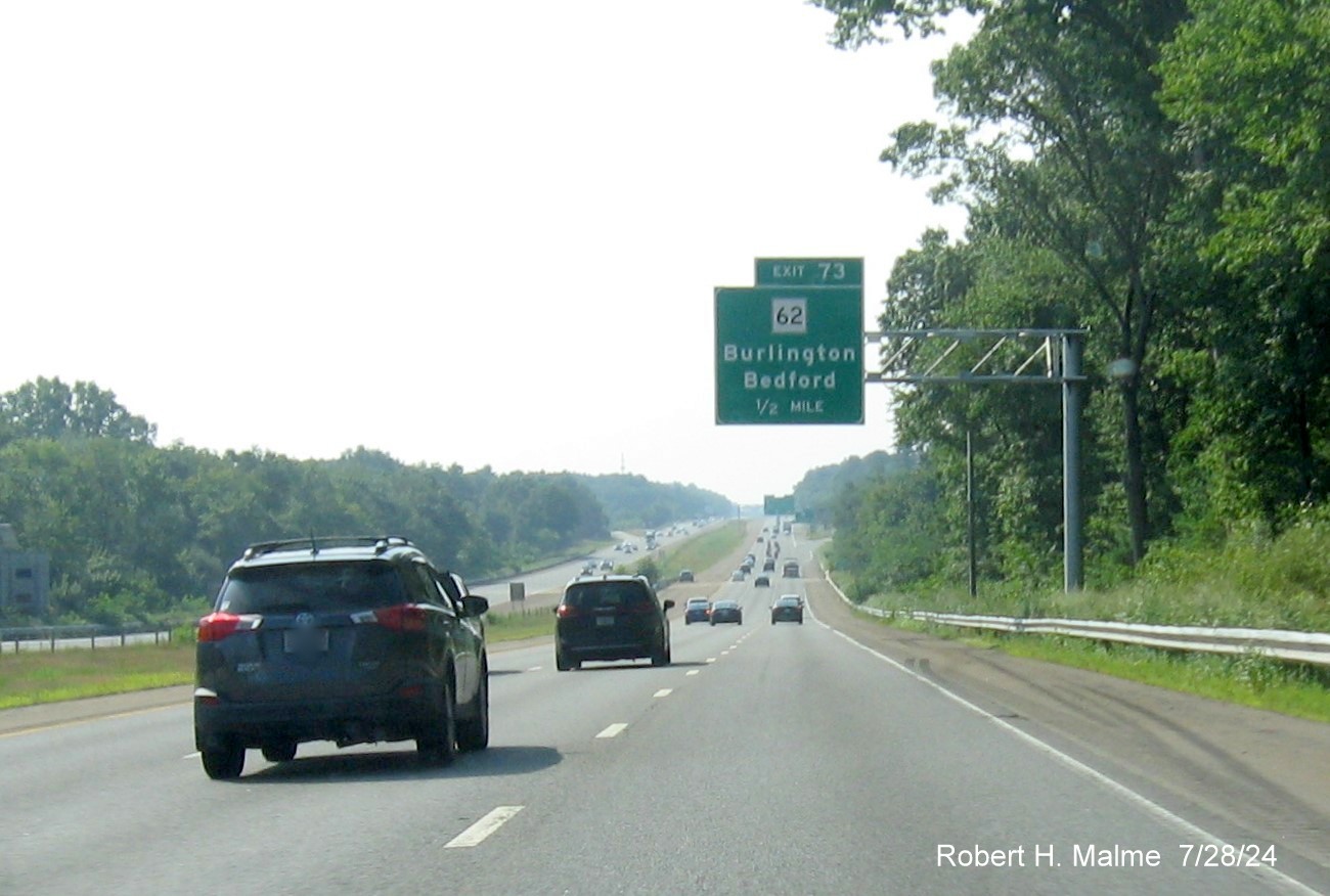
EXIT 73 - Route 62
All the overhead signs for this exit were replaced between May
and July 2024:
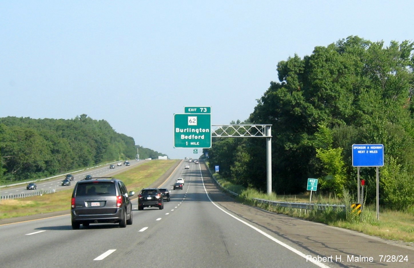
*The new 1 Mile advance sign headed north.
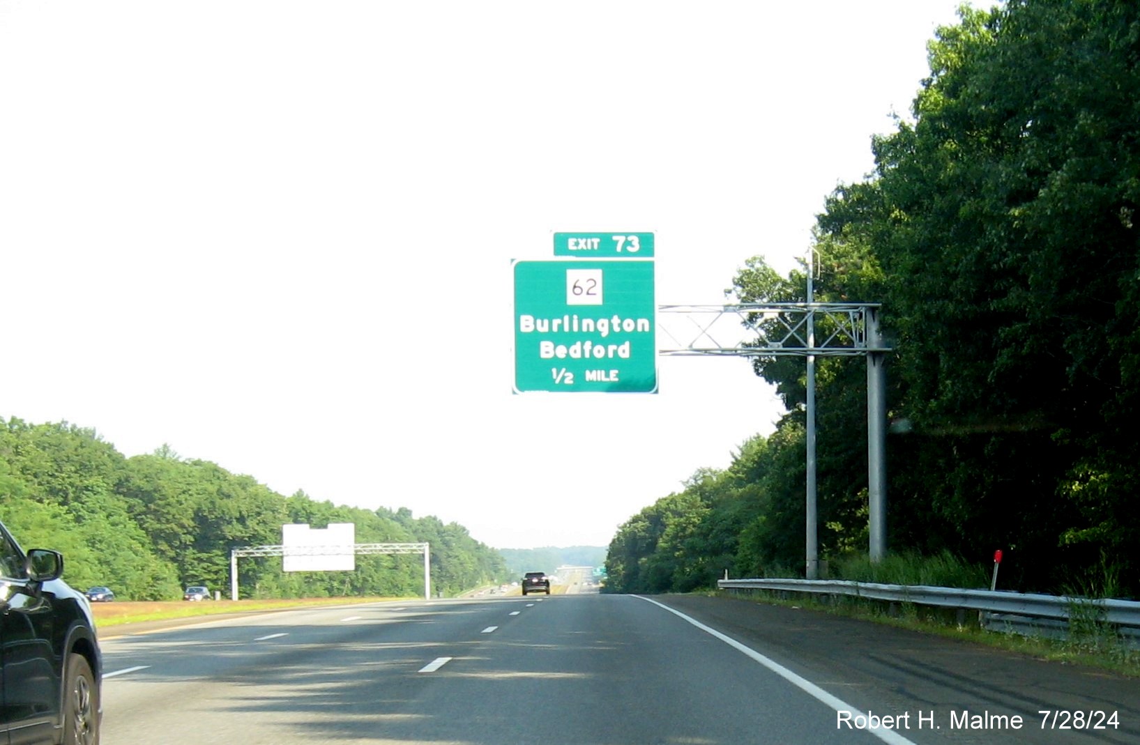
*The new 1/2 Mile advance sign.
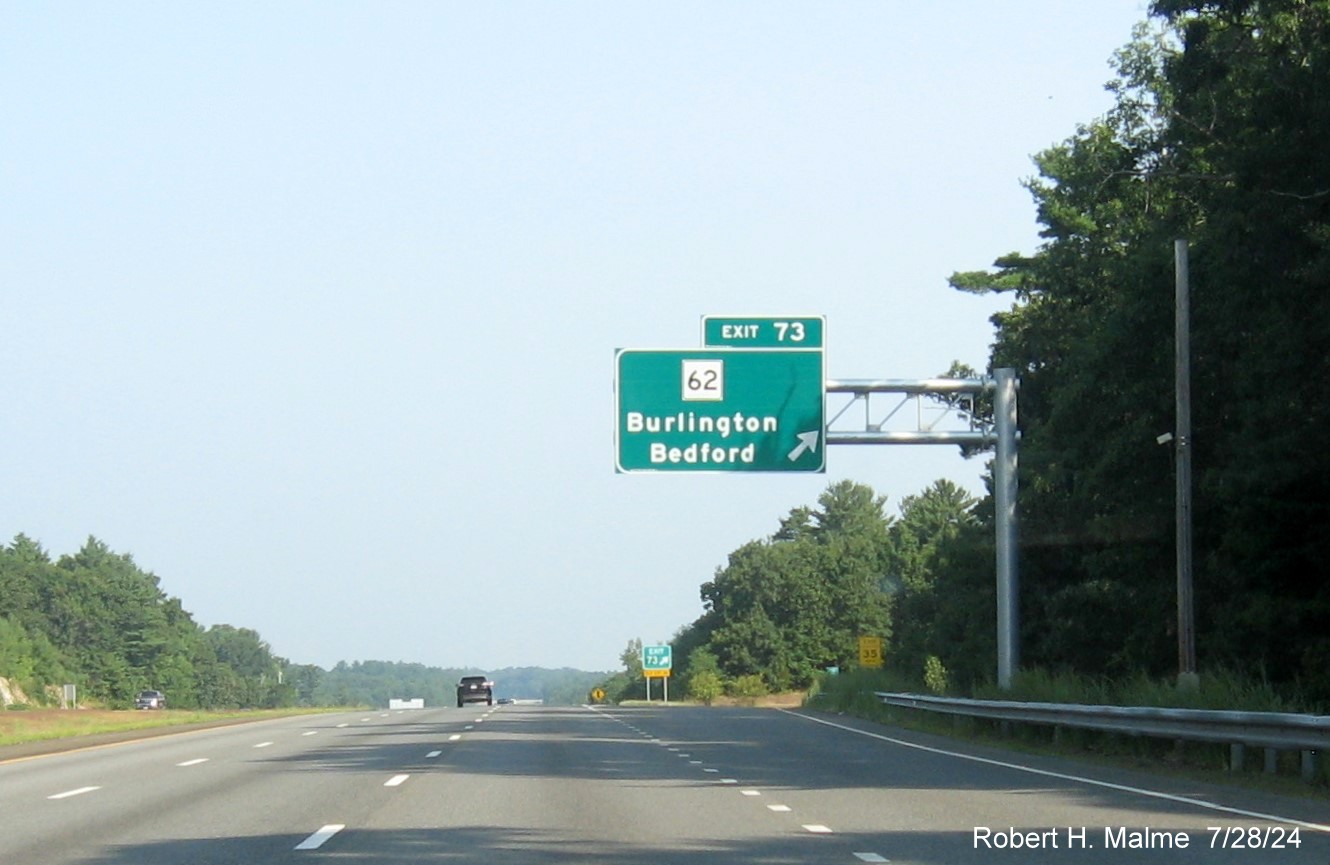
*The new sign at the exit itself, the gore sign had not been replaced.
Turning around...
*The new 1 Mile advance sign headed south, as with the previous sign
it shares a gantry with a VMS.
*The new 1/2 Mile advance sign, all by itself.
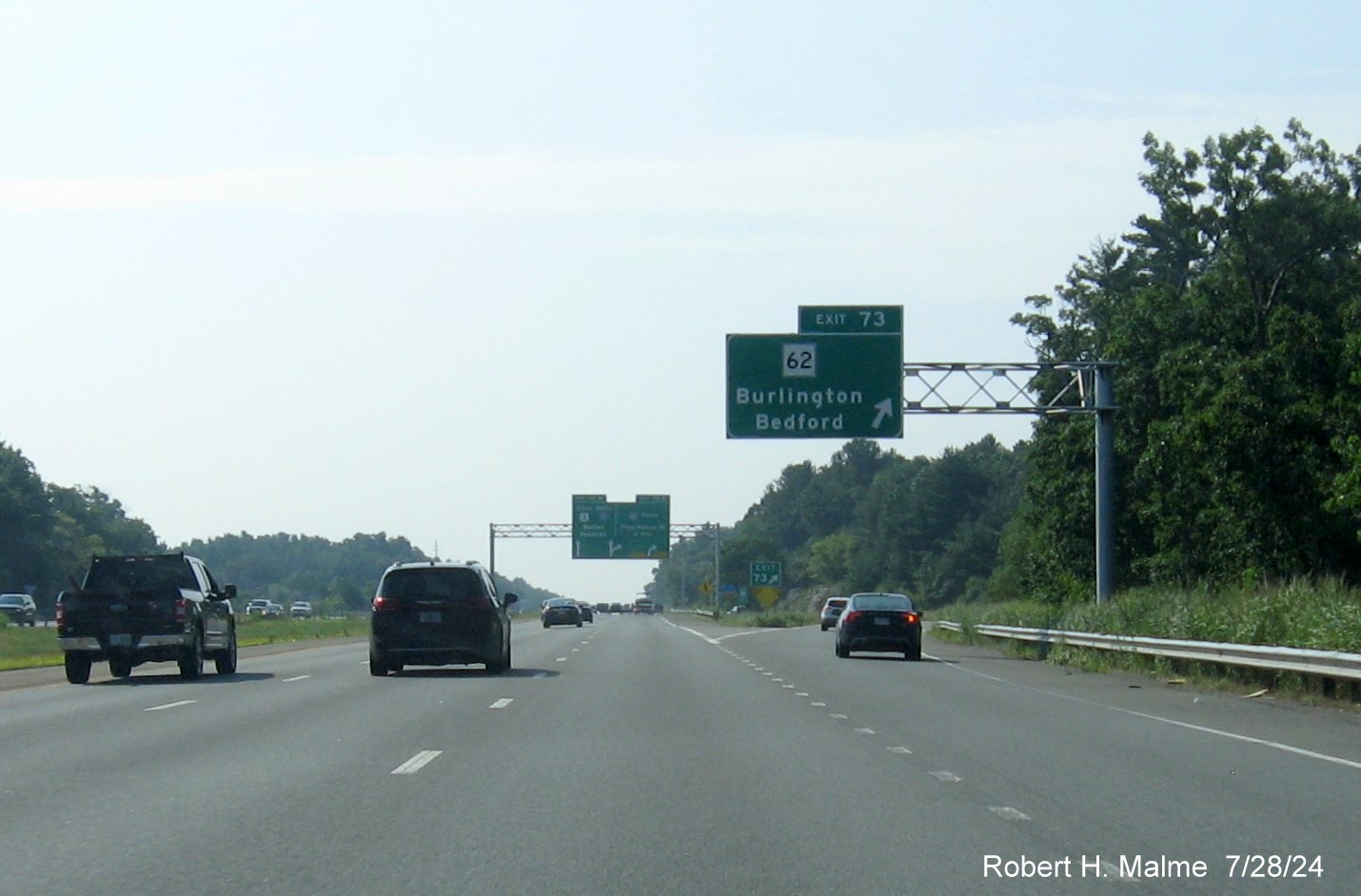
*The exit sign, with the first advance for the I-95 exits in the
distance.
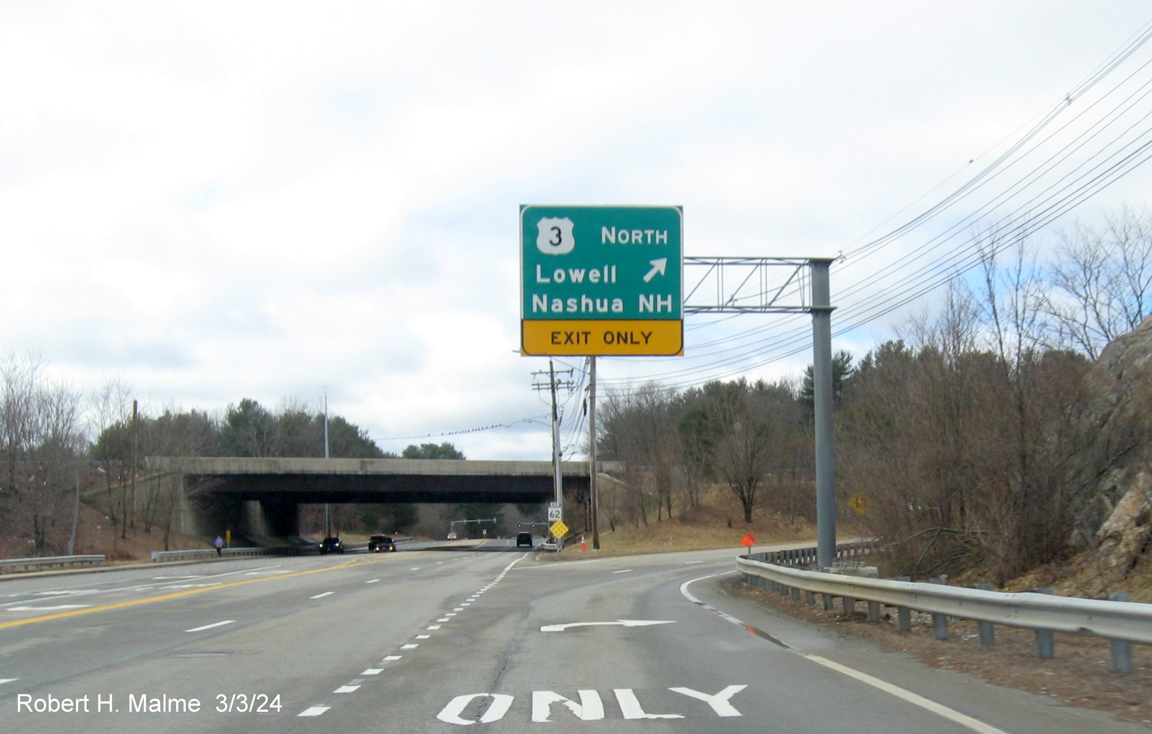
The overhead ramp sign for US 3 North on MA 62 West in Burlington
put up in late February.
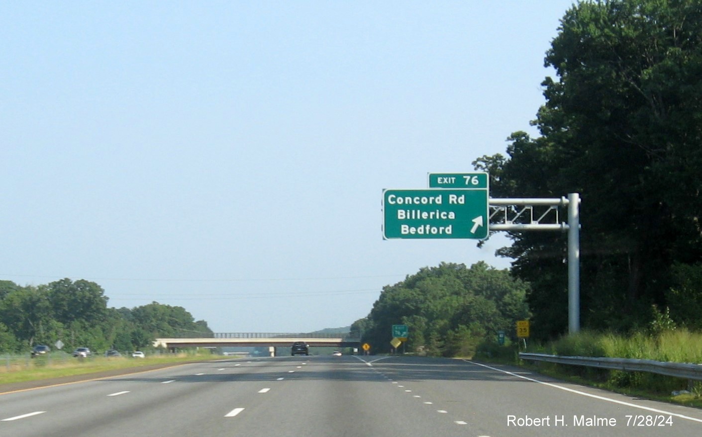
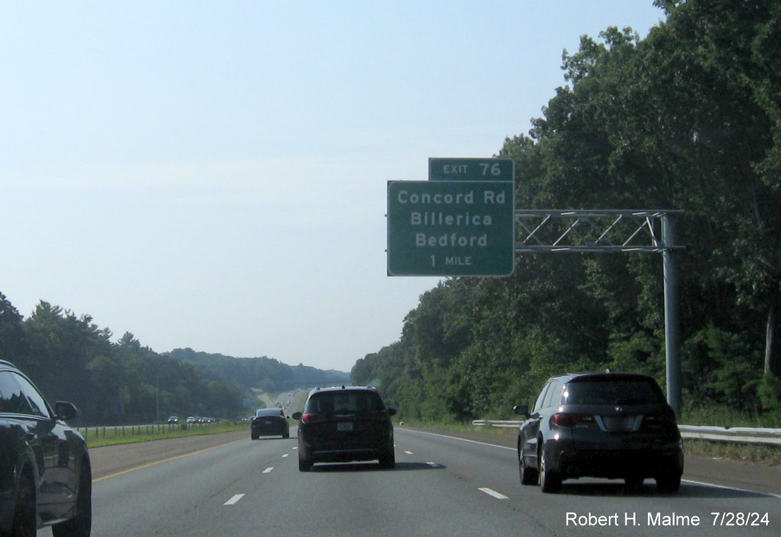
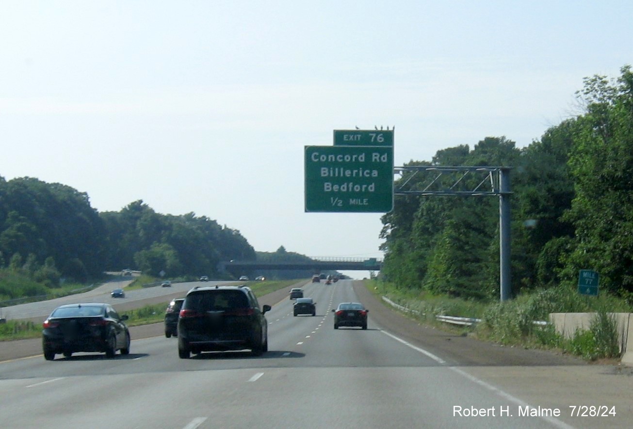
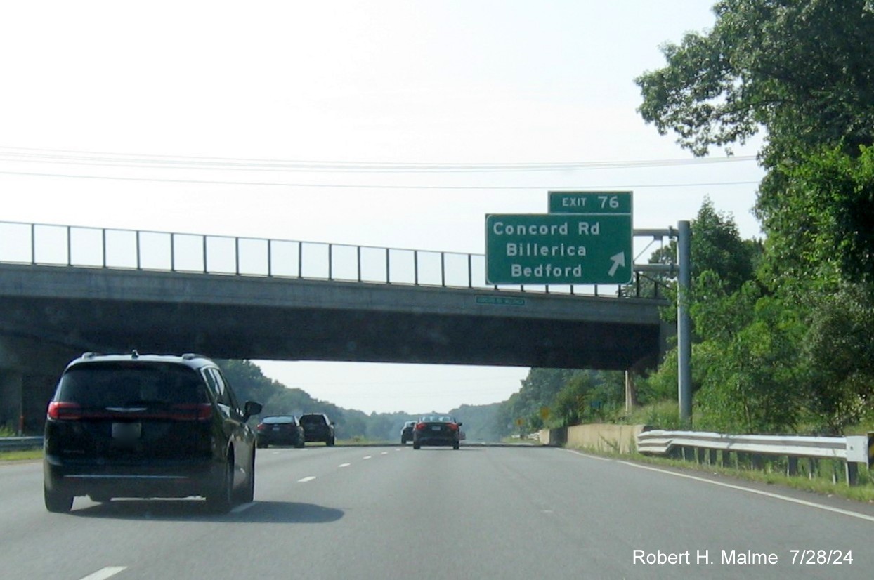
EXIT 76 - Concord Road
All the overhead signs for this exit were replaced between May and
July 2024:
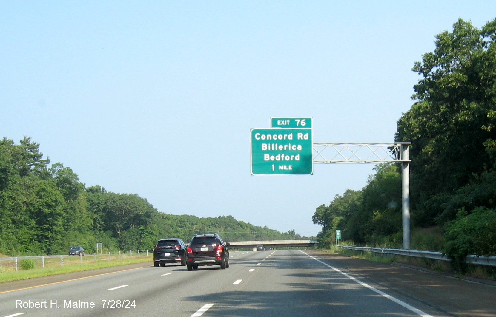
*The new 1 Mile advance sign headed north.

*The new 1/2 Mile advance sign by a noise wall.
*And the new exit sign, again still with old gore sign.
In the other direction...
*The new 1 Mile advance sign headed south.
*Birds have already found a new place to perch on the new 1/2
Mile advance sign. Notice the Mile 77.6 marker to the right. The exit is at Mile 77, many of the exit numbers seem to be 1 mile
off of where they should be.
*The new exit sign headed south. Also no new gore sign, only partly
visible in the distance.
*They also have not replaced the reassurance markers yet south of
I-495.
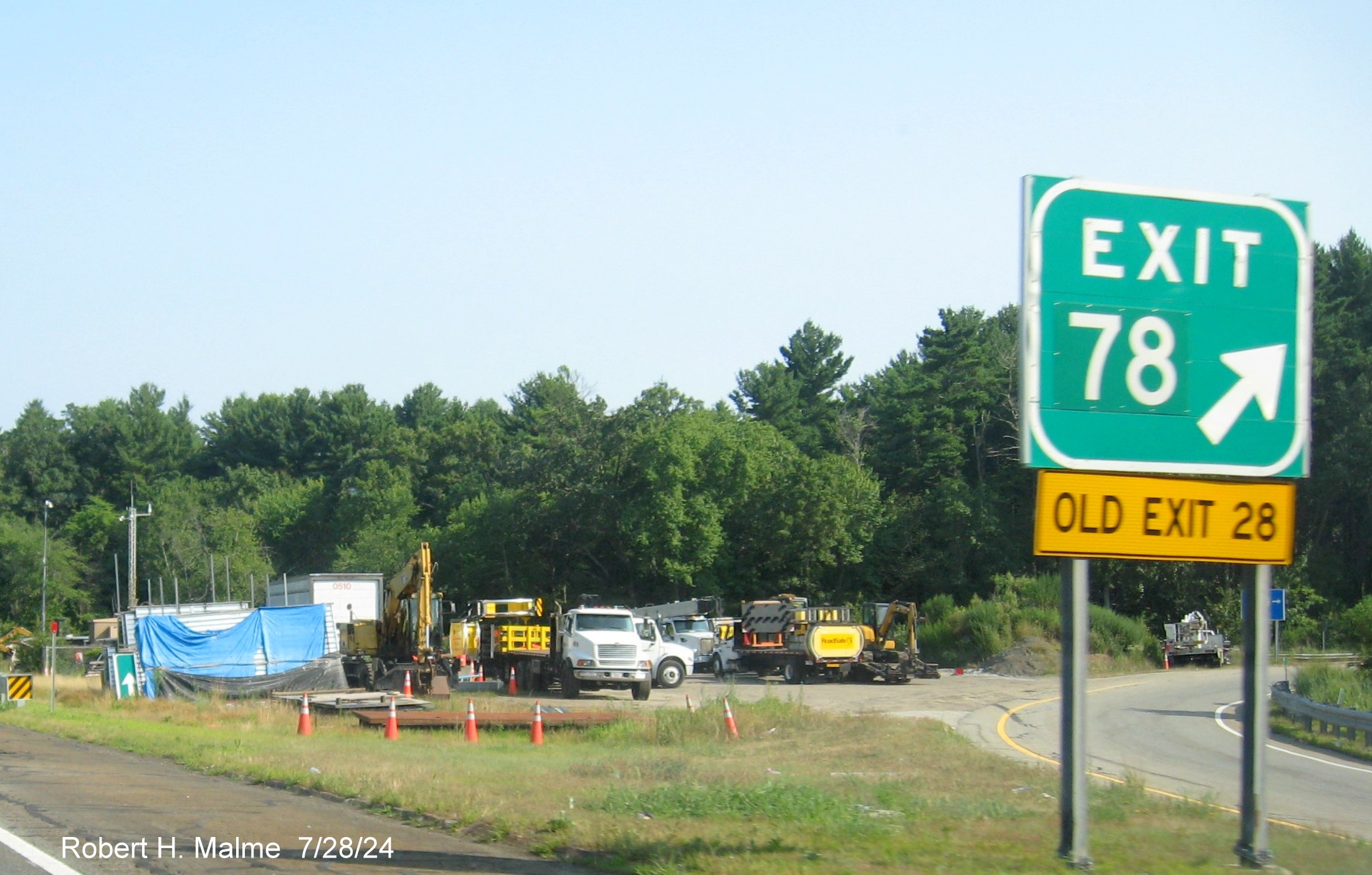
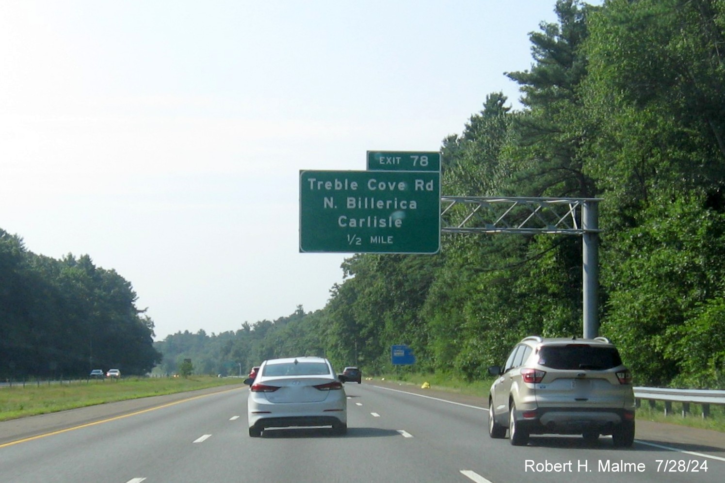
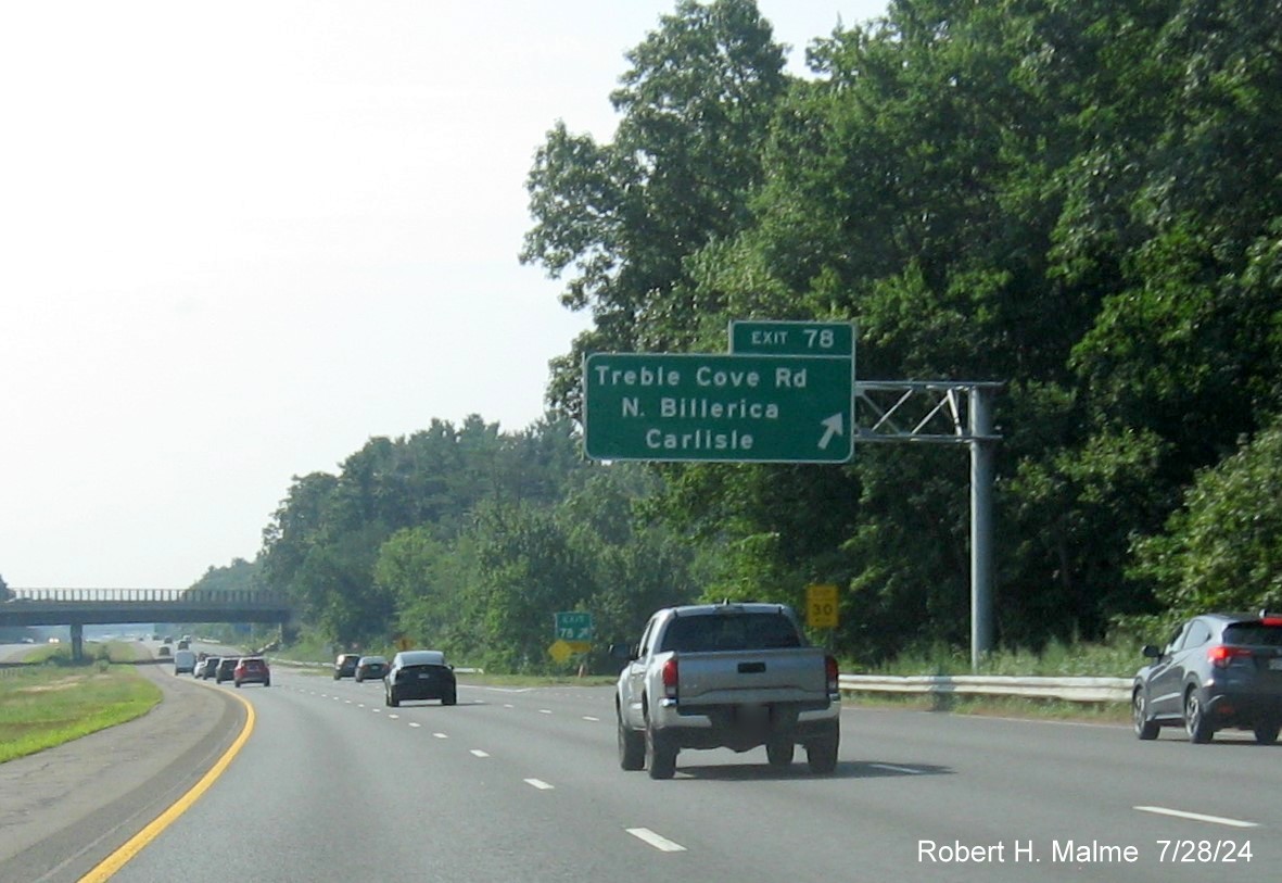
EXIT 78 - Treble Cove Road
All the overhead signs for this exit were replaced between May and
July 2024:
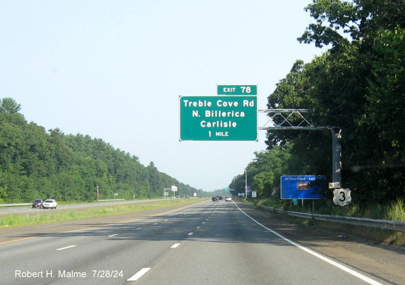
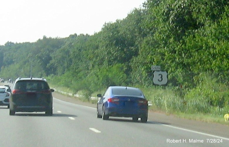
*The new 1 Mile advance sign headed north, near an old North US 3
reassurance marker.

*The new 1/2 Mile advance sign.

*The new exit sign, but old gore sign.
*Closeup of the old gore sign, with new exit number overlay. The
staging area beyond the ramp still has some new signs to be installed. Turning around...
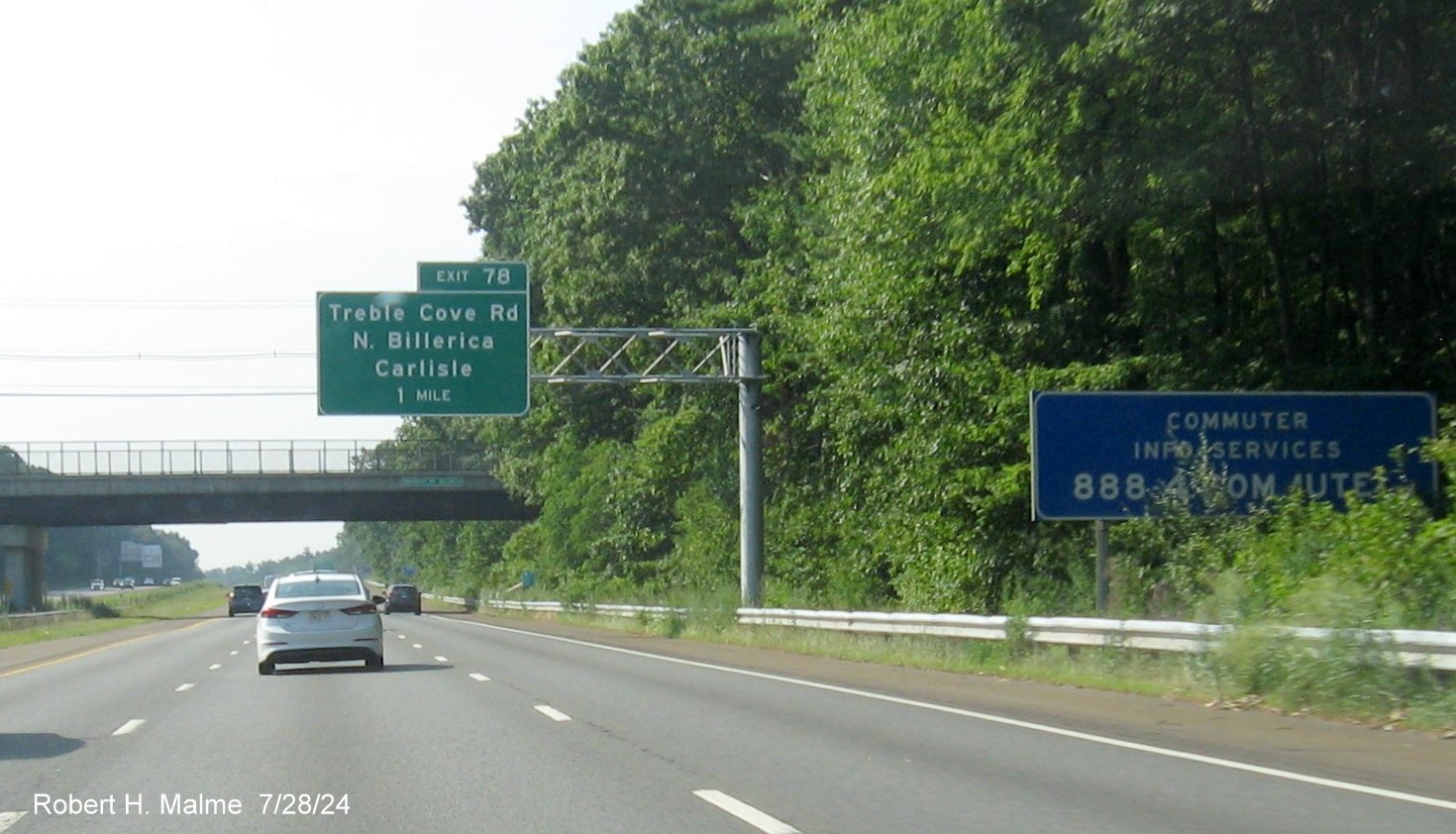
*The new 1 Mile advance sign headed south, behind a blue commuter
services info sign.
*The new 1/2 Mile advance sign.
*The new exit sign with the old gore sign once again.
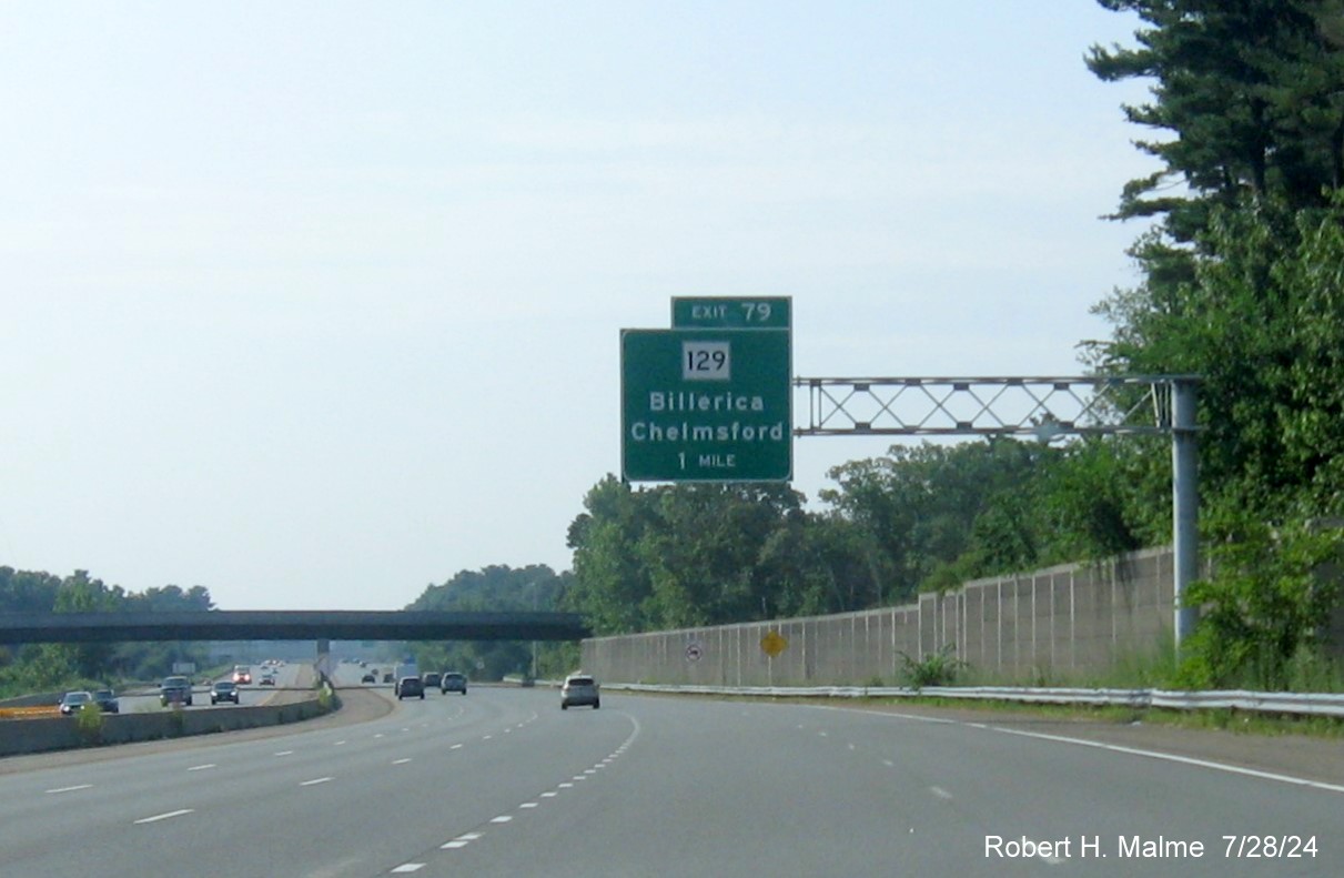
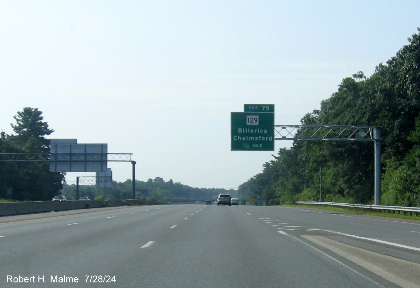
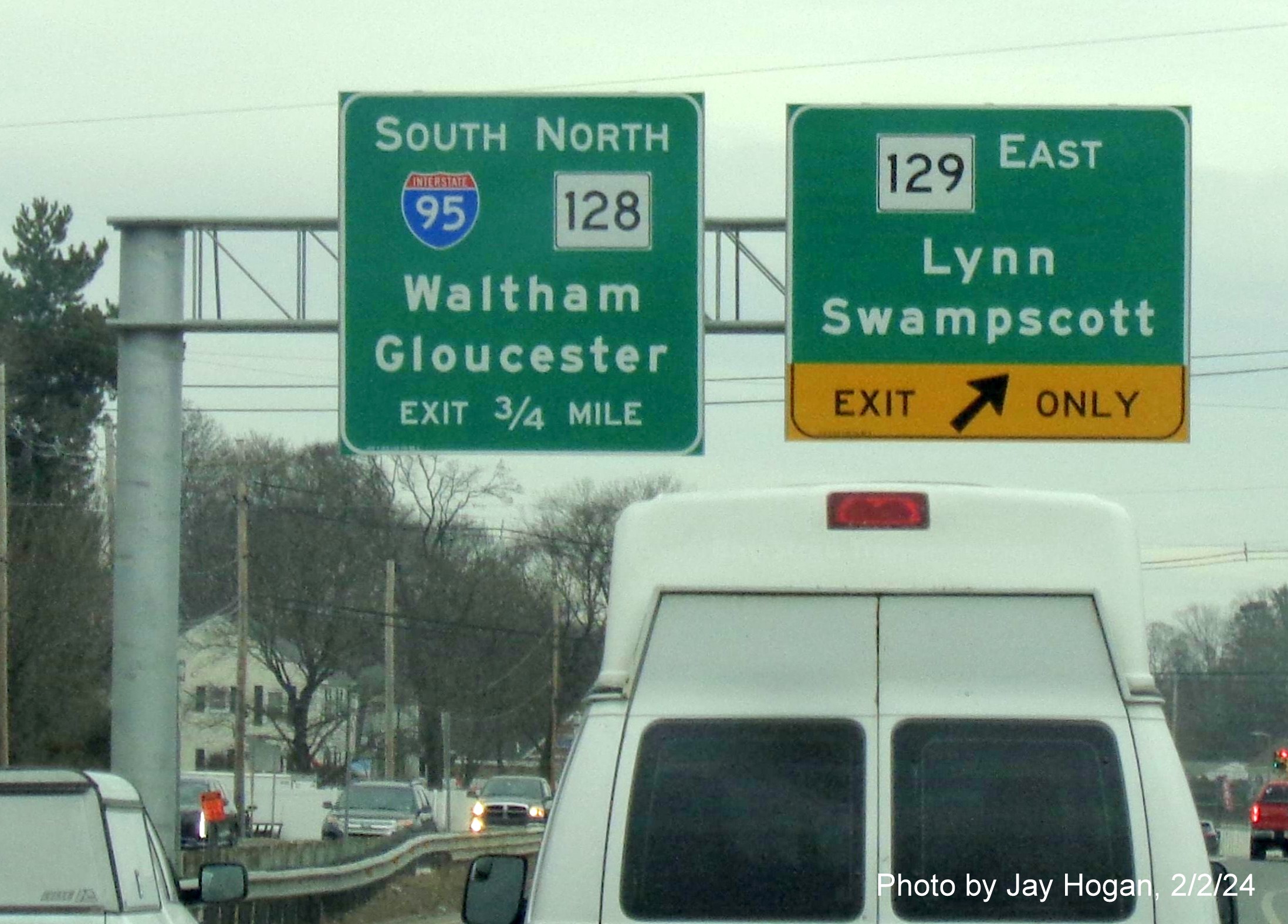
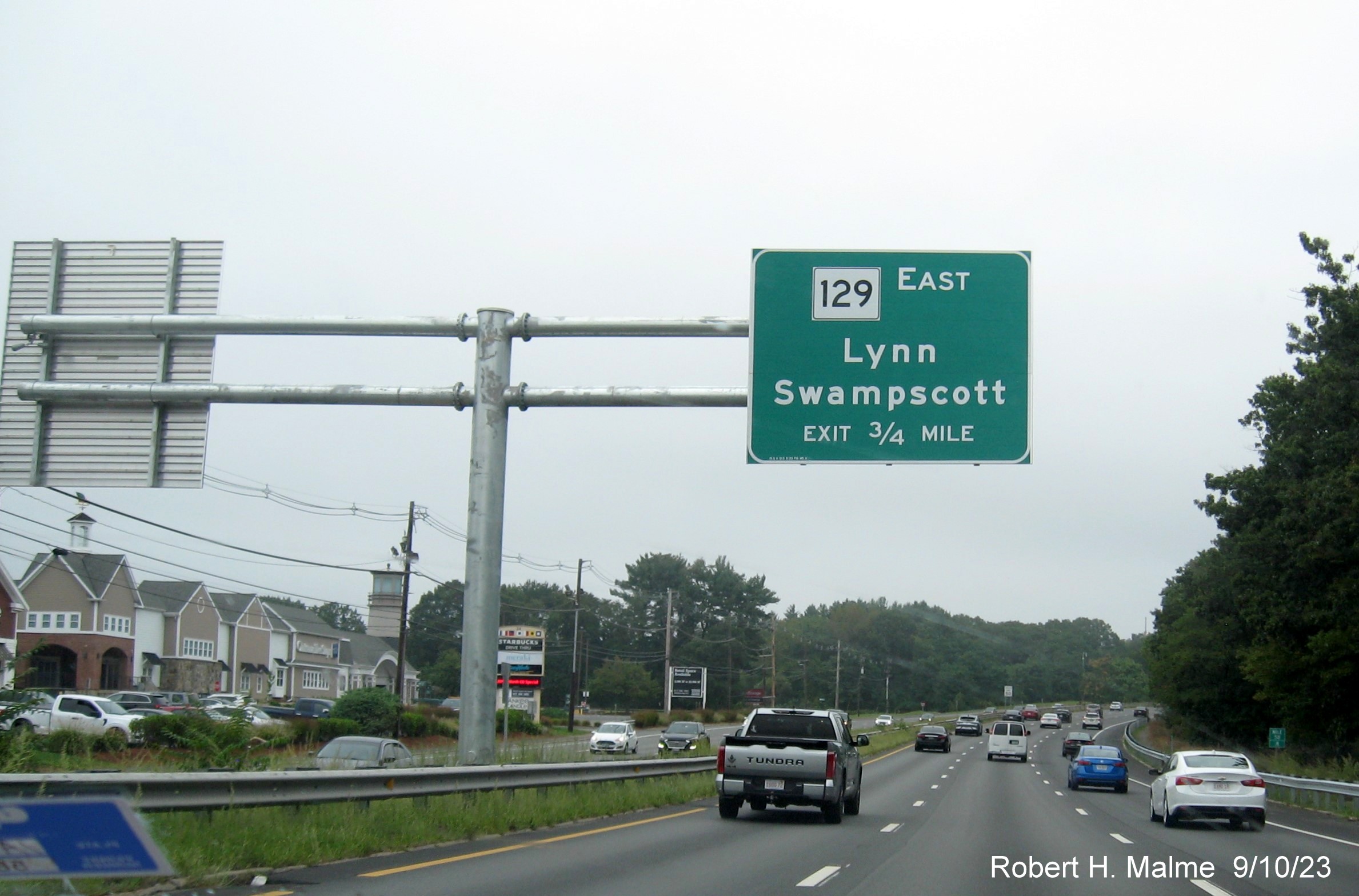
EXIT 79 - Route 129
All the overhead signs, but the 1 Mile advance sign for this exit
were replaced between May and July 2024. That sign is to be mounted on an existing I-495 sign gantry, the other signs in
this direction are in photos for I-495 below.
Turning around...
*The 1 Mile advance headed south, just after the first on-ramp
from the I-495/Lowell Connector.
*The 1/2 Mile advance after the second on-ramp from I-495.
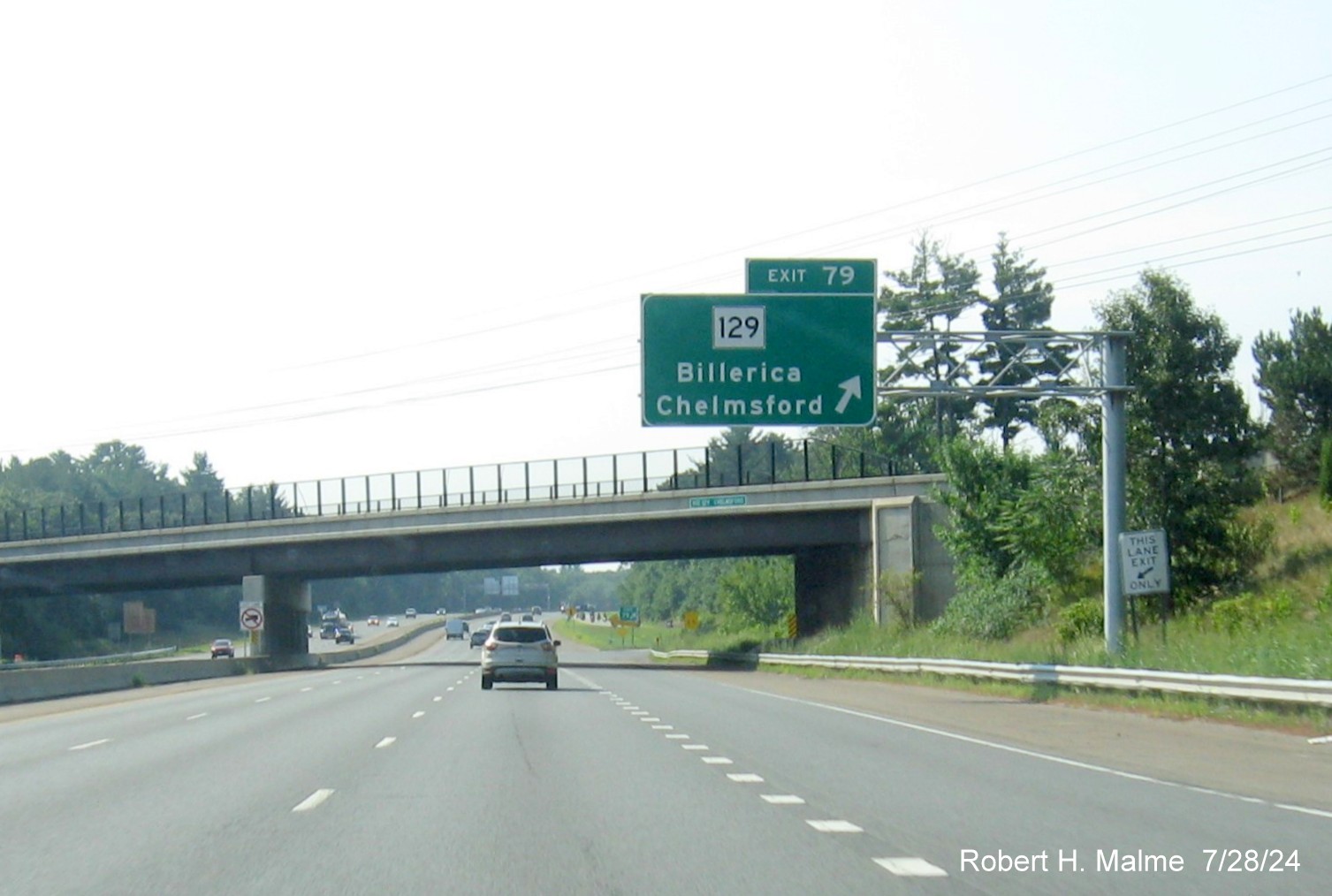
*The exit sign and old gore sign for Route 129.
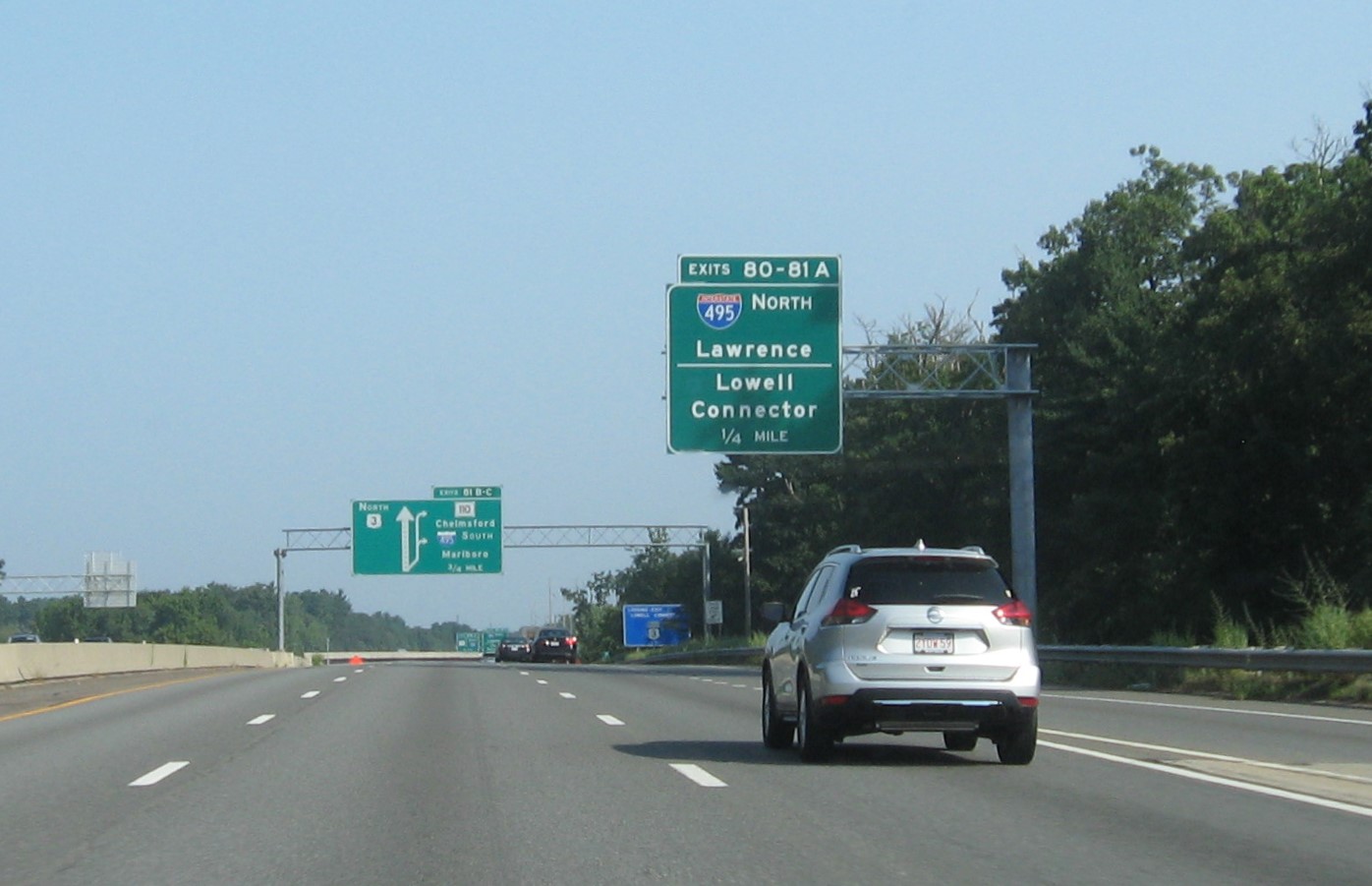
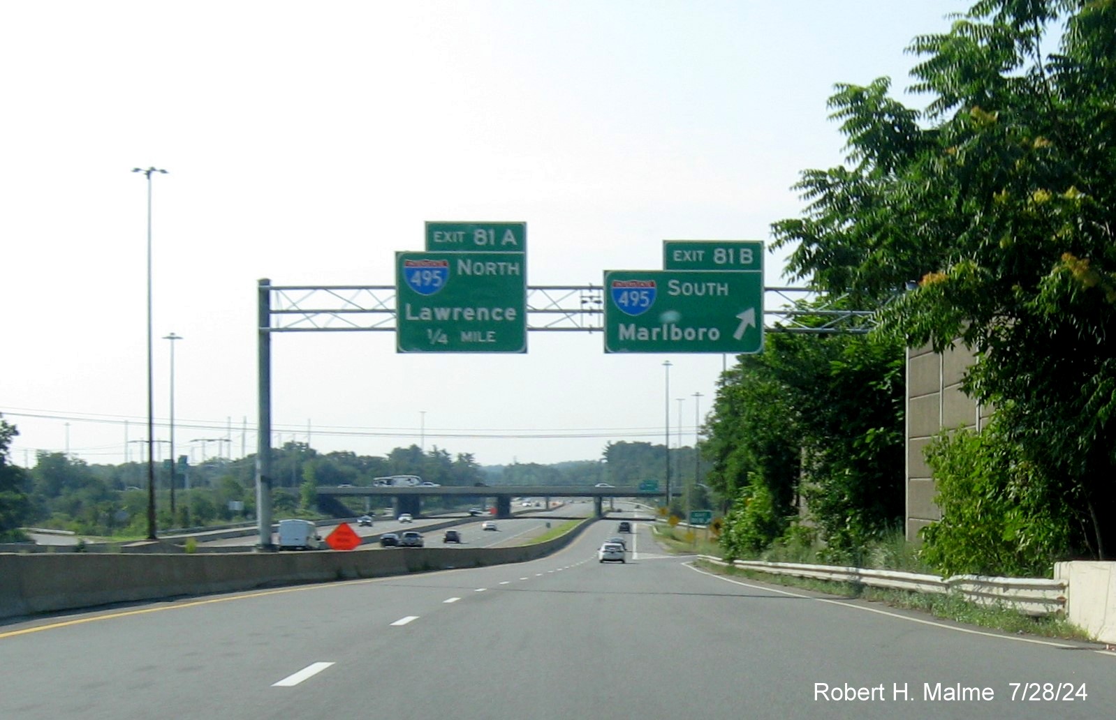
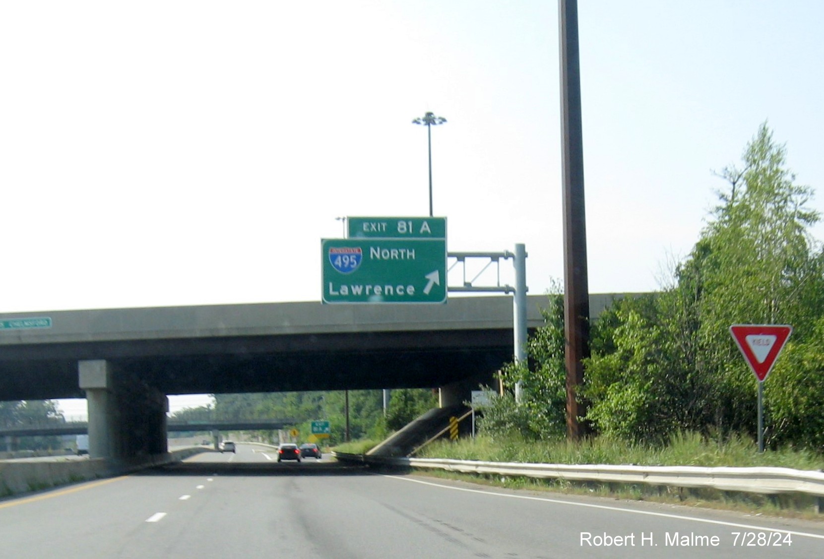
EXITS 80 / 81 A - Lowell Connector / I-495 North (NB)
New advance signs southbound were installed in early March 2024, most
signs northbound were put up in April.
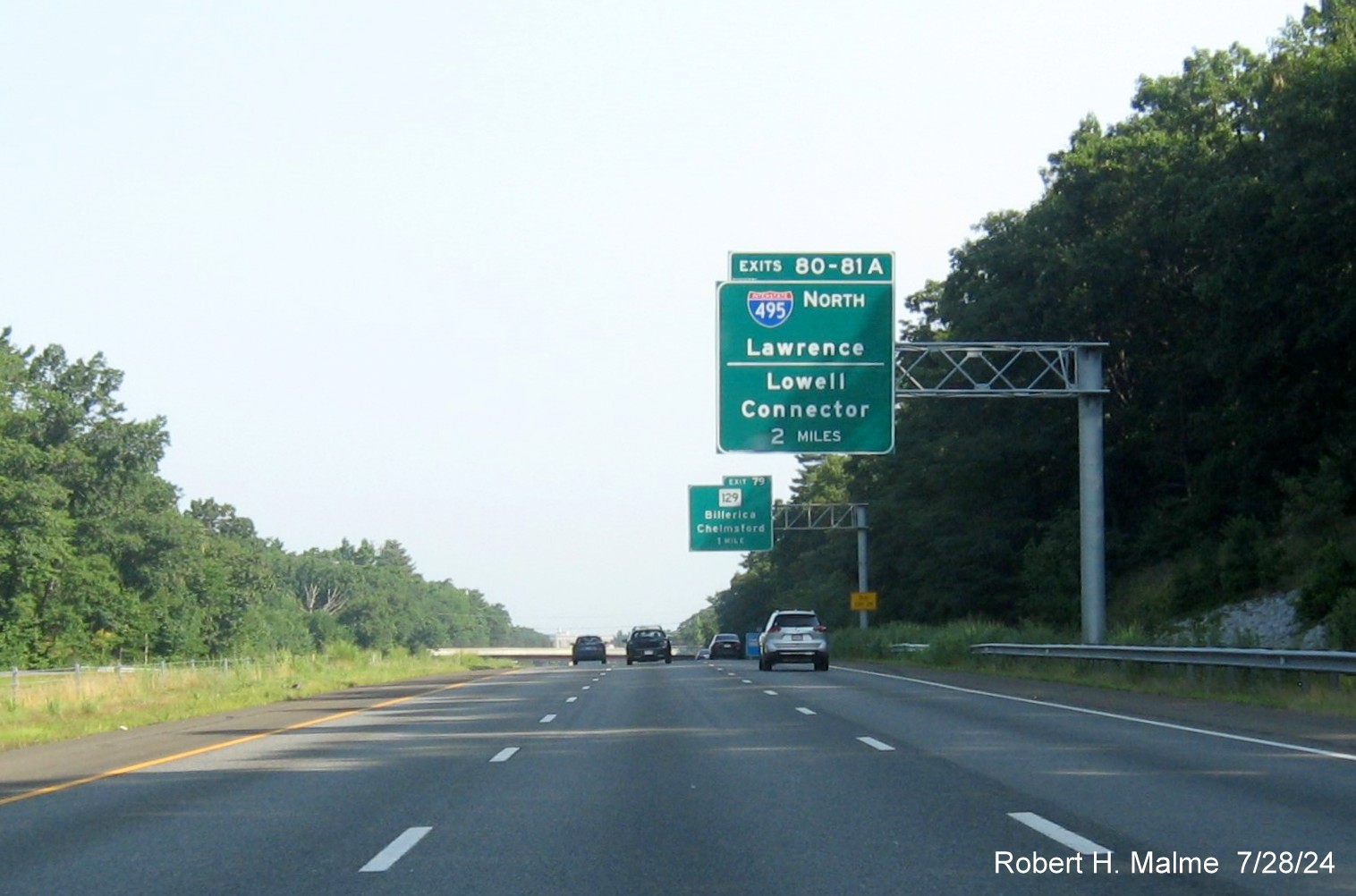
*The new 2 Miles advance sign went up later in May or June. Notice
the one remaining old overhead sign for the Route 129 exit in the distance.

*The 1 mile advance sign is paired with the 1/2 mile advance for the
Route 129 exit.
*The 1/4 mile advance sign before older diagrammatic that is not
being replaced for the I-495 South/Route 110 exit.
The diagrammatic advance signs are not being replaced in this
direction, but new signs at the exit were installed in April 2024, photo by Paul Schlichtman.
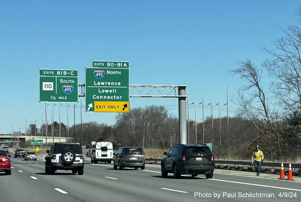
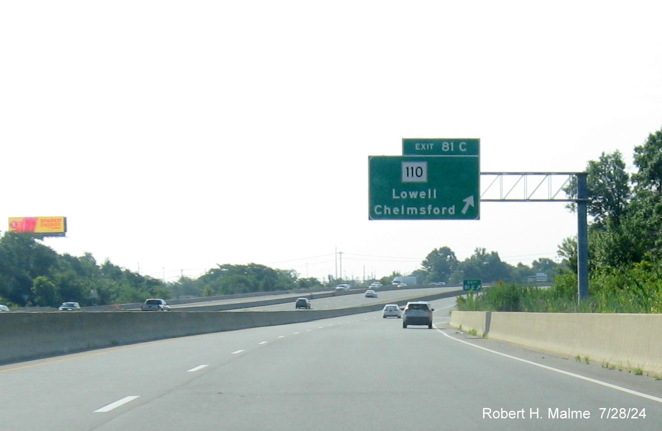
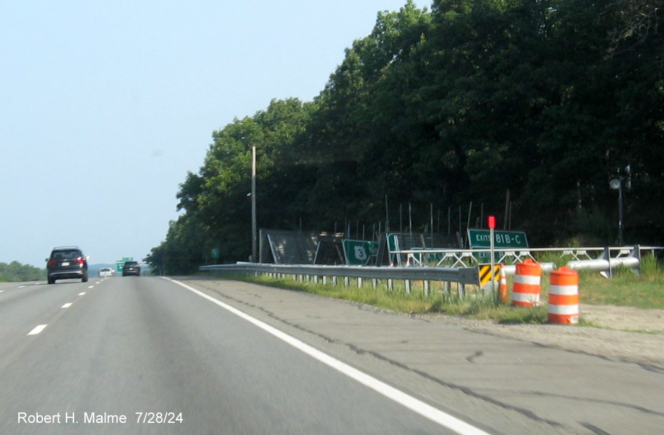
EXITS 81 B/C - Interstate 495 South / Route 110
Along the C/D ramp northbound:
The new signs were put up along the C/D ramp in April 2024.
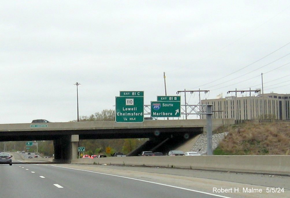
The new 2-sign cantilever at the I-495 South exit on the C/D ramp.
The new exit sign for the MA 110 exit at the end of the C/D ramp.
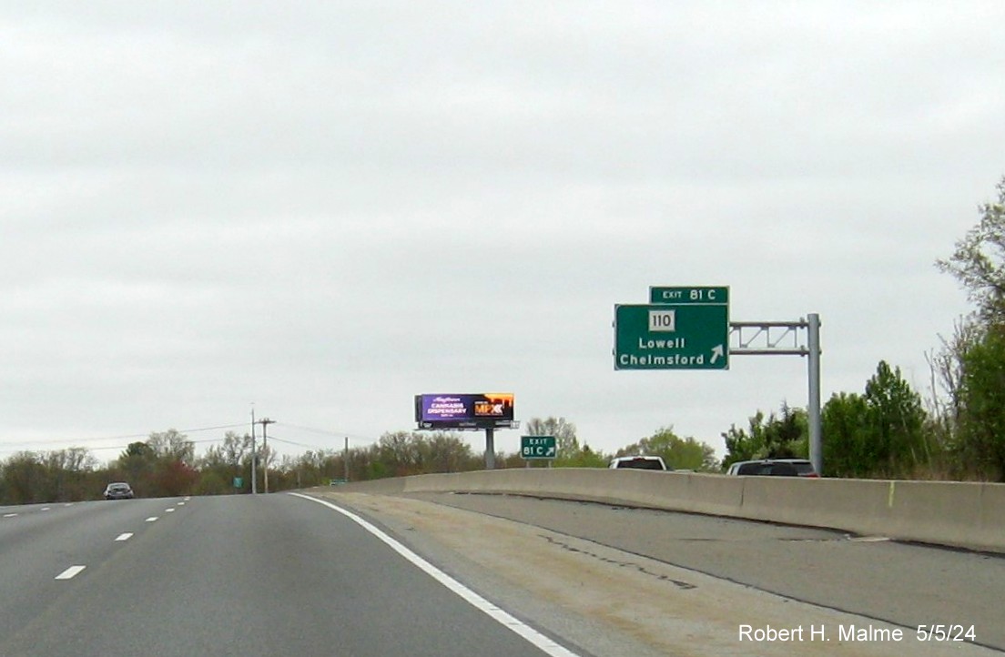
EXITS 81 C-B-A (SB) Route 110 / Interstate 495
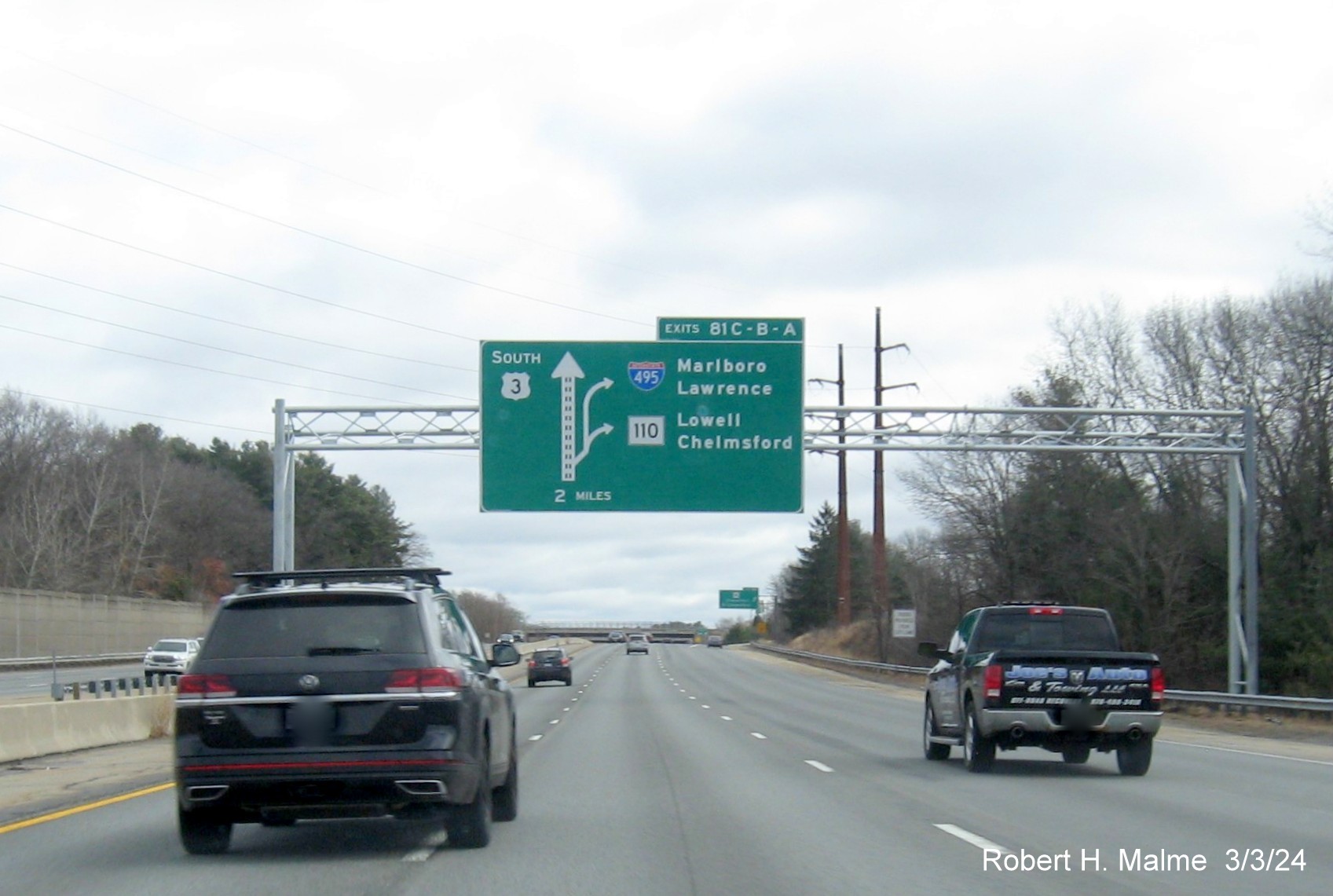
The only new signs placed in March 2024 for the I-495 and Route 110
exits were the 2 Miles advance diagrammatic, above and the similar 1 Mile advance sign.
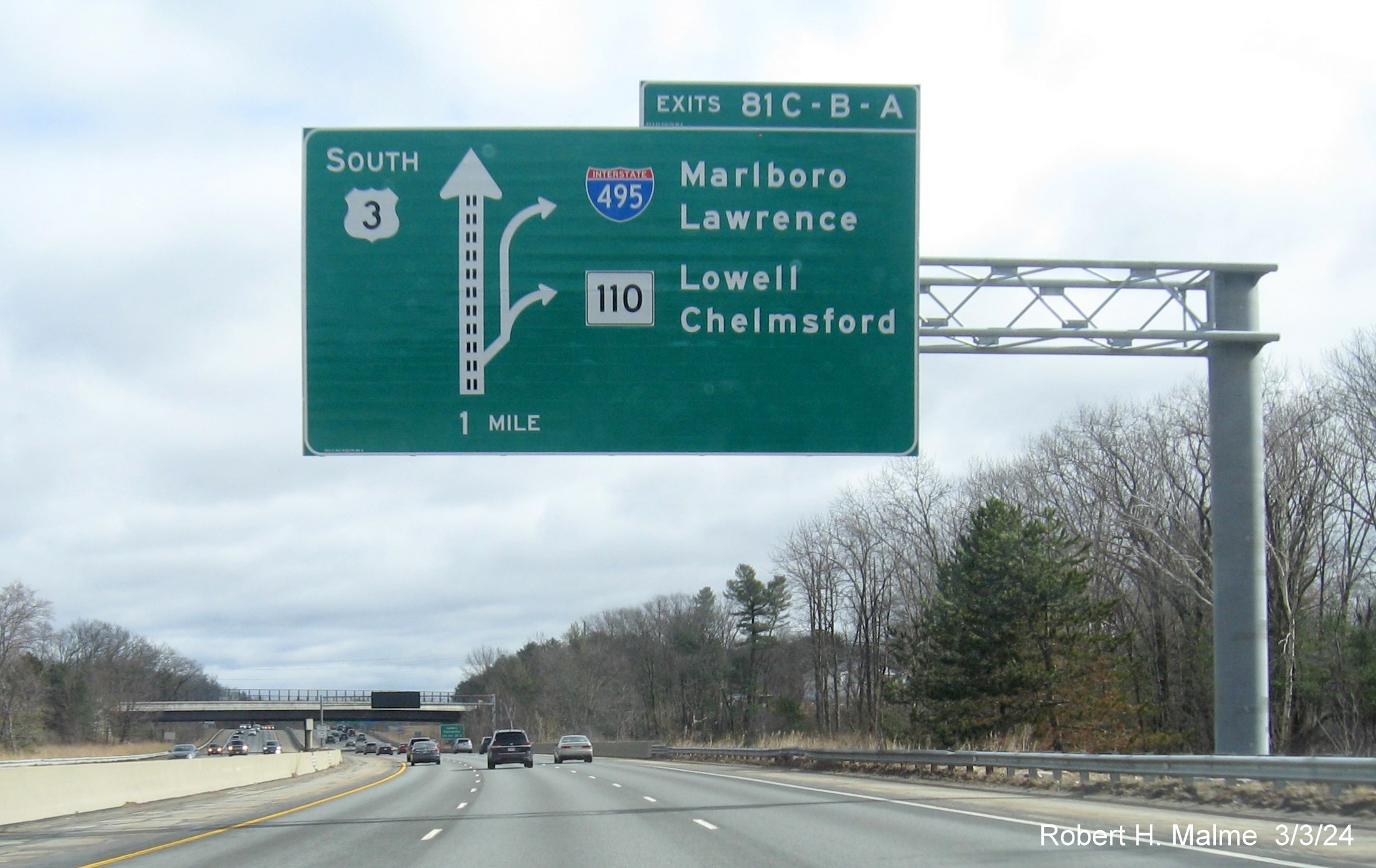
The 1 Mile advance diagrammatic. Followed by...
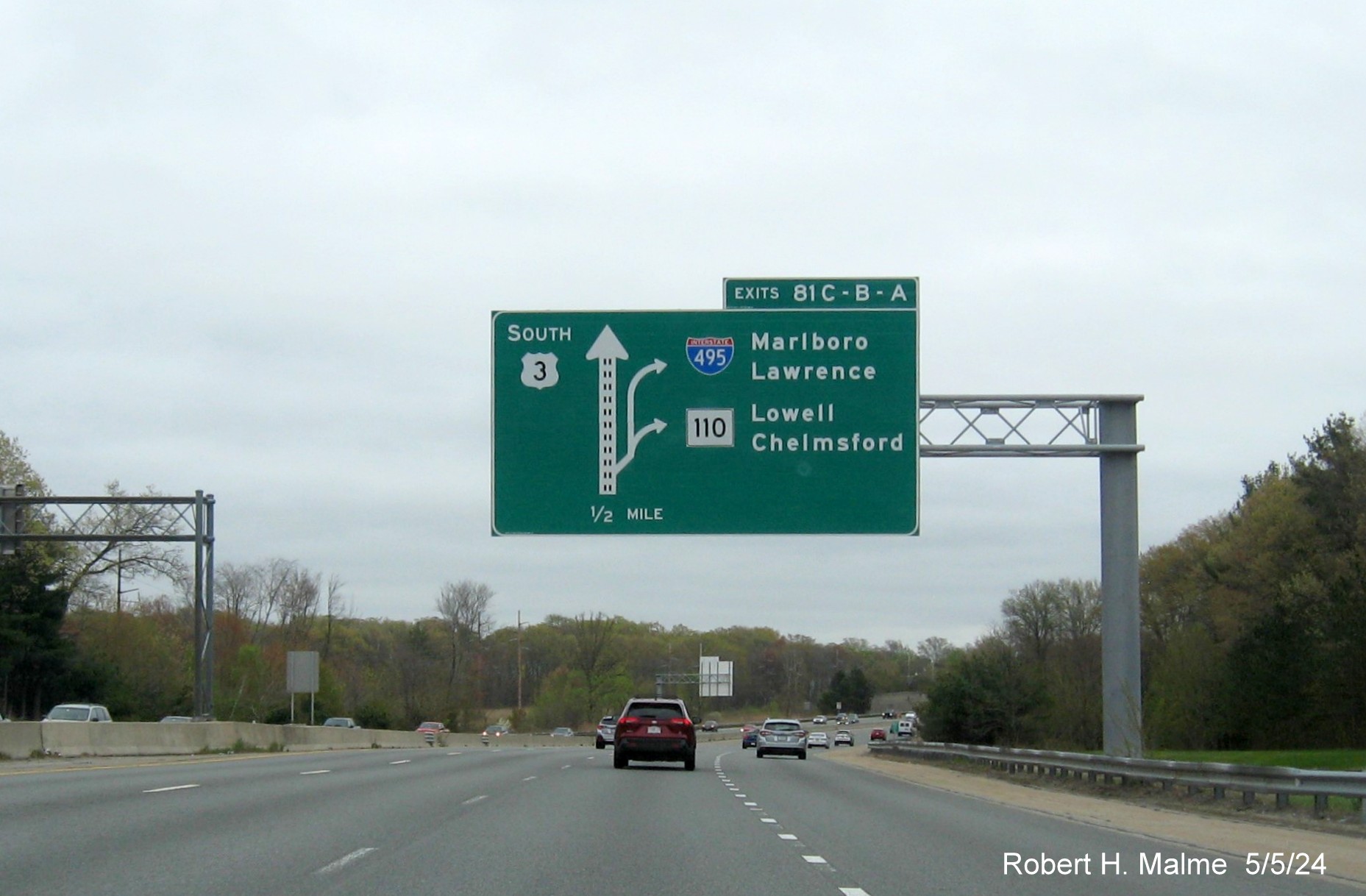
The new 1/2 Mile advance sign, put up in April. Many states,
encouraged by the new federal MUTCD, are phasing out these type of signs, but apparently MassDOT still likes them. Signage in
the C/D lane heading south was replaced after May 5, 2024.
*The first C/D ramp sign for the Route 110 exit.
*The overhead signs at the I-495 South exit.
*The last C/D ramp sign for the I-495 North exit.
Additional new signage:
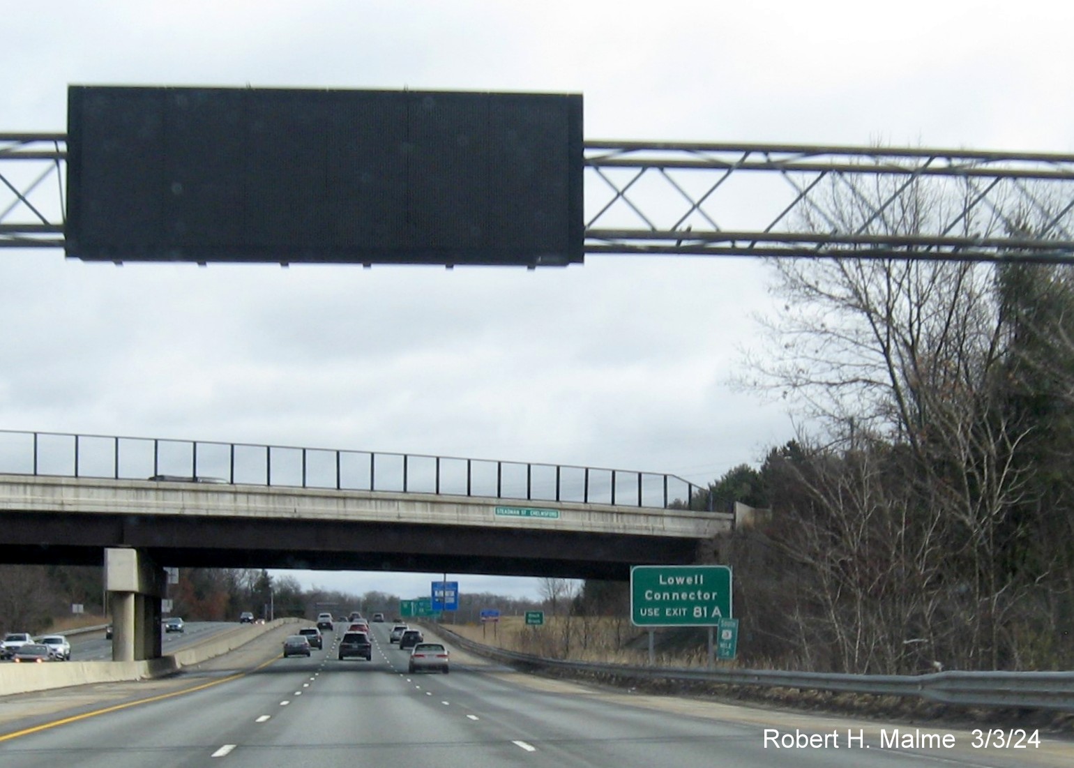
The new auxiliary sign for the Lowell Connector southbound prior
to the I-495/Route 110 C/D lanes.
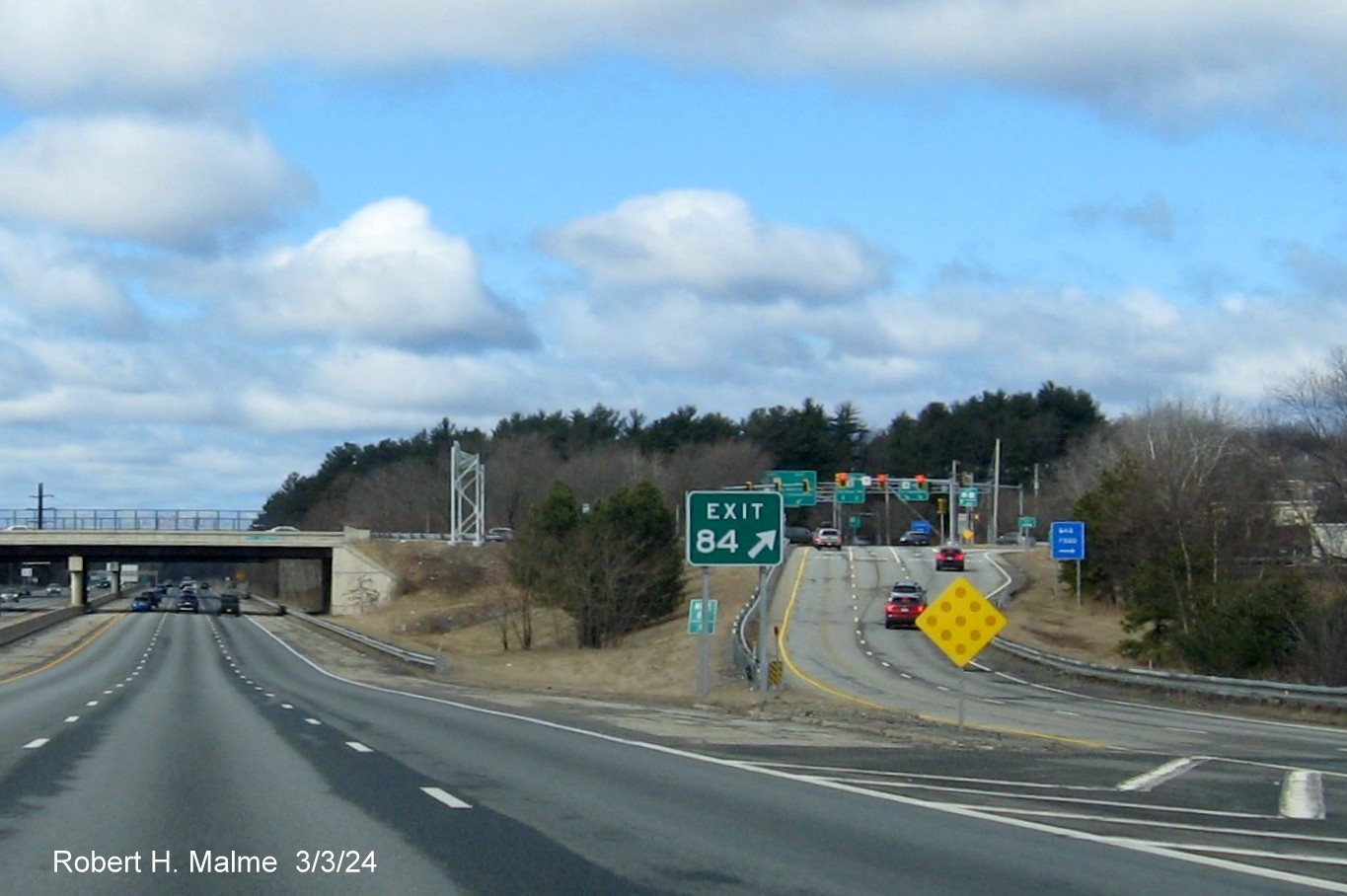
EXIT 84 - Route 4
All the overhead signs had been placed by early May 2024.
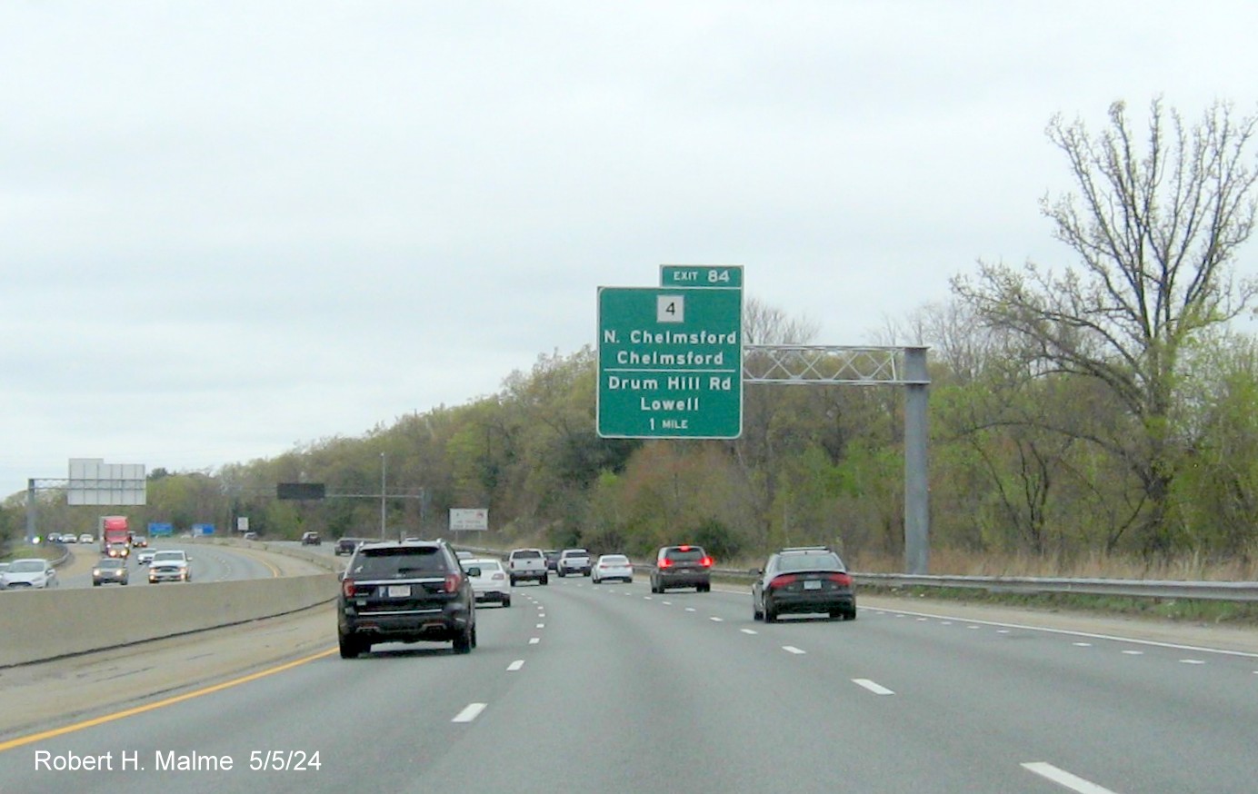
The new overhead signs for the MA 4 exit were put up in April 2024, the
new signs also included information about Drum Hill Road. The 1 Mile advance.
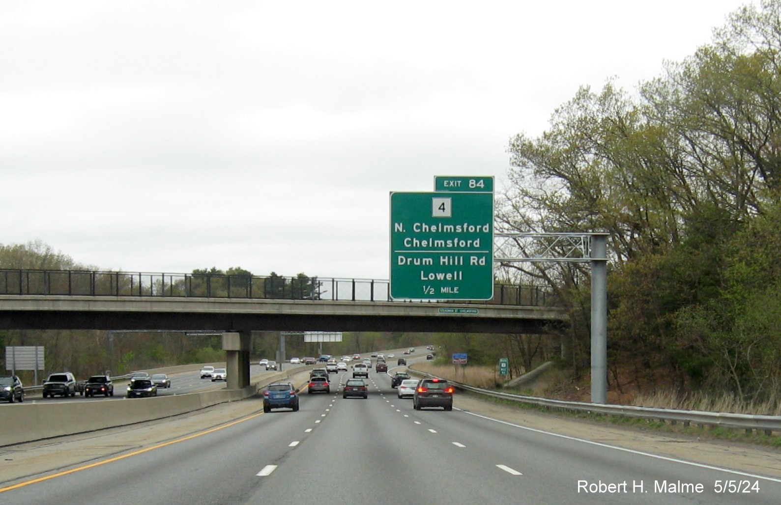
The 1/2 Mile advance.
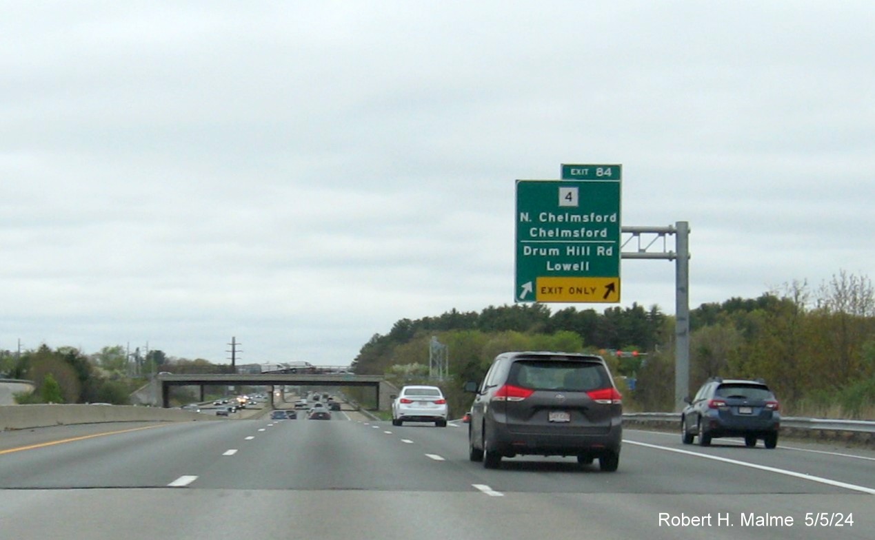
The exit ramp includes an exit only lane, in both directions.
The only new sign for this exit was the gore sign. Noted by its lack
of yellow Old Exit sign underneath. Turning around...

The new 1 Mile advance headed south.

The new 1/2 Mile advance. The auxiliary sign for UMass Lowell is
old, since it has an overlay for the new milepost exit number.
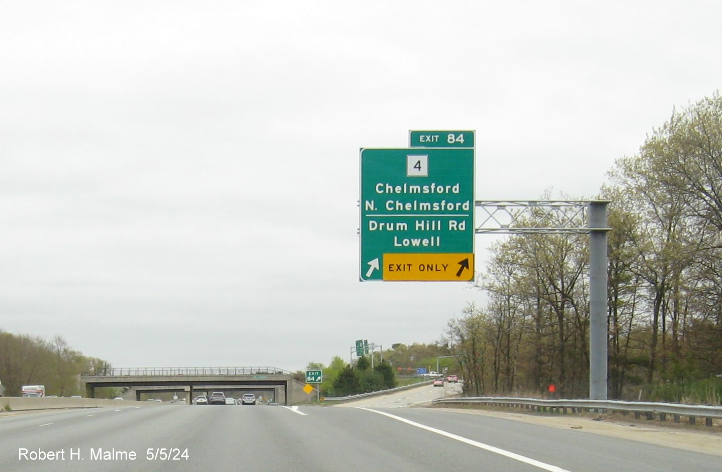
The new exit sign also with an exit only lane, useful for the Drum
Hill Road Rotary at the end of the ramp.
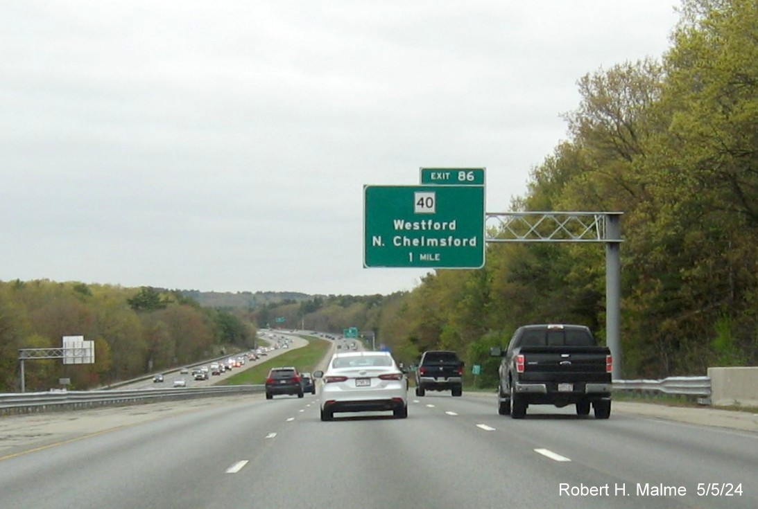
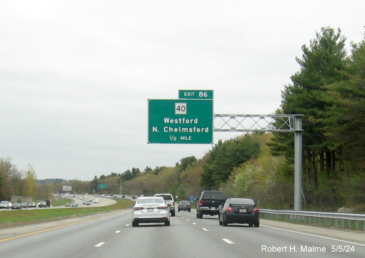
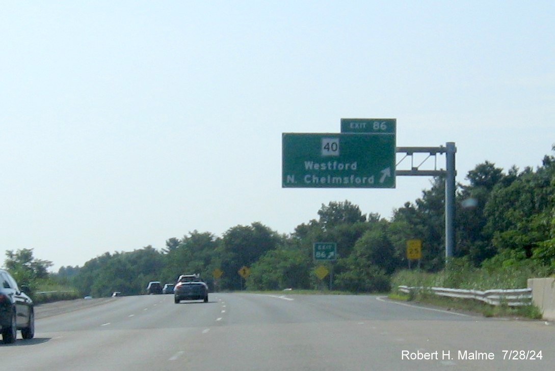
EXIT 86 - Route 40
All but the exit signs had been placed by early May 2024. Those
were put up between May and July 2024.
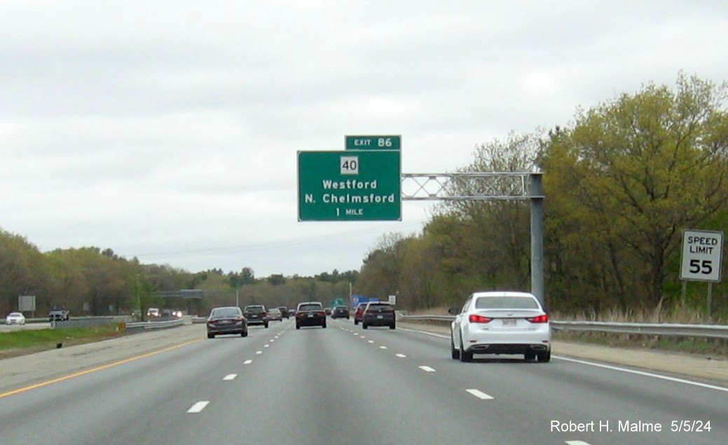
The new 1 Mile advance sign for the Route 40 exit headed north.
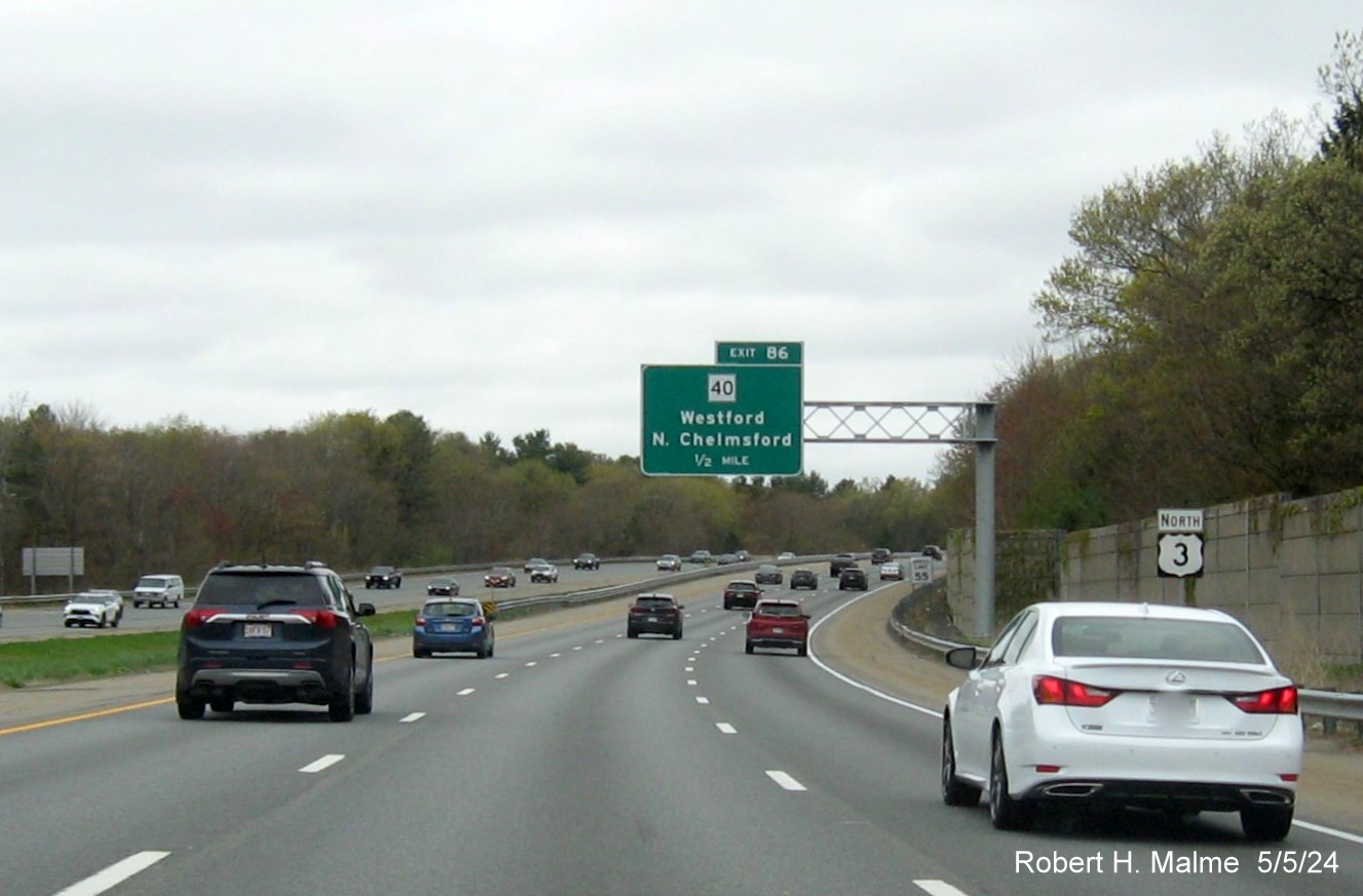
The new 1/2 Mile advance sits behind the recently placed new North
US 3 reassurance marker seen before.
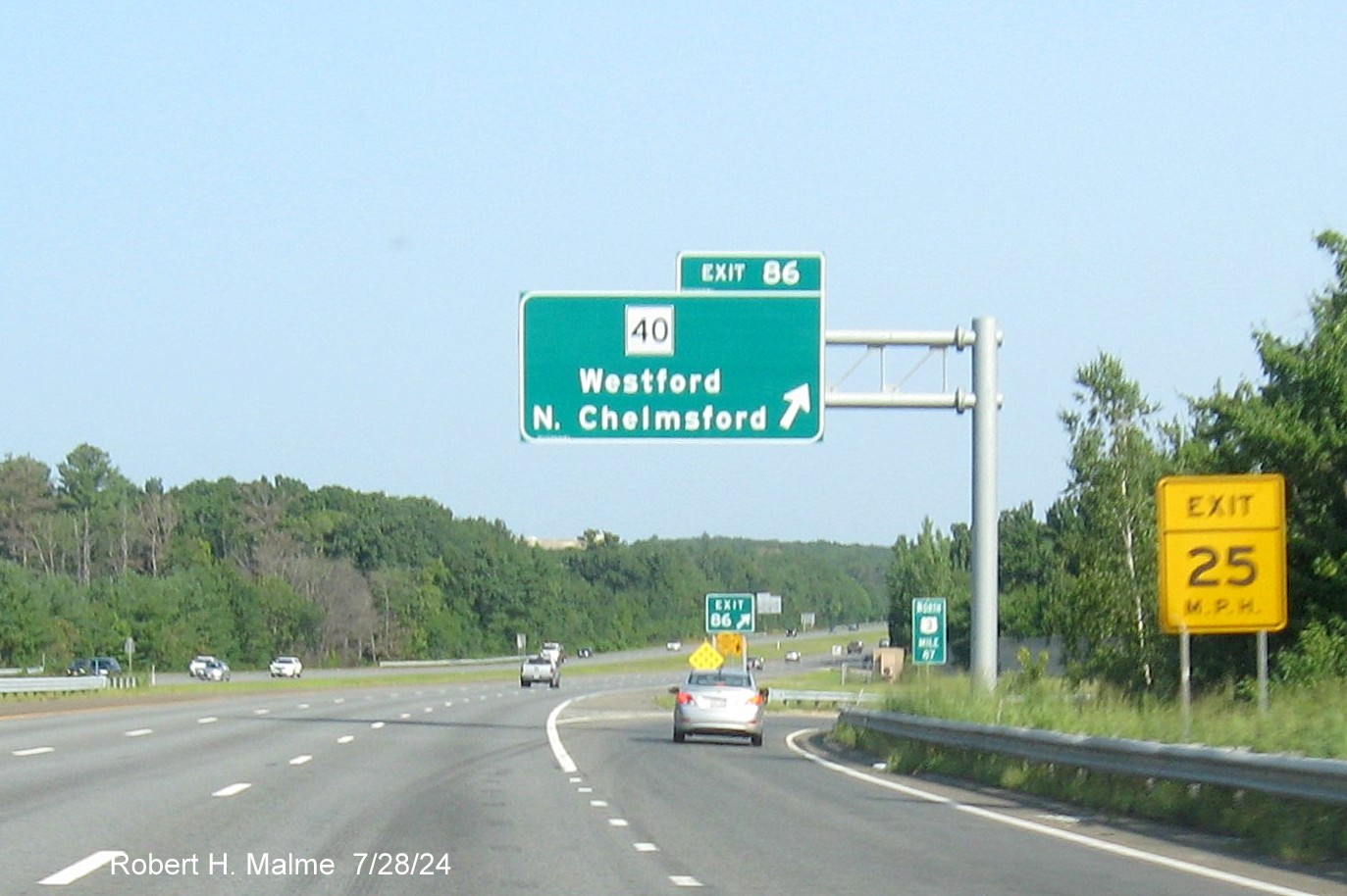
*The later installed exit sign, notice it is at milepost 87. Turning
around...
The 1 Mile advance sign for the Route 40 exit headed south.
The new 1/2 Mile advance sign, the old exit sign can be seen in
the distance.
*The new exit sign put up during the summer.

*The new gore sign for the Route 40 exit.
The view of one of the project staging areas along US 3 North in
Westford. Still looked like a lot more gantries needed to be put up during May 2024.
*The same view in July 2024, a few signs and gantries still remain
to be installed.
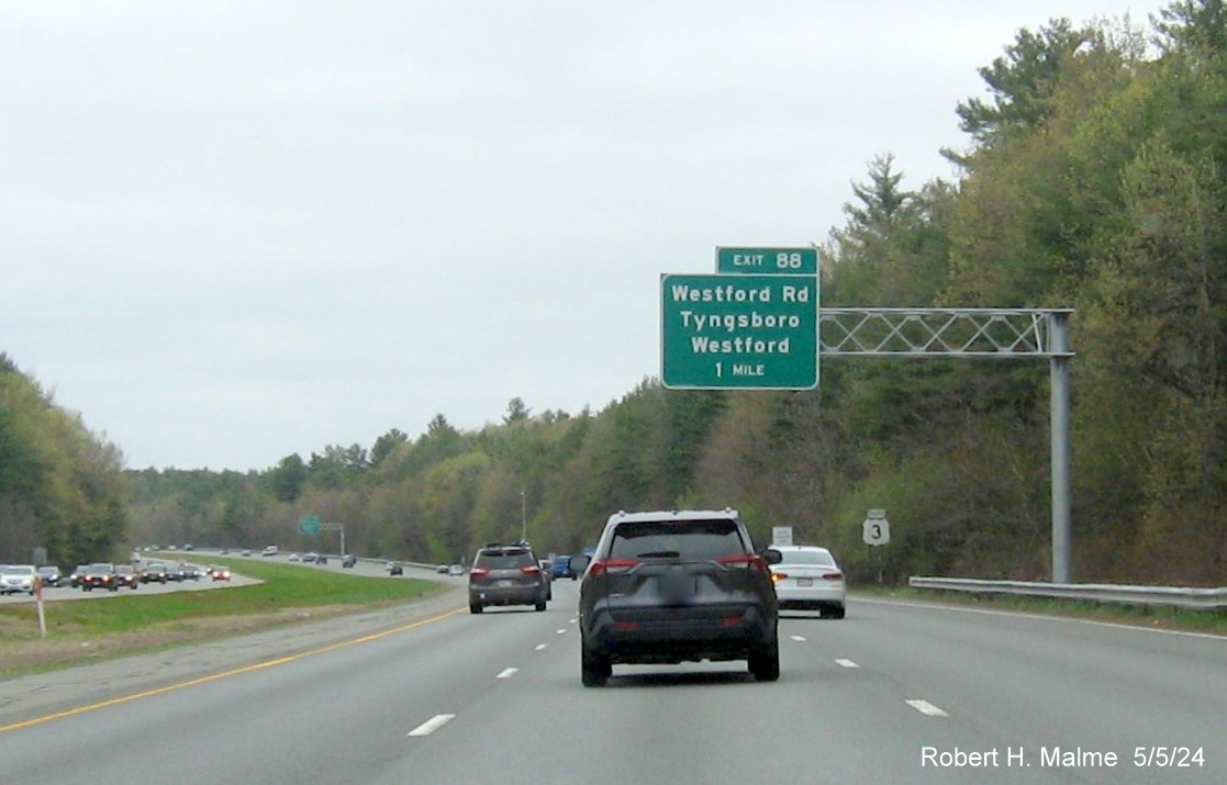
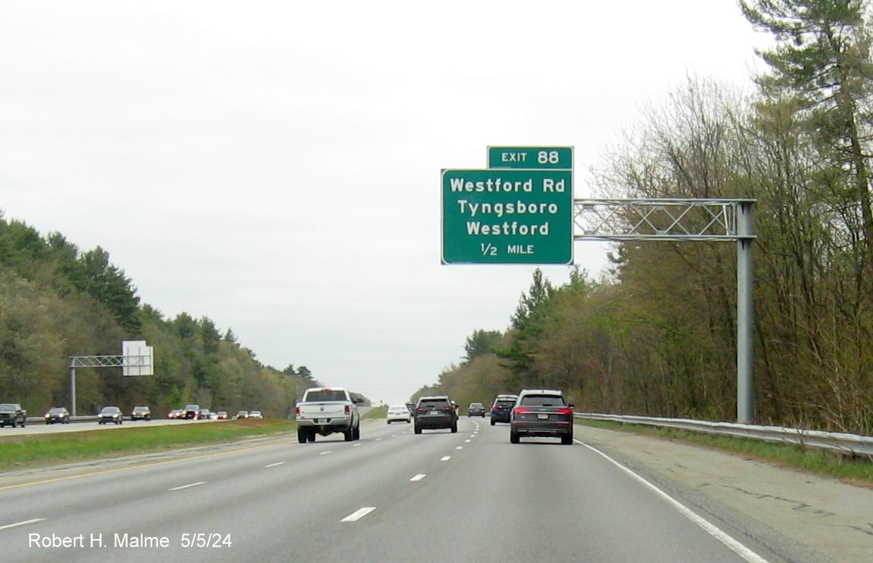
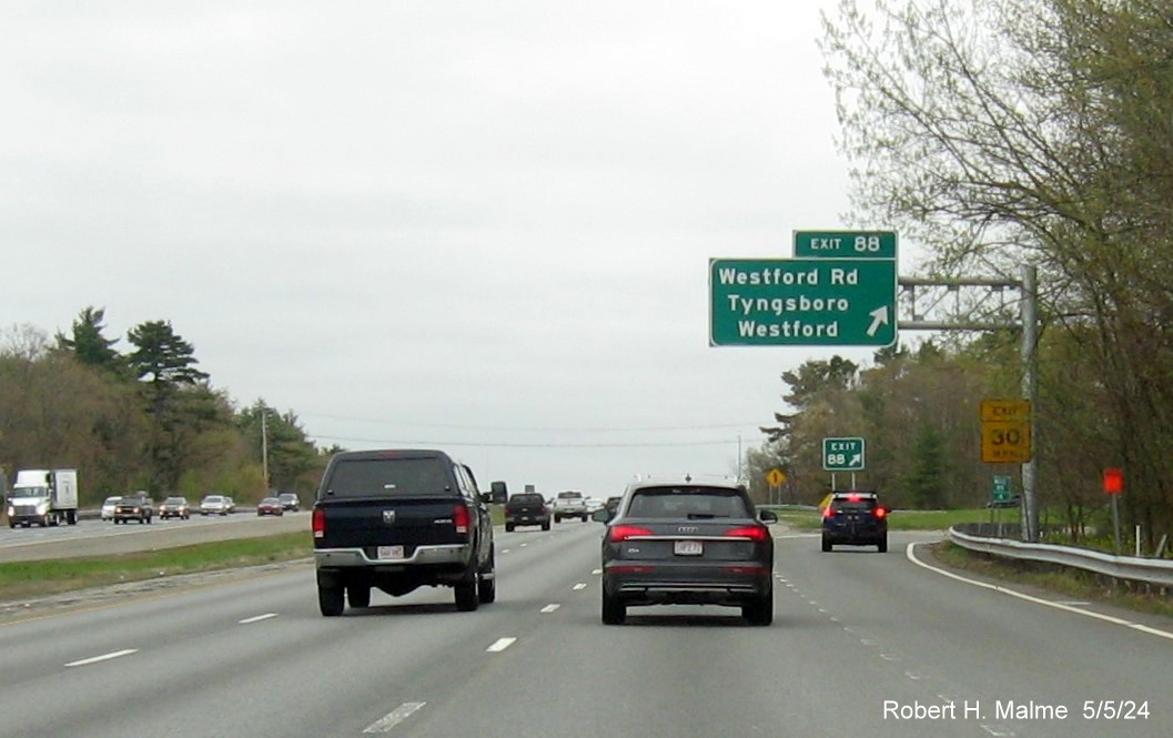
EXIT 88 - Westford Road
All the overhead signs were up for this exit as of early May 2024.
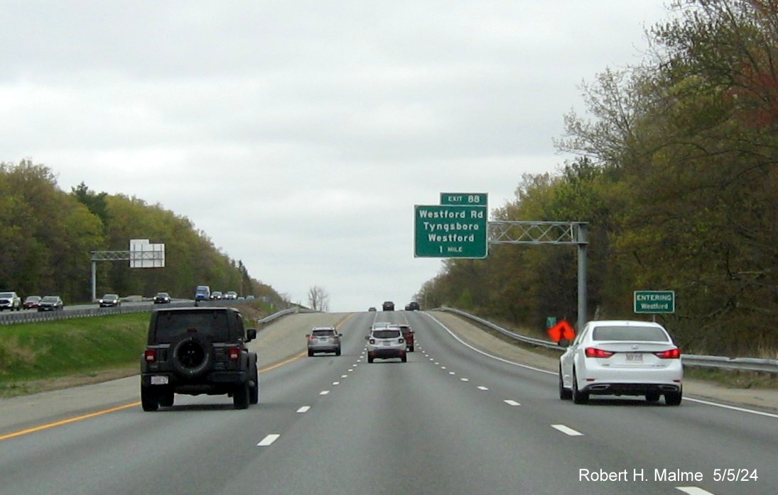
The new 1 Mile advance sign for the Westford Road exit headed north,
just over the town line.
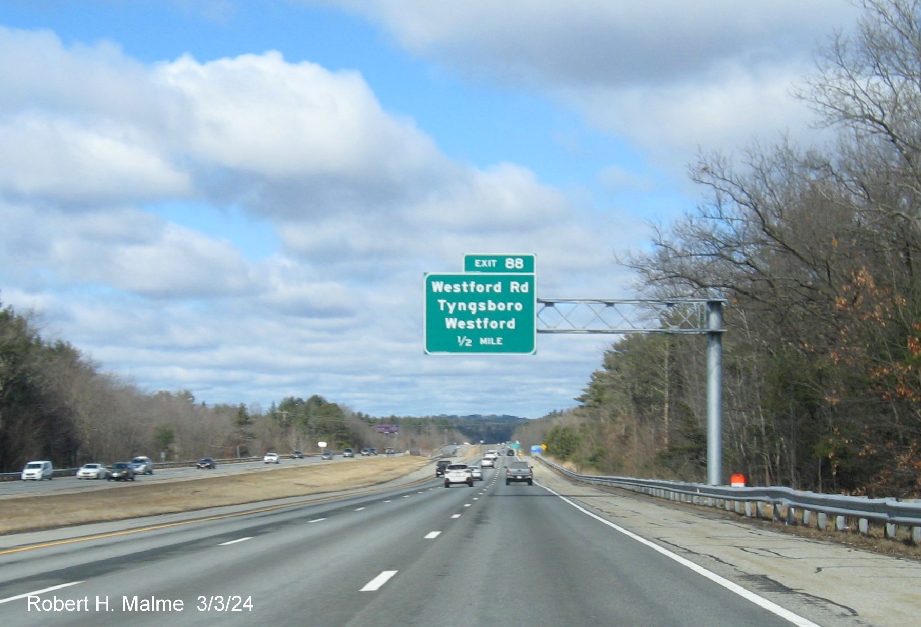
The 1/2 Mile advance sign for Westford Road put up in March.
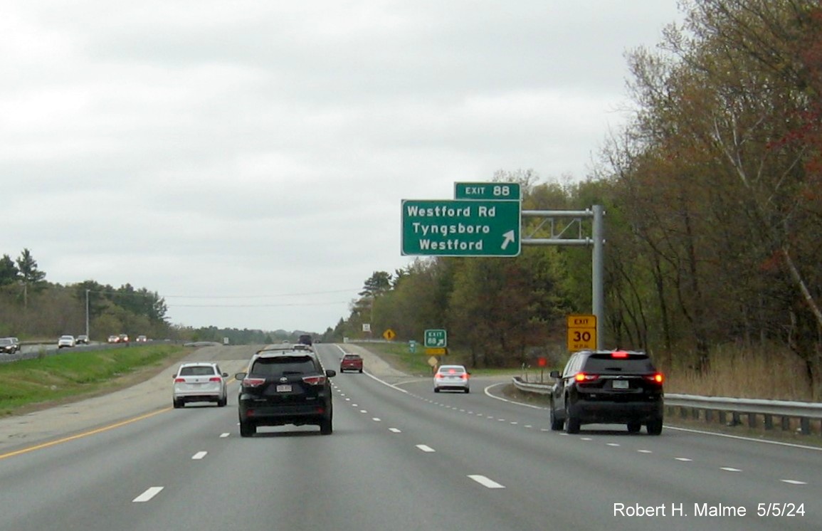
The new exit sign for Westford Road, the gore sign had not been
changed at the time, still having an Old Exit number plaque. Turning around...
New image of 1 Mile advance sign on US 3 South in early March. The
other new signs in this direction were put up in April 2024.
The new 1/2 Mile
advance sign for the Route 40 exit headed north.
The new exit sign for the Westford Road headed south. The gore sign
here appears to be new.
Other signage:
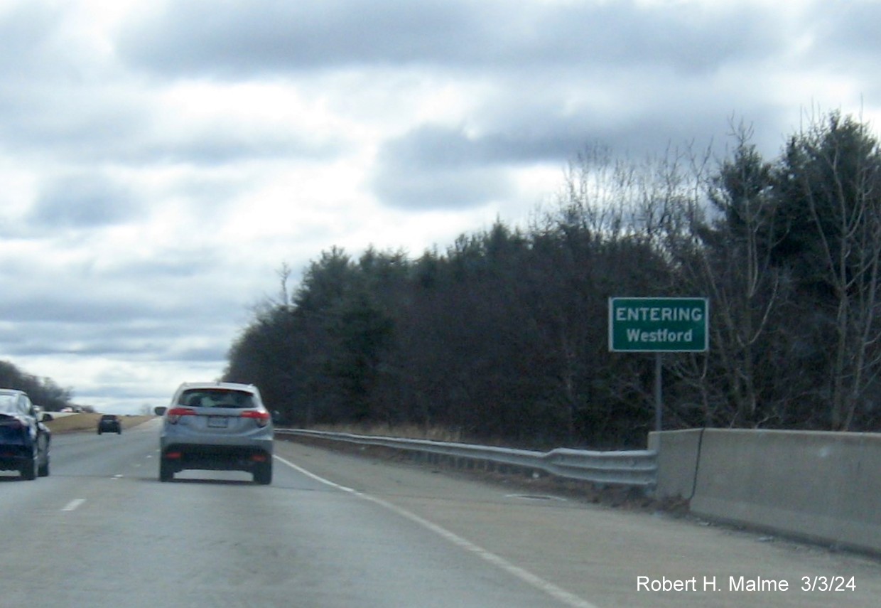
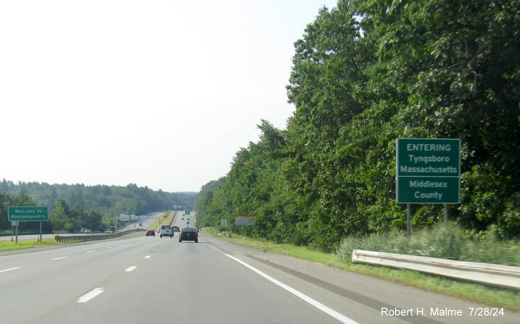
The new Entering Westford sign after the Westford Road exit.
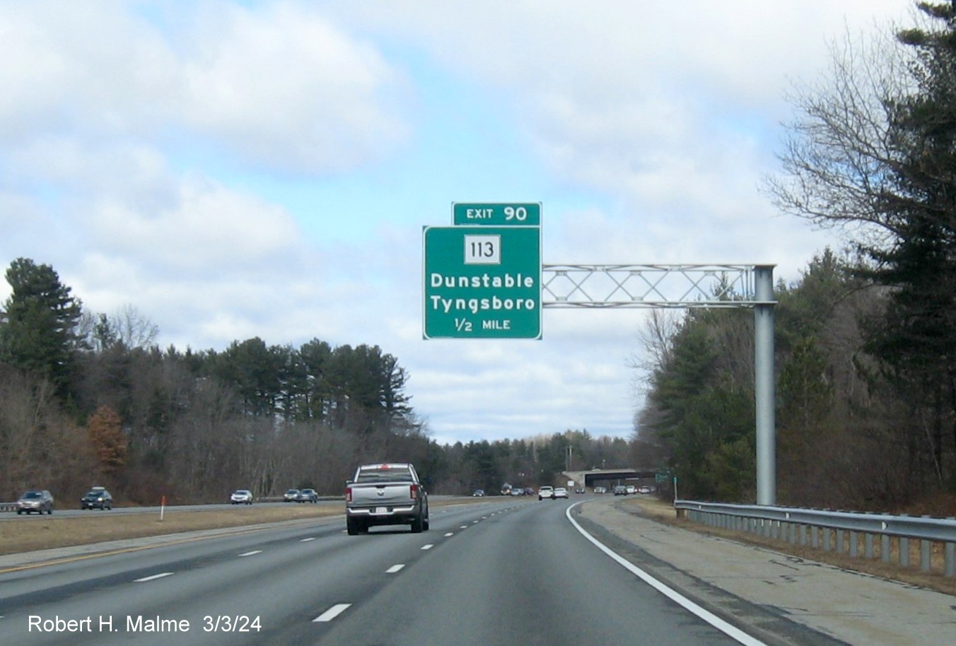
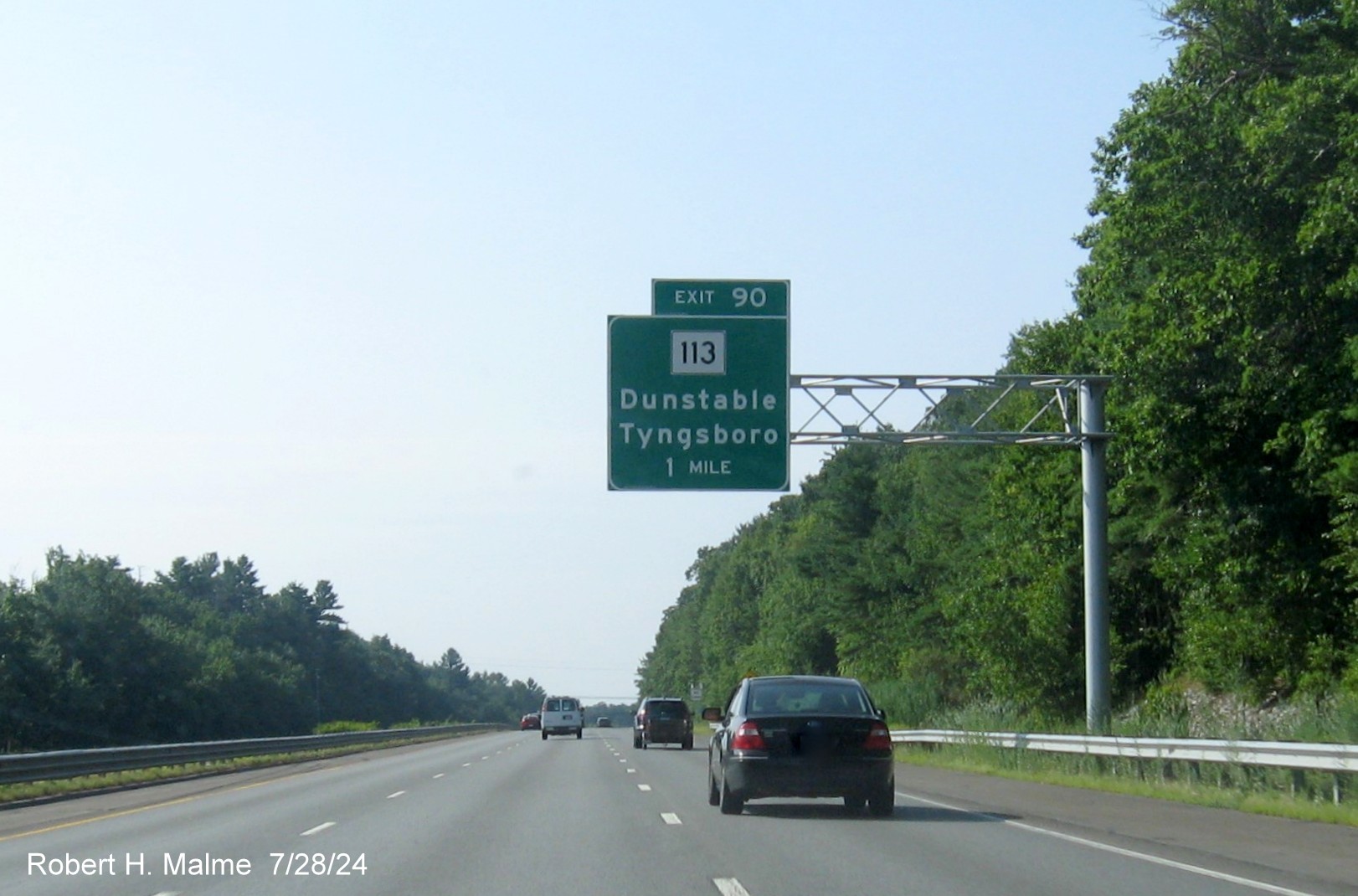
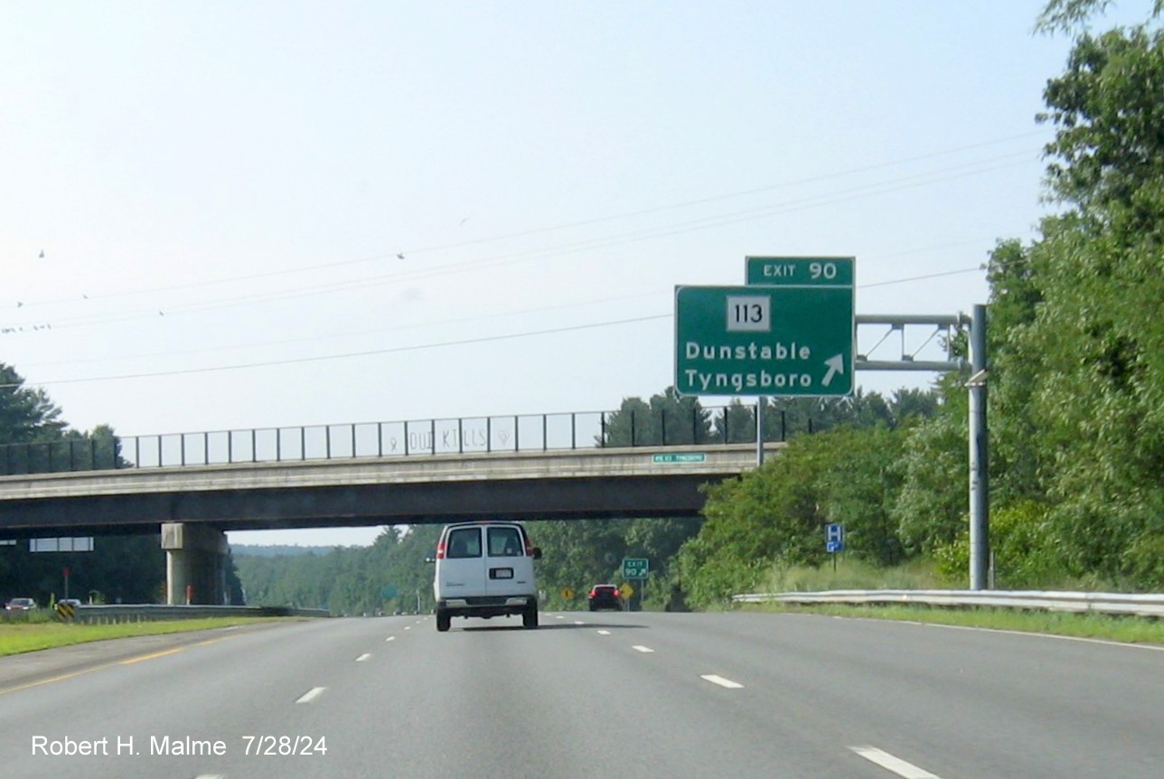
EXIT 90 - Route 113
Most of the advance signs were put up by May, the others by July
2024.
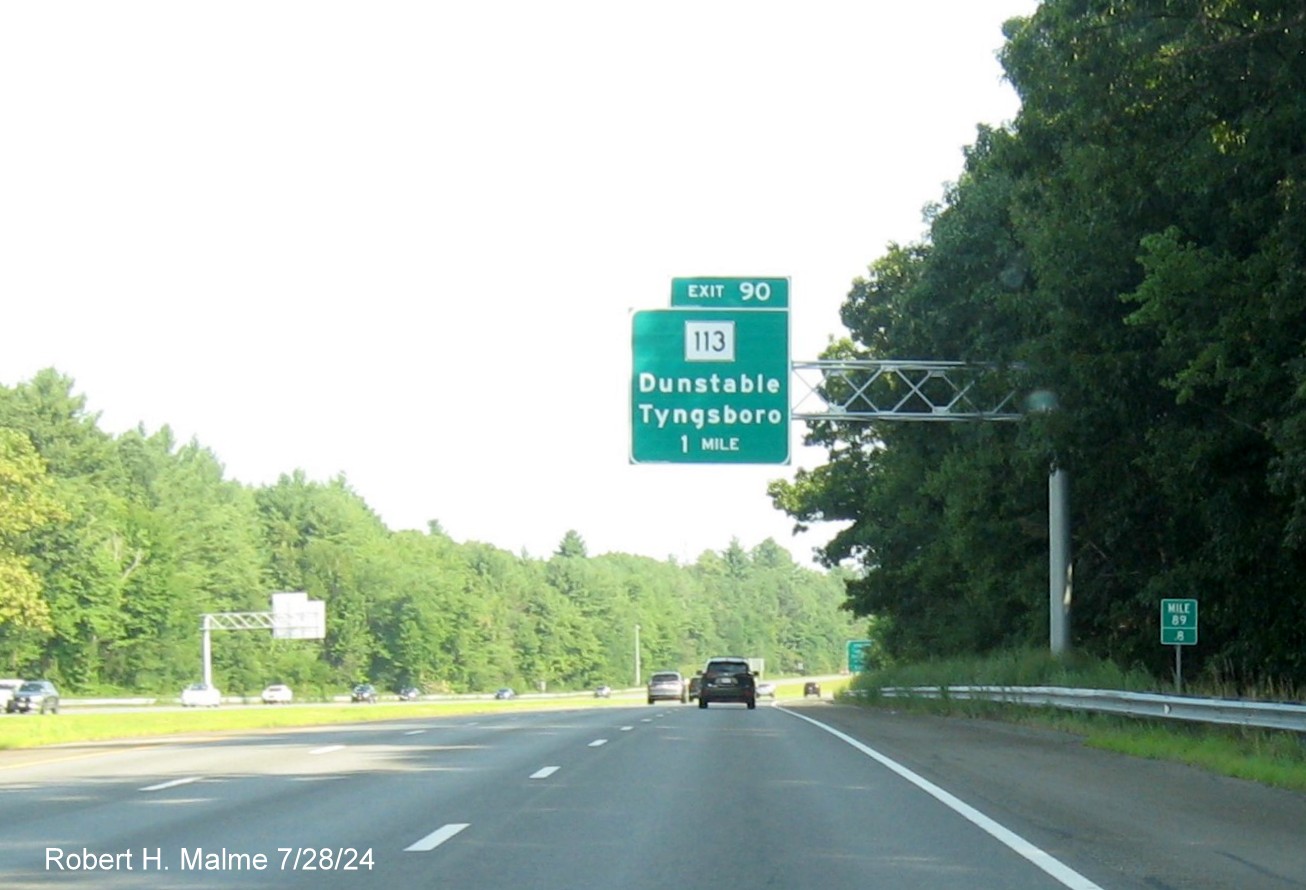
*One of the last
new signs to be put up north of I-495, the 1 Mile advance for Route 113.
Again, based on the mile marker the exit number should be 91, not 90.
The 1 Mile
advance sign for the Route 113 exit in Tyngboro(ugh). This was the first
sign for the exit put up in this direction.
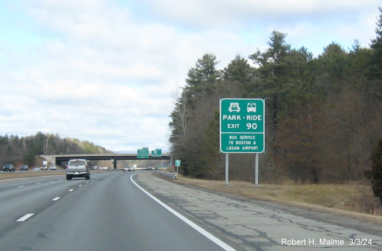
The new auxiliary sign for the Park and Ride lot at the Route 113
exit.
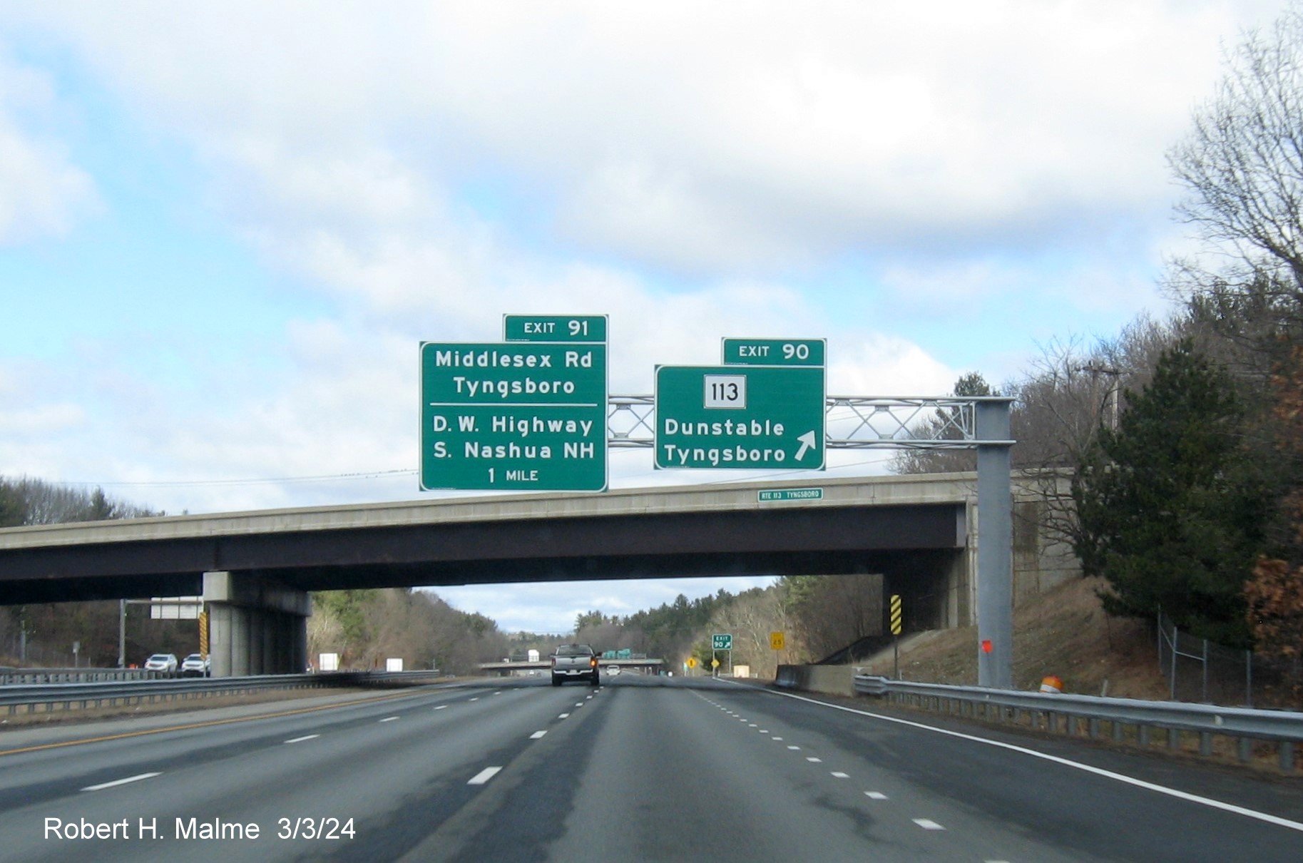
The new overhead
sign at the Route 113 exit also includes the 1 Mile advance for the last Massachusetts exit.
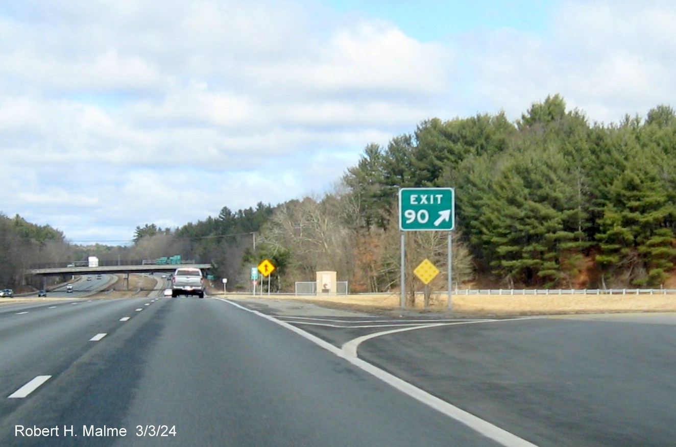
The new gore sign for the Route 113 exit. Turning around....
*One of the two signs put up during the summer in this direction,
the 1 Mile advance for Route 113.

The 1/2 Mile
advance sign on US 3 South. This was still the only new sign for this exit in this direction as of early May.
*The exit sign for Route 113, also put up in June or July.
Other Signs:
*The first new sign put up in this direction, crossing the border
from New Hampshire.
EXIT 91 - Middlesex Road (NB)
All signs were up for this exit as of early May 2024.
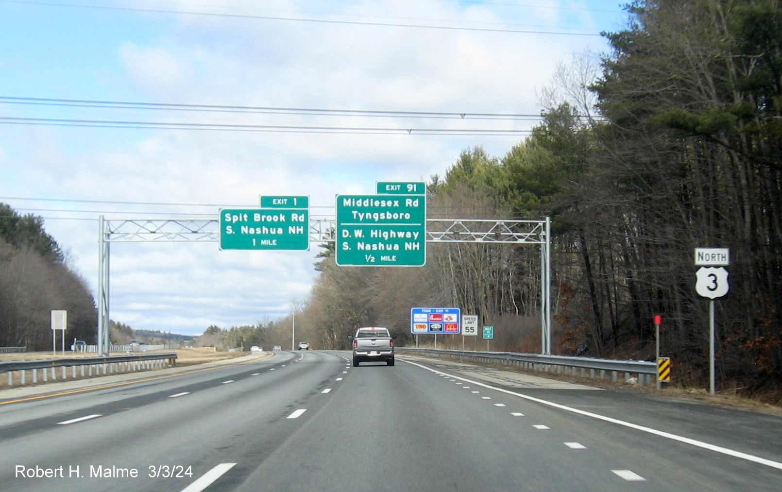
The new 1/2 Mile
advance sign for the Middlesex Road exit now includes a reference to the
Daniel Webster Highway which the road becomes after crossing the border.
There is also a 1 Mile advance sign for the first New Hampshire exit
which previously had no advance signs in Massachusetts.
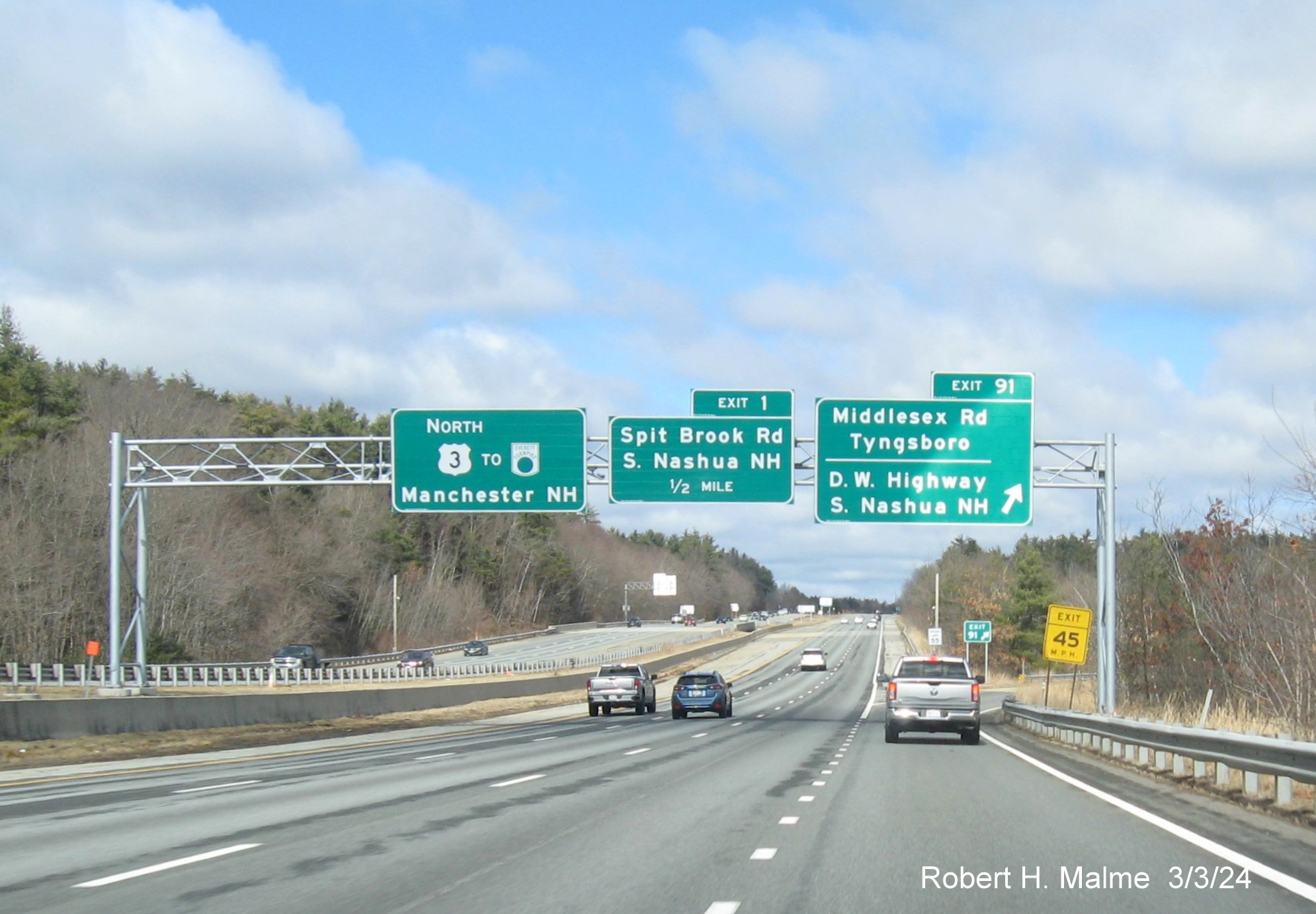
The new overhead signs at the Middlesex Road/D.W. Highway ramp also
included a 1/2 Mile advance for the first New Hampshire exit and a pull through for US 3 North with a Everett Turnpike logo.
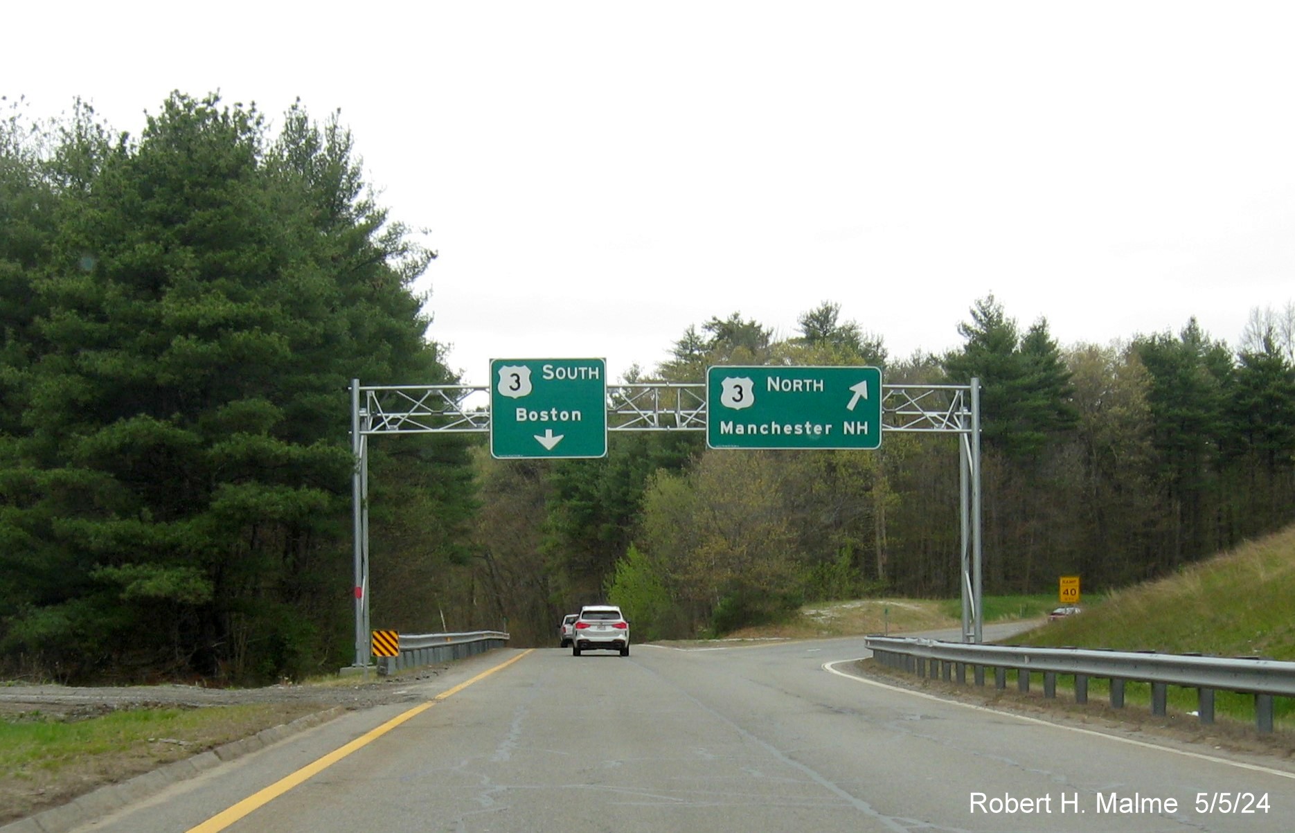
*The gantry of the US 3 on-ramp from Middlesex Road now has its
US 3 South ramp sign. The older gantry that was placed earlier along the ramp had been taken down.
The new gantry on the ramp from Middlesex Road was missing the
US 3 South sign in March. The old sign gantry at the beginning of the ramp had not yet been taken down.
And Most Importantly...The new Speed Limit 65 Signs put up the week
of July 22, 2024:
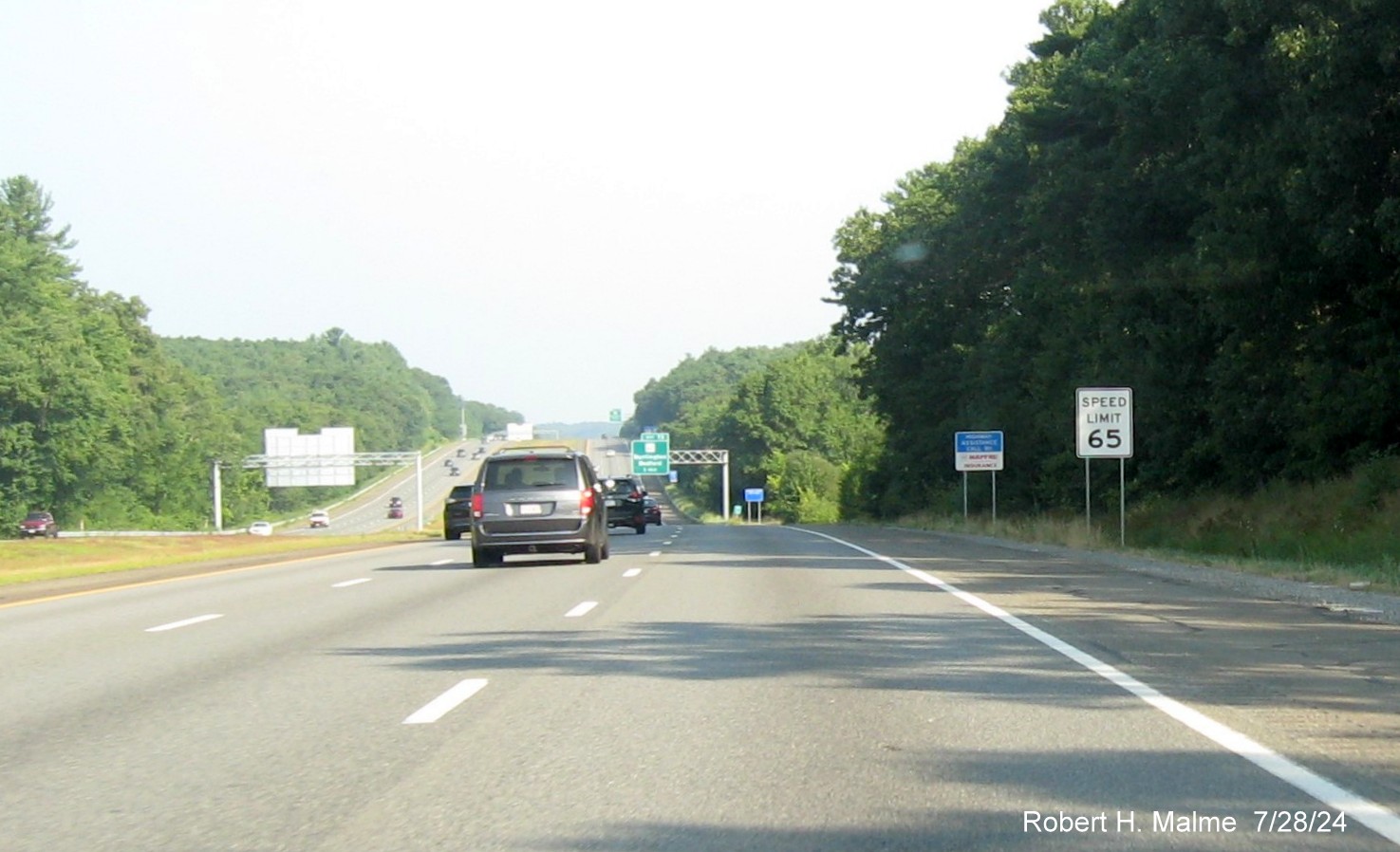
*The first new sign on US 3 North in Burlington.
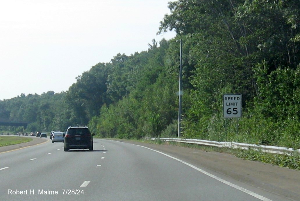
*The second to last new sign on US 3 South in Burlington after
the Concord Road exit.
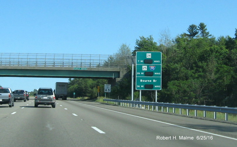
F. I-295 Sign Replacement, Attleboro, 2023-2024
Signs were replaced along the 4 mile segment of I-295 in
Massachusetts during a project that took place from April 2023 to May 2024. This project, since it only replaced the signage,
not the supports, and being only 2 exits, was nearly completed fairly quickly. Signs are listed, by exit heading north from
the Rhode Island border, all photos taken on April 29, 2024, just prior to work being completed:
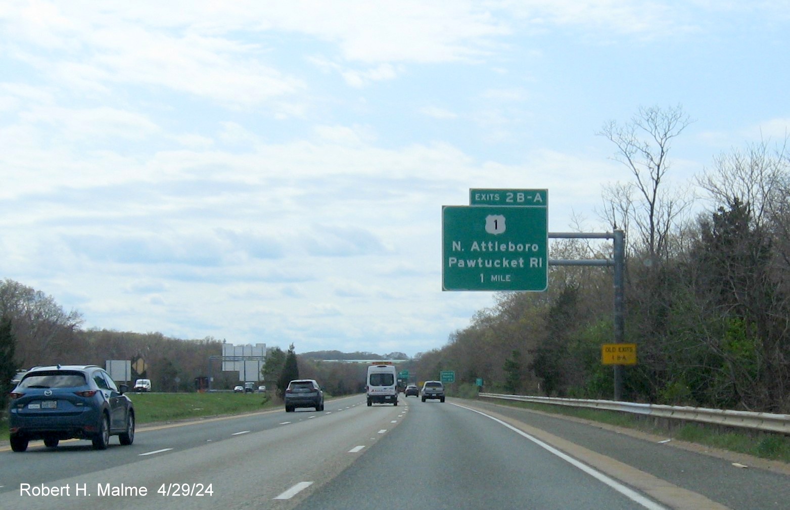
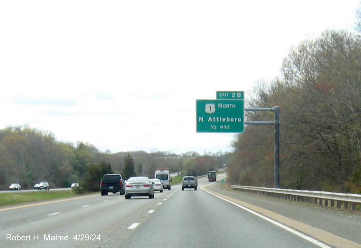
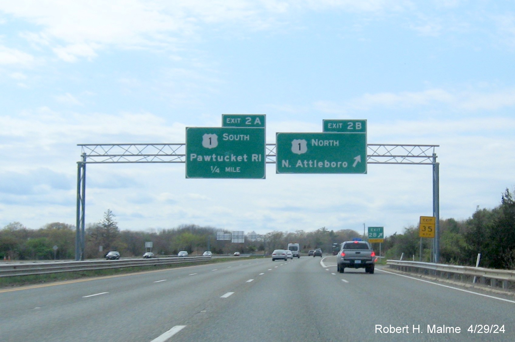
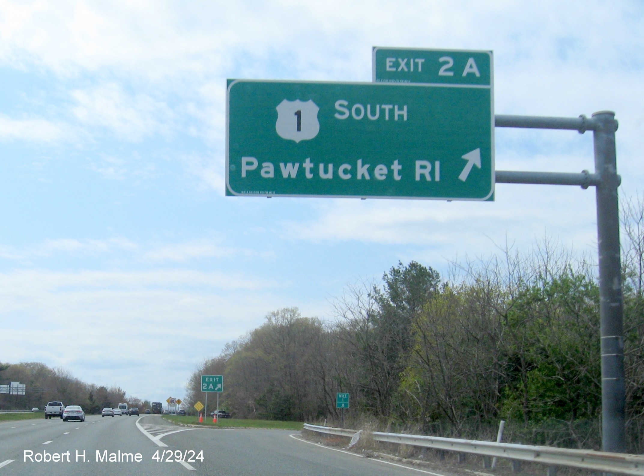
EXITS 2 A/B
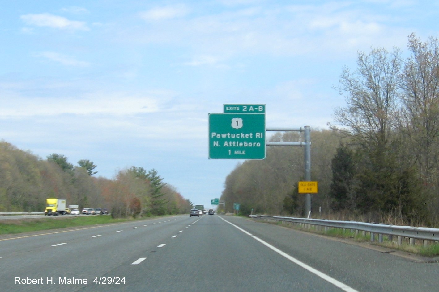
The 1 Mile advance overhead for the US 1 exit heading north. Because
the support post was not replaced, the Old Exits 1 A-B sign was not removed, though it had been 2 years since the exits were
renumbered.
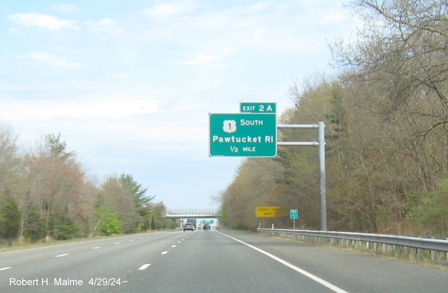
The 1/2 Mile advance overhead for the US 1 South exit.
The overheads at the US 1 South exit. It doesn't appear the gore
sign has been replaced since the Old Exits 1 A-B plaque is still attached.
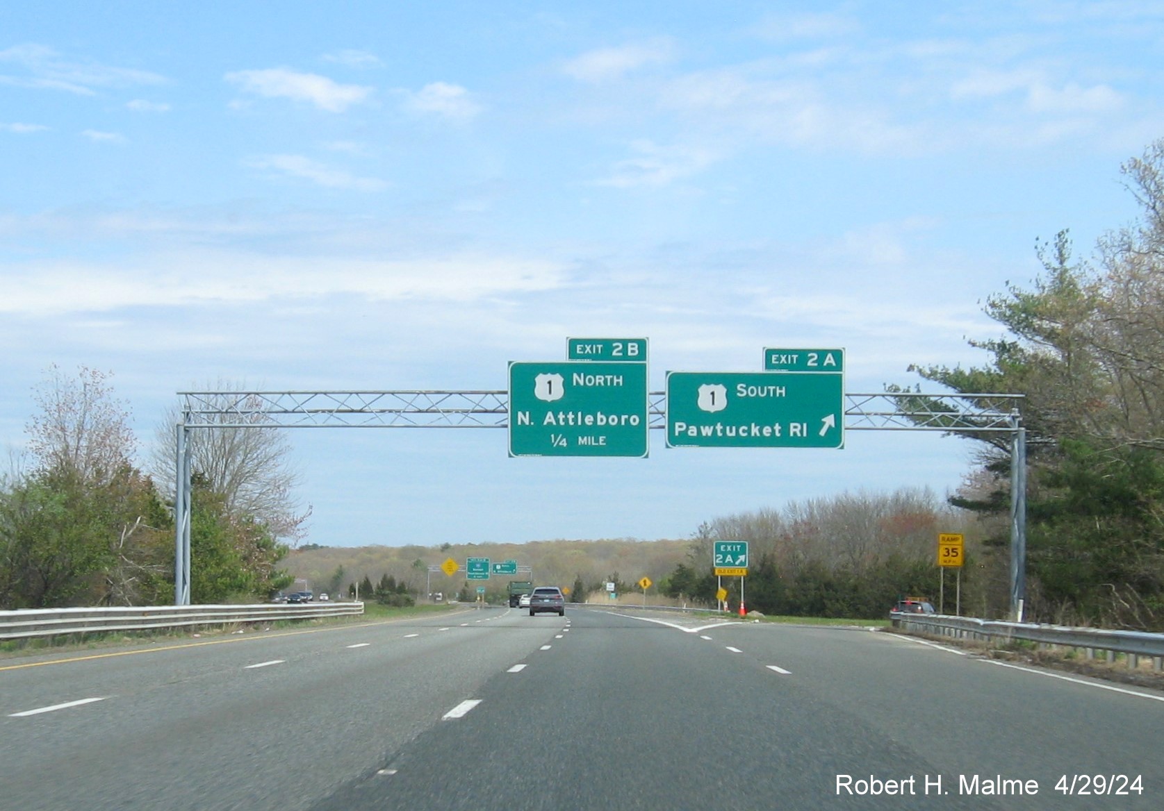
The exit sign for US 1 North.The gore sign here appears new,
since there is no Old Exit plaque. The sign shares the gantry with the first I-95 exits advance sign, more on that later.
Turning around for some signs heading south:
The 1 Mile advance overhead for the US 1 exits. The Old Exits
1 A-B sign was not removed here either.
The 1/2 Mile advance in this direction is for the US 1 North
exit.
The overhead signs at the US 1 North exit. Again the gore sign
for this exit does not appear new since there is the Old Exit plaque.
A closeup of the US 1 South exit sign and the apparent new gore
sign behind it.
The reassurance markers, if they are to be replaced, had not
been as of late April, this shield has been here, based on Google Maps Street View, since at least 2012.
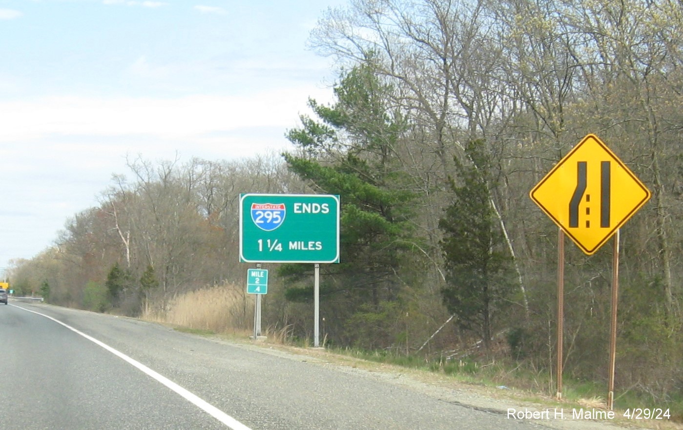
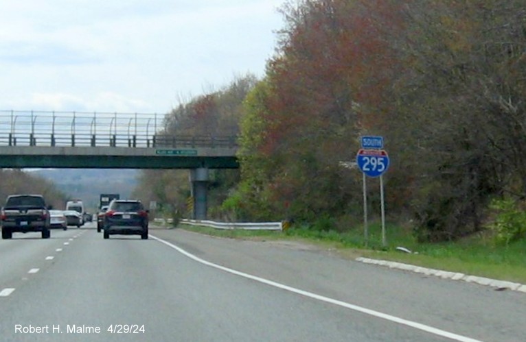
There was a new I-295 Ends (in) 1 1/4 Miles sign after the US 1
North on-ramp. If the sign is correct, I-295 then is 3.65 miles long in Massachusetts.
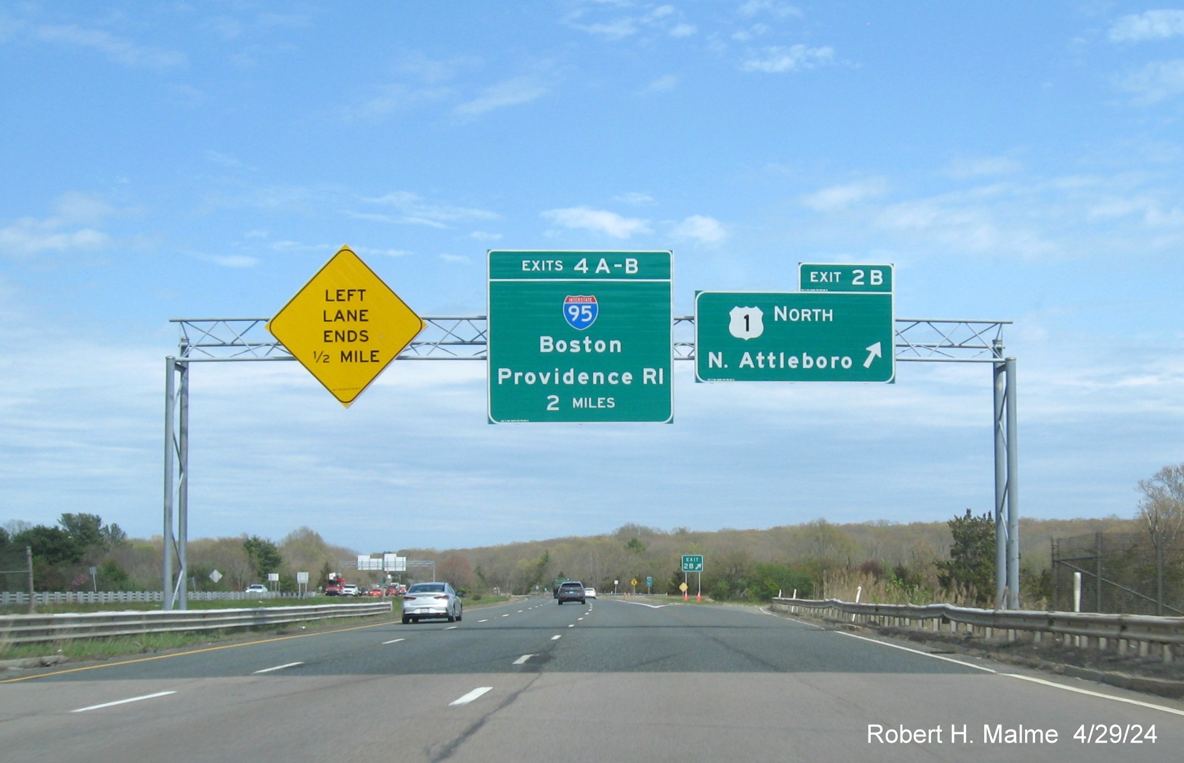
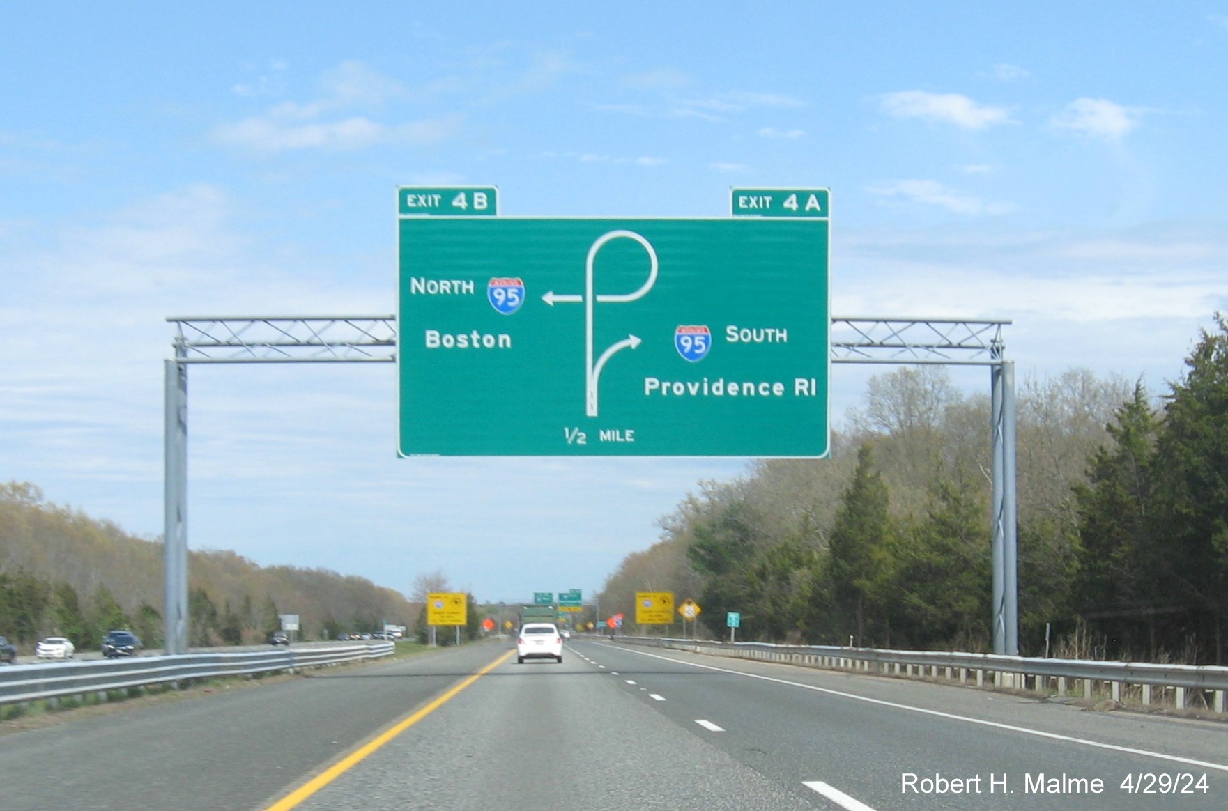
EXITS 4 A/B

The replacement of the 1 Mile advance diagrammatic overhead for
the I-95 exits. Largely the same as the old sign, these sign types are losing popularity around the country (and are not
recommended by federal sign guidelines), but apparently not in Massachusetts.
The new 1/2 Mile advance diagrammatic. All the ground mounted
yellow freeway end warning signs appeared to be new.
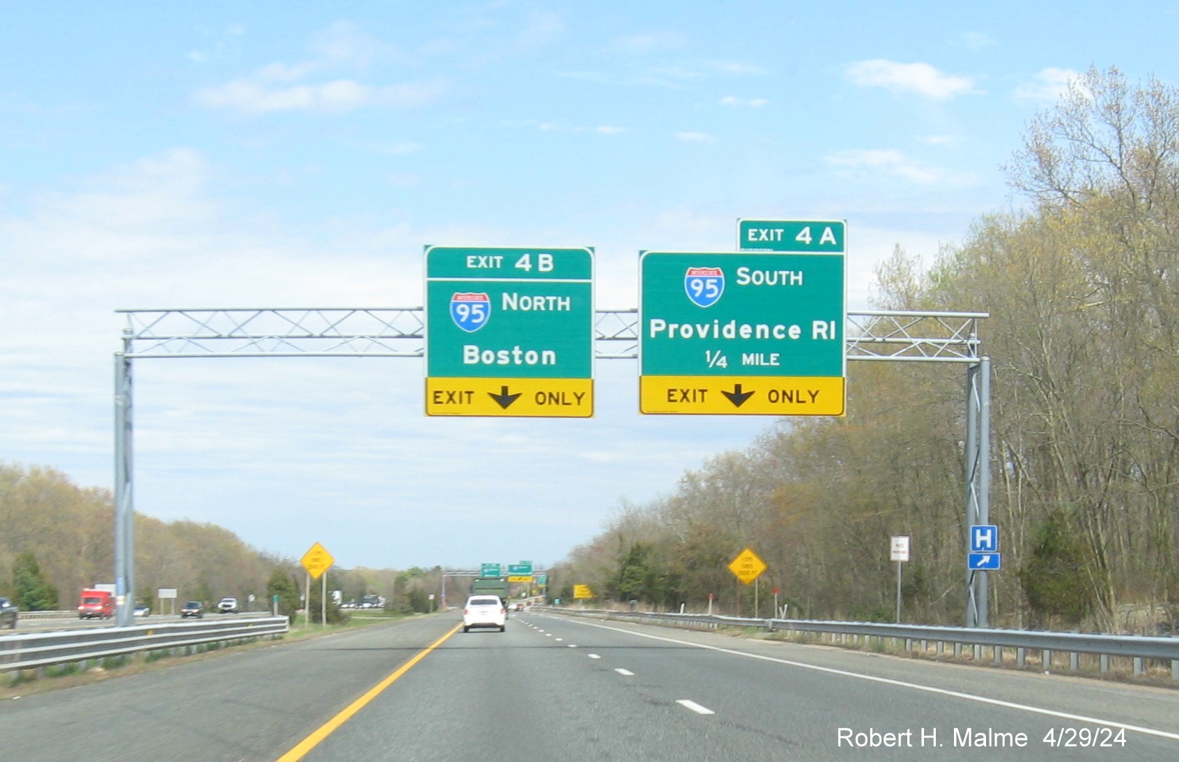
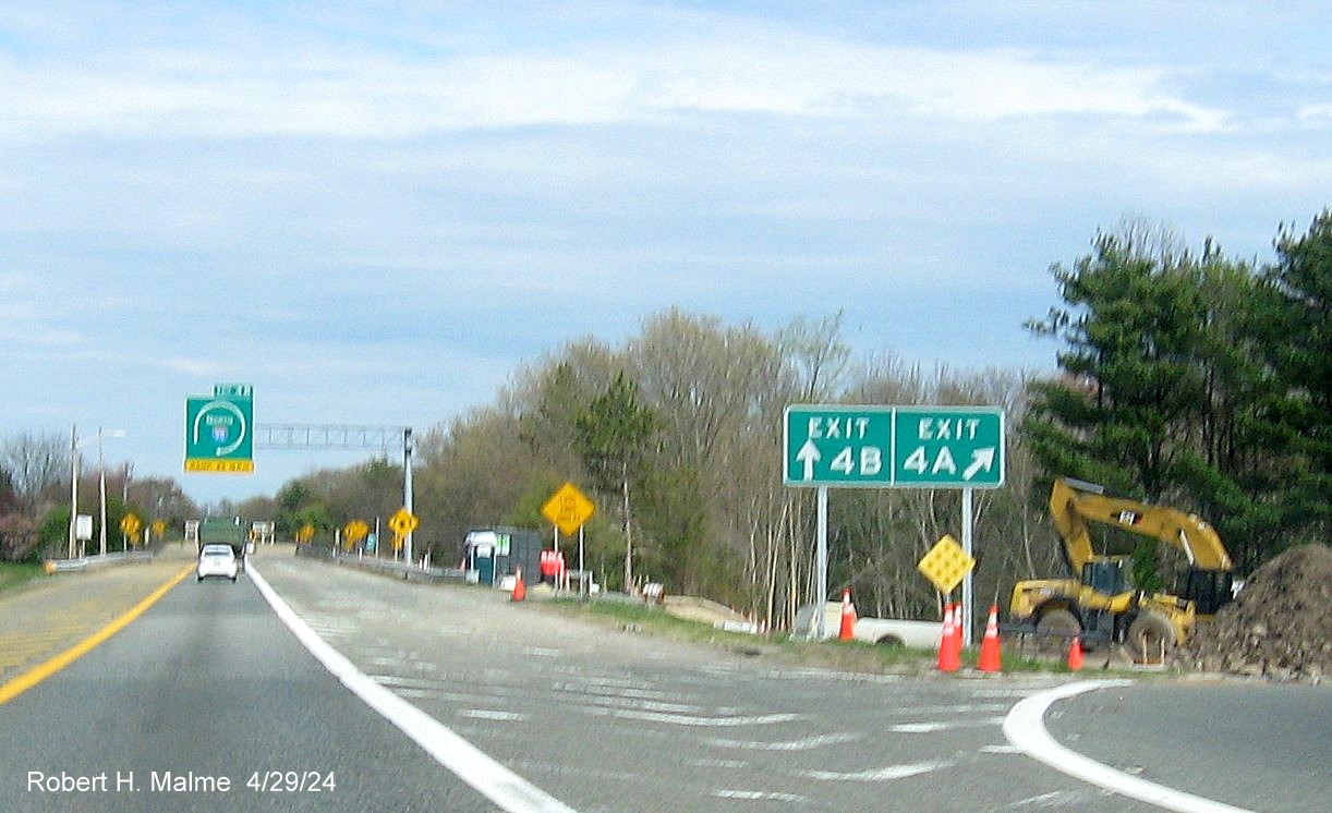
The 1/4 Mile advance overheads with yellow Exit Only tabs at the
bottom.

The overheads at the split of ramps for I-95 North and South. It
appears the sign replacement project has not yet restored the I-295 shields to the End I-295 signs, these have been missing
since at least 2016 based of Google Maps Street View images.
A pair of new gore signs at the I-95 South ramp. Work had begun
on a southbound ramp rehab project that closed one lane of I-95 South for several months starting in late May 2024.
The new version of the ramp curve 25 MPH warning sign. This sign
is rarely seen on interstates, though, because of canceled freeway projects in Massachusetts, this is one of two seen along
the I-95 North in Canton.
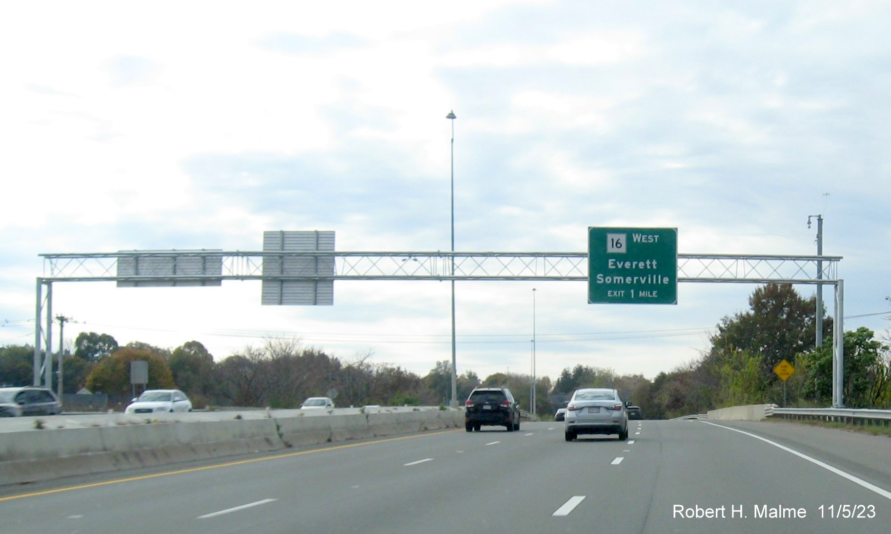
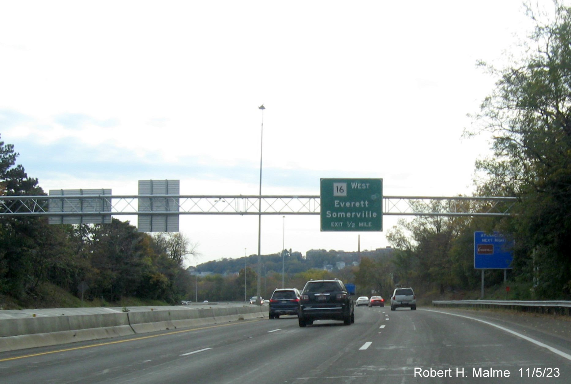
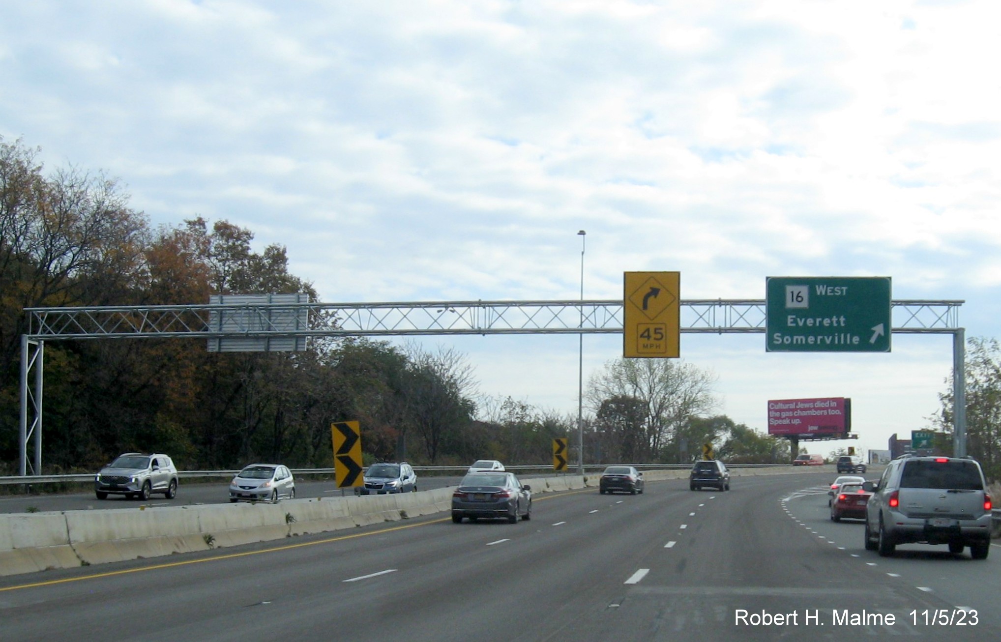
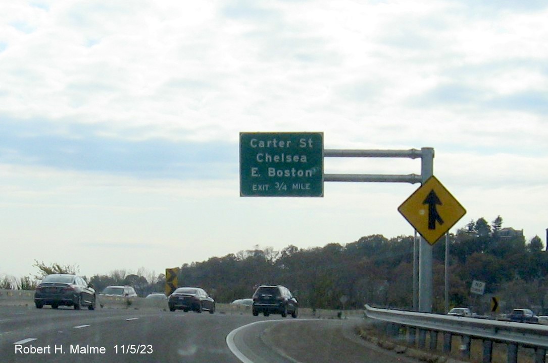
G. US 1 Sign Replacement, Chelsea to Danvers, 2020-2024
Signs along US 1
between Chelsea and Danvers are being replaced under a rather slow sign
replacement project that began in January 2020 and was still not quite
complete as of May 2024. The project included replacing overhead and
ground mounted signs and their supports along US 1 and its intersecting
roadways. This included both most of Northeast Expressway north of the
Tobin Bridge and the six-lane roadway between the Expressway and I-95 in
Danvers, including the interchange with I-95 and Route 128 in Peabody.
The project was listed by MassDOT as being completed later during the
summer. Photos here are displayed in reverse chronological order, latest first.
Sign photos on US 1 North taken May 5, 2024:
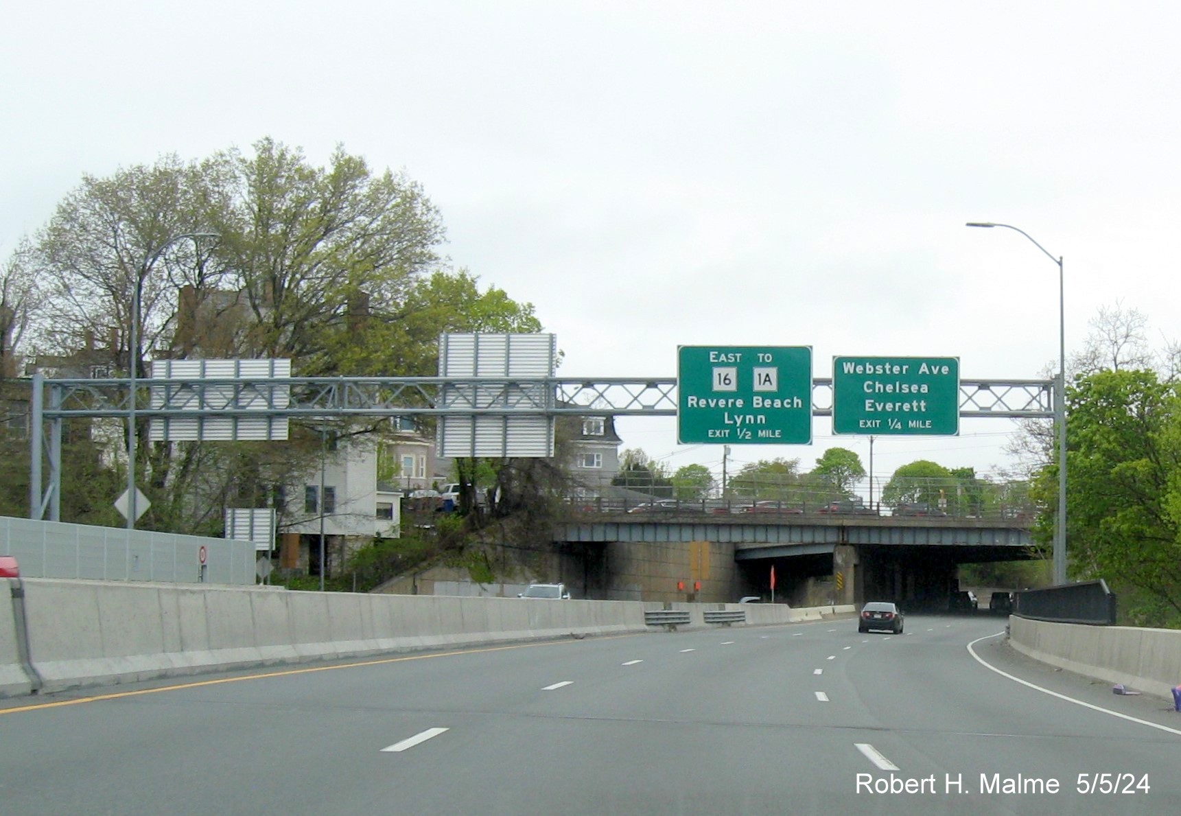
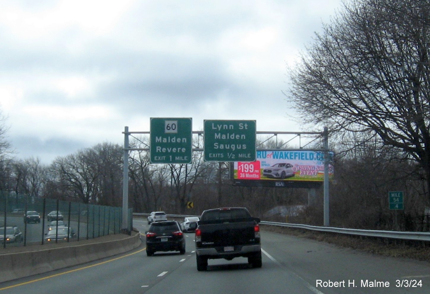
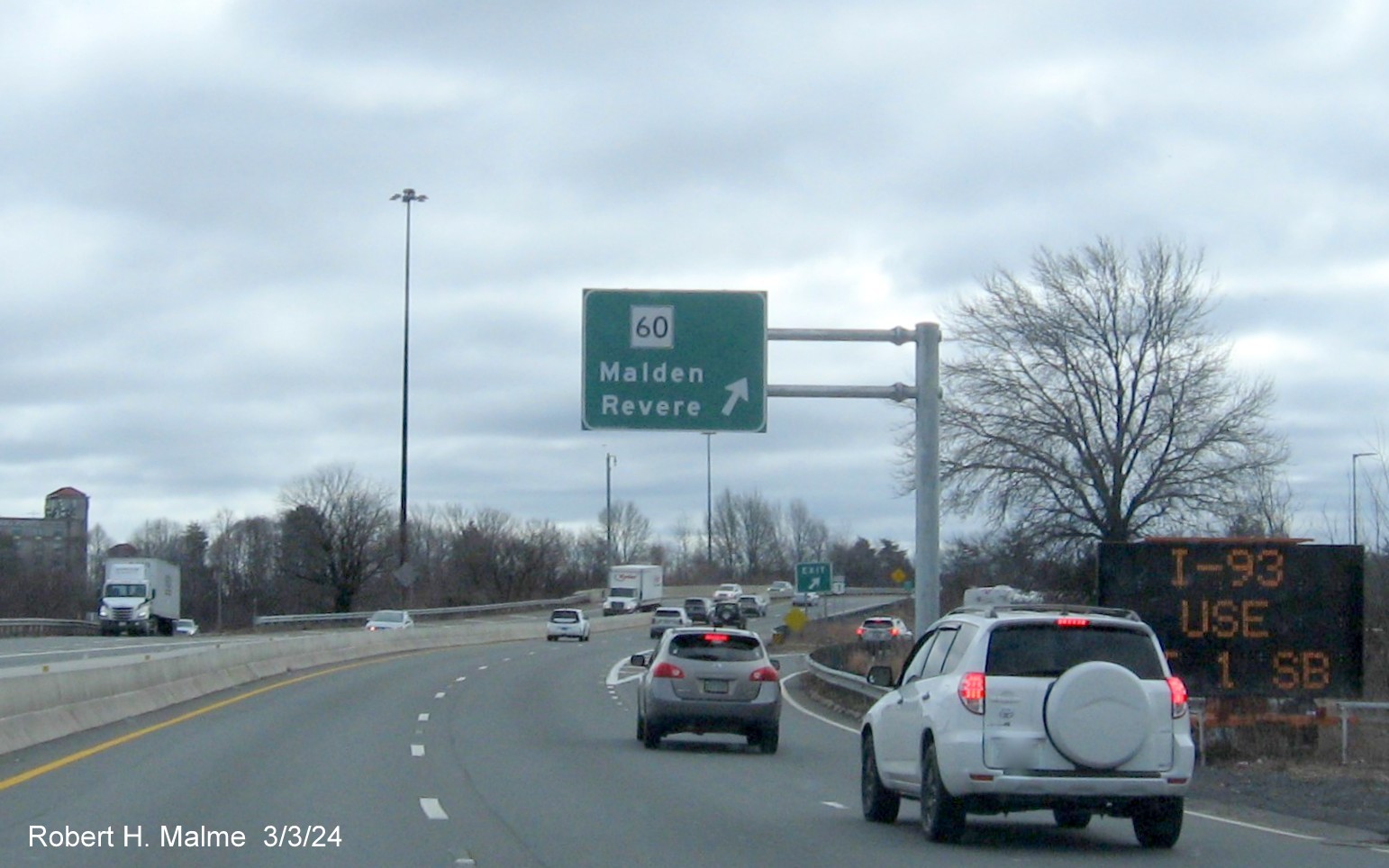
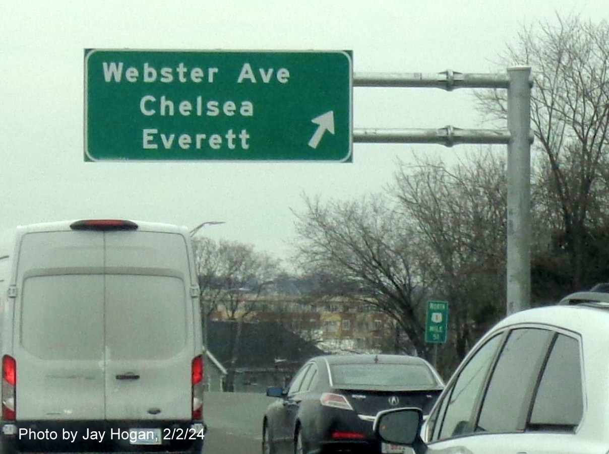
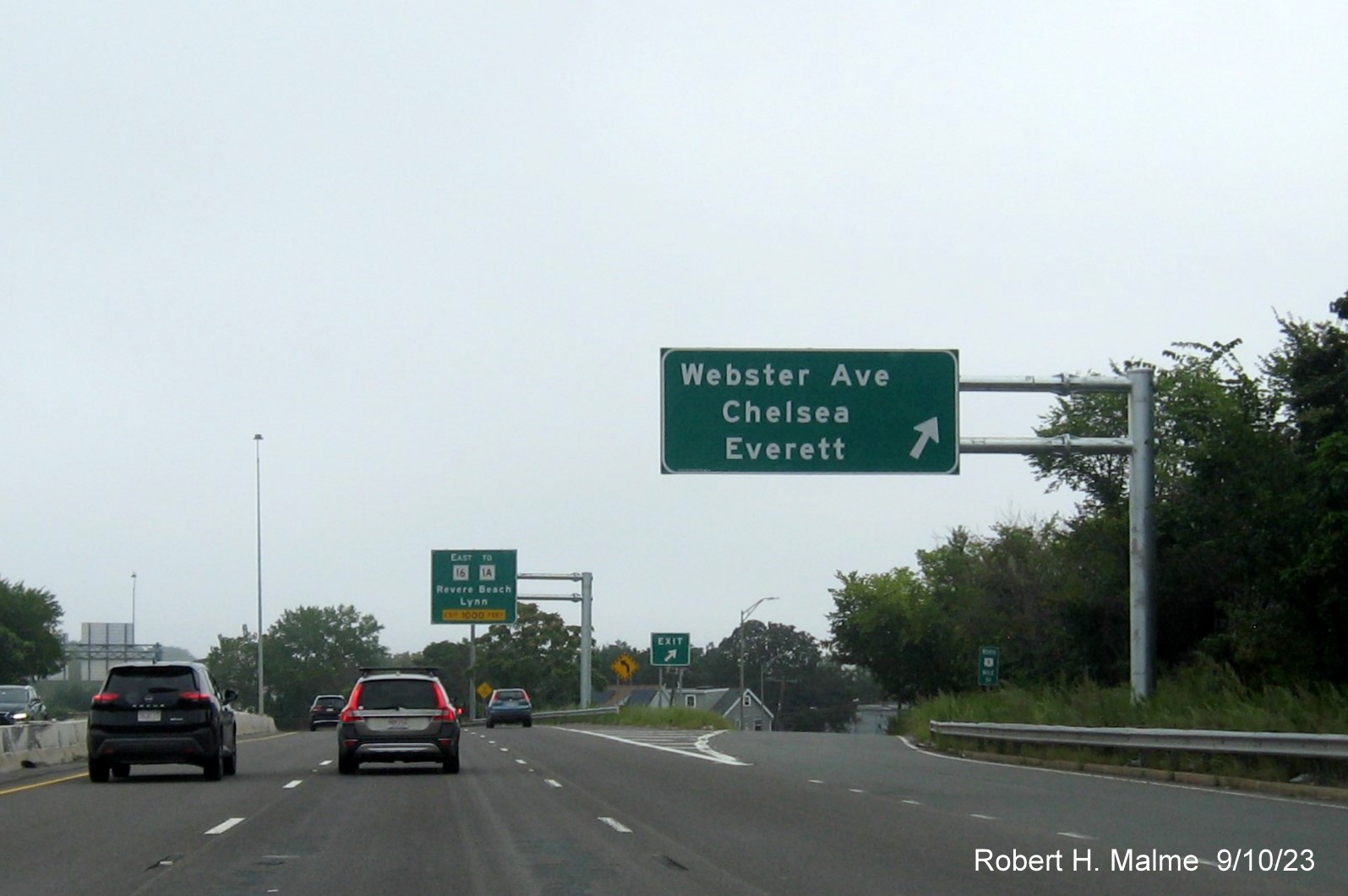
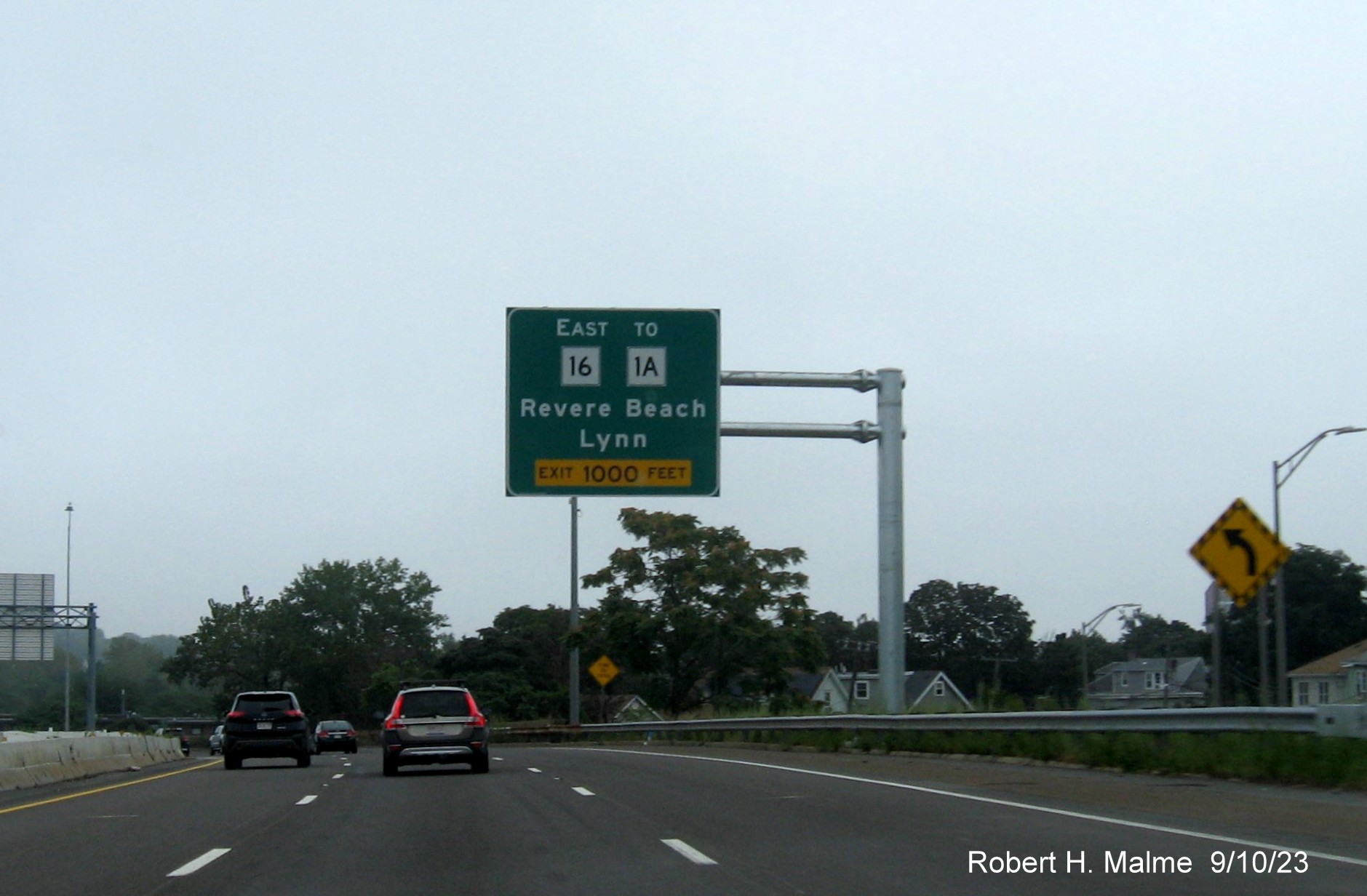
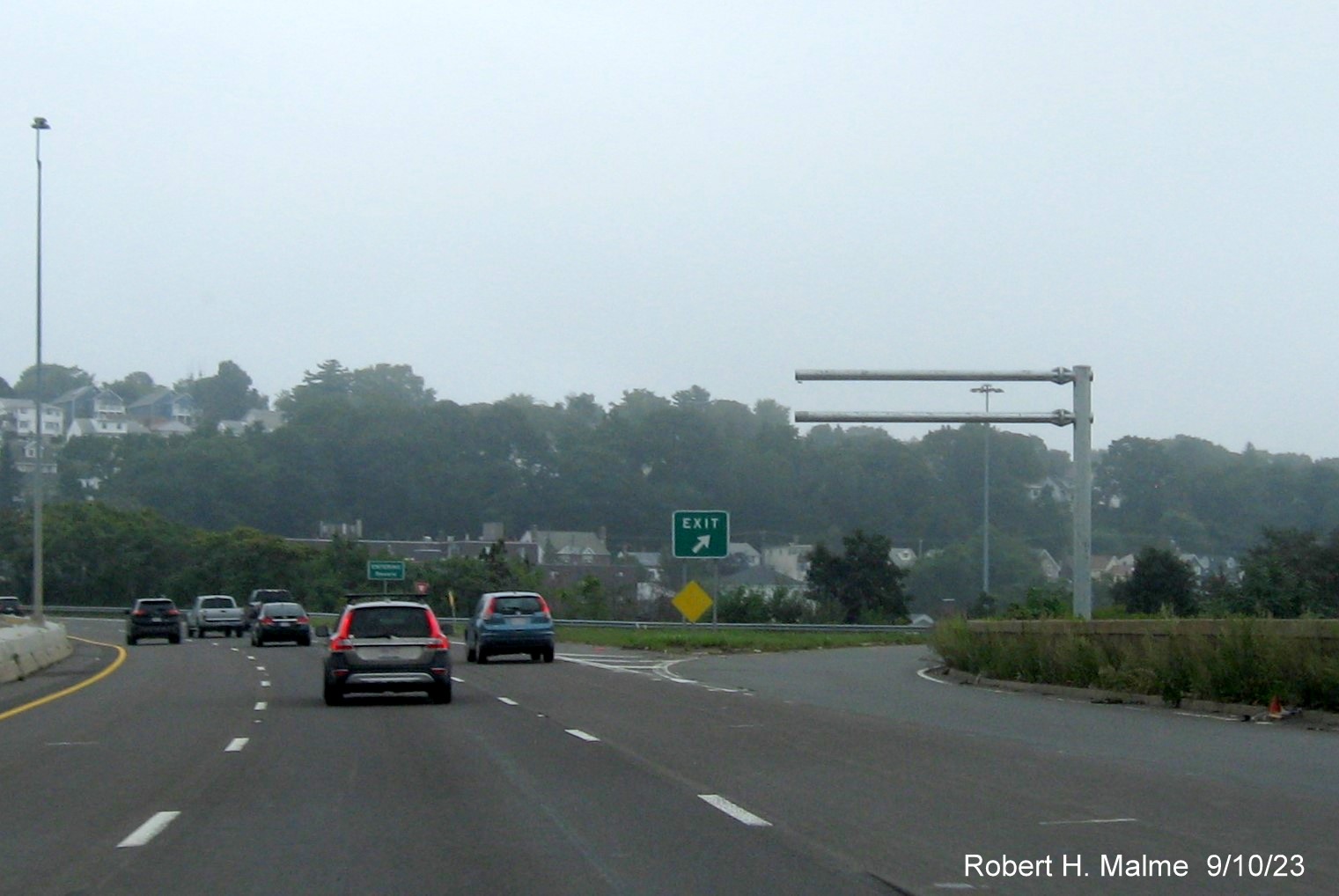
Advance signage for the Route 16 East and Webster Avenue exits
after the Chelsea curves put up earlier in the year.
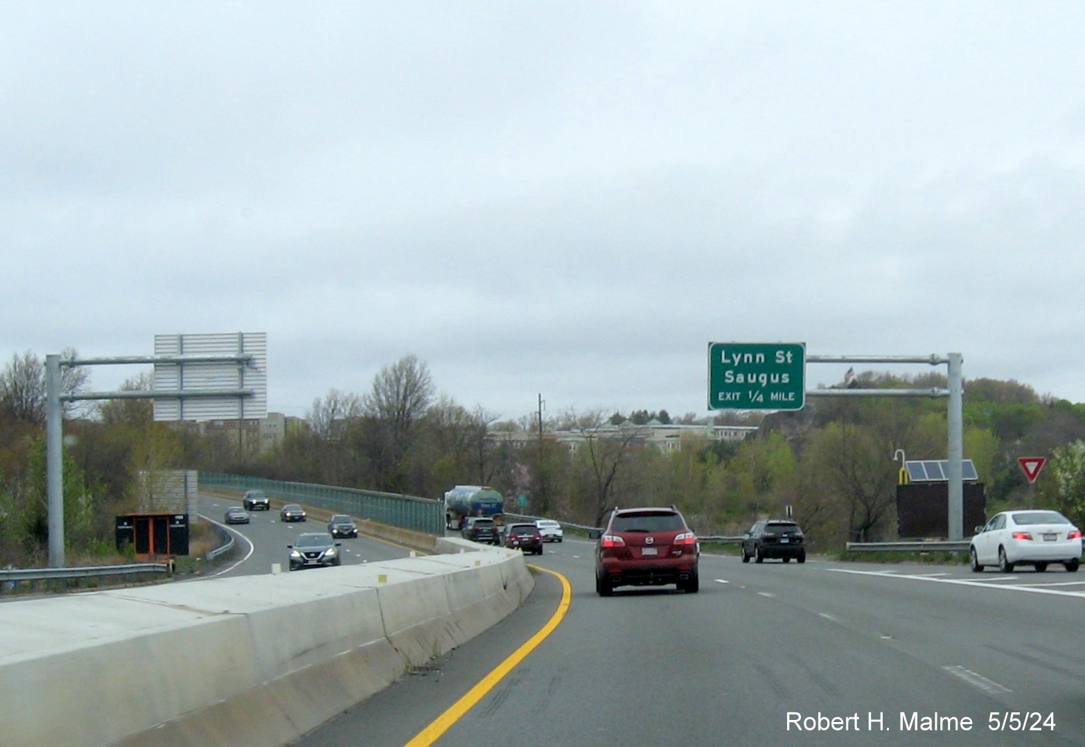
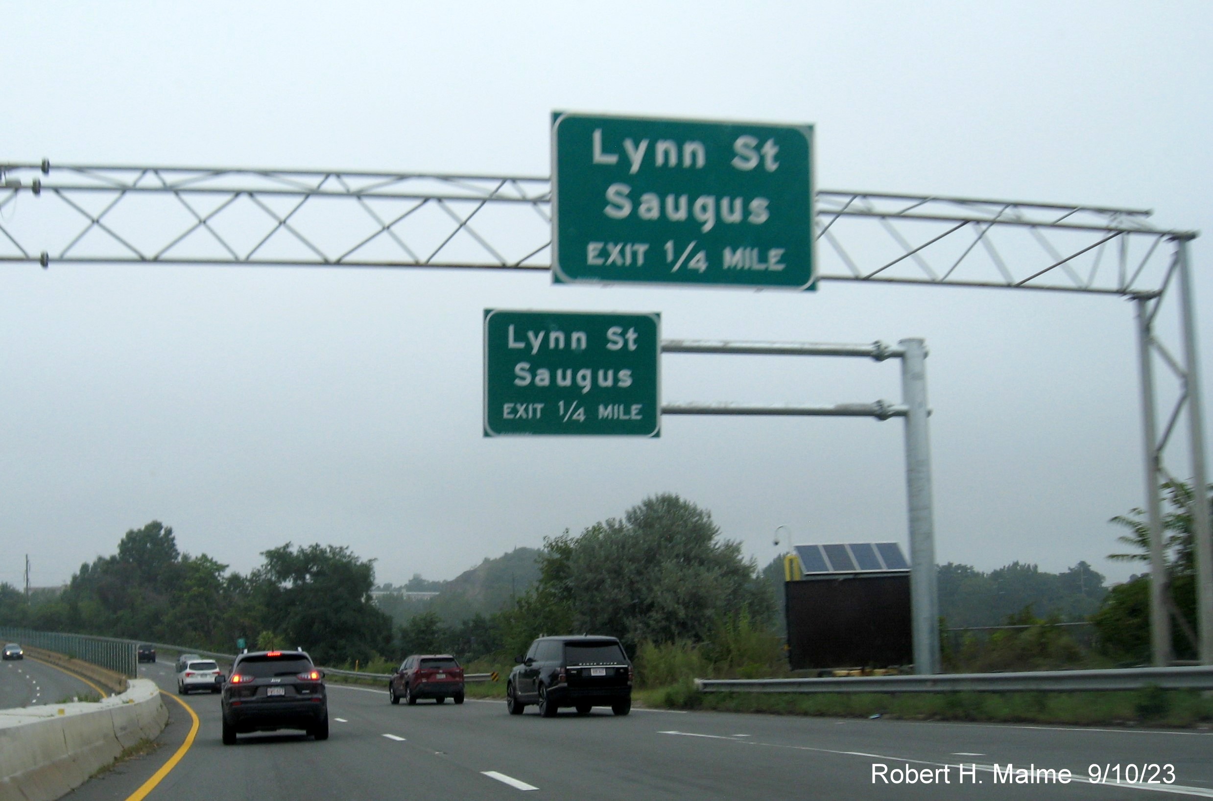
1/4 Mile advance signage for the Lynn Street exit at the end of
the Northeast Expressway also put up earlier.
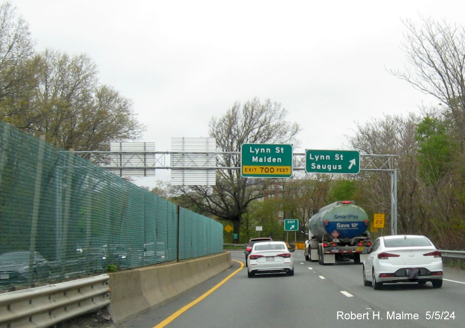
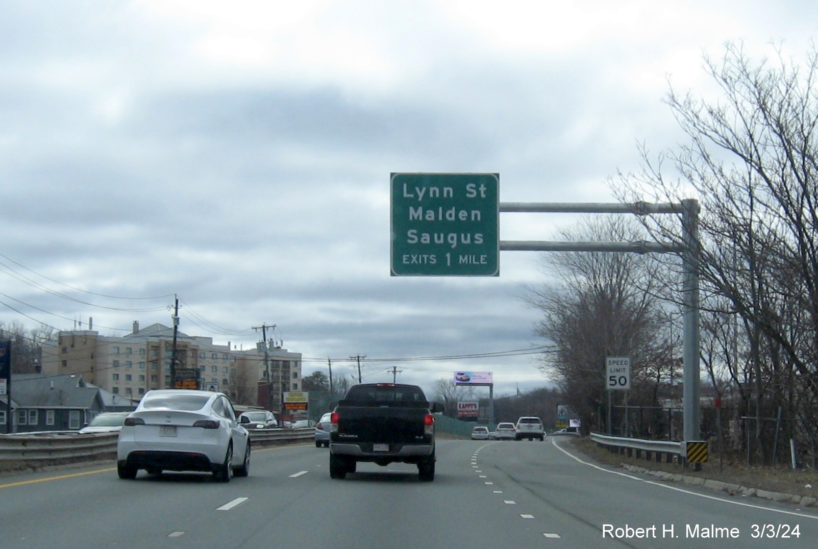
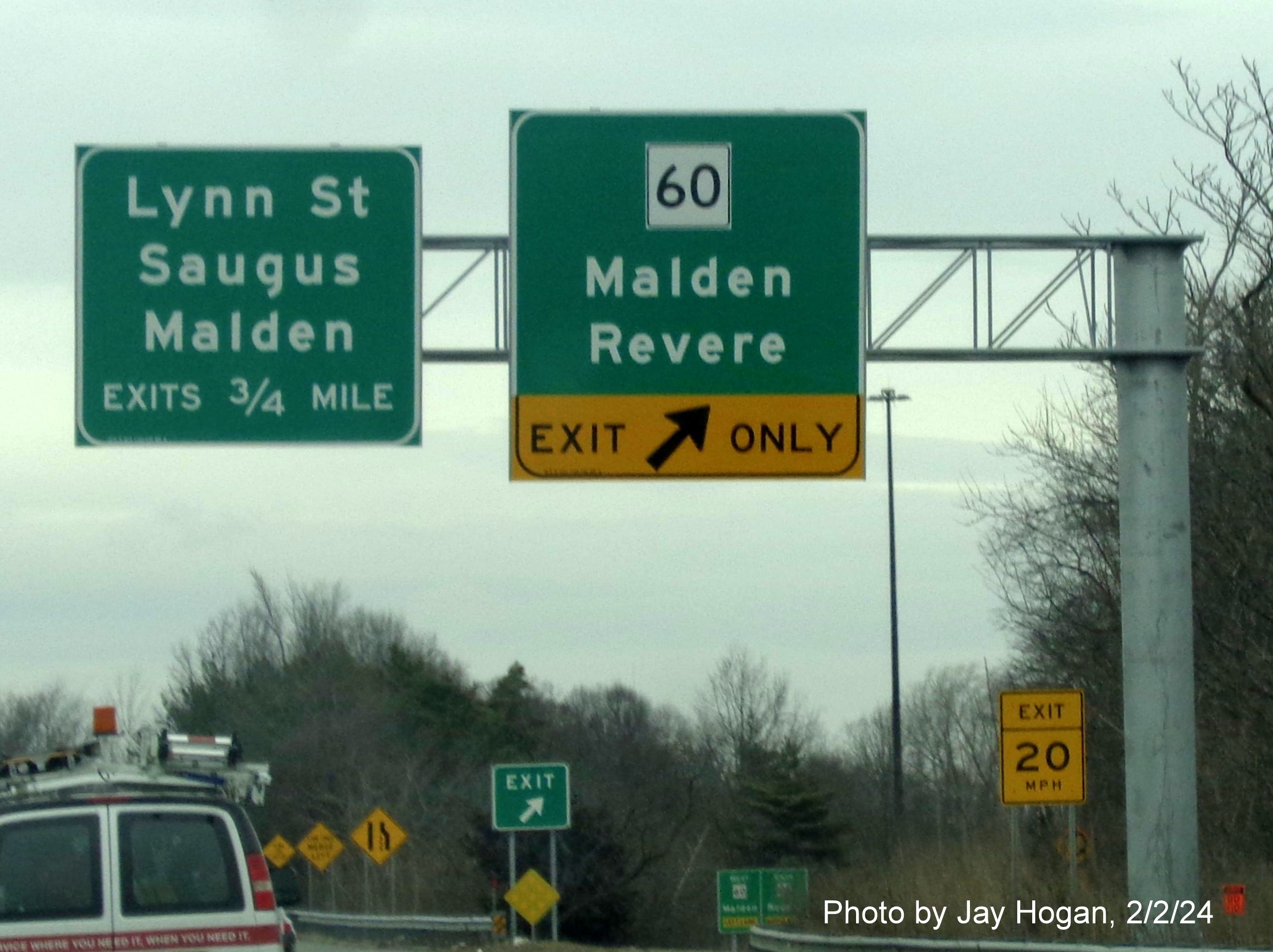
New overhead signage at the first Lynn Street exit as US 1 North is
about to enter Malden.

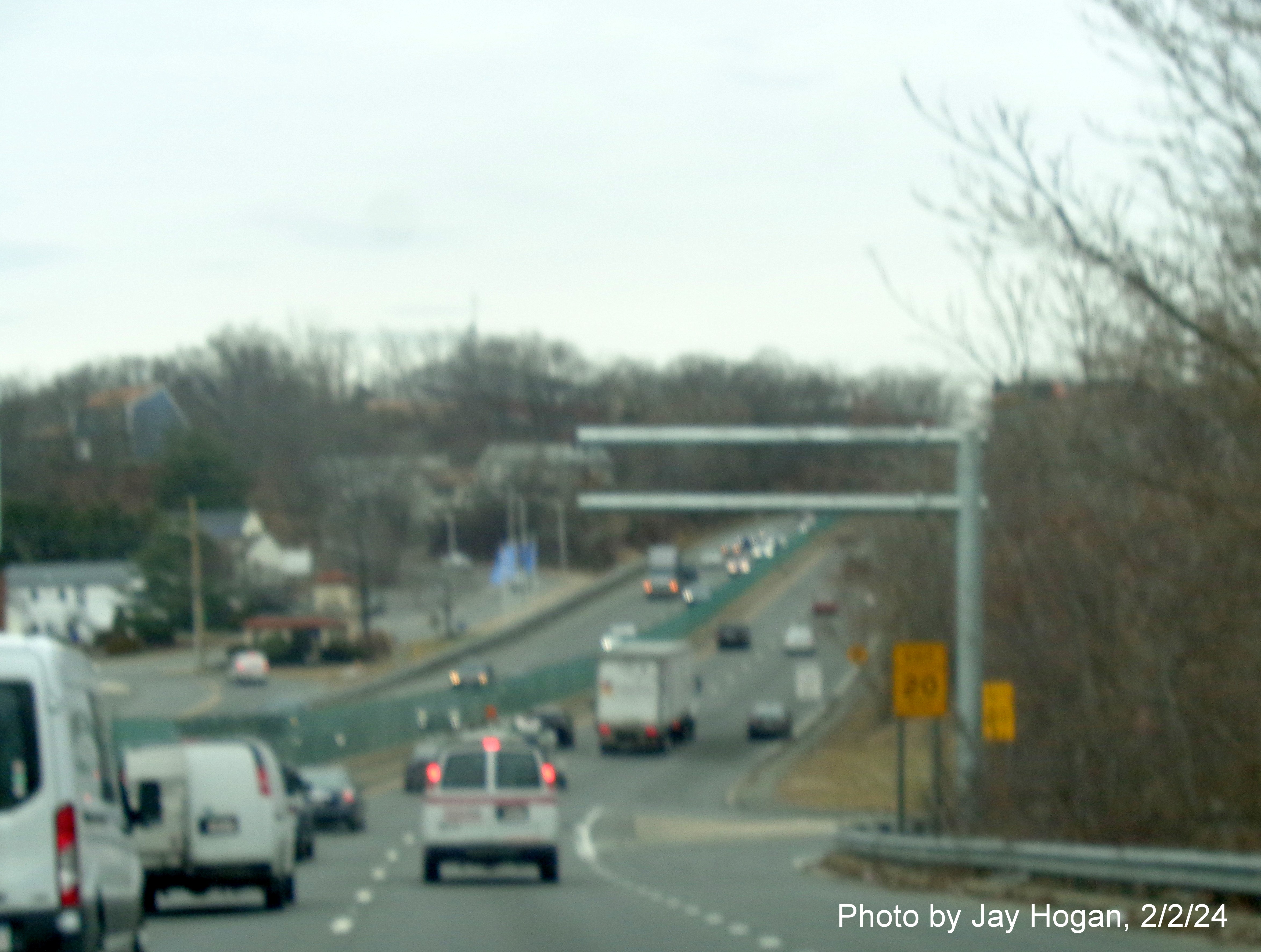
New overhead signage for the second Lynn Street exit currently with 2
advisory Speed Limit 20 MPH signs.
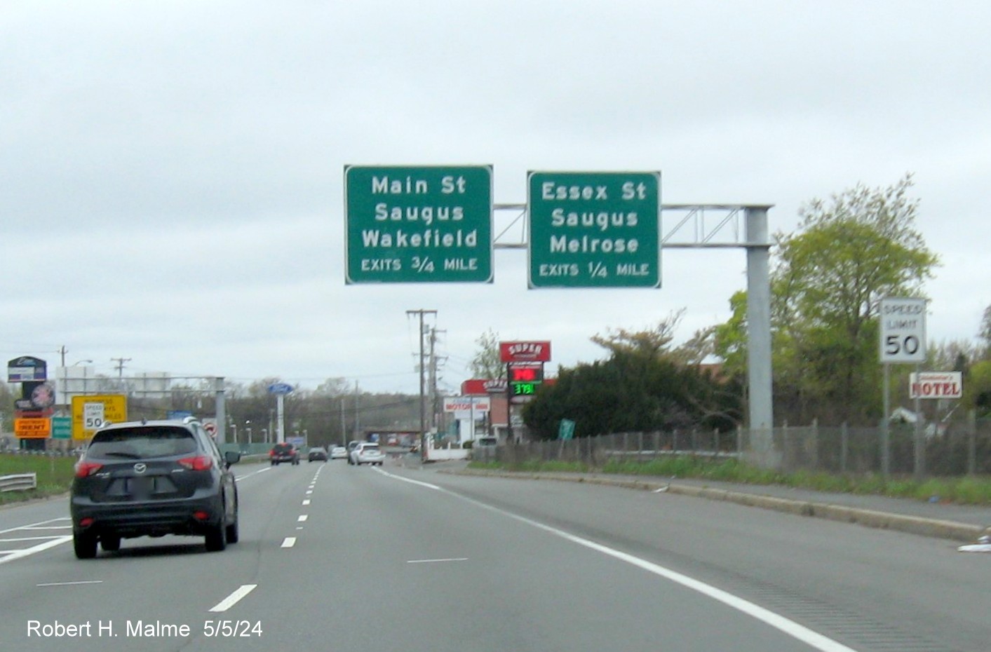
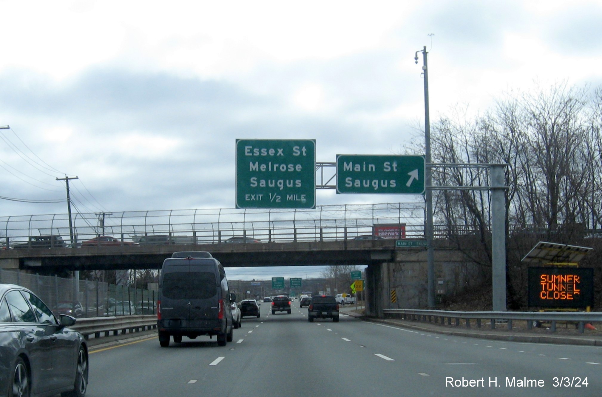
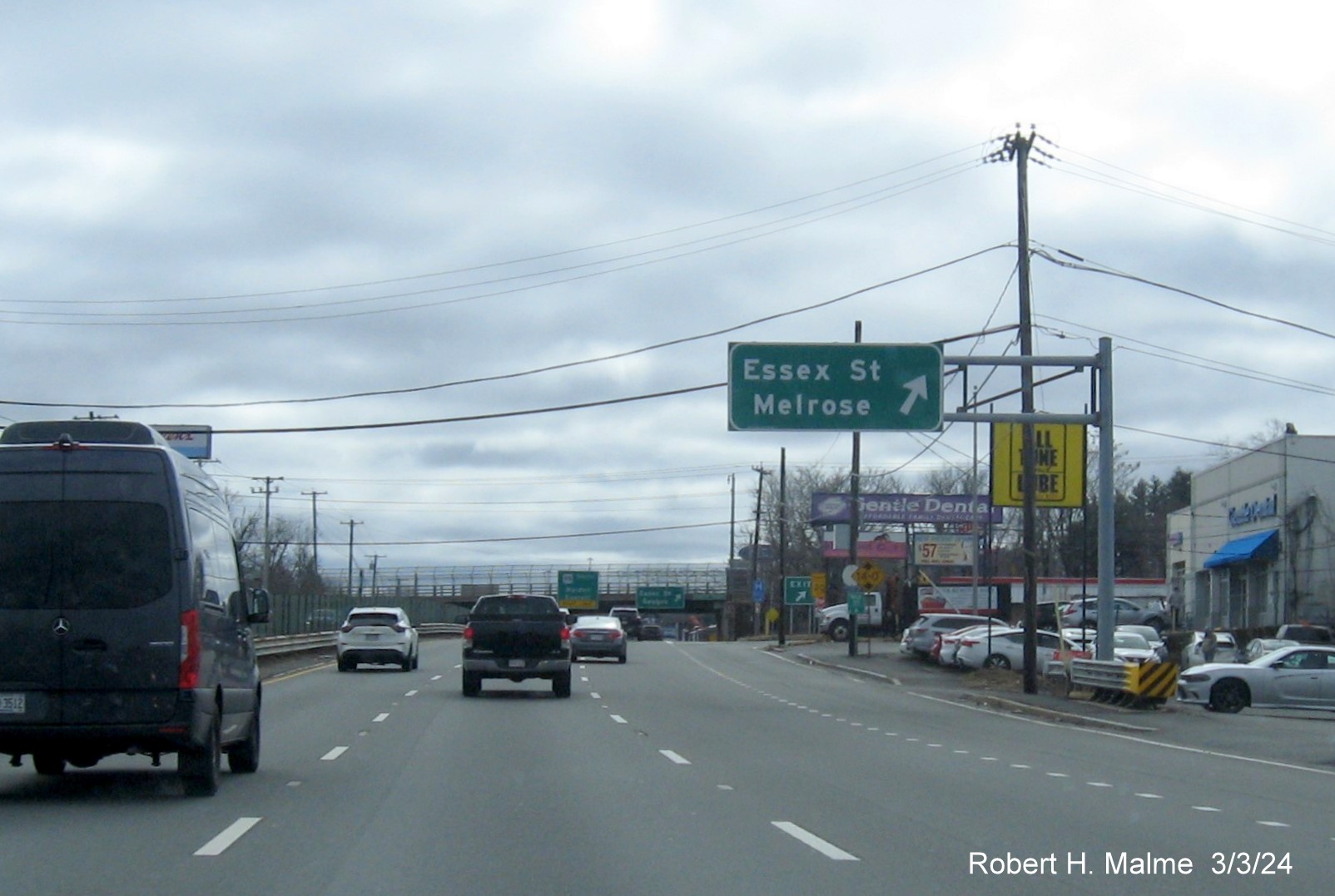
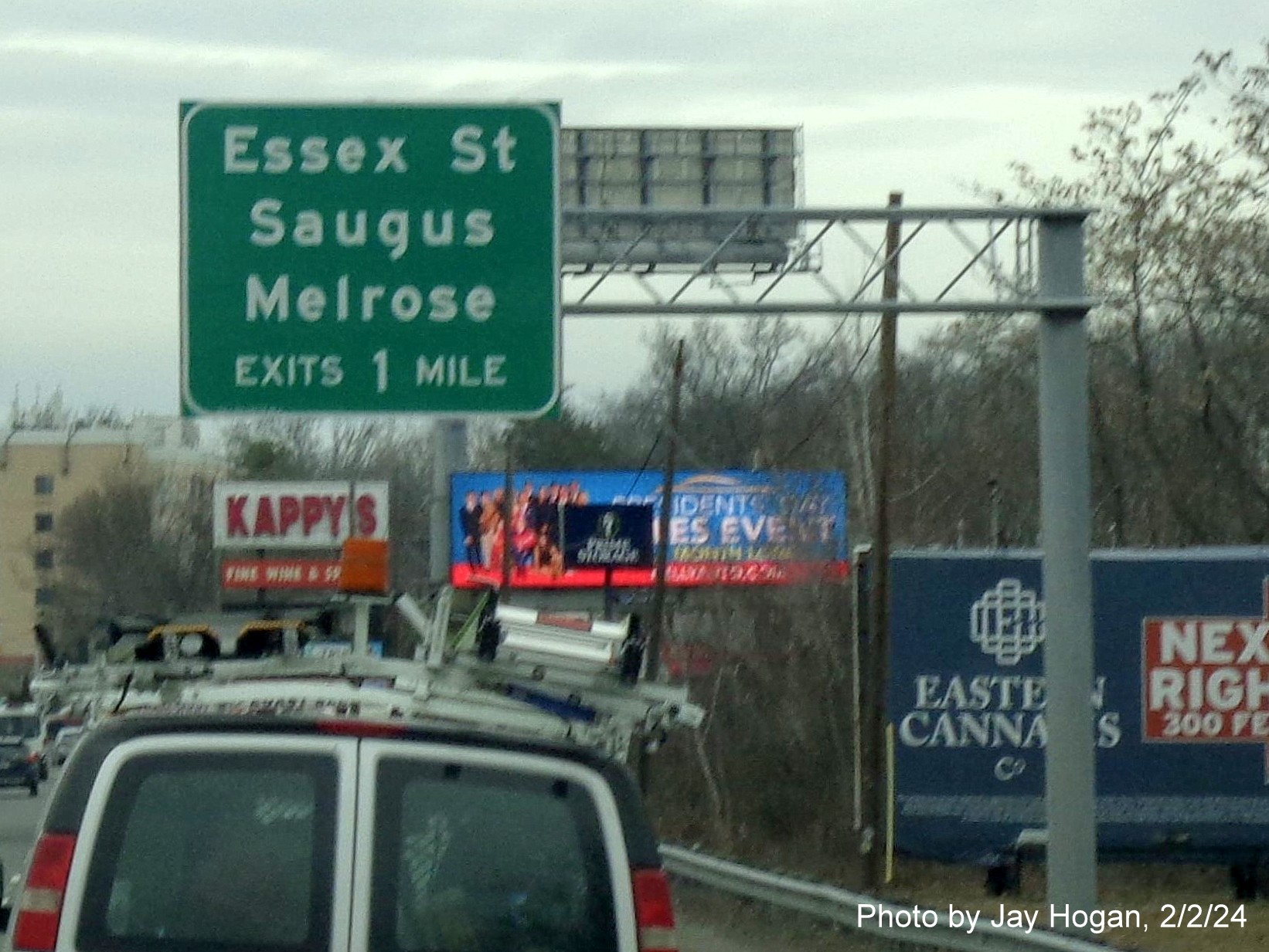
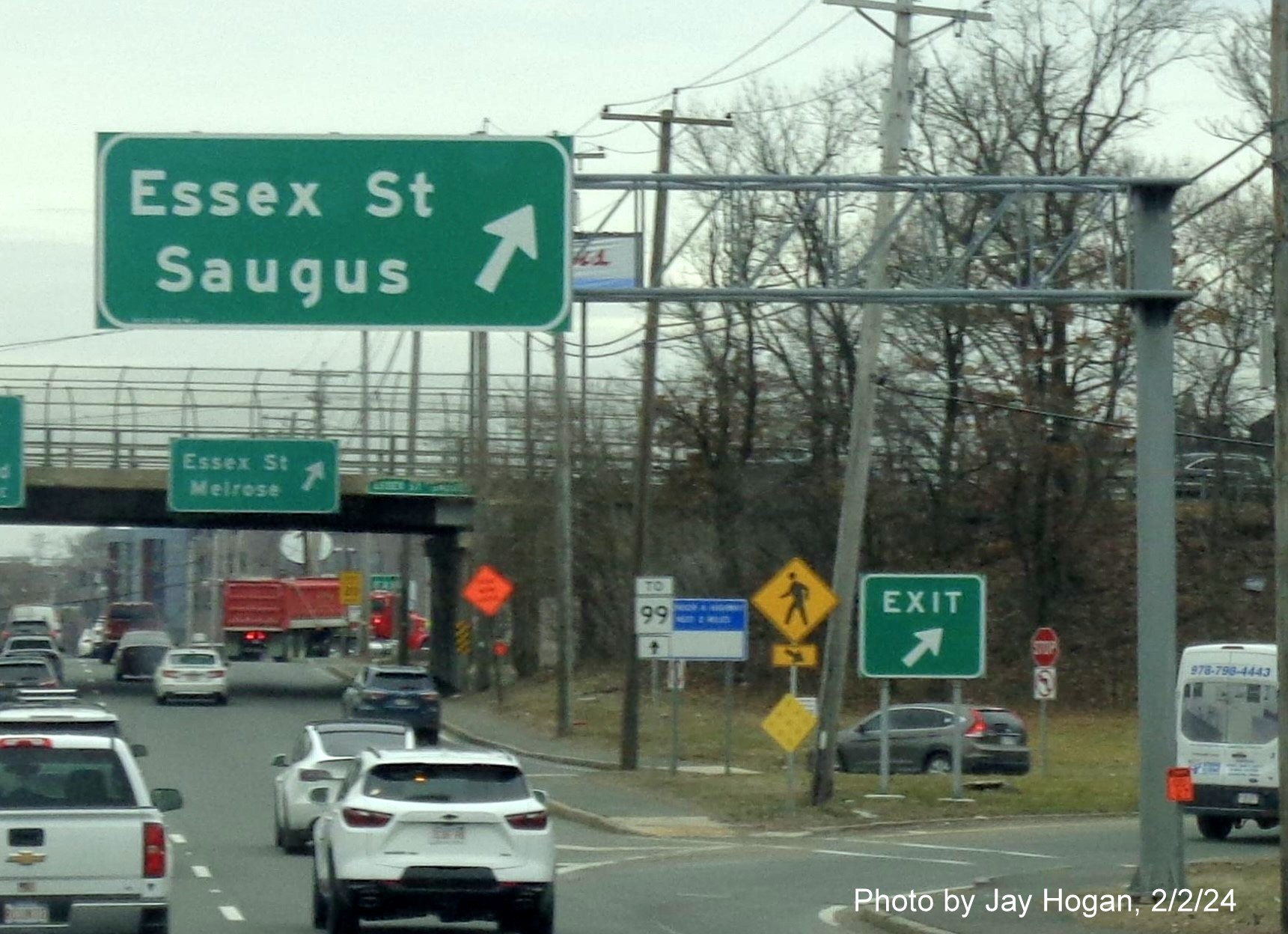
A 2 advance sign cantilever for each of the Essex Street 'exits'
just across the Saugus line put up earlier this year.
New and old signage at the Main Street exit still are both up as
they were earlier in the year, along with an old gore sign for the first Main Street exit.

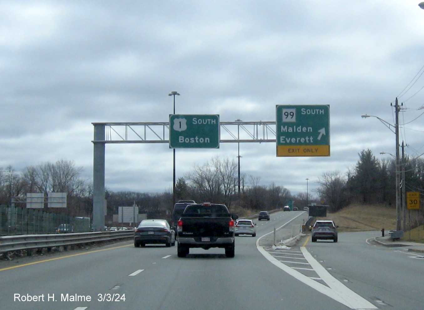
A left-side 1 Mile advance sign for I-95 North also put up earlier.
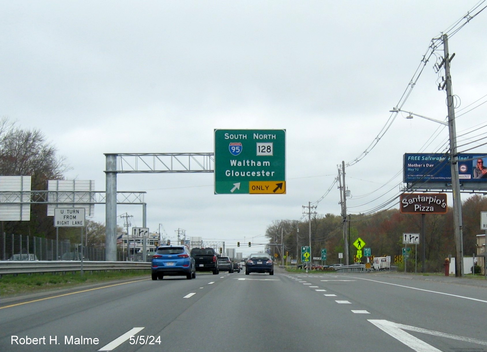
Another left-side
1 Mile advance sign, this for the I-95 South and Route 128 (I-95 North) exit also from earlier in the year.
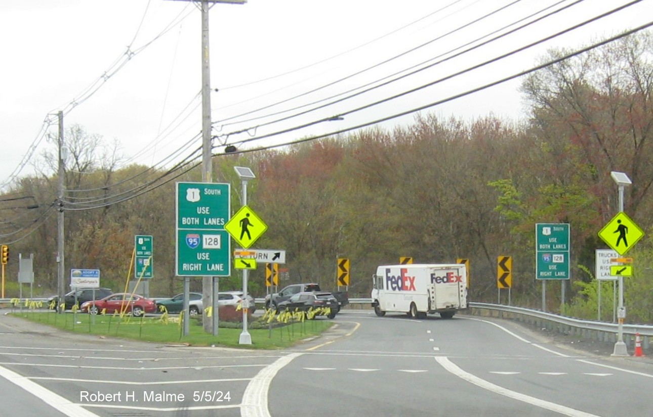
A closer look at
the recently placed ground mounted guide signs at the turnaround after the first I-95 ramp.
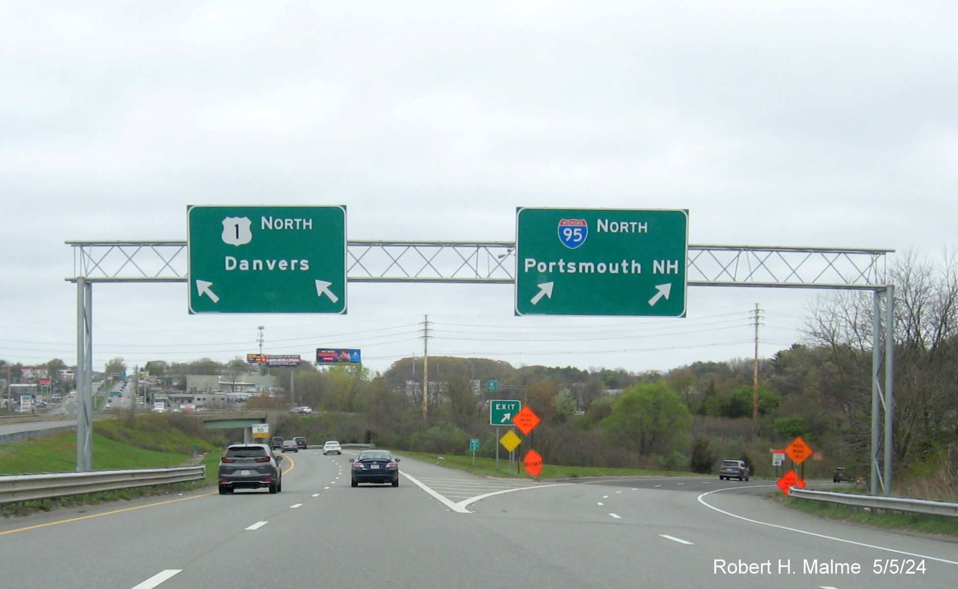
Overhead sign at the split of the US 1 North and I-95 North ramps
put up in early 2024.
It appears most
of the new signage has been put up on US 1 North between the I-95 exits in Peabody and Danvers:
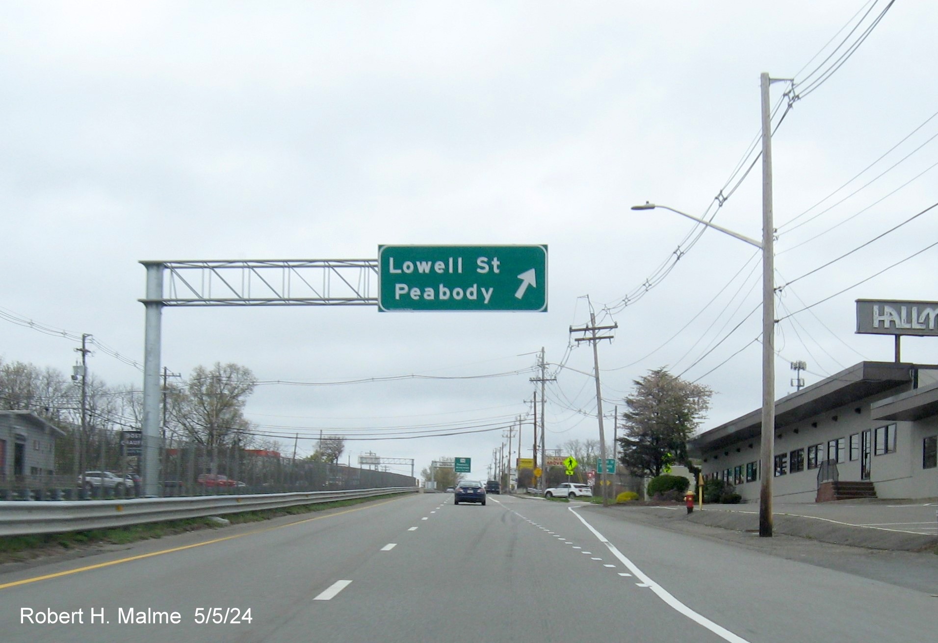
The first in a
series of left-side overhead signs for ramps along US 1 North, here for Peabody Street.

The Mass. guide or paddle sign at Lowell Street ramp itself.

The left-side 3/4 Mile advance sign for the Route 114 exits.
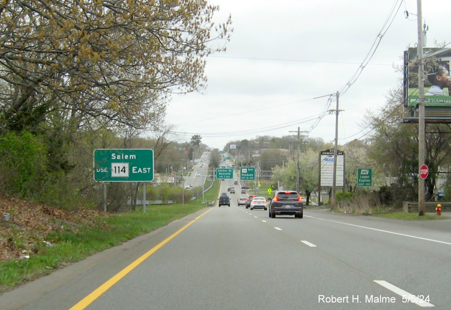
A new auxiliary sign along the left lane for Route 114 East.
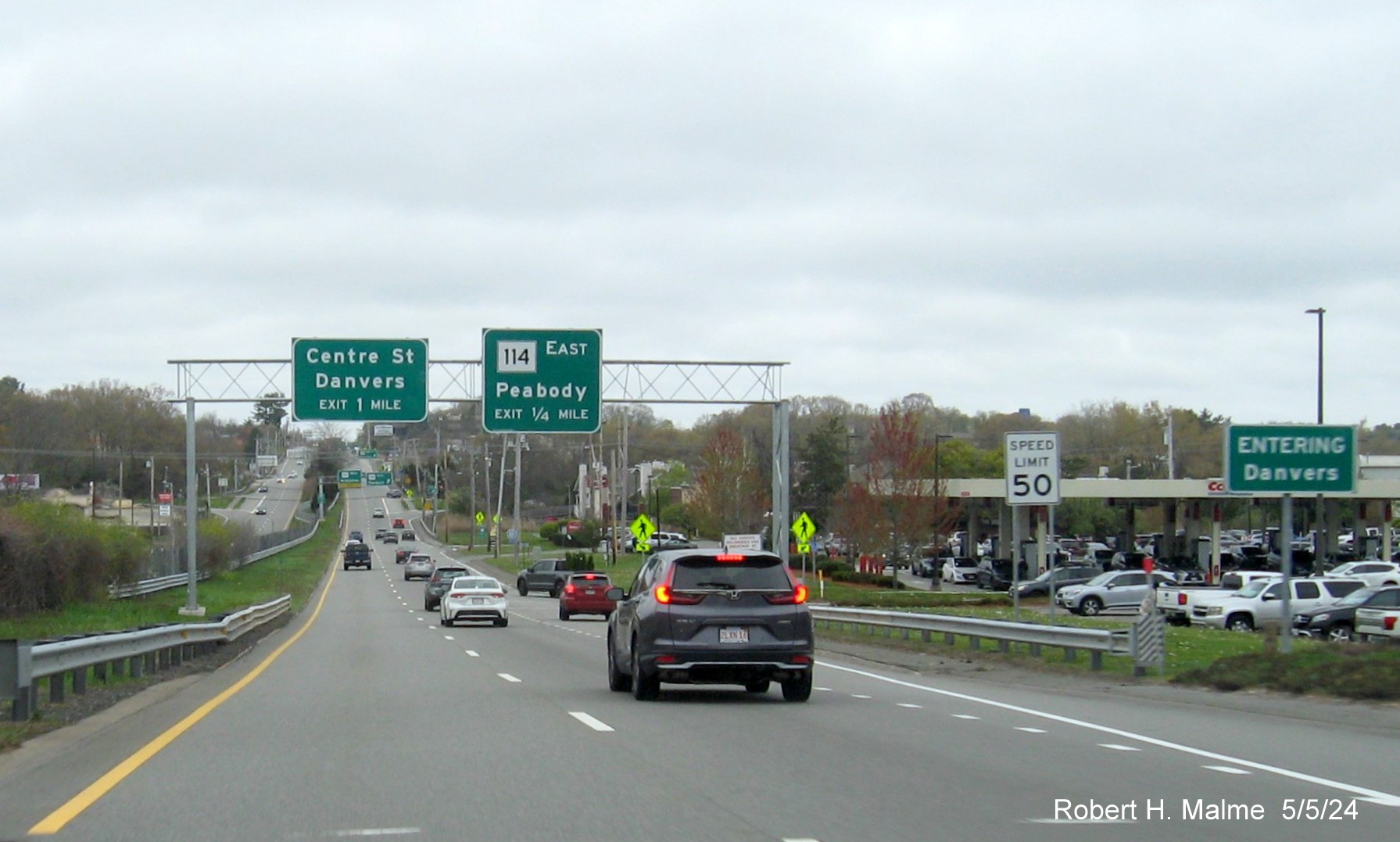
Overhead signs for the Centre Street and Route 114 exits after
crossing the Danvers line.
The new overhead signs at the East Route 114 exit.
Another left-hand
side overhead for a right-side exit for Route 114 West in Danvers.
New left-side 2
sign cantilever 1/2 and 1/4 Mile advance signs for the Centre Street and Popes Lane 'exits'.
The 1 Mile
advance sign for the Route 62 exits along with the exit sign for the Centre Street.
The recently
placed 1/2 Mile advance sign for the Route 62 East exit.
Overhead signs at
the ramp for Route 62 East.
Overhead signs at
the Route 62 West exit feature a Left Exit tabbed 3/4 Mile advance sign
for the next I-95 North exit.
The new 1000 Feet
advance sign for the left I-95 North ramp.
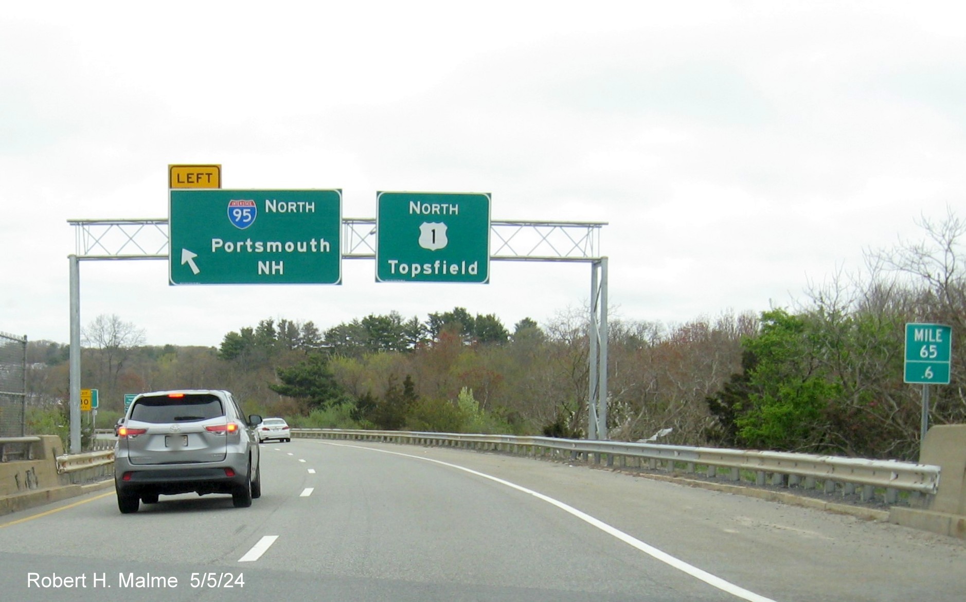
The gantry at the
I-95 North ramp features at North US 1 pull through sign.
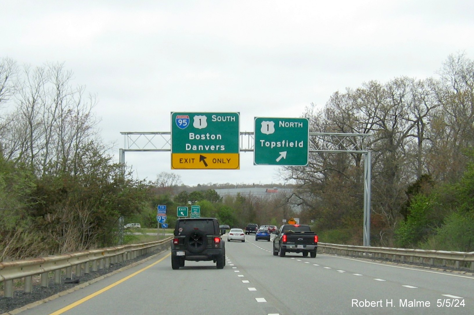
Approaching the
ramp taking you back to US 1 South and the I-95 South exit.
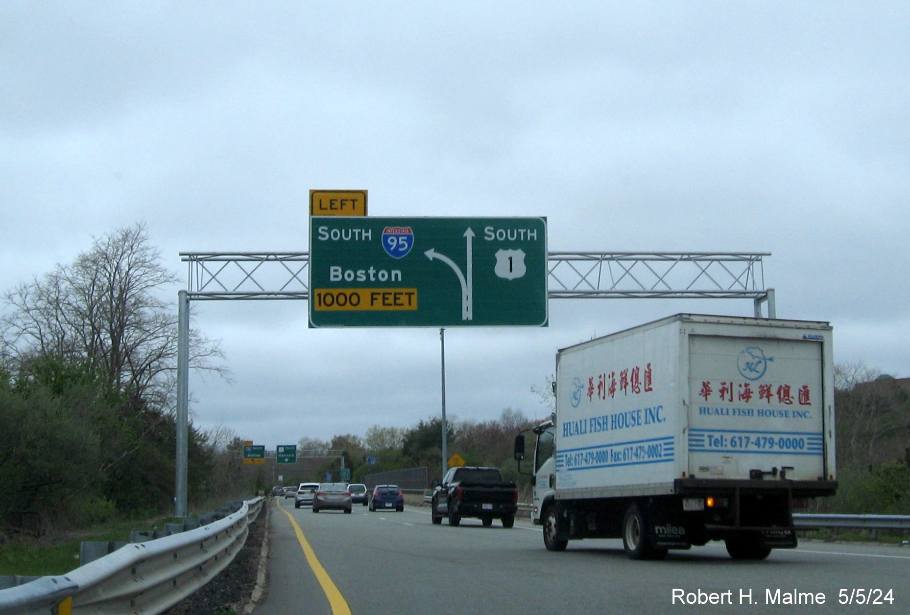
The new
diagrammatic overhead 1000 Feet advance sign for the I-95 South ramp on
US 1 South.
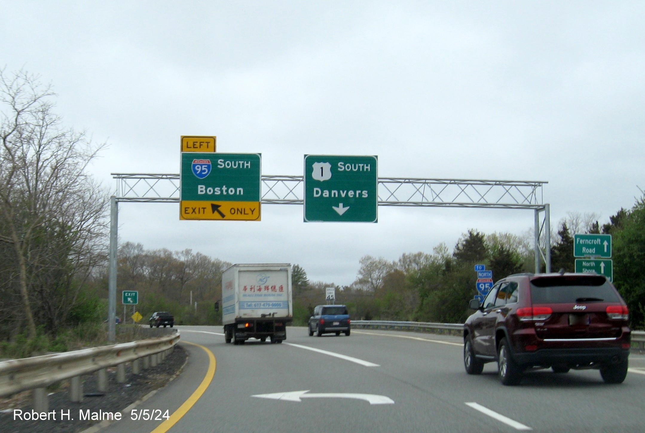
The signs at the
I-95 South ramp, and US 1 South pull through sign, the other signs on US
1 South will be documents on the next trip.
New Signs along
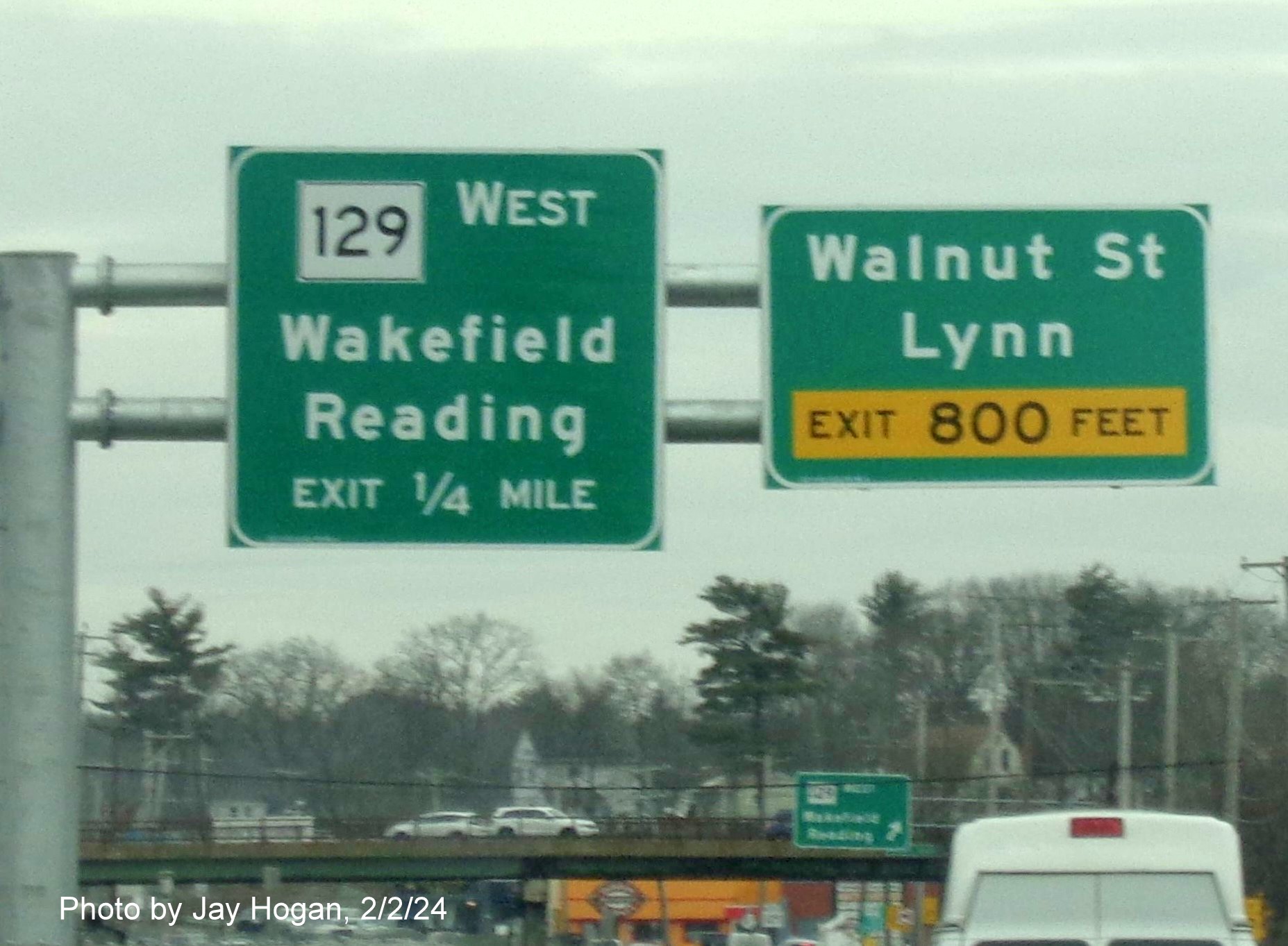
US 1 South from Lynnfield to Chelsea, taken on March 3, 2024:
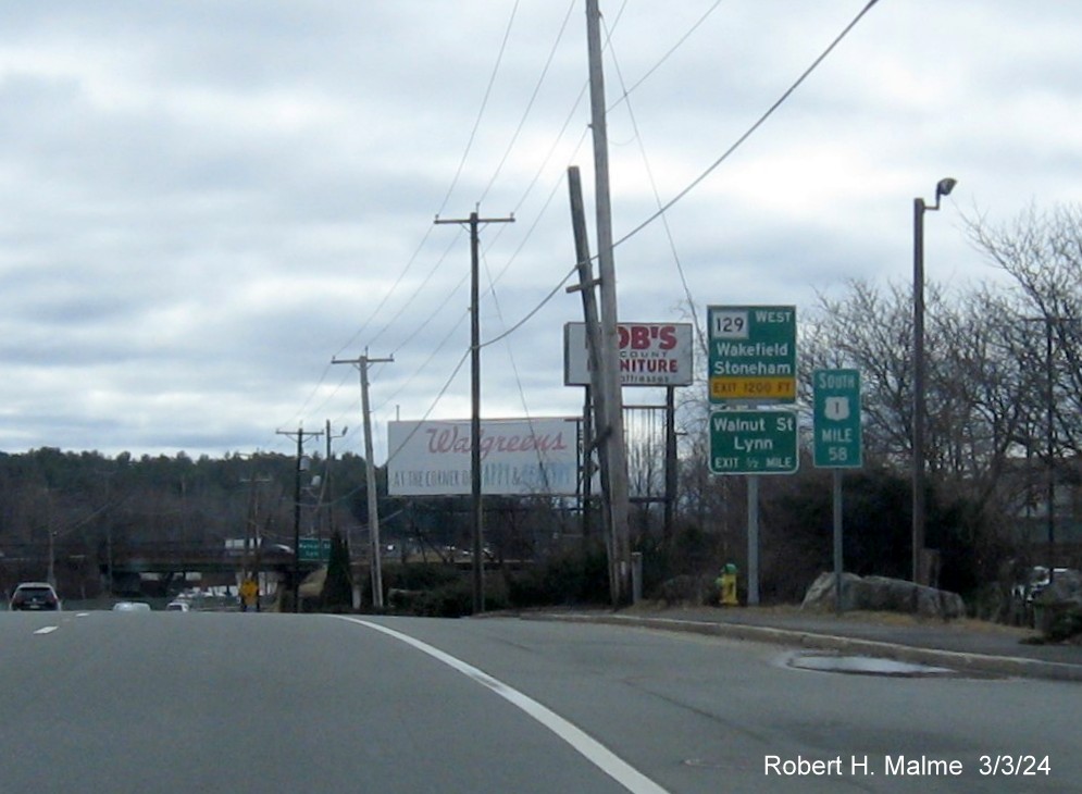
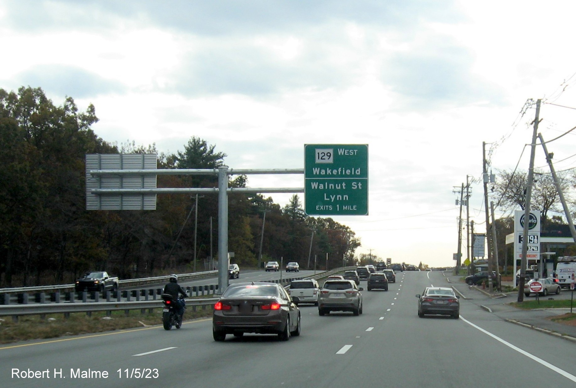
Not a new sign,
but a better image of the Route 129 West/Walnut Street guide signs in
Lynnfield at Mile Marker 58.
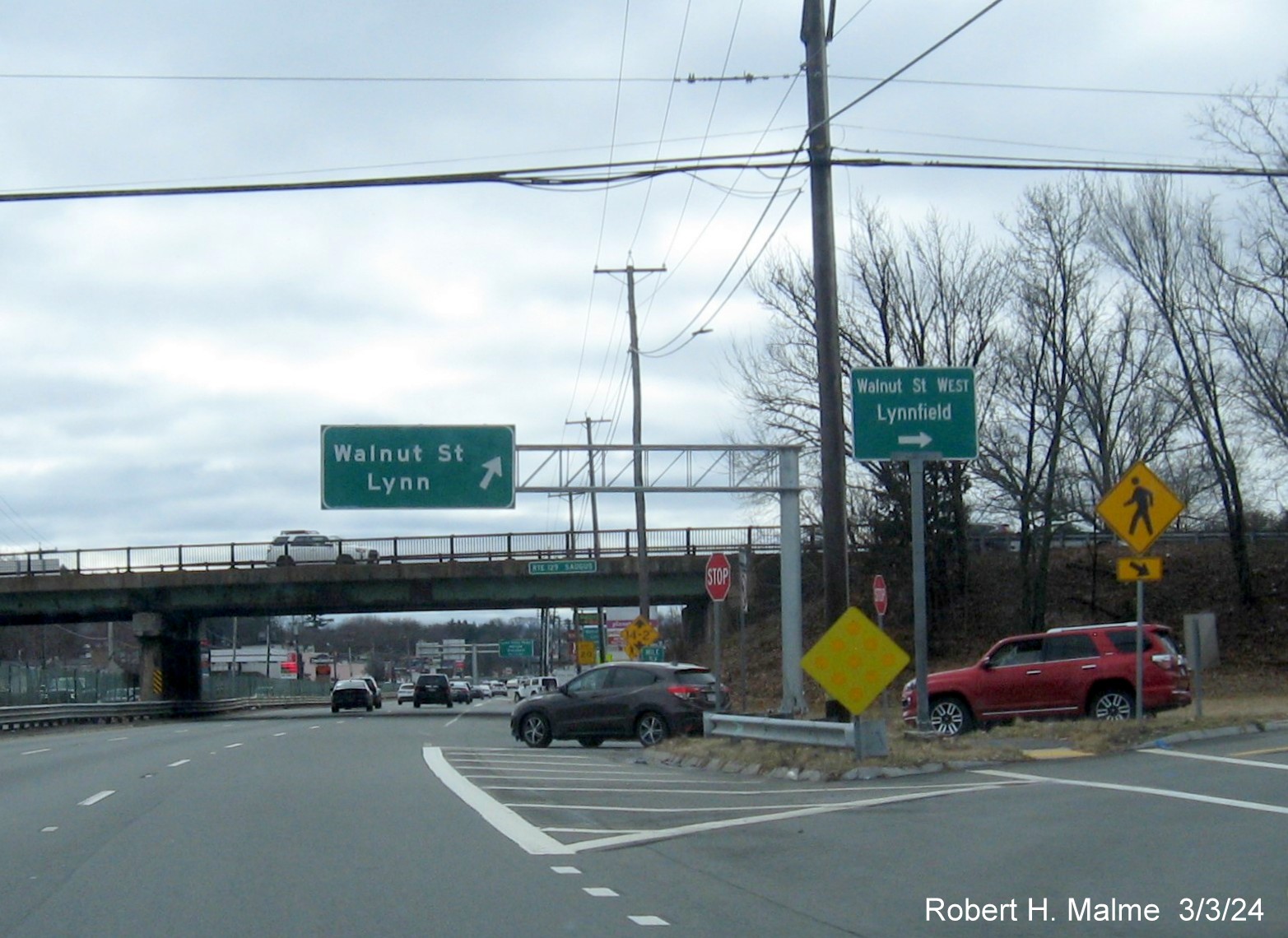
The guide sign is
not new, but the overhead for the second Walnut Street ramp is. Notice
the first guide sign does not have a reference to Route 129 West, unlike
in the photo above.
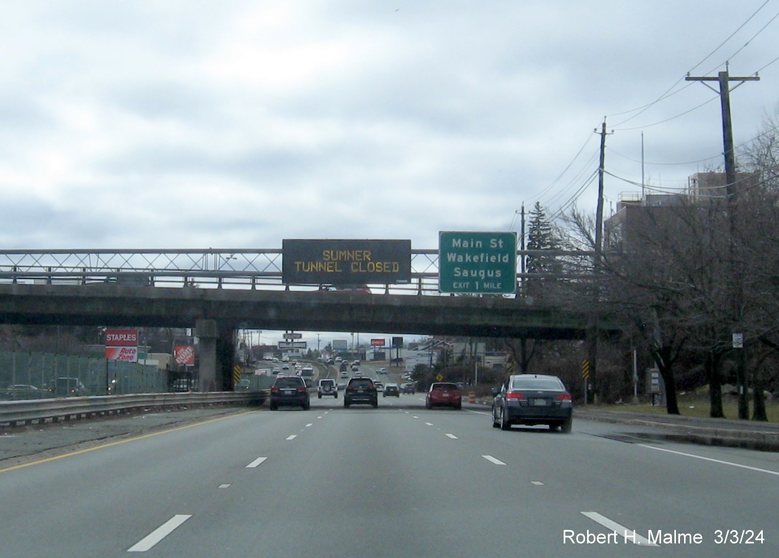
The gantry here
is not new, put up with a new VMS a few years ago, but the 1 Mile
advance for Main Street may be. The VMS is warning drivers of the first
Sumner Tunnel closure of the year.
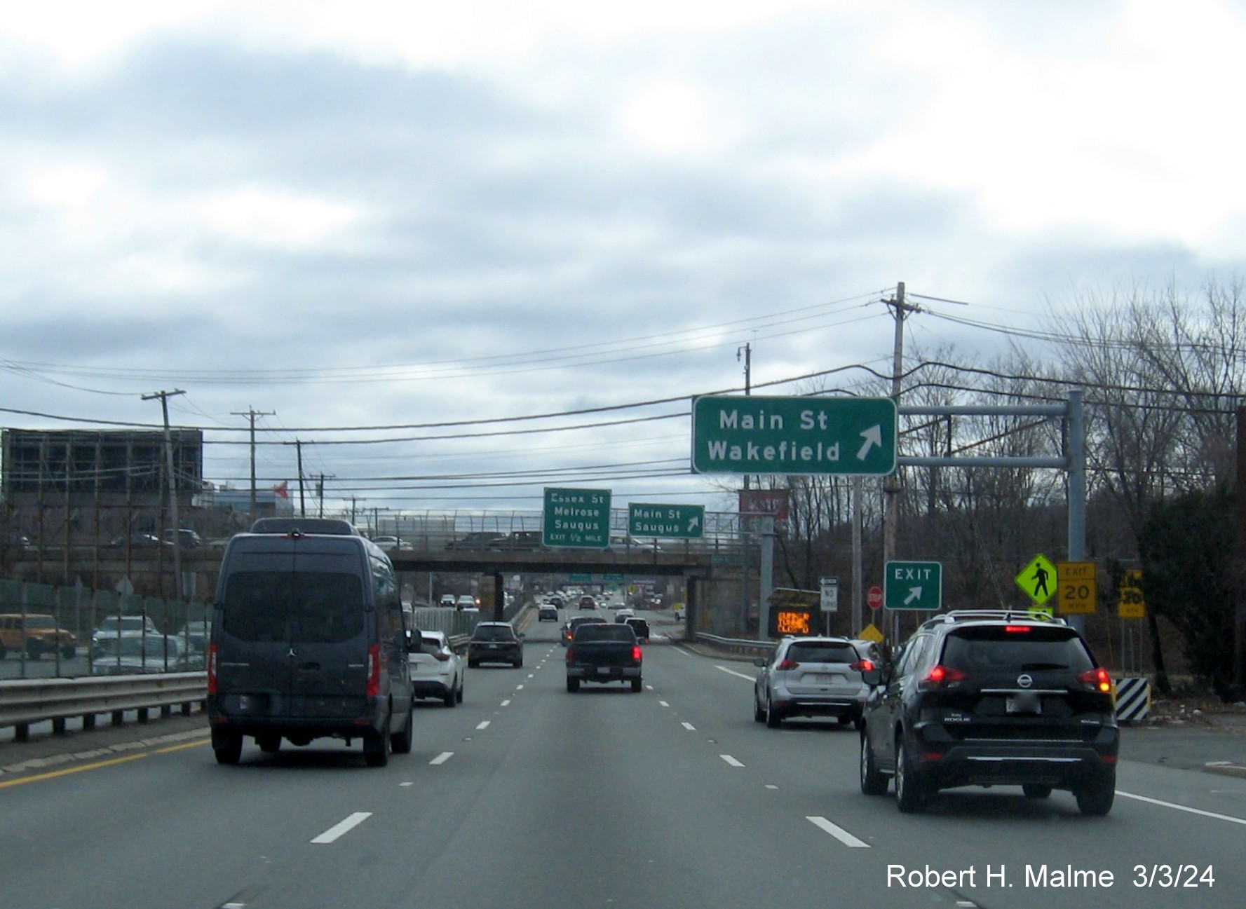
The first Main
Street sign is not new, but the ones in the distance are, replacing
bridge mounted versions.
A closeup of the
new pair of signs at the second Main Street ramp that includes a 1/2
mile advance for Essex Street (shouldn't this say 'Exits'?), also a
portable VMS with a Sumner Tunnel Closed message.
The new second
Main Street 'exit' gore sign currently paired with the older paddle gore
sign version, plus 2 Ramp speed advisories. The signs in the distance
have not been replaced.
The first Essex
Street exit sign and gore sign in the distance, again the next pair of
signs are still the old bridge mounted versions.
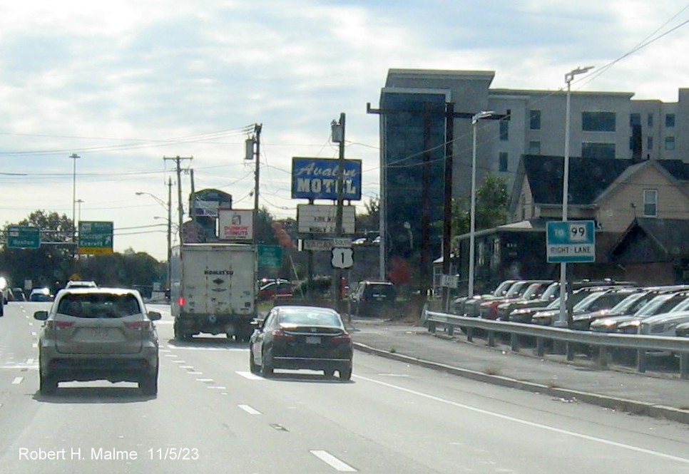
The only Route 99
exit sign to be replaced so far, this 2 sign cantilever at the exit
ramp, notice how long the gantry is extended but still can't quite reach
entirely over the exit ramp.
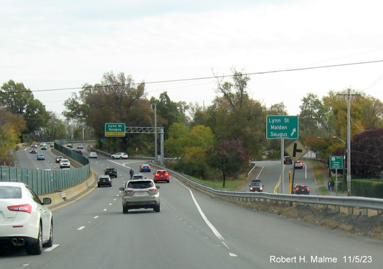
The new 1 Mile
advance for the Lynn Street exits after the Route 99 exit.
A pair of new
advance signs for both Route 60 and Lynn Street, if these were to have
numbers the milepost suggests they would be 53 and 54 A/B.
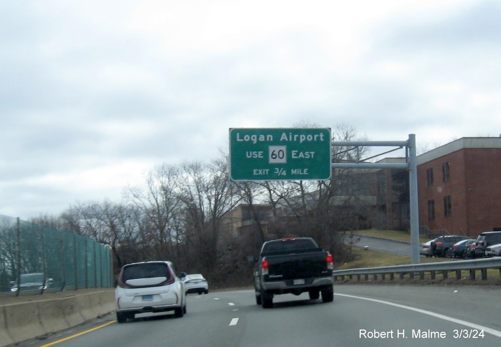
The overhead
auxiliary sign for the Route 60 exit. Those heading to Logan this day
hopefully know the Sumner Tunnel is closed for on the way back.
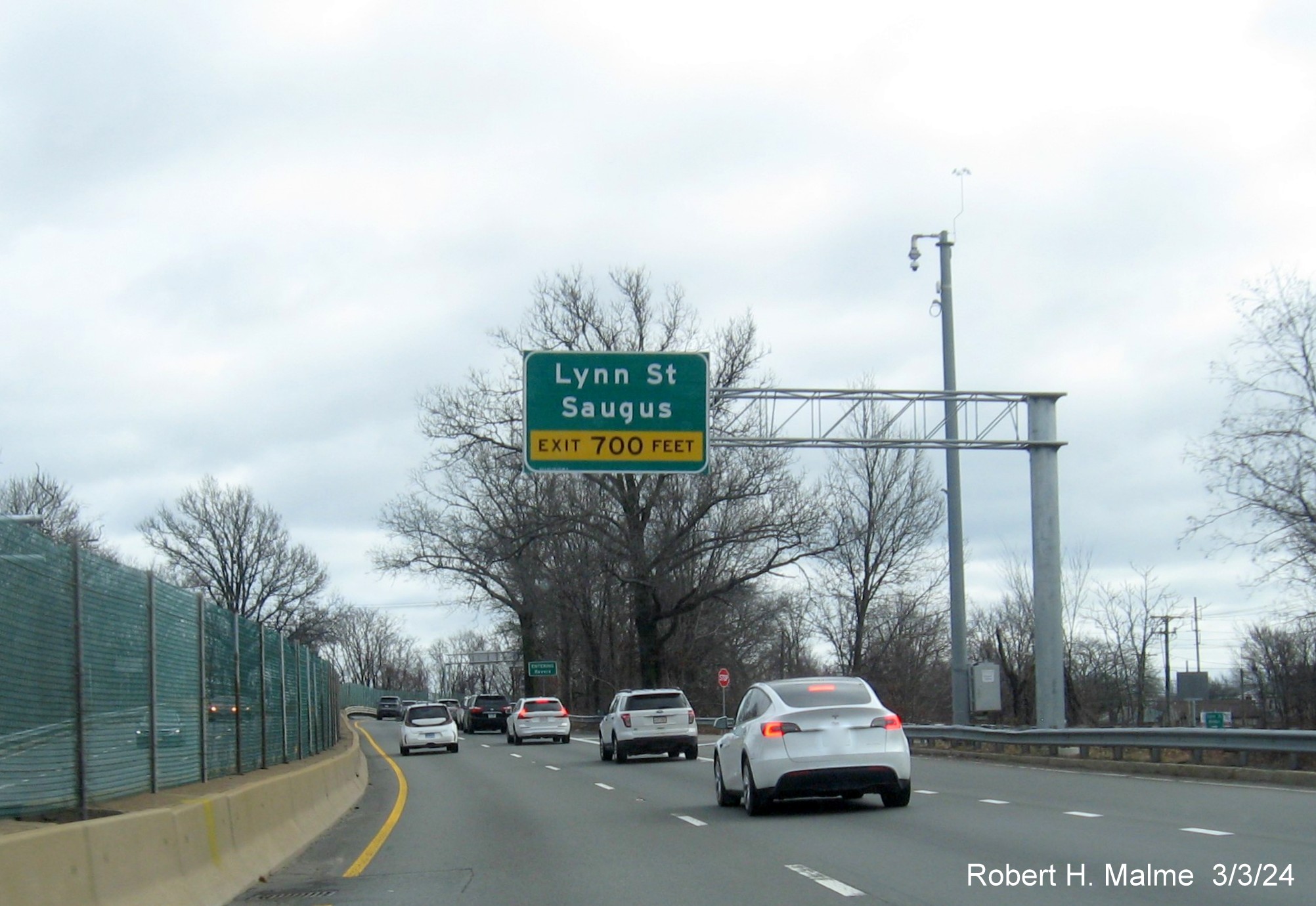
The advance
distance for the new second Lynn Street exit is 700 Feet.
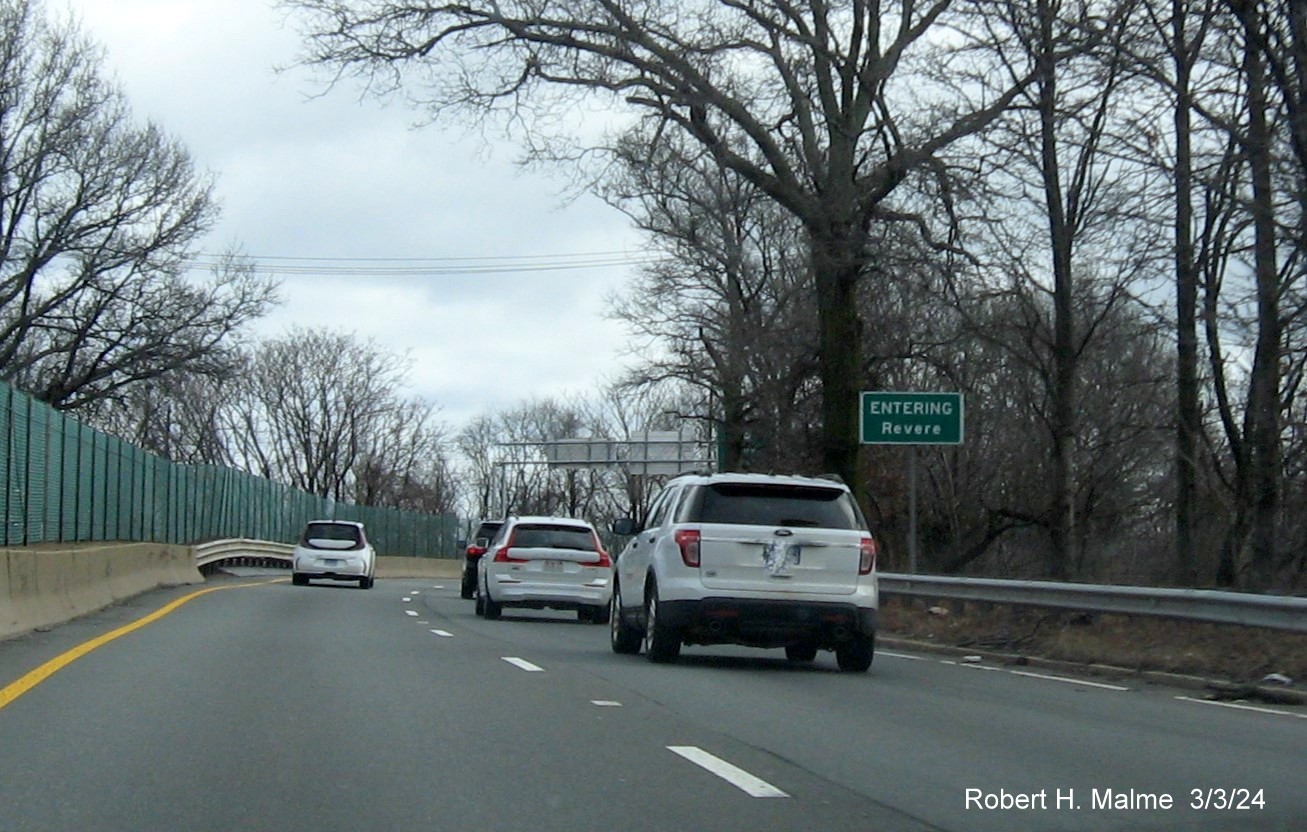
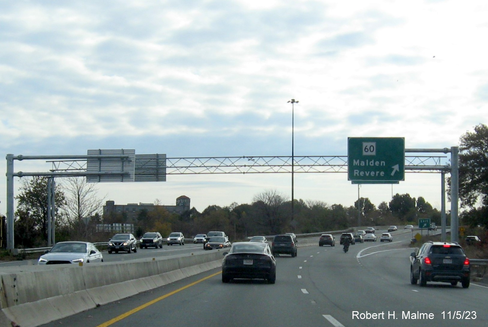
The new sign
indicating (or is it warning?) drivers are about to enter Revere.
The Route 60 exit
sign has been there a few months, but the old overhead sign behind it
has now been taken down.
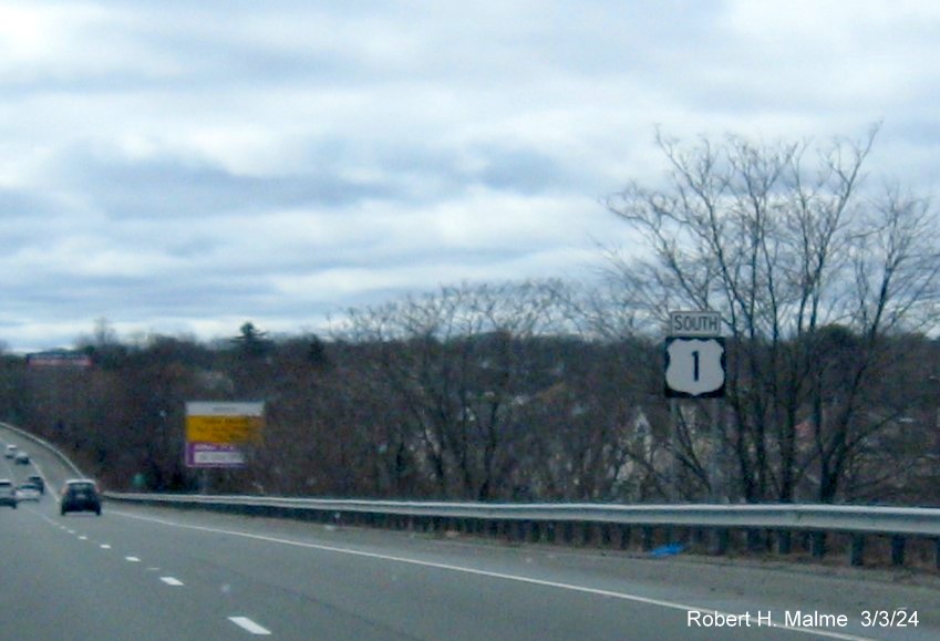
One of the new
South US 1 reassurance markers on the Northeast Expressway.
The rest of the
signs were replaced in the fall and can be found among the photos below.
Sign Photos along
US 1 North taken by Jay Hogan in February 2024:
The exit sign for
Webster Avenue at mile marker 51 put up last summer.
Closeup of the
Route 16 East 1000 Feet advance sign also put up last summer.
The new overhead
Route 16 East exit and gore signs.
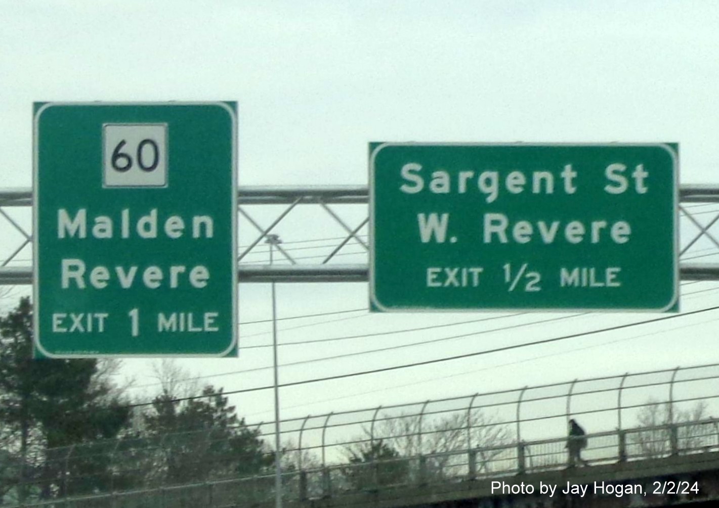
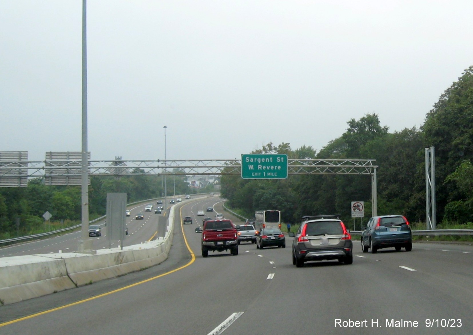
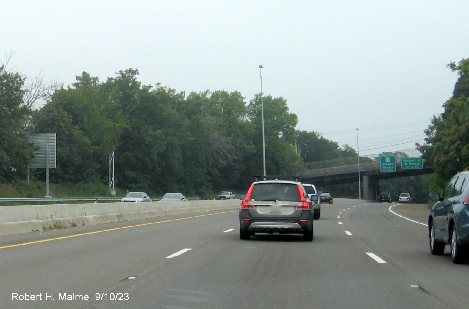
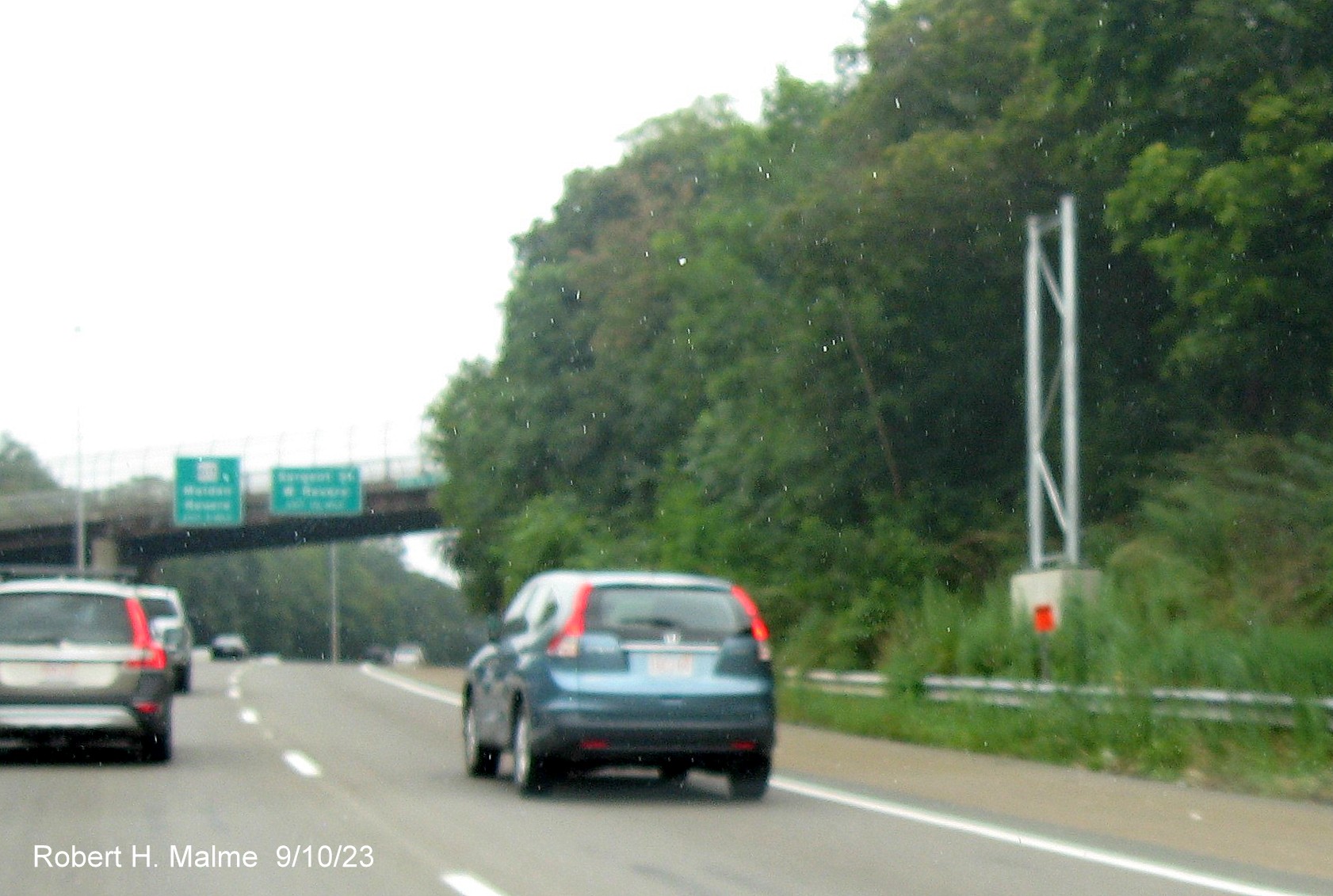
New advance
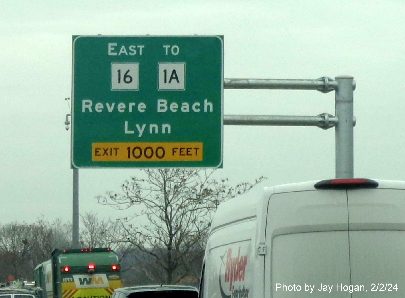
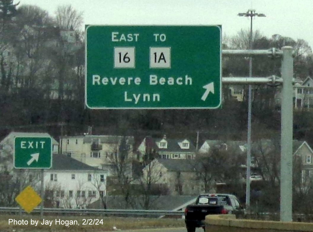
signage for the Route 60 and Sargent Street exits, also replacing bridge
mounted signage.
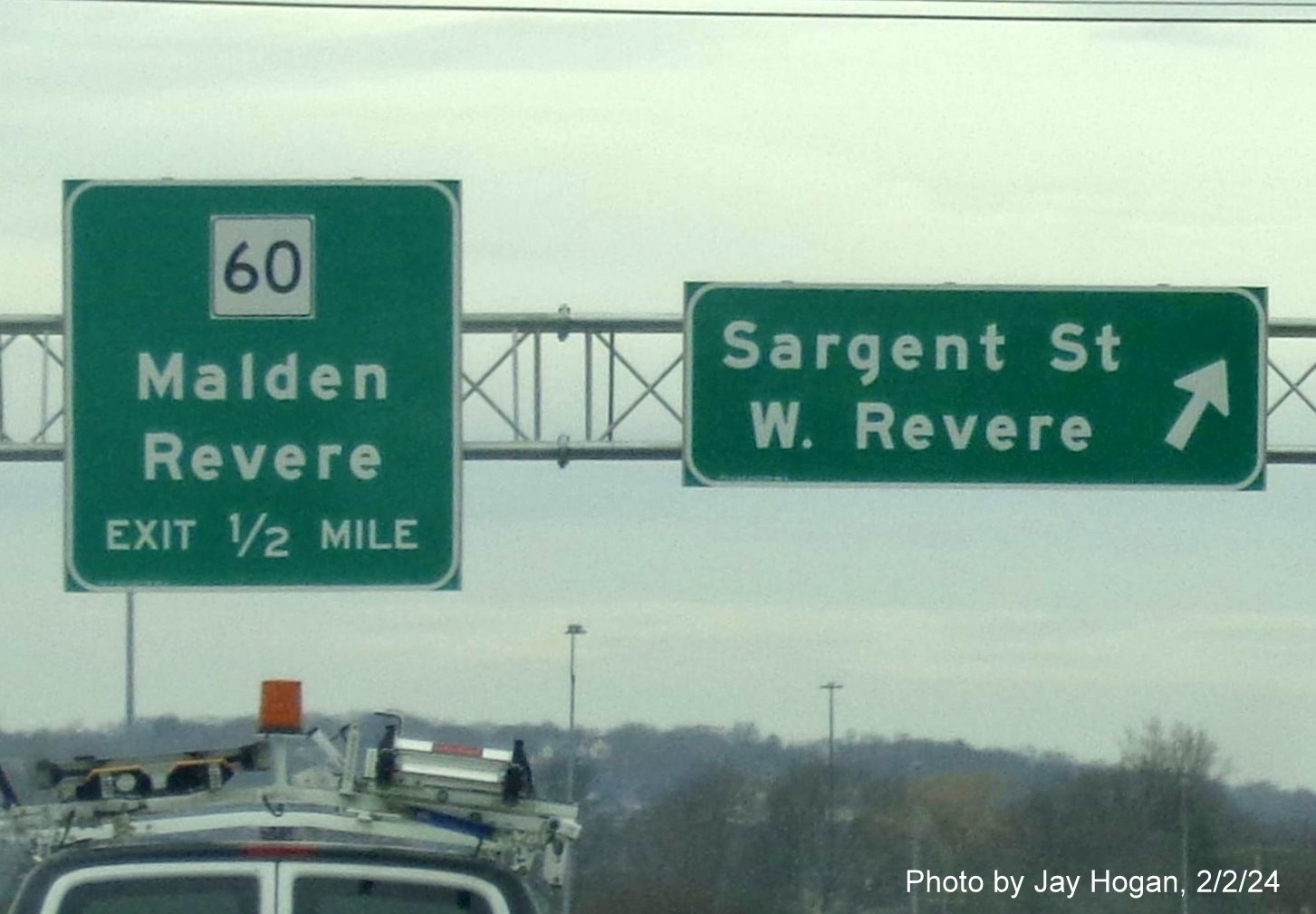
New overhead
signage at the ramp Sargent Street in Revere.
New signage at
the Route 60 exit which includes and advance for the Lynn Street exits
at the end of the Northeast Expressway.
While it appears
that all signage has been replaced along the Northeast Expressway
portion of US 1, the same cannot be said for the section between Route
60 and I-95/Route 128, there are still several signs needing
replacement, or here, at the second Lynn Street exit, only the
cantilever assembly had been put up.
The new 1 Mile
advance for the Essex Street exits at the start of the non-freeway
section of US 1 in Malden.
Close up of exit
signage for Essex Street, old bridge mounted signs beyond still in
place.
New overhead
signage at the Main Street exit in front of older bridge mounted signage
on US 1 North in Saugus.
Close up of new
advance signage for closely spaced off-ramps approaching Walnut Street.
New overhead sign
for the Route 129 West ramp supported by longer standing West Route 129
trailblazer.
New overhead
advance sign for the Route 129 East ramp with an Exit Only lane banner.
A closeup of the
overhead advance signage approaching the Route 129 East ramp in
Lynnfield.
A closeup of the
previously placed advance signage for the I-95 and Route 128 exits.
A ground mounted
guide sign for the I-95 South/(I-95/) Route 128 North ramp for traffic
entering from the Route 129 West ramp.
Another left lane
overhead 2 sign cantilever with the 1/2 Mile advance for the I-95 North
ramp heading towards Danvers.
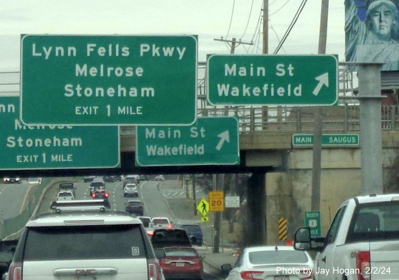
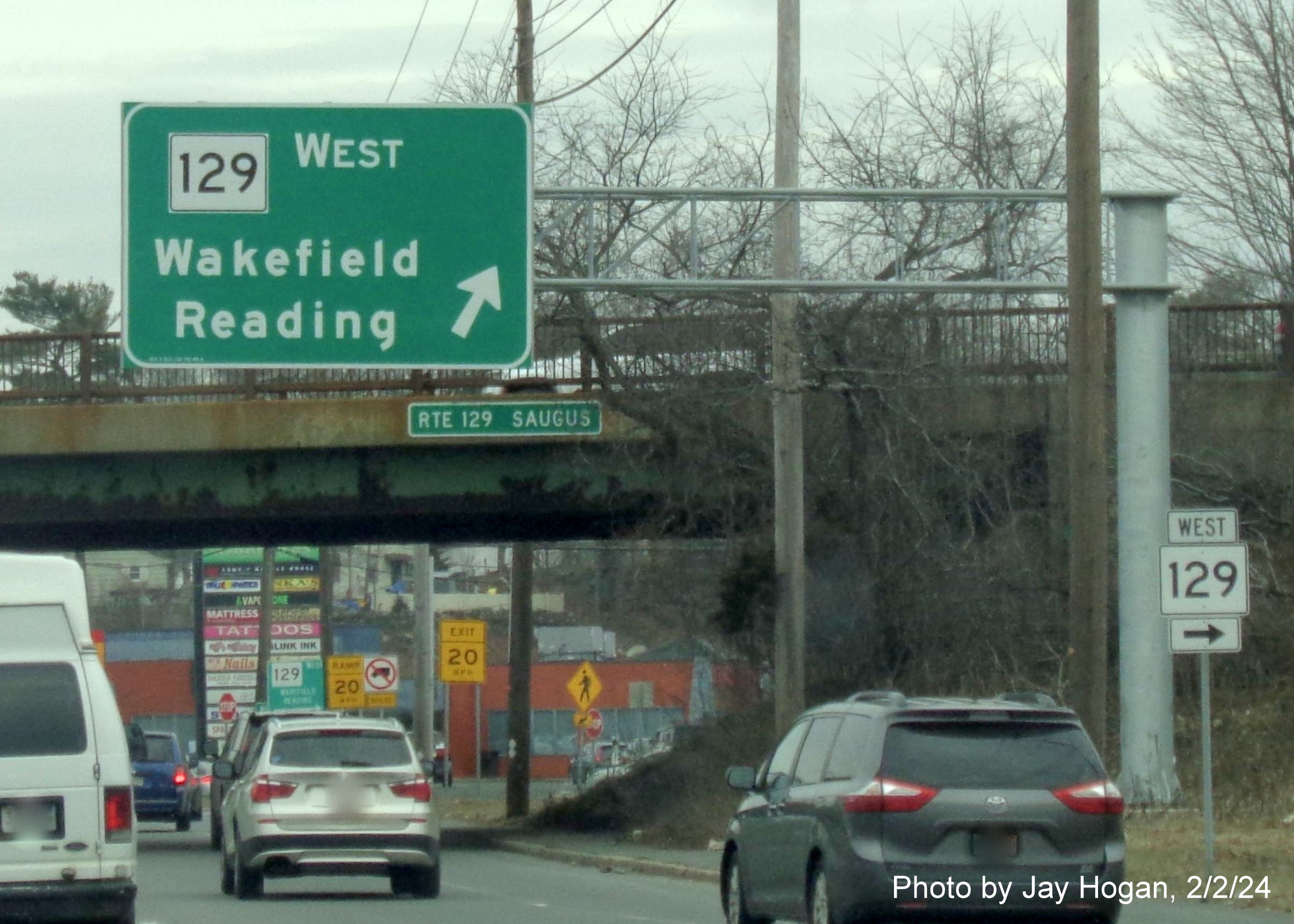
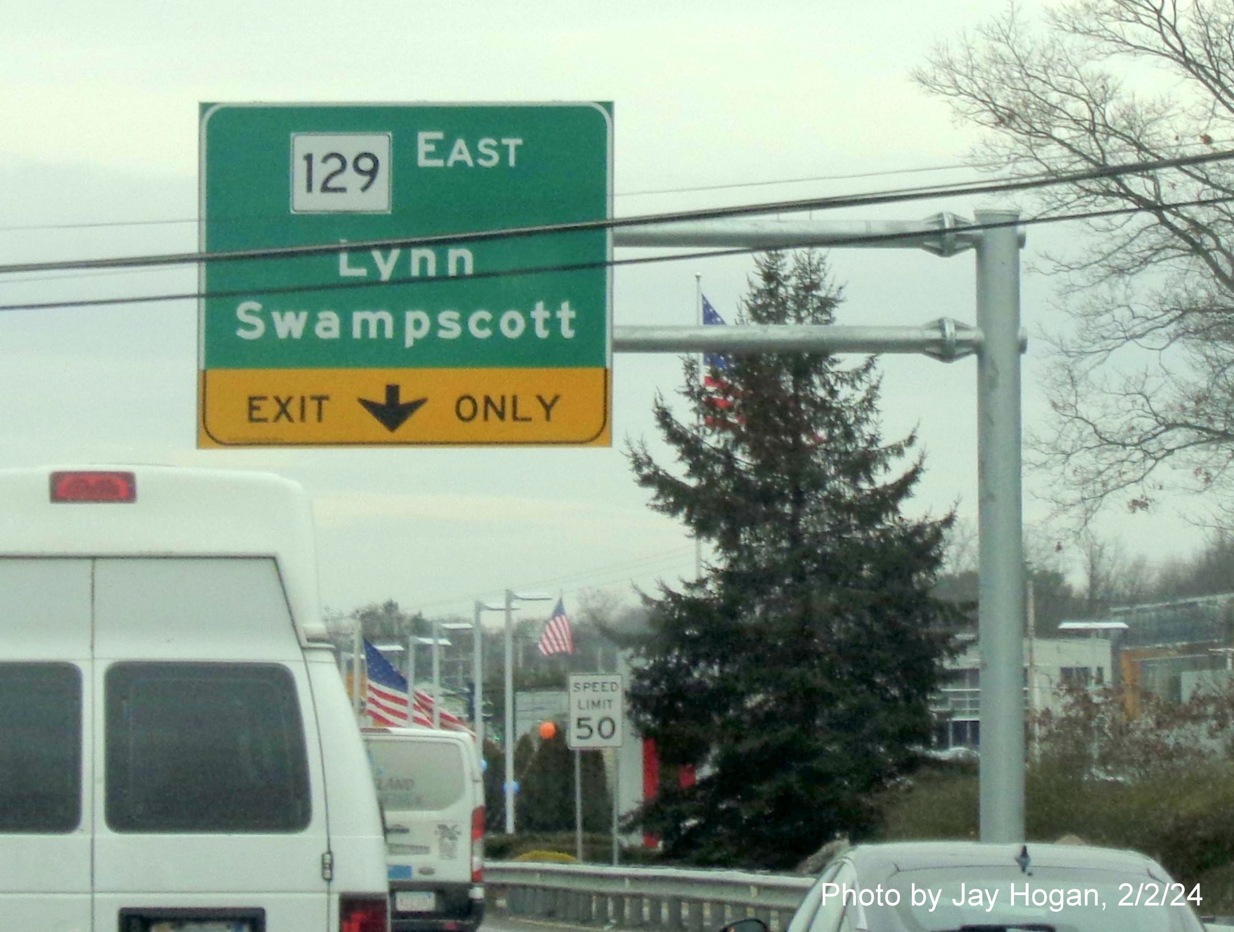
NEW SIGNS SOUTHBOUND, TAKEN ON NOVEMBER 5, 2023:
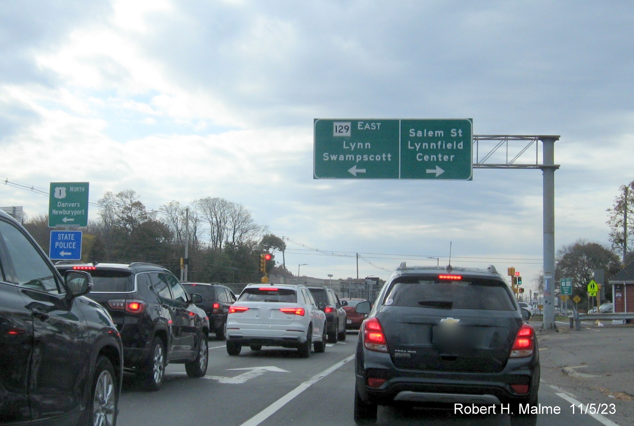
The overhead sign
at the intersection with Route 129 East/Salem Street on the ramp to US 1
South from I-95/Route 128 North in Lynnfield.
The next new
overhead sign southbound is the 1 Mile advance for the Route 129
West/Walnut Street exit. The first of several overhead signs placed in
the median supporting signs in both directions.
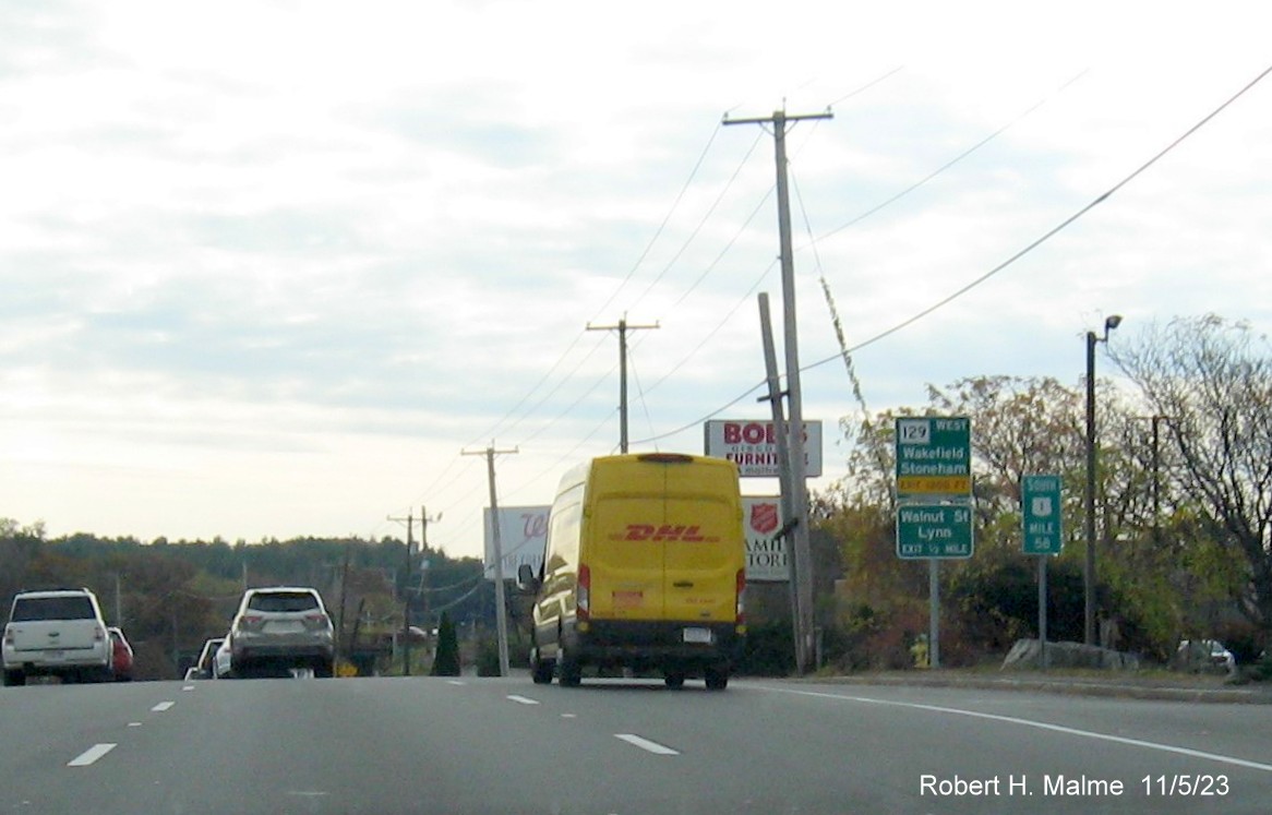
The 1/2 mile sign
for Route 129 West/Walnut Street is a ground mounted guide sign at Mile Marker 58.
The exit/guide
sign for the Walnut Street exit.
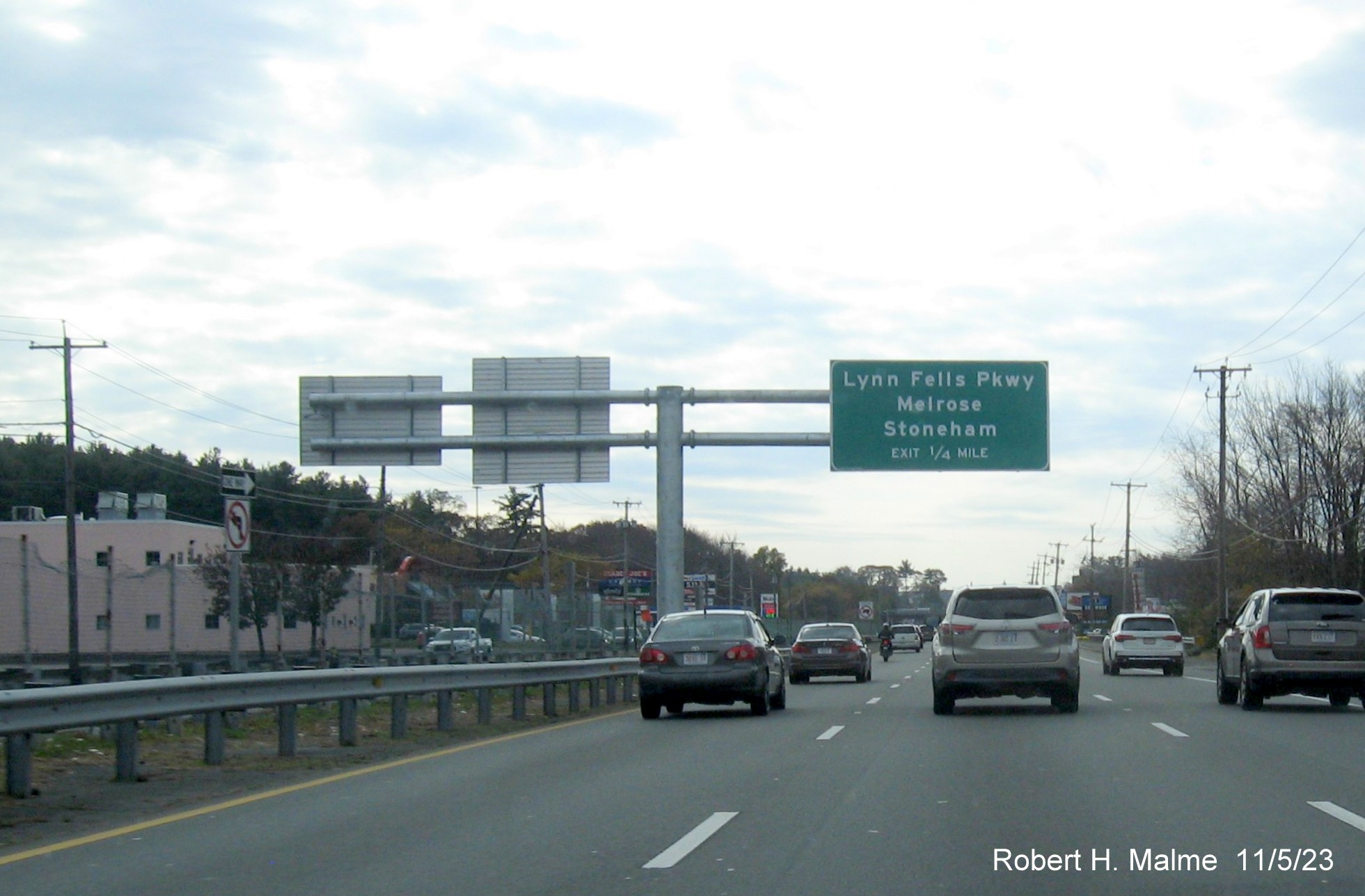
The 1/4 mile
advance sign for the Lynn Fells Parkway exit. Another median placed
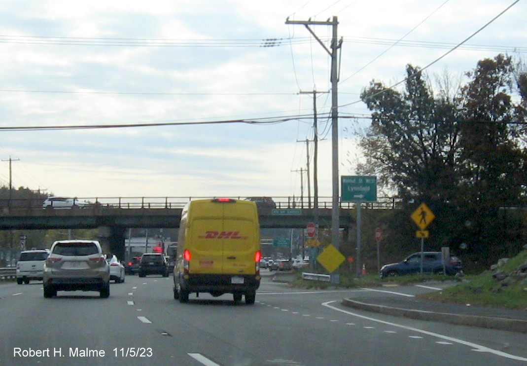
overhead sign.
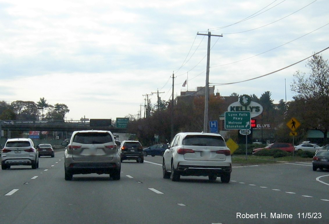
The ground
mounted exit sign for the Lynn Fells Parkway just before Kelly's Roast
Beef in Saugus. The bridge mounted signs in the distance have not been
replaced.
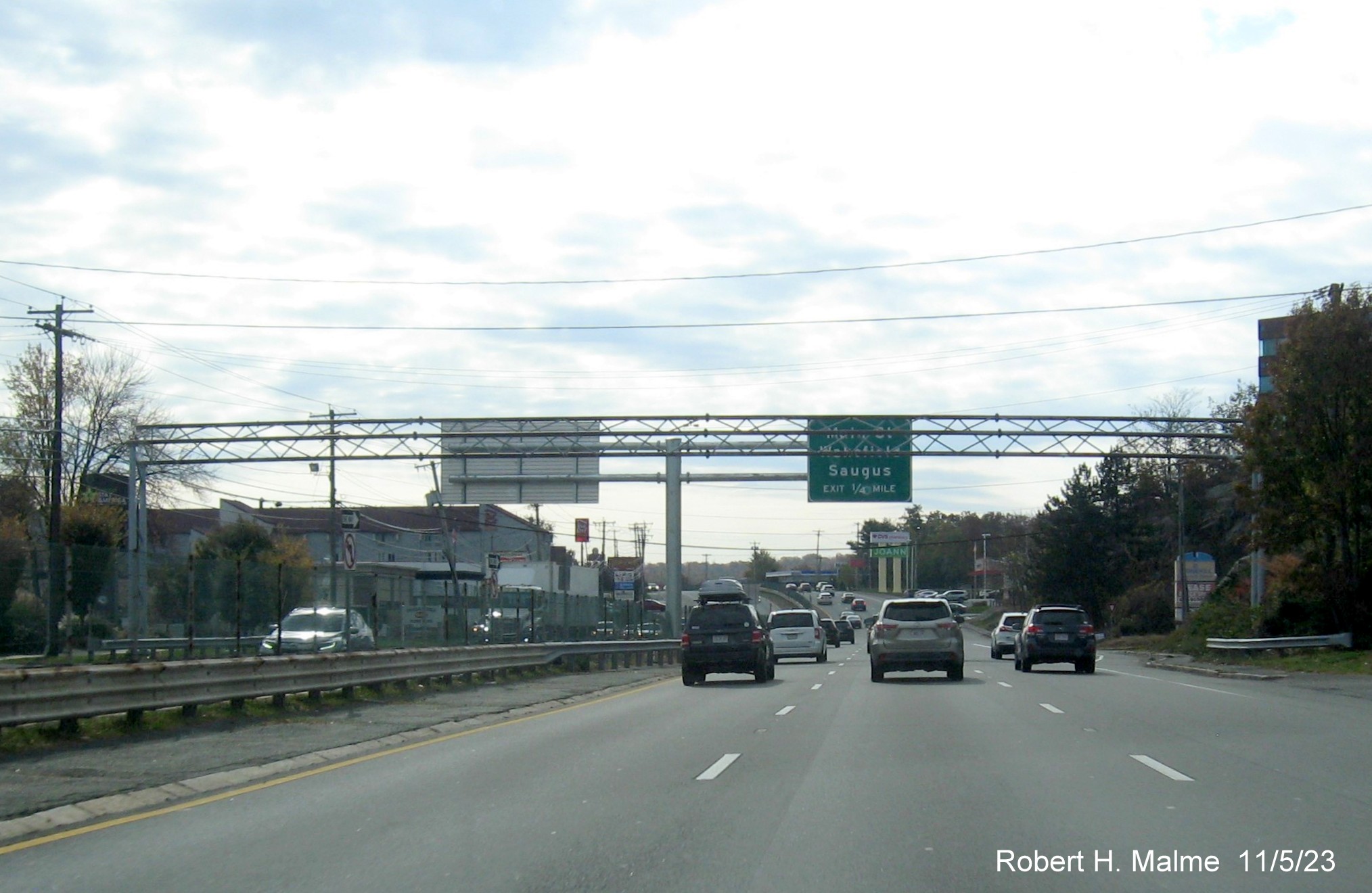
The new 1/4 mile
advance sign for the Main Street exit sits behind the old overhead
gantry southbound.
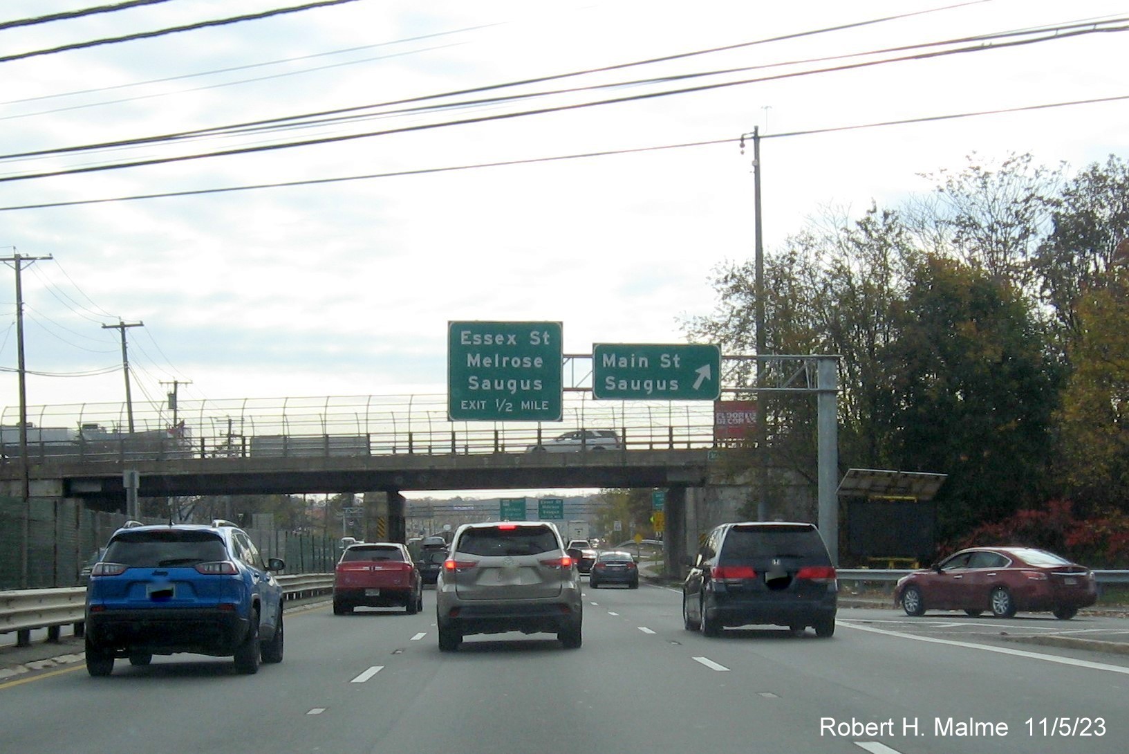
A rare right side
mounted sign for both the Main Street exit and the 1/2 mile advance sign for the Essex Street exit.
A small 1/4 mile
advance ground mounted sign for the Route 99 exit with a new South US 1 reassurance marker beyond.
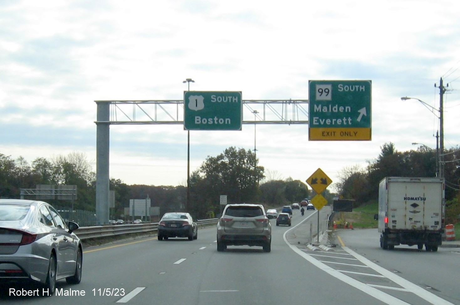
The new overhead
signs, more left side placed at the Route 99 South exit, the original
alignment for US 1 South.
Two types of
signs for the Lynn Street exit. A ground mounted advance and overhead exit sign in the distance.
The new exit sign
for the Route 60 exit stands in front of the old sign, while the old is
in front of the exit sign in the northbound direction.
The new 1 mile
advance sign for the Route 16 exit after the start of the Northeast
Expressway. It was decided not to place new milepost exit numbers
adopted in Massachusetts in 2020 along the expressway due to its short distance, this could be Exit 51.
The new 1/2 mile
advance sign for the Route 16 exit.
The new exit sign
for the Route 16 exit comes along with a Speed Limit 45 sign.
The last new sign
is the 3/4 Mile advance sign for the Carter Street exit in Chelsea, this
could be Exit 50. The rest of the signs to the Tobin Bridge were
replaced when tolls became electronic in the late 2010s.
New Signs Seen
Heading Northbound, 9/10/23
The new overhead
exit sign for the Webster Avenue exit. Other signs for this exit has not
been replaced at this time.
The one new
overhead advance sign for the Route 16 exit has the distance in feet,
1000 feet.
A new gantry
awaits the overhead exit sign for the Route 16 exit. The gore sign is
new, as is the Entering Revere sign seen in the distance.
One of the new
North US 1 reassurance marker along the Northeast Expressway.
A support post
for the future 1 Mile advance sign for the Sargent Street exit stands
before the existing sign that also had the old Route 16 exit sign in the
other direction.
One of the new
supports for the future Route 16 1/2 mile advance sign can be seen in
the other direction. Signs for the Route 60 and Sargent Street exits had
not been replaced.
The new support
post for future Route 60 and Sargent Street exits heading northbound.
The new
cantilever 1/4 Mile advance sign for the Lynn Street exit sits behind
the old overhead sign at the end of the Northeast Expressway.
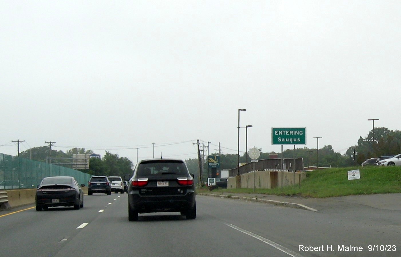
The new Entering
Saugus sign approaching Route 99 heading north.
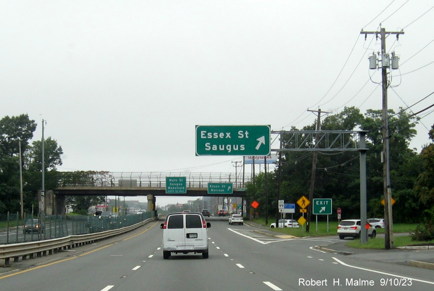
The new overhead
exit sign for the Essex Street exit. The other bridge mounted signs had
not been replaced.
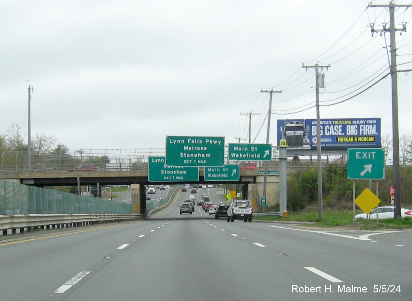
The new median
3/4 Mile advance sign for the Lynn Fells Parkway exit with the old sign
gantry behind.
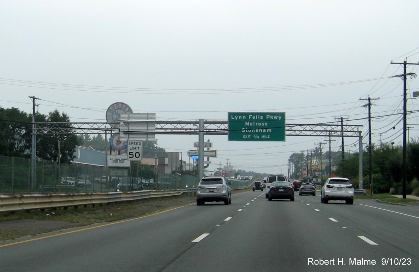
The new two-sign
cantilever at the Lynn Fells Parkway exit, with 1/2 Mile advance sign
for the Route 129 (West)/Walnut Street exit.
The new median
cantilever with 3/4 Mile advance sign for the Route 129 East exit.
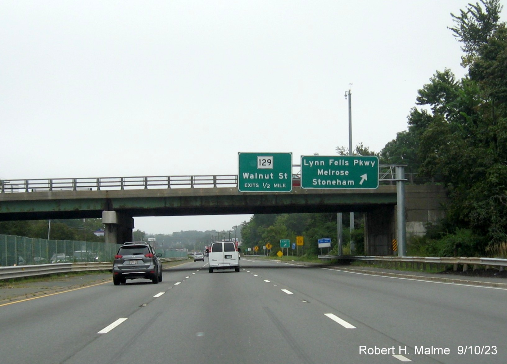
The new 1/4 Mile
advance sign for the I-95 South/Route 128 North exit with a Mile 60
marker behind.
The last new sign northbound for the I-95 South/Route 128 North
and I-95 North exits as of the fall of 2023.
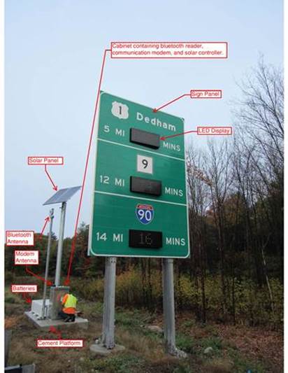
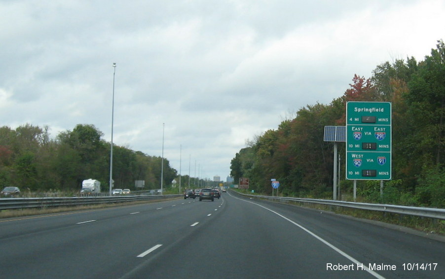
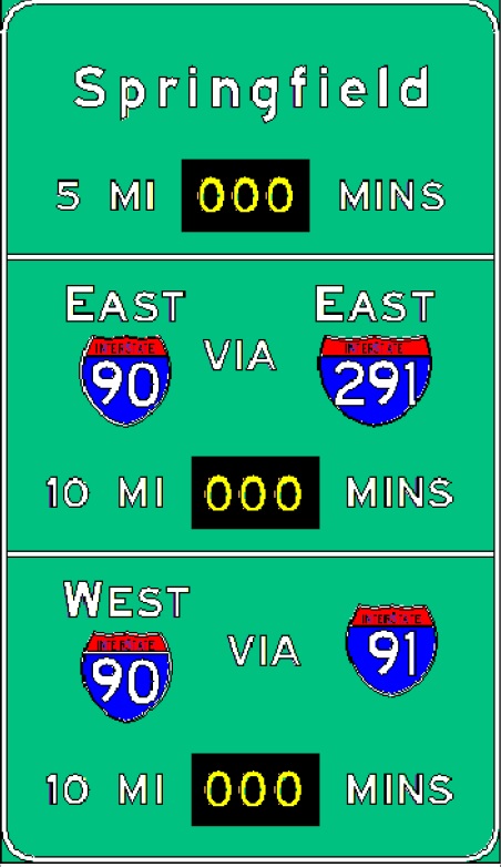
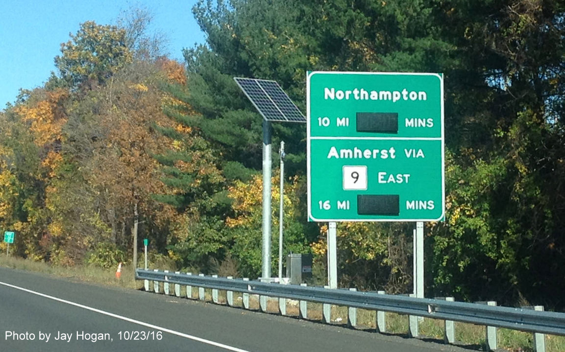
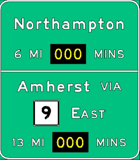
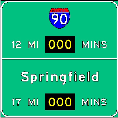
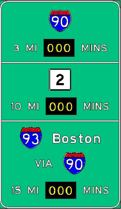
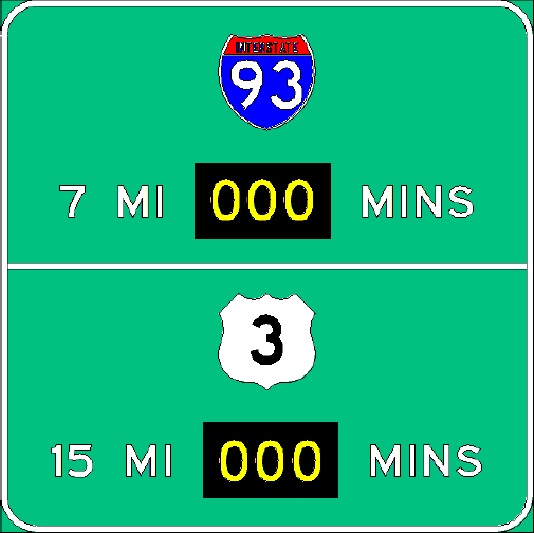
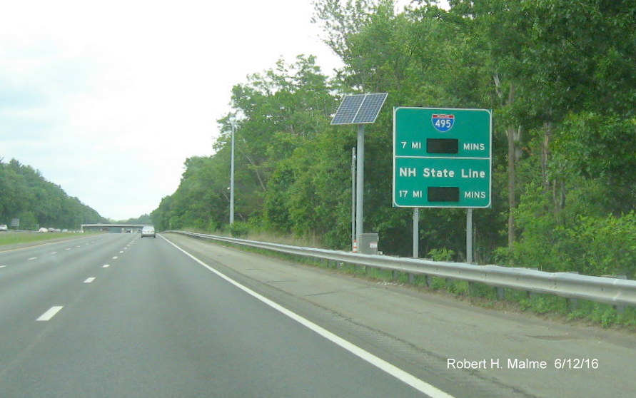
H. Installation of Real Time Traffic Management System 'Go Time' Signs (2014-2016)
[* New photos since 2020]
MassDOT announced
on January 18, 2017 that the contract to place 146 permanent Real Time
Traffic signs along the state's highways had been completed and all
signs activated. These permanent signs went up under a statewide
contract that was started in November 2015. The first of these signs
were put up along US 6 on Cape Cod and Route 25 in the spring of 2014 as
a trial project. The first signs north of the Cape to be activated were
Route 128 between Danvers and Gloucester in the Spring of 2016
Signs on I-90, I-91, I-93, I-95, I-195, I-290, I-495 and along MA 3, MA
24, MA 25 and the MA 140 expressway soon followed. This gallery features
photos of the installed signs along with sketches of the signs from
contract documents if there was any difference between the two, and
commentary as to what could still be changed to improve some of the signs:
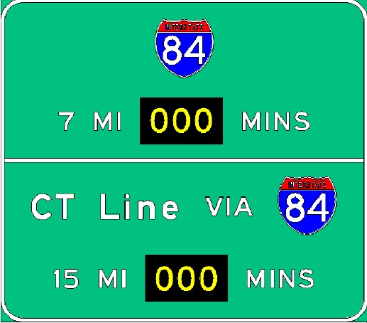
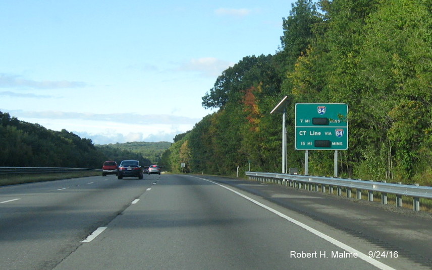
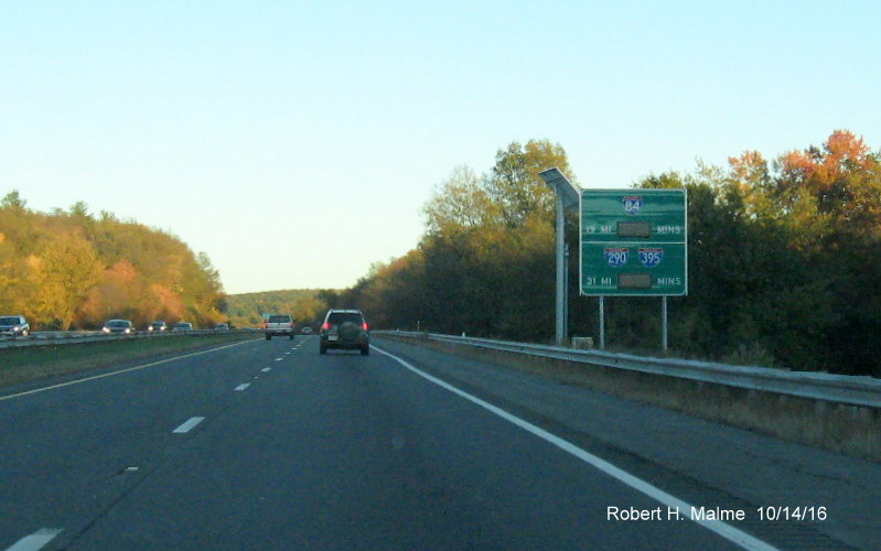
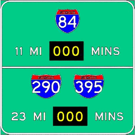
I-84
There are only
two RTT signs planned for this short route. Heading west from the Mass
Pike, this is the planned sign, including the time and distance to the
Connecticut border (this sign has not been installed as of June 4, 2017):
The first and
only installed sign is on I-84 East in Sturbridge which also lists the
time and distance to I-290 in Worcester:
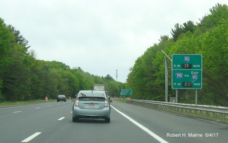
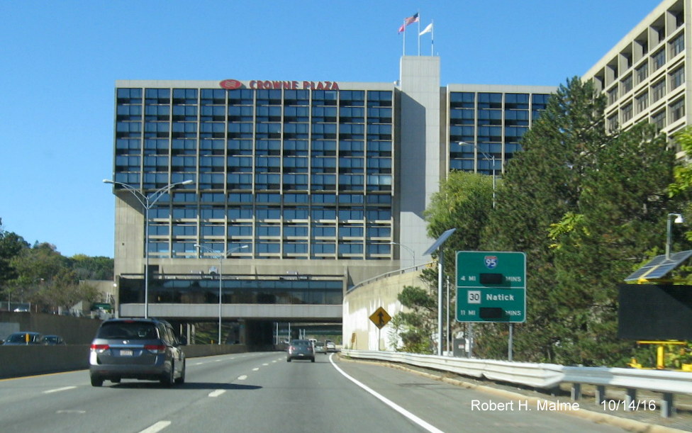
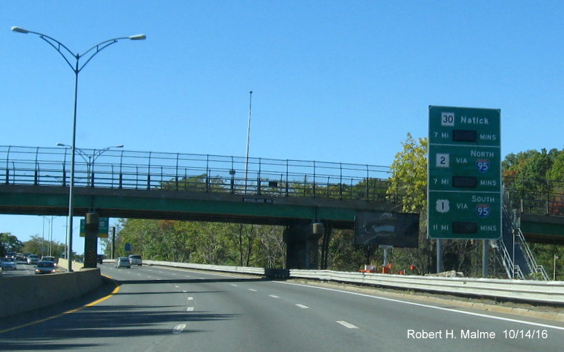
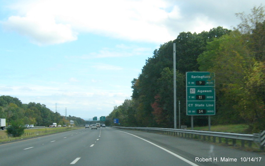
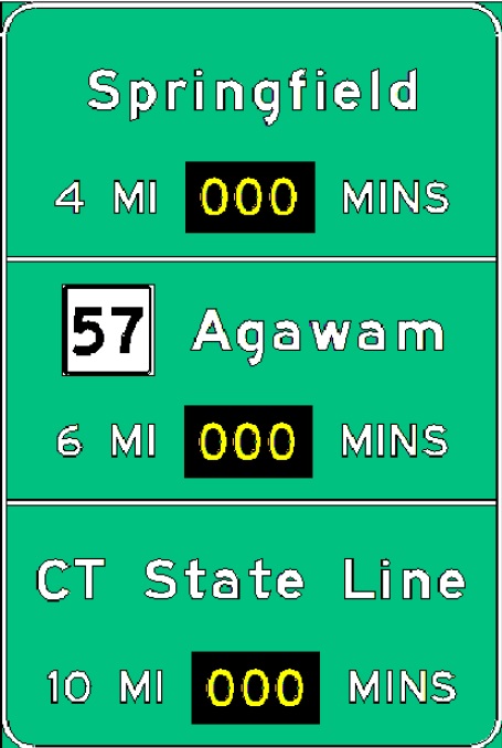
I-90/Mass Pike (New Photos 10/14/16)
Heading west in
Newton, this first sign appears after the Newton Exit, Exit 17:
The second Newton
sign appears just prior to the I-95/128 exit:
The next sign
westbound is in Framingham:
Eighteen miles
later there is the next sign in Millbury:
The sign in
Charlton has both the distance to I-84 and to the CT state line:
Heading further
west, this the sign up approaching Springfield, in Wilbraham:
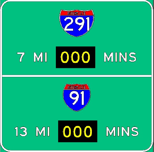
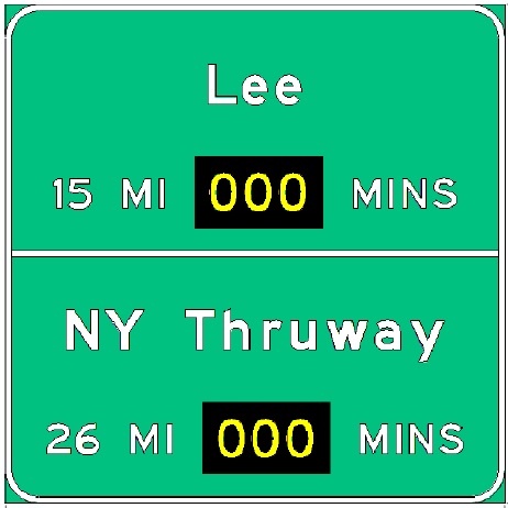
The original plan
had the sign going up a couple miles further to the west:
The next sign in
Westfield indicates the distance to the NY Thruway, not the state line
as with other highway's signs:
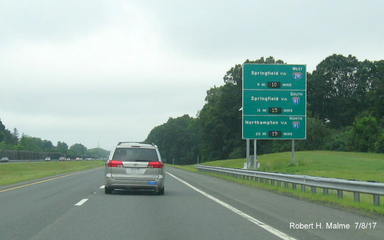
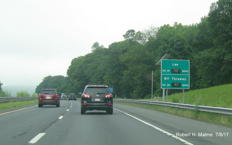
The final
sign westbound has the same information and was put up halfway
between Exits 3 and 2 in:
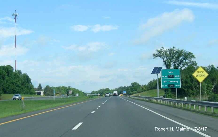
Notice
the distance to Lee was increased by a mile from the planned sign:
Returning
Eastbound, the first sign is in West Stockbridge (New 9/2/19):
Notice how the
bottom destination mileage was changed to 40 from 45 in the plans:
The
next sign is halfway between Exits 2 and 3 in Blandford (New 9/2/19):
Heading further
east, the sign in Westfield indicates distances to and along I-91 (New
9/2/19):
Beyond
Springfield, the next RTT sign is in Palmer alerting traffic to the
distances to the next 2 exits:
There's suppose
to be another one in Brimfield prior to the I-84 exit (still not up as
of 7/9/17):
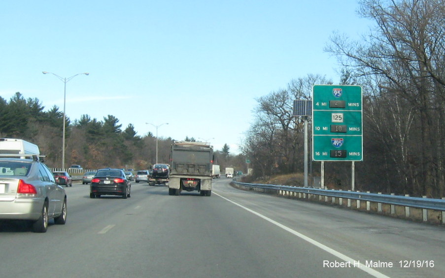
This sign is now
up just prior to the I-290/I-395 Exit in Auburn:
Just before the
I-495 exit in Westborough there are two signs, the first lists the
distance to the next 3 exits, I've kept the sign plan showing the
difference in state mileage to Route 9:
The second
mentions times along I-495:
This was not
among the original sign plans.
The first mention
of I-95 (128) is in Framingham after the Route 9 exit:
Prior to the
I-95/128 Exit there is a sign after the Natick Service Plaza,
activated as of the last week of October 2016:
After the
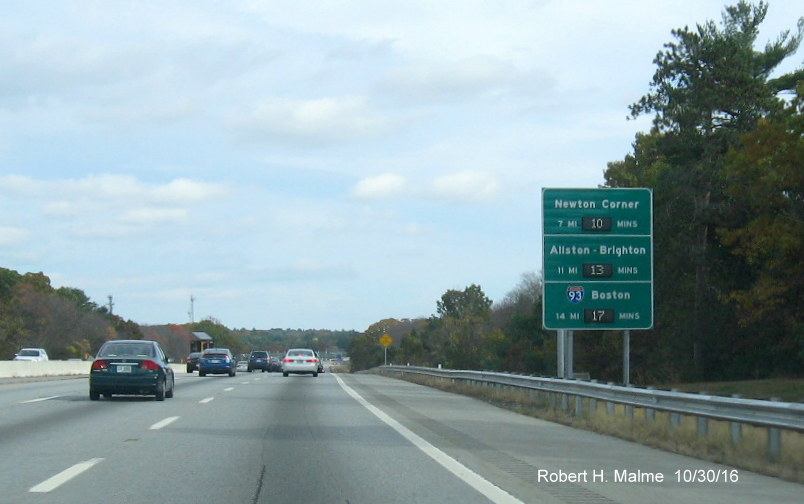
I-95/128 exit, here is the first of 2 RTT signs in Newton:
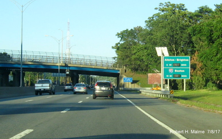
Here, the
sign was adjusted down by 1 mile for the Allston-Brighton exit:
The second sign
(and last sign eastbound) is only a couple miles further down I-90 prior
to the Newton Exit and includes the distance to Logan Airport:
Interstate 91
Heading
northbound from Connecticut, the first RTT sign is in West Springfield
(notice the mileage to Springfield was decreased by a mile from the
planned sign, below):
The next
northbound sign is after the I-391 exit in Holyoke (photo by Jay Hogan,
again the mileage in the sign plan was apparently wrong):
There will also
be one further north in Whately approaching Route 2, with the time to
the Vermont border (photo by Jay Hogan, this one identical to the plan):
Heading back
southbound, the first RTT sign on I-91 is in Deerfield which (the sign
plan, below, apparently had the mileage to I-90 wrong, it has increased
from 24 to 28):
This is followed
with the first sign mentioning Springfield put up in Northampton (again,
the mileage differs from the sign plan, in this case by 2 miles):
The last one is
after the Mass Pike exit in West Springfield (the mileage on this sign
has also been changed from the plan for Springfield, as seen below):
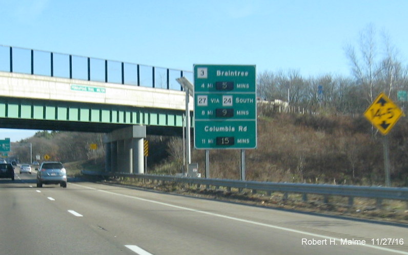
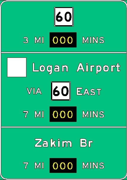
Interstate 93
[Signs activated in November 2016]
The first sign
northbound is in Milton prior to the MA 24 exit:
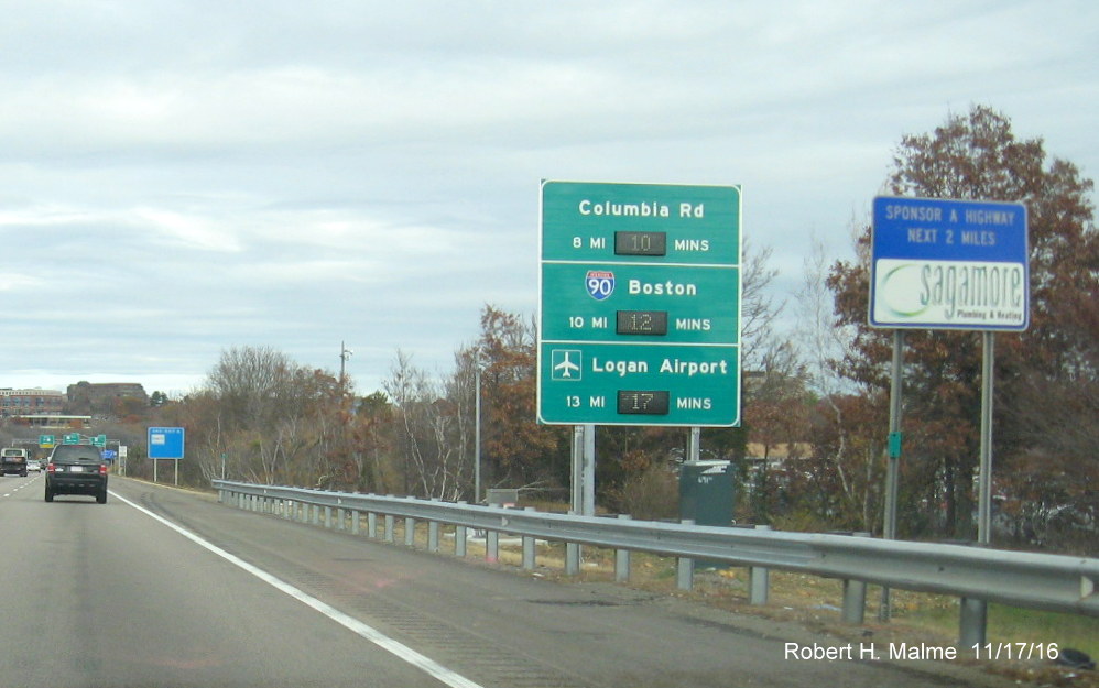
The one issue I
have with this sign is mileage. Under the proposed milepost based
system, the Houghton Pond/Ponkapaug Road exit, whose bridge is just
behind the sign, would be Exit 2. MA 3 is and would be Exit 7, while
Columbia Rd would be Exit 14, therefore, shouldn't the mileage to
those two exits be 5 and 12?
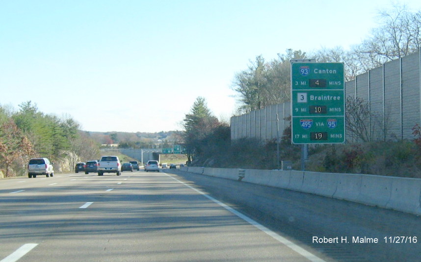
Approaching the
interchange with Route 37 in Braintree is this sign:
The next sign is
six miles further north, just after Neponset Circle. This one one of the
last signs put up, notice the right-hand support due to the placement
next to a steep embankment:
After the Big Dig
Tunnel, the southernmost of two RTT signs Medford lists the time to I-95
(put up week of 8/15/16):
The
northernmost lists both I-95 and I-495 (also put up week of 8/15/16):
North of I-95,
this will be an RTT sign in Wilmington telling drivers how much time
until the New Hampshire border:
+Heading back
Southbound, here's the plan for the sign in Methuen:
The next sign
will be in Andover:
The
sign is different from the sign plan in it includes Route 38 instead
of Route 28 (plan mistake?)
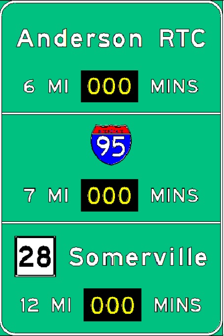
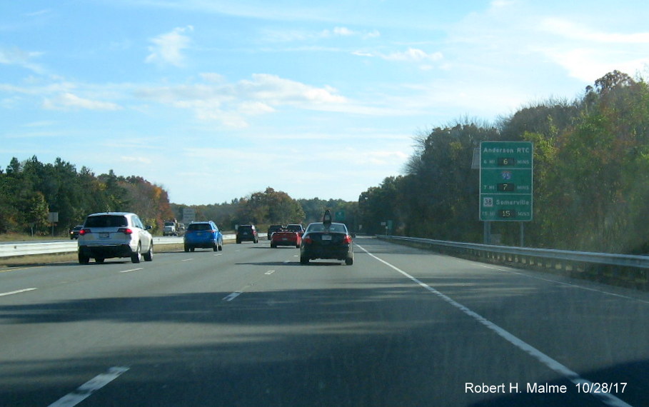
The Anderson RTC
as in 'Regional Transit Center' is a massive Park and Ride (as in take a
bus into Boston).
The next sign is
in Stoneham near Spot Pond, it has the first distance to Boston (Mass
Ave.), and the Logan Airport:
This was a change from the planned sign:
There's no
mention of I-90 Mass Pike, even though there's a connection westbound.
The US 1 sign apparently was supposed to be a Route 1A shield, since
there is no direct connection to US 1 Southbound and it would be rather
out of the way to cross the Tobin Bridge to go to the Airport.
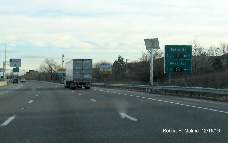
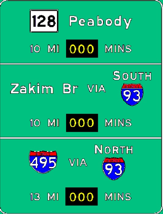
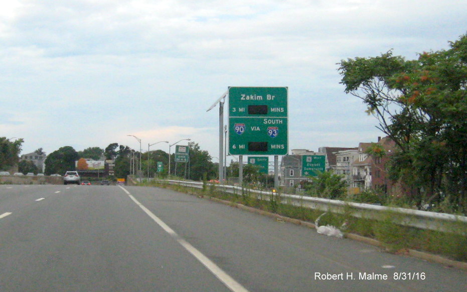
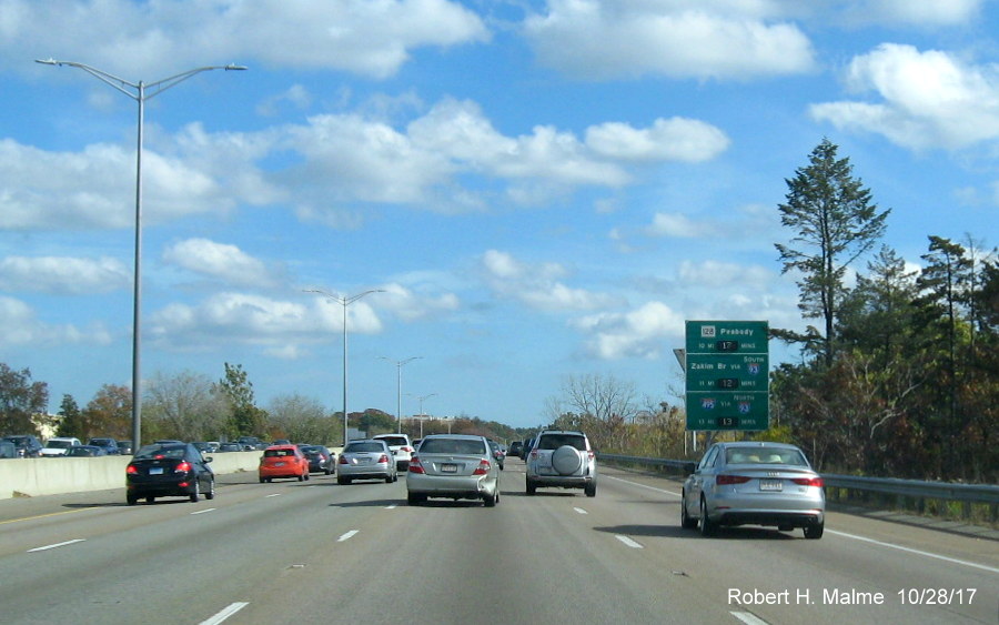
The next sign is
in Somerville and when first placed, due to contractor error, had the
distance to the Zakim is listed as the same for Mass Ave, 5 miles, this
was soon corrected to match the planned sign:
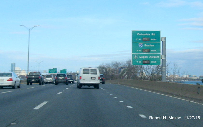
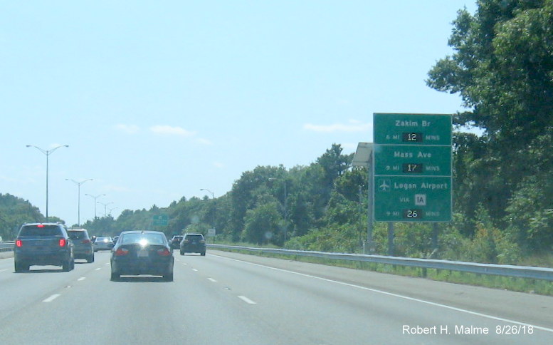
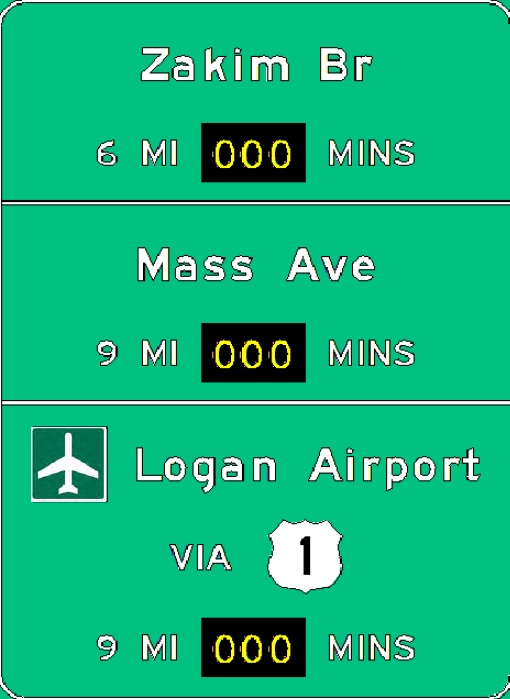
The next sign is
after the Tunnel and the Mass. Ave. exit, just after the South Bay
on-ramp:
Here they
reference Neponset Circle, not the MA 3A exit there. Also this is at
milepost 15, the MA 3 exit is at milepost 7, shouldn't that be 8 Miles?
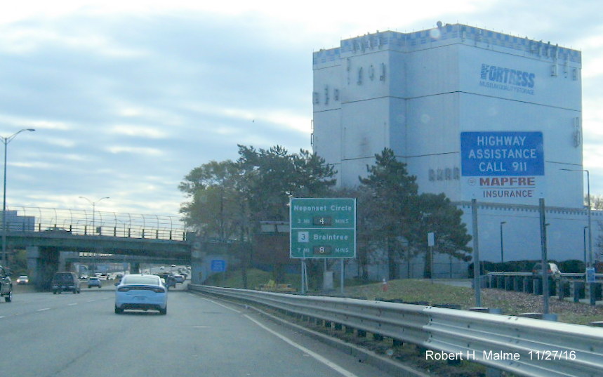
Seems to match up better with the travel time. Speaking of Neponset
Circle, here's the newly activated sign approaching that location after
the Morrissey Blvd/Freeport St on-ramp:
You'll notice
that the mileage for both Route 3 and 24 have been changed from when the
sign was first put up in July:
Apparently
MassDOT realized that since this is approaching milepost 12, why was it
4 miles for Route 3 (Mile 7) here? Route 24 is around milepost 3.5 so 9
miles makes sense, though they added a mile to that as well.
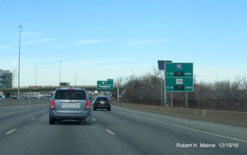
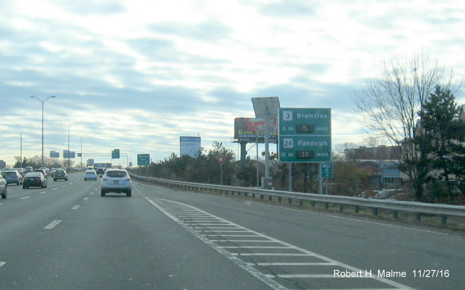
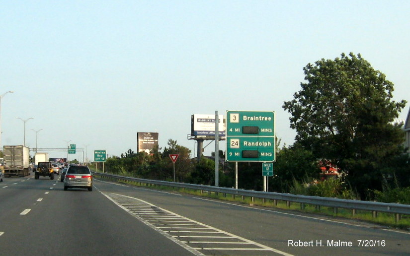
This is the final
sign along the Southeast Expressway in Quincy, the 1-Mile overhead for
the Braintree Split is in the distance:
The sign was
identical to the plan sketch. Unfortunately for there are some mileage
problems here too, that weren't fixed. This around milepost 8, so the
distance to Route 24 is right, however, since that route is 3.5 miles
from the end of I-93 at I-95, shouldn't the I-95 mileage be at least 8
miles? The Route 18 mileage is okay, since that exit is at milepost 38
and the last milepost heading northbound on 3 is 42.8, around milepost 7
for I-93. so 1+5=6. However, if MassDOT ever goes ahead with the
proposal to renumber exits based on mileposts, this exit would be 42 for
MA 3, so could cause some confusion. The last sign on I-93 South is in
Milton just after the Route 24 on-ramp and was used by MassDOT for the
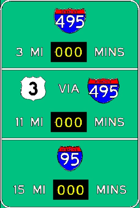
explanatory graphic about the signs (seen at the top of the section):
To be consistent
with other signs, there should be a 'Via I-95 North' by each entry or on
top of the sign. I guess they assume that drivers will know that I-93
ends at I-95 and that these are I-95 North exits.
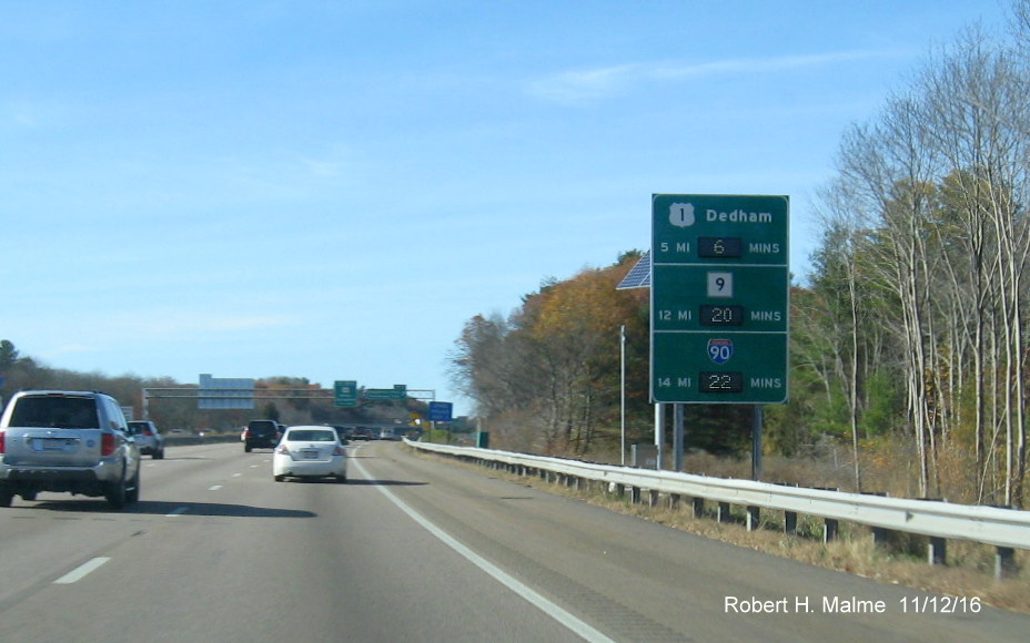
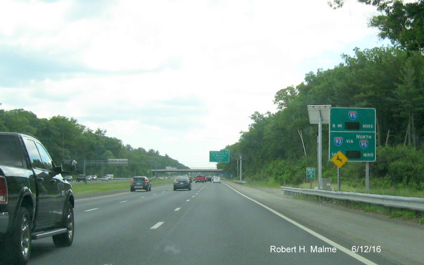
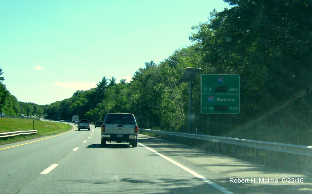
I-95
Entering
northbound from Rhode Island, the first RTT sign is one mile over the
state line in Attleboro:
The next sign
is five miles further north before the I-295 Exit, with the first mention on I-93:
The next sign
northbound, put up in March 2016 and activated in October, is in Foxboro:
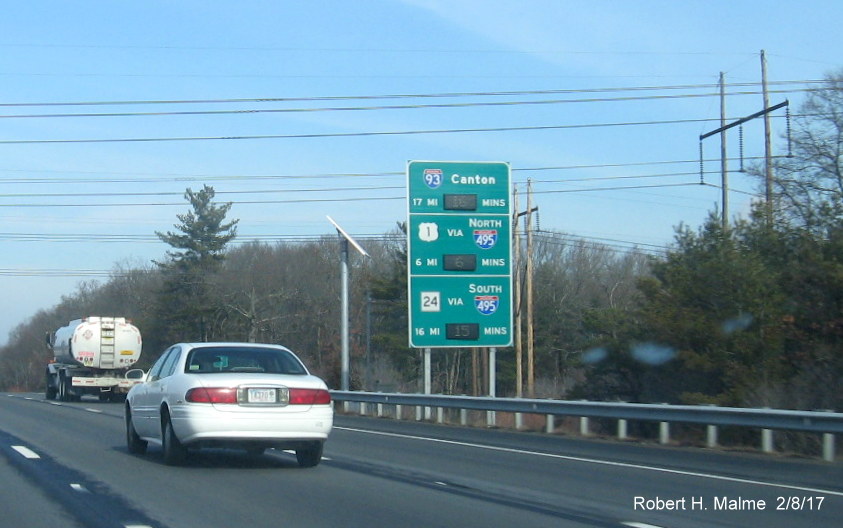
Approaching the Neponset Street interchange in Canton, the sign
was installed the week of March 21 and activated in October 2016:
It is identical to the sketch of the sign I had posted.
After the merge
with Route 128, the next sign is in Dedham between Route 109 exit ramps, put up the week of 9/18:
Before the Mass
Pike, is the next sign in Needham just prior to the new Kendrick Street
and under construction Highland Avenue exits, activated in late October:
This differs
from the planned sign below because originally this sign was to be
placed 1 mile further north, closer to the Highland Avenue exit:
Just
North of the Mass Pike exit in Weston, this sign has been activated:
The next sign is
in Waltham at the Trapelo Road Exit now listing only US 3 and I-93 with
Route 2 on the adjacent overhead sign:
In Lexington,
after the MA 4/MA 225 exit, it is apparently too close to US 3 to
include it on this sign, but still with I-93:
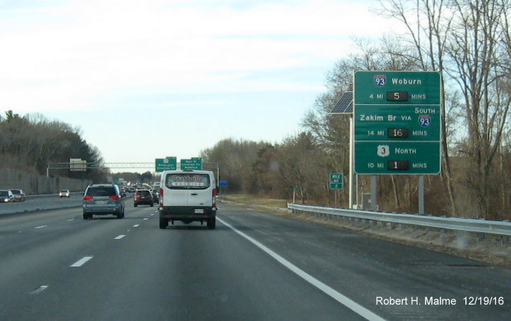
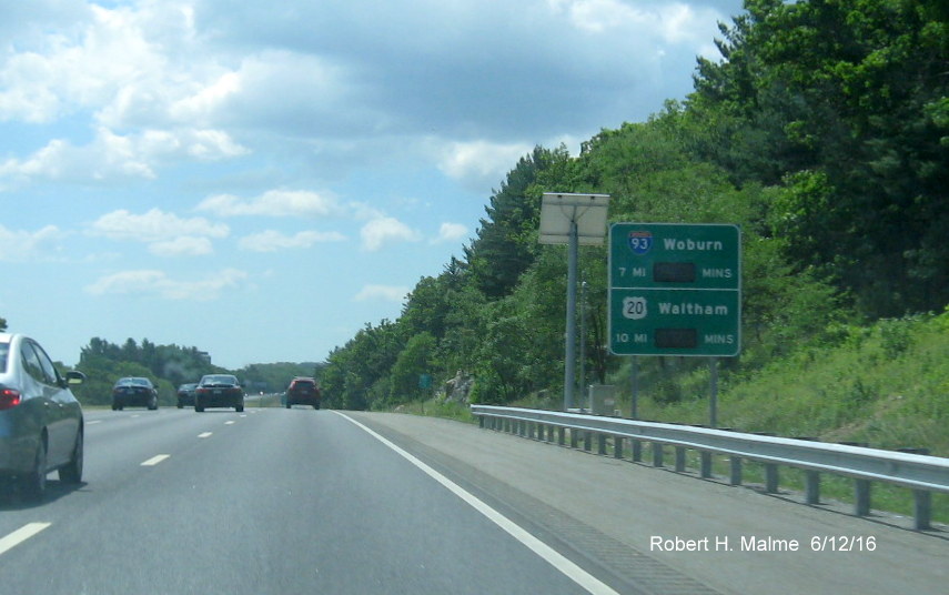
Just prior to the
I-93 exit in Woburn, this is the plan for the signage:
The
distance to the Zakim Bridge has been increased by 1 from that of the
planned sign:
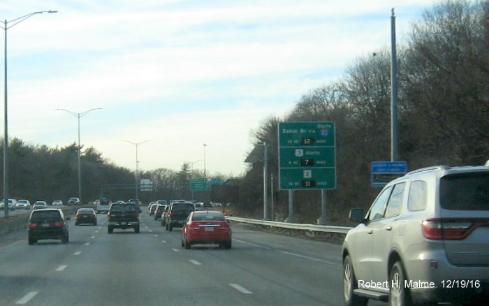
This is the sign
approaching the split with Route 128 in Wakefield, put up in March and
activated in November 2016, same as the sketch:
After the split
with Route 128, here is the RTT sign in Topsfield, which lists the time
to the NH border:
The first
number for the NH border is hard to make out in this photo.
Heading back
South, here's the first sign in Salisbury before the I-495 Exit, put up
in March, identical to the sketch:
Here's a sign put
up further south in Boxford, same as the sketch posted previously:
While here's the
signage after the Centre Street exit approaching Route 128 in Danvers
which will let you know what is the best route to Boston:
The next sign is
in Reading and provides the important time to the often congested I-93
interchange:
The sign just
before the I-93 interchange in Reading has the time to Boston (Zakim
Bridge), US 3 and Route 2:
This sign was
recently placed prior to the US 3 exit in Burlington and has the first
reference to I-90:
While this sign
was placed in March before the US 20 exit in Waltham, with same text as
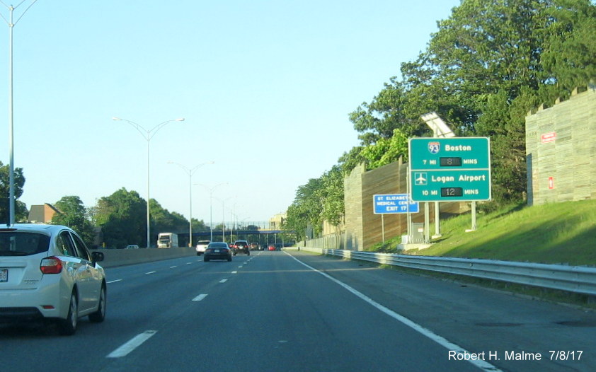
previous sketch, here seen activated in January 2017:
The next sign in
Needham, tries to help those driving to the Amtrak station, put up after
the Kendrick Street exit in the Add-A-Lane work zone in September and
activated in November:
You can see it
differs from the sign plan from the contract documents:
Apparently,
MassDOT decided that even if its called Route 128 station, a 128 shield
was too confusing, so it has University Ave. instead with the MBTA and
Amtrak logos. The last sign before I-95 leaves Route 128 is just before
the US 1 interchange in Dedham and was installed the week of March 21
and activated by November 2016:
The sign was
identical to the sketch plan which for consistencies sake, I though
shouldn't the MA 3 shield have 'Via I-93 North' next to it, as we
continue south of Route 128, the next sign is after the on-ramp to Coney
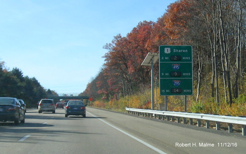
Street in Sharon, put up in late March 2016 and activated in November:
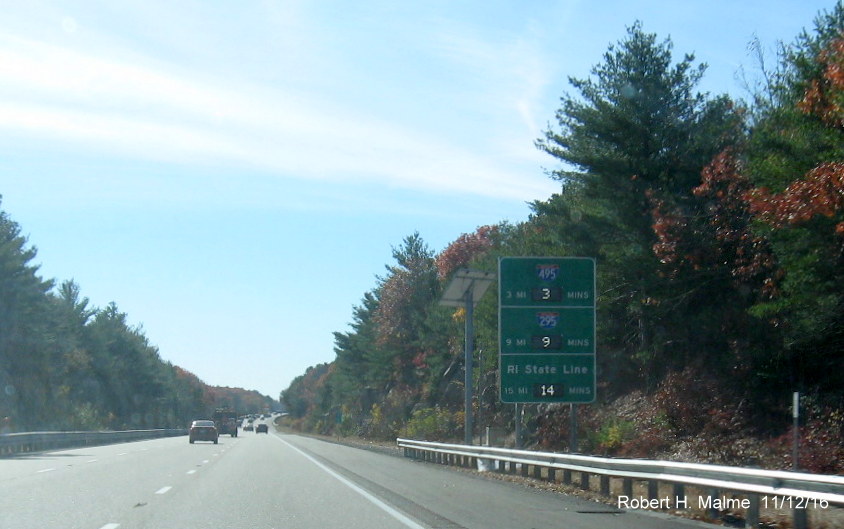
Going further
south the last sign in Foxboro notes the approaching state border, again
activated in November 2016:
Text identical
to that in the previously posted sketch.
Interstate 190
There is only one
sign on I-190, southbound in Lancaster:
Interstate
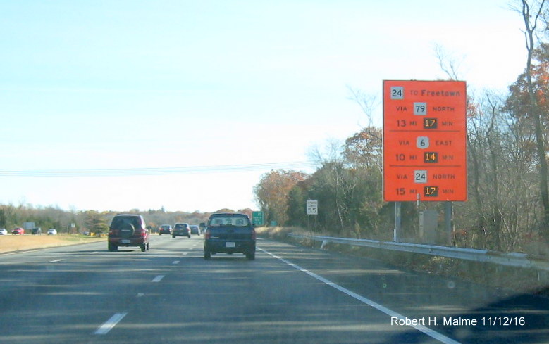
195 [Signs Activated 9/27/16]
Heading east from
Providence, the first sign is just over the RI border in Seekonk,
Courtesy of MassDOT:
A temporary
orange background RTT sign was put in place due to the ongoing
construction on the Braga Bridge and with the Route 79 Viaduct
replacement project, it is still up even though most of the work is done
as of November 2016:
The next
permanent sign is a few miles further east in Somerset, just before
entering Fall River:
The last one
eastbound is in Marion and has the important time to the Bourne Bridge:
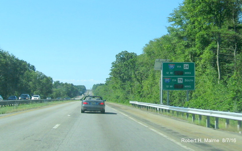
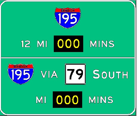
*Heading
westbound, the first I-195 RTT sign is in Wareham, noting the time to
the Braga Bridge, a typically congested area:
*The next sign
will be in Fairhaven, continuing the time to the Braga Bridge:
*As does this
sign further west in Dartmouth:
*The last sign in
Swansea simply gives the time to the border, again is this useful
information? Perhaps future coordination with RIDOT could give the time
to Providence:
Interstate 290
Despite its short
length, there will be six RTT signs planned for this route between the
Mass Pike/I-90 and I-495, the first one eastbound is in Auburn just
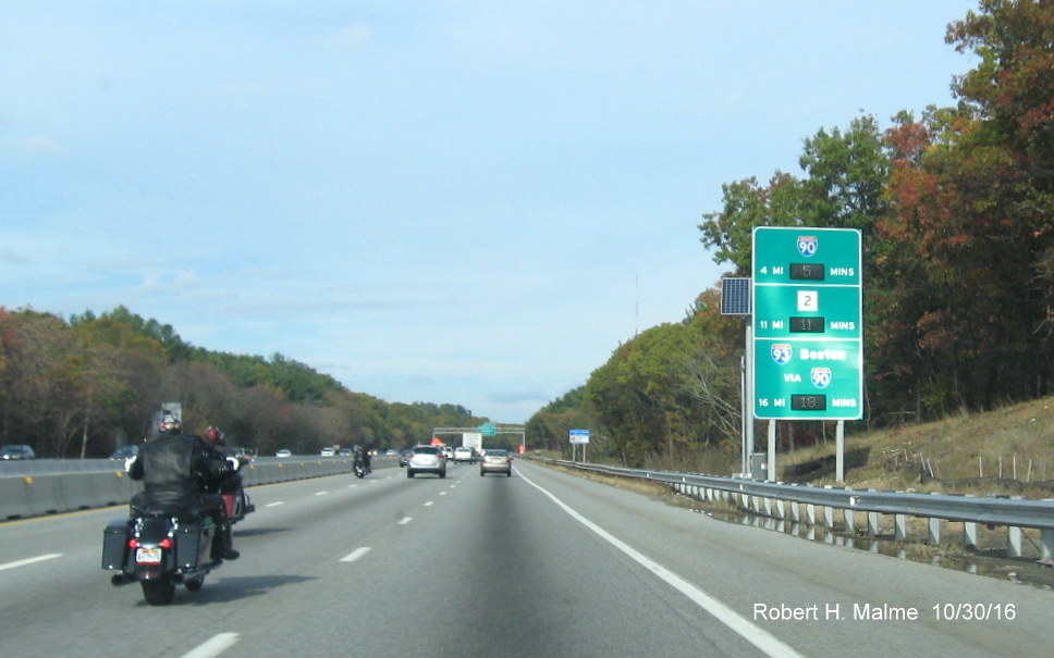
after the I-90/Mass Pike exit:
The next one is
beyond Worcester in Shrewsbury, not in the proposed location and changed
from the original sign plan, see below:
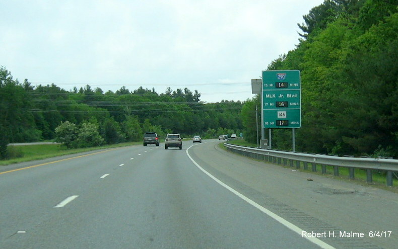
The last one is
near the end I-290 in Hudson basically providing I-495 drive times:
Turning around,
the first of the RTT signs on West I-290 is to be put up in
Northborough:
The next is 6
miles further west back in Shrewsbury:
The last one is
in Worcester after the interchange with I-190 providing a comparison of
alternate routes to the Mass Pike:
There is no
mention of I-395 on the I-290 signs, nor are there any sketches of
planned RTT signs on I-395.
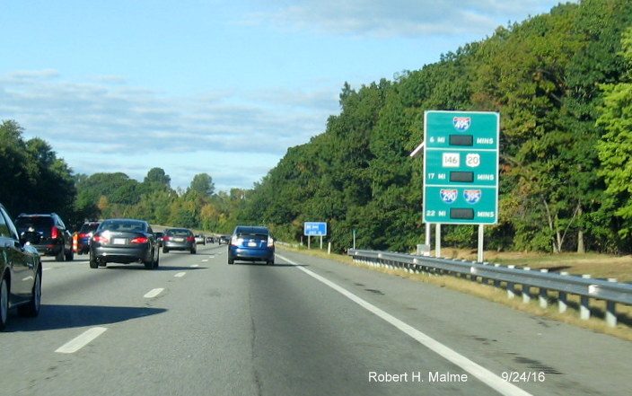
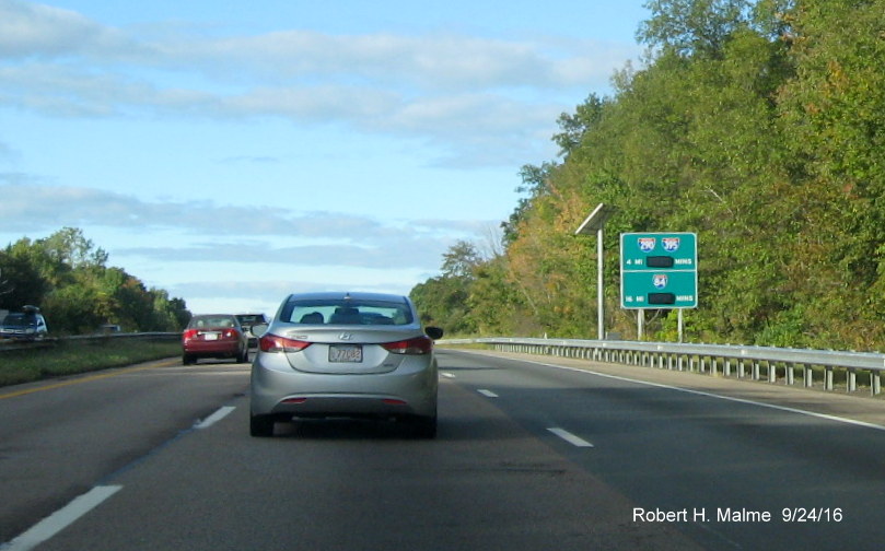
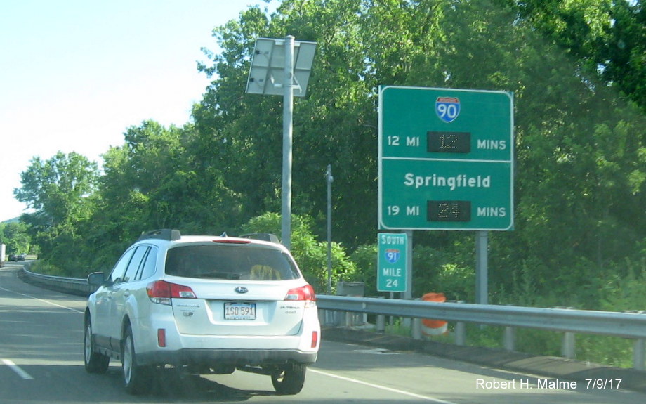
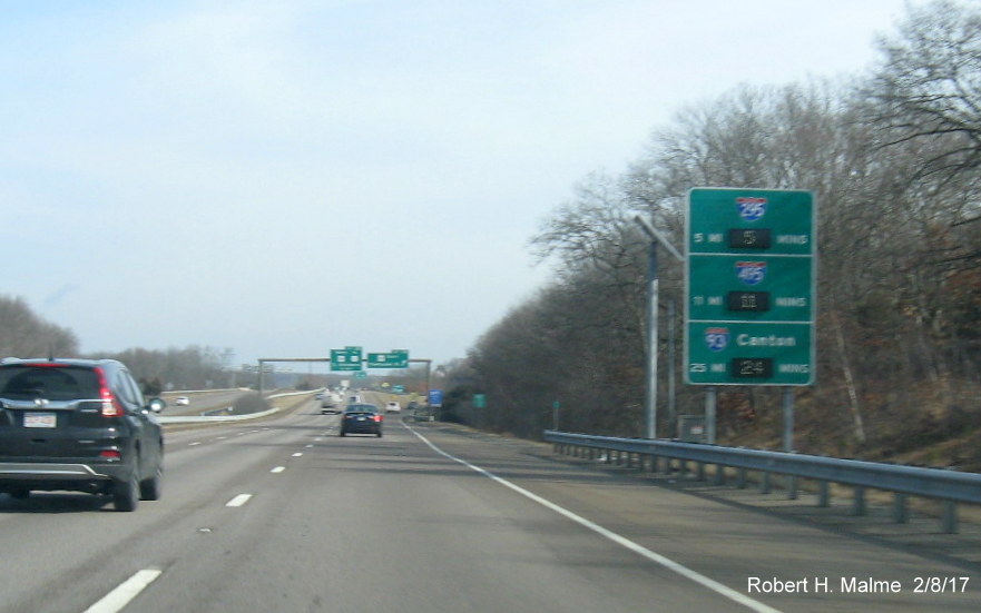
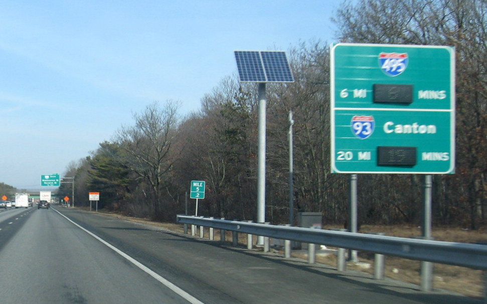
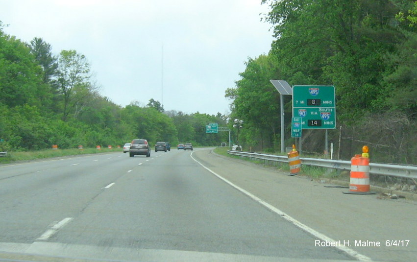
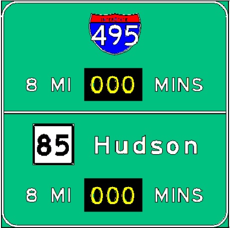
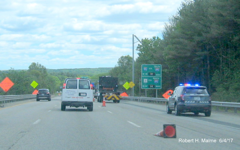
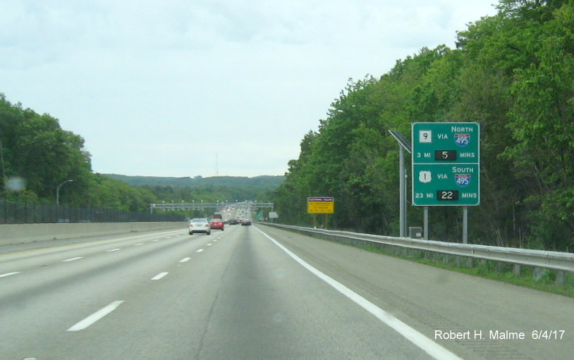
Interstate 495 (*New photos taken in Nov. 2024)
Heading
northbound, here is the first sign on Northbound I-495 in Middleboro:
The next sign
is a few miles prior to Route 24. Note the 6 mile distance, a 1/2
mile north, beyond the hill is a distance sign saying 24 is 7 miles
away (6 miles is the correct distance, the next distance sign is 3
miles before Route 24, saying its 4 miles away):
The next
sign is beyond Route 24 in Raynham, giving the time not only to
I-95, but travel times on I-95 itself (identical to sketch of
proposed sign):
Approaching
the Mass Pike in Bellingham, the sign will also indicate the time to
I-290/Route 85 Connector:
Beyond the
Mass Pike, here's the next sign in Bolton:
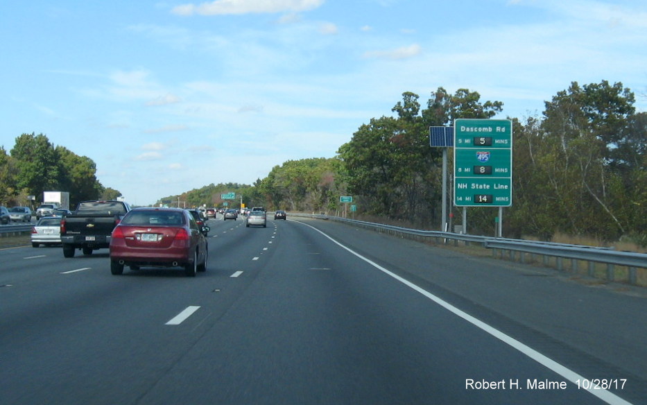
*The next
sign is in Westford, approaching US 3, the minutes reflect a traffic
jam before the US 3 exit in June 2021:
*Further north,
there is this sign in the Chelmsford Area after US 3:
*The last sign
northbound is to be in Methuen, less than 20 miles from I-95:
I don't know the
value of placing the state line distances on these signs, unless the
distance to the next major destination can be obtained other mileage
signs (according to a MassDOT source these are placeholders in case
NHDOT adopts the same system and a NH city can be put up over the
existing text).
+Heading back
south, the first sign will be in Methuen mentioning the time to I-93:
The next sign
will be in Andover approaching I-93 showing the time to I-95/128 via
I-93 or US 3:
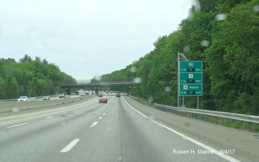
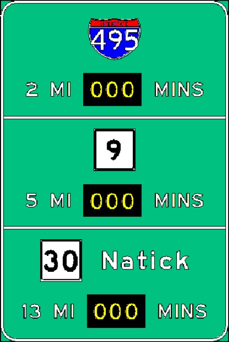
+Next, in Lowell
this sign will be installed approaching US 3, again with the time to
I-95/128:
+The plan for the
sign further south approaching Route 2 in Westford:
Here's
a sign approaching the Mass Pike in Marlboro:
The
next sign southbound is in in Hopkinton, with the first mention of
I-95:
Here's
the sign placed further south in Franklin approaching US 1 and I-95
(same as the original design sketch):
The
next sign is just prior to I-95 in Foxboro, this one only has travel
times on I-95 South and North in addition to Route 24:
After I-95,
signs start mentioning the end of I-495 at I-195, this is the sign in
Norton before the Route 123 exit (this is different from the planned
sign that was to be installed a couple miles further north (see below):
You wouldn't need
the MA 25 shield if I-495 was extended along that route (or I-195 for
that matter).
*You can tell
when you're nearing the Cape when signs with the time to the Bourne
Bridge is mentioned, such as this in Raynham (identical to sketch of
planned sign), taken in November 2024:
This is the last
sign southbound in Middleboro, it was not captured until Sept. 2018, not
being up during my previous drives through the area:
US 1
There are a
couple RTT signs placed along US 1 South between Peabody and Boston, the
first one in Saugus just after the MA 99 South exit*:
Notice that
mileage was changed from the original sign plan:
And the other is
just after the Route 16 exit and before the Tobin Bridge in Chelsea,
this was put up the week of 8/15/16:
US 3 [Signs
Activated in August 2016]
The only sign northbound is in
Bedford with times to I-495 and the New Hampshire Border:
+Heading back
south, here's the first planned RTT sign in Tyngsborough:
By
the time you get to Billerica, the signs have time and distance to
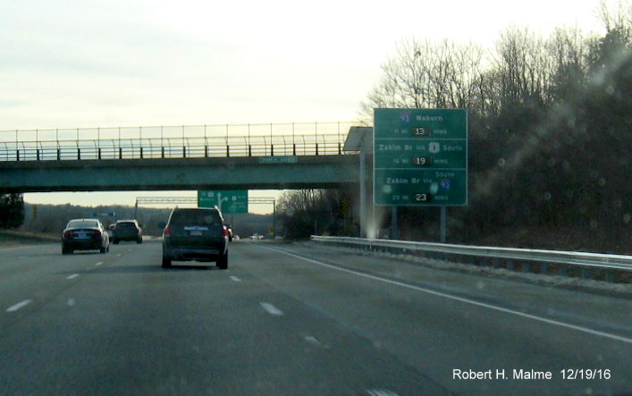
destinations on I-95 (the mileage to I-93, slightly obscured by the Deer Crossing sign, is 14):
The
final sign southbound in Burlington also includes US 20, but wouldn't it make sense, and be consistent with other signage,
if it included 'Via I-95 South' while I-93 had 'Via I-95 North'?:
US 6
Signs were
put up in April 2014 along the Mid-Cape Highway as part of trial for
the entire system installed later.
NEW-The first
RTT sign westbound is at the beginning of the Mid-Cape Highway in Orleans:
This is one of the signs showing the time to the Sagamore
Bridge just west of Yarmouth, taken in March 2017:
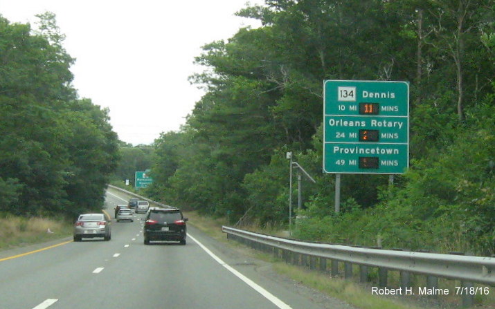
Heading further west there is a sign between Exits 3 and 2 in
Sandwich:
These are July 2016 photos taken of the working signs along US 6
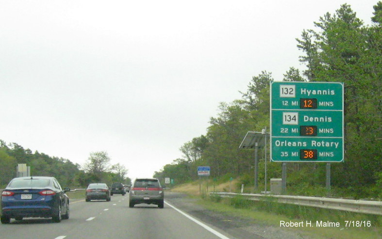
East, first just beyond the Sagamore Bridge and MA 6A Sandwich exit:
The next before the MA 132 Hyannis Exit:
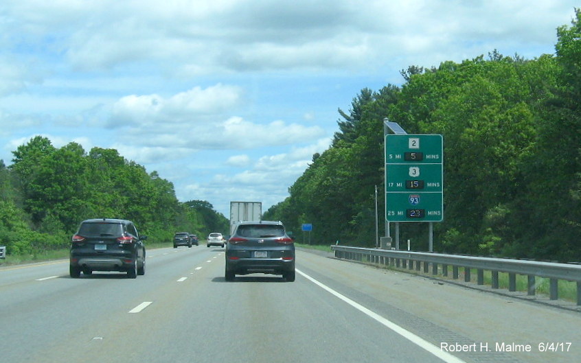
Route 2
There are two RTT
signs planned for Route 2. Heading west from Cambridge, the first is in Lexington, prior to the I-95 Exit:
Heading
eastbound, the sign is placed in Concord prior to the Sudbury Road
intersection with the all-important time and distance to the Alewife MBTA Station:
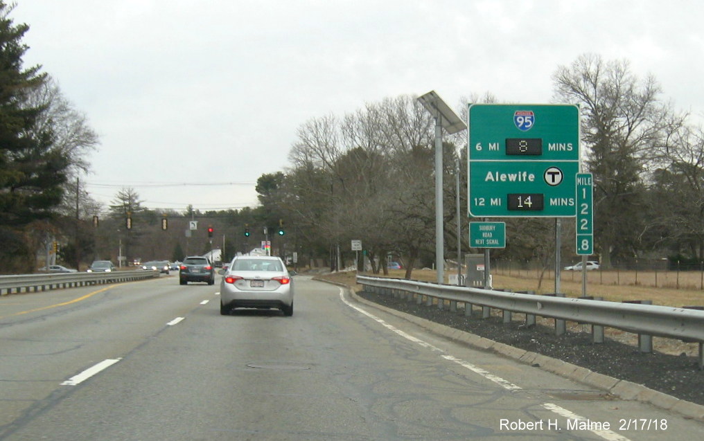
This
sign was originally to be 2 miles closer after the MA 126
intersection, as seen by the distances on the sign plan:
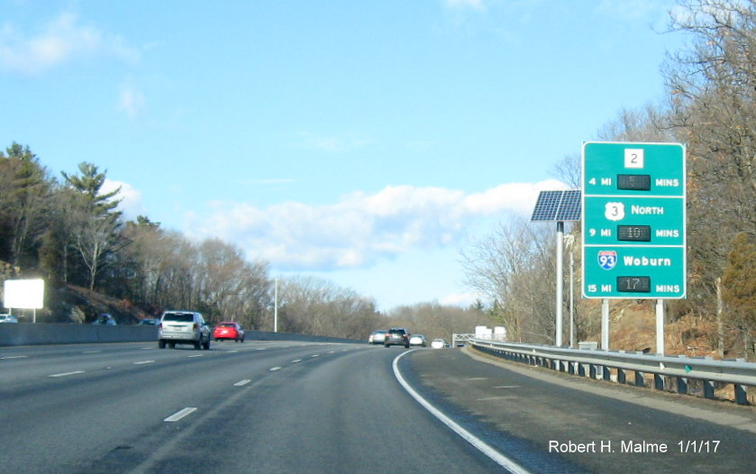
Route 3 [Signs activated week of 10/11/16]
Heading South
toward Cape Cod, the first sign placed on Route 3 is in Braintree on the
left side shortly after the merge of the ramps from I-93 North and
South:
The temporary VMS
sign this replaced had Route 18 and Route 139, but the Derby Street
destination is more helpful because it is after Route 3 narrows from 3
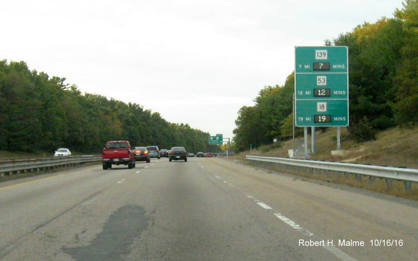
to 2 lanes where the highway frequently backs up. The next sign, in
Weymouth beyond the Route 18 exit, features the next appearance of Route
139 and the first for US 44:
Both of which
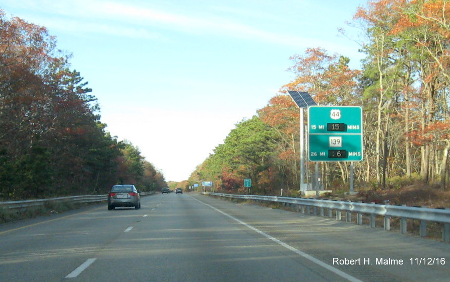
are also on the next sign in Hanover, just beyond the MA 53 Exit:
It might be
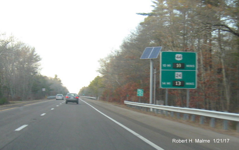
helpful to include more destinations with the route shields, for example
if you were heading to Plymouth and didn't know the exit for US 44 was
there, listing Plymouth would make the sign more useful. The time to the
all important Sagamore Bridge over the Cape Cod Canal starts to appear
on RTT sign in just before the MA 139 exit in Marshfield,, though the
sign was activated when the photo was taken, it does not seem to be
displaying accurate times:
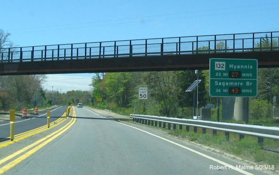
The next sign
is just prior to the first MA 3A Exit in Duxbury (sign identical to
plan):
The first
sign in Plymouth is just beyond the left exit for the Plimoth
Plantation Highway, here time to the Bourne Bridge is also
mentioned:
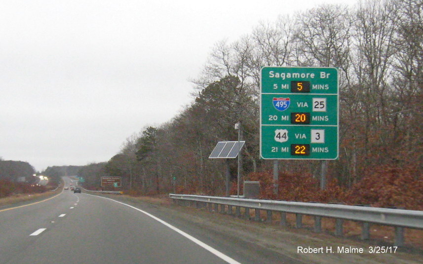
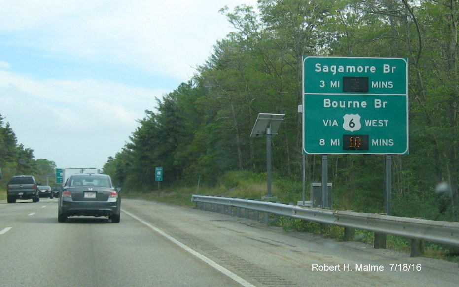
There is also a
sign placed five miles further south with distances to both the Sagamore
and Bourne Bridge, placed to help out drivers stuck in mid-summer
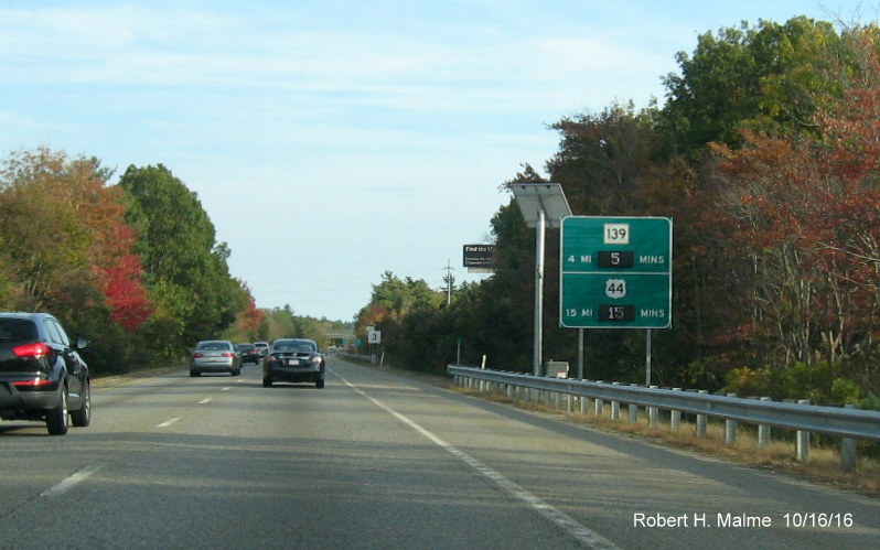
traffic jams:
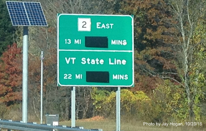
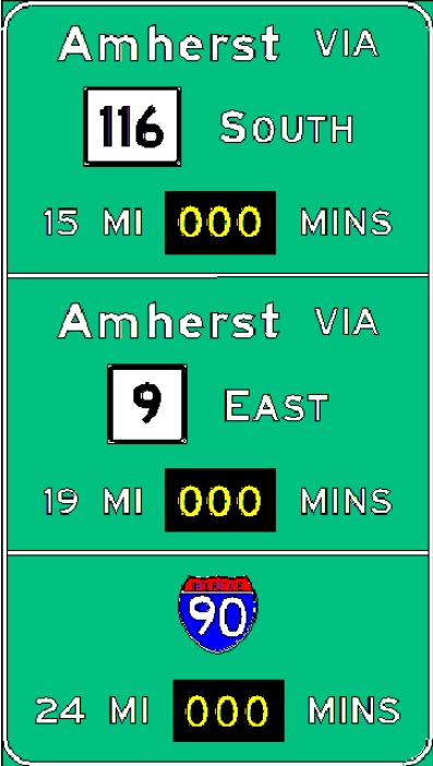
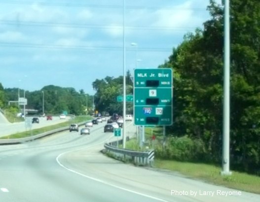
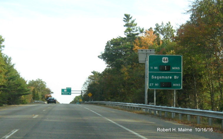
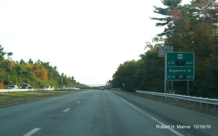
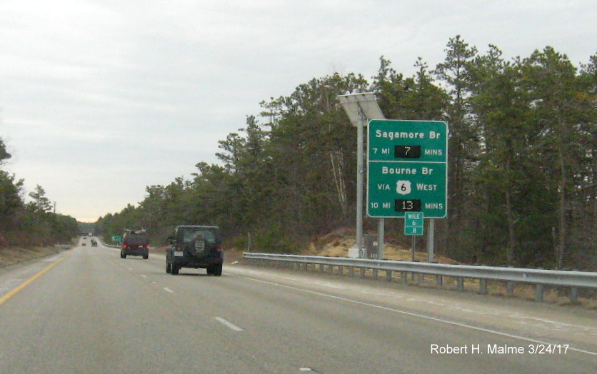
The last sign
southbound, 3 miles from the bridge, also in Plymouth and features both
the same information, it was operational as of July 2016:
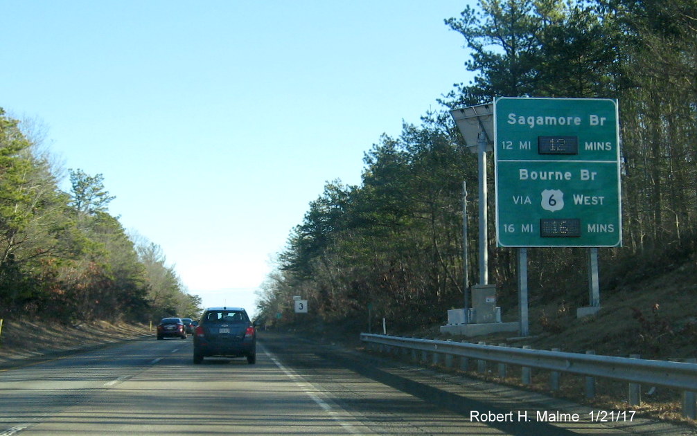
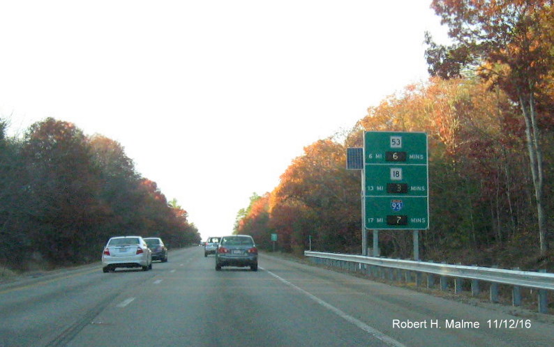
Heading back
northbound, the first RTT sign is just beyond the start of the Pilgrims
Highway in Bourne:
Again, maybe some
towns to go with the shields may make the sign more meaningful to out of
state drivers, as would on the next sign in prior to the MA 3A to 53
Exit in Duxbury (identical to plan):
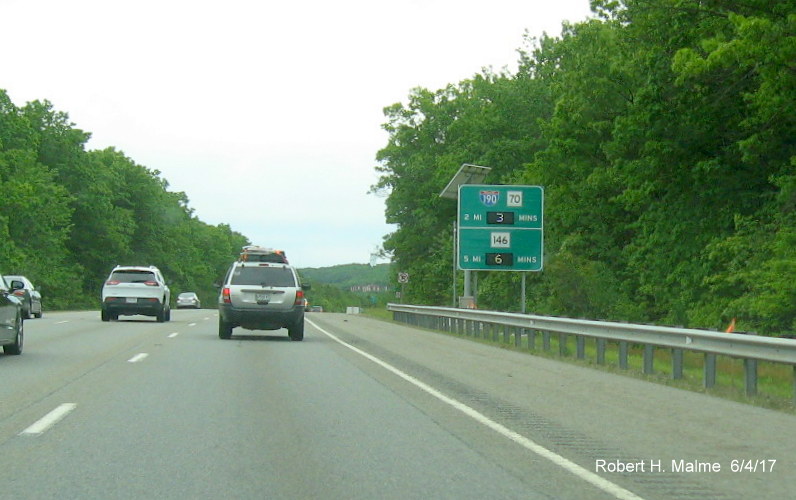
Further north,
still in Duxbury approaching MA 139, is the first RTT sign to mention
I-93 (I-93 readers were activated later, in November 2016):
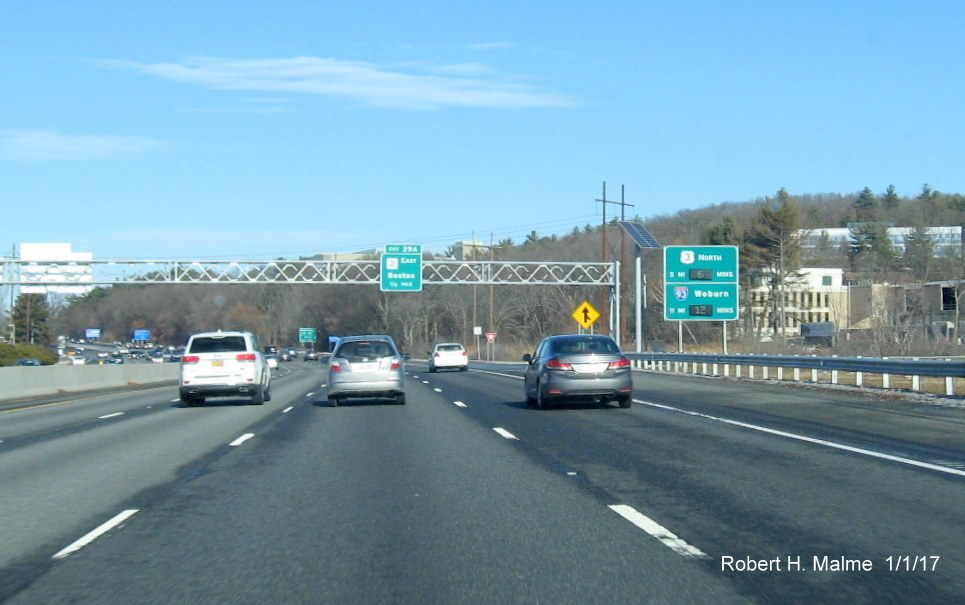
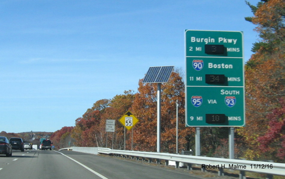
*Entering
Weymouth just beyond the Derby Street interchange, this sign was put up
the week of July 18, 2016 and fully activated with information about
I-93 and I-90 in November:
The addition to
the I-90 shield of Boston indicates the route via I-93 North, since you
could also get to the Mass Pike via I-93 South and I-95. Approaching
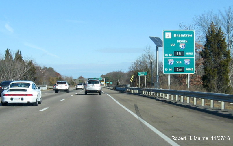
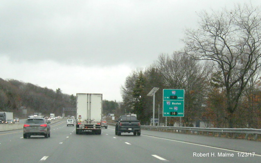
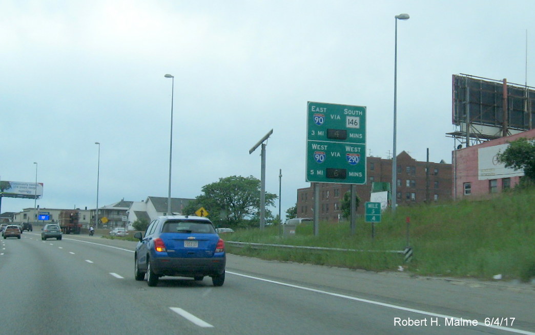
I-93 the last RTT sign is in Braintree, ironically, it doesn't include
the distance to I-93 (probably because the 2-mile advance sign for I-93
is visible from this location), but does have the distance along I-93
South to I-95, this was the last sign installed during the week of
August 15 (like all the other Route 3 signs, the text matches that in
the plan sketches) and fully activated in November:
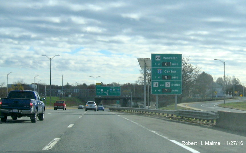
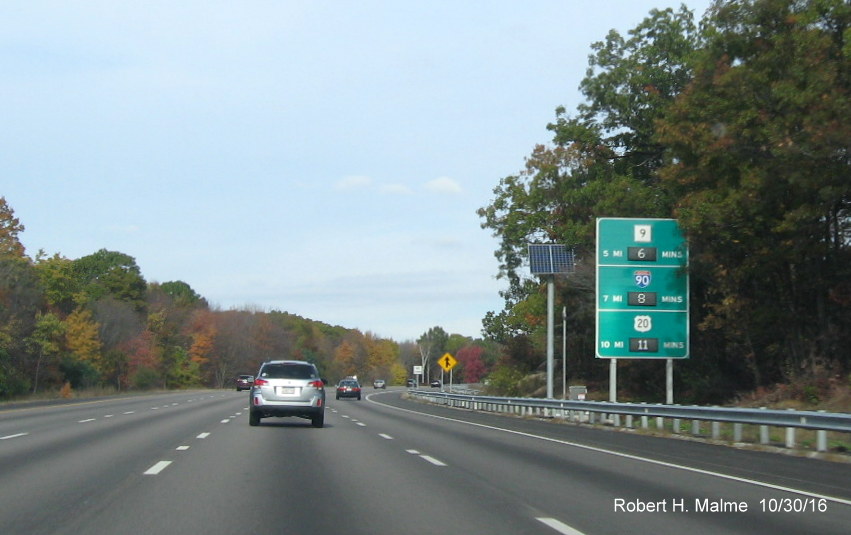
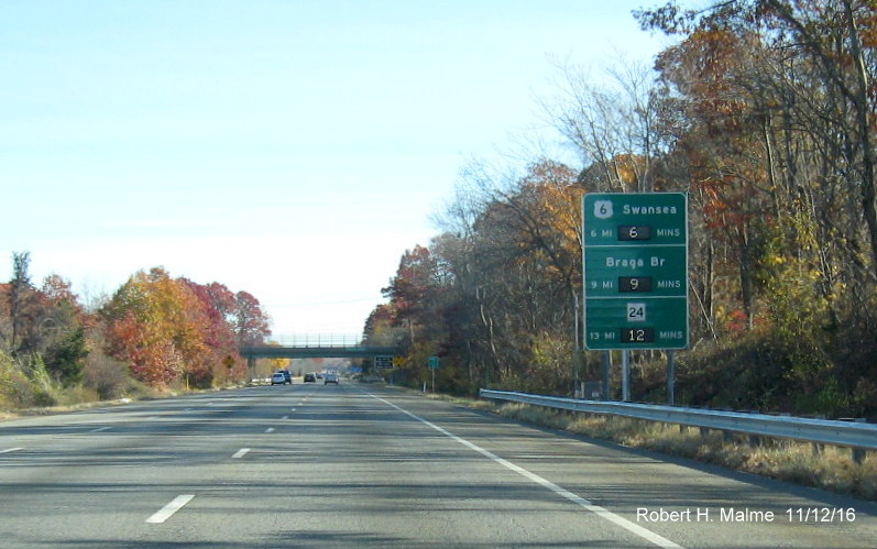
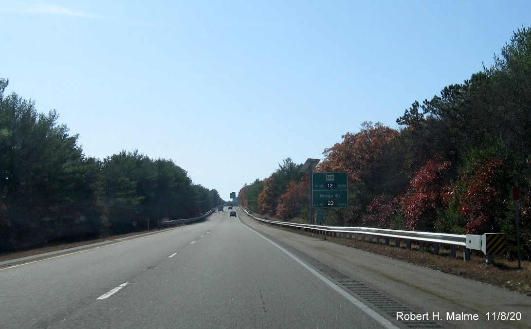
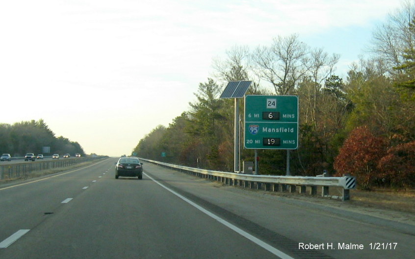
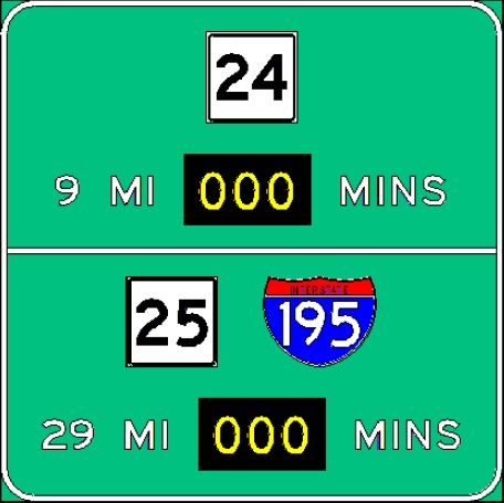
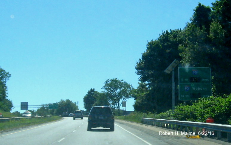
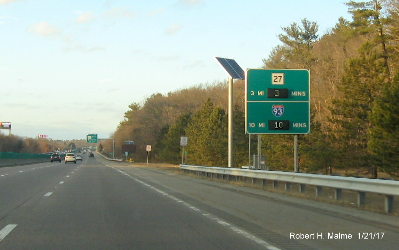
Route 24 [Signs Activated 9/19/16]
Heading south
toward Rhode Island from I-93 the first RTT sign is in Randolph just two
miles after the start of the highway:
The next sign is
in Brockton, prior to the Route 123 interchange:
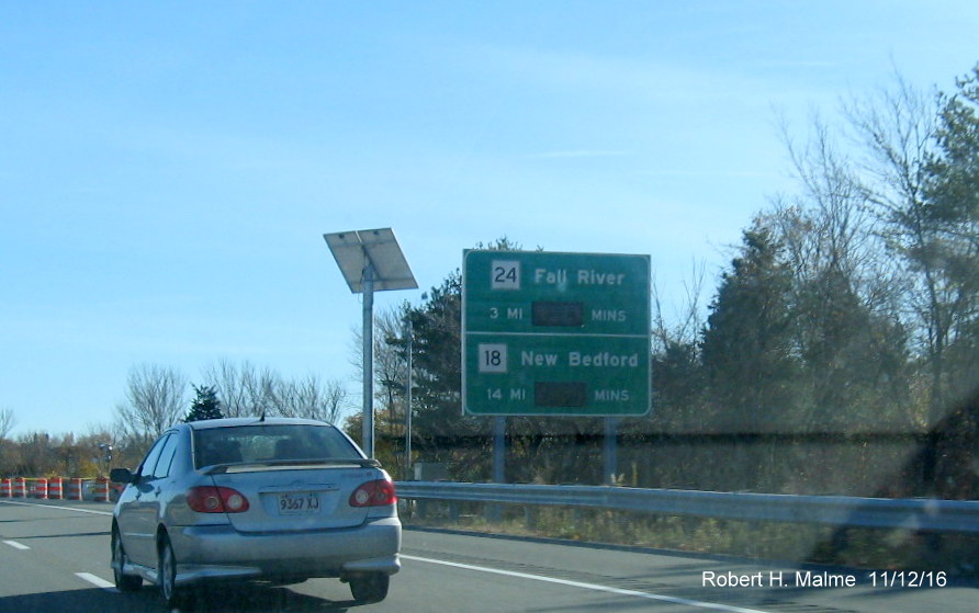
After I-495,
there is another sign in Raynham, for both I-195 and MA 140:
There is also an
additional sign in Berkley which compares the time to the I-195
interchange via Route 24 and Route 79 which are to join in a concurrency
a few miles to the south:

Better
earlier view:
The
Sign Sketch plan had no miles listed for Route 79, presumably due to
the construction project, recently completed, that rebuilt its
interchange with I-195:
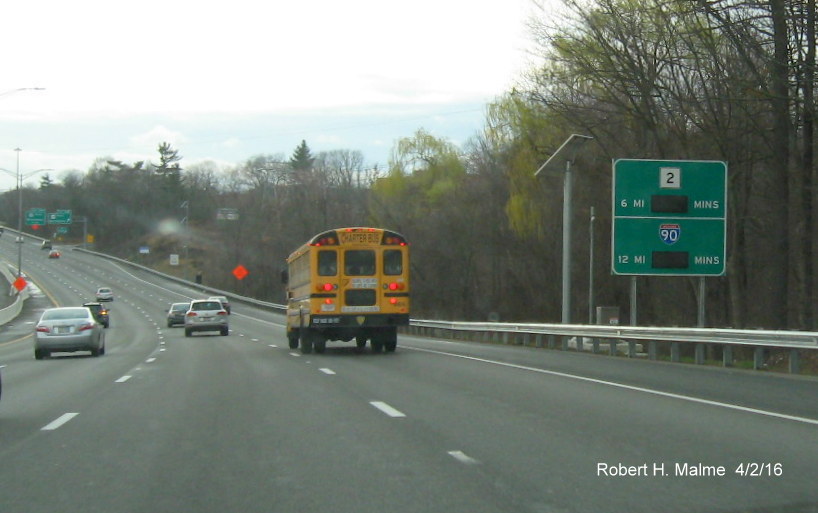
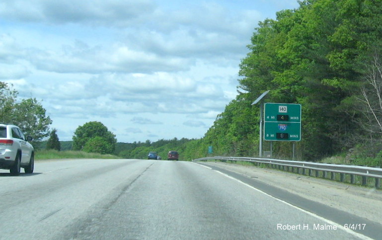
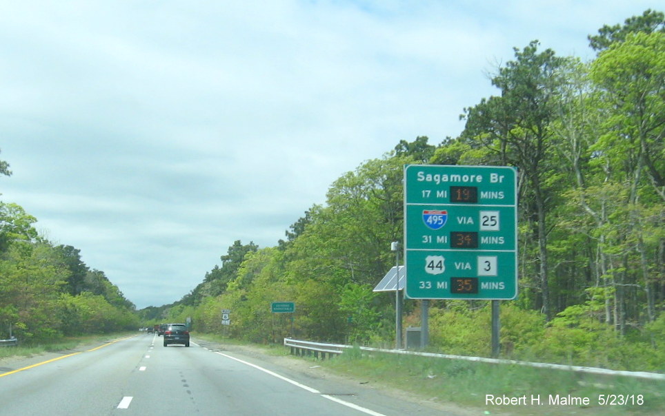
For the MA 79
construction project, a special orange travel time sign was installed a
couple miles north of the Route 79 Exit, still there as of August 2016
(Photo from May 16):
Heading back
north, the first Route 24 RTT sign is in Freetown:
The next sign is
in Raynham prior to the I-495 interchange, with the first reference to
I-93:
The
next sign is in West Bridgewater, with I-93 now 10 miles away:
And another in
Avon referencing times to and on I-93 North, now 5 miles away, though
wouldn't a 'Via I-93 North' for I-90 be appropriate to be consistent?:
The last sign
heading northbound in Randolph has both the times to to I-95 and Route
3:
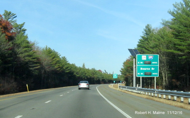
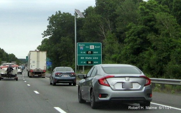
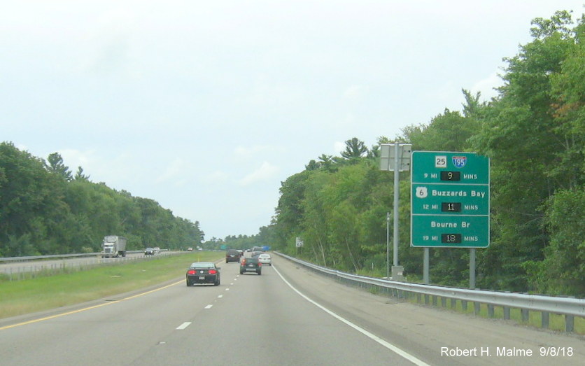
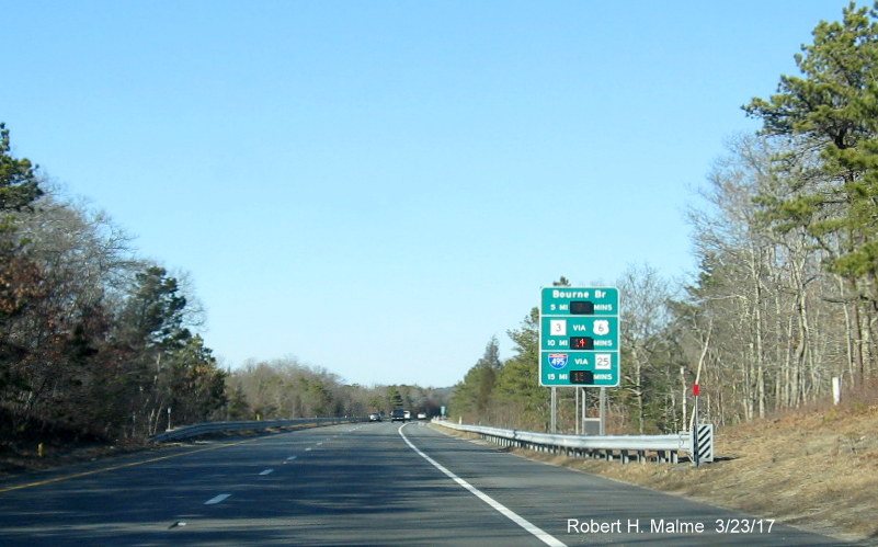
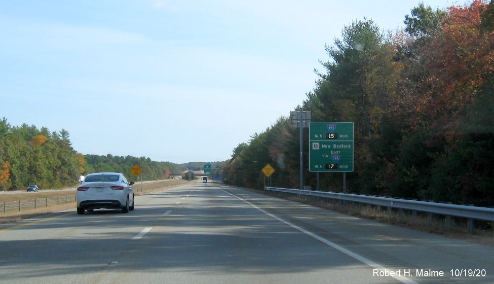
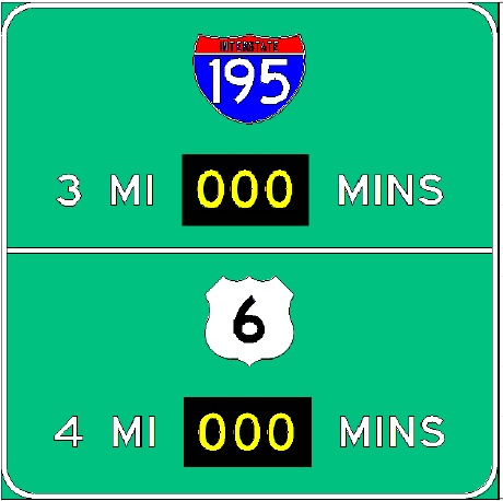
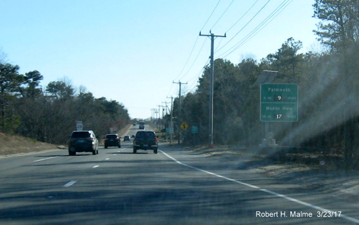
Route 25
There is one RTT
sign placed at the beginning of MA 25 West just over the Bourne Bridge:
Heading back
east, the first sign is just beyond the I-195 and I-495 interchange in
Wareham:
*The second and
final sign is on MA 25 East in Bourne. This was installed in April 2014
as a trial project and activated soon after, it is still there more than
10 years later, photo taken in November 2024:
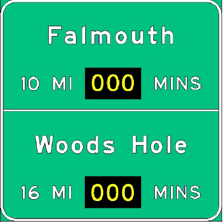
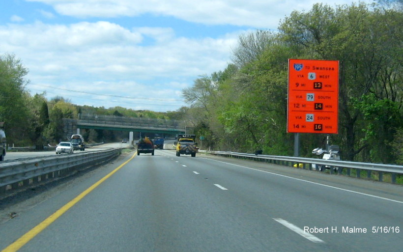
Route 28
There area a pair
of RTT signs along the expressway portion of Route 28 in Bourne,
southbound with the time to Falmouth, and the island ferries:
The distance to
Woods Hole was changed from the original sign plan:
There is also a
sign northbound, not in the original plans which lists the time to the
Bourne Bridge, Route 3 and I-495:
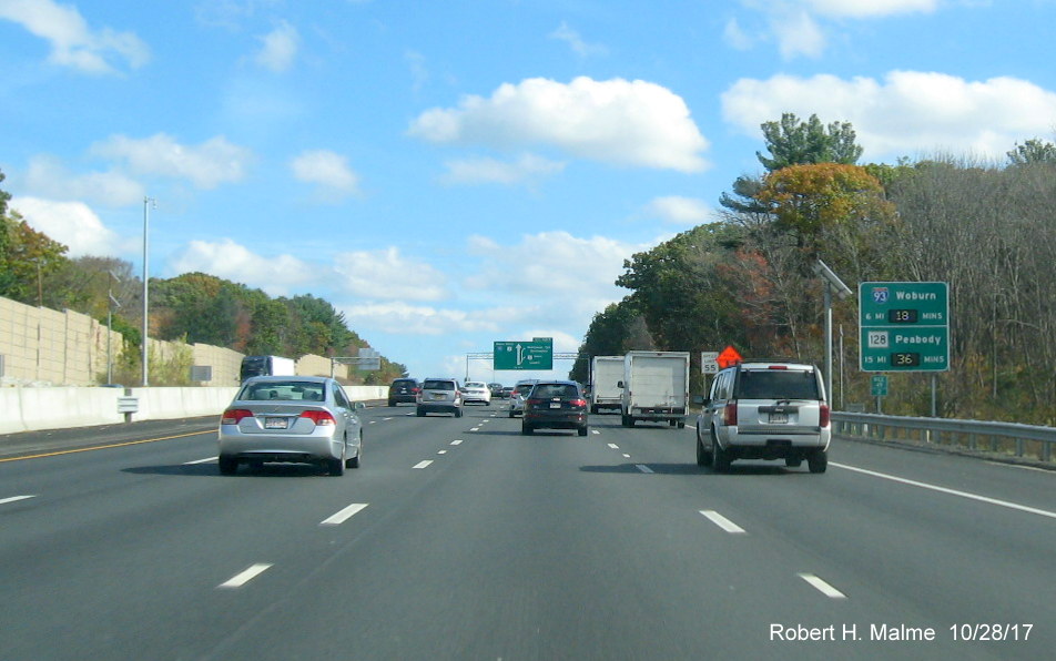
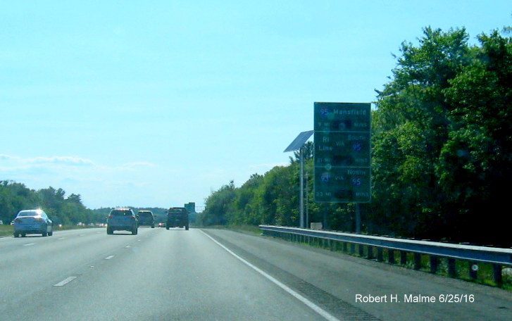
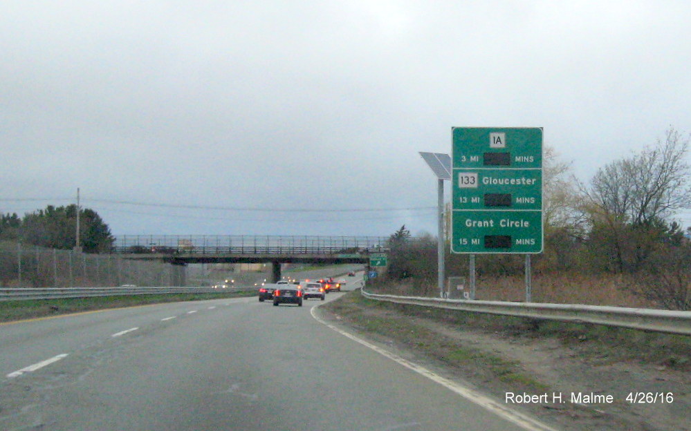
Route 128
The route from
Peabody to Gloucester has three RTT signs that have already been
installed, the one heading northbound includes the time across the
Annisquam River to Grant Circle and is the same as the previously posted
sketch:
The two signs
southbound, one in Essex, after MA 133, seen below, the other in
Beverly, below it, after MA 1A, have the time and distances to I-95 and
I-93 and were partially activated, showing the time to I-95 in June
2016:
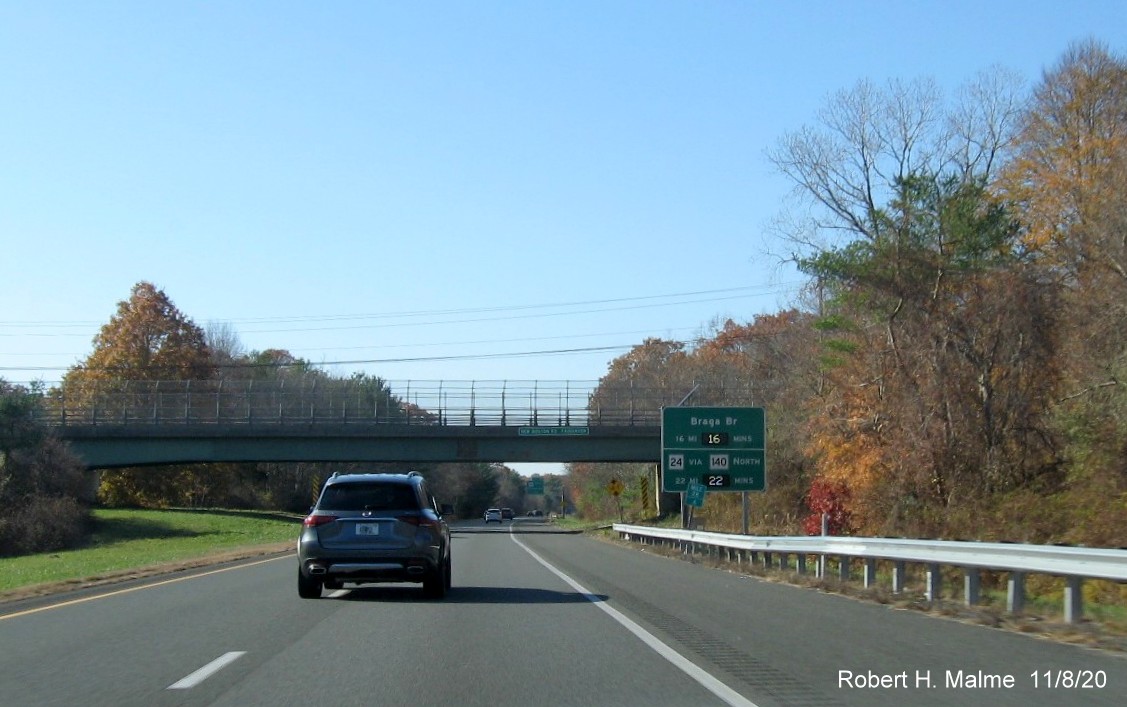
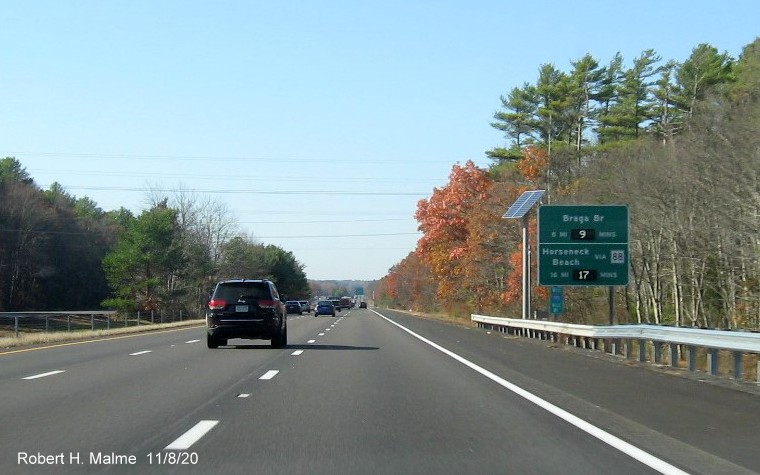
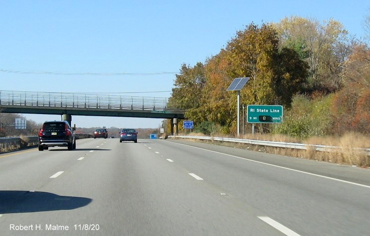
Route 140
There will be
three RTT signs placed along the freeway portion of this route from New
Bedford to MA 24. The only sign northbound will be in Lakeville (this,
like the others are identical to the sketch plans):
*The first
southbound sign will be right after the MA 140 freeway begins in
Taunton:
+The other
southbound sign will be in New Bedford, prior to its reaching the
Interstate 195 interchange:
Feel free to e-mail me any photos you wish to share.
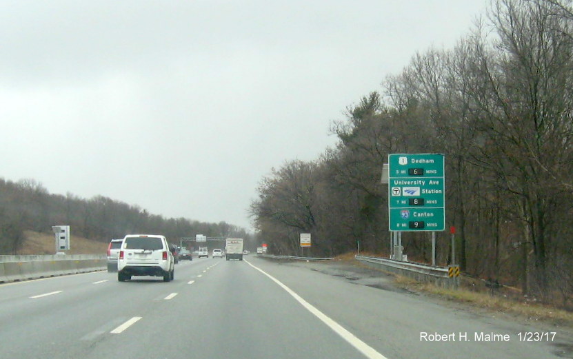
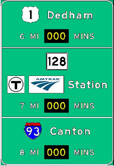
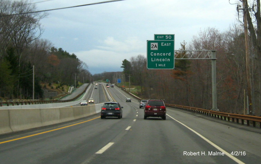
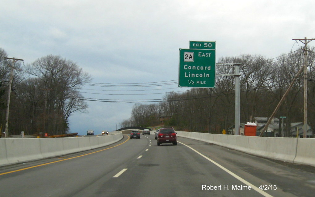
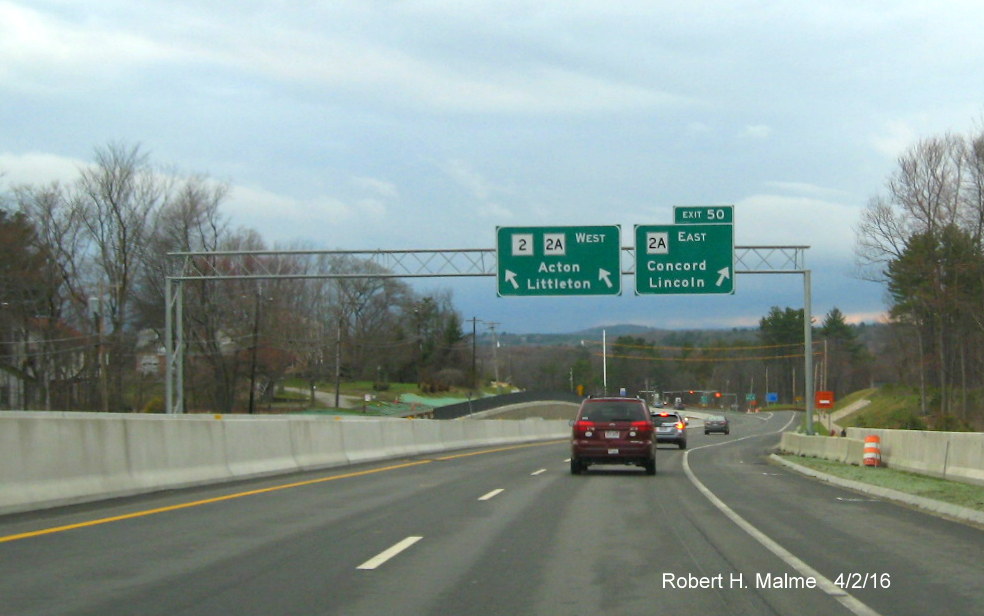
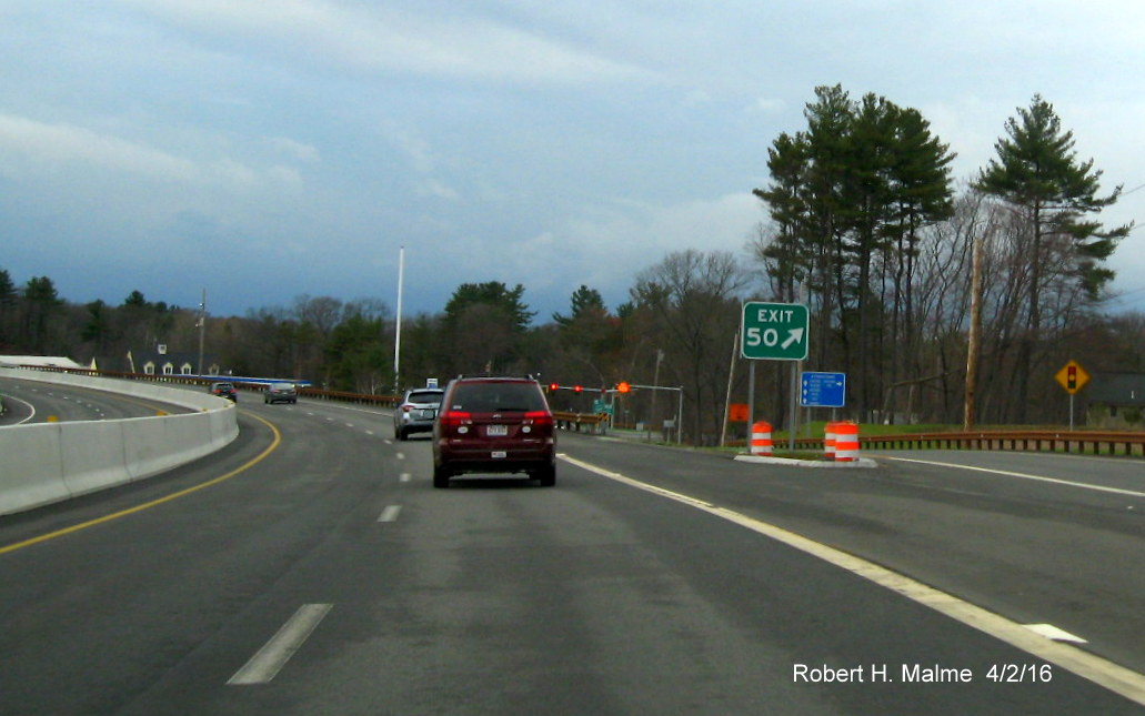
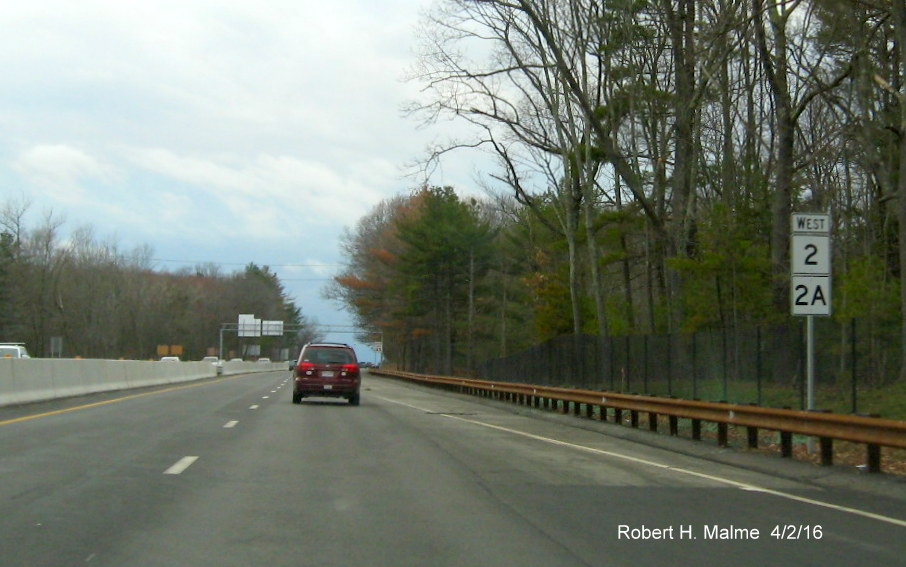
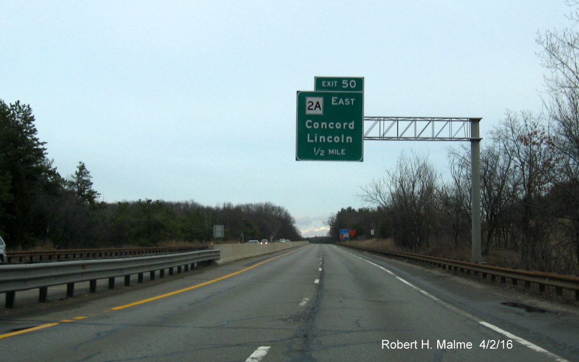
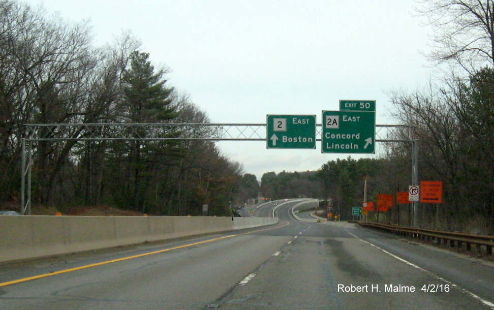
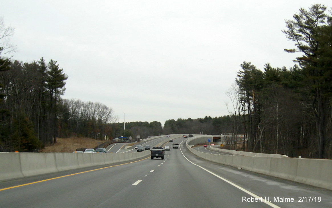
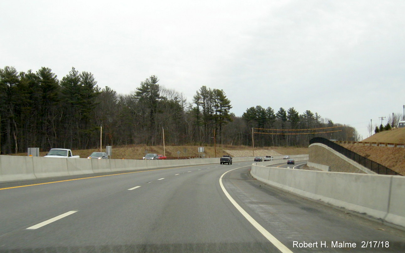
J. Route 2 Crosby's Corner Reconstruction (2/19/18)
In the spring of
2012 MassDOT began a project to rebuild Route 2 between Bedford Road and
Crosby's Corner, a notorious intersection along the highway in Concord.
In June 2015, a new off-ramp was opened westbound at Crosby's Corner
replacing the previous stoplight at the intersection with Route 2A.
Eventually, the entire intersection will be converted into an
interchange in both directions when the project is completed, currently
scheduled to be in the summer of 2016. Here are a few photos heading
both westbound and on Route 2 toward the new interchange, taken shortly
before construction was completed in April 2016:
Heading west, new
overhead signage bearing a new exit number, 50 were put up in late
2015. If the proposed switch to milepost based numbers, planned
for 2016 but postponed, ever happens, this should become Exit 125. The
one-mile advance sign:
Here's the next
sign, at the 1/2 mile mark:
There 's a
complete overhead assembly at the off-ramp itself, the pull through
shows this is one of the few places in Massachusetts where an alternate
route is officially signed with its parent (other routes like 1A and 3A
run concurrently but are not signed):
And here are the
new Exit 50 gore sign as seen from continuing on Route 2 West, this will
become Exit 125 under the new milepost based exit numbering system that
will be installed by 2021:
And here are the
new reassurance marker's showing the official duplex of Routes 2 and 2A:
Turning around at
the MA 126/Walden Pond intersection, the first sign for the new Crosby's
Corner exit is 1/2 mile away:
Like westbound,
the overhead support at the interchange has 2 signs, the Route 2
pull-through has a left-side upward arrow:
Here are several
photos of the reconstructed roadway eastbound following the exit, to see
westbound views, see below.
This is after the
off-ramp to Route 2A:
Heading over the
bridge seen above:
This is at the
end of the new on-ramp from Crosby's Corner:
Here's the view
on the other side of the hill:
The traffic light
in the distance for Bedford Road would be Exit 51 (or 126) if it was
ever turned into an interchange. Some bonus photos of overhead signage
for the next interchange with I-95:
This is the
1-Mile advance sign, placed back in 2012. There are no auxiliary signs
mentioning MA 128 here, though coincidentally this was proposed to be
Exit 128 under the Milepost Exit Numbering System that was to start
sometime in 2016, but is now indefinitely postponed. Here's the 1/2 mile
advance sign for I-95 South, the Attleboro destination or control city
is not consistent with other exit signage along I-95 in the area that
lists Providence, RI:
Same sign back in
2016 when the Route 2 bridge over I-95/128 was under construction:
The orange
construction sign refers to work on a project that is replacing the
Route 2 bridges over I-95/128. A closer view of the work zone:
The Spring Street
1-Mile advance sign is the last overhead sign before the work area. All
the other overheads were temporarily removed and replaced by orange
ground-mounted signs:
Here's the
appearance of the interchange after work was completed in the summer of
2016:
For some reason
(better visibility?) the Route 128 shield was replaced with a larger one
in 2017. Here was the 2016 version:
Previous Photos
-- taken
on July, 5, 2015:
East
of Crosby's Corner work has concentrated on expanding the roadbed and
adding new stone retaining walls, the first are along the eastbound
side.
Work
is almost complete on the new stone wall westbound 1/4 mile from
Crosby's Corner. Here's a closer view:
Closer to Crosby's Corner there is
evidence of much more work needing to be done:
The
sign in the distance is a temporary exit sign for the new MA 2A
off-ramp. Which, a closer look reveals...
Has
an exit number, 50. This will partially fill in a gap in Route 2 exit
numbers in this area. The last interchange to the East, I-95/MA 128, is
Exit 52, which, coincidentally, should have been Exit 128 when
Massachusetts adopted the federally mandated milepost referencing system
in 2021, however, to reduce the number of exits requiring letters to the
east, they have given it the number 127. The Concord exit will be 125.
K. Sign Goofs
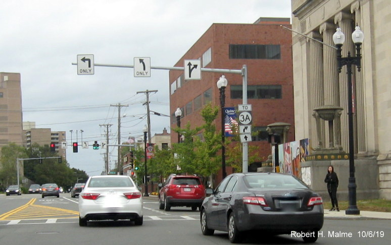
This goof has been around for a few years on Hancock Street in
Quincy Center. The arrows are correct, if not confusing, as you can get to 3A either going straight of right:
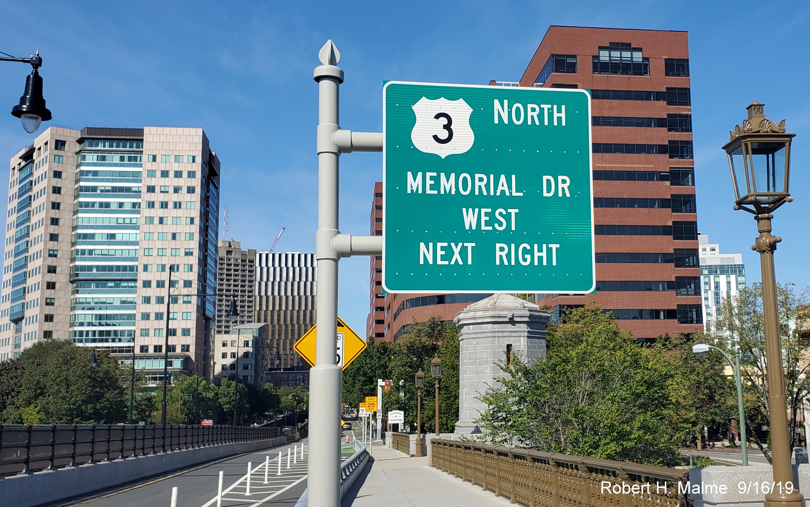
This new guide sign appeared with the completion of the multi-year
project rehabilitating the Longfellow Bridge between Boston and and Cambridge which is part of Route 3 in the summer of 2019.
As you see the eastern part of Memorial Drive has been upgraded:
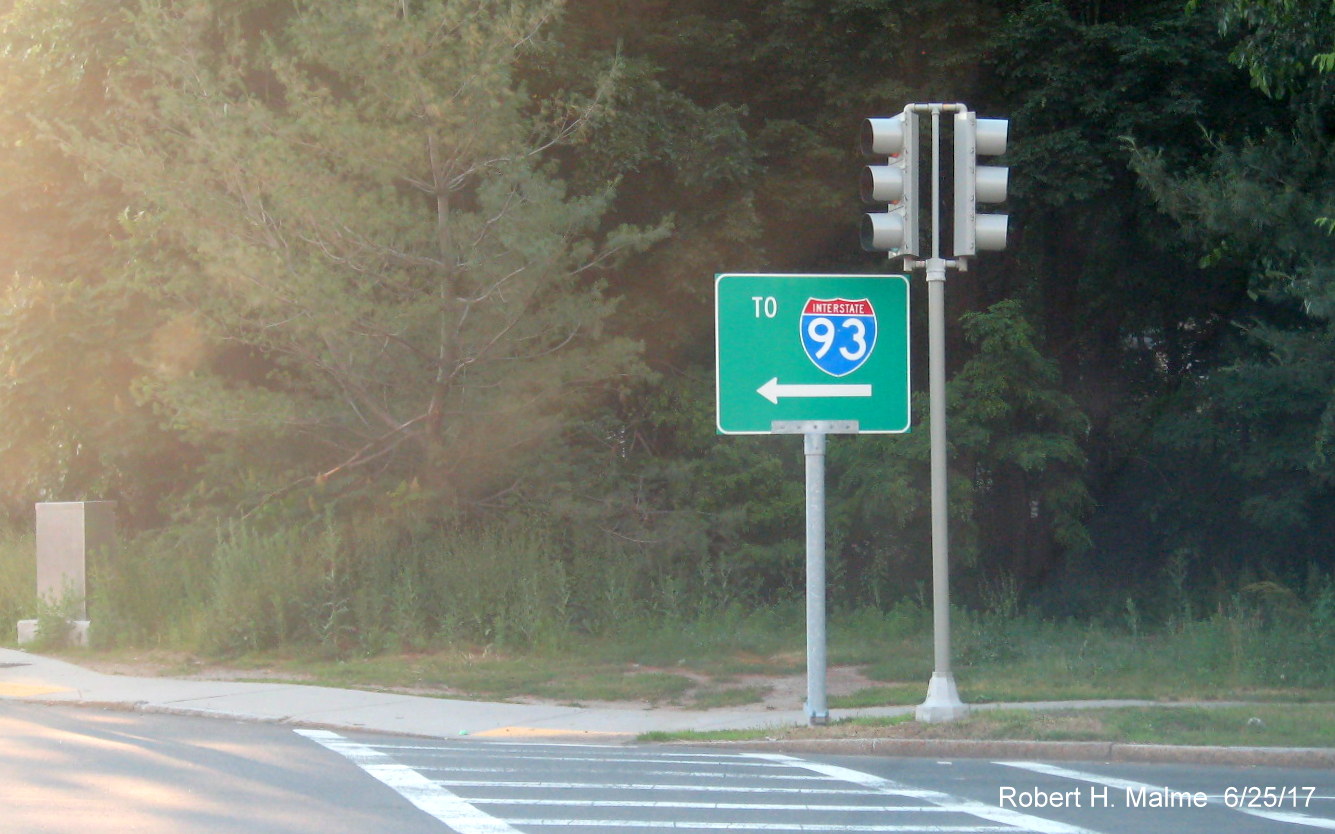
This sign
appeared in Quincy at the corner of Furnace Brook Parkway and Adams
Street in June 2017. While technically correct, if you turn left you
will eventually get to I-93 South which takes you to the beginning of
Route 128 in Canton, this sign replaced an older smaller To 128 sign
that dated to the time that route ended in Braintree (before 1989). This should say 'To I-93' or 'To I-93/US 1':
Once this photo
was posted on Facebook and on AARoads.com Forum, a MassDOT sign engineer saw it and asked it be changed to 'To I-93', this
change was made on June 23, 2017:
Here's a couple
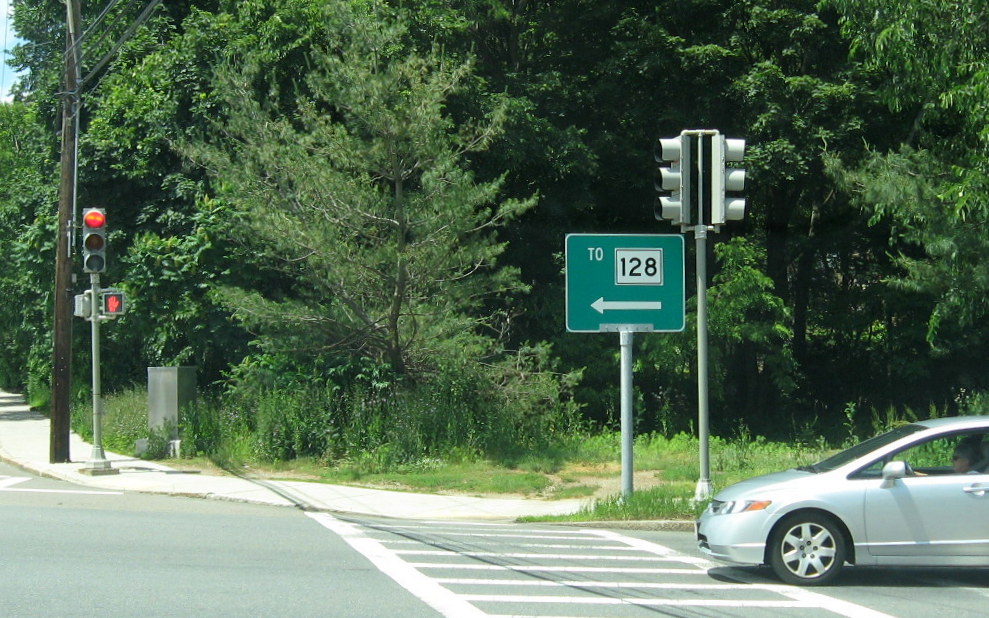
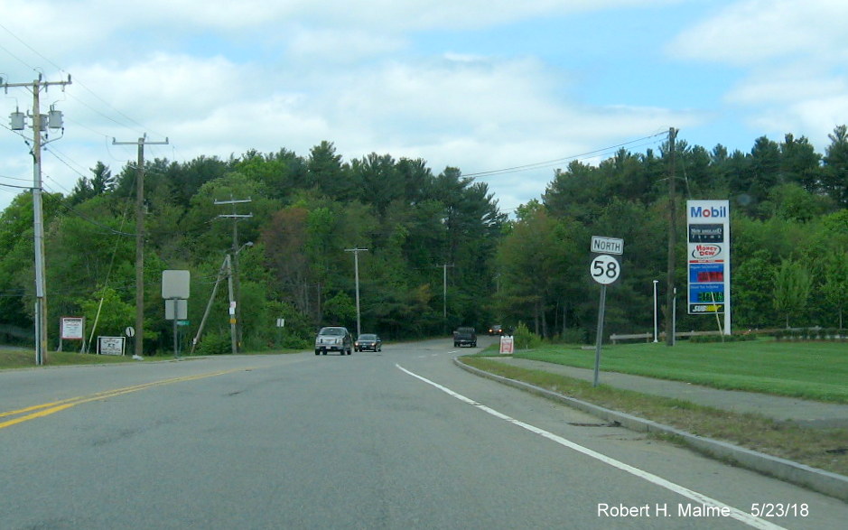
goofs found near the Route 58 interchange with US 44 in Carver. First heading southbound:
Apparently they had some extra shields in New Jersey or Delaware.
Turning around
and heading back toward US 44, drivers see this pair of relatively new guide signs:
Someone forgot to
check whether there is a MA 44. This same error is also at the signs at the intersection ahead:
NEW-Beyond the US
44 interchange there is also a circle 58 sign as well:
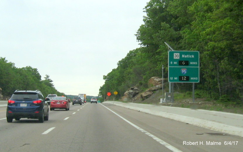
Earlier, from
10/30/16 showing a little mix up in a guide sign on Route 30 East in Weston:
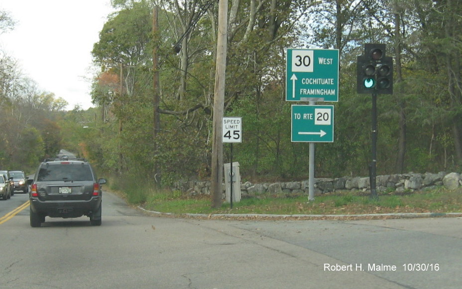
From 10/16/16:
This second US 3 shield has appeared on Route 3 South in Duxbury, after
the first Route 3A Exit, however it was changed to a MA 3 shield in late November:
The previous shield which has been US 3 for several years was also replaced at the same time:

Here's a new Exit sign that has appeared
along Soldiers Field Road westbound in Boston for the Harvard Square Exit in July 2014:
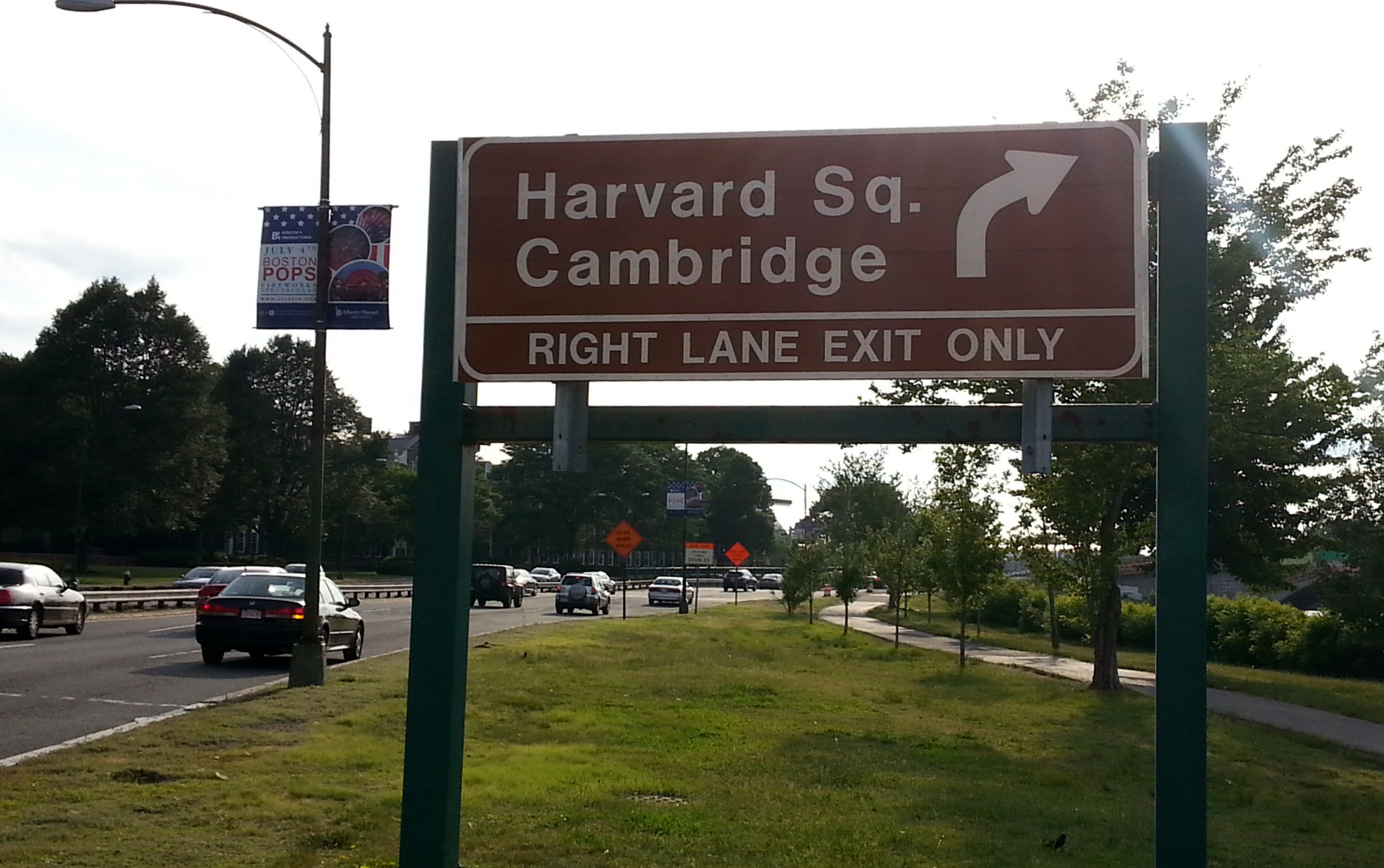
It replaced a former green sign with
similar information. Is Harvard Square so much of an attraction that it deserves a brown sign now?
A Fixed Sign Goof Along Forbes Road in
Braintree. Look at these 2 official MassDOT Guide Signs as they appeared in June 2013:
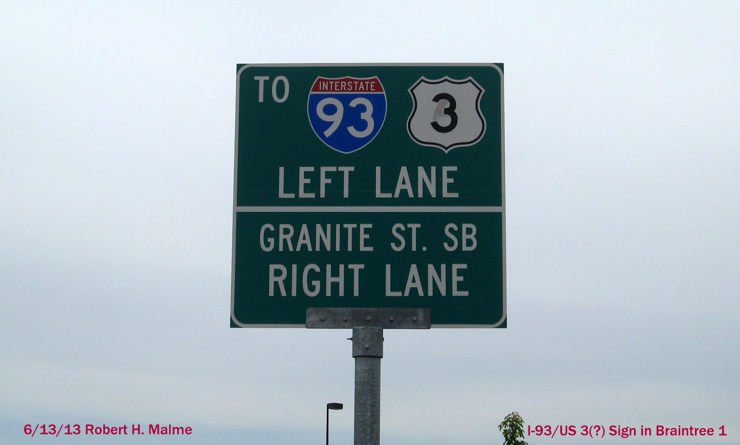
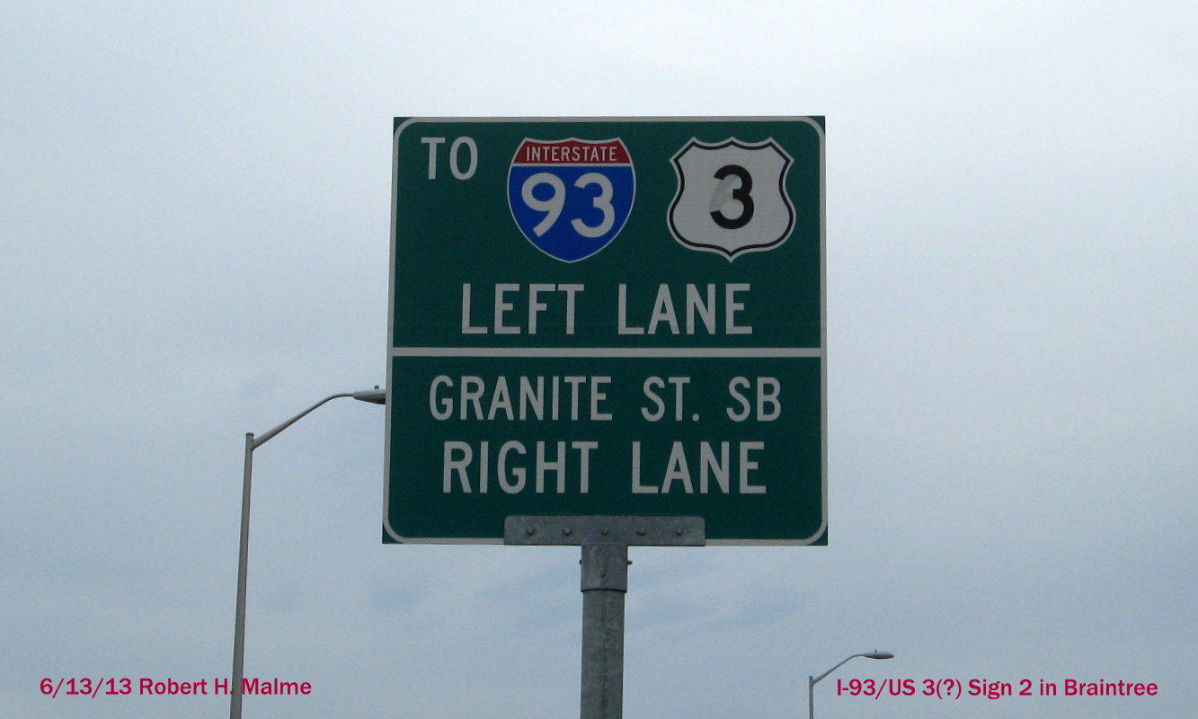
Both US shields seem to originally had a 6 in them, then overwritten with 3. They are getting warmer, I guess.
Here's what was on the back of the first sign:
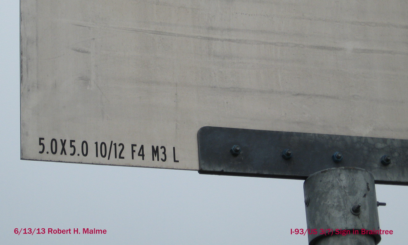
These lead to the intersection between Forbes Rd, Granite Ave. (MA 37)
and the first South Shore Plaza access Road. The Guide signs there are
older and indicate a turn left onto Granite Street or take MA 37 to the
right.
Update
11/24: Looks like someone noticed the error, and the signs were fixed.
Here's the new version of the second sign above: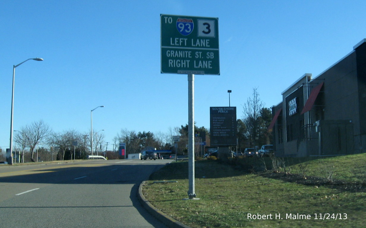
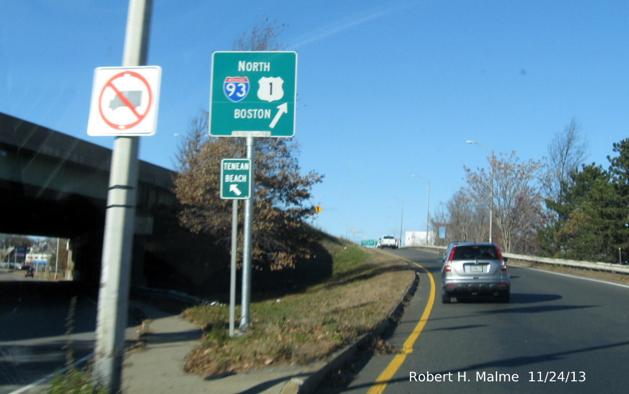
Here's a New and Correct Guide Sign in Boston. Part of the I-93 Signing
Project. This is at the on-ramp from Neponset Circle to the Southeast Expressway Northbound:
From August 2013 (Updated in April 2014):
 Or Not ; That is the Question...Apparently Not
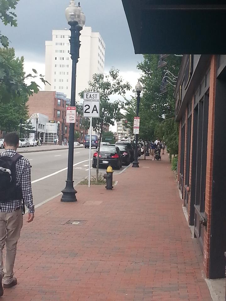
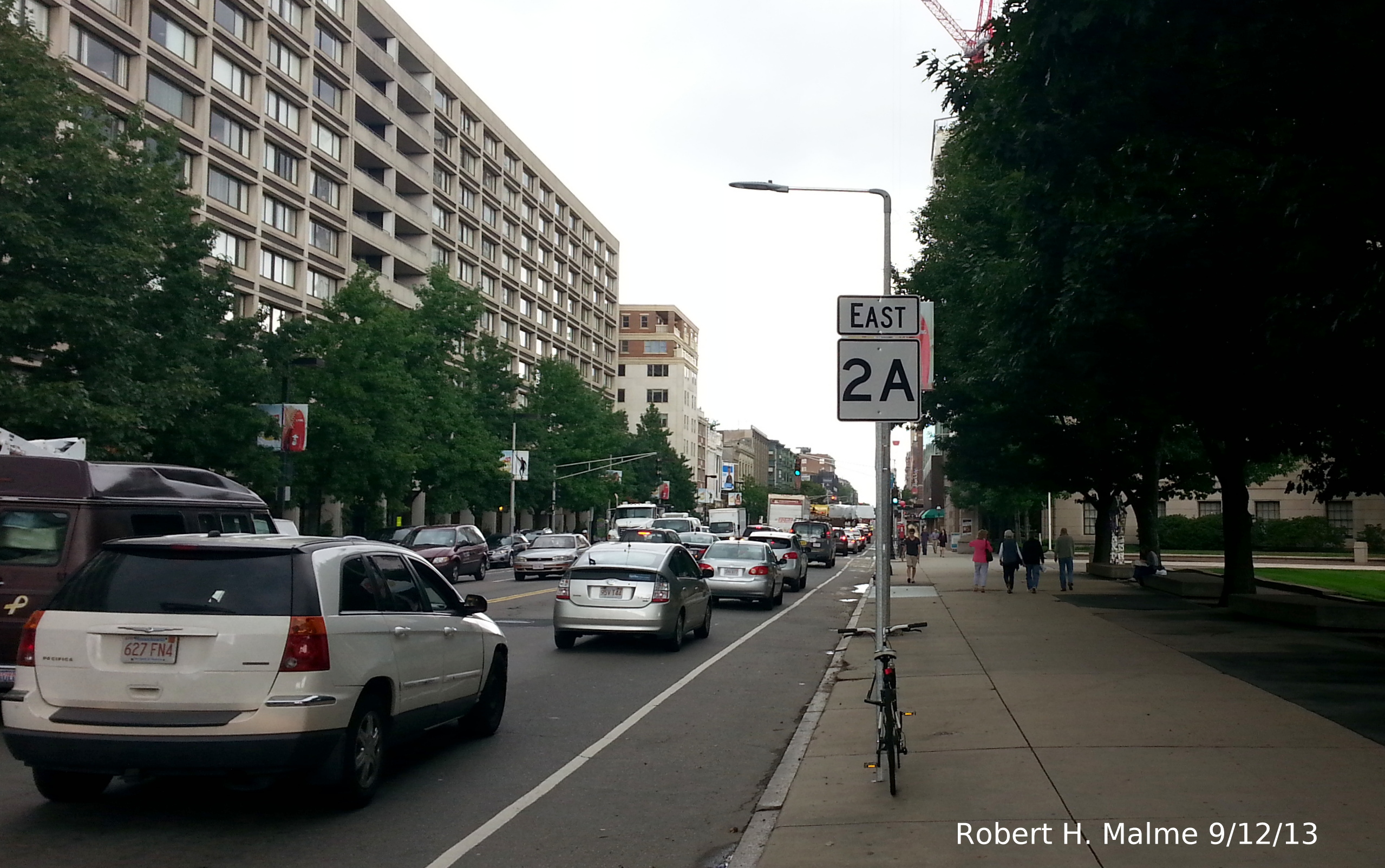
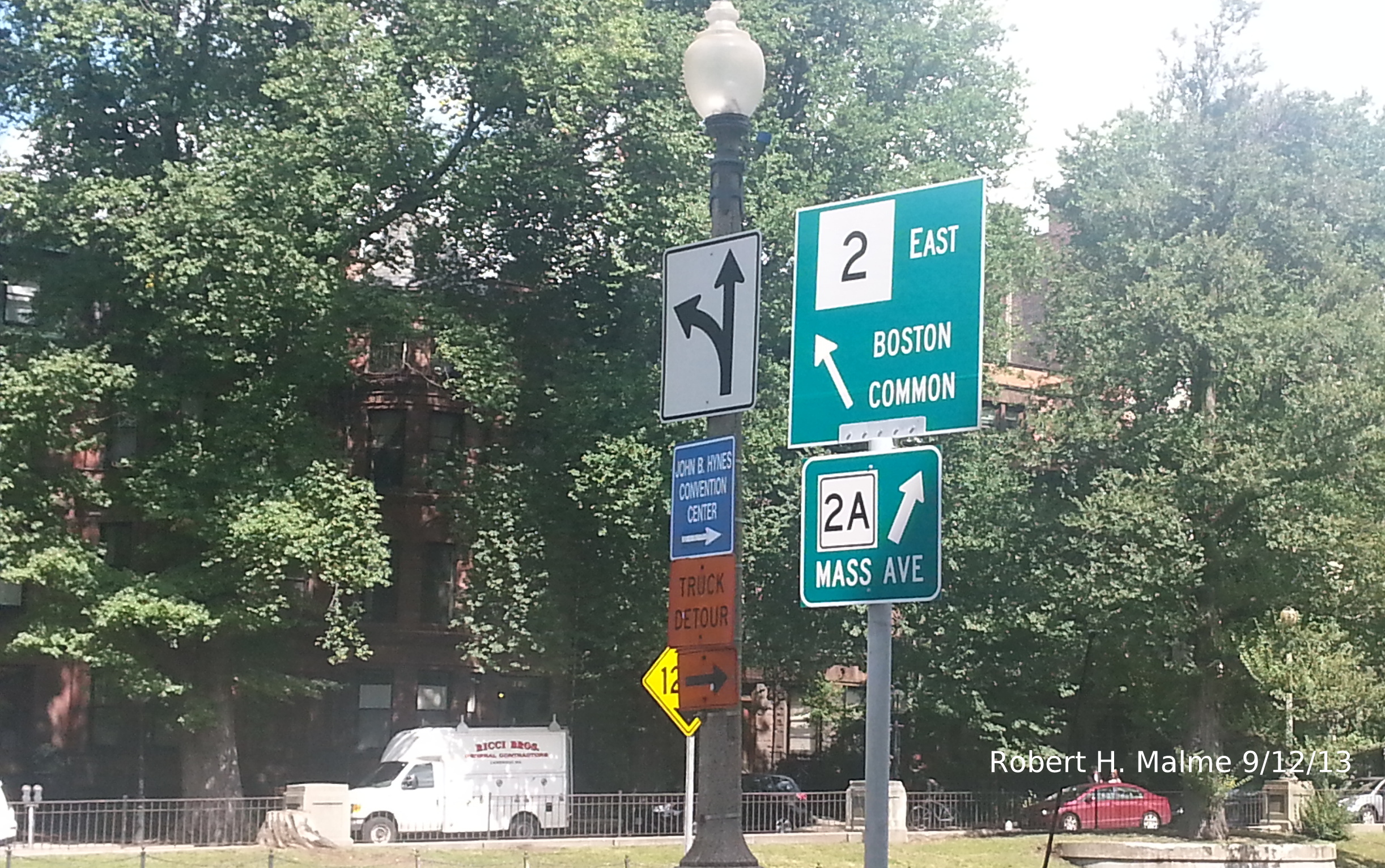
Starting
in the Spring of 2013 new routes signs started appearing throughout
Boston, some along their designated routes and intersecting roadways
throughout the city, and some not. During the summer, for example, new
Route 2A signs were put up along Massachusetts Avenue in Boston east
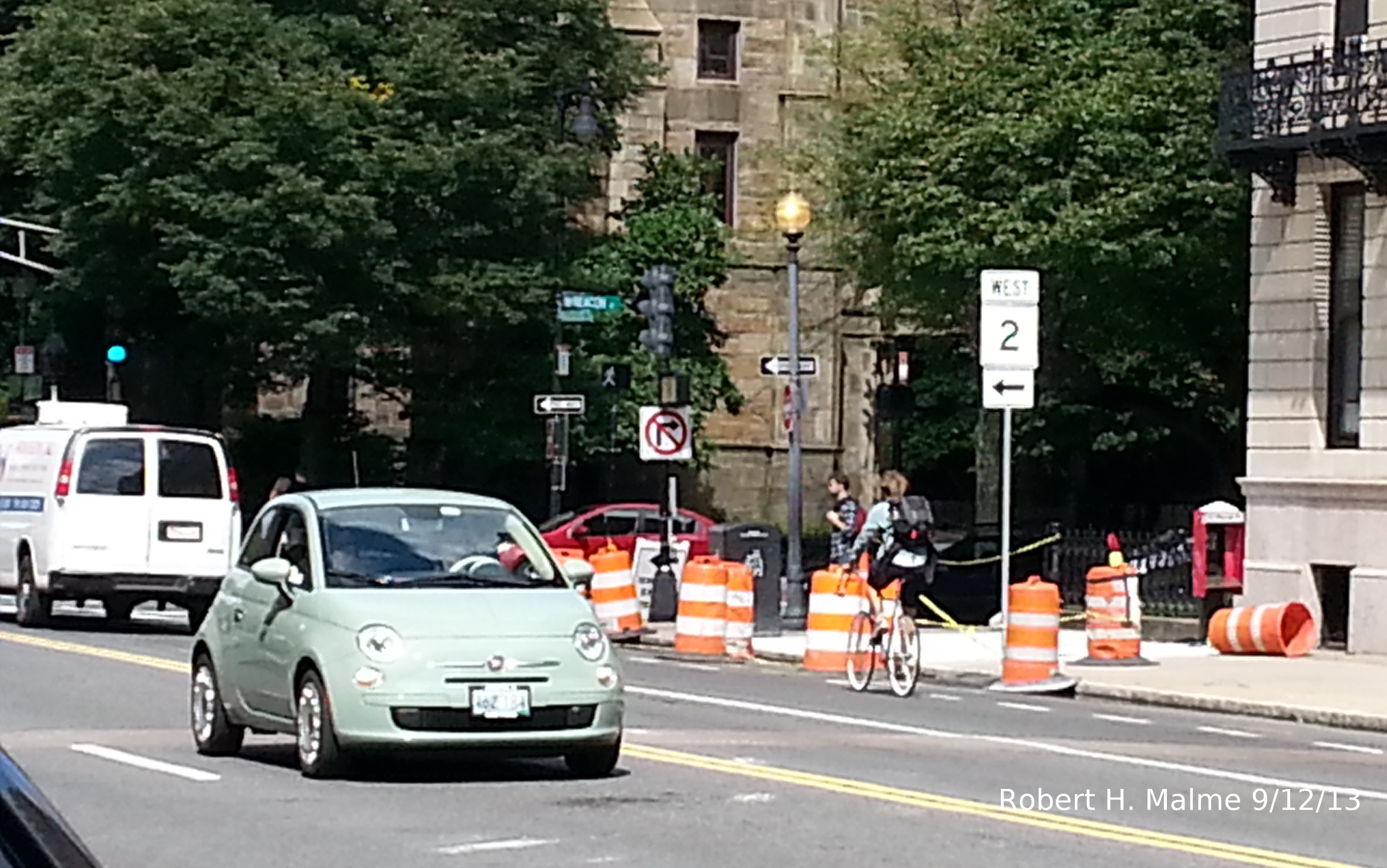
of where that route has officially ended, at Route 2, Commonwealth Avenue.
Here's
an example of one of the signs along Mass Ave headed toward the Boston
Medical Center Area just beyond Tremont Street:
And
here's one headed the other direction...
This
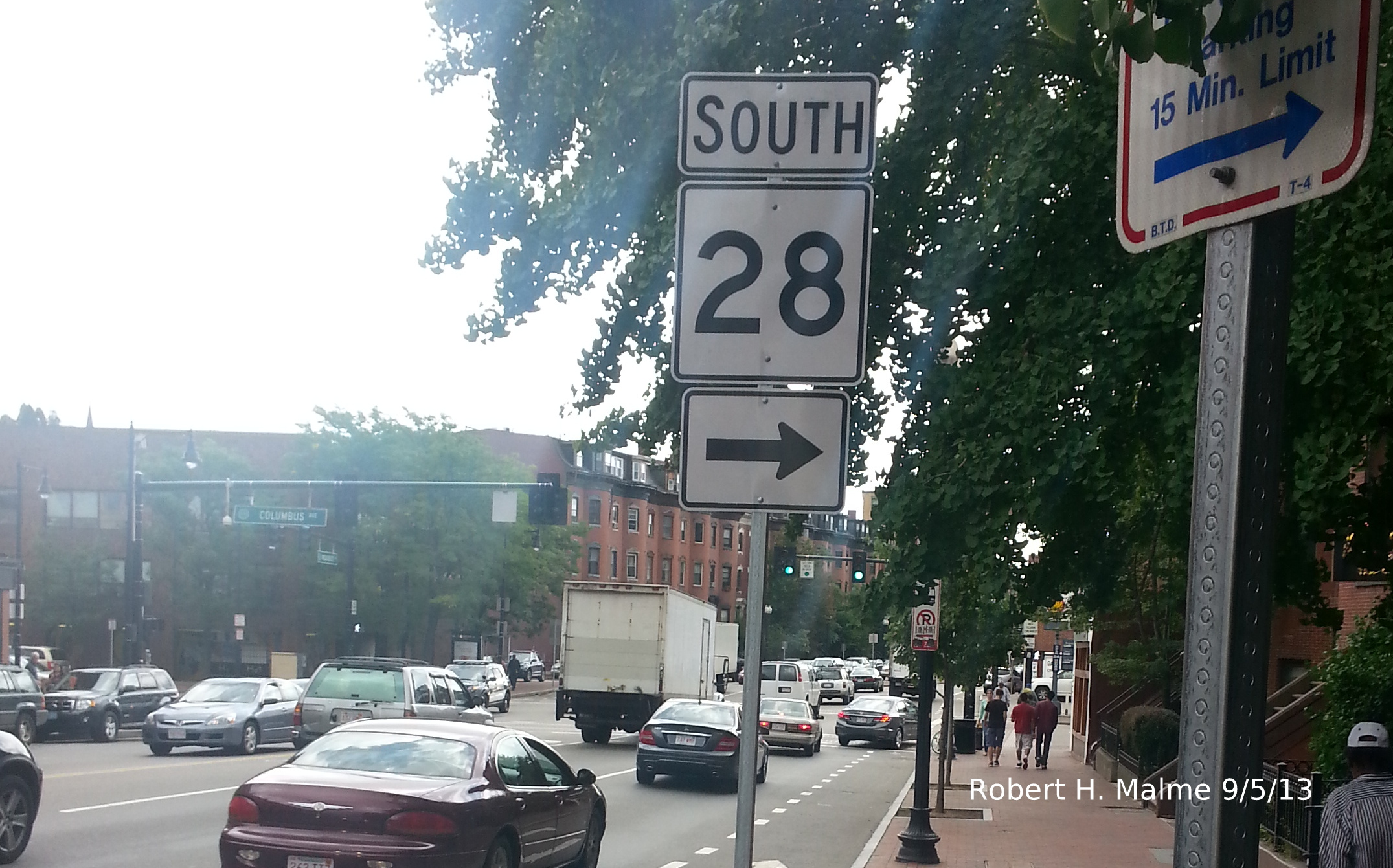
one is between Columbus Avenue (MA 28) and Huntington Ave (MA 9). Both
photos taken in early September 2013. Both of these signs are more
than 1/2 mile East from Commonwealth/Route 2. The other thing wrong
with these signs are the directional banners, they are 180 degrees
off. East 2A should be West, and vice versa. The same problem occurs
with all the other signs put up at the same time in the area...
This
sign is further west along Mass Ave between Huntington Avenue and Boylston Street by the Christian Science
Church Headquarters.
The
wrong directions also apply to signs on intersecting roadways. Here
are the signs along Tremont Street at Mass Ave.:
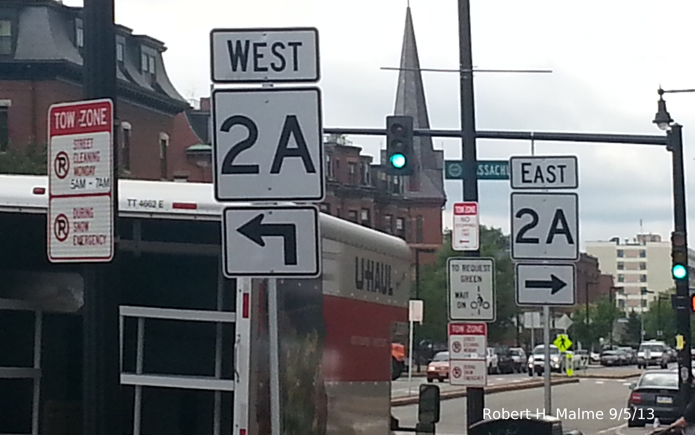
Wrong
directional banners are also a problem with other route signs put up at the same time:
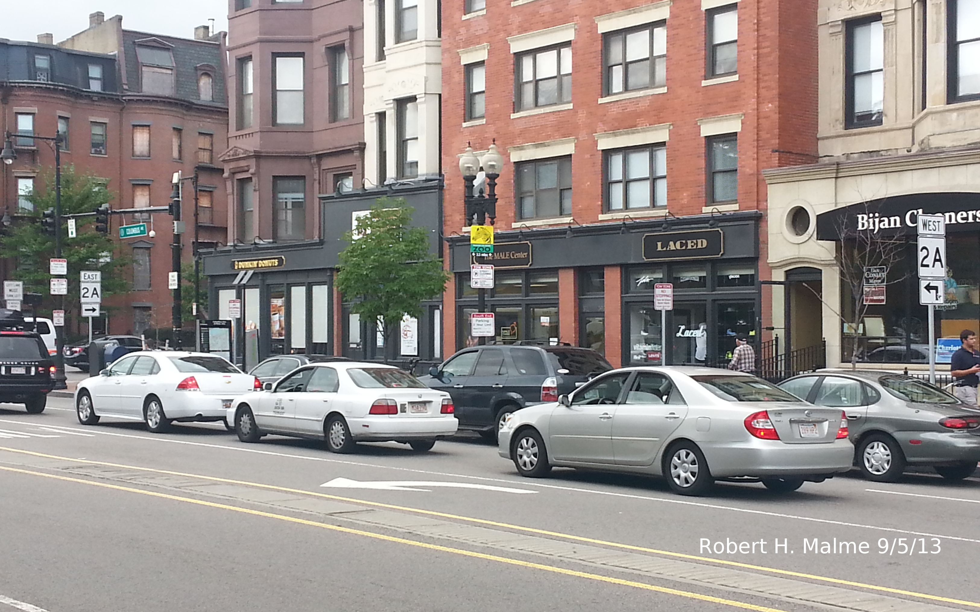
This
is a Route 28 West Sign on Tremont St prior to the Route 2A signs seen
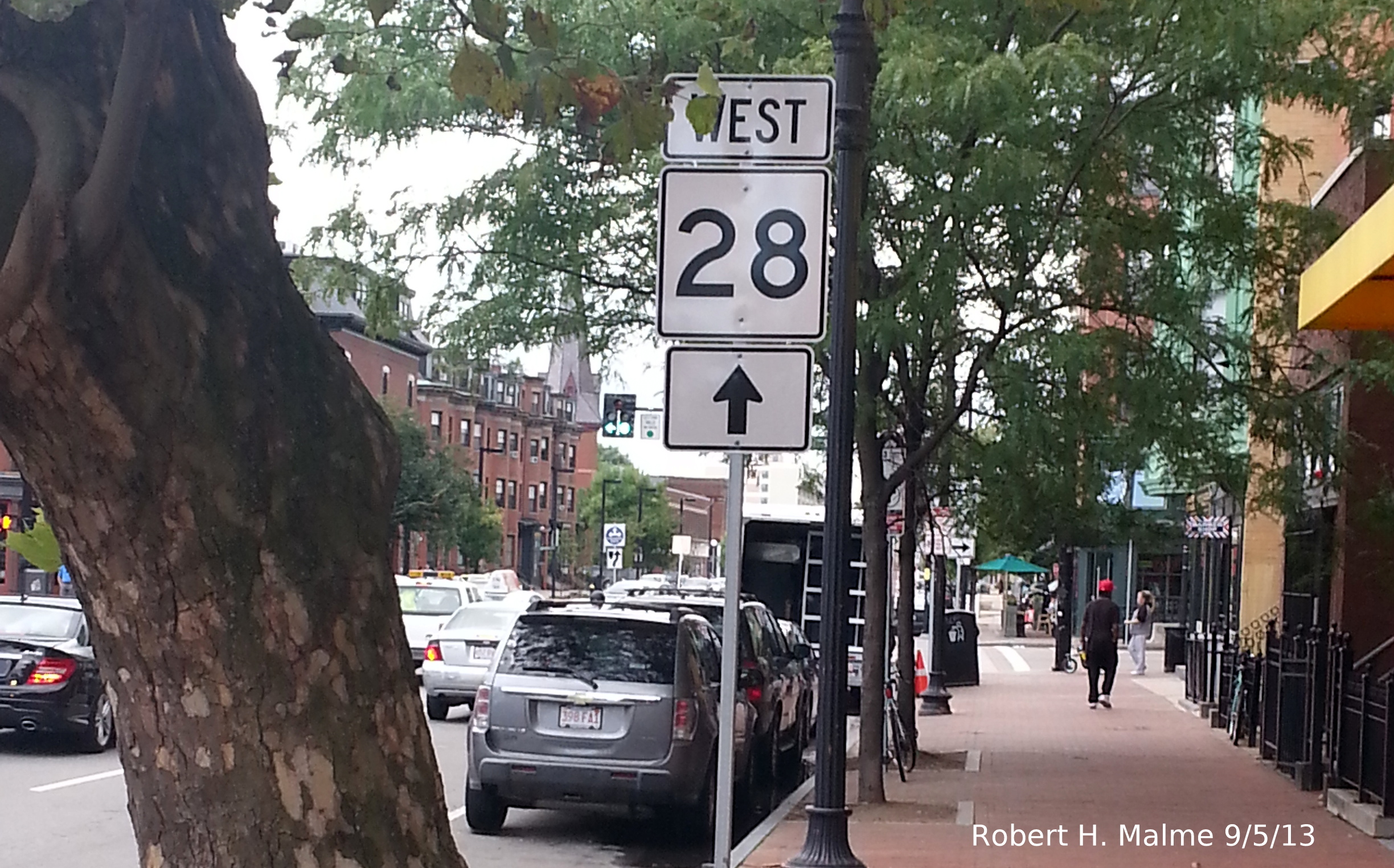
above. First of all, MA 28 runs along Columbus Avenue one block to the
west, and second, it is a north/south route. Curiously, the Route 28 signs put up along Mass Ave are correct.
Here's one approaching Columbus Ave from the west...
However,
headed on Columbus Ave, you again see directionally challenged Route 2A signs...
To
head toward Cambridge and points west you must follow the signs for Route 2A East.
Curiously
though two blocks east on Mass Ave at Huntington Ave (MA 9) there is no
Route 2A signage and the new Route 9 signage is correct:
A week later I
checked out the signage at the still official end of Route 2A at the intersection of Mass Ave and Commonwealth Ave
(Route 2)...
While
there are no new Route 2A shields at this intersection, a couple new Mass. Guide Signs (MGSs) had been placed
along the ramp from Commonwealth Ave (Route 2) East to Mass. Ave.:
There
is no matching Route 2A East Guide Sign to Imply the Route has been extended East. There is also a new smaller
guide sign for Route 2A along Commonwealth at the off-ramp:
Though
the Guide Signs are correct, this does not extend to the new route
markers in the area. The first Route 2A signage on what its official route west of Mass Ave has the same problem
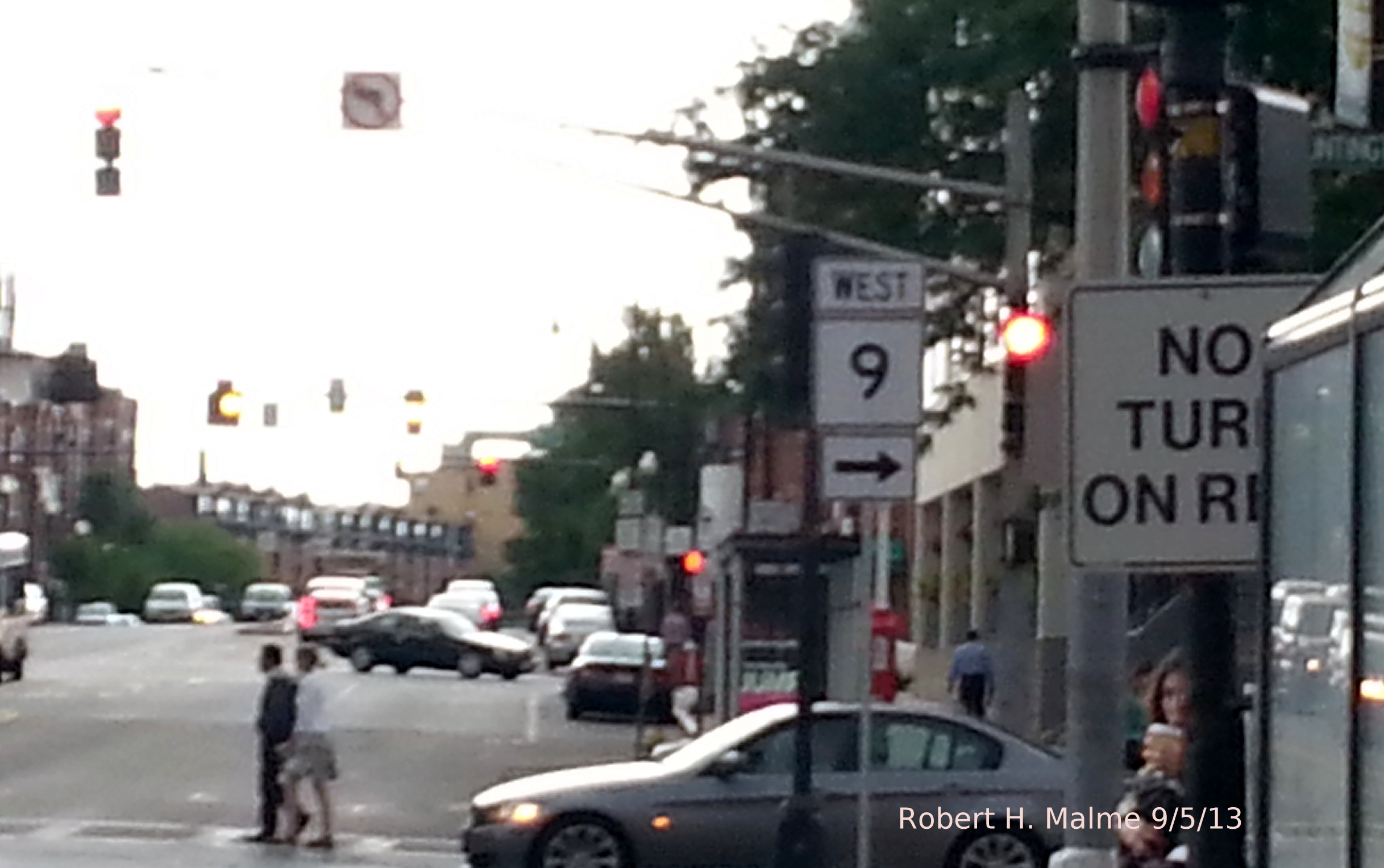
as the others, a wrong directional banner:
That
should be west. Also a new sign was put up east of Commonwealth at the
Mass Ave intersection with Boylston Street. Only one direction here, but
its the wrong one. If you want to go to Cambridge you need to turn left:
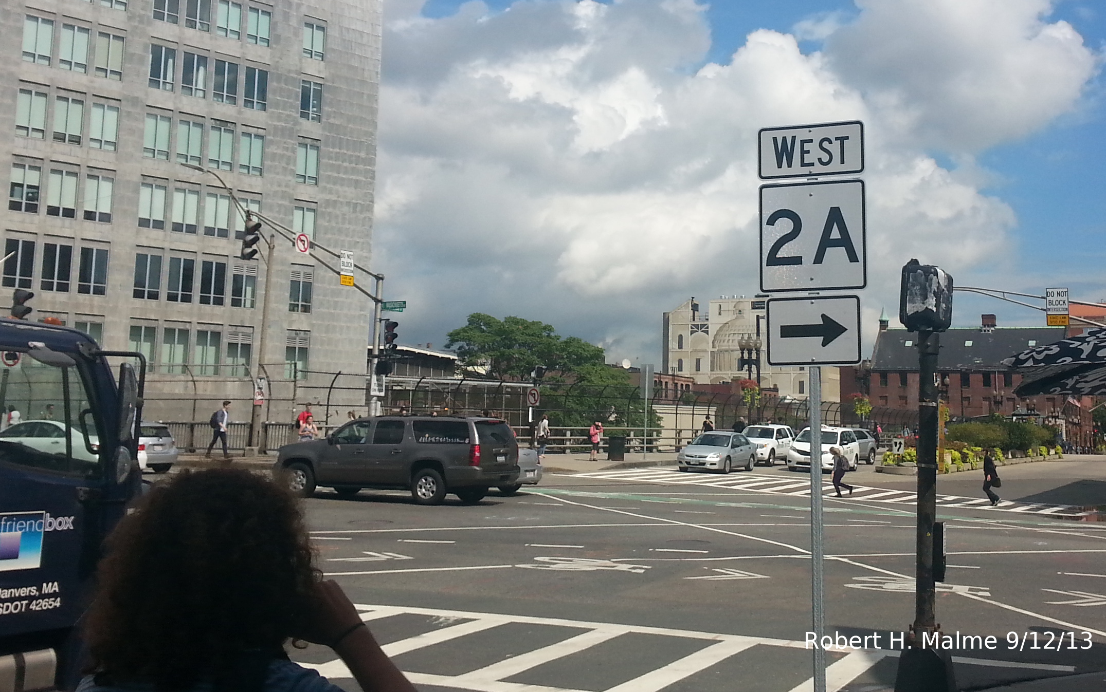
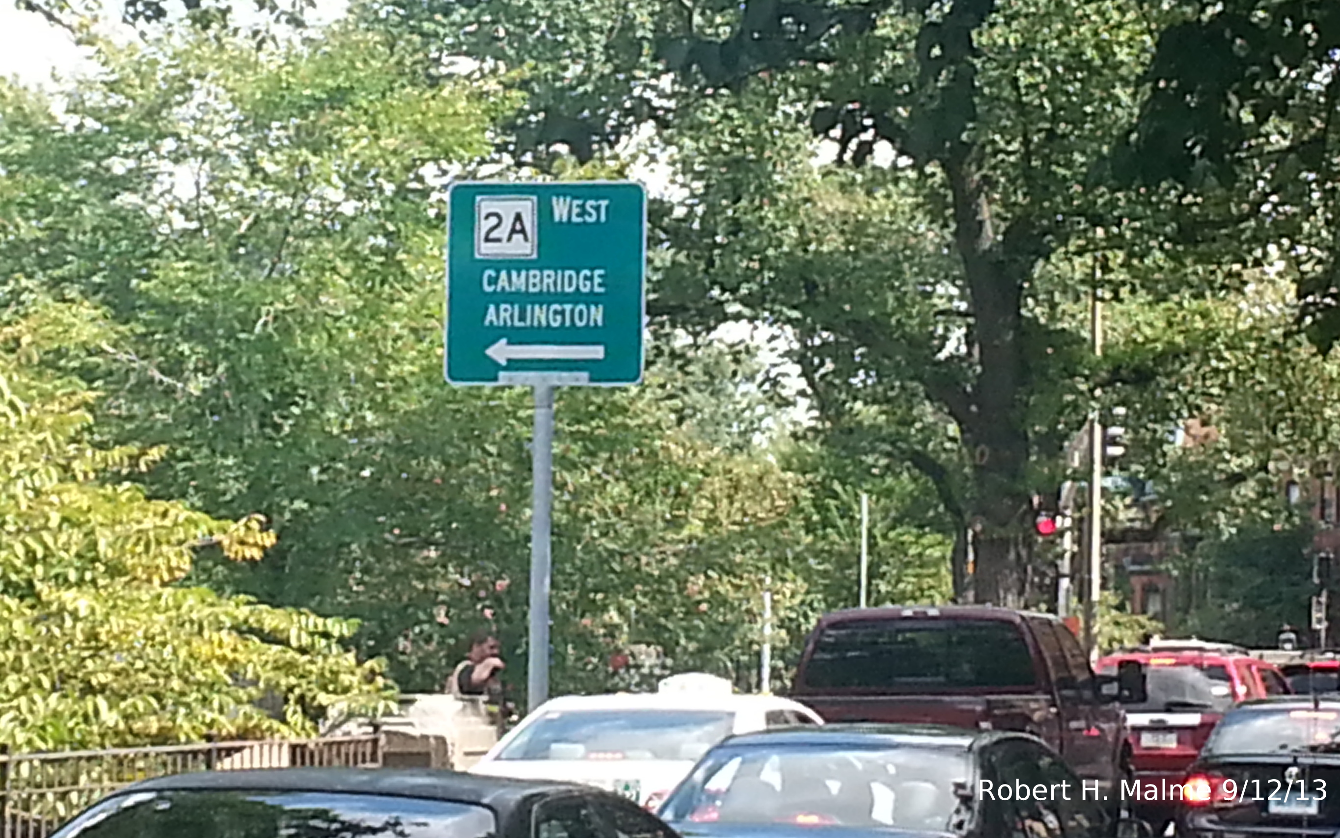
This
sign was placed in July and was accompanied by a 'To I-90 West' sign and a straight arrow...
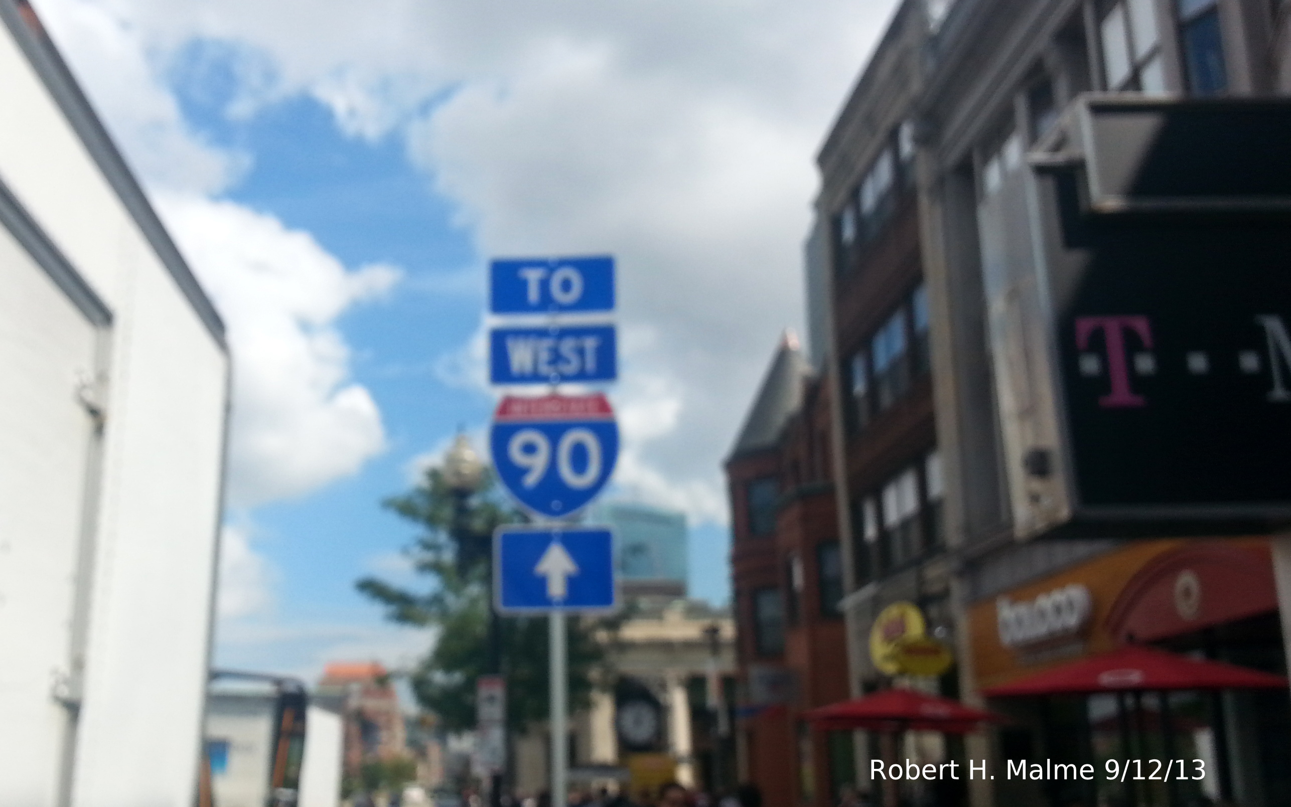
The
direction is correct, and technically the arrow is to. If you go
straight you will get to Copley Square and can access West I-90 there.
But it would be easier simply to take a left, go a block and make a left on the I-90 ramp along Mass Ave. And this
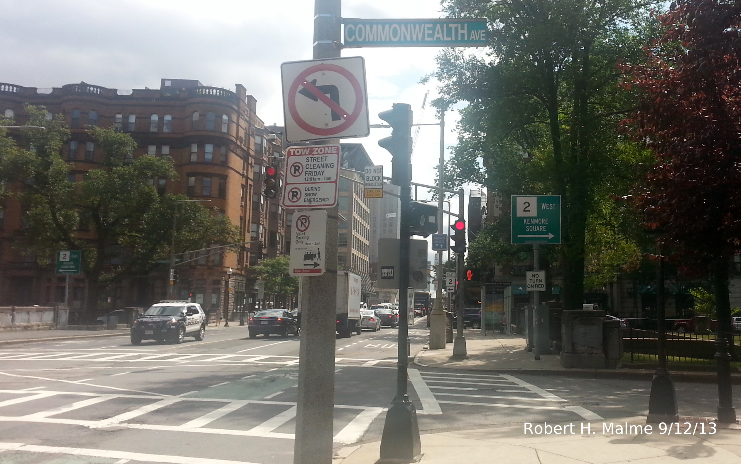
is not the only error here. Approaching Beacon Street on MA 2A West, a couple blocks away
from Commonwealth Ave., you see another West Route 2 Sign:
This
is at the corner of Mass Ave and Beacon St. If you do turn here, you will eventually get to Route 2 in Kenmore
Square.
Not
that all the signs in this area are wrong....
This
'To MA 2' signage is between the I-90 West ramp and Commonwealth Avenue. And here are the of signs at what is the
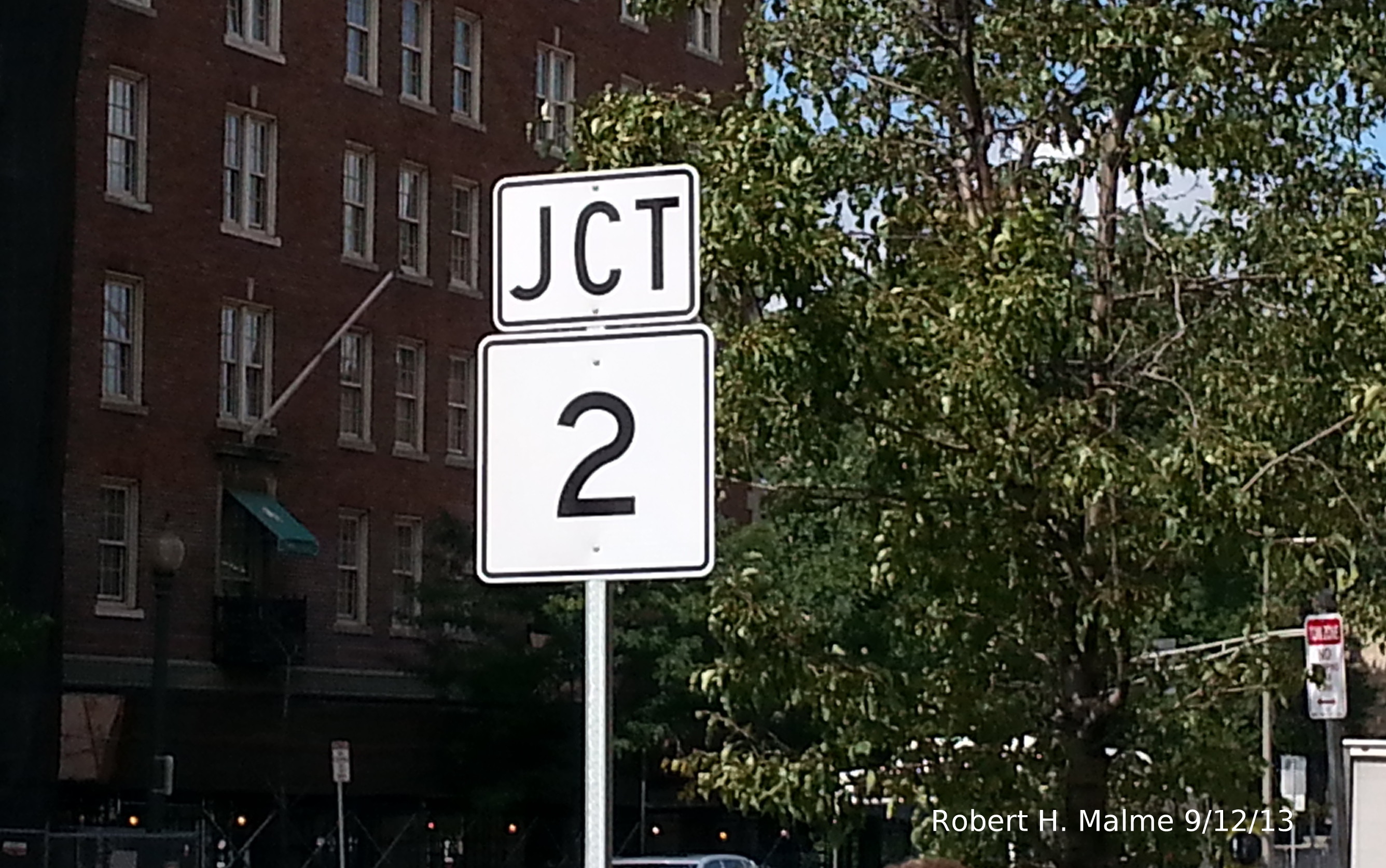
official End of MA 2A East at the intersection with Commonwealth Ave...
The
Guide signs are an old design and appear to be a few years old. the route
shields, however, are of recent vintage. These new signs help establish
that Route 2 is not going anywhere, so if Route 2A is to end at its parent, it's official route has not been extended.
And, some more
photos taken on Thanksgiving morning...
So, what is going on here?
In a later post
to AARoads Forum, poster Roadman, a MassDOT sign engineer, said he spoke
to a colleague in the District 6 Office in Boston about the Route 2A and
other recent signage. The colleague denied that MassDOT was responsible
for the signs, nor could he find anyone working for the City of Boston
to take credit either.(1) The Boston official suggested the work was by
an 'unknown organization.' However, a road trip I took on Thanksgiving
morning documenting the problems with many of the new signs pointed
to evidence suggesting
it must be a city project. The signs appear in locations overseen by two
different state agencies which would create a problem in placing some of
them, if the state had done it. As of the end of 2013 nothing had been
done to fix or take down any problems signs.
Here's the blog
entry from that November trip.
Signs Eventually to Be Fixed by Boston Transportation Dept. (UPDATE 4/6/14):
On February 26,
2014, a Boston TV station, Fox 25, aired
this
'undercover report' detailing the problem Route 2A and others
signs documented above and in the blog post. Again MassDOT denied it had
anything to do with it, however, Boston Transportation officials were
now ready to blame a contractor, Jacobs Engineering, for whom the city
had hired, for putting up the problem signs. The Boston officials, even
the new mayor, said they were embarrassed that not only had they
approved the wrong contract drawings, but that they had not noticed the
signs were wrong until the reporter showed them his report (from the BTD
response above, this seems to be stretching the truth). Officials
indicated they were moving quickly to fix the signs and possibly seek to
get some money back from Jacobs. In March, BTD employees fixed the MA 2A
signs by rearranging the banners, only to be told, that by someone at
MassDOT that the signs should not be there at all, since the route ends
at Comm Ave. They then, according to
This
Updated Report from Fox 25, went out and removed most of the
incorrect 2A markers. The only one left, apparently, is the one below between Symphony Hall and Boylston St (see
above) where the directional banner was replaced by a 'To' banner:
While this is now
'correct' technically, Mass Ave crosses I-90 and MA 2 before 2A, so
shouldn't they have 'To' markers too? They also fixed the signs featured
in the Fox 25 report with the opposite arrowed West 2A markers within a
few feet of each other. This was fixed by replacing the directional
banner with 'Jct' and, removing the arrow (sorry for hard to see, late evening photo):
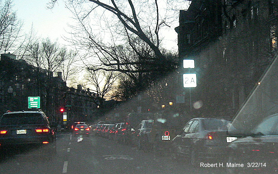
As of early April
there are still mistaken signs elsewhere in Boston. Here, along Comm Ave
west of Kenmore Square, they have extended MA 30 from its end in Brighton:
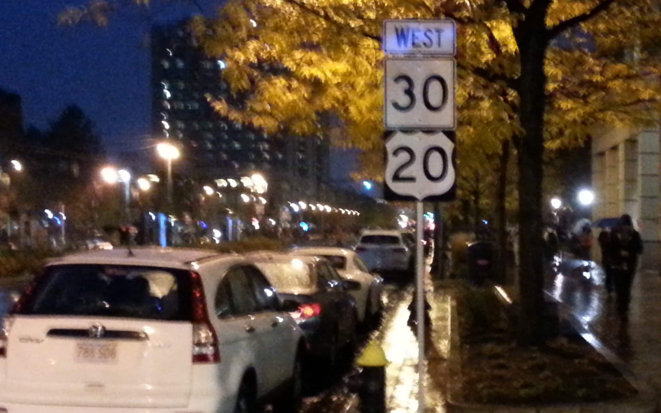
However, to show
you not all the route signs installed by Jacobs were wrong, here are the
signs approaching Columbus Avenue on Mass Ave heading west as of April 2014:
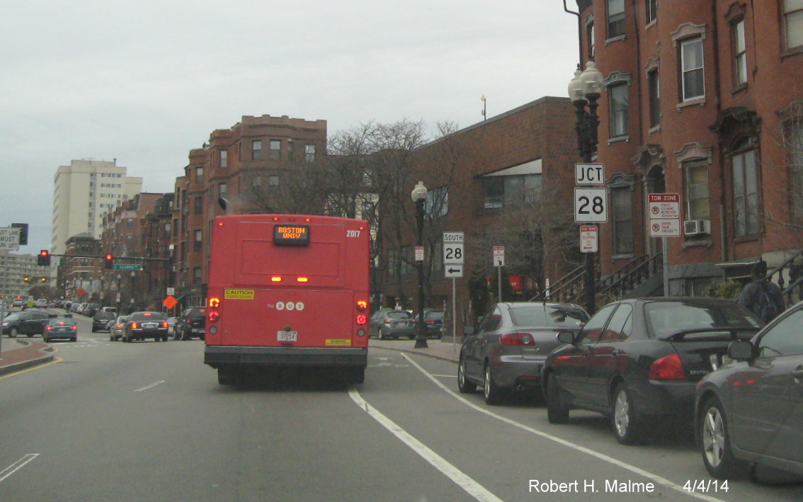
And here are some of the signs installed at the intersection of
Comm Ave and Charlesgate East near Kenmore Square:
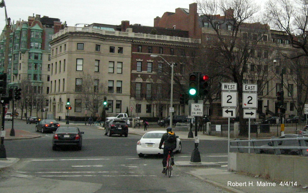
One of the correctly placed MA 2A signs can be sign on the
right side of the photo.
Check Out My Other Photo Pages:
Notes:
(1) http://www.aaroads.com/forum/index.php?topic=10141.msg246192#msg246192 Posted 9/10/13
*CCROG Memo To: Transportation Committee, From: Roger Krahn, Principal
Transportation Engineer/ Planner, Date: September 13, 2019
Subject: Interchange Exit Renumbering. Downloaded from:
http://crcog.org/wp-content/uploads/2018/12/Memo-2019-09-13-Exit-Renumbering.pdf, Oct. 24, 2019.
Copyright (c) Robert H. Malme 2015-2026