The Wilmington Bypass is a 25 and 1/2 mile freeway that runs from US 17
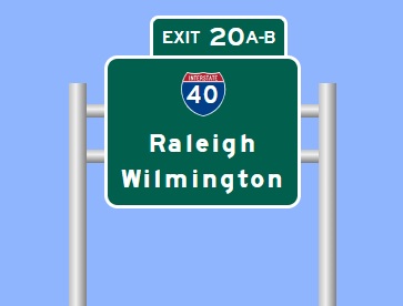
near Scotts Hill westward over to I-40 then further west to US 74-76
then south to US 17 near the town of Town Creek. The highway is
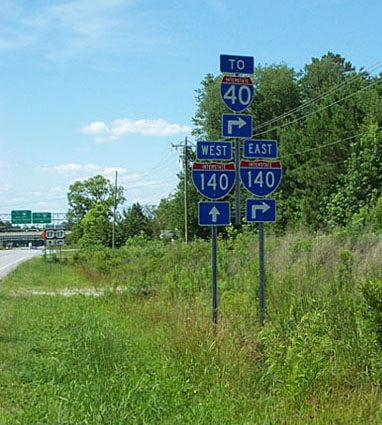
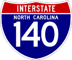
currently signed as Interstate 140 along part of the western half of its
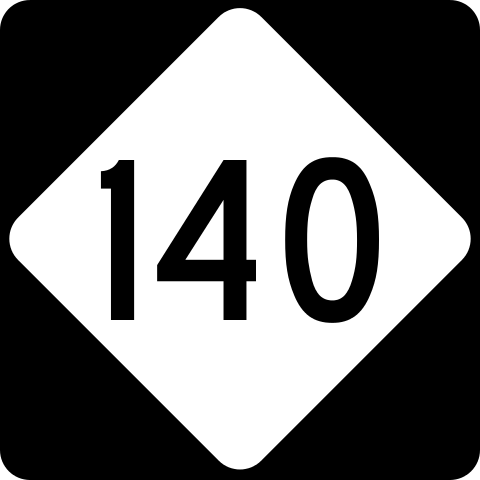
route and designated NC 140 along its eastern half. This will change upon the completion
of the Havelock Bypass in 2030 when I-140 will replace the NC 140 designation. Originally the Bypass
was also signed as US 17, though that highway was routed back through
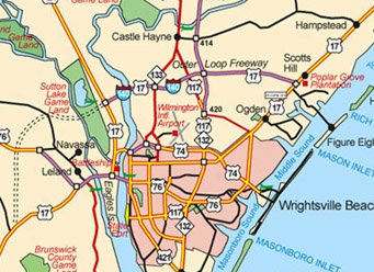
Wilmington in 2018 (see below). The following map showed the completed sections
of the route in 2006:
Map courtesy of Wilmingtontoday.com
History of the Wilmington Bypass
Four different construction projects were undertaken from 2003 to 2017
to build nearly 25 miles of the Wilmington Bypass route currently open
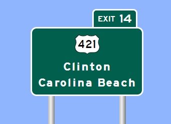
from US 17 at Scotts Hill over I-40, US 421 and US 74/76 back to US 17in
Brunswick County. Work began on two projects covering the 6.5 mile I-140
section from I-40 to US 421 in mid-2001. The three-mile section from
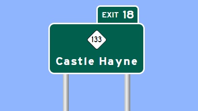
I-40 to Castle Hayne Road (NC 133) was completed first, with the roadway
opened to traffic on August 22, 2005.1 The 3.5 mile section
from NC 133 to US 421, including a bridge over the Cape Fear River
(named for former Wilmington Mayor Dan Cameron) was opened to traffic on
June 30, 2006.2 Construction on the 5 mile section east of
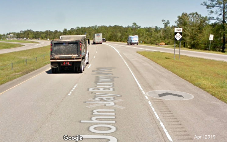
I-40, signed as US 17 only, and known as the John J. Burney Jr. Freeway,
was started in late 2003 and this section was also opened to traffic on
June 30, 2006.2,3 Prior to December 2017 the interchanges
along the I-140 section were for I-40, NC 133 and US 421. When the road
opened these interchanges did not have exit numbers, these were added in
spring or summer of 2007. (An exit list is below.)
Work on the next section from US 421 to US 74-76, approximately 7
miles, was originally scheduled to start in 2009,5 but
this segment's construction was delayed until 2014. Instead what was to
be the final section, approximately 5 miles from US 74-76 to US 17 near
its intersection with NC 87, became the fourth segment to be
constructed. Funded through federal stimulus moneys, work began under a
design-build contract in late March 2010 (for more details, see below)6
and was completed in September 2014.7 The final section from
US 421 to US-74/76 opened in December 19, 2017, the westbound section
opening midday and the eastbound section in the evening.8 A
ribbon-cutting for the last section was held on December 15, though the
road didn't open to the public for another week.9 AASHTO
approved the extension of I-140 along the section opened in December and
the earlier section between US 74/76 and US 17 on May 21, 2018, 5 months
after NCDOT signed it, curiously they did not apply to have I-140
extended east of I-40, now planned for 2030 (see Route Numbering History section below).10An additional
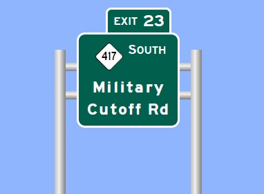
exit (23) east of I-40 for the Military Cutoff Road Extension, signed as NC 417, which will become part of a
longer planned bypass of Hampstead to the north, was opened in late September 2023.11
A future I-140 interchange is planned for Blue Clay Road but is not
currently funded. This will take traffic to the Wilmington International Airport.
Here was the official 2007 NCDOT timetable for the construction of the
Western Portion of the Wilmington Bypass. The BA and BB sections were
completed ahead of this schedule15:
Segment
Location
Length
Start
Date
Completion
Date
A
NC 87
SOUTH OF BISHOP TO US 74/US 76 EAST OF MALMO
5.3
miles
2010
September
2014
BA
US
74/US 76 EAST OF MALMO TO SR 1430 (CEDAR HILL ROAD)
3.9
miles
2013
June
2018
BB
(CEDAR
HILL ROAD) TO WEST OF US 421 NORTH OF WILMINGTON
3.7
miles
2013
April
2018
C
WEST
OF US 421 TO EAST OF I-40
7.1
miles
2001
June
2006
Route Numbering History
The Wilmington Bypass was first proposed as a bypass route for US 17.
The route was designed to take through traffic from the crowded
Wilmington streets and reroute it around the city. When the route was
completed from Scotts Hill to US 421 in 2006, the segment west of I-40
was signed a I-140 and, even though the route was not make it back to
the original alignment of US 17 until after 201712, the
entire route on both sides of I-40 was designated US 17, with US 17 then
routed south on US 421 to its existing alignment. The former US 17
through Wilmington became US 17 Business. Truck US 17, signed along
streets in downtown Wilmington, was decommissioned.5 However,
in 2014 NCDOT reversed course and proposed that US 17 be re-routed
through Wilmington along its old path, with the exception of using
Military Cutoff Road and Oleander Drive to make it back to its original
crossing over the Cape Fear River Memorial Bridge. The reason stated by
NCDOT was that the amount of traffic using Military Cutoff Road
justified a route designation. This proposal was endorsed by the
region's Transportation Advisory Committee in August 2014.12NCDOT
submitted this request to AASHTO's US Route Numbering Committee which
approved the relocation on May 15, 2015.13 Meanwhile, NCDOT
designated the entire Bypass route, including the section signed as
I-140, as NC 140 on January 14, 2015 citing their wish to have the
entire route designated as Interstate 140 in the future.14
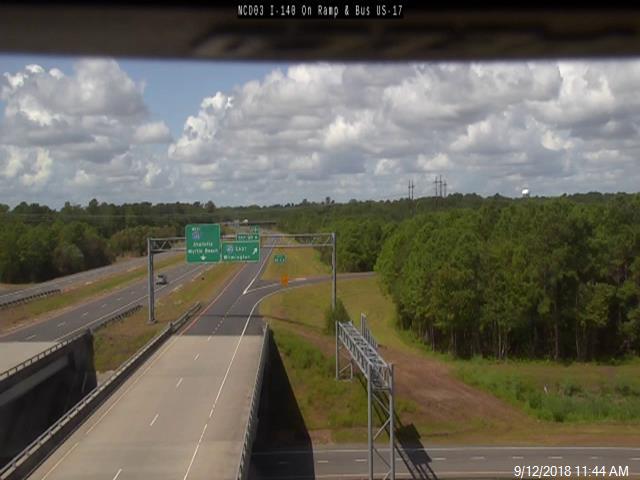
The FHWA granted the interstate designation for the western Wilmington
Bypass route on May 31, 2003. US 17 signs remained on the Bypass until
August 2018, more
than 8 months after the entire Bypass was completed. New sections were
signed just as I-140 (see photo section) and US 17 was removed
from existing overhead signage, such as at the I-40 exit, as shown in
this traffic camera photo from September 201815:
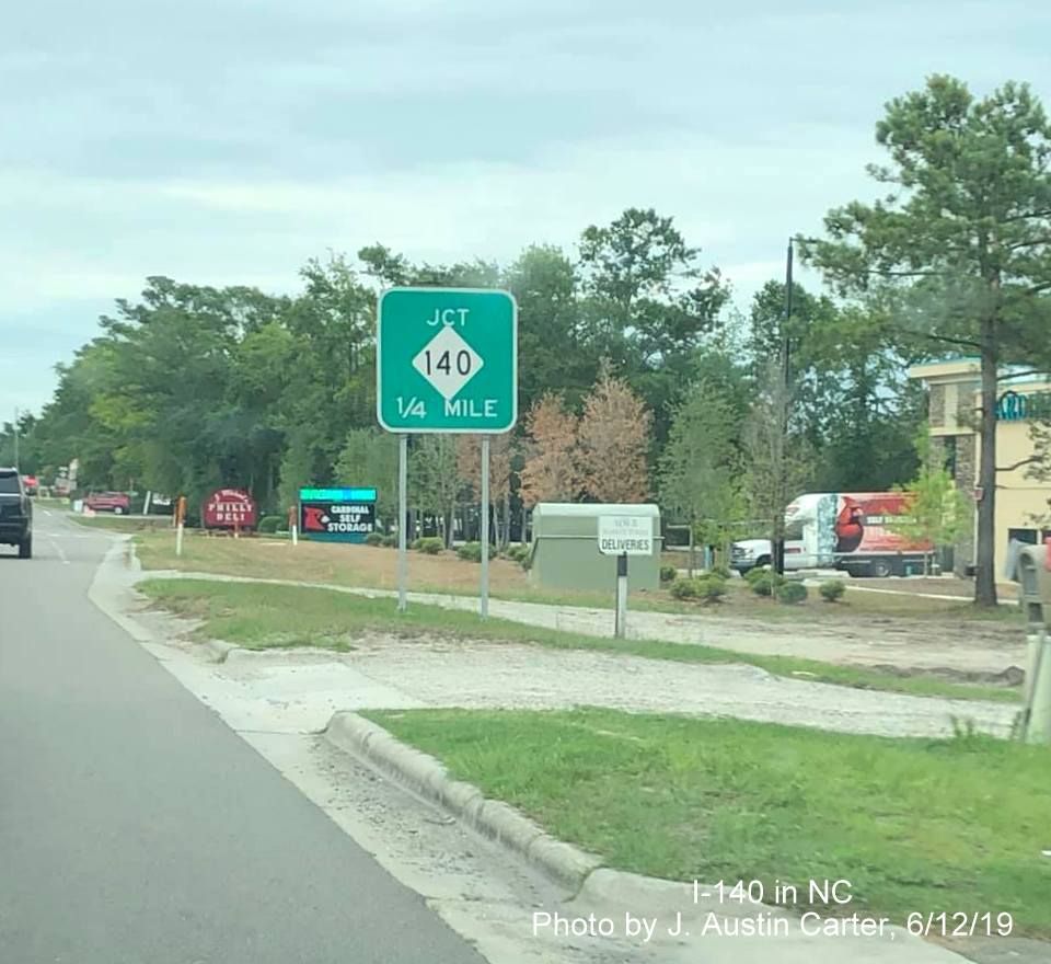
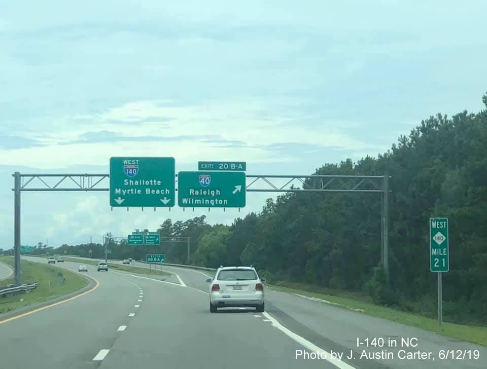
In late 2018, NCDOT put up NC 140 signs along the Bypass east of I-40 (see photos below).
A proposed Wilmington end-point for I-74 (and a possible spur of I-74,
see More about I-74 Here) would meet I-140
where it would intersect the existing US 74-76 freeway.16
I-140 Finally To Be Extended East
In May 2025 NCDOT posted plans for the construction of the southern half of the Hampstead Bypass. The sign plans indicated
that I-140 will be extended along what is now NC 140 when the work is completed, currently scheduled for 2030. In addition,
the Bypass, which was to be designated an extension of NC 417 from Military Cutoff Road, is now to be numbered as Bypass US
17. The route will start at the current end of NC 140 at US 17 in Scotts Hill and proceed along the Bypass 3 miles to the
Hampstead Bypass. These changes can be seen in the sign plans below:17
Future Signs at the I-40 interchange, current sign in white:
Future Signs at the eastern end of the Bypass:
Future Signs on Military Cutoff Road approaching the Bypass:
Future signage at end of the Hampstead Bypass:
Future highest I-140 Mile Markers
Future lowest US 17 Bypass Mile Markers
Wilmington Bypass and US 74/76 Videos
Drive the length of the Bypass during the summer of 2021 with these
videos from RoadwayWiz (Posted 12/26/21):
Travel over the opened section of the Wilmington Bypass on this
Video Courtesy of J. Austin Carter Taken in March 2013 (Best using Windows Media Player).
Continue on US 74/US 76 in Brunswick County and check out construction
of the next segment of the Wilmington Bypass (and the possible future
path of I-74) on this Video
Also Courtesy of J. Austin Carter Taken in January 2013 (Best using Windows Media Player).
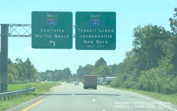
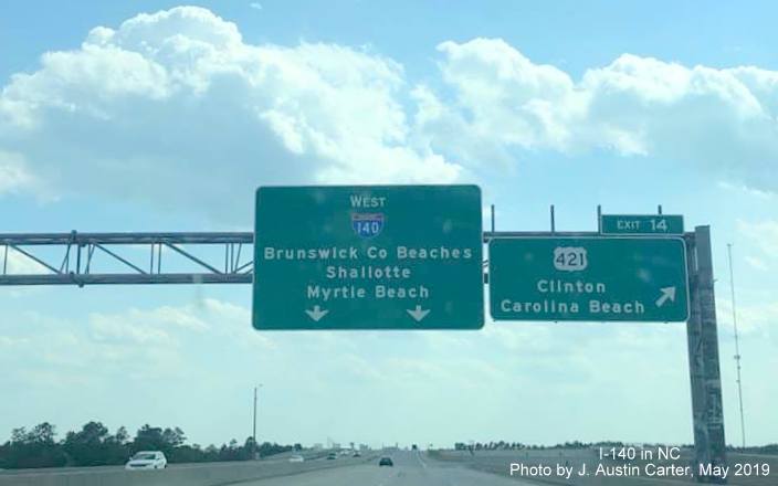
Photos of I-140 signage, going west
to east (Hover over for Larger Image)
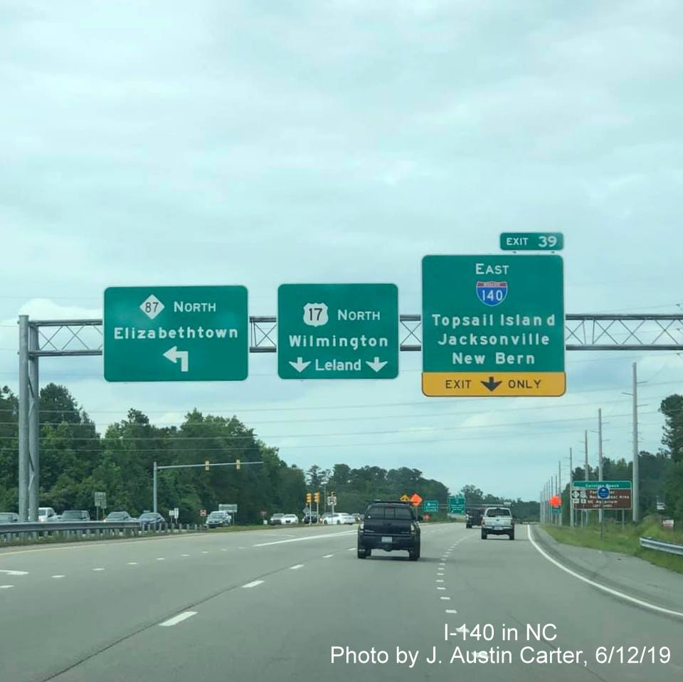
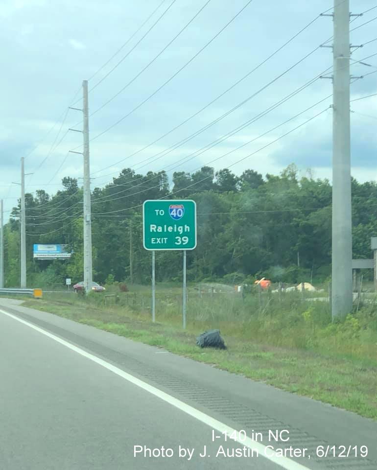
Signage starting on US 17 North in June 2019, courtesy of J. Austin Carter:
Signage for I-140 along US 17 North at the intersection with NC 87 North.
The signage at the beginning of I-140 East, the blank space over the US
17 shield was to be for Business before US 17 was routed back through
Wilmington in 2018 as seen in the sign plans above.
There is also an auxiliary sign for those looking for I-40 on US 17 North.
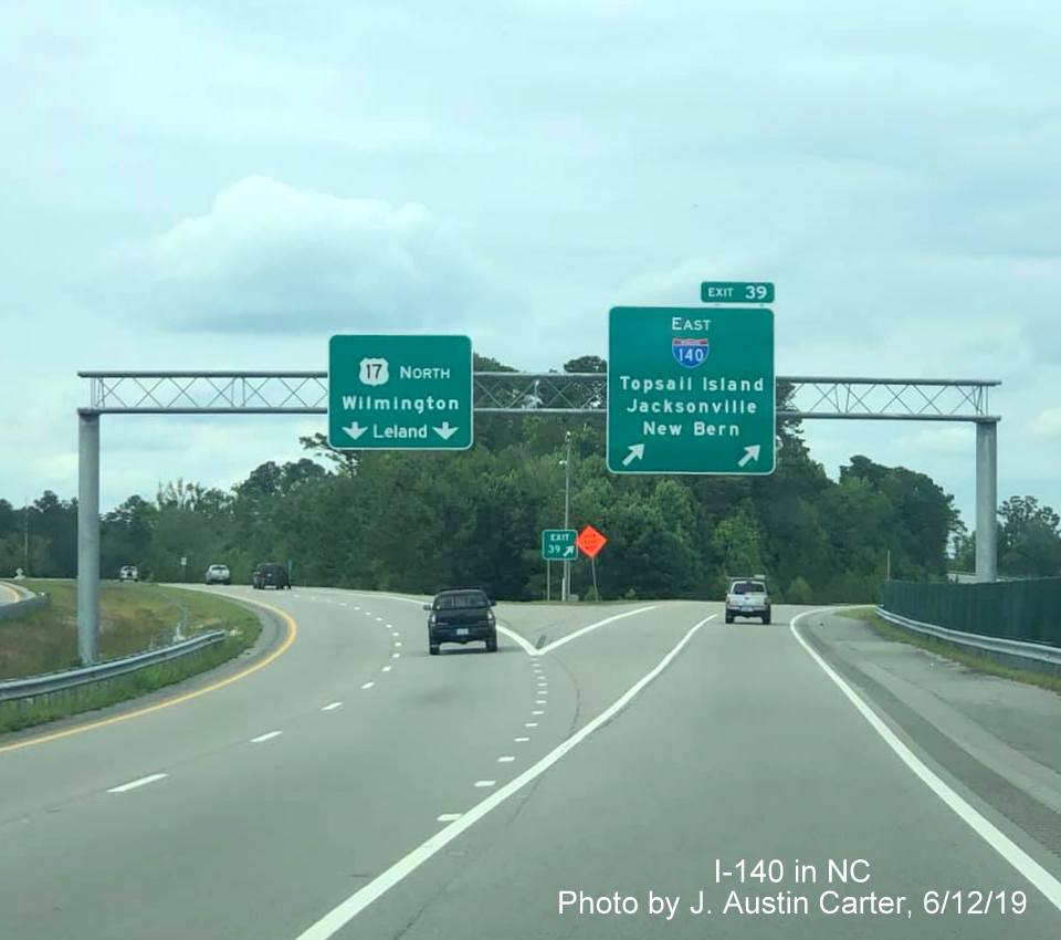
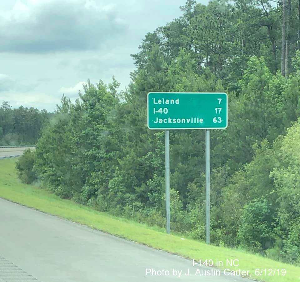
The first destination distance sign on I-140 North which includes
Jacksonville due to the former routing of US 17. Reversing direction:
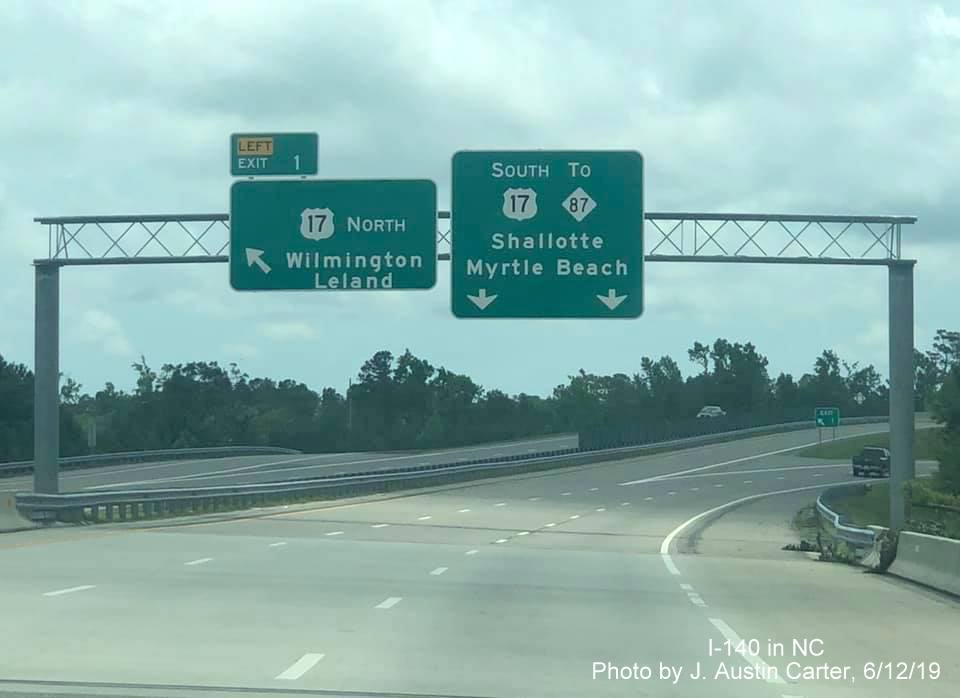
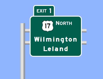
Signage at the end of I-140 West with Exit 1 being for US 17 North
(through traffic defaults onto US 17 South).
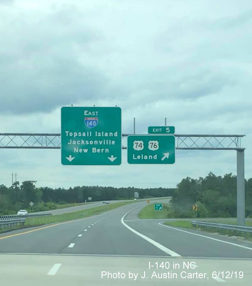
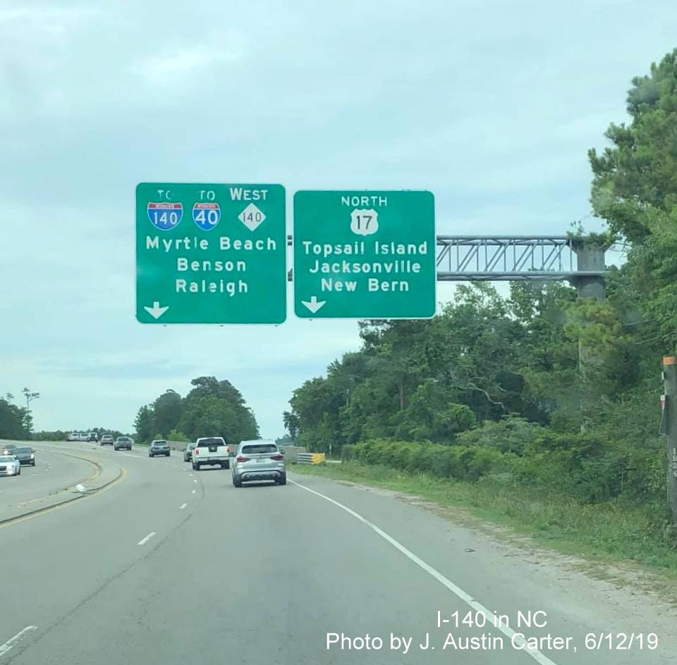
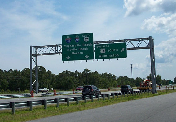
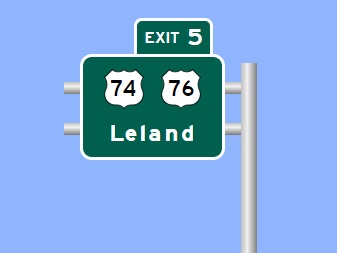
Overhead signage at the ramp to US 74/76 in Leland still headed east (north) on I-140.
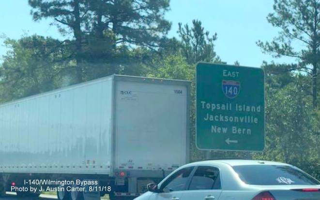
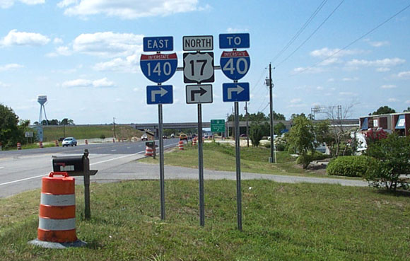
From US 74/76 interchange in August 2018, courtesy of J. Austin Carter:
Note that these signs do not feature US 17, which is still on other
signs, but is officially no longer routed with I-140 and that the ramp
construction did not include any major upgrading of US 74/76, which
might have been useful if NCDOT decides to route I-74 along US 74/76 to end here.
A ground mounted sign for I-140 East at the left entrance ramp from US 74/76 West.
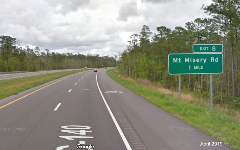
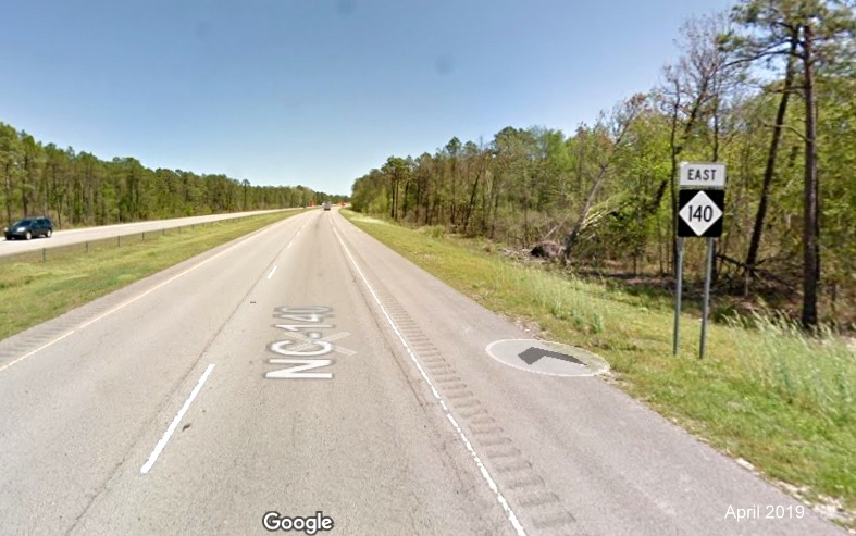
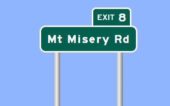
Google Maps Street View image of 1-Mile advance sign for Mt Misery Road
exit, taken in April 2019.
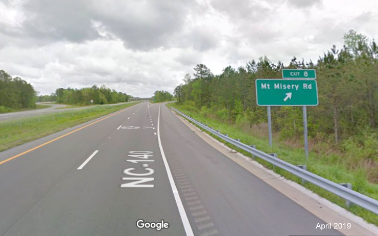
Street View image of the exit sign on I-140 East.
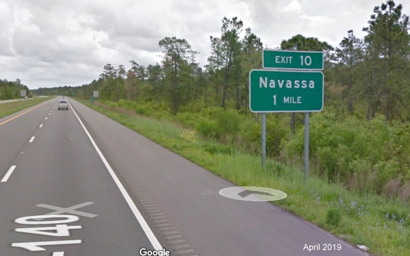
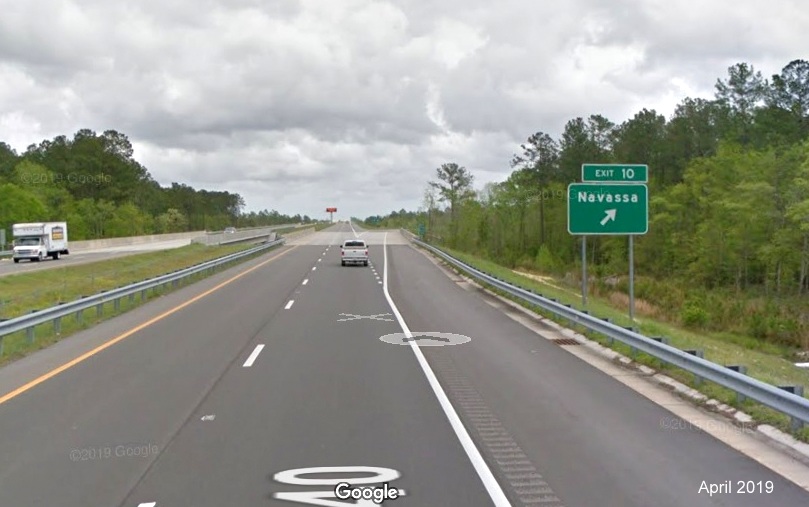
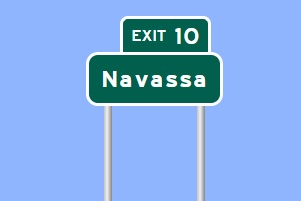
The 1-Mile advance for the next exit, Navassa, via Google Maps Street
View.
The exit sign
for Navassa, another Street View image from April 2019.
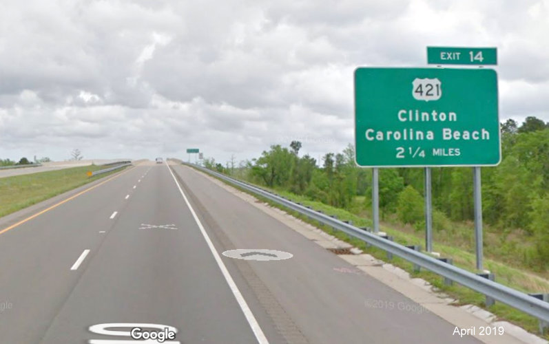
The first
advance sign on I-140 East for US 421. The distance is odd due to the
length of the bridge approaching the exit. Also from Google Street
View in April 2019.
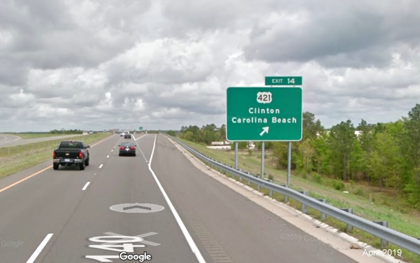
The exit sign at
the US 421 exit, the last exit for the final segment of I-140 that
opened in late 2017, another Street View image.
The US 421 exit signage heading west:
Signage at the former end of I-140 at US 421, the pull through
designed after the decision to remove US 17 from the Bypass. Taken in
May 2019 by J. Austin Carter.
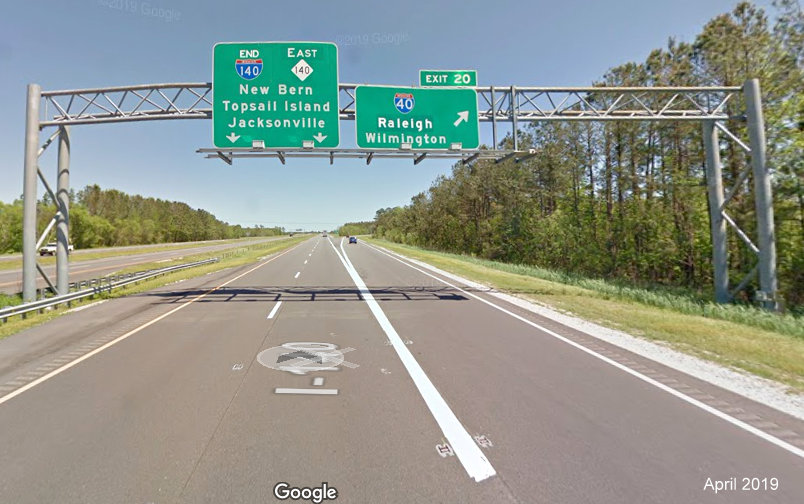
The
overhead signage at the I-40 exit has been altered after the removal
of US 17. The pull through sign used to say End I-140, North US 17.
Notice also that the control city for I-40 West has been changed from
Benson to Raleigh.
The first (and
last) East NC 140 reassurance marker following the I-40 exit.
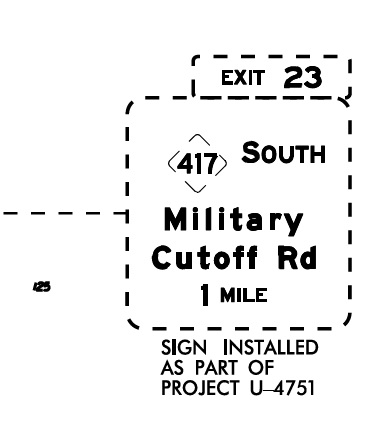
Sign plan for
the 1 Mile advance for the new Military Cutoff Road exit opened in
September 2023 (awaiting image of actual sign).
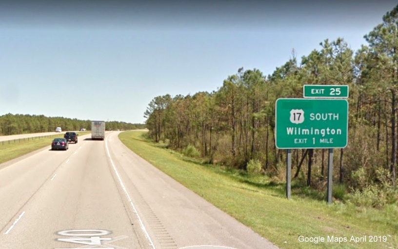
Street view
image of the 1-mile advance sign for the US 17 South exit taken in
April 2019. The Business banner has been greened out. Also notice the
Exit 1 Mile text, this sign didn't originally have an exit number
until the last section of I-140 was completed.
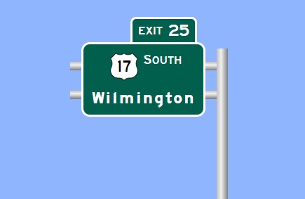
Street view
image of the overhead signs at the end of NC 140 East with the new
Exit 25 gore sign seen in the distance.
And another
Street View image showing the End NC 140 sign approaching the merge with US 17 North.
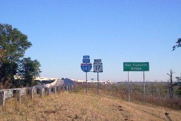
Approaching the beginning of the Wilmington Bypass on US 17 South in
Scott's Hill, Courtesy of J. Austin Carter, June 2019:
A junction NC 140 sign on US 17 South, the shield appears a little to
large for the sign, but this may have originally been for US 17 Business.
Overhead signage at once was the end of Business 17 North at the US 17
Wilmington Bypass, the sign on the left has been reconfigured with a NC
140 shield and an West directional banner. And at the I-40 interchange:
A NC 140 mile marker now greets drivers about to head into the C/D
lanes for the I-40 interchange. West I-140 officially starts here. A
closer view of the removed US 17 shield seen in the traffic camera image above.
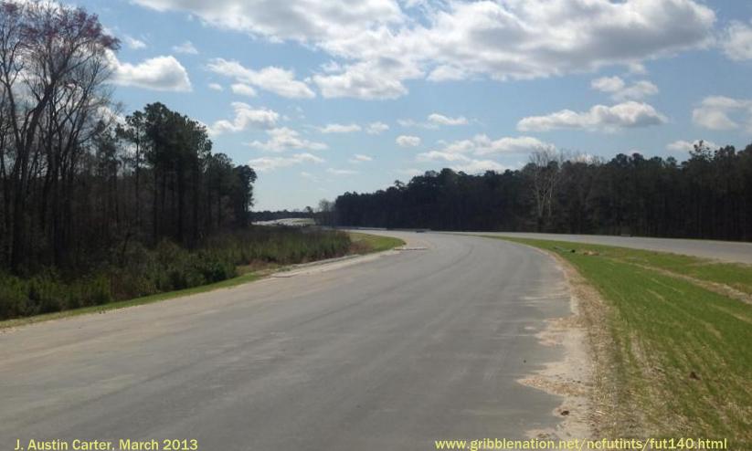
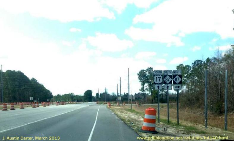
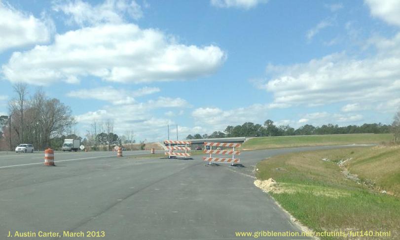
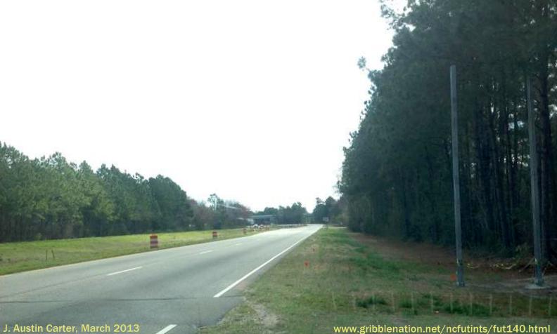
From Section Under Construction in March 2013, courtesy of J. Austin Carter:
At the future southern end of I-140 at US 17 near Leland, Looking north
along roadbed. Photo courtesy of J. Austin Carter. (3/26/2013)
At the future southern end of I-140 at US 17 near Leland, Looking south
at a bend along the road back toward future US 17 interchange. Photo courtesy of J. Austin Carter. (3/26/2013)
At the future southern end of I-140 along US 17 near Leland, Looking at
construction from US 17 South. Photo courtesy of J. Austin Carter. (3/26/2013)
This is the future I-140 on-ramp from US 17 near Leland. Photo courtesy of J. Austin Carter. (3/26/2013)
From the current eastbound lanes of US 74/76 showing posts for future 1
mile advance sign for I-140 . Photo courtesy of J. Austin Carter. (3/26/2013)
Photos from Open Segment of I-140 Taken in 2006 and 2007
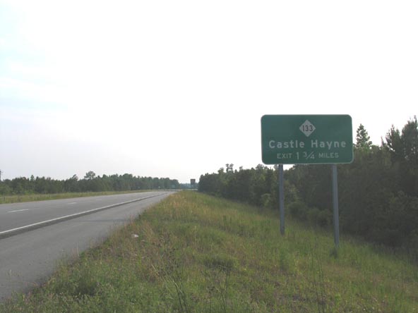
Along NC 133, Castle Hayne Road, nearing the I-140 interchange, July 2006
Photo of exit signage for the NC 133 interchange along West I-140, May
2006. Since then exit numbers have been added, this is now Exit 18.
Here's signage at the current end of I-140 at US 421, July 2006. Photo
courtesy of Adam Prince.
Here's a Begin I-140 sign in the distance as you start crossing the
Dan Cameron Bridge going east. Photo courtesy of Jon Meisenhelder.
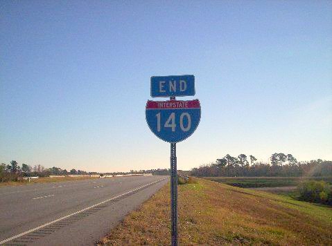
And since all things that begin must end, here's the eastbound End
I-140 sign at I-40. Photo courtesy of John Meisenhelder, Nov. 2007.
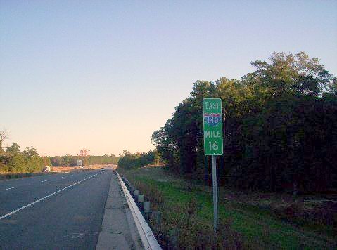
This is one of the I-140 East mile markers, Mile 16. Photo courtesy of John Meisenhelder, Nov. 2007.
Here's the signage at the start of the Loop in Scott's Hill that
reflected NCDOT's initial decision to route US 17 onto, but leave
I-140 off of, the eastern half of the Wilmington Bypass. (July 2006)
An I-140 Extension?
The NCDOT Strategic Highway Corridor map of the Wilmington area in
2011 showed I-140 being extended 9.5 miles over the proposed Cape Fear
Skyway south and east back over the Cape Fear River to US 421. (See
map below).19 This was the preferred route for the
Skyway, one of several proposed projects of the North Carolina
Turnpike Authority (NCTA) and would have been constructed as a toll highway.
The preferred route of the Skyway bridge would have run from Carolina Beach
Road at Independence Boulevard south of Wilmington over the Cape Fear
River. It would then connect to US 17 through an 8-mile-long extension
of Interstate 140 from it's current planned end near Town Creek. This
alignment has not been finalized (see below), however, and other
routes do not have the toll highway meeting I-140. The project was expected to cost between $1 and 1.5 billion
and would take five years to build.20 A feasibility study completed during the
summer of 2008 indicated only about 50% of the construction could be
funded by tolls. Additional funding from the state would have been needed.21 The project languished
for several years while funding was sought, but ended up being dropped from the state TIP, perhaps to be revived
again in the future.
Changes Made in the Final Sections to be Built:
NCDOT announced in July 2009 that federal stimulus funds would help
start further construction on I-140/US 17. The next section to be
constructed though was not going to be from US 421 to US 74/76,
Segment "B", but the section between US 74/76 and US 17 near NC 87,
Segment "A''. This is a design/build construction project which began
in March 2010. This segment was more 'shovel ready' and able to
receive stimulus funds. The project was completed in September 2014.
Segment "B" was complicated by another water crossing and later,
environmental litigation. Work finally began in the Fall of 2014,
meaning there was a gap in the route for more than three years.23
The entire route, though officially not to be complete until the
summer of 2018, was opened to traffic on December 19, 2017.8
Not NCDOT's First I-140 Proposal
This is not the first route NCDOT proposed as I-140. In 1999,
officials in Sanford wanted the newly completed US 1 freeway from
Raleigh to their city designated an interstate to help attract further
business. NCDOT applied to the FHWA to have the freeway designated as
Interstate 140. The FHWA rejected the designation, however, saying
Sanford was not a large enough urban area to warrant its own
interstate highway. Perhaps with the approval of I-685 that will meet US 1 in Sanford on its
planned route between between I-85 in Greensboro and I-95 in Fayetteville (or Dunn) perhaps NCDOT
will revisit a US 1 interstate designation proposal.
 Wilmington Bypass