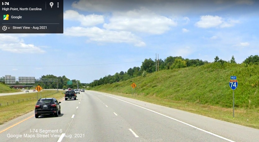
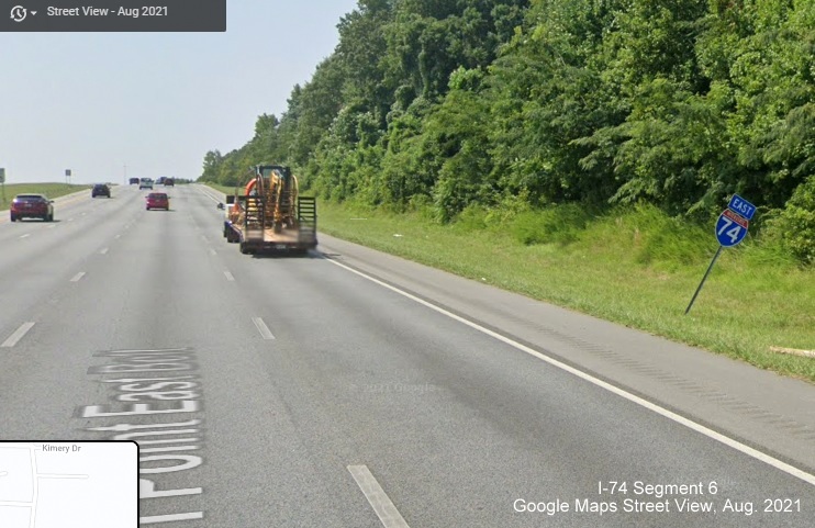
Segment 6
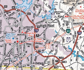 |
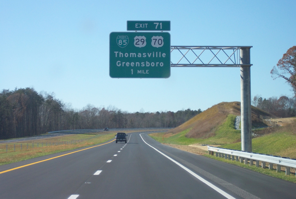
Where: US 311 High Point 'East Belt' Bypass, North Main Street, High Point, to South of I-85, Guilford CountyLength: 11 MilesCompleted: November 22, 2010Highway signed as:
|
Segment 6 |
Where: US 311 High Point 'East Belt' Bypass, North Main Street, High Point, to South of I-85, Guilford CountyLength: 11 MilesCompleted: November 22, 2010Highway signed as:
|
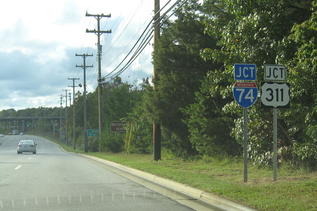
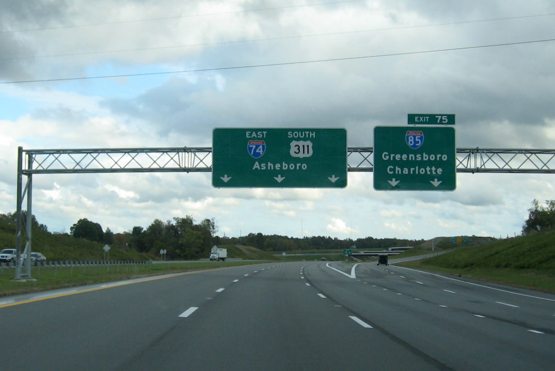
Completing the Route to Business 85
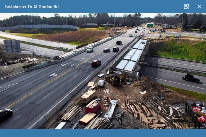
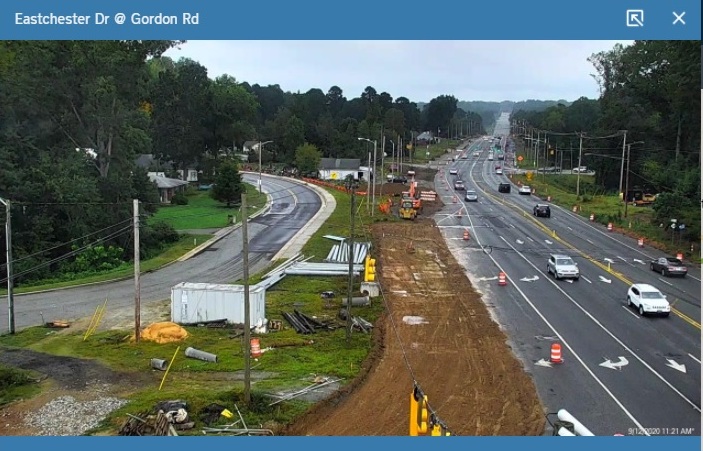
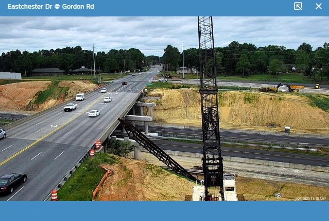
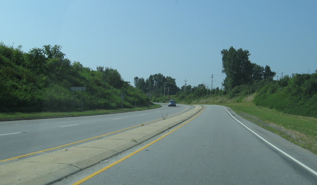
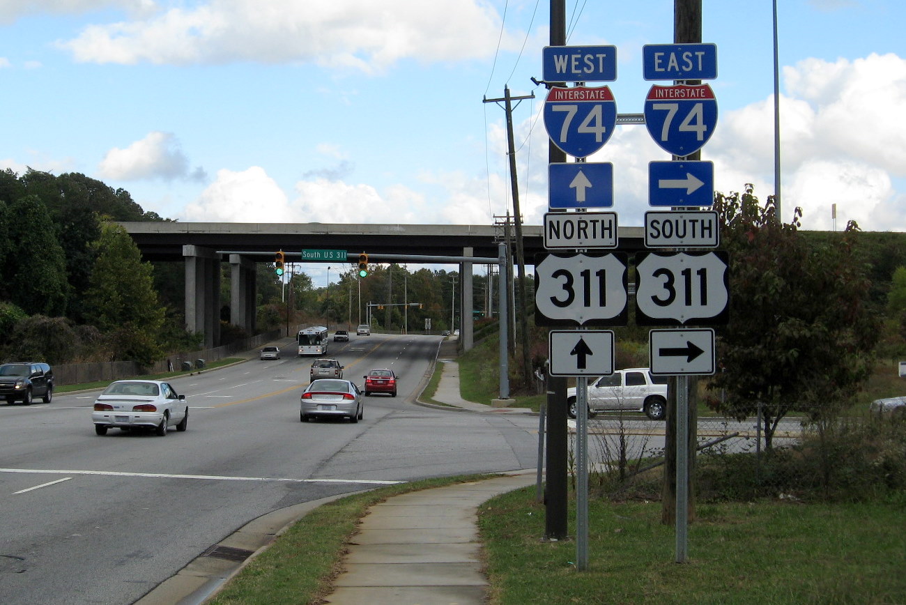
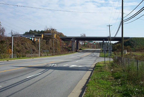
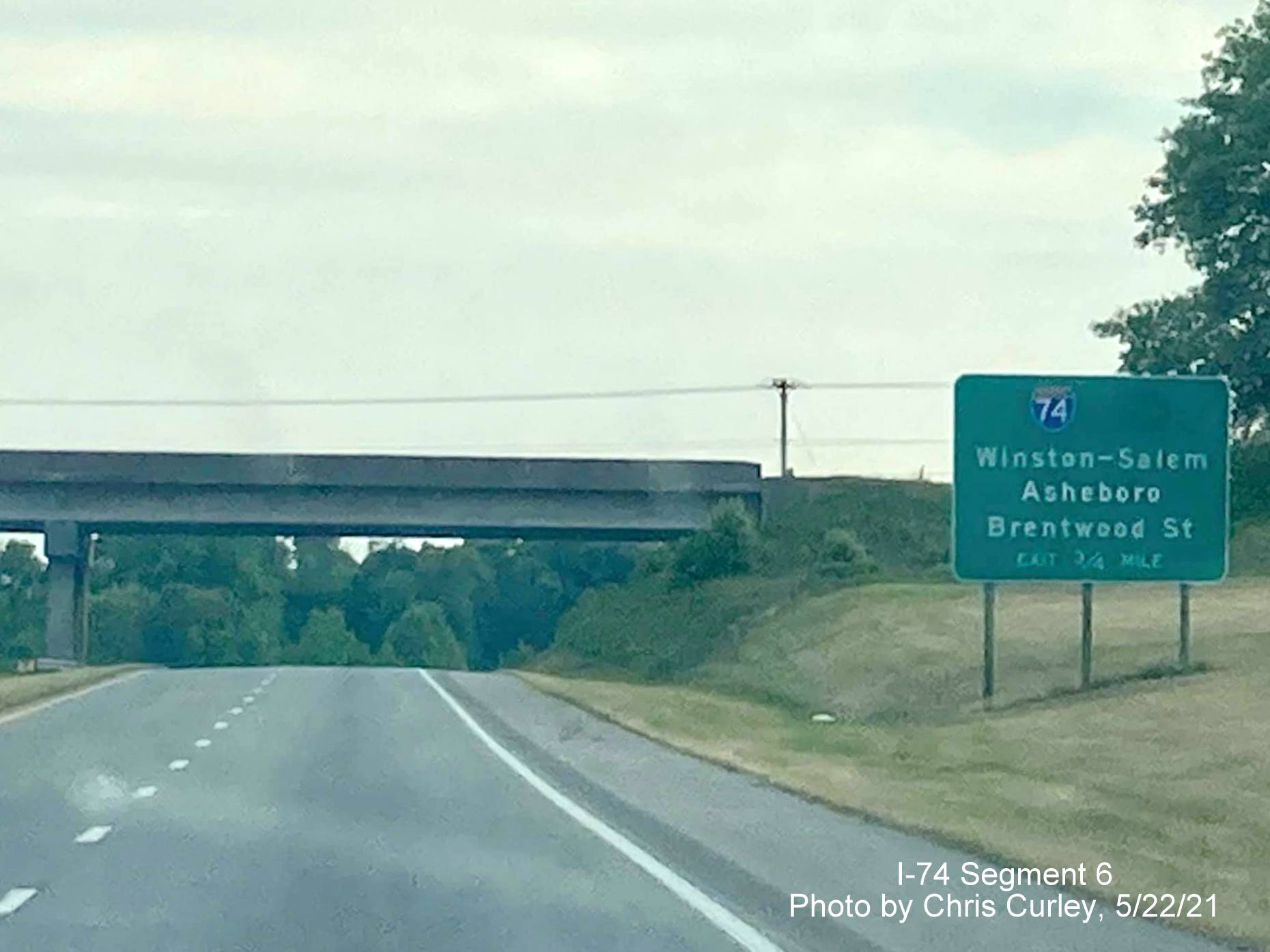
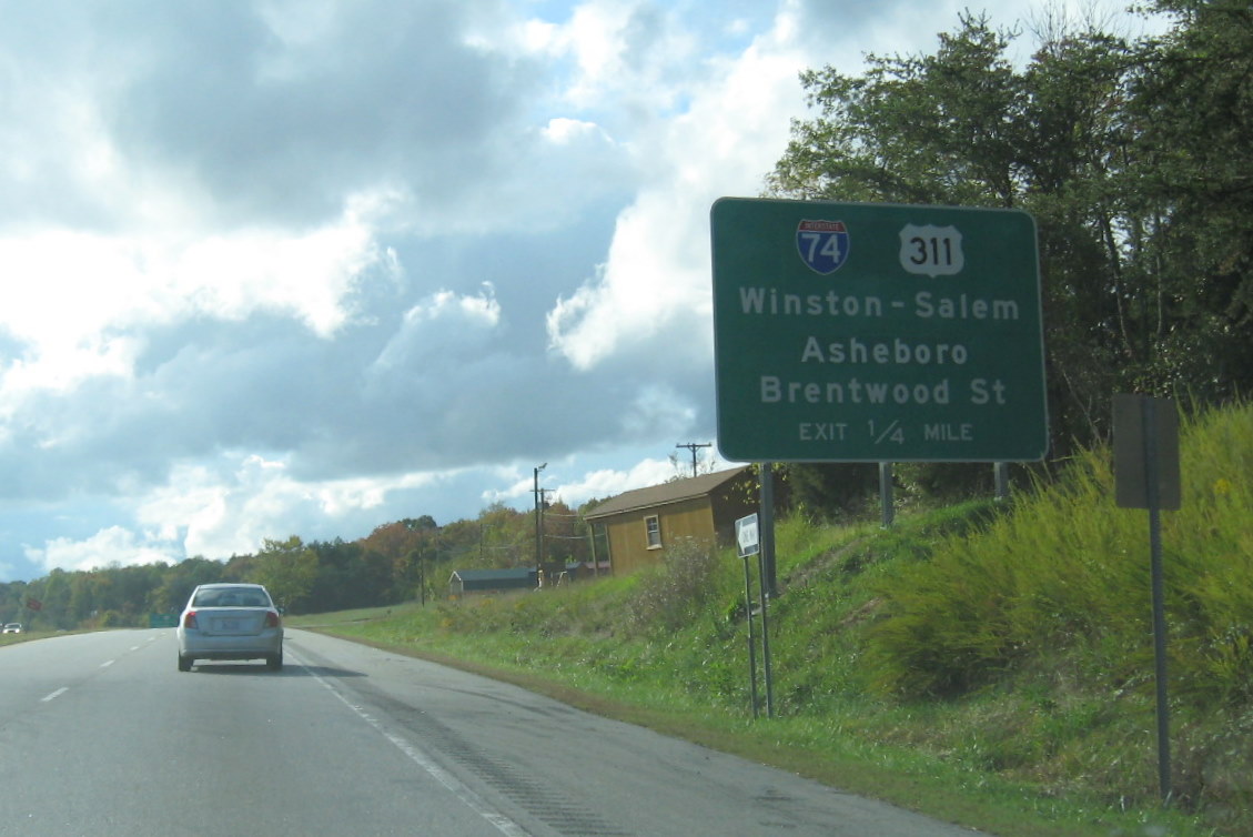
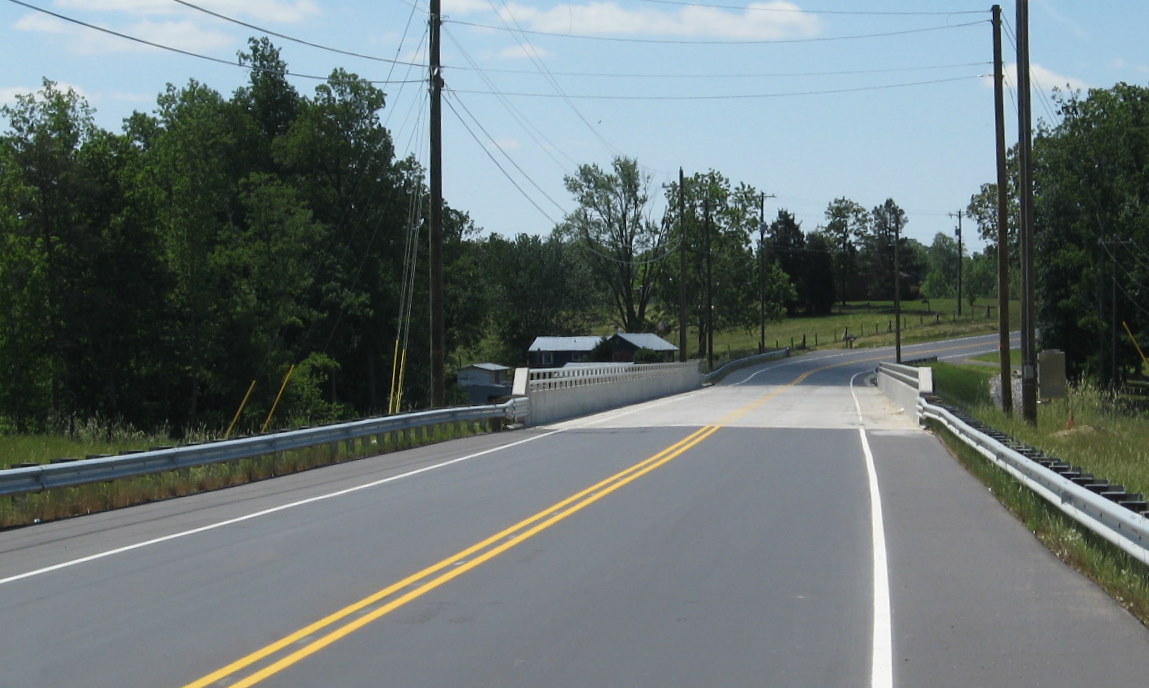
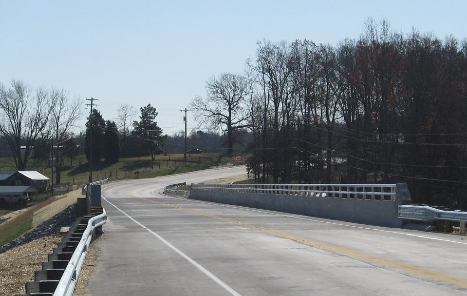
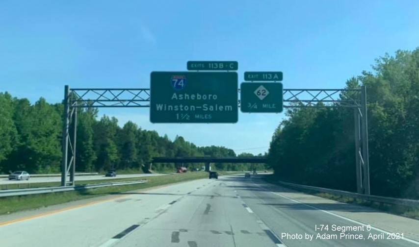
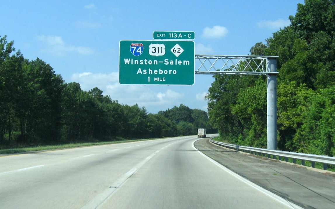
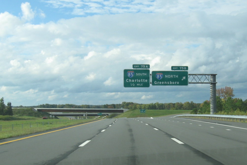
Segment 6 is part of I-74's second fully signed section in NC and was originally co-signed with US 311 on what is referred to as the "East Belt" bypass of High Point. The project to build this segment (Number R-609) was broken up into three parts.1 Part one, from where the US 311 freeway from Winston-Salem originally ended at Main Street (now Exit 65, former Bus. 311) to NC 68, Eastchester Drive (photo below), almost 2 miles in length, was completed in 1997. The second part, 4.5 miles from NC 68 to US 29/70 (Business Loop I-85), was opened on November 20, 2004 after a delay of nearly a year.2 Once this section was completed, US 311 was re-routed along the completed bypass to Business 85 and then south to its old route. The exits on both parts were first numbered based on US 311 mileposts, but were renumbered in 2008 to I-74 based mileposts (See the I-74 Exit List), to match those put up at the same time along Segment 5. Though some initial news reports indicated NCDOT was not planning to sign the highway as I-74 until the freeway was completed to US 220 (I-73)3, documents posted by NCDOT for the last section contract letting in late 2006 included detailed plans showing the placement of I-74 signage along the entire stretch of the East-Belt at the conclusion of the project. Though the final segment opened in November, some of the I-74 signs were not placed on the previous completed sections until December 2010.4
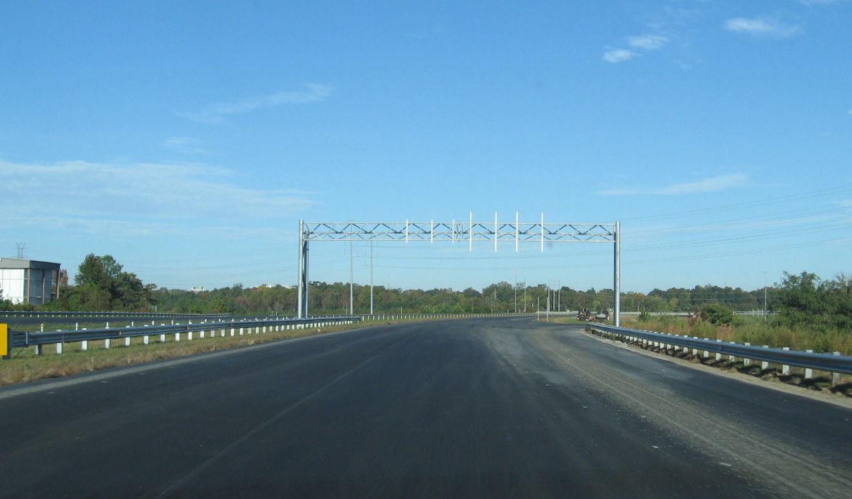
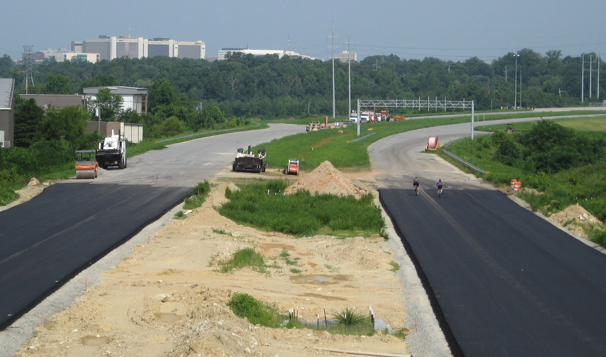
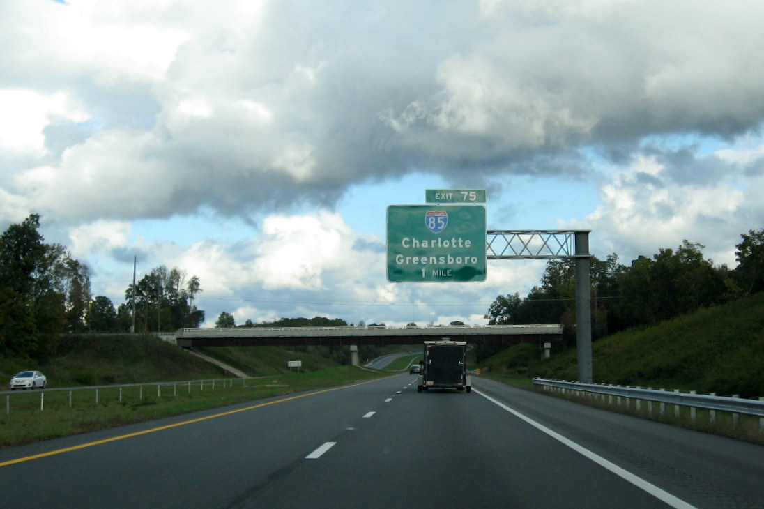
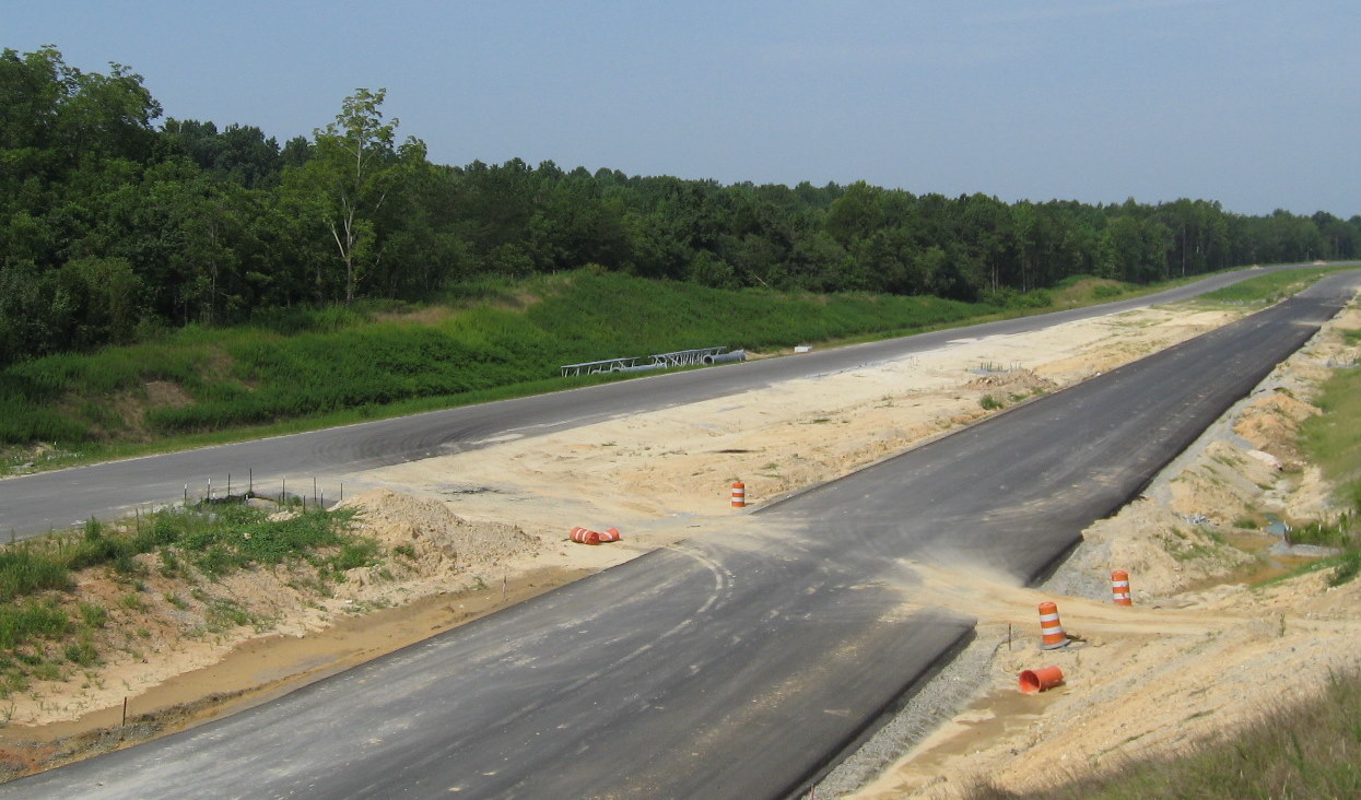
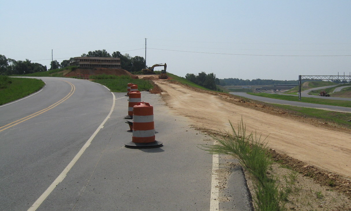
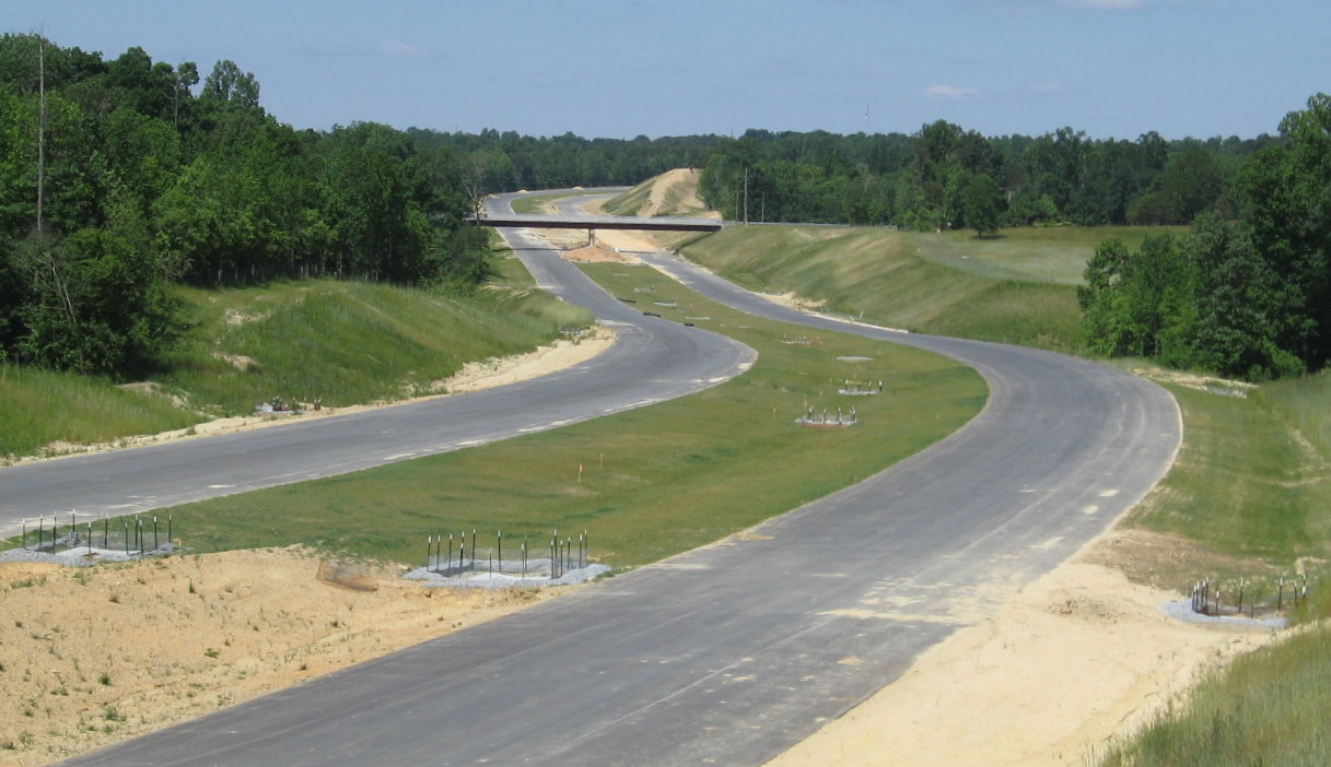
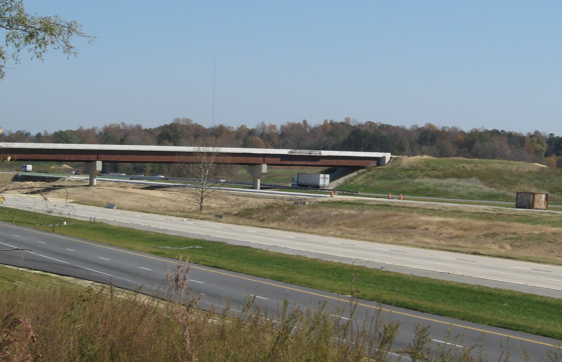
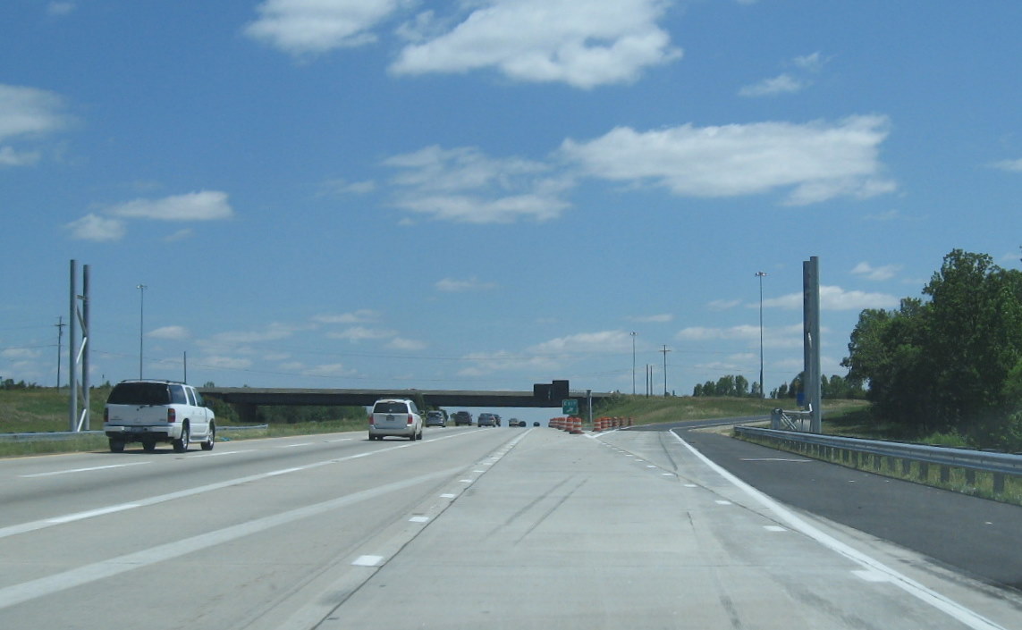
The Right-of Way acquisition phase for the third part (6.7 miles from Business 85 across I-85 to Tuttle Road, SR 1920 near Archdale) was delayed a year, to 2003, due to environmental concerns about the road's path being near the new Randleman Reservoir, a future drinking water source for Greensboro.5,6 Complicating matters, for the 2007 contract letting this segment was split into smaller pieces with part of the contract (a one mile piece east of I-85 to Tuttle Road) assigned to the contract for the next NCDOT project (R-2606), officially called the US 311 Bypass (see I-74 Segment 7). The winning contractor, Blythe Construction put in a combined bid ($104 million) for both projects. Construction started on May 31, 2007, three years after first scheduled.7 There was a ceremonial groundbreaking for the project on July 16, 2007, as described in the official NCDOT press release.8 According to the NCDOT press release noting the contract was approved, the tentative completion date was set for May 2011. However, NCDOT announced in March 2010 that the road would open by that November, 6 months early (even though it was originally supposed to be completed in 2007).10 The 2009-2015 STIP indicated total costs for building this entire segment at $242.8 million.1 The new I-85 interchange was near the pre-existing NC 62 exit, so traffic would use collector/distributor (C/D) ramps to access both NC 62 (now Exit 113A) and I-74/US 311 (Exits 113B and C)from I-85.4 In May 2008, for construction of the I-85 interchange, the ramp from NC 62 to I-85 South was closed and because I-74 passes under I-85, it was necessary to build the C/D ramps for the future I-74 interchange first and then, in October 2008, place I-85 traffic in both directions temporarily on these ramps so that new bridges could be constructed to take I-85 over I-74.11 The new bridges were completed in April 2010 and NCDOT re-opened the original I-85 lanes during April and May. The remaining six months of construction were spent bringing the I-74 roadway to completion.7 For photos documenting the construction of the third section from 2007 to 2010, go to the I-74 Segment 6 Construction Photo Page.
In February 2018 NCDOT advertised for two construction projects along and adjacent to this segment. The first was the building of an extension of Greensboro Road that started just east of the I-74 interchange near High Point. Part of the project was updating the signage for I-74. When the sign plans came out, there was something of a surprise:
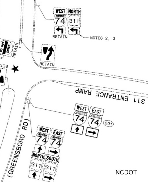
The plans called for only retaining the I-74 signs with the new on-ramp signage only listing I-74. It seemed US 311 was either being removed or re-routed. The answer came in March 2018 when NCDOT announced it wanted to truncate US 311 to High Point due to the confusion of having 2 signed routes in different directions on the same roadway. High Point city officials supported the move.12 AASHTO approved NCDOT's application which calls for the removal of all US 311 signage from the segment by the end of 2018.13 The other construction project, the revising of the NC 68 High Point interchange, let in June 2018, also has signage that will reflect the removal of US 311, and that references to I-40 would be removed from the new NC 68 exit signs:
While US 311 signs were removed from the Forsyth County section of I-74 (see I-74 Segment 5) in April 2020, signage remained in Guilford County until 2021 and have not yet been removed from Randolph County as of late 2025.14
I-74 East at North Main Street: From Just Before Exit 65 Off-Ramp (April 2024)
I-74 East at US 29: From Volleyball Interchange On-Ramp (June 2023)
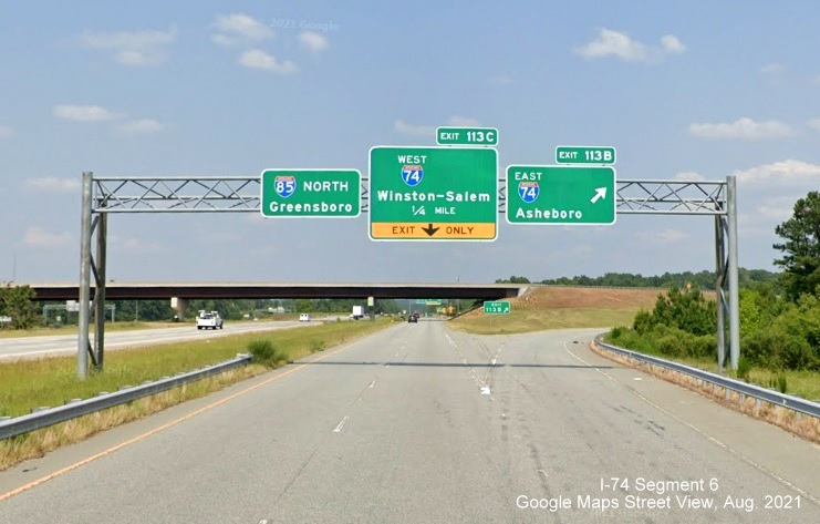
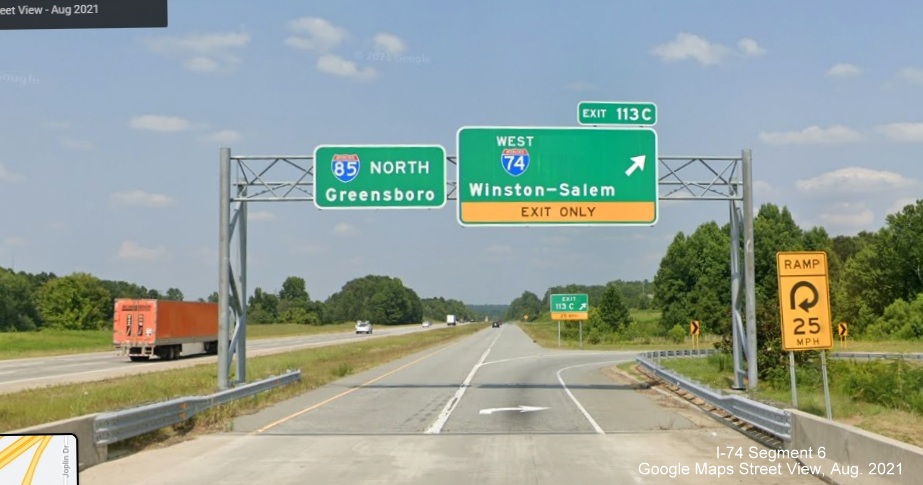
I-74 West at I-85: From On-Ramp to I-85 North (May 2023)
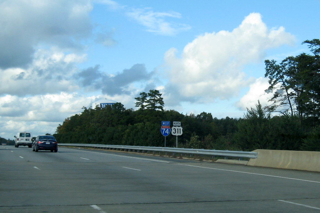
I-74 West at US 70/NC 68: Just Before Exit 67 Off-Ramp (September 2023)
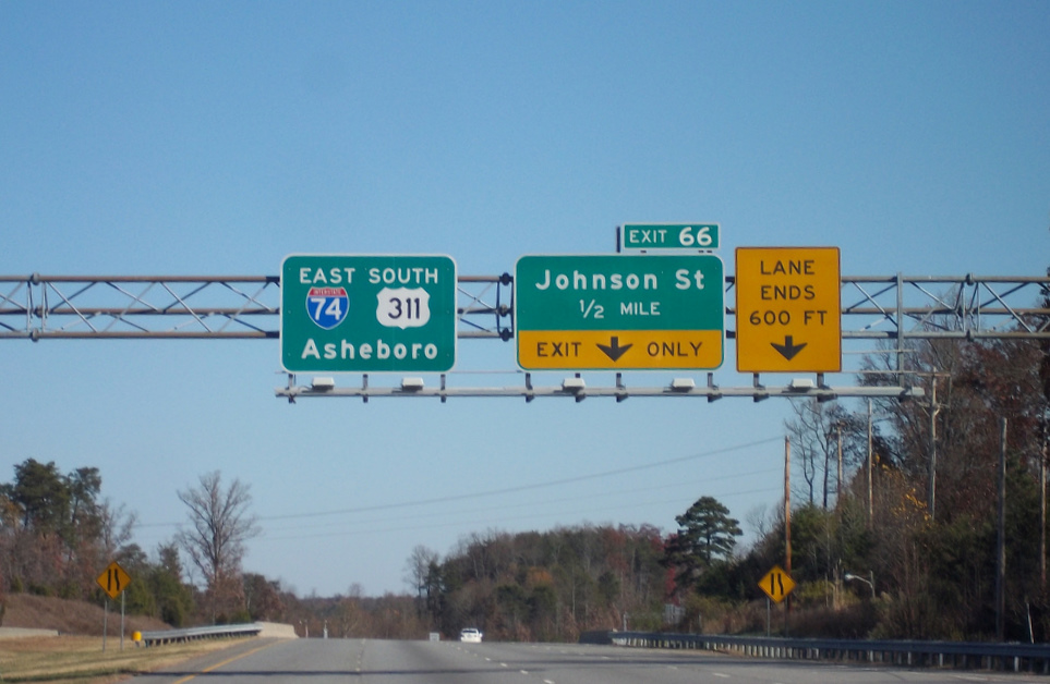
 Pull through sign approaching Johnson Street exit with South US 311
information removed.
Pull through sign approaching Johnson Street exit with South US 311
information removed.
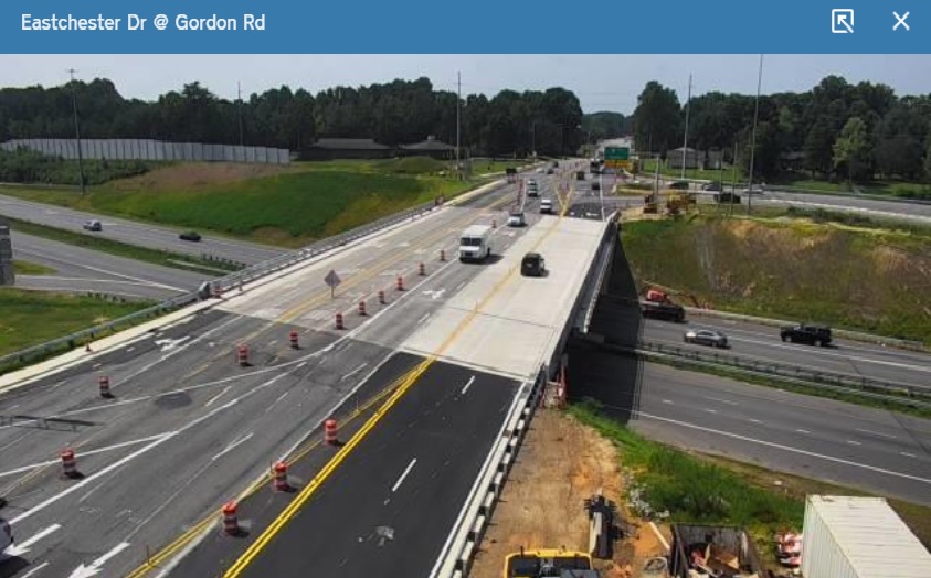
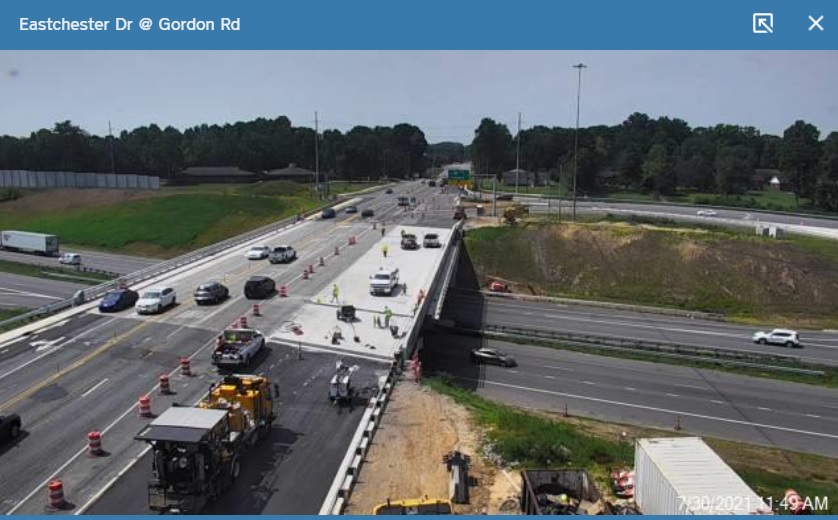
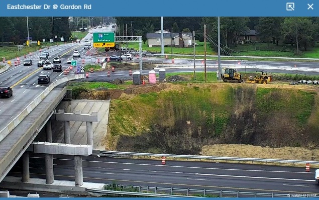
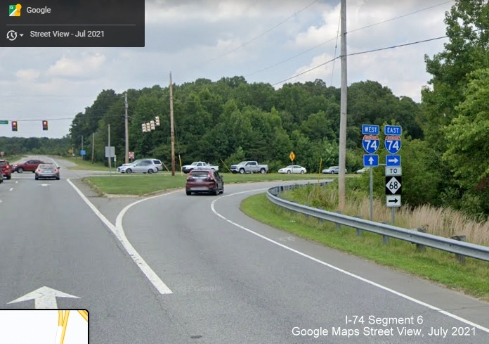
 Signage at the recently revamped NC 68 interchange (see photos below).
The exit sign would be updated in 2024 to reflect that US 70 also now runs along Eastchester Drive.
Signage at the recently revamped NC 68 interchange (see photos below).
The exit sign would be updated in 2024 to reflect that US 70 also now runs along Eastchester Drive.
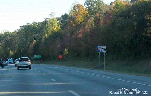 Just when you thought US 311 had disappeared from High Point,
this new sign mysteriously appeared in the fall of 2022. This is after the Greensboro Road exit, probably an in-kind
replacement gone wrong.
Just when you thought US 311 had disappeared from High Point,
this new sign mysteriously appeared in the fall of 2022. This is after the Greensboro Road exit, probably an in-kind
replacement gone wrong.
 Pull through sign at the current Business 85/US 29/US 70 exit with South US 311
information removed. The right hand sign should look similar soon with Business 85 and US 70 removed.
Pull through sign at the current Business 85/US 29/US 70 exit with South US 311
information removed. The right hand sign should look similar soon with Business 85 and US 70 removed.
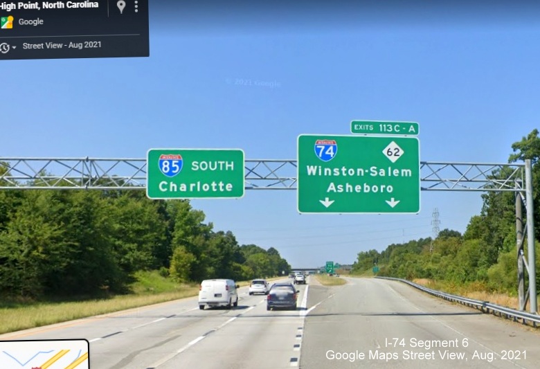
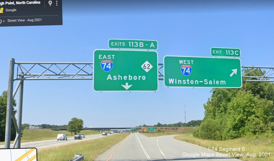
Signage on I-85 for the I-74 interchange:
 Overhead signage on C/D ramp along I-85 North at the ramp for I-74 East with US 311
shields removed.
Overhead signage on C/D ramp along I-85 North at the ramp for I-74 East with US 311
shields removed.
 Overhead signage further up on C/D ramp along I-85
North at the ramp for I-74 West exit , again with US 311 shields removed.
Overhead signage further up on C/D ramp along I-85
North at the ramp for I-74 West exit , again with US 311 shields removed.
 Now heading south, the removed US 311 makes for
widely spaced I-74 and NC 62 shields ahead of the entrance for the C/D ramp along I-85 South.
Now heading south, the removed US 311 makes for
widely spaced I-74 and NC 62 shields ahead of the entrance for the C/D ramp along I-85 South.
 No US 311 shields on the C/D ramp overheads at the
I-74 West exit on I-85 South.
No US 311 shields on the C/D ramp overheads at the
I-74 West exit on I-85 South.
 Finally, the removed US 311 at the I-74 East exit.
Signage on I-74 at I-85:
 Pull through sign for I-74 East with blank area formerly occupied
by US 311 South.
Pull through sign for I-74 East with blank area formerly occupied
by US 311 South.
At the (soon to be former) Business 85 exit:
 Overhead signage at
the "Volleyball" interchange for I-74 exit ramps headed north. Blank space for former references to US 311.
Overhead signage at
the "Volleyball" interchange for I-74 exit ramps headed north. Blank space for former references to US 311.
 Corresponding overhead signage headed south. More blank
spaces for former US 311 shields.
Corresponding overhead signage headed south. More blank
spaces for former US 311 shields.
Further along I-74 in Guilford County:
 Now standalone West I-74 reassurance marker following the I-85 exit.
 West I-74 pull through sign without US 311 following the Business I-85 exit.
 Tipped standalone I-74 East reassurance marker
following MLK Jr. Drive exit.
Tipped standalone I-74 East reassurance marker
following MLK Jr. Drive exit.
 A West I-74 reassurance marker on Greensboro Road no longer
paired with North US 311.
A West I-74 reassurance marker on Greensboro Road no longer
paired with North US 311.
 Standalone West I-74 reassurance marker after Greensboro Road exit.
At the NC 68 (Future US 70) interchange:
 New overhead signage on the ramp from I-74 West, this was replaced in 2024 to reflect US 70 signed along with NC 68.
 New overhead signage for the I-74 West ramp on NC 68 North (Future US 70
East). No blank space because sign was put up with no reference to US 311.
New overhead signage for the I-74 West ramp on NC 68 North (Future US 70
East). No blank space because sign was put up with no reference to US 311.
 The overhead sign for the I-74 East ramp on NC 68 South (Future US 70 West). The one seen in
the traffic camera images above.
The overhead sign for the I-74 East ramp on NC 68 South (Future US 70 West). The one seen in
the traffic camera images above.
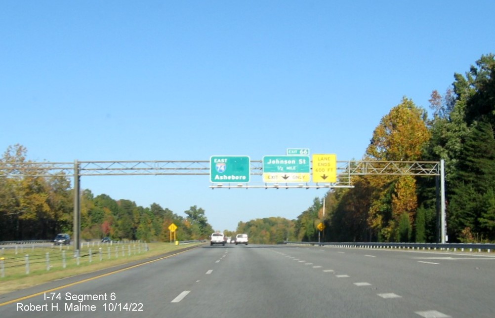
West of the NC 68 exit
 Overhead
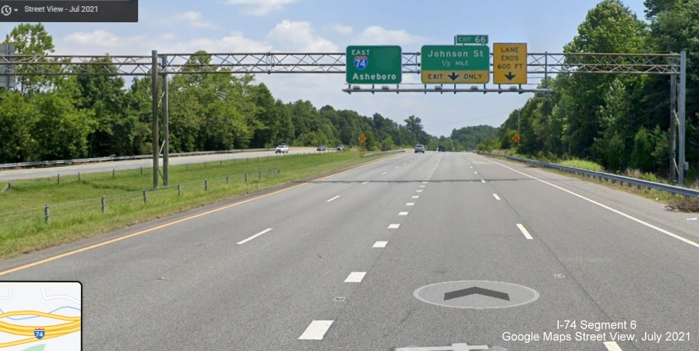
signage at the 1/2 Mile advance for the Johnson Street exit on I-74 East. Blank space for former reference to South US 311.
Overhead
signage at the 1/2 Mile advance for the Johnson Street exit on I-74 East. Blank space for former reference to South US 311.
 Overhead signage
at the North Main Street Street exit on I-74 East. Again a blank space for former reference to South US 311.
Overhead signage
at the North Main Street Street exit on I-74 East. Again a blank space for former reference to South US 311.
 I-74 West and East trailblazers at East I-74 ramp,
no more references to US 311.
I-74 West and East trailblazers at East I-74 ramp,
no more references to US 311.
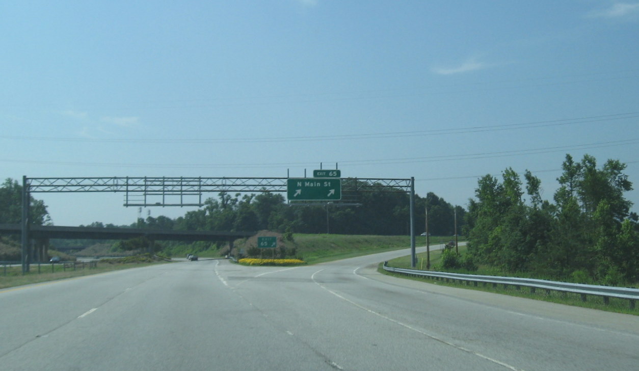
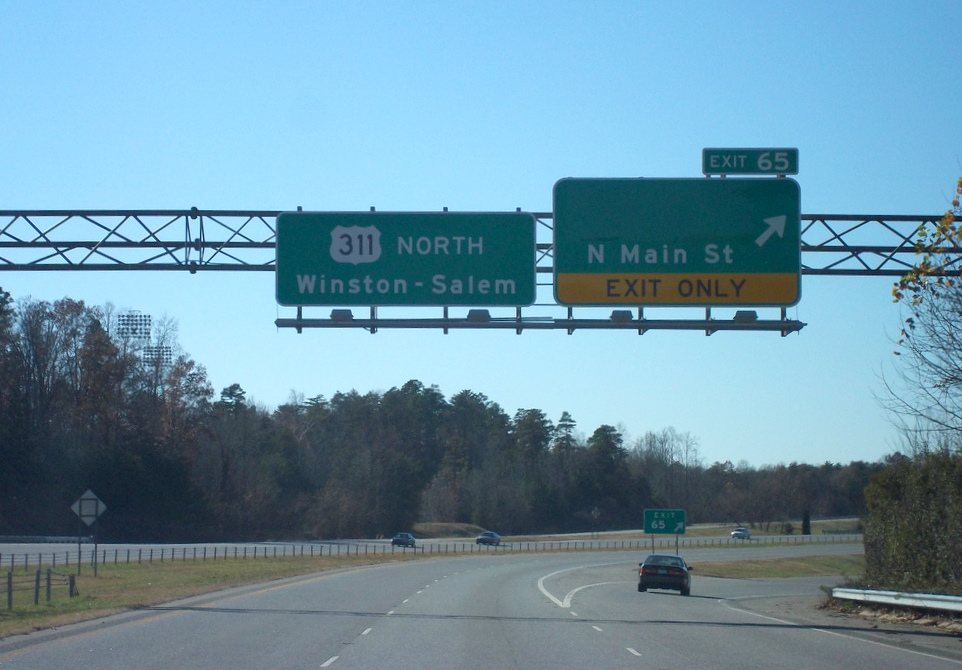
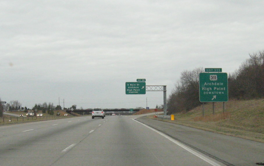
Section 1, Exit 65 (Main Street) to Exit 67 (Eastchester Drive)
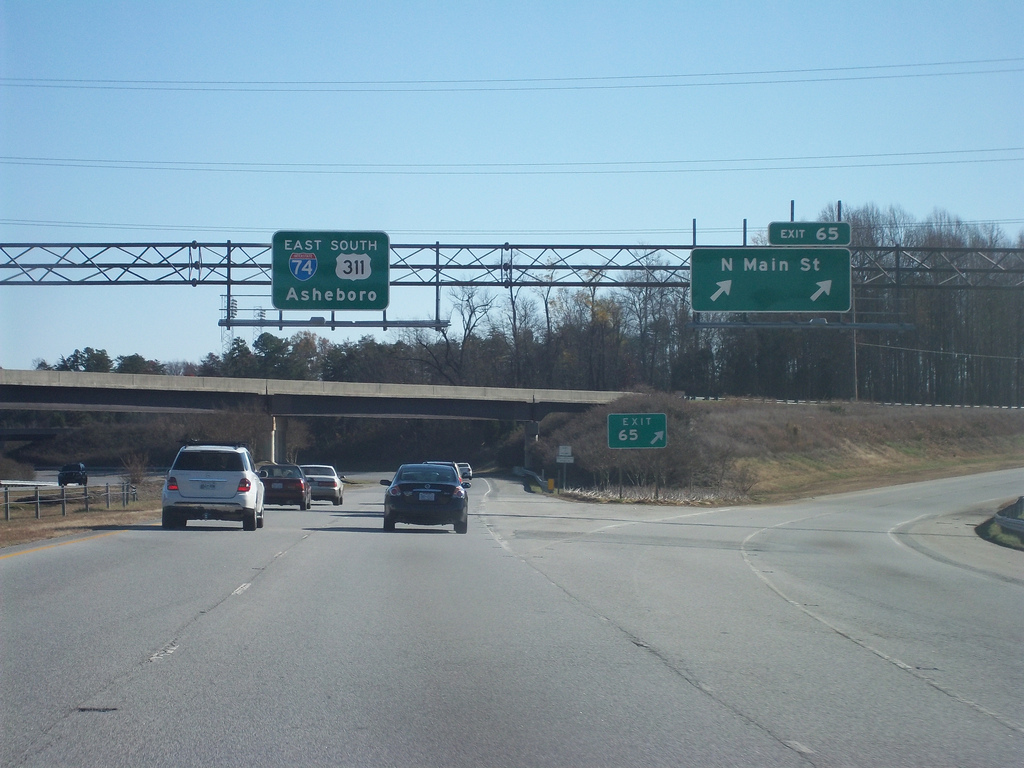 Signage at the start of the 'East Belt' after the
entire freeway was completed in November 2010 (Photo Courtesy of Adam Prince (AP)) (10/28/10) The US 311 shield was removed
from the sign in the spring of 2021.
Signage at the start of the 'East Belt' after the
entire freeway was completed in November 2010 (Photo Courtesy of Adam Prince (AP)) (10/28/10) The US 311 shield was removed
from the sign in the spring of 2021.
 This is how signage appeared in the Spring of 2010 after a tornado had blown
off the original signs, only a new sign for Exit 65 was put up, the former sign has Business US 311, but the route was
decommissioned in the fall of 2009. (4/6/10)
This is how signage appeared in the Spring of 2010 after a tornado had blown
off the original signs, only a new sign for Exit 65 was put up, the former sign has Business US 311, but the route was
decommissioned in the fall of 2009. (4/6/10)
 Sign assembly heading north
on Main Street in High Point. Anyone driving straight beyond the light
enters ramp to US 311 North (Despite what the signs on the right say,
I-74 West ends currently ends at this interchange, the route beyond is
signed Future I-74/North US 311). (10/13/11) This was formerly US 311
(and briefly US 311 Business) before the East Belt was completed to Business 85.
Sign assembly heading north
on Main Street in High Point. Anyone driving straight beyond the light
enters ramp to US 311 North (Despite what the signs on the right say,
I-74 West ends currently ends at this interchange, the route beyond is
signed Future I-74/North US 311). (10/13/11) This was formerly US 311
(and briefly US 311 Business) before the East Belt was completed to Business 85.
 Signage was updated prior to the Johnson Street
exit in November 2010 to reflect the new I-74 designation (AP). (11/28/10)
Signage was updated prior to the Johnson Street
exit in November 2010 to reflect the new I-74 designation (AP). (11/28/10)
 In contrast, the sign was not changed after Exit 66 going
westbound, because currently I-74 ends westbound at Exit 65, though there's no sign to signify this (as opposed to the
eastern end, see below). (AP 11/28/10).
In contrast, the sign was not changed after Exit 66 going
westbound, because currently I-74 ends westbound at Exit 65, though there's no sign to signify this (as opposed to the
eastern end, see below). (AP 11/28/10).
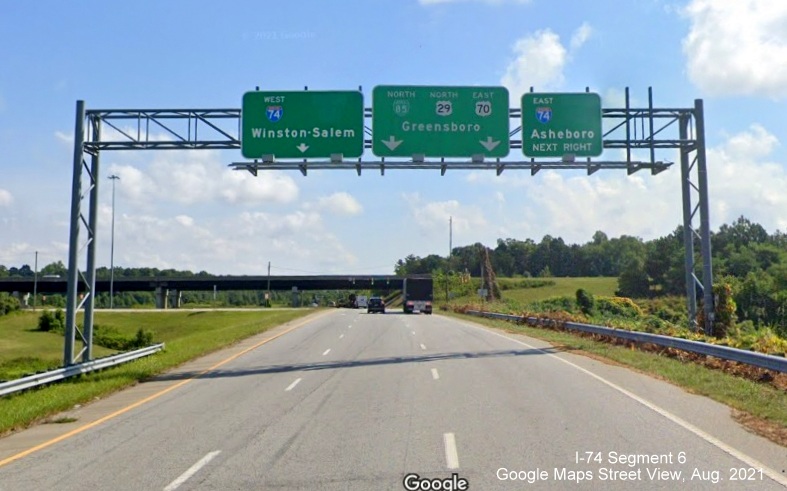
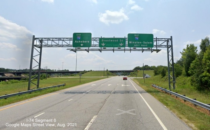
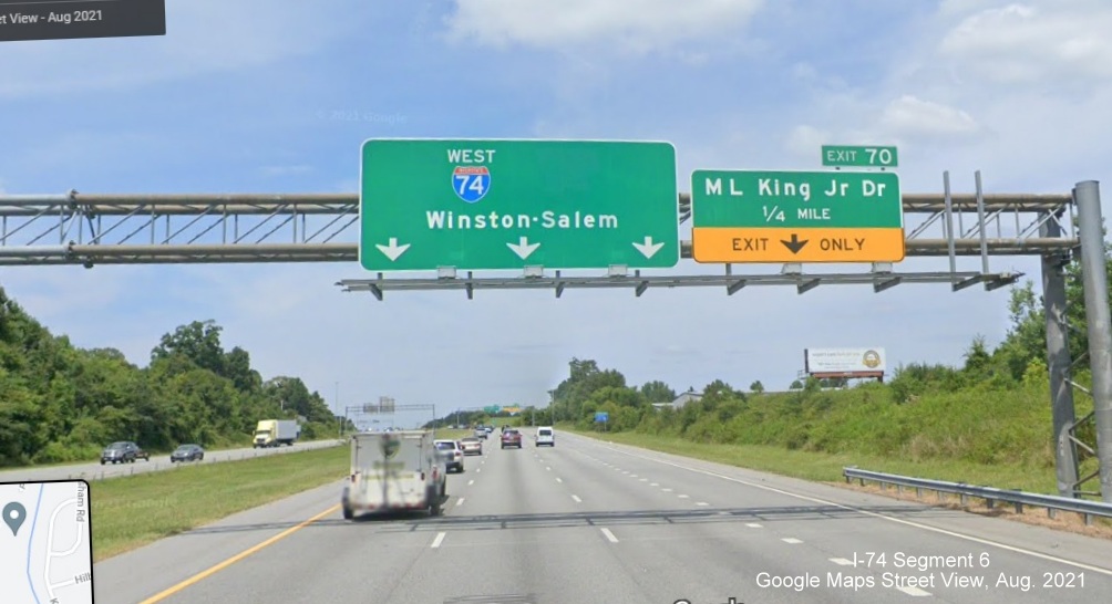
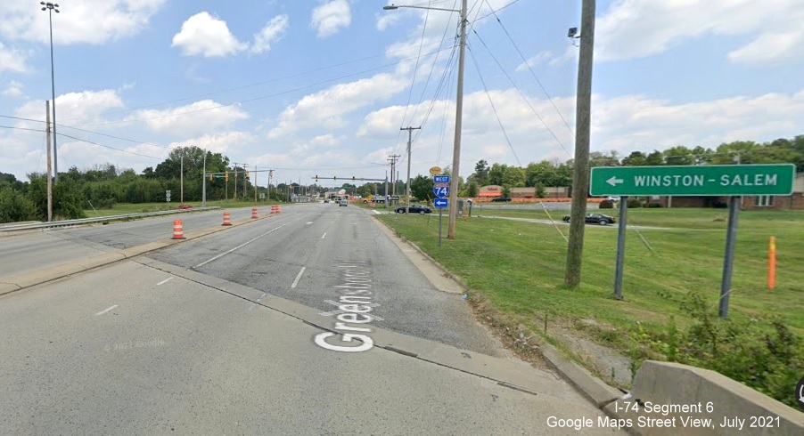
Section 2, Exit 67 (Eastchester Drive) to 71B (Business 85/US 29/US 70)
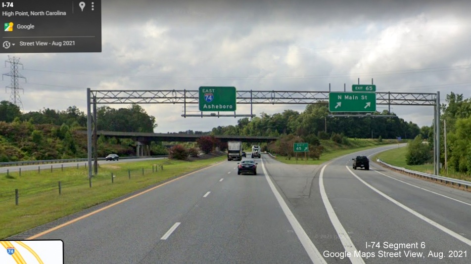
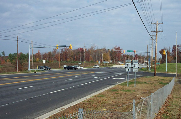
 West I-74/North US 311 signage approaching the NC 68 interchange (Exit 67)
in October 2011. (10/13/11)
West I-74/North US 311 signage approaching the NC 68 interchange (Exit 67)
in October 2011. (10/13/11)
 Looking northbound on NC 68 at the US 311 (Future I-74) interchange in the fall
of 2004. There was a sign assembly before the entrance ramp indicating a control city of Greensboro for US 311 South.
(Winston-Salem is the control city northbound) (11/21/04).
Looking northbound on NC 68 at the US 311 (Future I-74) interchange in the fall
of 2004. There was a sign assembly before the entrance ramp indicating a control city of Greensboro for US 311 South.
(Winston-Salem is the control city northbound) (11/21/04).
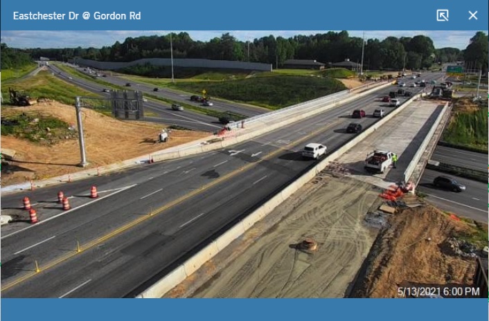
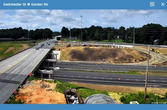
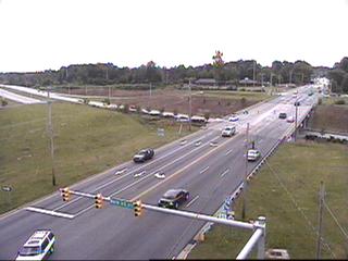 View of the completed I-74/US 311, Eastchester Drive (NC 68) interchange
from city of High Point traffic camera (5/18/11)
View of the completed I-74/US 311, Eastchester Drive (NC 68) interchange
from city of High Point traffic camera (5/18/11)
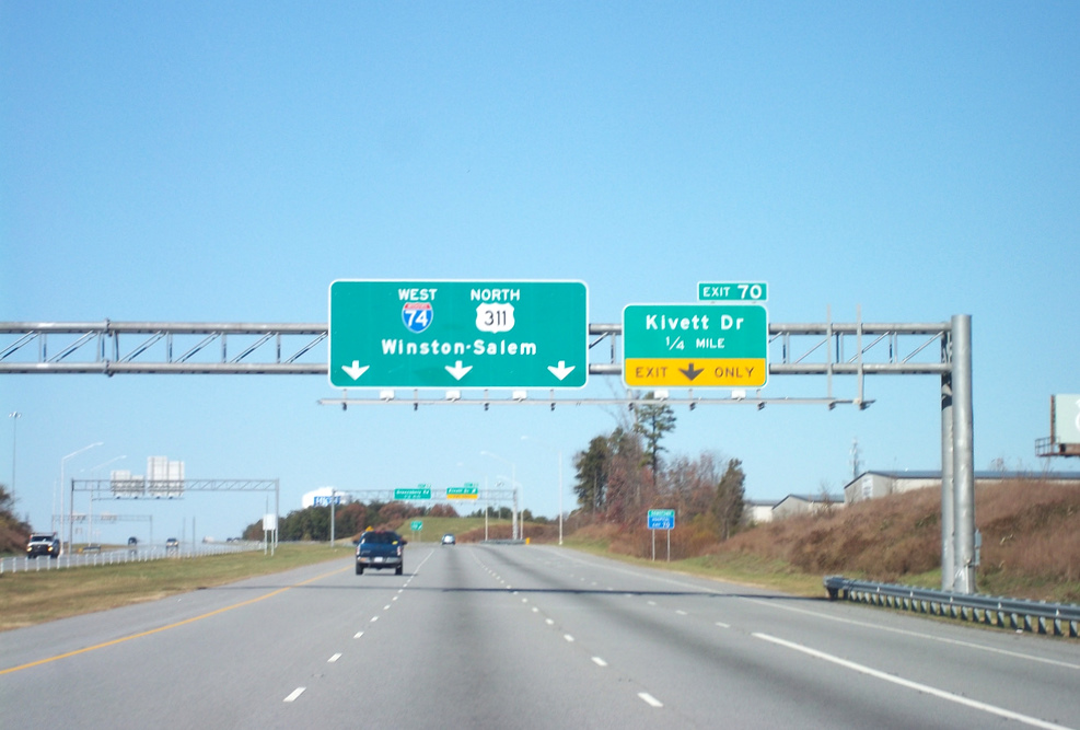 View of new I-74/US 311 signage heading westbound before the Kivett Drive
exit. (AP 11/28/10)
View of new I-74/US 311 signage heading westbound before the Kivett Drive
exit. (AP 11/28/10)
 View traveling up ramp from Kivett Drive to US 311 South (then Future I-74 East)
in July 2010. The interchange has begun to show its age. (7/25/10)
View traveling up ramp from Kivett Drive to US 311 South (then Future I-74 East)
in July 2010. The interchange has begun to show its age. (7/25/10)
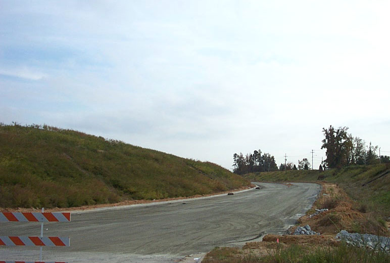 Photo shows Kivett Drive ramp being constructed a year before it opened to US 311
South. (October 2003)
Photo shows Kivett Drive ramp being constructed a year before it opened to US 311
South. (October 2003)
 New signage in place on Kivett Drive
heading west after the competion of the East Belt Highway in November 2010. (10/13/11)
New signage in place on Kivett Drive
heading west after the competion of the East Belt Highway in November 2010. (10/13/11)
 Signage at Kivett Drive onramp to I-74 East. Not all the signs had been changed from the earlier
photo below, particularly the street sign on the traffic light. (10/13/11)
Signage at Kivett Drive onramp to I-74 East. Not all the signs had been changed from the earlier
photo below, particularly the street sign on the traffic light. (10/13/11)
 The US 311 Bypass (I-74) interchange and bridge over Kivett Drive in High Point
almost a year later, the day after the bypass opened. (November 21, 2004)
The US 311 Bypass (I-74) interchange and bridge over Kivett Drive in High Point
almost a year later, the day after the bypass opened. (November 21, 2004)
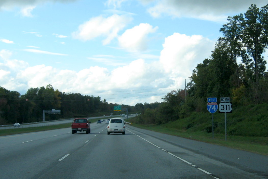
 West I-74 and North US 311 shields heading toward Kivett Drive (Exit 70)
in October 2011. (10/13/11)
West I-74 and North US 311 shields heading toward Kivett Drive (Exit 70)
in October 2011. (10/13/11)
 The then US 311 freeway westbound showing the replacement of exit numbers
with those based on I-74 mileposts in December 2008. The placement of I-74 signs would have to wait until the third segment
was completed in late November 2010. The Exit 70 sign was changed in 2015 when Kivett Drive was renamed Martin Luther King Jr
Drive by the City of High Point.
The then US 311 freeway westbound showing the replacement of exit numbers
with those based on I-74 mileposts in December 2008. The placement of I-74 signs would have to wait until the third segment
was completed in late November 2010. The Exit 70 sign was changed in 2015 when Kivett Drive was renamed Martin Luther King Jr
Drive by the City of High Point.
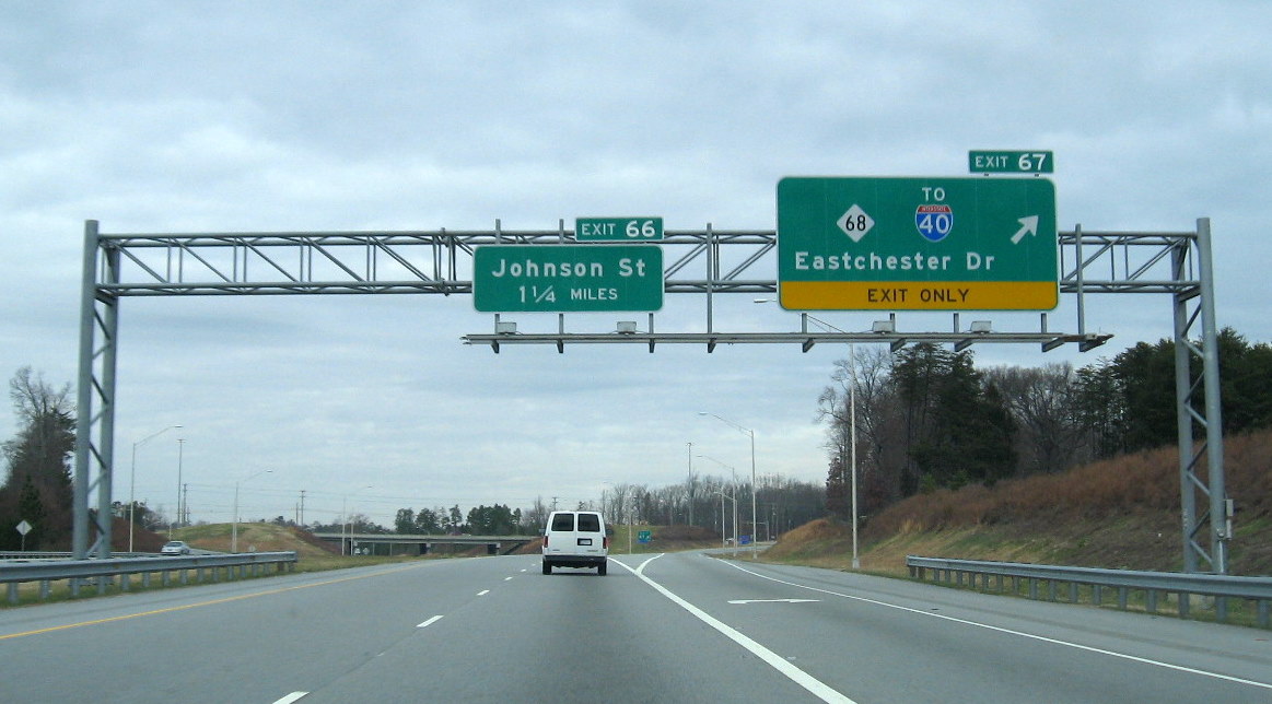
 View further down the US 311 freeway heading westbound showing new exit numbers
in December 2008. (12/14/08)
View further down the US 311 freeway heading westbound showing new exit numbers
in December 2008. (12/14/08)
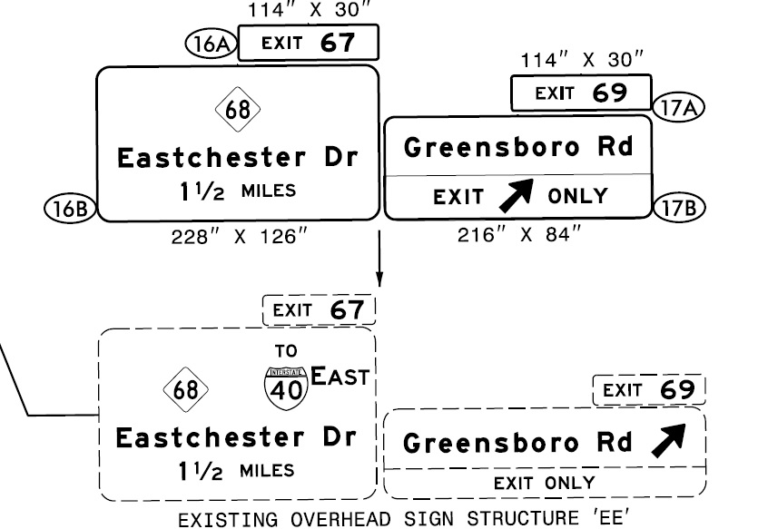
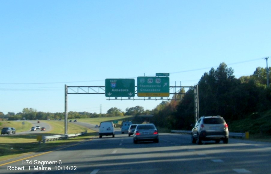
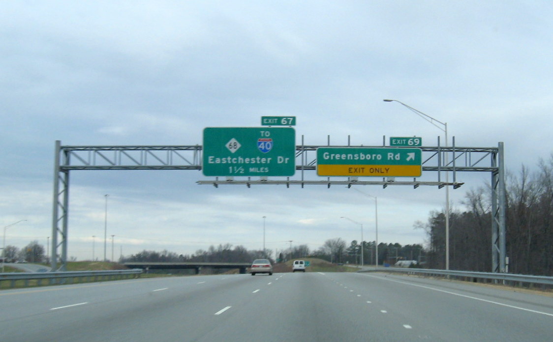
 Continuing westbound on yet to be signed I-74 in December 2008 returning to the
first segment built (The Exit 67 sign was modified to read To I-40 East in 2014 due to comments by drivers). (12/14/08)
Continuing westbound on yet to be signed I-74 in December 2008 returning to the
first segment built (The Exit 67 sign was modified to read To I-40 East in 2014 due to comments by drivers). (12/14/08)
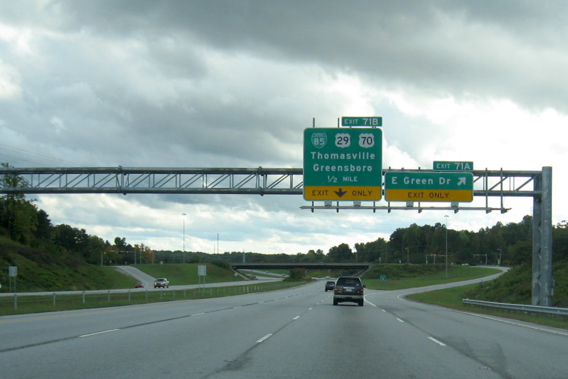 Signage for Business 85 Exit 'Volleyball Interchange' on I-74 East,
the empty bracket was for the former 'All Traffic Exit'' tab. (10/13/11)
Signage for Business 85 Exit 'Volleyball Interchange' on I-74 East,
the empty bracket was for the former 'All Traffic Exit'' tab. (10/13/11)
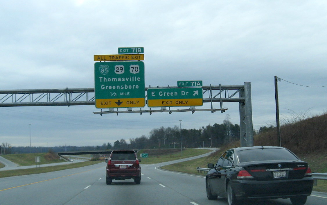 The same exit signs approaching Business 85 heading
eastbound when this was the end of the East Belt Freeway. (12/14/08)
The same exit signs approaching Business 85 heading
eastbound when this was the end of the East Belt Freeway. (12/14/08)
 Signage for ramps to I-74 East and West from Business 85 South 'volleyball'
interchange showing post-opening signage. (10/13/11)
Signage for ramps to I-74 East and West from Business 85 South 'volleyball'
interchange showing post-opening signage. (10/13/11)
 Looking at the unopened ramp from I-74 West/ US 311 North in the Fall of 2007,
which lead to the former construction area (September 2007).
Looking at the unopened ramp from I-74 West/ US 311 North in the Fall of 2007,
which lead to the former construction area (September 2007).
 Signage for I-74 exit on Business 85 South, after US 311 shield was
removed after that route was decommissioned in 2020. Photo by Chris Curley on May 22, 2021.
Signage for I-74 exit on Business 85 South, after US 311 shield was
removed after that route was decommissioned in 2020. Photo by Chris Curley on May 22, 2021.
 Signage for I-74 Exit on Business 85 South when first put up with US 311 shield.
First exit sign is only 1/2 mile from the exit ramp. (10/13/11)
Signage for I-74 Exit on Business 85 South when first put up with US 311 shield.
First exit sign is only 1/2 mile from the exit ramp. (10/13/11)
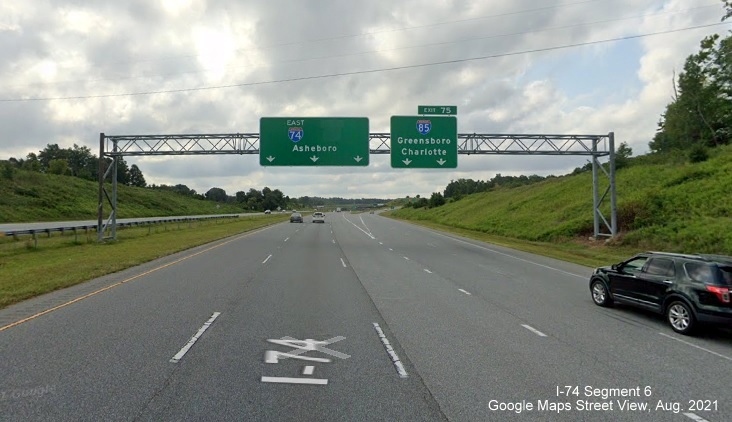
Section 3, Exit 71B (Business 85/US 29/US 70) to Exit 75 (I-85)
This section also includes photos summarizing final construction at each bridge over I-74 before the opening of the roadway in November 2010:15
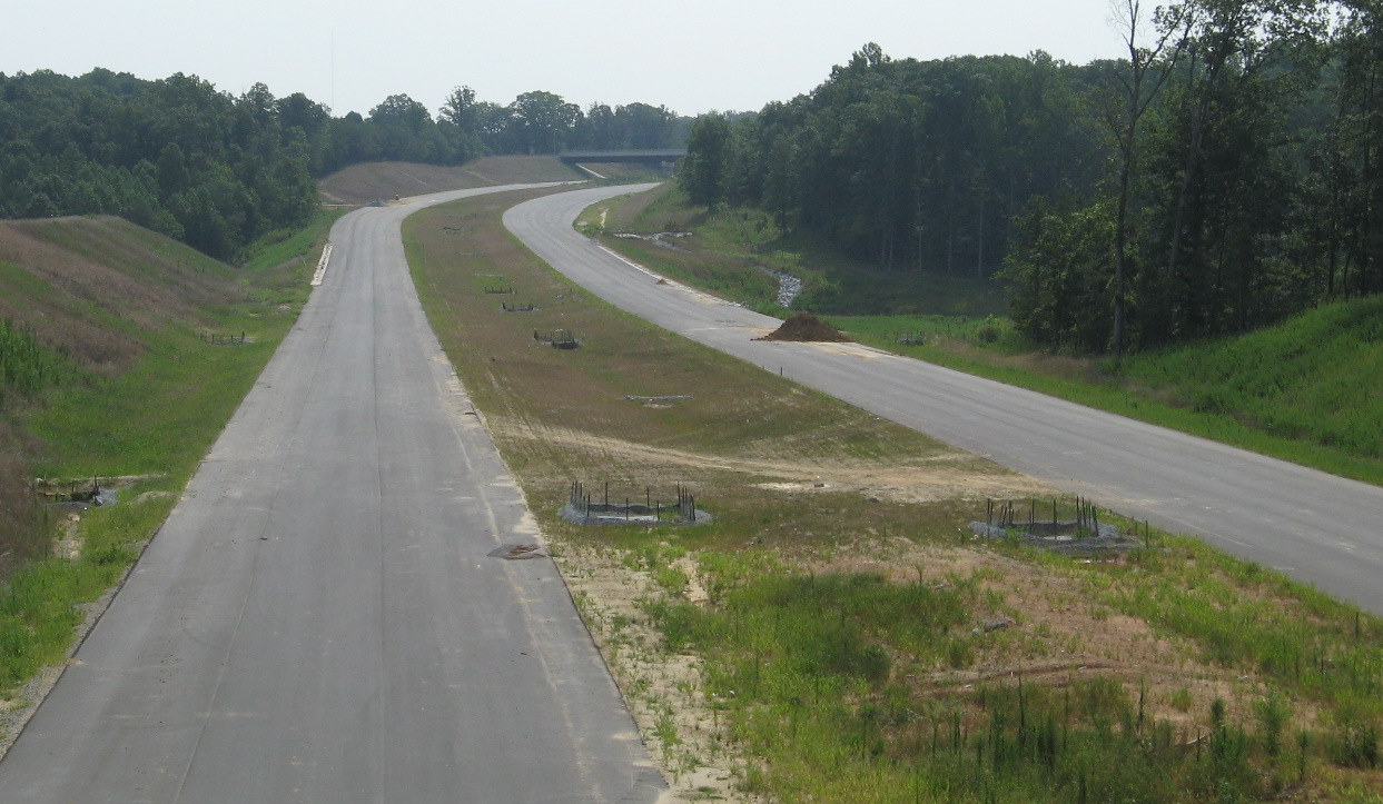
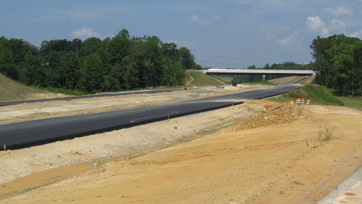
1. Business 85 interchange - the unopened section of the interchange was completed in October 2010. Signs were added to the south (east) of Business 85 in early November 2010, prior to the road opening on November 22.
 View of sign gantries for Business 85 needing signage in October
2010. View is looking along I-74 west where road curves crossing Business 85. (10/23/10)
View of sign gantries for Business 85 needing signage in October
2010. View is looking along I-74 west where road curves crossing Business 85. (10/23/10)
 View of Business 85 from unopened I-74 freeway westbound bridge in October 2010.
The top of the van seen above is using the ramp to I-74 West. (10/24/10)
View of Business 85 from unopened I-74 freeway westbound bridge in October 2010.
The top of the van seen above is using the ramp to I-74 West. (10/24/10)
 I-74 East signage at Business 85 interchange, the former end of the East Belt
highway before November 2010. (10/13/11)
I-74 East signage at Business 85 interchange, the former end of the East Belt
highway before November 2010. (10/13/11)
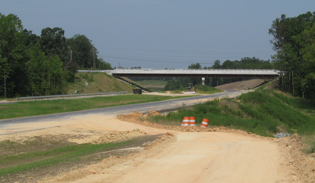
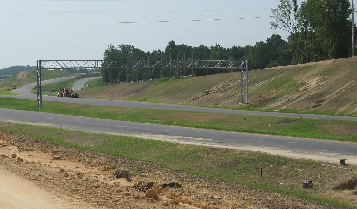
2. Baker Road Bridge - The new bridge was completed in early February 2010 after an 8 month project that started in June 2009. Traffic was put onto a temporary road to the north, completed in June therefore not requiring a detour until the new bridge was completed. Work started on the bridge in July 2009 and by the middle of January 2010 it appeared almost ready to open. Concrete for the roadbed had been completed and asphalt was being laid down to connect the bridge to the old road alignment, as seen in the photo below. The bridge was not opened to traffic though until early March, a delay probably due to weather problems preventing lane markings from being put down.
 The view driving over the newly opened Baker Rd bridge, heading west,
in March 2010. (3/10/10)
The view driving over the newly opened Baker Rd bridge, heading west,
in March 2010. (3/10/10)
 Before the opening of the bridge, a milestone was reached in
July 2010 when the final asphalt layer for the latest part of the freeway met the previous segment's
pavement layer, same sign gantries seen in Business 85 photo above. (7/25/10)
Before the opening of the bridge, a milestone was reached in
July 2010 when the final asphalt layer for the latest part of the freeway met the previous segment's
pavement layer, same sign gantries seen in Business 85 photo above. (7/25/10)
 I-85 exit sign on the opened I-74 East approaching the Baker Road Bridge in
October 2011. (10/13/11)
I-85 exit sign on the opened I-74 East approaching the Baker Road Bridge in
October 2011. (10/13/11)
3. Jackson Lake Road Bridge - This bridge was completed and opened to traffic at the end of November 2008.
 This shows the roadway around the bridge after it received its final coat of
asphalt in April 2010. (5/9/10)
This shows the roadway around the bridge after it received its final coat of
asphalt in April 2010. (5/9/10)
 Here's the view of the bridge soon after it opened, heading south across it
toward its intersection with NC 610. Work to consolidate the excavated material besides the roadbed continued through August
2009. (11/23/08)
Here's the view of the bridge soon after it opened, heading south across it
toward its intersection with NC 610. Work to consolidate the excavated material besides the roadbed continued through August
2009. (11/23/08)
 Approaching the Jackson Lake Road bridge on I-74 East with the second I-85 exit
sign in October 2011. (10/13/11)
Approaching the Jackson Lake Road bridge on I-74 East with the second I-85 exit
sign in October 2011. (10/13/11)
 Proceeding under the Jackson Lake Road bridge along the unopened I-74 East freeway
in October 2010. Note completion of side and median guard rails but not line markings or placement of exit signs. (10/23/10)
Proceeding under the Jackson Lake Road bridge along the unopened I-74 East freeway
in October 2010. Note completion of side and median guard rails but not line markings or placement of exit signs. (10/23/10)
 While most of the project had been completed looking east toward Kersey Valley
Road, work appeared to still be needed for landcaping and water runoff a few months earlier in July 2010. (7/25/10)
While most of the project had been completed looking east toward Kersey Valley
Road, work appeared to still be needed for landcaping and water runoff a few months earlier in July 2010. (7/25/10)
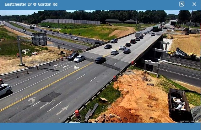
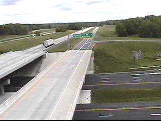
 View from traffic camera at Jackson Lake Road Bridge.
Looking east on open I-74/US 311 in May 2011. (5/18/11)
View from traffic camera at Jackson Lake Road Bridge.
Looking east on open I-74/US 311 in May 2011. (5/18/11)
 View along I-74 of roadway at exit sign for
Business 85 heading westbound just after Jackson Lake Road Bridge. (AP-11/28/10)
View along I-74 of roadway at exit sign for
Business 85 heading westbound just after Jackson Lake Road Bridge. (AP-11/28/10)
 Traveling along the unopened freeway in October 2010 heading west, note the I-74
mile marker, but lack of other signage placement. (10/23/10)
Traveling along the unopened freeway in October 2010 heading west, note the I-74
mile marker, but lack of other signage placement. (10/23/10)
 Looking west in July 2010 at a pile of poles and other metal structures put
together for one of the I-85/NC 62 interchange signs, not the sign above from 11/28/10, assembled in early August. (7/25/10)
Looking west in July 2010 at a pile of poles and other metal structures put
together for one of the I-85/NC 62 interchange signs, not the sign above from 11/28/10, assembled in early August. (7/25/10)
 Here's a view of the opened bridge in November 2009 from another angle. (11/9/08)
4. Kersey Valley Road Bridge - This bridge was opened to traffic in October 2008.
 This view from May 2010 looks southwest along
the curved bridge after the final layer of asphalt had been placed. (5/9/10)
This view from May 2010 looks southwest along
the curved bridge after the final layer of asphalt had been placed. (5/9/10)
 Approaching the newly opened bridge from the southwest in October 2008. A road
off Kersey Valley called Dresden Road (where the truck is seen turning on the right) was used as a detour route and now is a
dead end service road since the freeway excavation cut off access back to Kersey Valley Rd (see photo below).(10/31/08)
Approaching the newly opened bridge from the southwest in October 2008. A road
off Kersey Valley called Dresden Road (where the truck is seen turning on the right) was used as a detour route and now is a
dead end service road since the freeway excavation cut off access back to Kersey Valley Rd (see photo below).(10/31/08)
 This view of the bridge from July 2010 shows the
addition of guardrails along the eastbound lanes, additional landscaping, plus the completion of the construction road seen a
month earlier whose necessity will become apparent in a photo below. (7/25/10)
This view of the bridge from July 2010 shows the
addition of guardrails along the eastbound lanes, additional landscaping, plus the completion of the construction road seen a
month earlier whose necessity will become apparent in a photo below. (7/25/10)
 The view from June 2010 shows work had been completed on placing down the asphalt
layers for the highways, though some landscaping and guardrail work remains. (6/20/10)
The view from June 2010 shows work had been completed on placing down the asphalt
layers for the highways, though some landscaping and guardrail work remains. (6/20/10)
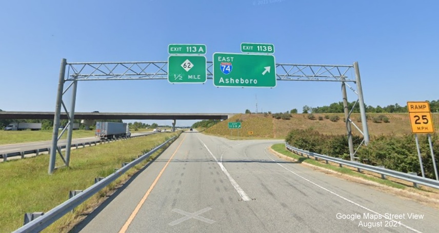
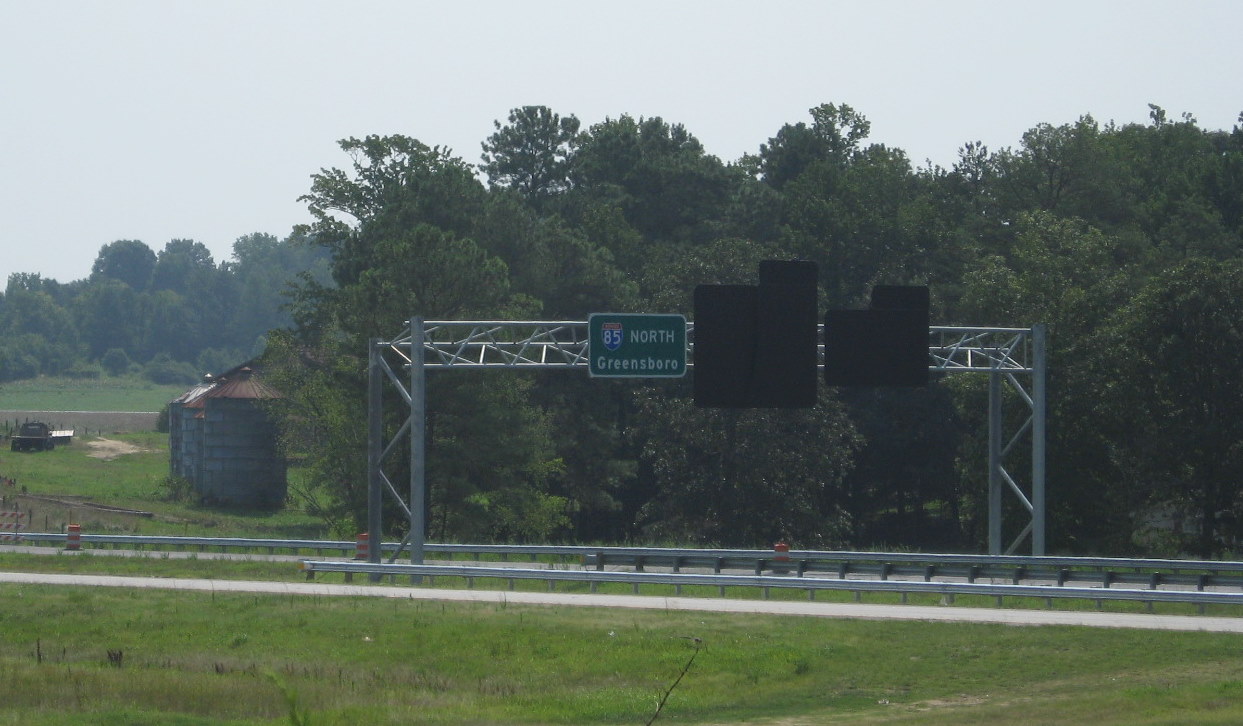
 Overhead signs at the I-74 East interchange with I-85. The interstate and
interchange flyover ramps can be seen in the distance. (10/13/11) The US 311 shield was removed in the spring of 2021, after
that route was decommissioned.
Overhead signs at the I-74 East interchange with I-85. The interstate and
interchange flyover ramps can be seen in the distance. (10/13/11) The US 311 shield was removed in the spring of 2021, after
that route was decommissioned.
 The look south toward the interchange from Dresden Road shows a then new overhead
exit sign assembly that was completed in July 2010 and awaited sign placement. (7/25/10)
The look south toward the interchange from Dresden Road shows a then new overhead
exit sign assembly that was completed in July 2010 and awaited sign placement. (7/25/10)
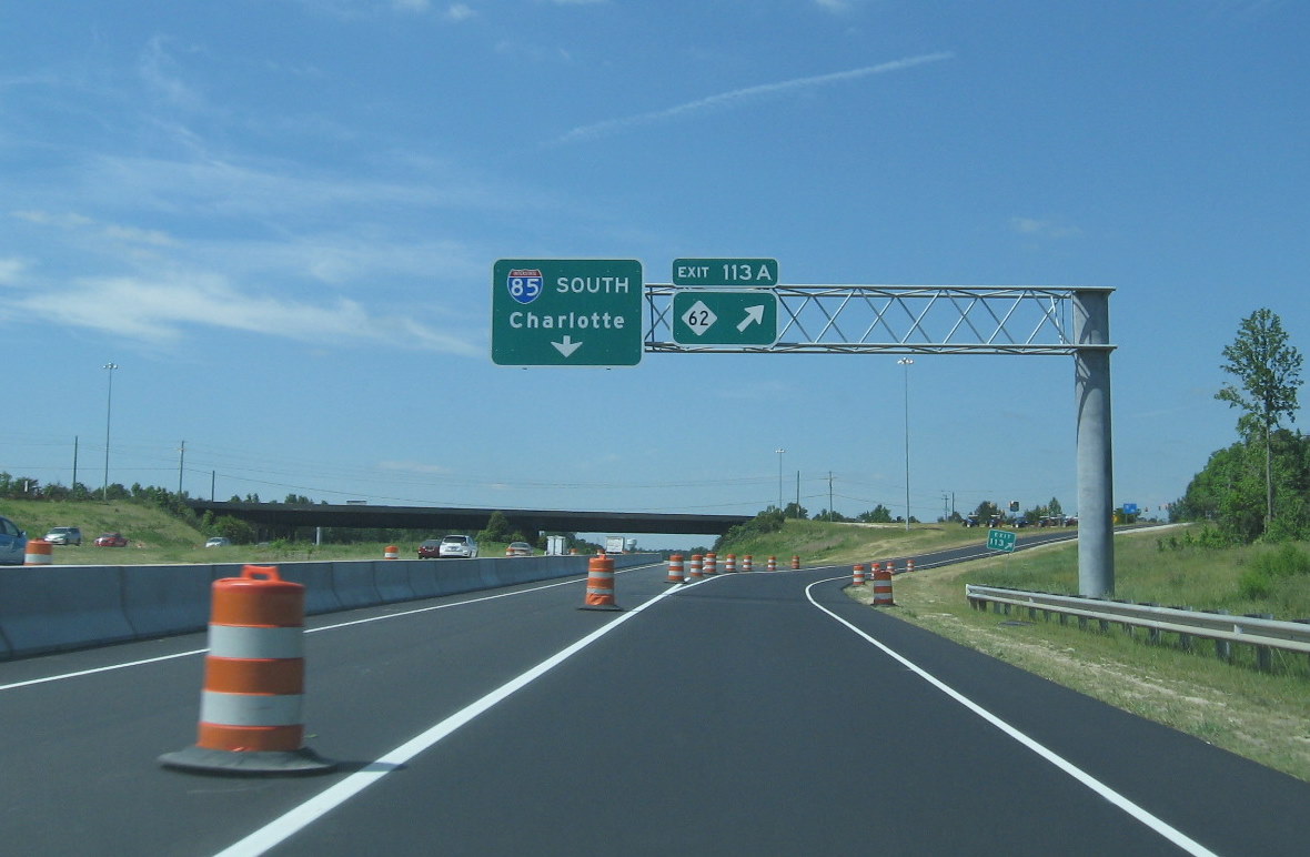
 View of signage on I-85 ramps from I-74 East. The I-85 south ramp leads to C/D
lanes and the NC 62 exit. (10/13/11)
View of signage on I-85 ramps from I-74 East. The I-85 south ramp leads to C/D
lanes and the NC 62 exit. (10/13/11)
 View of the construction materials that can be moved using the freeway
due to the construction of a temporary access road from the freeway towards Dresden Road in June and July 2010. (7/25/10)
View of the construction materials that can be moved using the freeway
due to the construction of a temporary access road from the freeway towards Dresden Road in June and July 2010. (7/25/10)
 View from the bridge looking northwest back
toward the Jackson Lake bridge. This section was one of the most completed in May 2010. (5/9/10)
View from the bridge looking northwest back
toward the Jackson Lake bridge. This section was one of the most completed in May 2010. (5/9/10)
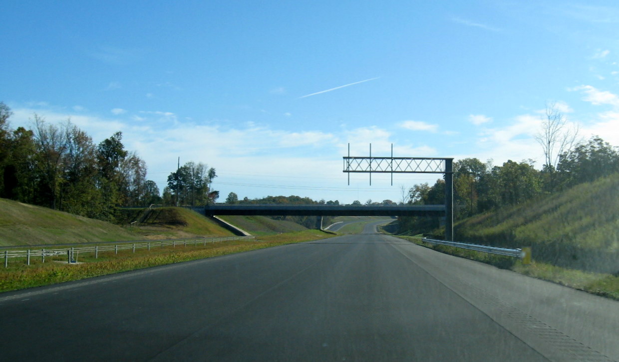
5. The I-85 / US 311 - I-74 interchange
Footings for bridge structures were completed over the summer of 2008 and C/D lanes constructed for the future interchange. Traffic was switched on I-85 in both directions onto the C/D lanes once they were completed in October 2008 so the I-85 road could be excavated for the I-74 freeway. Besides the I-85 bridges, a flyover ramp to carry I-74 East traffic to I-85 north was also constructed and the existing NC 62 exit ramps reconfigured. The original I-85 roadway reopened in mid-April 2010 six months before I-74 in November.
 NEW Photo of I-74 1 1/2 Miles advance sign after US 311 shield was removed, taken by Adam Prince in April
2021.
NEW Photo of I-74 1 1/2 Miles advance sign after US 311 shield was removed, taken by Adam Prince in April
2021.
 Work still remained on building the support
walls for the I-85 roadway over I-74 in Nov. 2009, there also appears to be little asphalt on the southern roadbed after the
flyover. (11/8/09)
Work still remained on building the support
walls for the I-85 roadway over I-74 in Nov. 2009, there also appears to be little asphalt on the southern roadbed after the
flyover. (11/8/09)
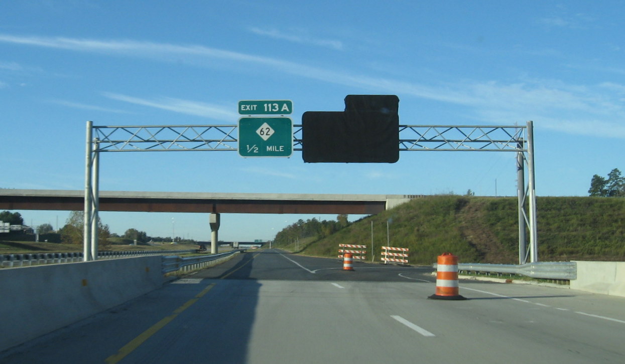
 New exit signs installed in the spring of 2010 on I-85 South, showing the NC 62
exit now designated 113A (old number 113 gore sign on right). (5/9/10)
New exit signs installed in the spring of 2010 on I-85 South, showing the NC 62
exit now designated 113A (old number 113 gore sign on right). (5/9/10)
 Approaching the I-74 interchange back in 2010 a month before it opened showing the
completed signs covered over, the ramp was opened before the I-74 exit was completed to allow access to the NC 62 exit above.
(10/23/10)
Approaching the I-74 interchange back in 2010 a month before it opened showing the
completed signs covered over, the ramp was opened before the I-74 exit was completed to allow access to the NC 62 exit above.
(10/23/10)
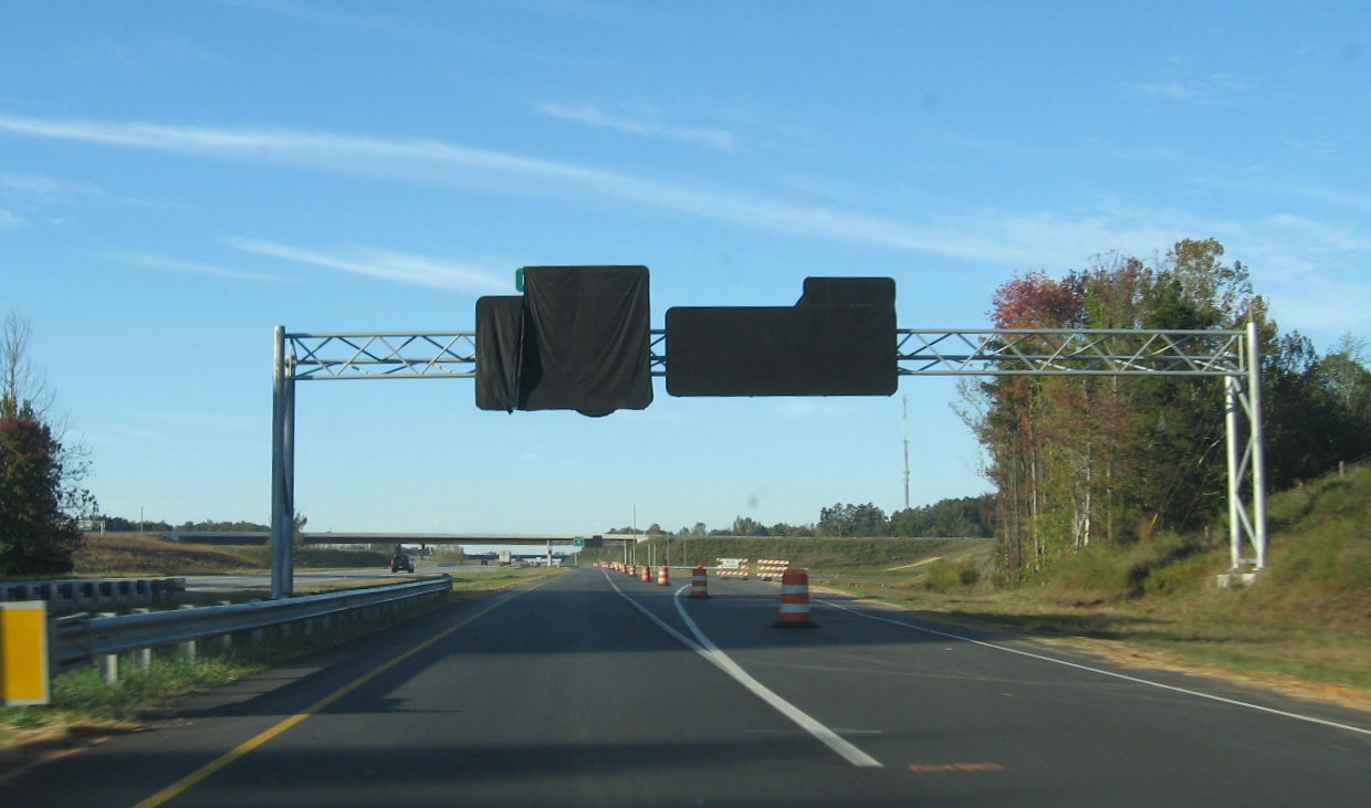 Overhead signs for the future I-74 east and west exit ramps covered over the month
prior to freeway completion. (10/23/10)
Overhead signs for the future I-74 east and west exit ramps covered over the month
prior to freeway completion. (10/23/10)
 A view of the I-74 East ramp off of I-85 South in the setting sun in October
2011. (10/13/11)
A view of the I-74 East ramp off of I-85 South in the setting sun in October
2011. (10/13/11)
 Sign covered over for yet to open I-74 East ramp, through traffic must exit at
ramp for NC 62 seen above, taken one month prior to freeway opening. (10/23/10)
Sign covered over for yet to open I-74 East ramp, through traffic must exit at
ramp for NC 62 seen above, taken one month prior to freeway opening. (10/23/10)
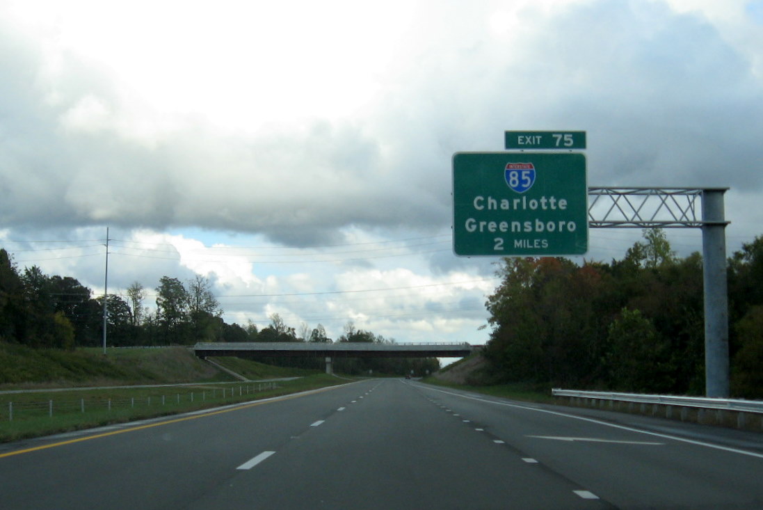
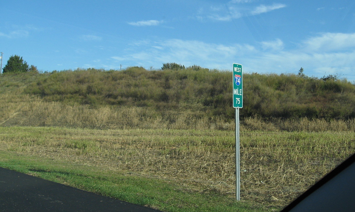 Mile markers for I-74, here for mile 75 near the I-85
interchange, were installed in October 2010, these were continued onto the previously opened section of freeway to the west
after this section was opened to traffic in late November 2010. (10/23/10)
Mile markers for I-74, here for mile 75 near the I-85
interchange, were installed in October 2010, these were continued onto the previously opened section of freeway to the west
after this section was opened to traffic in late November 2010. (10/23/10)
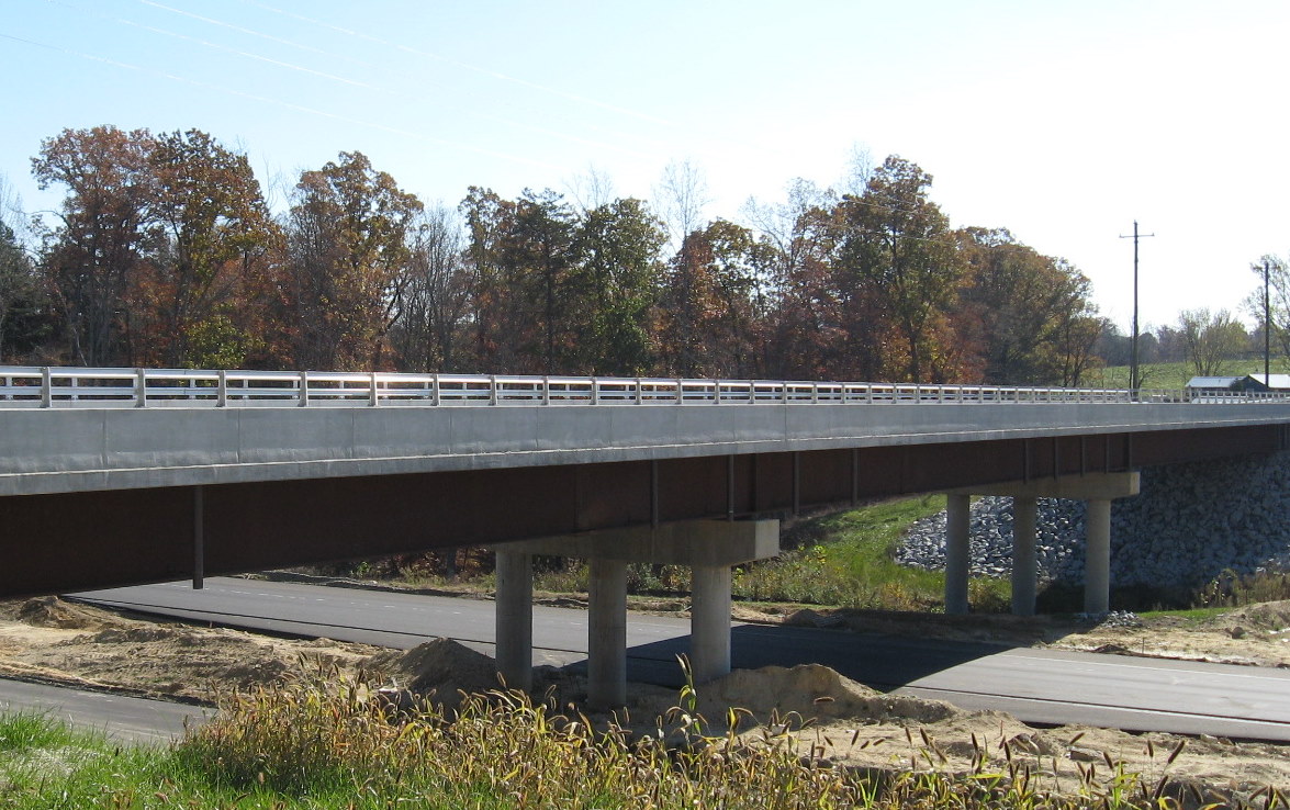
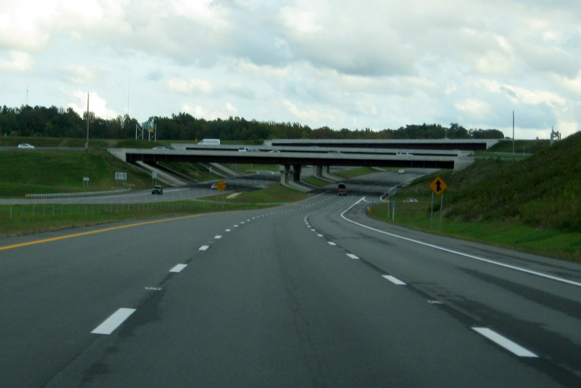 Approaching the I-85 interchange bridges along eastbound I-74 nearly a year after
road opened. There are a total of five bridges over I-74, though some are hidden in this photo. (10/13/11)
Approaching the I-85 interchange bridges along eastbound I-74 nearly a year after
road opened. There are a total of five bridges over I-74, though some are hidden in this photo. (10/13/11)
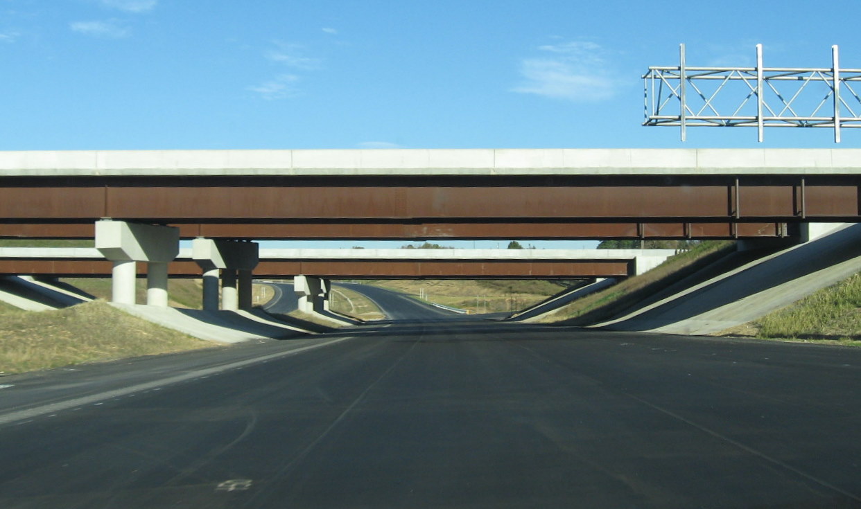 Traveling under I-85 along the unopened I-74 West freeway in October 2010.
Note the lack of line markings and signs needed to still be put in place at that time. (10/23/10)
Traveling under I-85 along the unopened I-74 West freeway in October 2010.
Note the lack of line markings and signs needed to still be put in place at that time. (10/23/10)
 Traveling under sign gantry for I-85 interchange on unopened I-74 East freeway,
same gantry sign as in photo in Kersey Valley Road section taken in July 2010. (10/23/10)
Traveling under sign gantry for I-85 interchange on unopened I-74 East freeway,
same gantry sign as in photo in Kersey Valley Road section taken in July 2010. (10/23/10)
 Photo from July 2010 showing sign assemblies, and signs had
been put up, the future exit signs covered over. (7/25/10)
Photo from July 2010 showing sign assemblies, and signs had
been put up, the future exit signs covered over. (7/25/10)
 Further down I-85 South at the then US 311 Exit, a
new overhead sign indicates a change of the planned Business 311 designation for Main St in High Point and its decommissioning
to a secondary route designation when US 311 was moved to the new freeway. (3/10)
Further down I-85 South at the then US 311 Exit, a
new overhead sign indicates a change of the planned Business 311 designation for Main St in High Point and its decommissioning
to a secondary route designation when US 311 was moved to the new freeway. (3/10)
 The next sign assembly for the I-74 West off-ramp along the I-85 North C/D
ramps near High Point. (7/25/10)
The next sign assembly for the I-74 West off-ramp along the I-85 North C/D
ramps near High Point. (7/25/10)
 Here are the first signs being put up for the new interchange on I-85
North, the NC 62 ramp also has received a new coat of asphalt. (5/9/10)
Here are the first signs being put up for the new interchange on I-85
North, the NC 62 ramp also has received a new coat of asphalt. (5/9/10)
 View of I-85 interchange signage from I-74 West in October 2011. (10/13/11)
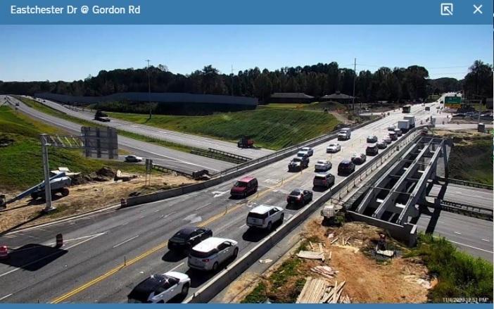
 View of I-85 North C/D ramp and I-74 West exit from city of High Point traffic camera in May 2011.
(5/18/11)
View of I-85 North C/D ramp and I-74 West exit from city of High Point traffic camera in May 2011.
(5/18/11)
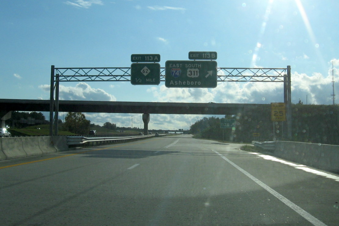
NCDOT changed the exit numbers in the Fall of 2008 along the open part of this segment to conform to those in the East Belt Freeway Contract Documents.3 The former US 311 numbers are in [ ]:
Exit 65 US 311 Business* High Point [25]
Exit 66 Johnston St [24]
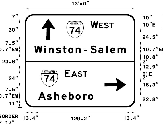
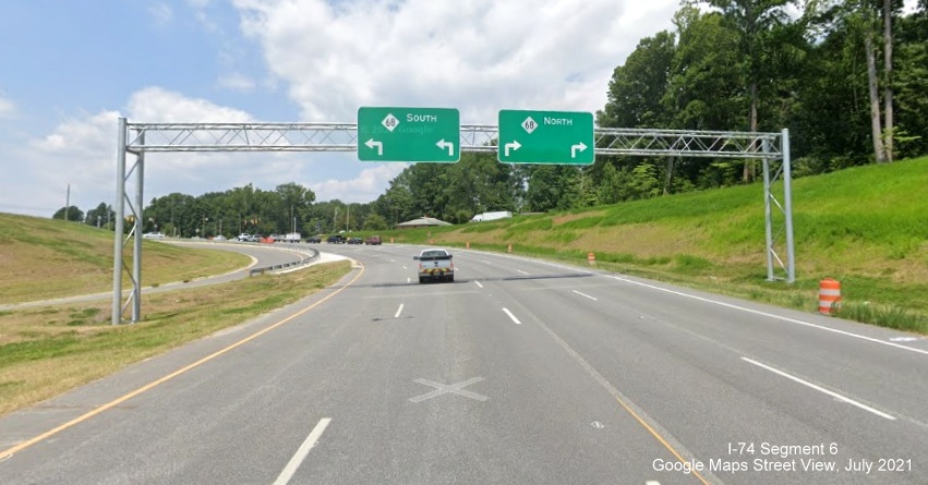
Exit 67 NC 68 to I-40 Eastchester Drive [23]
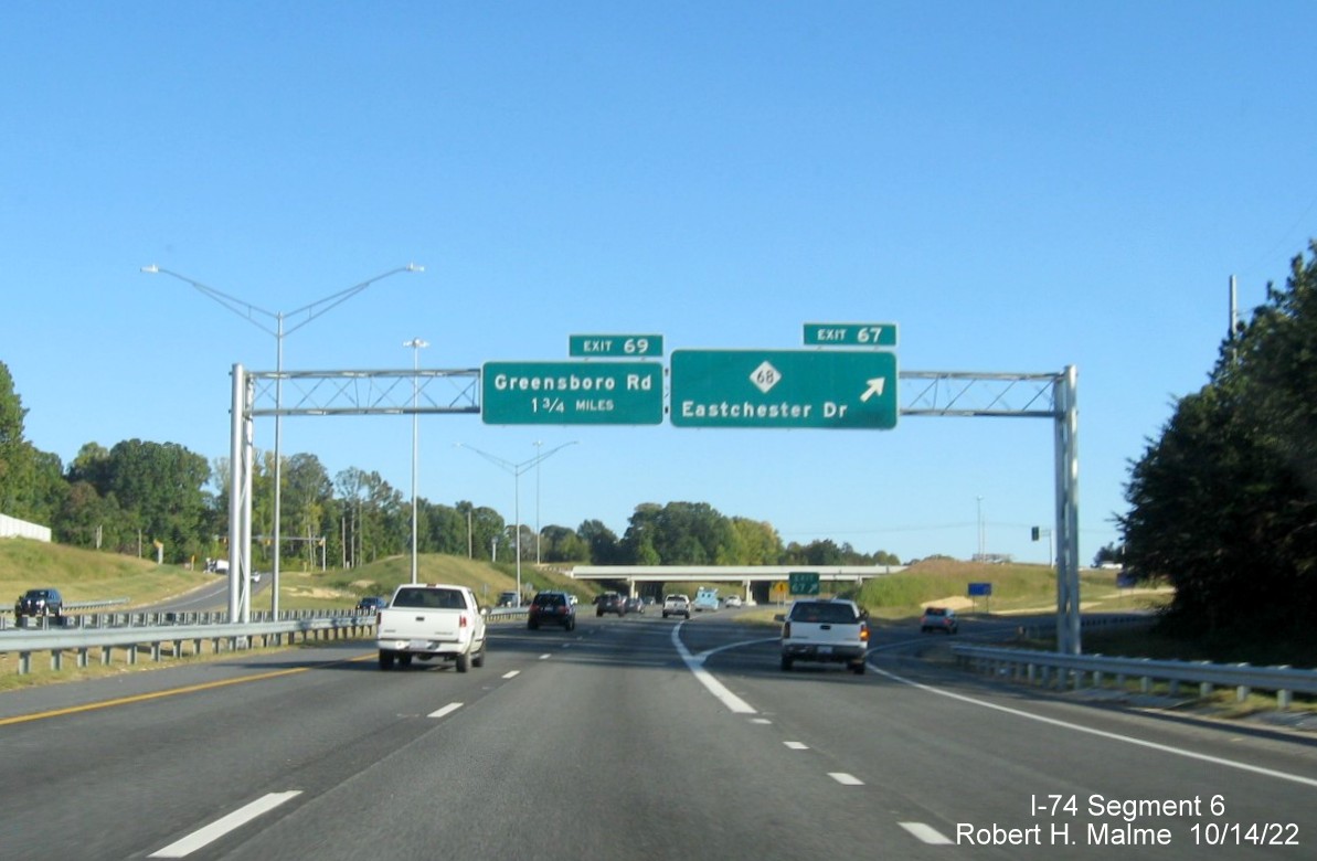
Exit 69 Greensboro Rd [21]
Exit 70 Kivett Drive [20]
Exit 71A Green Street (WB only) [19B]
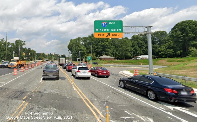
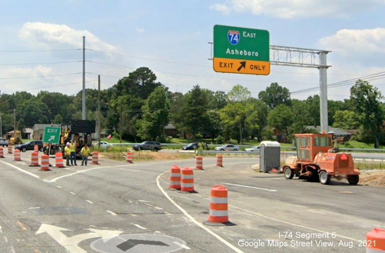
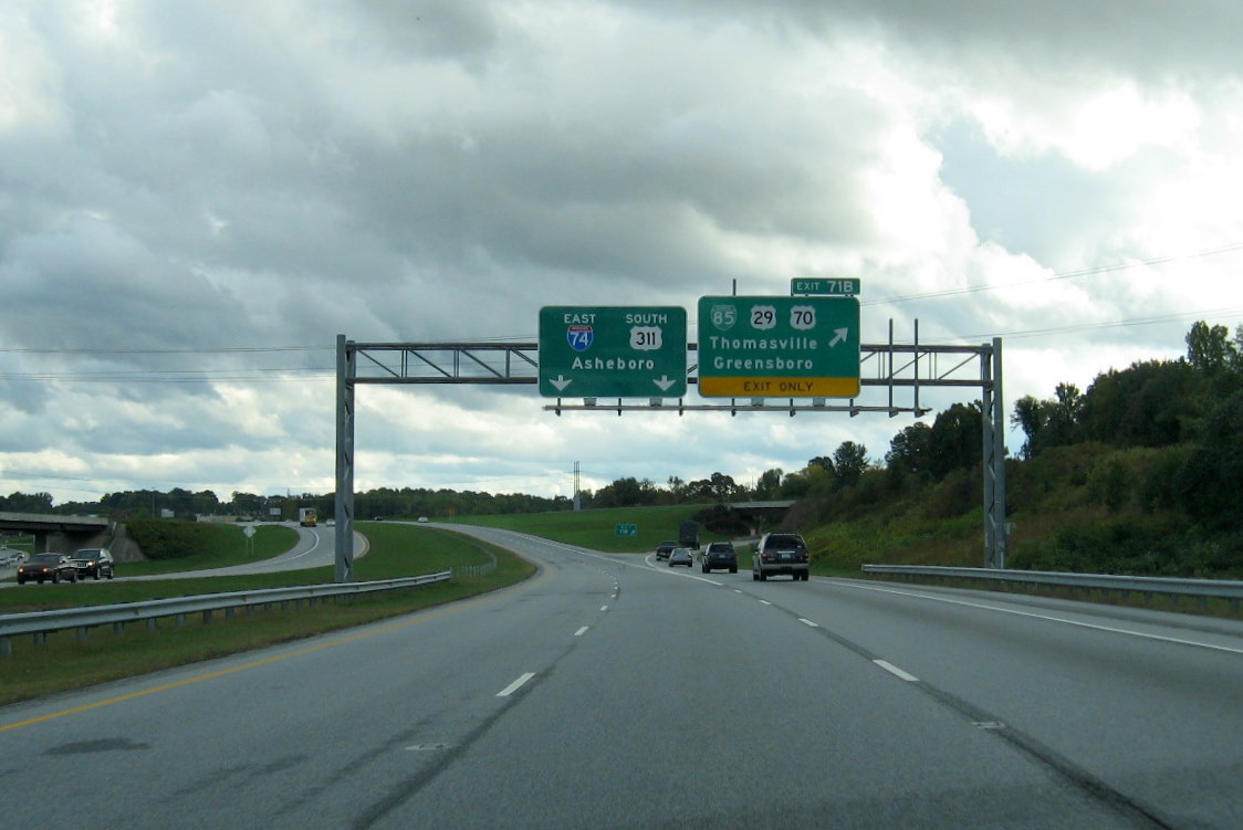
Exit 71 (71B WB) Bus. Loop 85/ US 27/ US 70 Thomasville Greensboro [19(A)]
*NCDOT submitted an application to AASHTO's U.S. Route Number Committee to eliminate the Business 311 designation along Main Street through High Point and return it to a secondary route status. This request was approved at the Fall AASHTO meeting in Los Angeles in late October 2009, signs were not changed until 2010.