Wilson-Goldsboro FreewayFirst Proposed: 2001Route Approved: September 2007Initially Signed: November 2007Fully Signed: March 2010The Route: Former US 117 Freeway from US 70 near Goldsboro
|
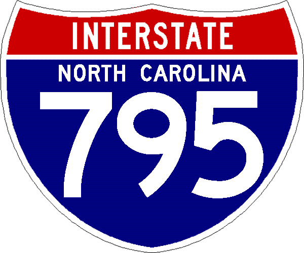
Interstate 795 is the designation for the former US 117 freeway between I-95 at the now I-587/US 264 interchange in Wilson and US 70 in Goldsboro, though the route was official in 2007, not all the route and exit signage (particularly needed along the US 264 section) was put up until March 2010. The route is now planned to be extended further south from Goldsboro to I-40 near Faison. In anticipation, two interchanges have been upgraded along US 117 south of Goldsboro, but most of the work remains unfunded with the release of the Final 2026-2035 STIP in July 2025.
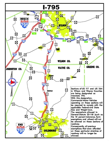 Map courtesy of NCDOT
Check out these new videos from Roadwaywiz from February 2026:
Travel I-795 North from Goldsboro to I-95
Travel I-795 South from I-95 to Goldsboro
Establishment
This freeway was only established in 2007 but quickly became an infamous interstate due to its many problems. The route starts at the current I-95 interchange (Exit 119) with US 264, and, as of 2022, I-587 near Wilson. At the time only the second concurrent routing of 2 3 digit interstates (3dis) in the country (joined by the I-785 and I-840 Greensboro Loop in 2023) and proceeds four miles east to the interchange with the formerly US 117 freeway finished in 2006. The route then travels south 21 miles to the last freeway exit at US 70 in Goldsboro. Getting the US 117 freeway designated as an interstate had been a long-range goal by Goldsboro and Wayne County officials. The route number was first proposed in 2001.1 AASHTO conditionally approved the number for the highway on September 28, 2007 after several months of negotiating with the FHWA and NCDOT. The condition was largely getting word from the FHWA that they approved the interstate route, see below for details. It seems trucks larger than 48 feet could not use the route due to a lack of an interstate designation, and so many trucks were fined by the NC State Police for using it. With the AASHTO approval, on October 8, 2007 the route became an interstate according to state troopers, which then allowed 53-foot trucks to use the road without fear of getting a ticket.1,2 AASHTO removed the conditional approval tag on October 22, 2007.3 The officially signing of the road started on November 8, 2007 (again, see below).
AASHTO's approval came after a rejection earlier that year at the May 4, 2007 meeting of the organization's Special Committee on U.S. Route Numbering (USRN).4 That committee listed the reason for its rejection the belief that the interstate application was premature as that the proposed route did not appear on the FHWA's list of future interstate corridors. Correspondence with the FHWA sent to AASHTO in April 2007 indicated that agency would probably approve the route if NCDOT improved a section of the US 117/264 freeway which was prone to accidents in wet weather. NCDOT indicated a contract to do so would be let in May.5 The contract, W-5007 was listed in the 2007-2013 State TIP as costing $800,000, and was completed by the end of the summer of 2007.6 The US 117 freeway part of I-795 was built to interstate standards and did not need any new construction to get the I-795 number, at least in 2007.
Problems with Pavement
A swift deterioration in the pavement of the 2-year old route was first reported on in January 2008 along a 2.5 mile segment of I-795. Speculation was that due to the design, which used a thinner layer of asphalt typically used for US routes, not a thicker slab typical of interstate highways, the road surface had not held up to use by heavy trucks.7 In April 2008, the FHWA agreed to study the problem and recommend a solution. Part of the study included using a specialized truck that sent sound waves through the asphalt to try to detect whether the rest of the roadbed was deteriorating, or just that short section.8 While the FHWA continued to study the road, NCDOT patched the 2.5 mile problem area starting in Fall of 2008 at a cost of $483,000.9 On January 8, 2009 NCDOT released to the public the content of the FHWA's report. The report indicated the width of the pavement was probably not to blame but the quality of the pavement (that included possible air bubbles) and the use by heavy trucks combined that resulted in the crumbling of the pavement in some areas. They recommended that the whole route be rebuilt with an additional 2.5 to 3 inches of asphalt added for the future roadbed. The total cost would run between $15 and $22 million to repair.10 The public was not amused by another 'botched job' by the NCDOT.11 The repair project started in November 2009, an initial asphalt layer was to be placed on the highway along the right lanes first, before the end of 2009. Then both lanes of the highway in either direction would receive a final layer of asphalt. The initial asphalt has been placed on the entire affected area northbound as of mid-January, but only partly southbound. The entire route was repaved by the fall of 2010. In 2011, the repaving project, somewhat ironically, won the Sheldon G. Hayes Award from the National Asphalt Pavement Association for excellence in asphalt pavement construction with credit given both the contractor and NCDOT.12
Complications with Signing I-795
NCDOT announced on November 8, 2007 that I-795 signs would start going up along the roadway within the next two weeks. Signage was put up along the highway and at most exit ramps on November 28. Mileposts and revising signs at the interstate's endpoints were supposed to take a little longer, but as the press release indicated these would be installed by the spring of 2008.13 However, a trip along I-795 six months later in September 2008 showed no further progress. Exit numbers and mileposts had not been changed to reflect I-795's mileage. US 117 signs were taken off the freeway when the I-795 signs went up and put back up on its old alignment that had been re-designated US 117 Alternate. The end of US 117 reverted to its previous end at US 301 and all US 117 signs along the US 264 freeway portion were removed. However, in what could be called a slight miscalculation on NCDOT's part, AASHTO rejected moving US 117 back to its old alignment both in May and November 2008 citing a provision where a US route cannot be put back on an alignment inferior to its current one, in this case going from a 4-lane freeway back to a 2-lane road.14 NCDOT re-sent the application again explaining since US 117 had been on its previous alignment for more that 50 years, it was less confusing to the public to have it restored to its old route and sign the new freeway I-795 (and besides NCDOT had not added many 'Alternate' banners to the existing US 117 signs along the route anyway). AASHTO then finally agreed to a change of heart and approved restoring US 117 back to its old route in April 2009.15 NCDOT could now go forward with revising exit numbers and mileposts, the new exit numbers appearing first on the 2009-10 NC State Map released in January 2009, though they did not start changing the numbers on the actual road until late 2009. The numbers according to the map were to start at I-95 and increase as one goes south, US 70, the last interchange, was to be exit 24. This is opposite to standard interstate mileage practice, where mileage starts at the southern border or highway end. However, it was in compliance with 2009 MUTCD standards which indicate mileage on a spur route should start at its parent roadway interchange and increase from there. However, NCDOT ended up not putting in new I-795 numbers, sticking to the existing US 264 mileage numbers, where that highway shared the freeway with I-795 for the first 5 miles. Ironically, this was contrary to the MUTCD which indicates exit numbers for an interstate take precedence over a US route, even if the US route was there first. When I-587 was established along US 264 in 2022, exit numbers were finally updated to an interstate routes, I-587. (To see new I-587 signage, visit the New/Future I-587 page).
Extension beyond Goldsboro Approved in 2015
Original proposals for an interstate route along US 117 had the interstate continue south from Goldsboro to connect with I-40 near Kenly. A NCDOT spokesman in 2005 though indicated this proposal was too costly since it would require massive reconstruction of the route through Goldsboro, though both that city's and Wilson officials would like an extension of the route down to I-40 to help commercial and local traffic.7,16 In 2014, Senators Richard Burr and Kay Hagan, along with several NC congressman, sponsored a piece of legislation called the "Route to Opportunity and Development Act of 2014,” that would designate U.S. 117 as a future interstate highway between Goldsboro and I-40, presumably for an extension of I-795.17 In 2016 Congress passed a new transportation funding law, The Fixing America's Surface Transportation (FAST) Act, which was signed by President Obama on December 14, 2015, that included the upgrading of US 117, with the exception of a bypass around Goldsboro, to interstate standards. While no money was included in the bill, NCDOT, as part of its preliminary list of 2018-2027 STIP projects,18 included several US 117 projects that could be use to upgrade parts of the route to an interstate, pending their inclusion in the final documents. Here was a list of the projects:
| Route | From / Cross Street | To /Cross Street | Project: | Cost |
| US 117 | North of SR 1135 (Country Club Road) | South of SR 1129 (South Landfill Road) | Upgrade Roadway to Interstate | $17,300,000 |
| US 117 | South of SR 1129 (South Landfill Road) | South of SR 1927 (Genoa Road) | Construct Interstate on New Location | $35,000,000 |
| US 117 | South of SR 1927 (Genoa Road) | South of NC 581 (Arrington Bridge Road) | Construct Interstate on New Location | $62,400,000 |
| US 117 | South of NC 581 (Arrington Bridge Road) | North of NC 581 (West Ashe Street) | Construct Interstate on New Location | $111,300,000 |
| US 117 | SR 1006 (W Trade Road) | NC 55 in Mount Olive, NC | Upgrade US 117 to Interstate, with interchanges at US 117 and NC 50. | $61,400,000 |
| US 117 | I-40 in Sampson County | SR 1006 (W Trade Road) | Upgrade US 117 to Interstate, with interchanges at US 117 and SR 1006. | $69,900,000 |
Two years later, the Final 2020-2029 STIP included the following listings for 4 of the above projects, those upgrading US 117 to Interstate Standards were funded, the other 2 were unfunded and delayed 2 years from the previous STIP:
* North of Country Club Road to south of South Landfill Road at Dudley; $17.3 million; right of way, 2025; construction, 2029.
* South of South Landfill Road to south of Genoa Road; $35 million; right of way, 2025; construction in 2029.
* South of Genoa Road to south of Arrington Bridge Road (N.C. 581); $62.4 million; unfunded for future years past 2029.
* South of Arrington Bridge Road (N.C. 581) to north of West Ash Street
(N.C. 581); $111.3 million; unfunded for future years past 2029.19
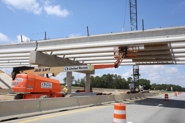
Three new interchanges were to be built. Work was completed on the first
two at Country Club Road and O'Berry Road, a project started on July 31,
2017. The O'Berry Road project was finished in late 2018 while
work on the Country Club Road exit was completed in early 2020.20
O'Berry Road now travels over U.S. 117 while U.S. 117 passes over
Country Club Road. Initially, work was to be completed by December 2019
on the Country Club Road interchange with additional landscaping work completed in January 2021.19
Another project was to realign Smith Chapel Road with Lee's Country Club Road just south of Mount Olive where an interchange will be built. It also included constructing a new connector road along U.S 117 in that area. The estimated cost was $28.5 million with right-of-way acquisition to start in 2024 followed by construction in 2026 and 2027.19
NCDOT held a public meeting on December 3 and 4, 2018 regarding its
proposal to complete upgrading US 117 to an interstate for the 24 miles
between Goldsboro and I-40. Officials again reiterated that only the
section between Country Club Road and Genoa Road was funded at this time
and that construction would not start on that section until 2027.
Several proposals were on the table to take the route around Goldsboro.
For the Country Club to Genoa Road stretch, the Final Environmental
Decision Document was to be due in 2023-24 with Right of Way acquisition to start in 2025.21
PROJECT HALTED IN 2020 DUE TO BUDGET SHORTFALLS, [UPDATED 8/16/25]
However, in September 2020 NCDOT revised the 2020-2029 STIP to account for budget shortfalls generated by the COVID-19 pandemic, the US 117 extension project became unfunded, meaning there would now be no construction beyond the first two interchanges until after 2029.22 Two and 1/2 years later, in the Final 2024-2033 STIP released in June 2023, partial funding was restored. Work on upgrading US 117 to interstate standards from Country Club Road to South Landfill Road was moved up, now planned to start in 2028, while the section between South Landfill and Genoa Road was again to start in 2029. The remainder, the new freeway sections, remained unfunded meaning construction would not start until at least 2034.23
In the list of possible 2026-2035 STIP projects released in May 2024 only two projects related to the I-795 extension were listed, the ones listed as unfunded in the last STIP:
* South of Genoa Road to south of Arrington Bridge Road (N.C. 581);
Cost now is $249.4 million, the Statewide Mobility Score: 63.24/100.
* South of Arrington Bridge Road (N.C. 581) to current I-795; Cost is
now $127.5 million, the Statewide Mobility Score: 63.19/100.24
The scores were rather low and when the Draft STIP was released in January 2025, they remained unfunded. The 2 projects originally funded in the original 2020-2029 STIP, from north of Country Club Road to south of Genoa Road, received only moneys for preliminary engineering.25 Nothing changed with the release of the Final STIP on July 8. Therefore, there is no plans for any construction on the I-795 extension until at least 2036.26
For the latest news, check out the NCDOT Project Page.
PHOTOS (Updated 4/12/25)
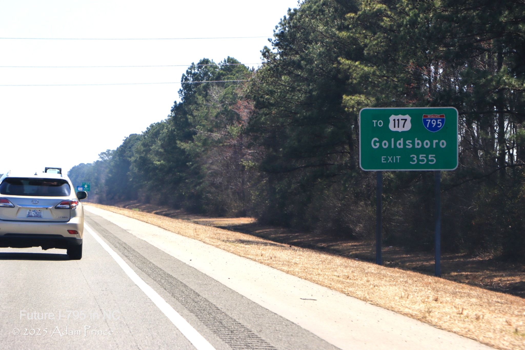
Photo taken of I-795 related signage on I-40 by Adam Prince in March 2025
Photos of the ompleted interchanges, from Google Maps Street View (3/15/24)
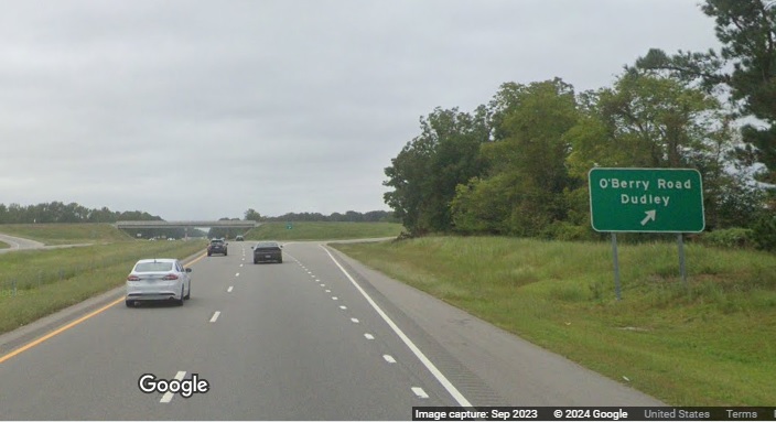
The O'Berry Road exit sign on US 117 (Future I-795) South. (September 2023)
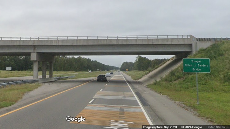
The O'Berry Road bridge over US 117 (Future I-795) dedicated to NC State Trooper Nolan J. Sanders. (September 2023)
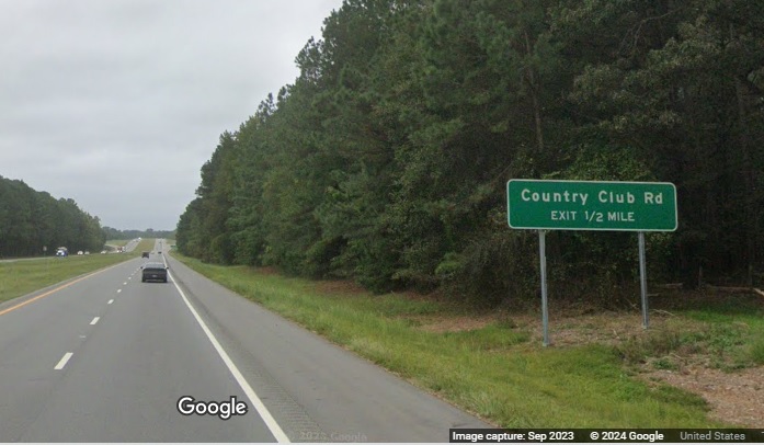
The first, and only, advance sign for the Country Club Road exit on US 117 (Future I-795) South. (September 2023)
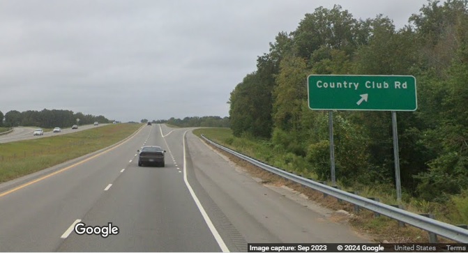
The Country Club Road exit sign, notice the interstate standard shoulders between the new exits. (September 2023)
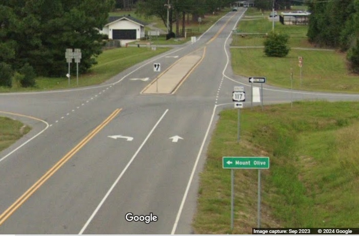
View from the Country Club Road bridge of ramp signage for US 117 South. (September 2023)
Here's an earlier photo showing progress on the future O'Berry Road bridge and interchange, courtesy of the Goldsboro News-Argus26:
NCDOT has also posted Future I-795 signs south of Goldsboro, like This one.
Some I-795 Video Links
Traverse the current I-795 corridor through these videos from Roadwaywiz:
Exits 1 to 9 Southbound Exits 9 to 18 Southbound Exits 18 to 25 Southbound
Exits 25 to 18 Northbound Exits 18 to 9 Northbound Exits 9 to 1 Northbound
I-795 PHOTOS FROM 2024
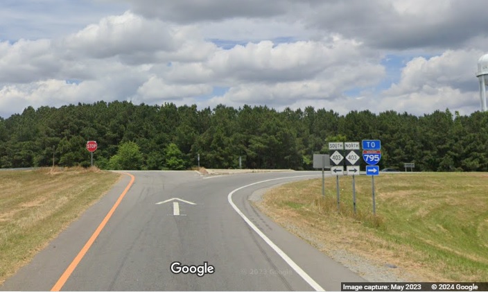
Signage at the end of the ramp from I-40 West at NC 403, the future site of the I-795 interchange, has To I-795 trailblazer signage. Google Maps Street View image capture, May 2023.
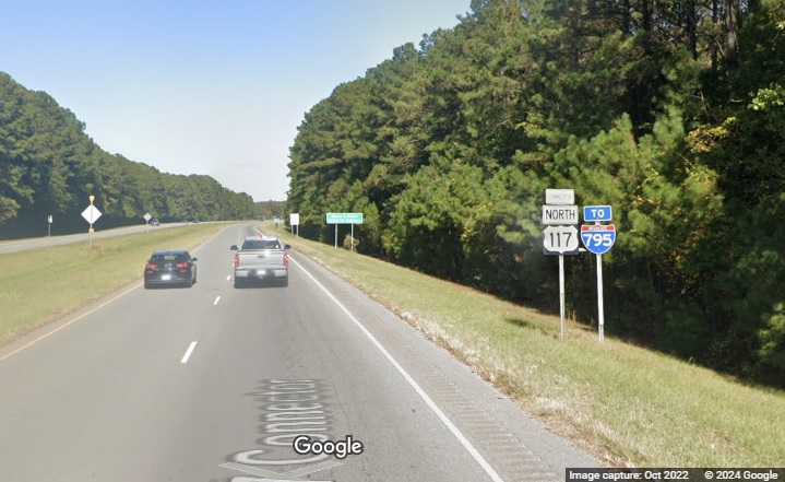
There is also a To I-795 trailblazer after the intersection of NC 242 and the US 117 Connector in Faison. Google Maps Street View image capture, October 2022.
Some Earlier I-795 Photos
The photos below, taken between 2007 and April 2010, help illustrate issues in the initial signing of the route listed in the text above. Most of the signage in these photos, with the exception of those involving I-587, has not been updated since 2010.
 Here's the first I-795 shield after the I-95 interchange.
(12/2/07)
Here's the first I-795 shield after the I-95 interchange.
(12/2/07)
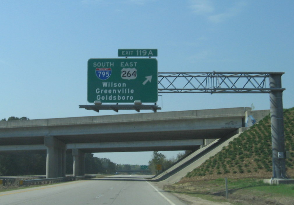
 In March 2010, the
former US 117 exit sign was replaced by one with I-795. The interstate, however, remains an exit off of US 264. (4/5/10)
In March 2010, the
former US 117 exit sign was replaced by one with I-795. The interstate, however, remains an exit off of US 264. (4/5/10)
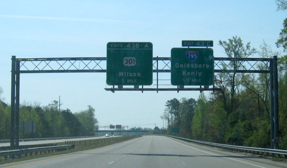 The change for Exit 43C
on the first overhead sign, a ground-level sign after the exit tells
you to take US 301 to get to US 117. Notice no direction is given for I-795 on any of the southbound signs. (4/5/10)
The change for Exit 43C
on the first overhead sign, a ground-level sign after the exit tells
you to take US 301 to get to US 117. Notice no direction is given for I-795 on any of the southbound signs. (4/5/10)
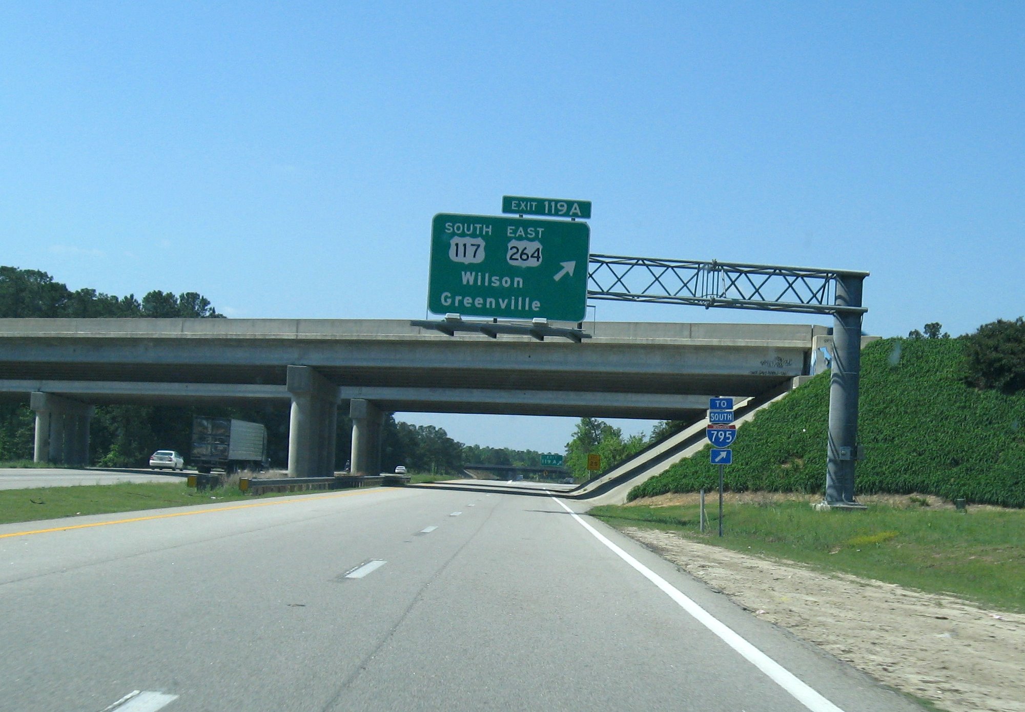
 This
overhead sign is clearly better than the one trailblazer sign that
could be missed that was just before where the bridge is from the end of 2007 until March 2010. (4/5/10)
This
overhead sign is clearly better than the one trailblazer sign that
could be missed that was just before where the bridge is from the end of 2007 until March 2010. (4/5/10)
 You can actually get on US 301 by taking I-795, and if you
miss the I-795 exit get back on using US 301 South, as seen in the photos below. (4/5/10)
You can actually get on US 301 by taking I-795, and if you
miss the I-795 exit get back on using US 301 South, as seen in the photos below. (4/5/10)
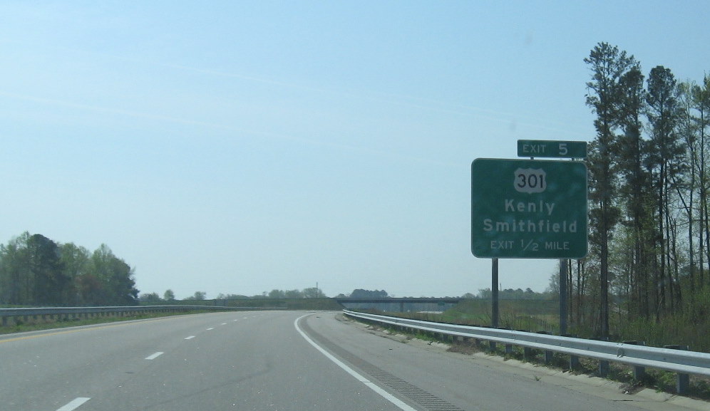
 If there's any doubt which route is US 117 and which I-795, NCDOT has left large signs
indicating which is which on US 301 heading toward the I-795 ramps. (1/16/10)
If there's any doubt which route is US 117 and which I-795, NCDOT has left large signs
indicating which is which on US 301 heading toward the I-795 ramps. (1/16/10)
 Signs at the US 301 interchange in January 2010. (1/16/10)
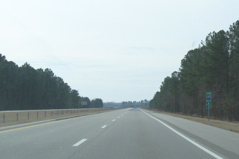 NCDOT replaced the US 117 mile
markers with I-795 directional mile markers every 1/2 mile after the
US 264 split, here being mile 6.5. The mile markers for mile 24.5 were
put in wrong, having the northbound marker going south and vice versa, sorry, no photo. (1/16/10)
NCDOT replaced the US 117 mile
markers with I-795 directional mile markers every 1/2 mile after the
US 264 split, here being mile 6.5. The mile markers for mile 24.5 were
put in wrong, having the northbound marker going south and vice versa, sorry, no photo. (1/16/10)
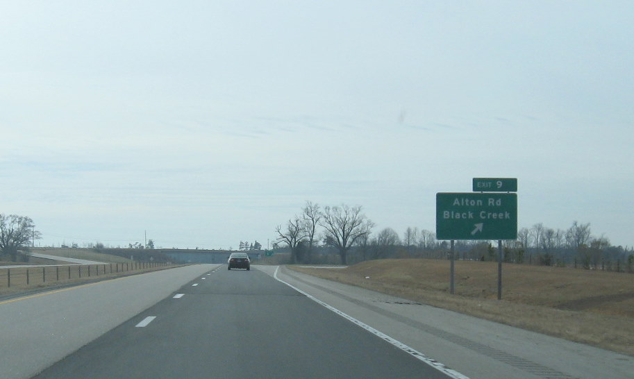 The revised exit number,
9, for the second exit going southbound, Alton Road. (1/16/10)
The revised exit number,
9, for the second exit going southbound, Alton Road. (1/16/10)
 The next exit southbound, NC
222 is now exit 14. Notice the new pavement on the right side lanes
completed as part of the I-795 pavement repair project. (1/16/10)
The next exit southbound, NC
222 is now exit 14. Notice the new pavement on the right side lanes
completed as part of the I-795 pavement repair project. (1/16/10)
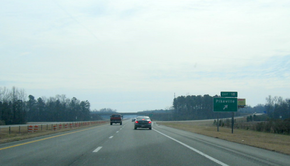 The Pikeville exit is now
18. Notice that the repaving has stopped going south, it was completed by the end of 2010. (1/16/10)
The Pikeville exit is now
18. Notice that the repaving has stopped going south, it was completed by the end of 2010. (1/16/10)
 They had not changed the exit number for the last exit,
US 70, still with US 117 mileage, when this photo was taken in 2010.
Later this was changed to 22, perhaps they had first thought that I-795 would end at the US 70 Bypass. (1/16/10)
They had not changed the exit number for the last exit,
US 70, still with US 117 mileage, when this photo was taken in 2010.
Later this was changed to 22, perhaps they had first thought that I-795 would end at the US 70 Bypass. (1/16/10)
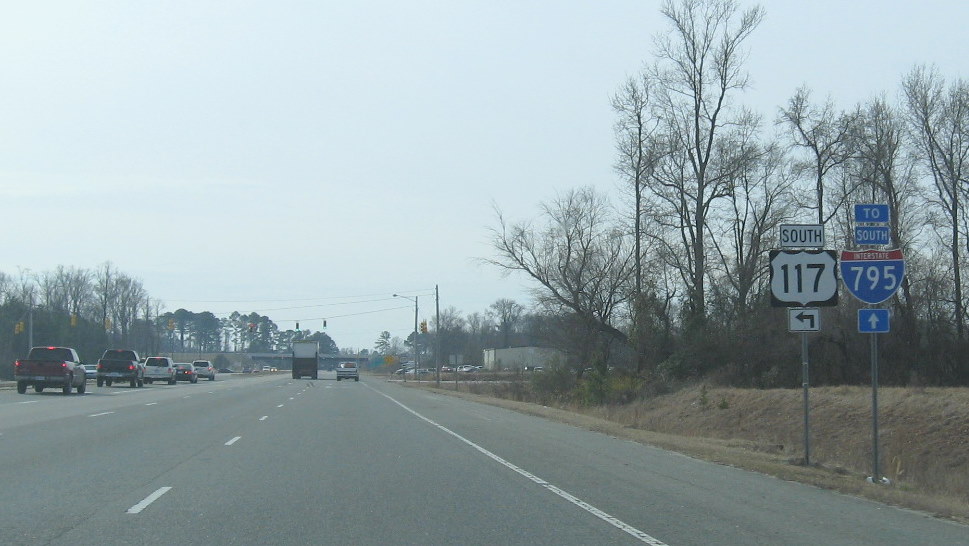
 I-795 is
marked going northbound along US 70 West, East the sign says 'To
I-795'. Notice the US 117 South sign which indicates it travels along
US 70 after its intersection to the east. The signage in the area though is not consistent. (1/16/10)
I-795 is
marked going northbound along US 70 West, East the sign says 'To
I-795'. Notice the US 117 South sign which indicates it travels along
US 70 after its intersection to the east. The signage in the area though is not consistent. (1/16/10)
 This is the first mile
marker going Northbound, Mile 24, this is before the US 70 bypass construction seen in the distance. (1/16/10)
This is the first mile
marker going Northbound, Mile 24, this is before the US 70 bypass construction seen in the distance. (1/16/10)
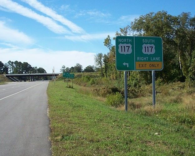
 The final exit on the
former US 117 portion going north. You cannot exit onto US 264 east from I-795. (1/16/10)
The final exit on the
former US 117 portion going north. You cannot exit onto US 264 east from I-795. (1/16/10)
 The
left overhead sign above still referred to US 117 until March 2010. Again, after the merge with US 264 heading north,
there are no signage updates due to NCDOT keeping US 264 milepost exit numbers. (4/5/10)
The
left overhead sign above still referred to US 117 until March 2010. Again, after the merge with US 264 heading north,
there are no signage updates due to NCDOT keeping US 264 milepost exit numbers. (4/5/10)
 Here's signage heading toward I-95. (December 2007)
 Here's an end I-795
(north) sign just before the I-95 interchange. (December 2007)
Here's an end I-795
(north) sign just before the I-95 interchange. (December 2007)
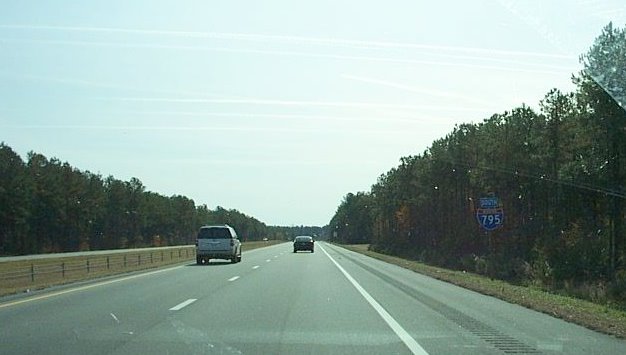 Here's I-795 signage
heading south toward Goldsboro and Seymour Johnson Air Force Base,
which seems to be busy with all the contrails in the sky above.
Here's I-795 signage
heading south toward Goldsboro and Seymour Johnson Air Force Base,
which seems to be busy with all the contrails in the sky above.
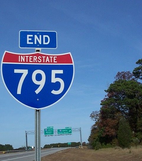
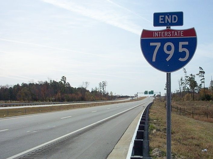 The end (south) I-795
sign just before the US 70 exit in Goldsboro. (December 2007)
The end (south) I-795
sign just before the US 70 exit in Goldsboro. (December 2007)
Here's are photos illustrating the many sign changes that took place during the first three years of I-795's existence:
 Signing looking south
along US 301, to be compared with future signage when interstate 795 shields replace US 117 (10/21/07).
Signing looking south
along US 301, to be compared with future signage when interstate 795 shields replace US 117 (10/21/07).
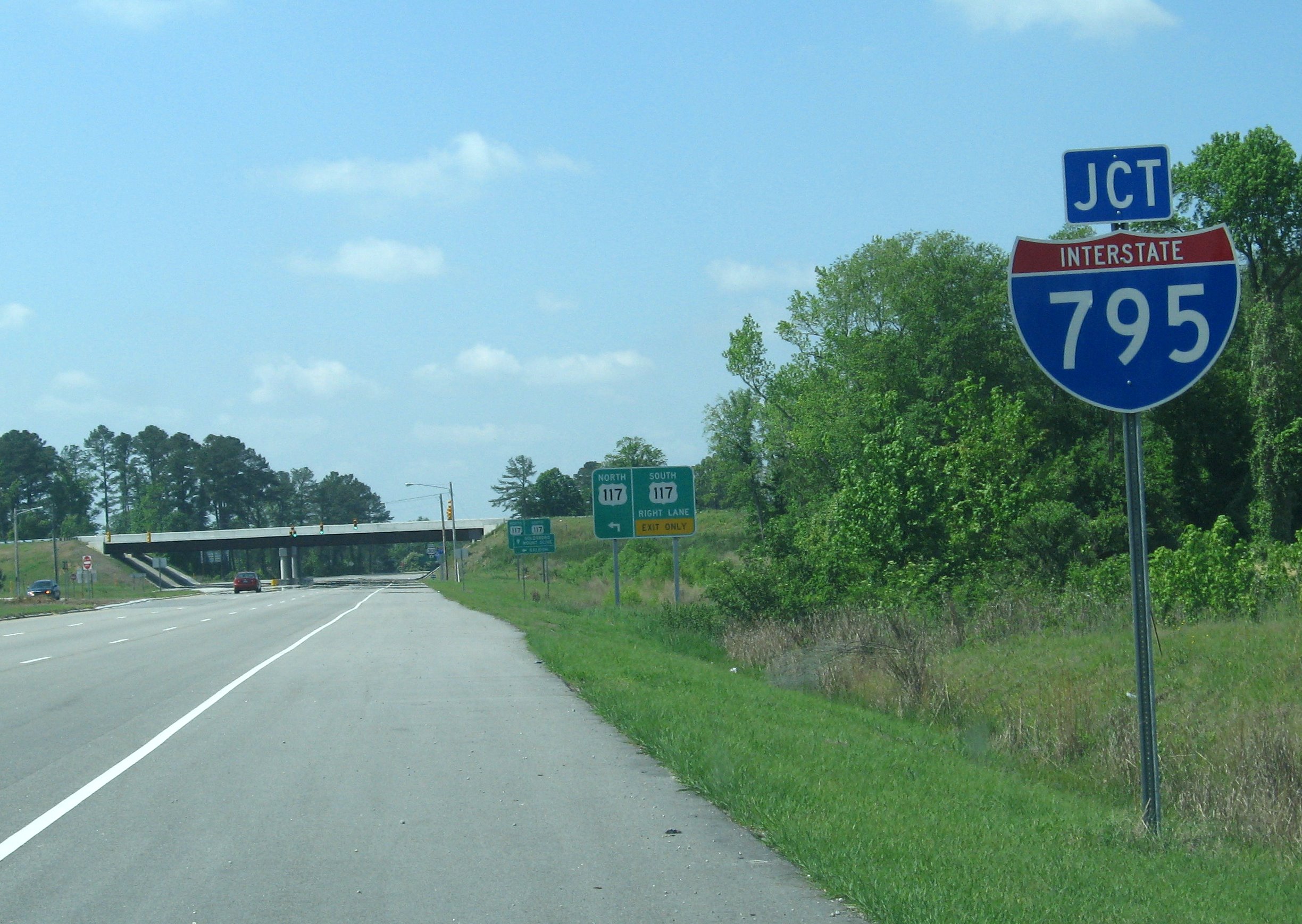 The only thing that
changed by May 2008 was the addition of a Junction I-795 sign, and additional signs at the on-ramps. (5/4/08)
The only thing that
changed by May 2008 was the addition of a Junction I-795 sign, and additional signs at the on-ramps. (5/4/08)
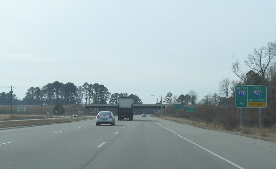 And here is what it looked like in January 2010. (1/16/10)
 A new sign was put up in
March 2010 along I-95 which now included the I-795, dropped the US 117
signage, and included Goldsboro as a control city. The previous sign
is below, I-795 was only added as a trailblazer under the overhead sign. (4/5/10)
A new sign was put up in
March 2010 along I-95 which now included the I-795, dropped the US 117
signage, and included Goldsboro as a control city. The previous sign
is below, I-795 was only added as a trailblazer under the overhead sign. (4/5/10)
 The sign situation
between Dec. 2007 and March 2010, the 'To' was not really necessary on
the trailblazer since the route technically began with the off-ramp (photo taken May 4, 2008), same view on 1/16/10.
The sign situation
between Dec. 2007 and March 2010, the 'To' was not really necessary on
the trailblazer since the route technically began with the off-ramp (photo taken May 4, 2008), same view on 1/16/10.