Where: US 74 Freeway from End of Laurinburg
Bypass to NC 41 south of Lumberton, Robeson County
Length: 19 Miles
COMPLETE-Entire Section Open to Traffic on September 26,
2008
Route signed as:
Segment Information
From the end of the current US 74 Laurinburg-Maxton Bypass near Alma,
to a few miles beyond its intersection with Interstate 95 near
Lumberton, I-74 uses the 'American Indian Highway' a freeway opened in
2008. The freeway also carries US 74, which had used a two lane highway
paralleling the new road prior to opening of the freeway. Construction
started on the I-74 freeway on November 29, 2004 though NCDOT contract
documents initially only referred to it as a reroute of US 74 onto a
"4-lane divided facility on new location" south of the existing highway.
New mileposts and signage installed along the road near Maxton though
confirmed that I-74 would be the primary route upon completion.1
The project was listed in the NCDOT 2009-2015 STIP as Number R-513.2
Construction, originally scheduled to start in 2007, was pushed up to
late 2004 with NCDOT borrowing funds that were to be paid back out of
program accounts when the project was completed. The contract for the
project was awarded in two parts on November 5, 2004. The first part was
constructing 11 miles of the freeway from Henry Berry Road southeast of
Pembroke to NC 41 south of Lumberton. The second part was building the
remaining 8 miles from Pembroke to the end of the US 74
Laurinburg-Maxton Bypass in Alma. The project included building a new
cloverleaf interchange with I-95 (Exit 13) 1/2 mile south of the
existing US 74 exit (Exit 14), which was eliminated at the end of
construction and, in anticipation, the southbound I-95 on-ramp and
northbound off-ramp were permanently closed to traffic on October 31,
2006.2
Lane closures occurred frequently on I-95 in 2006 and 2007 around the
future I-74/US 64 exit as Collector/ Distributor (C/D) ramps were built
on either side of the existing highway and the bridge that would carry
I-74 over I-95 was being built.3 Parts of other local roads
were closed as well. These closures lasted until the freeway opened in
September of 2008.4,5 The total cost of the project was
estimated at $238 million.6 The original estimated date of
completion was December 2008. Work proceeded though ahead of schedule
whereby, on September 26, 2008 the I-74 roadway was opened to traffic in
both directions (the eastbound section had opened the previous weekend),
the road was opened while remaining construction east of I-95 continued.4,7,8,9
Almost a year before, on November 30, 2007 a ribbon-cutting ceremony
preceded the opening of a 6-mile section from the end of the Maxton
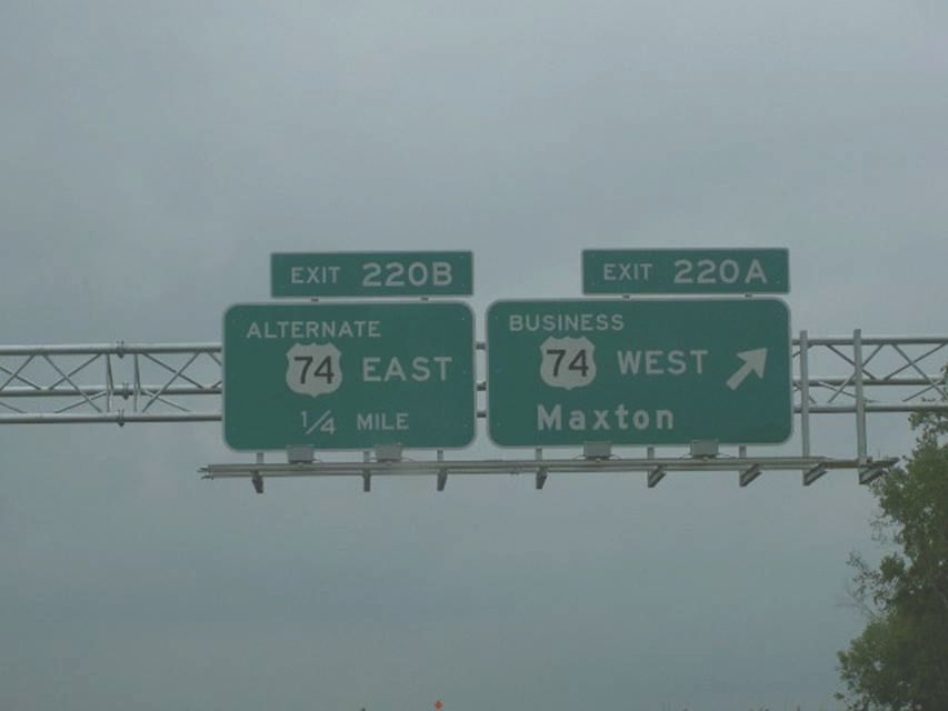
Bypass to NC 710.10 In July 2007 NCDOT put up what will be
the first I-74 exit signs along the route at the end of the Maxton
Bypass (see photo below). The signs were for the future Alternate US 74
East.
"Drive" This Segment using Google Maps Street View (Updated Links)
The photos below were taken either after the route to NC 710 was opened
November 30, 2007 or after the rest of the eastern portion was open
around September 19, 2008. There has been little change to the signage
in the years since.
First
I-74 exit signs for the new US 74 (future Alt US 74)/US 74 Business
interchange at the end of the Maxton bypass. The speed limit was
originally 55 mph starting near then exit 220 (now 194), but was
increased to 70 mph after the rest of the highway was completed. (August
2007). Photo courtesy of Nick Hudson.
Signage at the I-74/NC 710
interchange south of Pembroke. I-74 was signed as an interstate even
before the freeway reached Lumberton and I-95. (Nov. 30, 2007)
A
closer look at the bridge and the NC 710 interchange when it first
opened. (Nov. 30, 2007)
Looking east from the
temporary end of I-74 at NC 710 in 2007, the road was basically complete
except for signage. (Nov. 30, 2007)
This was the first I-74/US
74 signage combination you saw going westbound after the NC 710 on-ramp
when the first segment opened (Nov. 30, 2007).
A closer look at this
unique combination, the first time an interstate and a US route with the
same number were signed on the same highway. (Nov. 30, 2007)
Here's a Junction I-74/US
74 sign assembly at the Cabinet Shop Road Exit (197, formerly 223).
The view of
the NC 710 Exit in September 2008 just after the I-74 freeway was
completed to NC 41 going eastbound.(9/20/08)
As you can see, the speed
limit on the new section of I-74 is 70 mph. (9/20/08)
The next exit
eastbound is for Dew Road, notice the exit number difference. The
original number, according to contract documents, for this exit was 230.
NCDOT apparently found the reason why their I-74 mileposts were 27 miles
too high between 2007 and 2008, this exit number, coincidentally or not,
matched that from my exit list created before this segment was
completed. (9/20/08)
Here's the sign for the
next exit, Back Swamp Road, the original exit number would have been
234. (9/20/08)
Here's the first sign for the
I-95/US 301 interchange, the only one that is ground mounted. (11/15/09)
The first
overhead I-95 interchange signage, just 1/2 mile from the previous exit
before the south I-95/US 301 off-ramp. (11/15/09)
Here's a closeup of the
I-95/US 301 northbound off-ramp with the sign for the next exit US 74
Alternate. (9/20/08)
Here's a closeup of the
1/2 mile advance sign for the US 74 Alternate exit going eastbound in
September, Exit 210. (9/20/08)
They also installed
an overhead for Exit 210 at the completion of the project in December
2008. (2/7/09)
Here's one of the signs
indicating that I-74 in Robeson County is officially the "American
Indian Highway" (2/7/09)
All the mile markers along
this stretch come complete with I-74 shields, this is between Exits 210
and 213. (May 2009) JM
Here's the last exit
eastbound, first westbound for NC 41. The entrance ramp eastbound still
includes a shield for I-74 east, because the road ends about 1/2 mile
further east. (2/7/09)
By December they had completed
most of the work to the NC 41 (Exit 213) interchange eastbound, which
included an end sign for I-74 after the exit (Photo courtesy of Stephen
Summers, 12/08). The sign still stands as of 2021.
Here are photos approaching the new I-74 freeway, first from I-95/US
301 South taken 10/12/08
The first I-74 exit
sign is 2 miles out, the sign in the distance says to access the former
route (now US 74 Alternate), use exit 13A.
Now 1 mile away, the
excitement, or is it the confusion among drivers seeing the same number
on two different routes, is building.
Both directions of
I-95 feature parallel C/D exit ramps. Driving on to the C/D ramps one
has an interesting choice of destinations, only 1 of which (Laurinburg)
does I-74 actually go to.
The eastbound
on-ramp is ahead, or one can get back on I-95.
Now the view from I-95/US 301 approaching from the South (and South
of the Border)....
The one mile sign heading
northbound, a more rural landscape than that behind the 1 mile sign
southbound (May 2009). JM
There seems to be some
discrepancy between the milepost number and the exit number (May 2009)
JM
Now the view traveling on I-74 westbound:
The first I-74 numbered exit
sign for NC 41, notice the VMS assembly they put up probably for I-95
traffic troubles. (May 2009) JM
This
is the first I-74/US 74 seen now going westbound, after the NC 41 Exit
(May 2009). JM
Same C/D set up going
north on I-95.
Similar sign set up going
westbound as east, except no sign for the next exit.
The
NC 710 Exit Marked with the Right number in May 2009 (Photo courtesy of
James Mast, JM)
The old
exit number for NC 710 as it appeared in October 2008, the exit number
stayed though many of the mileposts in the area have been stripped of
their wrong mile signage.
View
showing you can now go both directions at the NC 710 interchange
(October 2008).
The
new number for the Cabinet Shop Road Exit can be seen heading westbound.
(May 2009) JM
The
intersection with the pre-existing Maxton Bypass is beyond this exit.
Slightly confusing maybe, a sign with 2 US 74 shields on a highway with
2 different shields with the 74 number (May 2009) JM.
Here's what the western
end of the new freeway at the Business US 74/Alternate US 74 interchange
looked like in October 2007 with the former exit number (Exit 220).
There is only one ramp westbound vs. two going eastbound. (October 2007)
The exit leads to this possibly confusing
sign assembly, Business 74 goes toward Maxton and predates the new
freeway, Alternate US 74 replaced the current US 74 when construction of
I-74 was complete.
This
also may be a future confusing sign complex for some people. This is the
ramp to East I-74/US 74 at the end of Business US 74 and the beginning
of Alternate US 74.
Is this
assembly at the other end in Lumberton any less confusing?
For history buffs, these other photos show the progress in constructing
the I-95/I-74 interchange in early August through November 2007.
Looking south at the future
I-95/I-74 interchange from what was US 74 in the summer of 2007. (August
2007)
Here's another
photo showing the I-95/I-74 interchange in the summer of 2007. Photo
courtesy of Nick Hudson.
Here's
a look at the progress at the east end of the project as of November
2007, clearly not as advanced as the west end. (photo courtesy of Rodney
Gardner). The road you see graded had been paved, but had not been
connected to the old road. (9/20/08)
Here are some photos of the completed bridge work around the eastern
end of the project courtesy of Nick Zachetti from early July 2008,
according to the photographer the graded areas were paved in August
2008:
Here are more photos taken August 25, 2008 courtesy of Nick Zachetti
showing construction progress:
Another NCDOT Project related to this segment is Number K-4002 which
will build a Rest Area on I-74 east of the I-95 interchange. The project
was listed for 'planning and environmental study only' and thus has no
official timetable or cost. No sign of its construction has appeared
along I-74 after it was completed in 2008.12
During 2000 several Future I-74 Corridor signs were put up along the
stretch of now US 74 Alternate, like the one below.
Photo courtesy of Adam
Prince
At the urging of area citizens and local politicians, NCDOT named the
new highway the American Indian Freeway due to the large Native American
population in Robeson County. Many local citizens had complained that
the current US 74's designation as the Andrew Jackson highway would be
inappropriate for the new freeway. The current Jackson highway name was
retained on the old route (now US 74 Alternate) after the freeway was
built.13
The following are exit numbers in use on this segment of I-74. The
original numbers, according to NCDOT Contract Documents,14
are listed in parentheses. New numbers based on a corrected 2008
spreadsheet sent to me from NCDOT15 were also in
disagreement, and I sent a reply indicating my numbers still did not
agree. Apparently NCDOT then redid their calculations and came up with
new mileage for I-74, with mileposts that were closer to my originally
calculated exit numbers, NCDOT started replaced these numbers between
Mid-April and early May 2009.16 For more info see the I-74
Exit List:
 Segment 16
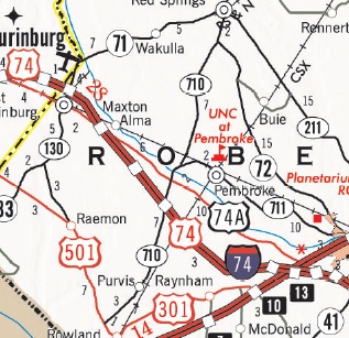
 First
I-74 exit signs for the new US 74 (future Alt US 74)/US 74 Business
interchange at the end of the Maxton bypass. The speed limit was
originally 55 mph starting near then exit 220 (now 194), but was
increased to 70 mph after the rest of the highway was completed. (August
2007). Photo courtesy of Nick Hudson.
First
I-74 exit signs for the new US 74 (future Alt US 74)/US 74 Business
interchange at the end of the Maxton bypass. The speed limit was
originally 55 mph starting near then exit 220 (now 194), but was
increased to 70 mph after the rest of the highway was completed. (August
2007). Photo courtesy of Nick Hudson.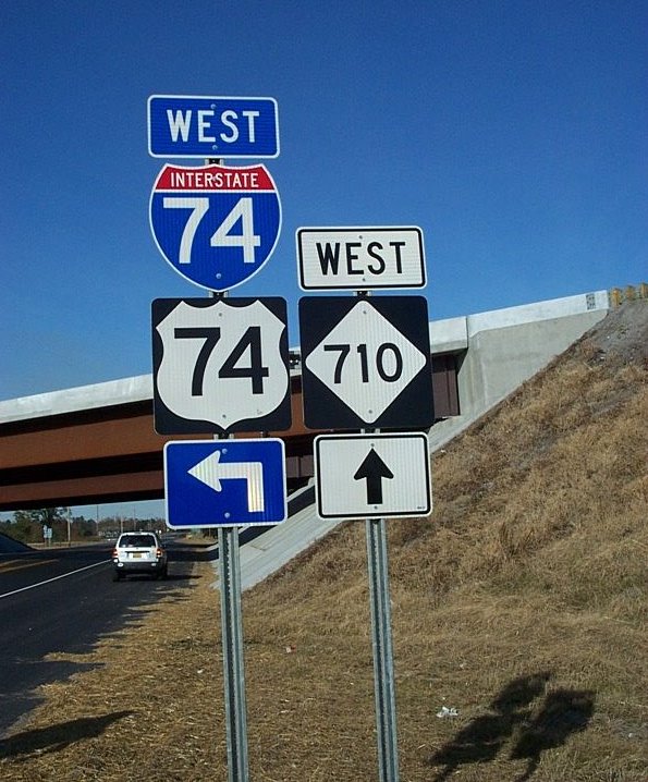 Signage at the I-74/NC 710
interchange south of Pembroke. I-74 was signed as an interstate even
before the freeway reached Lumberton and I-95. (Nov. 30, 2007)
Signage at the I-74/NC 710
interchange south of Pembroke. I-74 was signed as an interstate even
before the freeway reached Lumberton and I-95. (Nov. 30, 2007)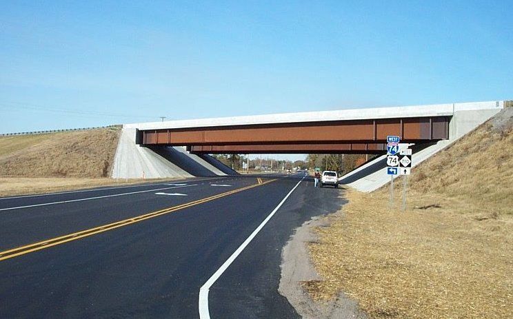 A
closer look at the bridge and the NC 710 interchange when it first
opened. (Nov. 30, 2007)
A
closer look at the bridge and the NC 710 interchange when it first
opened. (Nov. 30, 2007) Looking east from the
temporary end of I-74 at NC 710 in 2007, the road was basically complete
except for signage. (Nov. 30, 2007)
Looking east from the
temporary end of I-74 at NC 710 in 2007, the road was basically complete
except for signage. (Nov. 30, 2007)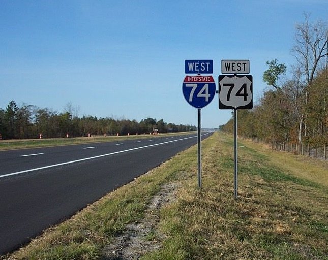 This was the first I-74/US
74 signage combination you saw going westbound after the NC 710 on-ramp
when the first segment opened (Nov. 30, 2007).
This was the first I-74/US
74 signage combination you saw going westbound after the NC 710 on-ramp
when the first segment opened (Nov. 30, 2007).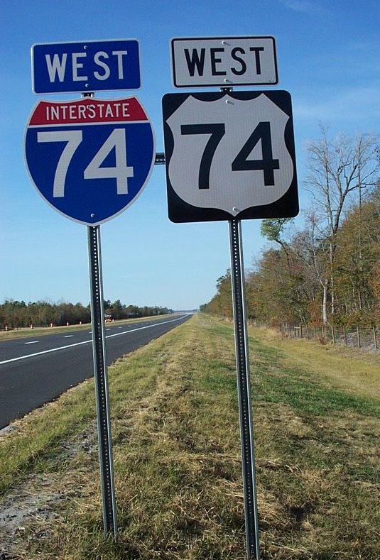 A closer look at this
unique combination, the first time an interstate and a US route with the
same number were signed on the same highway. (Nov. 30, 2007)
A closer look at this
unique combination, the first time an interstate and a US route with the
same number were signed on the same highway. (Nov. 30, 2007)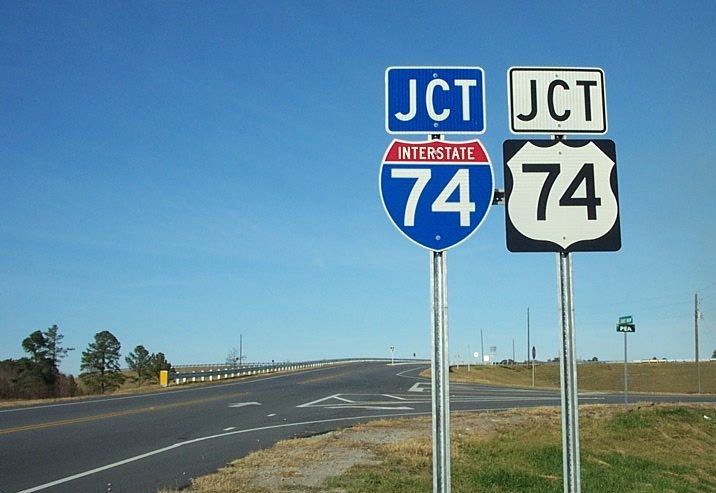 Here's a Junction I-74/US
74 sign assembly at the Cabinet Shop Road Exit (197, formerly 223).
Here's a Junction I-74/US
74 sign assembly at the Cabinet Shop Road Exit (197, formerly 223).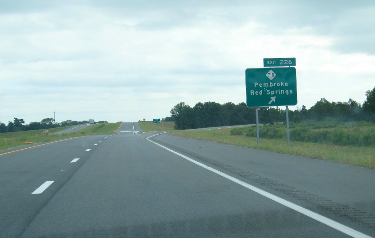 The view of
the NC 710 Exit in September 2008 just after the I-74 freeway was
completed to NC 41 going eastbound.(9/20/08)
The view of
the NC 710 Exit in September 2008 just after the I-74 freeway was
completed to NC 41 going eastbound.(9/20/08)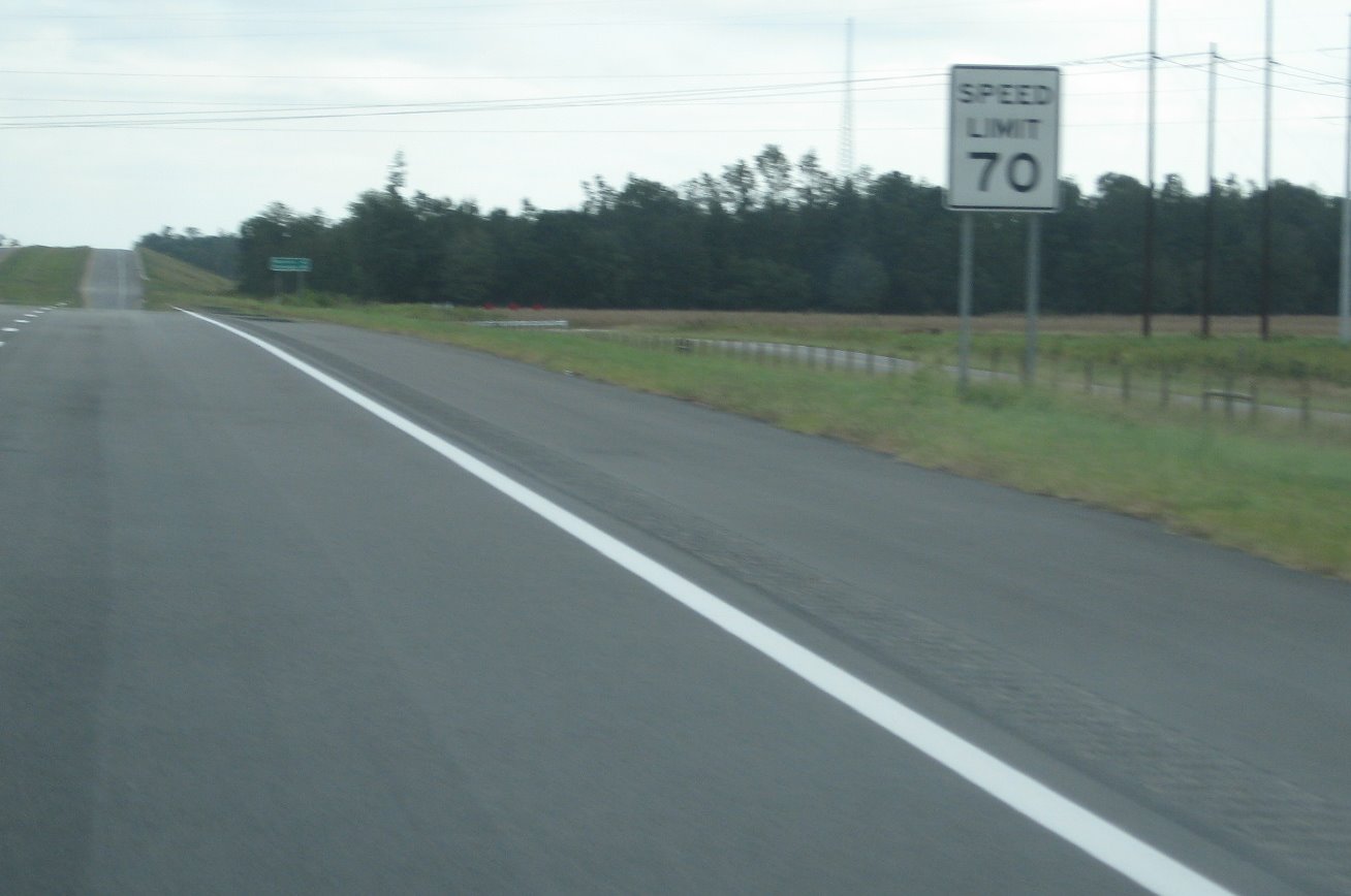 As you can see, the speed
limit on the new section of I-74 is 70 mph. (9/20/08)
As you can see, the speed
limit on the new section of I-74 is 70 mph. (9/20/08)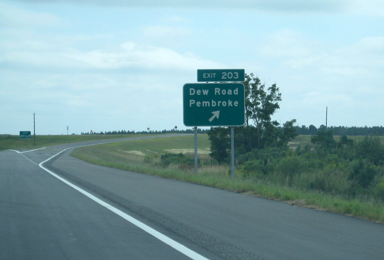 The next exit
eastbound is for Dew Road, notice the exit number difference. The
original number, according to contract documents, for this exit was 230.
NCDOT apparently found the reason why their I-74 mileposts were 27 miles
too high between 2007 and 2008, this exit number, coincidentally or not,
matched that from my exit list created before this segment was
completed. (9/20/08)
The next exit
eastbound is for Dew Road, notice the exit number difference. The
original number, according to contract documents, for this exit was 230.
NCDOT apparently found the reason why their I-74 mileposts were 27 miles
too high between 2007 and 2008, this exit number, coincidentally or not,
matched that from my exit list created before this segment was
completed. (9/20/08)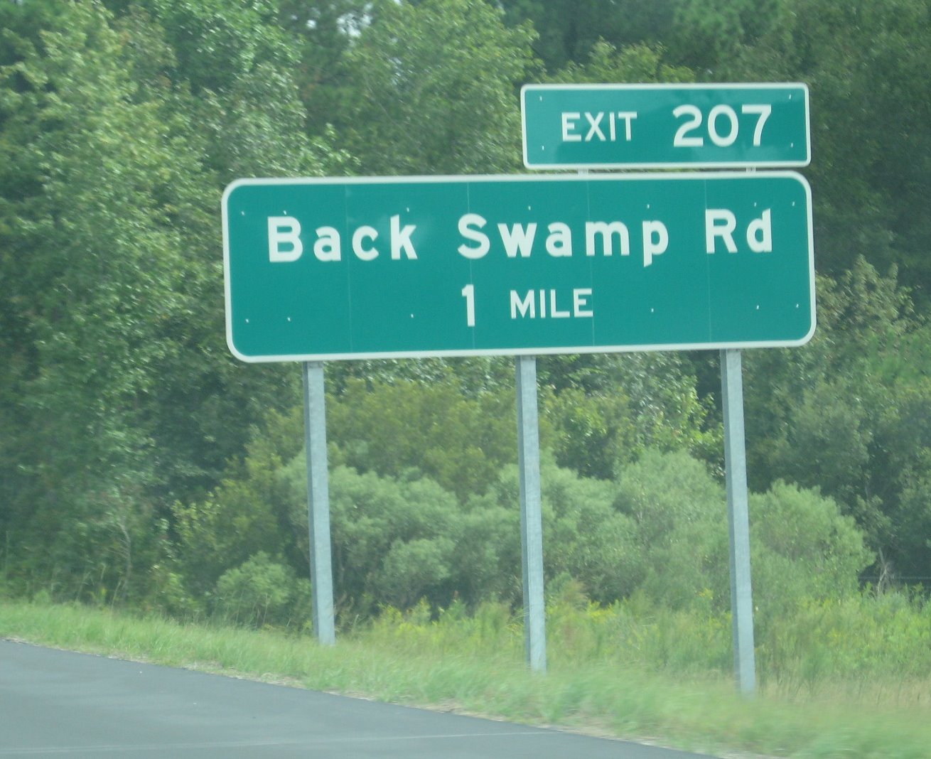 Here's the sign for the
next exit, Back Swamp Road, the original exit number would have been
234. (9/20/08)
Here's the sign for the
next exit, Back Swamp Road, the original exit number would have been
234. (9/20/08)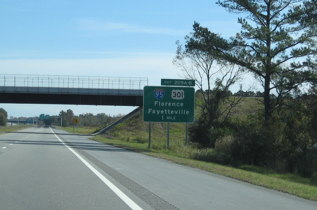 Here's the first sign for the
I-95/US 301 interchange, the only one that is ground mounted. (11/15/09)
Here's the first sign for the
I-95/US 301 interchange, the only one that is ground mounted. (11/15/09)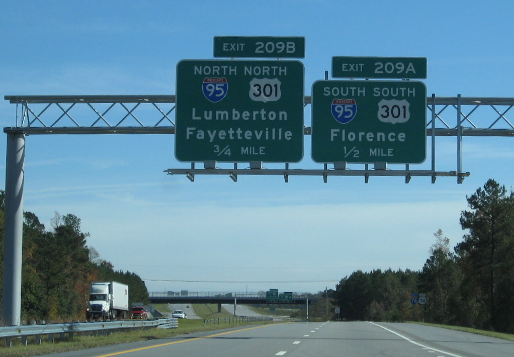 The first
overhead I-95 interchange signage, just 1/2 mile from the previous exit
before the south I-95/US 301 off-ramp. (11/15/09)
The first
overhead I-95 interchange signage, just 1/2 mile from the previous exit
before the south I-95/US 301 off-ramp. (11/15/09)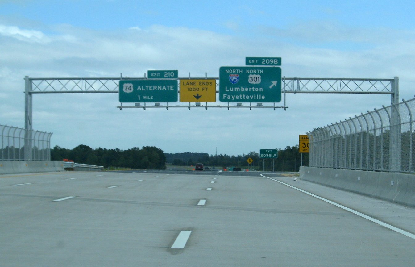 Here's a closeup of the
I-95/US 301 northbound off-ramp with the sign for the next exit US 74
Alternate. (9/20/08)
Here's a closeup of the
I-95/US 301 northbound off-ramp with the sign for the next exit US 74
Alternate. (9/20/08)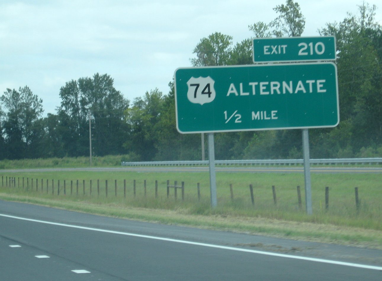 Here's a closeup of the
1/2 mile advance sign for the US 74 Alternate exit going eastbound in
September, Exit 210. (9/20/08)
Here's a closeup of the
1/2 mile advance sign for the US 74 Alternate exit going eastbound in
September, Exit 210. (9/20/08)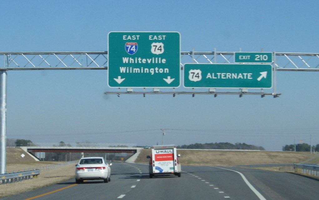 They also installed
an overhead for Exit 210 at the completion of the project in December
2008. (2/7/09)
They also installed
an overhead for Exit 210 at the completion of the project in December
2008. (2/7/09)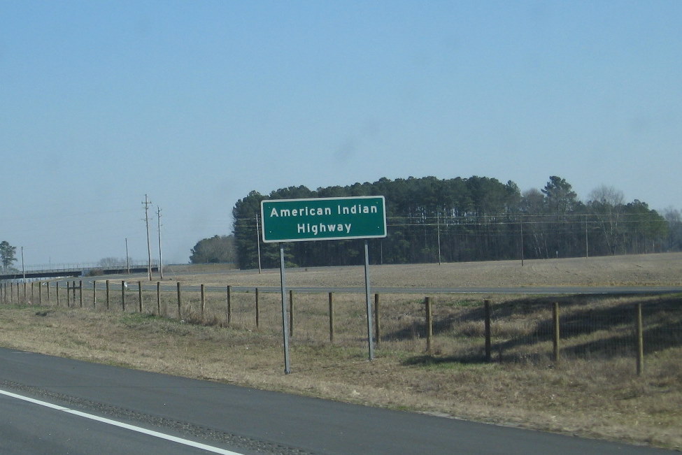 Here's one of the signs
indicating that I-74 in Robeson County is officially the "American
Indian Highway" (2/7/09)
Here's one of the signs
indicating that I-74 in Robeson County is officially the "American
Indian Highway" (2/7/09)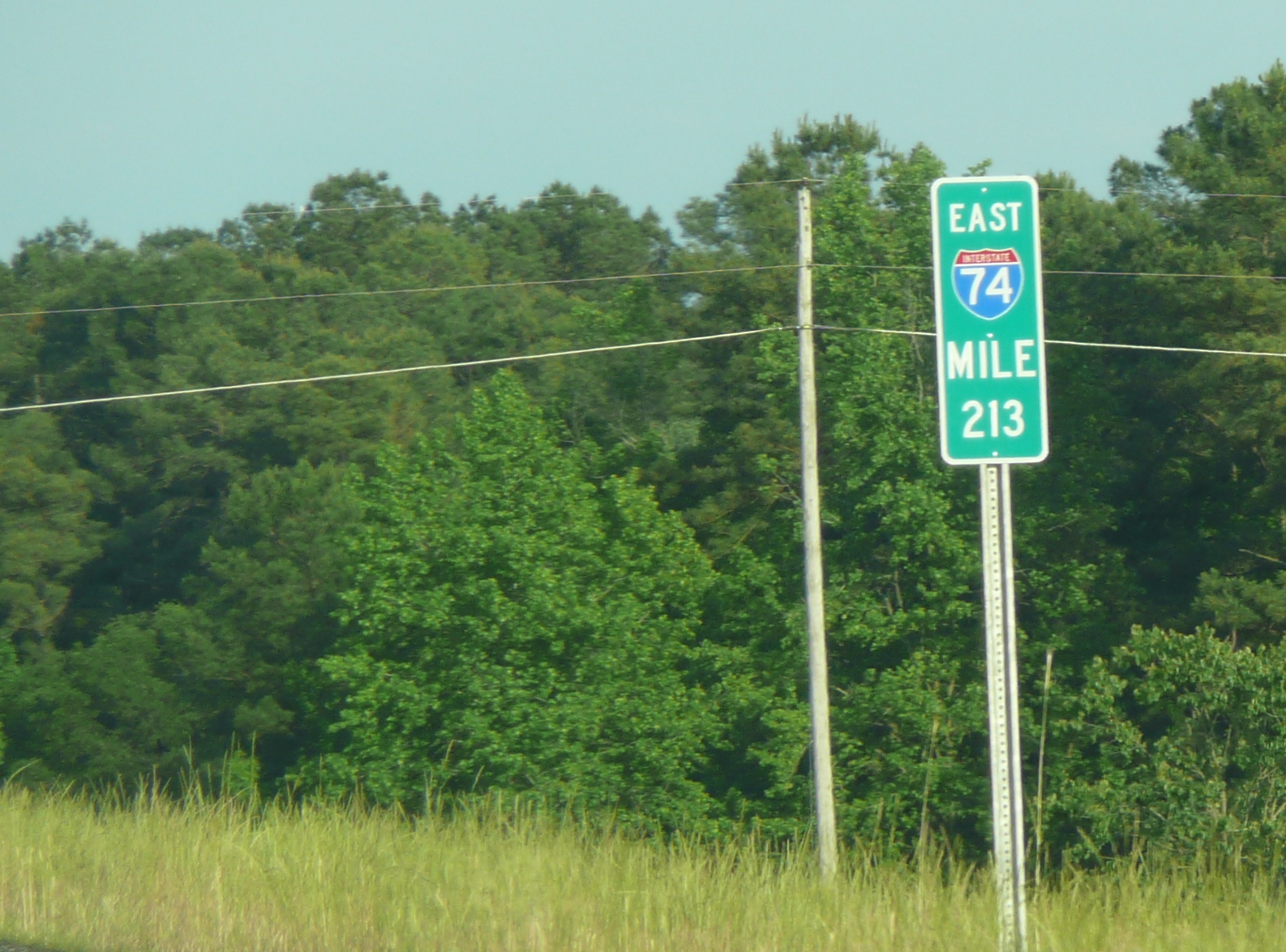 All the mile markers along
this stretch come complete with I-74 shields, this is between Exits 210
and 213. (May 2009) JM
All the mile markers along
this stretch come complete with I-74 shields, this is between Exits 210
and 213. (May 2009) JM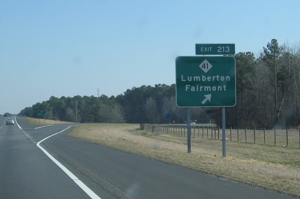 Here's the last exit
eastbound, first westbound for NC 41. The entrance ramp eastbound still
includes a shield for I-74 east, because the road ends about 1/2 mile
further east. (2/7/09)
Here's the last exit
eastbound, first westbound for NC 41. The entrance ramp eastbound still
includes a shield for I-74 east, because the road ends about 1/2 mile
further east. (2/7/09)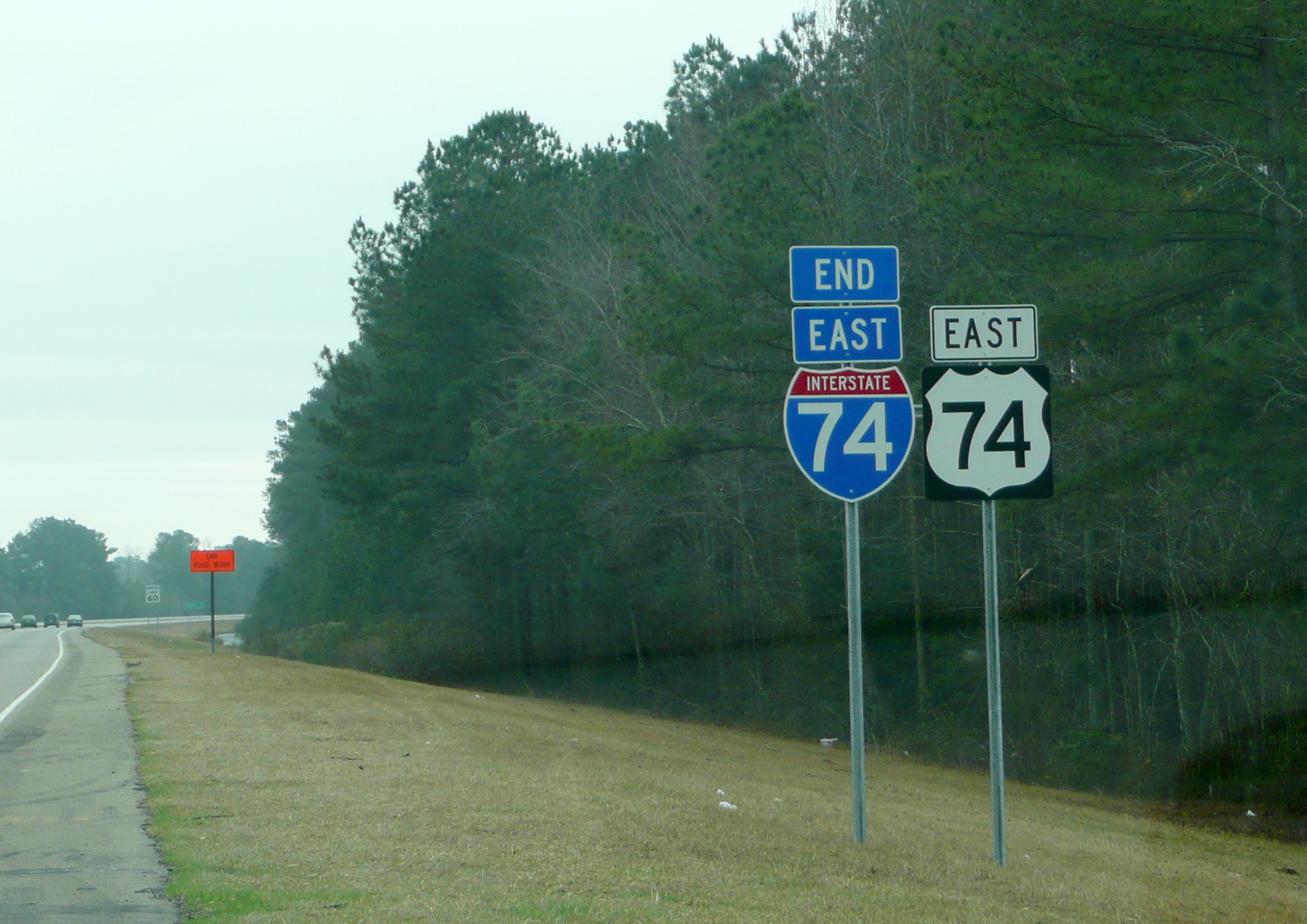 By December they had completed
most of the work to the NC 41 (Exit 213) interchange eastbound, which
included an end sign for I-74 after the exit (Photo courtesy of Stephen
Summers, 12/08). The sign still stands as of 2021.
By December they had completed
most of the work to the NC 41 (Exit 213) interchange eastbound, which
included an end sign for I-74 after the exit (Photo courtesy of Stephen
Summers, 12/08). The sign still stands as of 2021.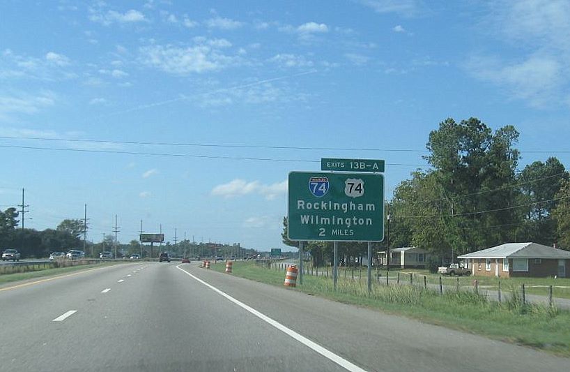 The first I-74 exit
sign is 2 miles out, the sign in the distance says to access the former
route (now US 74 Alternate), use exit 13A.
The first I-74 exit
sign is 2 miles out, the sign in the distance says to access the former
route (now US 74 Alternate), use exit 13A.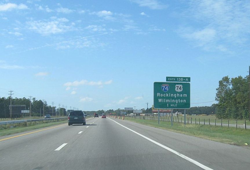 Now 1 mile away, the
excitement, or is it the confusion among drivers seeing the same number
on two different routes, is building.
Now 1 mile away, the
excitement, or is it the confusion among drivers seeing the same number
on two different routes, is building.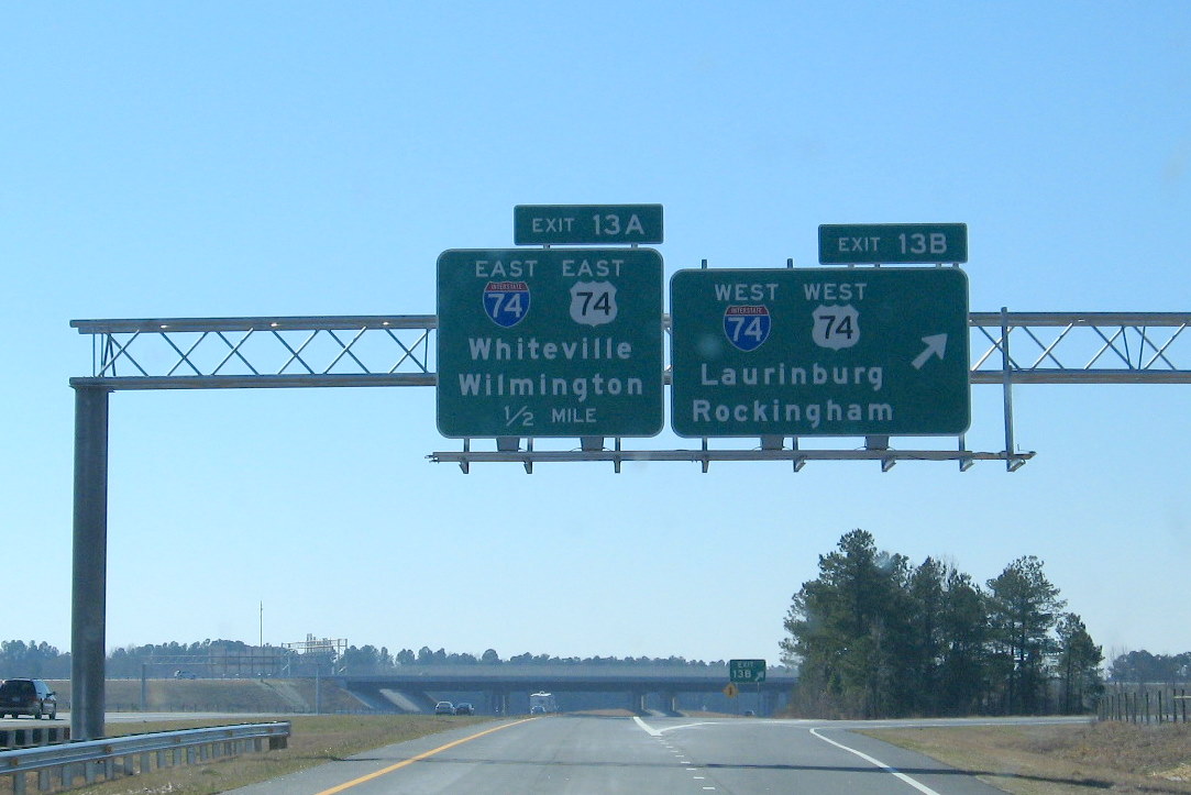 Both directions of
I-95 feature parallel C/D exit ramps. Driving on to the C/D ramps one
has an interesting choice of destinations, only 1 of which (Laurinburg)
does I-74 actually go to.
Both directions of
I-95 feature parallel C/D exit ramps. Driving on to the C/D ramps one
has an interesting choice of destinations, only 1 of which (Laurinburg)
does I-74 actually go to.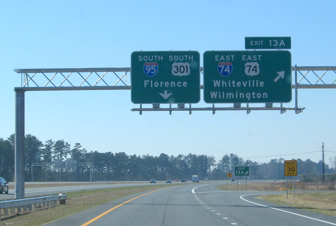 The eastbound
on-ramp is ahead, or one can get back on I-95.
The eastbound
on-ramp is ahead, or one can get back on I-95.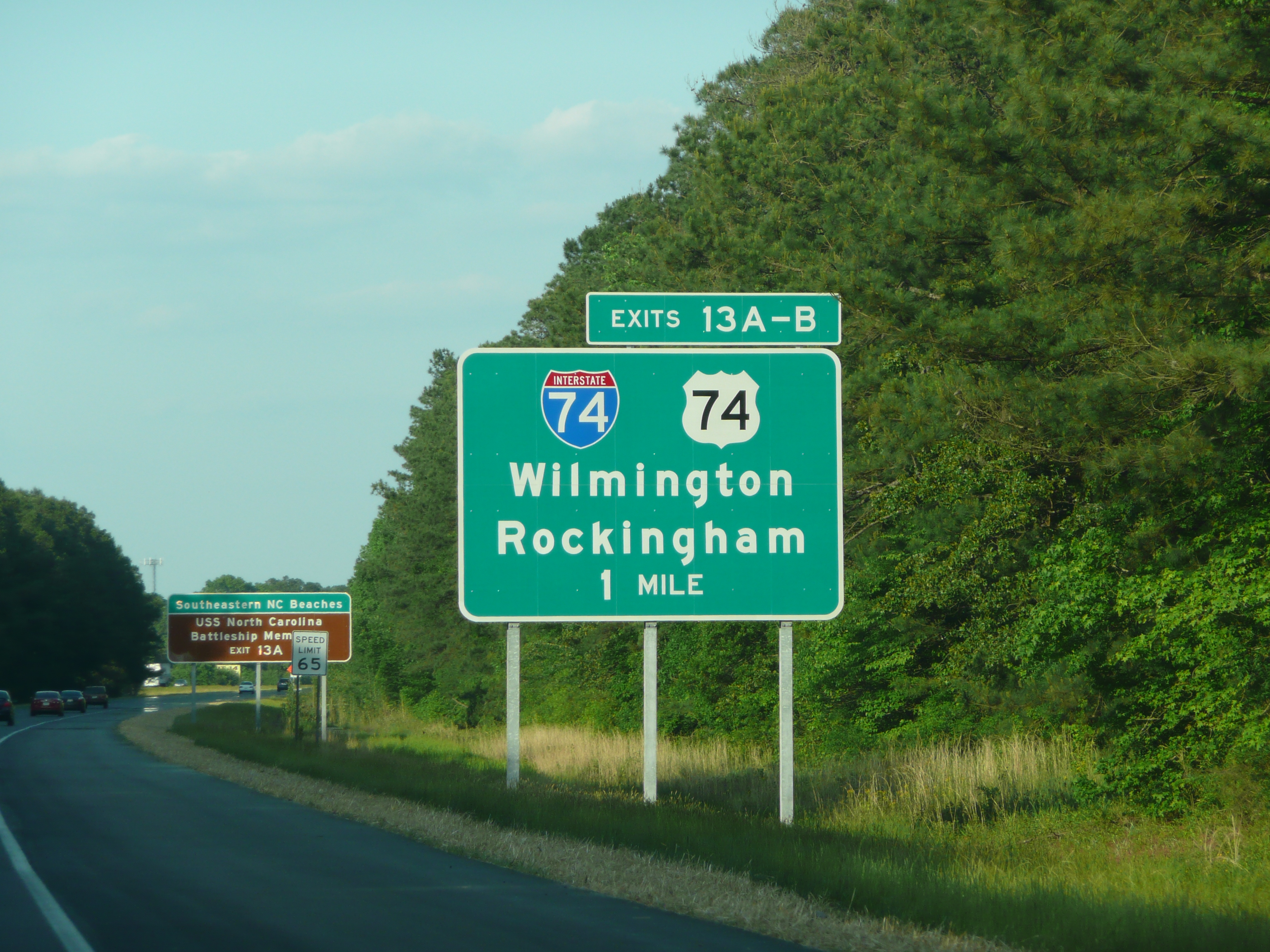 The one mile sign heading
northbound, a more rural landscape than that behind the 1 mile sign
southbound (May 2009). JM
The one mile sign heading
northbound, a more rural landscape than that behind the 1 mile sign
southbound (May 2009). JM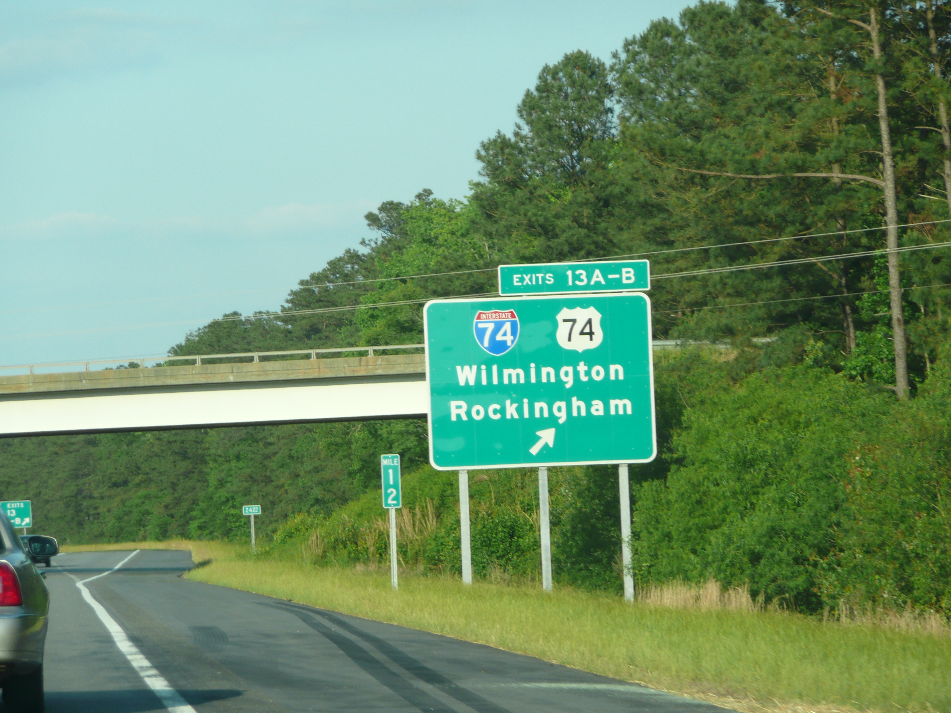 There seems to be some
discrepancy between the milepost number and the exit number (May 2009)
JM
There seems to be some
discrepancy between the milepost number and the exit number (May 2009)
JM 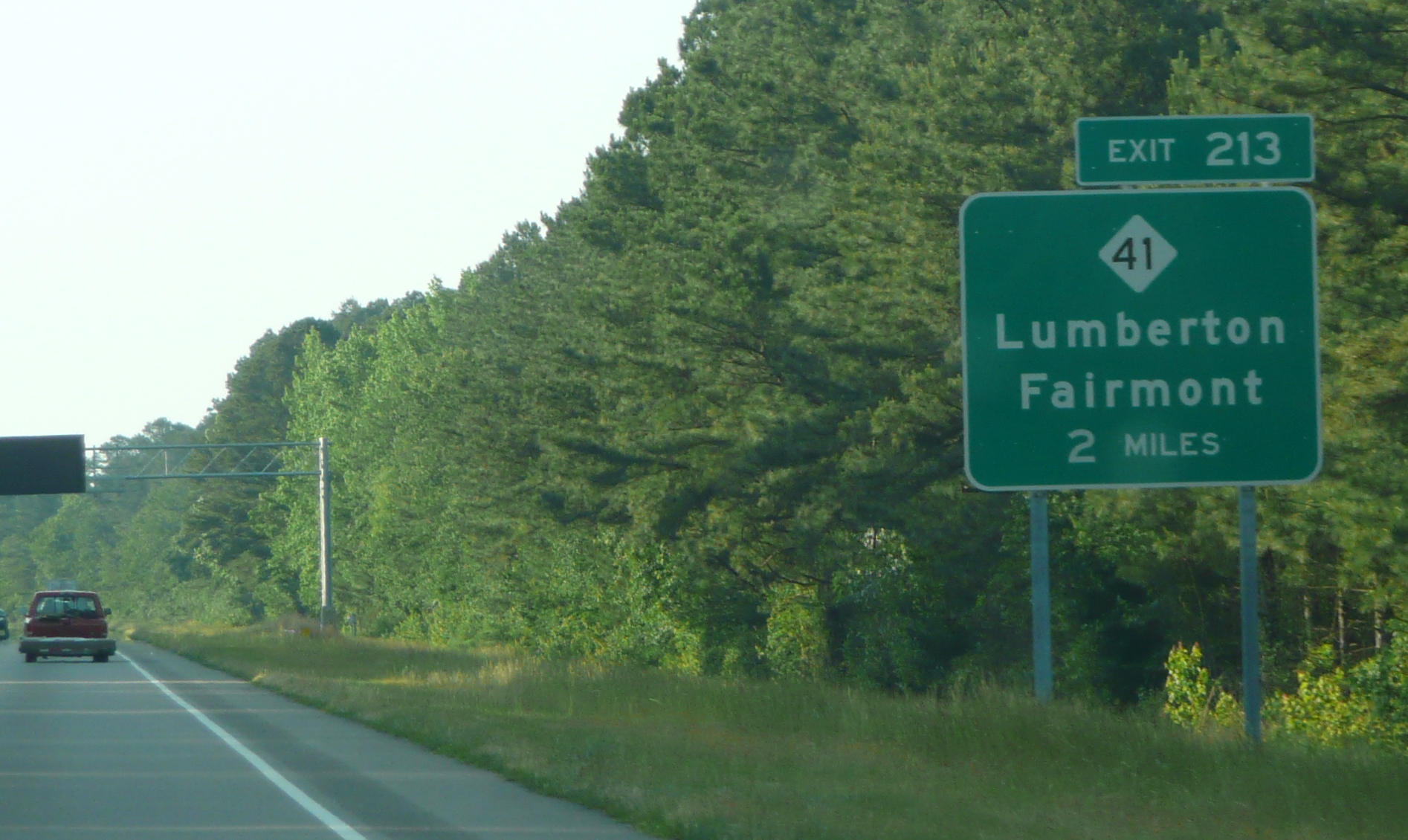 The first I-74 numbered exit
sign for NC 41, notice the VMS assembly they put up probably for I-95
traffic troubles. (May 2009) JM
The first I-74 numbered exit
sign for NC 41, notice the VMS assembly they put up probably for I-95
traffic troubles. (May 2009) JM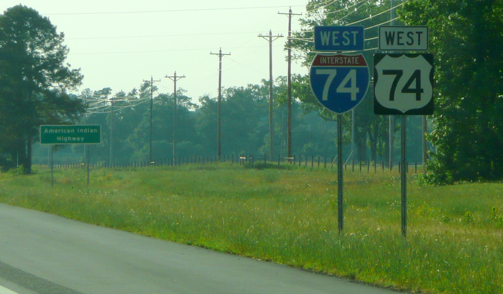 This
is the first I-74/US 74 seen now going westbound, after the NC 41 Exit
(May 2009). JM
This
is the first I-74/US 74 seen now going westbound, after the NC 41 Exit
(May 2009). JM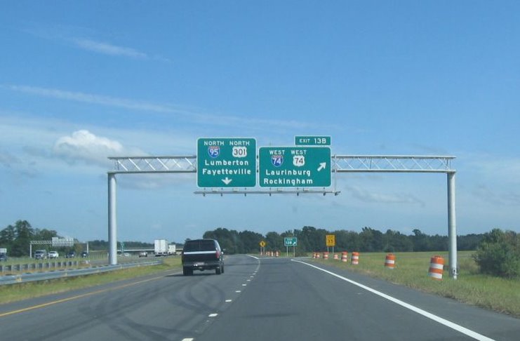 Same C/D set up going
north on I-95.
Same C/D set up going
north on I-95.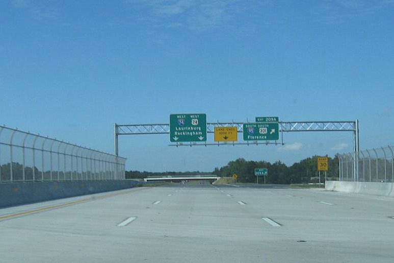 Similar sign set up going
westbound as east, except no sign for the next exit.
Similar sign set up going
westbound as east, except no sign for the next exit.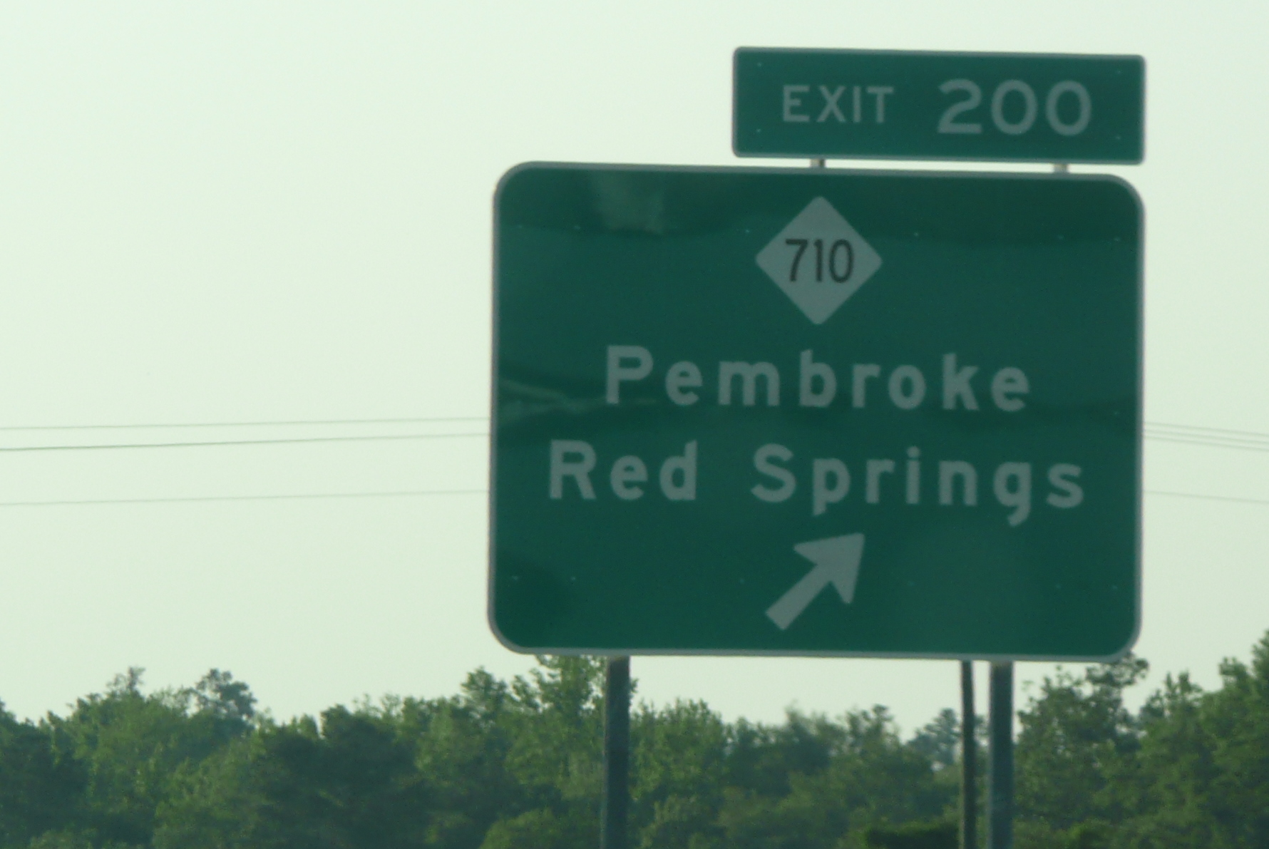 The
NC 710 Exit Marked with the Right number in May 2009 (Photo courtesy of
James Mast, JM)
The
NC 710 Exit Marked with the Right number in May 2009 (Photo courtesy of
James Mast, JM)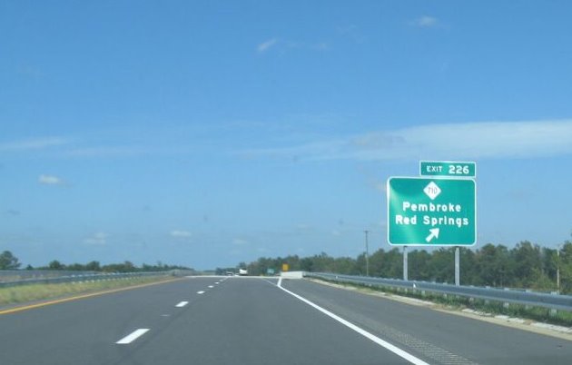 The old
exit number for NC 710 as it appeared in October 2008, the exit number
stayed though many of the mileposts in the area have been stripped of
their wrong mile signage.
The old
exit number for NC 710 as it appeared in October 2008, the exit number
stayed though many of the mileposts in the area have been stripped of
their wrong mile signage.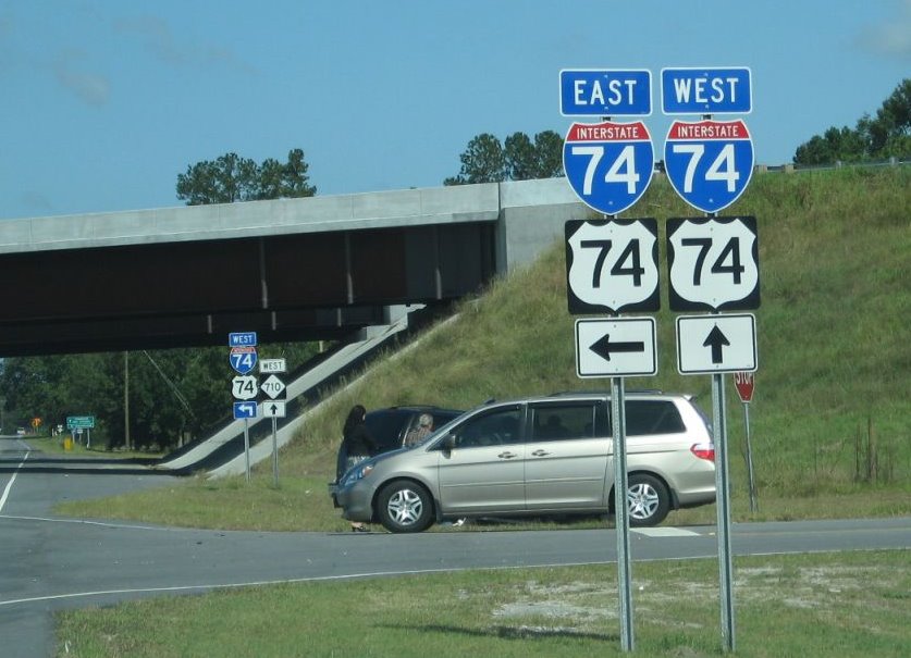 View
showing you can now go both directions at the NC 710 interchange
(October 2008).
View
showing you can now go both directions at the NC 710 interchange
(October 2008).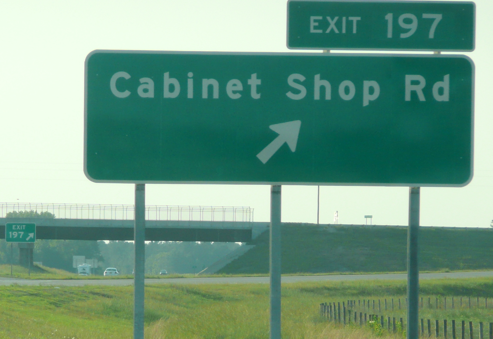 The
new number for the Cabinet Shop Road Exit can be seen heading westbound.
(May 2009) JM
The
new number for the Cabinet Shop Road Exit can be seen heading westbound.
(May 2009) JM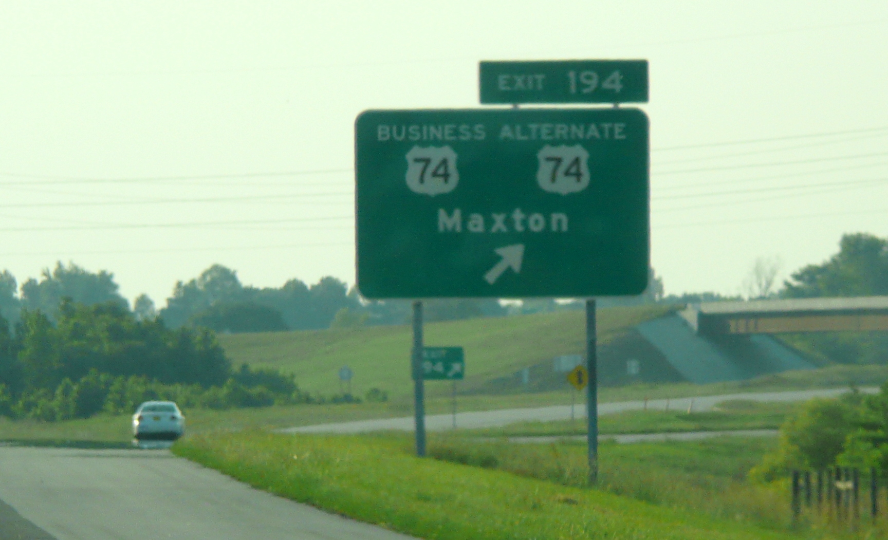 The
intersection with the pre-existing Maxton Bypass is beyond this exit.
Slightly confusing maybe, a sign with 2 US 74 shields on a highway with
2 different shields with the 74 number (May 2009) JM.
The
intersection with the pre-existing Maxton Bypass is beyond this exit.
Slightly confusing maybe, a sign with 2 US 74 shields on a highway with
2 different shields with the 74 number (May 2009) JM.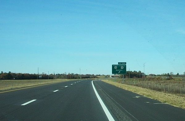 Here's what the western
end of the new freeway at the Business US 74/Alternate US 74 interchange
looked like in October 2007 with the former exit number (Exit 220).
There is only one ramp westbound vs. two going eastbound. (October 2007)
Here's what the western
end of the new freeway at the Business US 74/Alternate US 74 interchange
looked like in October 2007 with the former exit number (Exit 220).
There is only one ramp westbound vs. two going eastbound. (October 2007)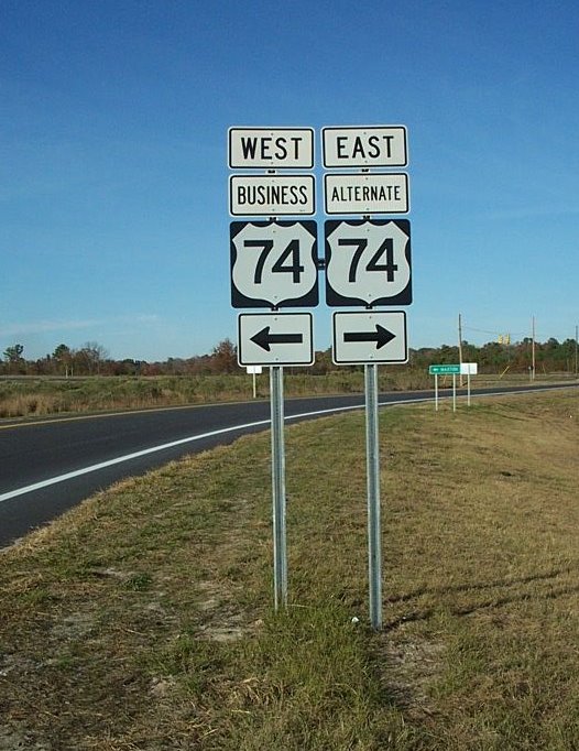 The exit leads to this possibly confusing
sign assembly, Business 74 goes toward Maxton and predates the new
freeway, Alternate US 74 replaced the current US 74 when construction of
I-74 was complete.
The exit leads to this possibly confusing
sign assembly, Business 74 goes toward Maxton and predates the new
freeway, Alternate US 74 replaced the current US 74 when construction of
I-74 was complete.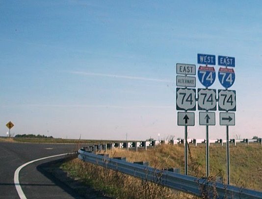 This
also may be a future confusing sign complex for some people. This is the
ramp to East I-74/US 74 at the end of Business US 74 and the beginning
of Alternate US 74.
This
also may be a future confusing sign complex for some people. This is the
ramp to East I-74/US 74 at the end of Business US 74 and the beginning
of Alternate US 74.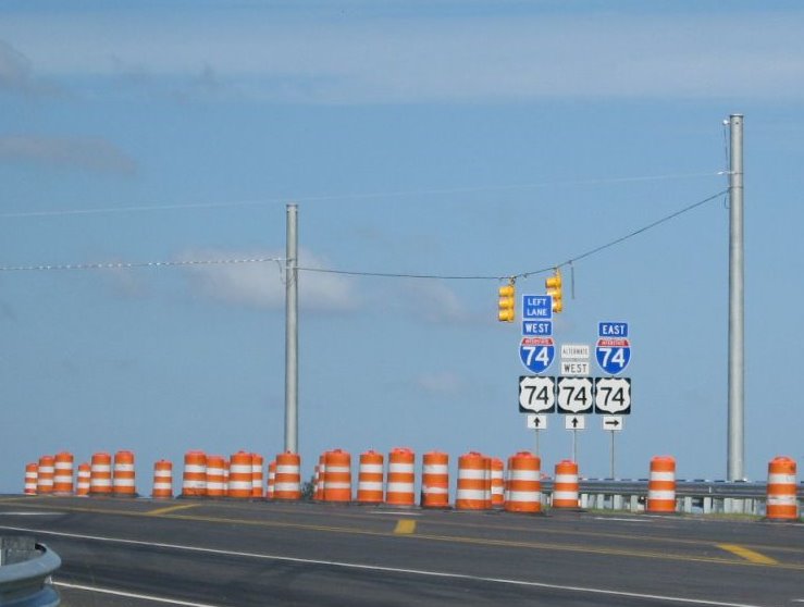 Is this
assembly at the other end in Lumberton any less confusing?
Is this
assembly at the other end in Lumberton any less confusing? Looking south at the future
I-95/I-74 interchange from what was US 74 in the summer of 2007. (August
2007)
Looking south at the future
I-95/I-74 interchange from what was US 74 in the summer of 2007. (August
2007)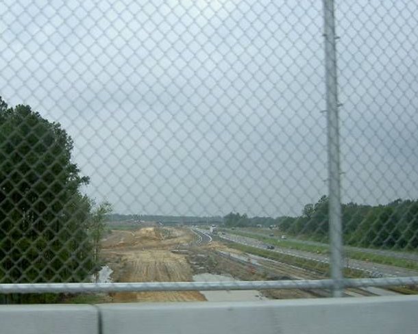 Here's another
photo showing the I-95/I-74 interchange in the summer of 2007. Photo
courtesy of Nick Hudson.
Here's another
photo showing the I-95/I-74 interchange in the summer of 2007. Photo
courtesy of Nick Hudson.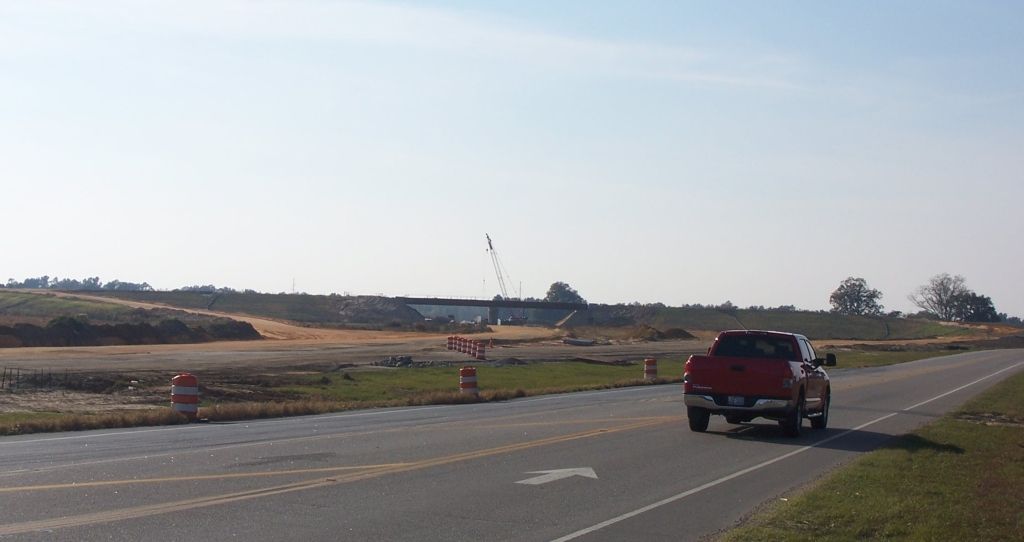 Here's
a look at the progress at the east end of the project as of November
2007, clearly not as advanced as the west end. (photo courtesy of Rodney
Gardner). The road you see graded had been paved, but had not been
connected to the old road. (9/20/08)
Here's
a look at the progress at the east end of the project as of November
2007, clearly not as advanced as the west end. (photo courtesy of Rodney
Gardner). The road you see graded had been paved, but had not been
connected to the old road. (9/20/08)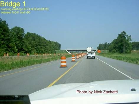
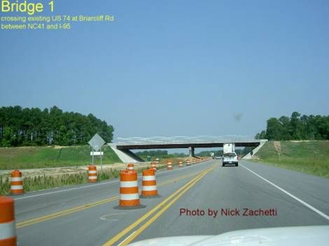
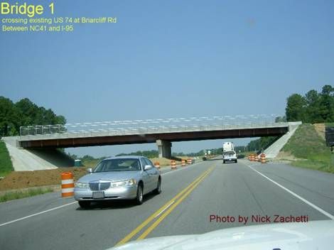
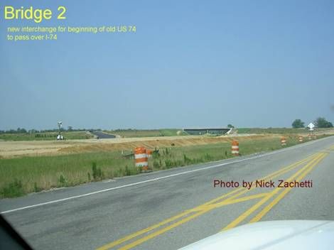
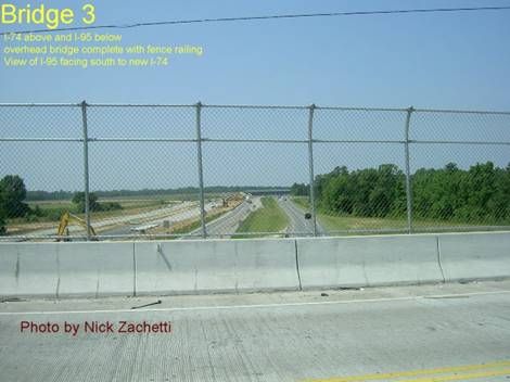
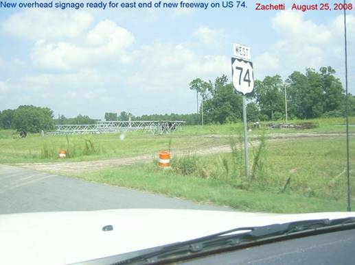
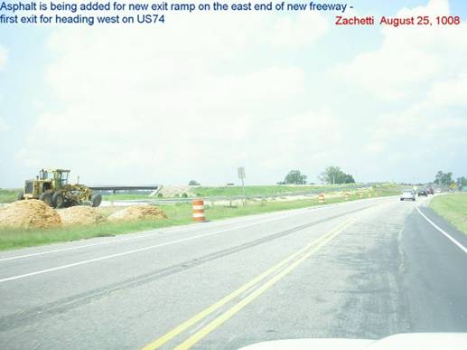
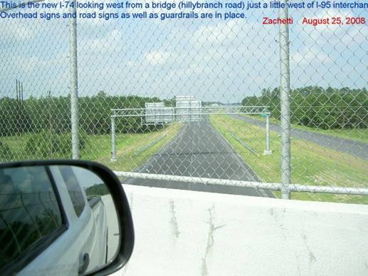
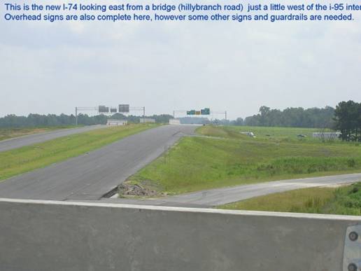
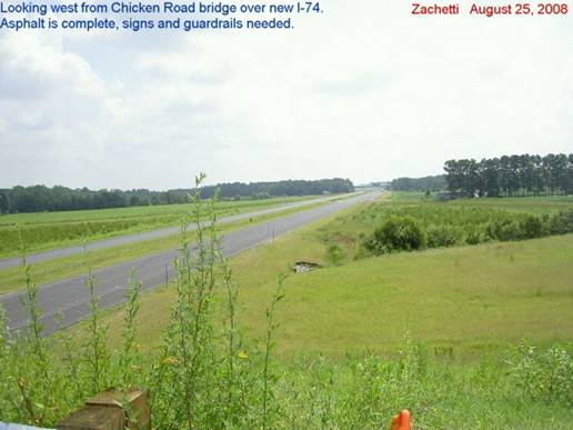
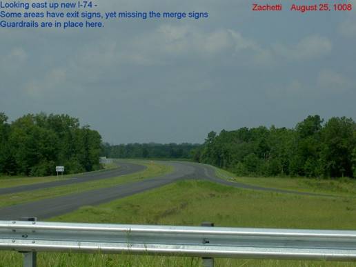
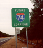 Photo courtesy of Adam
Prince
Photo courtesy of Adam
Prince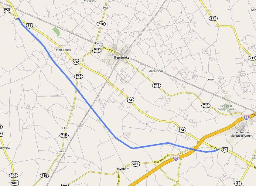 Map overlay of aerial image
courtesy of Rodney Gardner.
Map overlay of aerial image
courtesy of Rodney Gardner.